National Parks Atlas
To the park
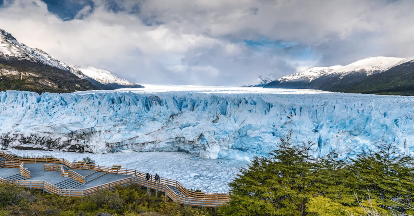
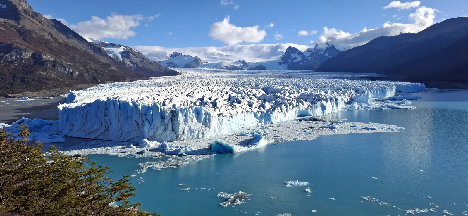
Perito Moreno Glacier in Los Glaciares National Park seen from the walkways: a white ice front above Lago Argentino, snow-covered mountains behind

Los Glaciares National Park: map

16 places with verified coordinates · 2 with photo

Bookable in the park · 5

Ad · partner links: we may earn a commission if you book – at no extra cost to you. Thank you for supporting the atlas. Offer details checked 9 Oct 2026; dates and prices with the provider.

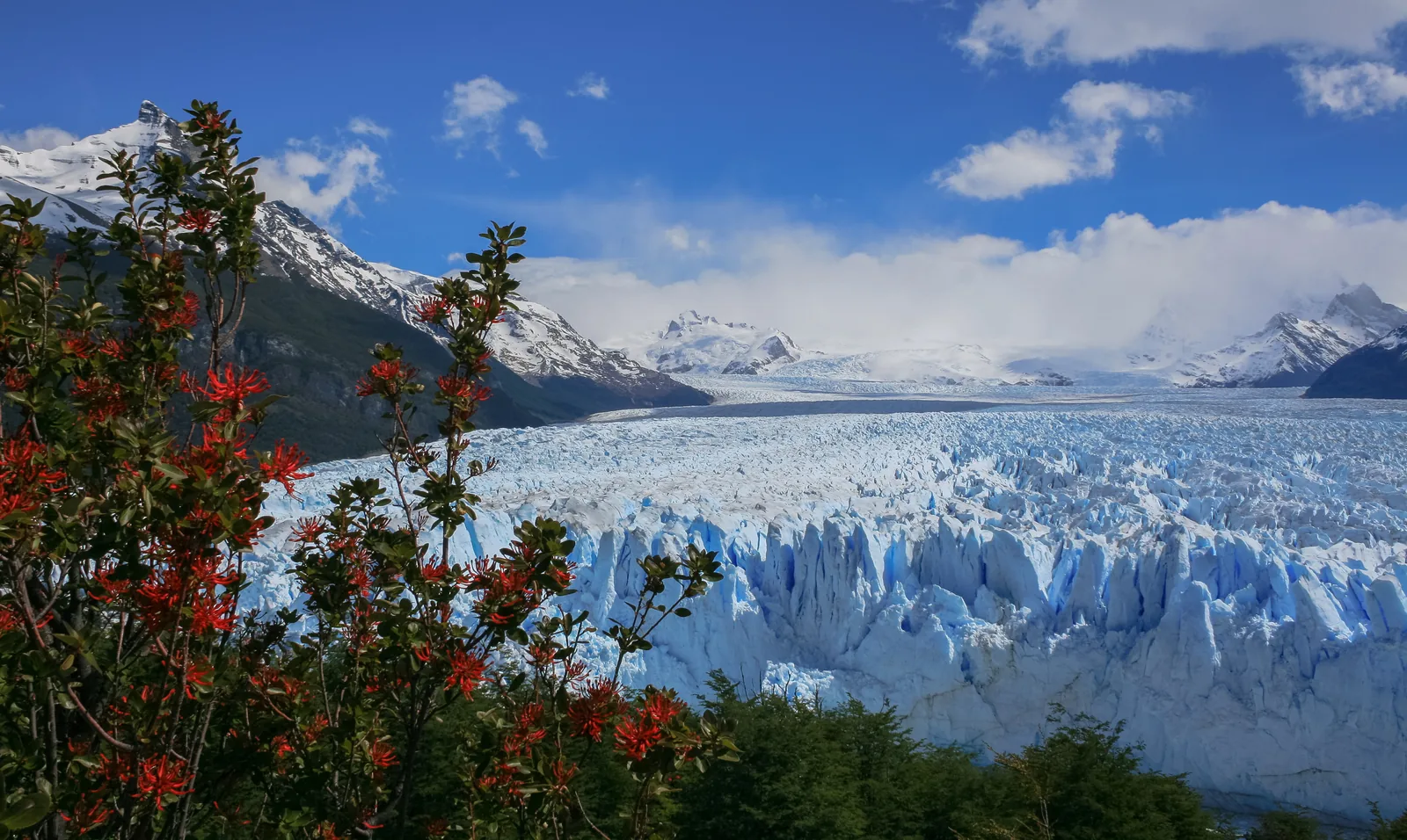
Red notro flowers in front of the Perito Moreno Glacier in Los Glaciares National Park, the ice front and snowy peaks behind under a blue sky
Photo: Diego Delso ↗ · CC BY-SA 3.0 ↗

Trails · First balcony of the walkways facing the Perito Moreno Glacier

Walkways, Primer Balcón

Six trails between 150 and 1,117 metres; the shortest is wheelchair accessible.

The glacier that regularly dams an entire arm of the lake – and that walkways bring you almost face to face with.

Length
almost 30 km (19 mi)
Front
4–5 km (2.5–3.1 mi) wide
Height of the front
about 70 m (230 ft)
From El Calafate
80 km (50 mi)

Own page

Perito Moreno Glacier

An ice front 4 to 5 km (2.5 to 3.1 mi) wide and about 70 m (230 ft) high – and walkways that take you almost up to it.

Los Glaciares National Park entry, South Zone (Corredor Mitre–Moreno), valid since 1 June 2026
Foreign visitors (General)50,000 pesos
Residents of Argentina (Nacional)25,000 pesos
Residents of Santa Cruz Province8,000 pesos

Walkways, fees & getting there

Visiting Los Glaciares: ice field, glaciers and granite

South Zone: El Calafate

The south holds the Perito Moreno Glacier, Lago Argentino with Upsala and Spegazzini, and Lago Roca. The gateway is El Calafate, outside the park.

APN: activities (trails, walkways, ice trekking, boat trips, cycling) ↗

Best time to visit: September to April

Opening hours at the glacier

Only the Corredor Mitre–Moreno has fixed hours: from 1 September to 30 April entry 8:00 to 18:00, stay until 20:00; from 1 May to 31 August 9:00 to 16:00, stay until 18:00.

APN: opening hours and getting there (Corredor Mitre–Moreno, airport, buses) ↗

Activities: walkways, ice, boats and trails

Perito Moreno walkways

Six trails on walkways and balconies lead to the glacier front, between 150 metres and 1,117 metres long according to the park authority's map. The Sendero Accesible (565 m) is wheelchair accessible.

APN: Perito Moreno walkways map 2024 (six trails, distances, times) ↗

Rules in Los Glaciares: no dogs, no drones, fires only where permitted

Keep your distance from the ice front

Falling ice throws splinters dozens of metres. On the walkways never climb over railings or barriers, and hold the handrail on the steps.

APN: Perito Moreno walkways map 2024 (six trails, distances, times) ↗

Guided from here · Ad

Partner links: we may earn a commission if you book – at no extra cost to you. Thank you for supporting the atlas. Dates and prices with the provider.

Open in OpenStreetMap ↗Location source ↗

-50.46880, -73.03216

Arrival · Terminus of the buses from El Calafate

Glaciar Perito Moreno bus stop

The walkways to the glacier start here; restaurant and snack bar nearby.

Own page

Perito Moreno Glacier

An ice front 4 to 5 km (2.5 to 3.1 mi) wide and about 70 m (230 ft) high – and walkways that take you almost up to it.

Walkways, fees & getting there

How to get there: fly to El Calafate, bus to El Chaltén

To the glacier: 80 kilometres

From El Calafate it is about 80 km (50 mi) on the paved RP 11 to the walkways. Scheduled buses leave from the bus station; alternatives are hire cars, remises (private cars with driver) and guided tours.

APN: opening hours and getting there (Corredor Mitre–Moreno, airport, buses) ↗

Open in OpenStreetMap ↗Location source ↗

-50.46880, -73.02969

Arrival · Boat pier for Minitrekking and Big Ice

Puerto Bajo de las Sombras

The boat leaves here across Brazo Rico to the south face of the glacier.

Own page

Perito Moreno Glacier

An ice front 4 to 5 km (2.5 to 3.1 mi) wide and about 70 m (230 ft) high – and walkways that take you almost up to it.

Walkways, fees & getting there

Activities: walkways, ice, boats and trails

On the ice: Minitrekking

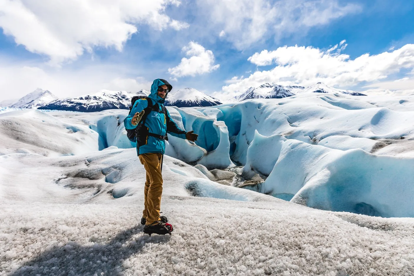
According to the park authority, the ice treks on the Perito Moreno are run by the concessionaire Hielo y Aventura. On the Minitrekking you spend about one hour on the ice in crampons; it is open to ages 8 to 65, the longer Big Ice to ages 18 to 50.

Hielo y Aventura (concessionaire): Minitrekking, ages 8 to 65 ↗

Open in OpenStreetMap ↗Location source ↗

-50.47461, -72.99368

Arrival · Fee-paying entrance at Punta Bandera harbour

Punta Bandera ticket office

Boats to Upsala and Spegazzini leave from here.

Activities: walkways, ice, boats and trails

Boats to Upsala and Spegazzini

From Punta Bandera, boats sail through the Brazo Norte of Lago Argentino to the Upsala and Spegazzini glaciers. According to the park authority, the concessionaires are Solo Patagonia, Cruceros Marpatag and Southern Spirit.

APN: concessionaires (Solo Patagonia, Marpatag, Southern Spirit, Hielo y Aventura, Camping Lago Roca) ↗

Open in OpenStreetMap ↗Location source ↗

-50.29943, -72.79959

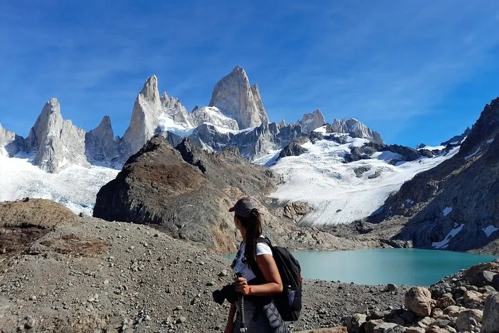
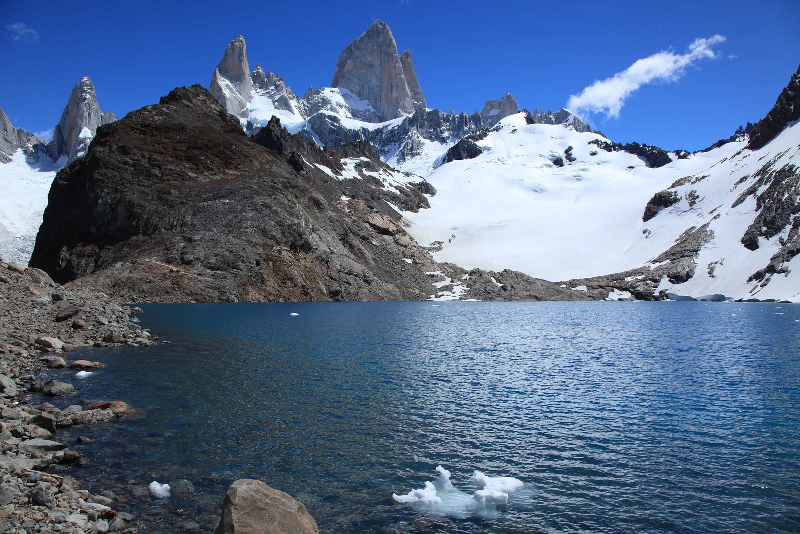
Fitz Roy in Los Glaciares National Park above Laguna de los Tres, a dark rocky ridge and snowfields in front under a blue sky
Photo: Liam Quinn from Canada ↗ · CC BY-SA 2.0 ↗

Arrival · Park authority visitor centre outside El Chaltén

Centro de Visitantes Ceferino Fonzo

Registration for climbing and remote trails, information on every North Zone trail.

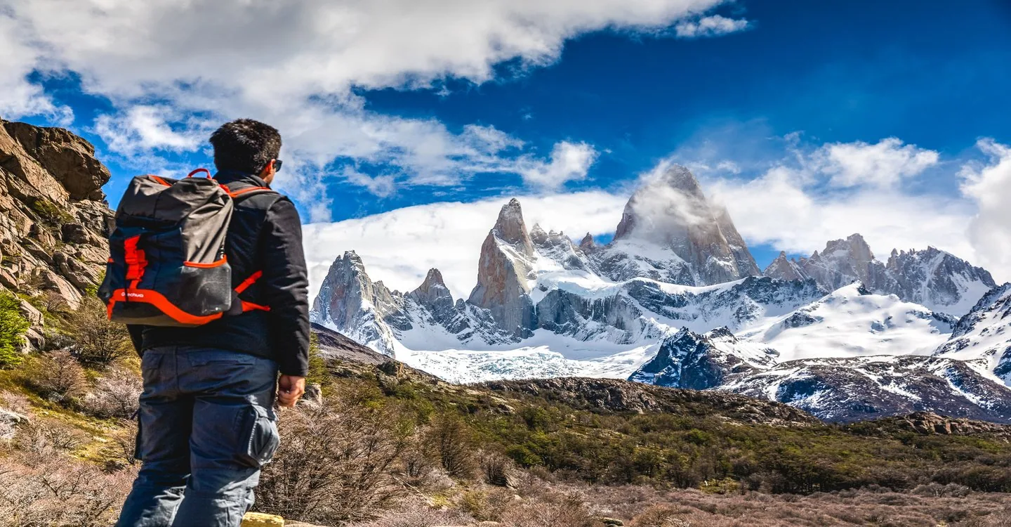
The mountain above El Chaltén – and the steep trail to its closest viewpoint.

Fitz Roy
3,405 m (11,171 ft)
Laguna de los Tres
10 km (6.2 mi) each way
Elevation gain
750
Start
El Chaltén

Own page

Fitz Roy

Granite growing out of the ice: the mountain the Tehuelche called Chaltén – and the trails that start right at the edge of El Chaltén.

Los Glaciares National Park entry, North Zone (Portal El Chaltén), valid since 1 June 2026
Foreign visitors (General)50,000 pesos
Residents of Argentina (Nacional)25,000 pesos
Residents of Santa Cruz Province8,000 pesos

Trails, fees & getting there

Visiting Los Glaciares: ice field, glaciers and granite

North Zone: El Chaltén

In the north, the trails to Fitz Roy and Cerro Torre start right in El Chaltén. The park authority calls it Argentina's trekking capital.

APN: overview (best time to visit, El Chaltén, glaciers, what to bring) ↗

Visiting Los Glaciares: ice field, glaciers and granite

Contact

The park administration is in El Calafate, Av. Libertador 1302; in the north, the Ceferino Fonzo visitor centre at the entrance to El Chaltén is the place to go.

APN: Parque Nacional Los Glaciares (area, founded 1937, World Heritage 1981, contact) ↗

Los Glaciares fees: 50,000 pesos, second day at half price

El Chaltén charges entry too

The park authority's fee annex lists the North Zone with the El Chaltén portal as a separate line, with the same amounts as the south. According to the park authority, the checkpoints are Los Cóndores, Cerro Torre/Base Fitz Roy and Río Eléctrico.

APN: fee annex IF-2026-52297961 (Zona Sur and Zona Norte – Portal El Chaltén, second-day discount) ↗

Rules in Los Glaciares: no dogs, no drones, fires only where permitted

Register for remote trails

Anyone climbing or visiting remote areas such as Laguna Toro must register at the visitor centre outside El Chaltén or online.

APN: recommendations for your visit (dogs, drones, fires, winter equipment) ↗

Guided from here · Ad

Partner links: we may earn a commission if you book – at no extra cost to you. Thank you for supporting the atlas. Dates and prices with the provider.

Open in OpenStreetMap ↗Location source ↗

-49.33753, -72.88134

Arrival · El Chaltén bus station

Terminal de Ómnibus El Chaltén

Daily buses to and from El Calafate.

Own page

Fitz Roy

Granite growing out of the ice: the mountain the Tehuelche called Chaltén – and the trails that start right at the edge of El Chaltén.

Trails, fees & getting there

How to get there: fly to El Calafate, bus to El Chaltén

Buses from Argentina and Chile

Bus stations in El Calafate and El Chaltén are served by routes from across the country and from southern Chile, from Punta Arenas and Puerto Natales. Buses run daily between the two towns.

APN: opening hours and getting there (Corredor Mitre–Moreno, airport, buses) ↗

Open in OpenStreetMap ↗Location source ↗

-49.33360, -72.88291

Viewpoint · Closest viewpoint to Fitz Roy

Laguna de los Tres viewpoint

According to the park authority's leaflet, 10 km (6.2 mi) and 5 hours each way from El Chaltén.

Own page

Fitz Roy

Granite growing out of the ice: the mountain the Tehuelche called Chaltén – and the trails that start right at the edge of El Chaltén.

Trails, fees & getting there

Activities: walkways, ice, boats and trails

Laguna de los Tres

The best-known trail in the north runs from El Chaltén to the viewpoint below Fitz Roy: 10 km (6.2 mi) and 5 hours each way, 750 m (2,461 ft) of elevation gain, the last part very steep.

APN: North Zone trails leaflet 2024 (distances, times, elevation gain) ↗

Open in OpenStreetMap ↗Location source ↗

-49.27979, -72.98572

Viewpoint · Viewpoint above Laguna Torre

Mirador Maestri

End of the Cerro Torre trail, 12 km (7.5 mi) from El Chaltén.

Own page

Fitz Roy

Granite growing out of the ice: the mountain the Tehuelche called Chaltén – and the trails that start right at the edge of El Chaltén.

Trails, fees & getting there

Activities: walkways, ice, boats and trails

Laguna Torre

Through the Río Fitz Roy valley to the lake below Cerro Torre: 10 km (6.2 mi) each way, about 3.5 hours, only 250 m of climbing. Mirador Maestri is 12 km (7.5 mi) out.

APN: North Zone trails leaflet 2024 (distances, times, elevation gain) ↗

Open in OpenStreetMap ↗Location source ↗

-49.31820, -73.00176

Trails · Start of the Fitz Roy trail

Sendero Monte Fitz Roy

At the north end of the village; the trails to Laguna Capri and Laguna de los Tres start here.

Own page

Fitz Roy

Granite growing out of the ice: the mountain the Tehuelche called Chaltén – and the trails that start right at the edge of El Chaltén.

Trails, fees & getting there

Open in OpenStreetMap ↗Location source ↗

-49.32111, -72.89459

Water · Lake with a view of the Fitz Roy massif

Laguna Capri

4 km (2.5 mi) from the village, about 1 hour 45 minutes; campsite with reservation.

Own page

Fitz Roy

Granite growing out of the ice: the mountain the Tehuelche called Chaltén – and the trails that start right at the edge of El Chaltén.

Trails, fees & getting there

Open in OpenStreetMap ↗Location source ↗

-49.30485, -72.93608

Where to stay · Campsite in the forest

Campamento Poincenot

8 km (5 mi) from the village; last stop before the steep climb.

Own page

Fitz Roy

Granite growing out of the ice: the mountain the Tehuelche called Chaltén – and the trails that start right at the edge of El Chaltén.

Trails, fees & getting there

Open in OpenStreetMap ↗Location source ↗

-49.28488, -72.95707

Trails · Start of the Laguna Torre trail

Laguna Torre Trailhead

On the western edge of the village.

Own page

Fitz Roy

Granite growing out of the ice: the mountain the Tehuelche called Chaltén – and the trails that start right at the edge of El Chaltén.

Trails, fees & getting there

Open in OpenStreetMap ↗Location source ↗

-49.33111, -72.89518

Trails · Second balcony of the walkways

Segundo Balcón

Lower down and closer to the water.

Own page

Perito Moreno Glacier

An ice front 4 to 5 km (2.5 to 3.1 mi) wide and about 70 m (230 ft) high – and walkways that take you almost up to it.

Walkways, fees & getting there

Open in OpenStreetMap ↗Location source ↗

-50.46926, -73.03307

Nature · Lowest balcony on the Sendero Inferior

Balcón Inferior

At the end of the most demanding trail, 1,100 metres and about 2 hours.

Own page

Perito Moreno Glacier

An ice front 4 to 5 km (2.5 to 3.1 mi) wide and about 70 m (230 ft) high – and walkways that take you almost up to it.

Walkways, fees & getting there

Open in OpenStreetMap ↗Location source ↗

-50.47278, -73.03376

Arrival · Boat pier by the walkways

Navegación Glaciar Perito Moreno

Boat trips to the ice front start here, also combined with the walkways.

Own page

Perito Moreno Glacier

An ice front 4 to 5 km (2.5 to 3.1 mi) wide and about 70 m (230 ft) high – and walkways that take you almost up to it.

Walkways, fees & getting there

Open in OpenStreetMap ↗Location source ↗

-50.46319, -73.02510

Arrival · Landing on the western shore of Brazo Rico

Embarcadero Minitrekking

Starting point of the ice treks, with a refuge.

Own page

Perito Moreno Glacier

An ice front 4 to 5 km (2.5 to 3.1 mi) wide and about 70 m (230 ft) high – and walkways that take you almost up to it.

Walkways, fees & getting there

Open in OpenStreetMap ↗Location source ↗

-50.48923, -73.04481

Locations verified from the linked original sources and OpenStreetMap. The map shows no trails or park boundaries; markers do not imply that access is permitted.

Map: © OpenStreetMap contributors, OpenMapTiles, OpenFreeMap. Elevation: Terrain Tiles (Mapzen, AWS Open Data); 3DEP, GMTED2010 and SRTM courtesy of the U.S. Geological Survey; EU-DEM (Copernicus, European Union); ETOPO1 (NOAA); ArcticDEM (NSF, DigitalGlobe); Geoscience Australia; Open Data Austria (DGM); Open Government Licence – Canada; INEGI; Land Information New Zealand; Kartverket; Environment Agency (UK).

Park photo: Photo: Accuratelibrarian ↗ · CC BY-SA 4.0 ↗

Loading map …