National Parks Atlas
MapPDF

01 · Canada · Ontario · St. Lawrence River

Thousand Islands National Park

The oldest national park east of the Rocky Mountains, and the only one you mostly enter by boat.

Photo: Mykola Swarnyk ↗ · CC BY-SA 4.0 ↗

Thousand Islands at a glance · PDF, 2 pages

Thousand Islands National Park: landscape and origins

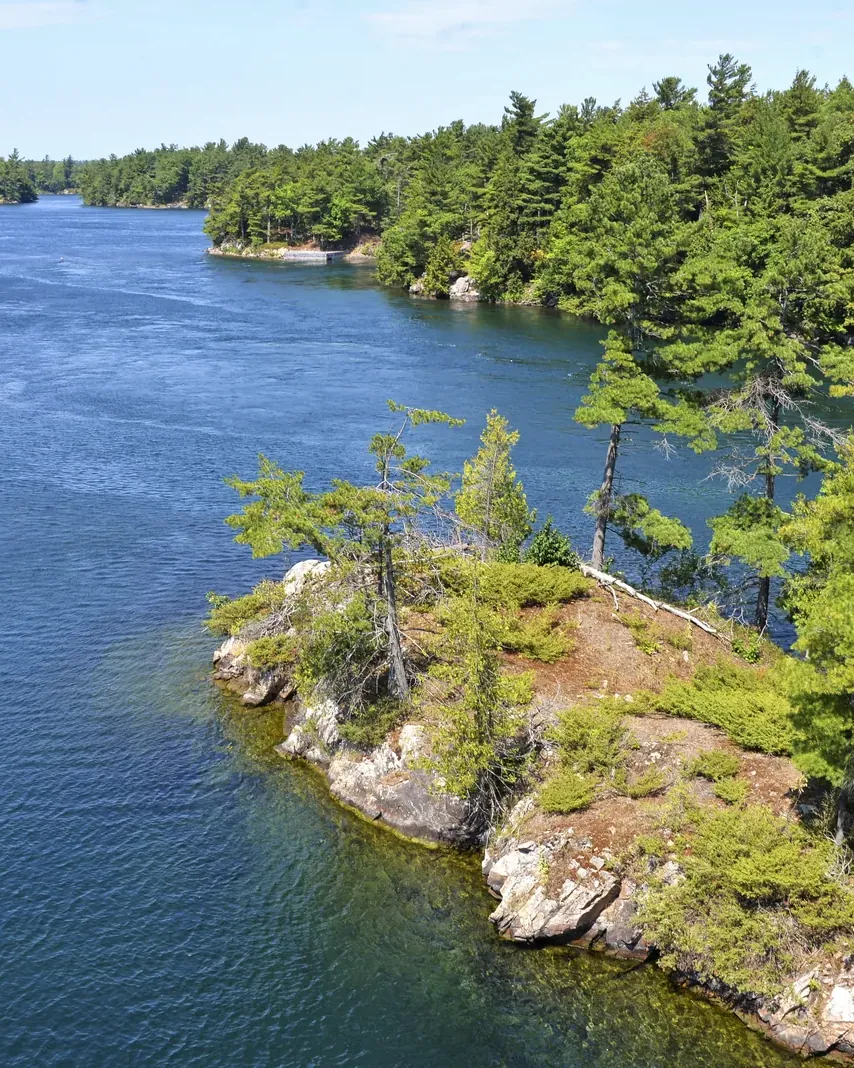
Thousand Islands is a small park with many parts: islands and islets in the St. Lawrence River, plus three properties on the mainland.

According to the park authority, the park comprises 19 to 26 islands and 80 to 90 islets between Kingston and Brockville, plus several properties on the mainland.

Its position on the Frontenac Arch makes the park one of the most species-rich in Canada. The islands form a chain of stepping stones across the river and shorten the distances between the land masses, a corridor between the Adirondacks and Algonquin Park. The park authority measures the health of forest, wetland and streams with fifteen ecological indicators.

Among the most common animals by the water are ospreys, northern map turtles, mink, great blue herons and white-tailed deer. On a single day, 102 bird species were identified on Grenadier Island; the St. Lawrence moderates the climate enough for northern species such as the common loon to meet southern ones like the turkey vulture.

People have come here in summer since the end of the last Ice Age. In 1979 a diver off Grenadier Island found a clay pot of the Point Peninsula culture, which lived about 2,500 years ago. French accounts from the 17th century describe summer camps with hundreds of people, including Onondaga, and a large eel fishery between Mallorytown Landing and Ivy Lea. European families settled after 1784; from the 1860s fish stocks declined. Today the park carries out research together with the Mohawks of Akwesasne.

Nature and science ↗

The park in numbers

Established
1904, as St. Lawrence Islands
Distinction
first national park east of the Rockies
Islands
19 to 26, depending on how they are counted
Islets
80 to 90
Mainland
three properties on the Parkway
Map points
22 with published coordinates
Trails
12 km Jones Creek, 7 km Landon Bay, 2 km Mallorytown
oTENTiks
10 on two islands and on the mainland
Tent sites
28 reservable, 32 first come, first served
Biosphere reserve
Frontenac Arch, UNESCO since 2002
Species at risk
10 reptiles and amphibians
Birds
102 species in one day on Grenadier
Visiting Thousand Islands: overview and planning

01

Between Kingston and Brockville

The islands lie in the St. Lawrence River between Kingston and Brockville. The visitor centre, administration and mainland trails are on the Thousand Islands Parkway between Brockville and Gananoque, reached via exits 647 to 685 of Highway 401.

Getting there by land and water ↗

02

The islands by boat only

The islands can only be reached by boat; if you camp there, you must arrange your own transport. If you have no boat, take a water taxi, rent a kayak or boat, or go on a cruise.

Camping and accommodation ↗

03

No admission, but fees

The park’s fee list has no daily admission. You pay for parking, the boat launch, docking, moorings, beaching, camping and firewood, due immediately on arrival at machines and green pay stations on every island.

Rules and regulations ↗

04

Fee season

Fees are charged from the Victoria Day weekend to Thanksgiving. The revenue stays in the park and goes into facilities and services.

Rules and regulations ↗

02 · Places

Map and places in the park

All 22 points with the coordinates the park authority itself publishes.

Photo: The Cosmonaut ↗ · CC BY-SA 2.5 ca ↗

Place in the park

Landon Bay

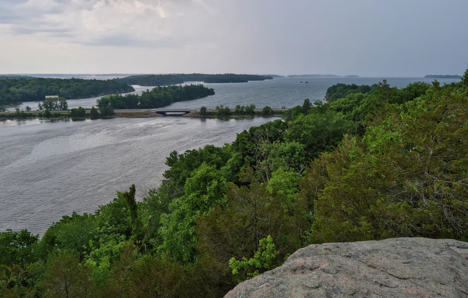
Seven kilometres of trails on the mainland, and the lookout rock that the park authority considers the best natural view in the region.

Address
302 Thousand Islands Parkway, exit 647.
Trails
Seven kilometres, six different loops.
View
Lookout Trail, with several sets of stairs.
Time
About an hour for the lookout loop.
Audio tour
Narrated by the five-lined skink and the gray ratsnake.
Overnight stays
Not allowed.

Hiking at Jones Creek and Landon Bay ↗

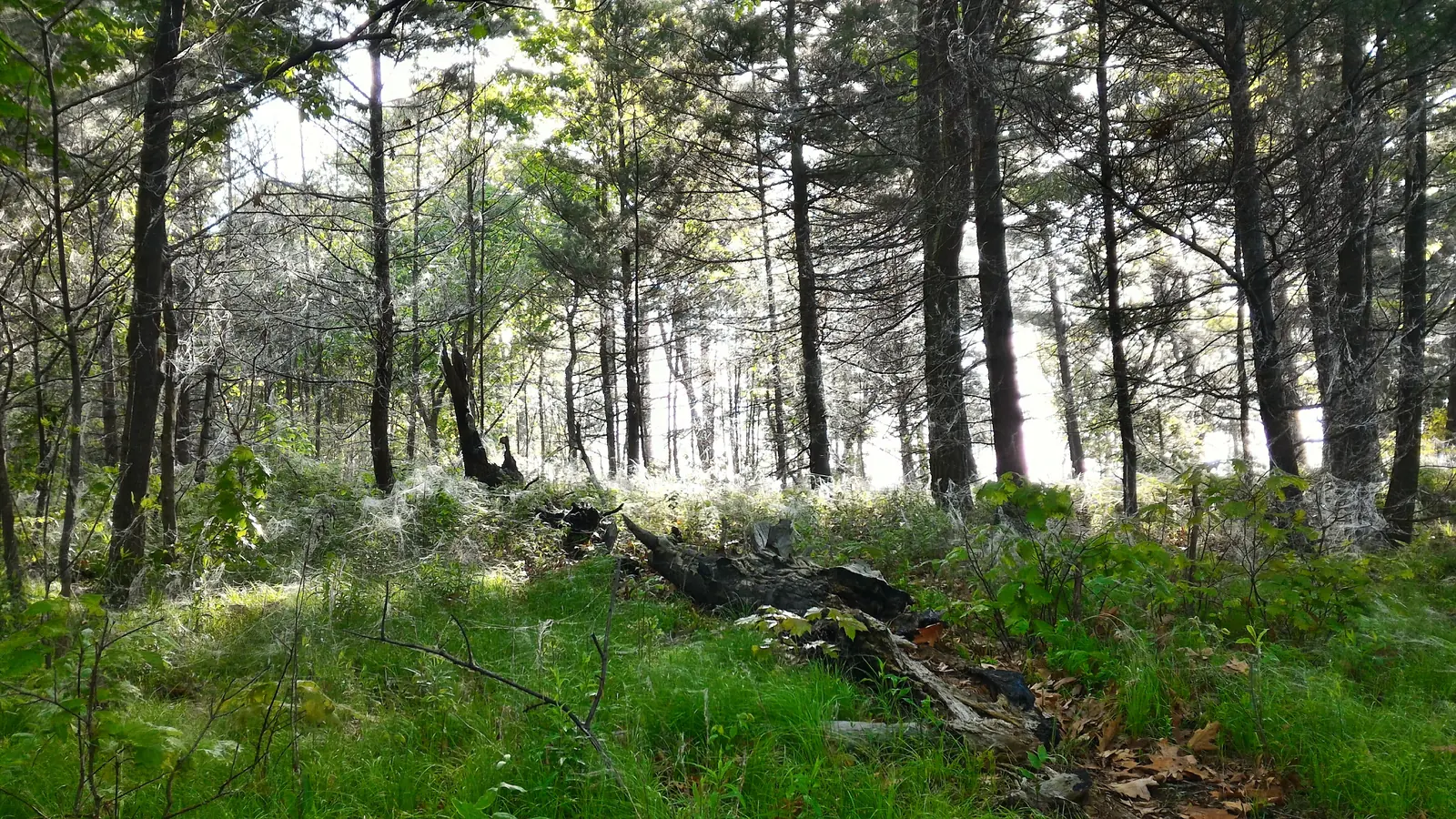
Open pine forest on an island, sunlight falling between the trunks onto grass and fallen deadwood
Photo: Ferris842 ↗ · CC BY-SA 4.0 ↗

Place in the park

Gordon Island

One of the two islands with oTENTiks: pine forest, tent sites and red chairs, reachable only by water.

Group
Navy Islands.
Coordinates
44.330466, −76.103106.
oTENTiks
Two.
Docking
Over 90 metres (295 ft) of dock space.
Access
Misty Isles Lodge or water taxi.
Drinking water
None; bring your own.

oTENTik accommodation ↗

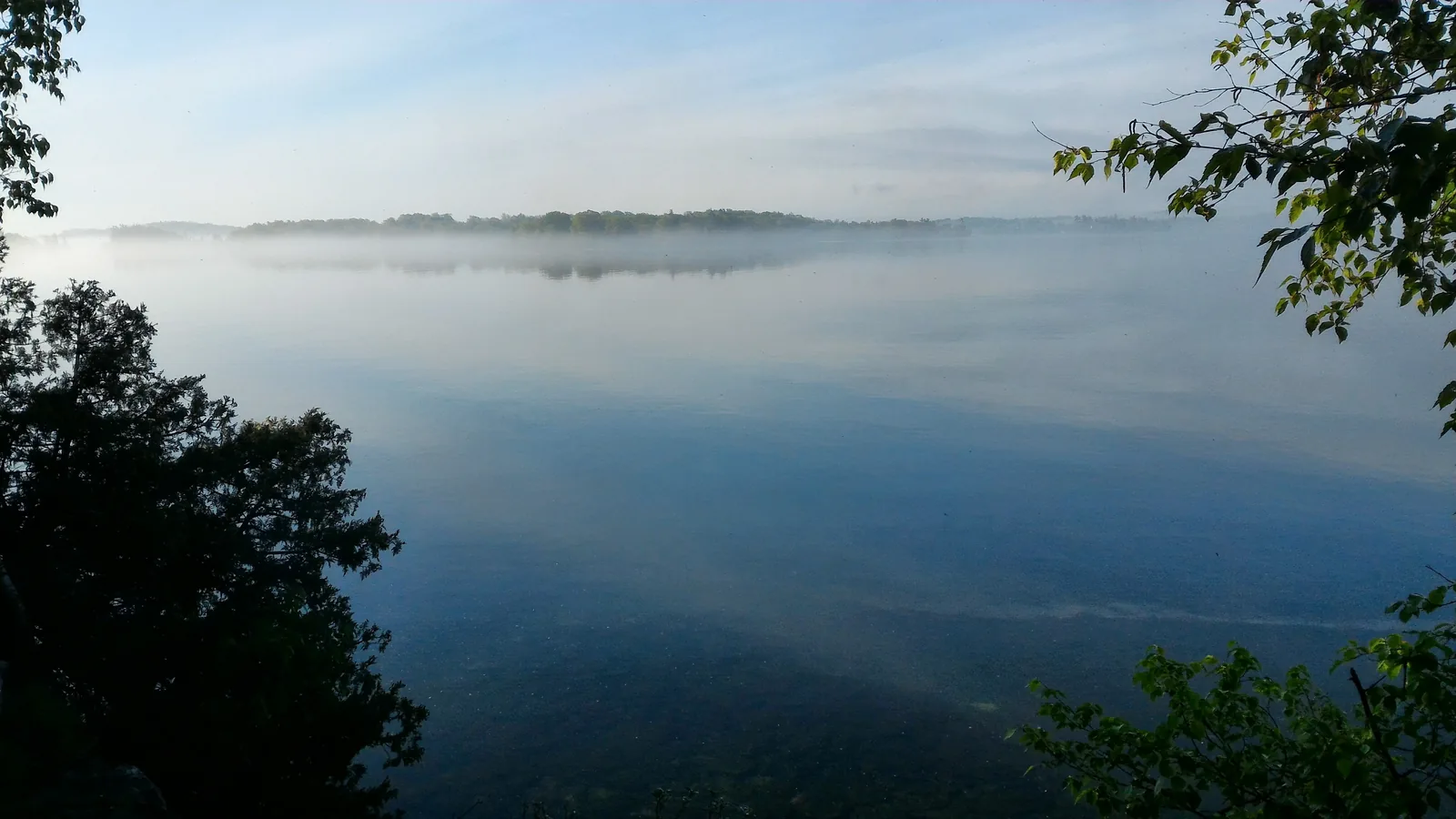
Morning mist over the glassy river, leaves in the foreground, a low forested shore on the horizon
Photo: Ferris842 ↗ · CC BY-SA 4.0 ↗

Place in the park

Morning on the river

The St. Lawrence from a park island: early in the day it lies still, later it gets busy between the boats.

Quiet months
June and September.
Heavy traffic
July and August.
Water level
Highest in June and July.
Late summer
Lake breezes make the water rough.
Routes
Nine full-day and half-day routes.
Charts
Nautical charts are needed, not just route maps.

Paddling in the Thousand Islands ↗

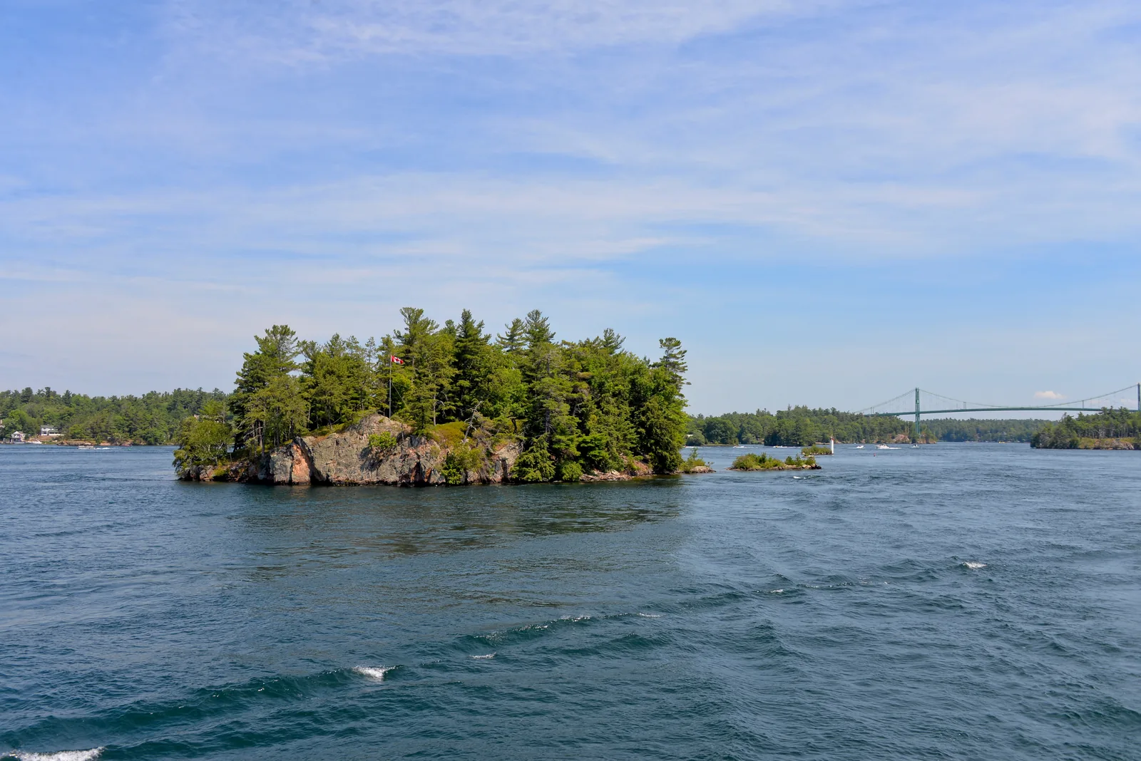
A small forested granite island with a Canadian flag in the river, a suspension bridge in the background on the right
Photo: Mykola Swarnyk ↗ · CC BY-SA 4.0 ↗

Place in the park

The islands by the bridge

At Georgina, Constance and Hill the river narrows: a fine view, difficult paddling.

Access
Ivy Lea boat launch and Ivy Lea Provincial Park.
Current
Strong and hard to predict.
Boat traffic
Heavy.
Recommendation
Paddling for experienced paddlers only.
Hill Island
Generators allowed, dock space 30–90 metres.
Bridge
Thousand Islands International Bridge to the USA.

Island maps with coordinates ↗

An osprey sits on a large stick nest built on a red and white channel marker buoy in the river
Photo: Mykola Swarnyk ↗ · CC BY-SA 4.0 ↗

Place in the park

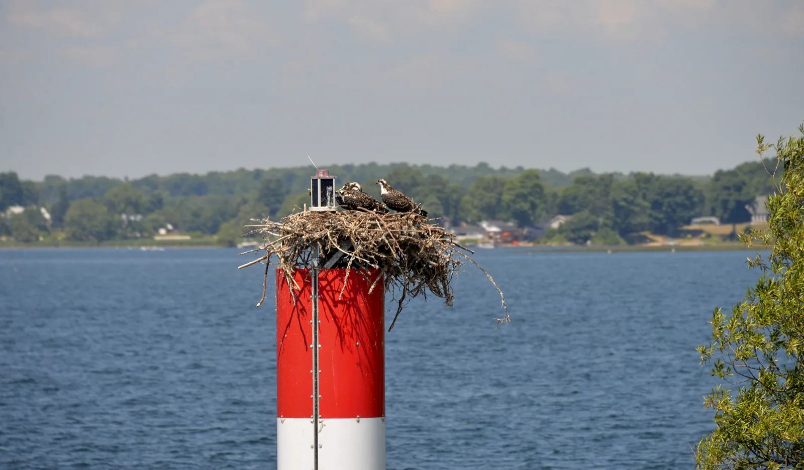
Ospreys

The osprey tops the list of the five animals visitors are most likely to see here.

Common
Osprey, northern map turtle, mink, great blue heron, white-tailed deer.
Best time
Early in the morning and shortly after dusk.
Turtles
In the afternoon on driftwood and rocks.
Birds
102 species in one day on Grenadier Island.
Rule
Attracting wildlife with recordings is not wanted.
Fine
Disturbing wildlife can cost up to 2,000 CAD.

Wildlife viewing ↗

Map

22 places on the map

All 22 points with the coordinates the park authority itself publishes.

Open map3D terrain · details and photos for every place
  • Water19
  • Arrival1
  • Nature2

03 · Out and about

Things to do: hiking, paddling and island hopping

Hiking on the mainland, paddling and anchoring among the islands.

Photo: David W Enstrom ↗ · CC BY-SA 4.0 ↗

“In 1904 a family gave the federal government a waterfront property on condition that it be used as a park. Nine federally owned islands were added, and Canada’s first national park east of the Rocky Mountains was born.”

Thousand Islands National Park · Evening off Thwartway Island

Things to do: hiking, paddling and island hopping

Hiking

Jones Creek has a twelve-kilometre (7.5 mi) trail network, from an easy twenty-minute walk to a two-hour moderate loop, with lookout rocks and a boardwalk. At Landon Bay, seven kilometres lead through fields, forest and wetland. Mallorytown Landing has two short trails: the Smoky Fire Trail at 850 metres and the Six Nations Trail at 1.1 kilometres.

Hiking at Jones Creek and Landon Bay ↗

Paddling

The Thousand Islands Water Trail offers maps for nine full-day and half-day routes that can be linked into longer trips. Island groups give shelter from the wind and have lower speed limits for other boats. At the bridge near Georgina, Constance and Hill the current gets strong; experienced paddlers only.

Paddling in the Thousand Islands ↗

Red chairs

Four pairs of red chairs stand in the park. The park authority names five locations with coordinates: Gordon, Camelot, Aubrey and Beau Rivage on the islands and Jones Creek on the mainland.

The red chairs ↗

Swimming, diving, fishing

There are two sandy beaches: on Central Grenadier and on Thwartway. Divers find wrecks on the shoals of the region, with charter boats from Brockville to Kingston. You can fish from the dock or a boat with a valid licence; under 18 and over 65 you need none.

Swimming in the St. Lawrence ↗

Audio tours

The park authority’s app has self-guided tours in which the park’s species tell their stories from their point of view, designed for children aged 4 to 15. There is no Wi-Fi on site, so download the tour beforehand.

Park authority audio tours ↗

Offer photo: Gananoque: 1000 Islands cruise & optional Boldt Castle entry

City Cruises Gananoque · GetYourGuide

Gananoque: 1000 Islands cruise & optional Boldt Castle entry

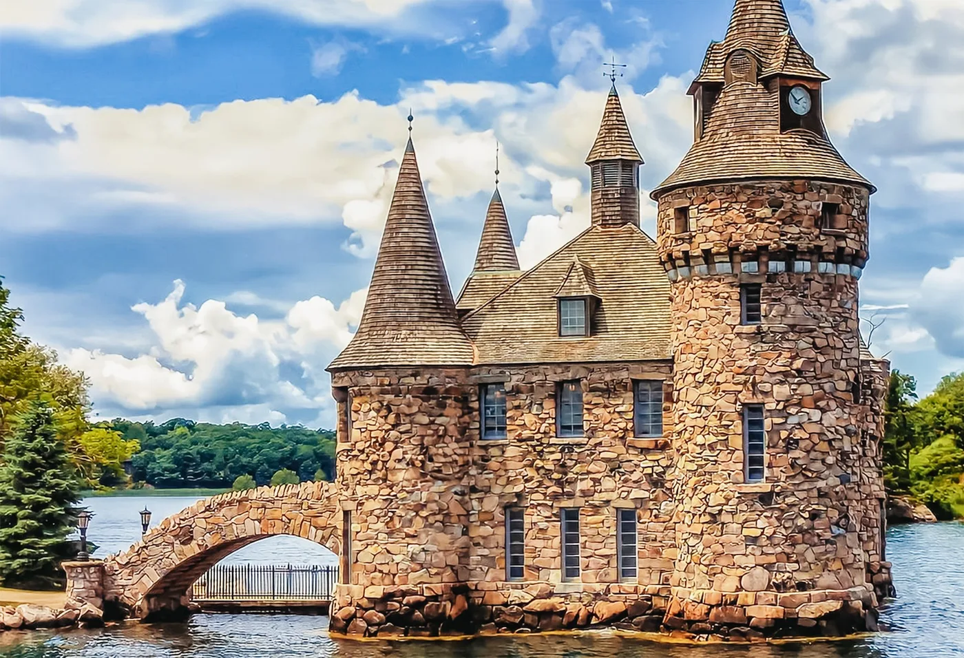
One, three or five hours from the City Cruises harbour in Gananoque, which the park authority itself names as the access point for the Admiralty Islands. The one-hour cruise goes through the Admiralty and Navy island groups, which include islands of the national park. The three-hour cruise also shows Boldt Castle and Millionaire's Row on the US side; the five-hour cruise stops at Boldt Castle.

4.5 out of 5 stars5,851 reviews on GetYourGuidefrom €26.03as of 4 Oct

  • 1, 3 or 5 hours
  • From Gananoque
  • Commentary in English and French
  • Boldt Castle stop only with a passport

Departure City Cruises harbour on Main Street in Gananoque, Ontario; check in with the staff. Paid parking at the harbour.

For the five-hour cruise with a stop at Boldt Castle on US territory, US entry requirements apply: a valid passport or Nexus card, and for guests from other countries an approved ESTA or a visa as well. The one-hour cruise shows neither Boldt Castle nor Millionaire's Row. Commentary in English and French. Food and drinks on board at extra cost. Cancellation up to 24 hours in advance with a full refund.

View tour ↗Ad · partner link · checked 2 Oct 2026

More checked toursAd · partner link · checked 3 Oct 2026

Provider's product photo · GetYourGuide

View from the Lookout Trail at Landon Bay over forested shores to the St. Lawrence River with the Thousand Islands between Gananoque and Ivy Lea

City Cruises Gananoque · GetYourGuide

From Ivy Lea: 1000 Islands Boldt Castle scenic cruise

One or two hours from the City Cruises harbour in Ivy Lea, one of the access points the park authority names for Georgina, Constance and Hill islands. The one-hour cruise shows Boldt Castle, the Zavikon Islands with the shortest international bridge and the St. Lawrence statue; the two-hour cruise also shows Singer Castle. Both castles are on US territory and are seen from the water.

4.6 out of 5 stars1,512 reviews on GetYourGuidefrom €26.03as of 4 Oct

  • 1 or 2 hours
  • From Ivy Lea
  • No passport needed
  • First deck wheelchair accessible

Departure City Cruises harbour in Ivy Lea, 95 Ivy Lea Road, Lansdowne, Ontario, on the 1000 Islands Parkway near the Thousand Islands Bridge; be there 30 minutes before departure.

Commentary in English. Food and drinks on board at extra cost; you may not bring your own; no pets. Cancellation up to 24 hours in advance with a full refund.

View tour ↗Ad · partner link · checked 2 Oct 2026

Landscape image, not a provider photo · Photo: The Cosmonaut ↗ · CC BY-SA 2.5 ca ↗

A small forested granite island with a Canadian flag in the St. Lawrence River, a suspension bridge in the background on the right

1000 Islands Helicopter Tours · GetYourGuide

From Gananoque: helicopter flight over the 1000 Islands

Scenic flight from the heliport in Gananoque with a window seat for every guest. The ten-minute option flies over Gananoque and the Admiralty, Navy and Lake Fleet island groups, which also include the national park islands. The 20- and 30-minute options continue to the Ivy Lea Bridge and to Boldt and Singer Castle on the US side; there is also a one-hour option.

4.9 out of 5 stars488 reviews on GetYourGuidefrom €79.88as of 4 Oct

  • 10 minutes to 1 hour
  • Window seat and headset
  • Commentary in six languages
  • Departs from Gananoque heliport

Departure Gananoque heliport on Highway 401, about 20 minutes east of Kingston; check in at reception, followed by a pre-flight briefing.

You can choose flights from 10 to 60 minutes. At most 3 guests per helicopter; solo travellers fly together with other guests. Flights only in suitable weather; maximum 125 kg (276 lb) per seat, children from 2 years need their own seat. The pilot commentates in English, and there are recorded commentaries in other languages. Cancellation up to 24 hours in advance with a full refund.

View tour ↗Ad · partner link · checked 2 Oct 2026

Landscape image, not a provider photo · Photo: Mykola Swarnyk ↗ · CC BY-SA 4.0 ↗

Morning mist over the glassy St. Lawrence River seen from a park island: calm water for kayaking between the islands

1000 Islands Kayaking, named by Parks Canada for guided kayak tours · Guided kayak tour · named by Parks Canada

Guided sea kayaking through the Admiralty Islands, with a stop on a park island

For beginners, Parks Canada recommends the guided tours of regional outfitters and names 1000 Islands Kayaking in Gananoque. After a short briefing, the group paddles with certified guides into the Admiralty Islands, where the island group gives shelter from the wind and motorboats have to slow down. The day tour lands on a national park island for a picnic, with time for a short walk or a swim. If you have less time, choose a three-hour morning or afternoon tour, or in high summer an evening sunset tour.

  • Day tour 7 hours, half-day 3 hours
  • Ages 6 and up, no experience needed
  • Kayak and safety gear provided
  • Bring your own lunch

Meeting point 1000 Islands Kayaking, 110 Kate Street, Gananoque; arrive 15 to 20 minutes before the start. No parking of its own; park on Main, John or South Street or in the City Cruises lot.

Day tour daily from 9:00 to 16:00; half-day tours from 8:30 to 11:30 and from 13:00 to 16:00, sunset tours in high summer Wednesday to Saturday from 17:00 to 20:00. Tours run with two or more participants; solo paddlers join a group. Tours run in any weather: bring a rain jacket and quick-drying clothing, no cotton. Book ahead; less than 48 hours ahead only by phone; changes and cancellations up to 48 hours in advance. Season from May to mid-October according to the operator; prices from the operator. Paddling on your own: the business also rents kayaks with maps, route suggestions and the park’s beaching permits.

Go to 1000 Islands Kayaking ↗Outfitter named by Parks Canada · no partner link · checked 2 Oct 2026

Landscape image, not a provider photo · Photo: Ferris842 ↗ · CC BY-SA 4.0 ↗

Offer photo: From Kingston: sunset dinner cruise into the Admiralty Islands

Kingston 1000 Islands Cruises (Kingston Destination Group) · Evening cruise from Kingston · dinner on board

From Kingston: sunset dinner cruise into the Admiralty Islands

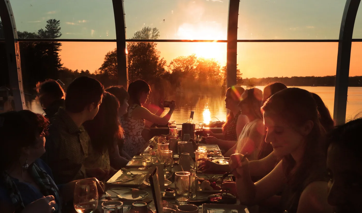
Three hours in the evening from Crawford Wharf in Kingston, with a three-course plated dinner, live music and commentary. The boat travels downstream into the Admiralty Islands; along the way the operator points out Napoleon's Hat and the Wanderer's Channel, beside which lies the park island of McDonald. On Mondays and Tuesdays a three-deck paddlewheeler sails, on other days a vessel with a glass roof and all-round views.

4.5 out of 5 stars328 reviews on GetYourGuidefrom €89.31as of 4 Oct

  • 3 hours
  • Early evening departure
  • Three-course dinner
  • Commentary in English

Departure Crawford Wharf, 1 Brock Street, Kingston, Ontario; arrive 30 minutes before boarding and exchange your voucher for tickets. There is no parking at the wharf.

Tickets are non-refundable. Drinks, special menu requests and tips are not included; vegetarian dishes are available, state allergies when booking. Wheelchair accessible. No passport is needed, as the cruise stays in Canadian waters. According to the operator, the boat sails from May to mid-October, Fridays to Sundays in spring and autumn and daily in summer, departing at 17:30 or 18:30 depending on the season.

View tour ↗Ad · partner link · checked 2 Oct 2026

Provider's product photo · GetYourGuide

Ad · we may earn a commission if you book through this partner link – at no extra cost to you. Thank you for supporting the atlas. Offer details checked 2 Oct 2026. See official ticket information.

Nature and history of Thousand Islands

The Frontenac Arch

The park lies on an eighty-kilometre-wide band of granite hills linking the Canadian Shield with the Adirondacks in New York. 10,000 years ago the glaciers scraped off the sediments; when the St. Lawrence flooded the basin, a thousand hilltops became a thousand islands.

The Frontenac Arch ↗

Biosphere reserve since 2002

The park lies in the Frontenac Arch Biosphere Reserve, recognised by UNESCO in 2002. At that time it was one of thirteen Canadian biosphere reserves.

Frontenac Arch Biosphere Reserve ↗

Species at the edge of their range

Because the Great Lakes moderate the climate, many plants and animals reach the limit of their range here. They include rue anemone, the gray ratsnake as Canada’s largest reptile, pitch pine, the least bittern and deerberry.

The Frontenac Arch ↗

Ten species at risk

Ten of the park’s reptile and amphibian species are considered at risk. The R.A.R.E. project incubates threatened turtle eggs and releases the hatchlings, builds artificial nesting sites and has tracked five gray ratsnakes by transmitter since spring 2022.

R.A.R.E.: reptiles and amphibians ↗

Protected since 1904

The park was created in 1904 from a waterfront property that the Mallory family gave to the federal government on condition that it be used as a park; nine federally owned islands were added. It was Canada’s first national park east of the Rocky Mountains and was called St. Lawrence Islands National Park until a few years ago.

History since 1904 ↗

04 · Before you go

Park film and places nearby

Photo: Mykola Swarnyk ↗ · CC BY-SA 4.0 ↗

Film by the park authority

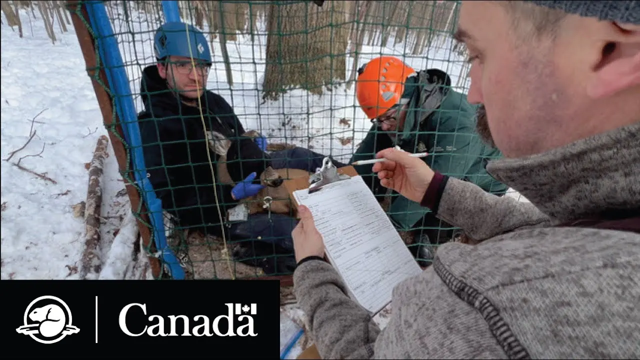
Monitoring Deer Movement | Climate Crew | Parks Canada

Just under seven minutes from Parks Canada, from 2024: the team captures white-tailed deer, measures them and fits them with tracking collars. The film shows why the park studies its very numerous deer and their movements between the islands and the mainland. In English.

Source: Parks Canada · View channel ↗

Around the park

Gananoque and Brockville

Both towns are on the Parkway and have harbours from which cruise boats and water taxis depart. Dive charters run to the wrecks from Brockville to Kingston.

Cruises ↗

Cruises

Public and private cruises run from Kingston to Brockville, some with themes on the region’s nature and history. Routes and prices vary.

Cruises ↗

Cycling on the Parkway

Along the Thousand Islands Parkway you can explore the region by bike, right up to the oTENTiks at Mallorytown Landing. Cycling is not allowed on the park’s hiking trails.

Cycling on the Parkway ↗

Historic sites nearby

Parks Canada runs places in the area including Bellevue House in Kingston, Fort Wellington in Prescott, the Kingston Fortifications and the Rideau Canal.

Park authority: Thousand Islands ↗

Field book · Thousand Islands National Park

checked 20 Sep 2026

Thousand Islands at a glance · PDF, 2 pages ↓

00My visit

Nothing saved yet. Every place card has a pin, and so does every place on the Map. What you save collects here, with days, notes and a preview you can share.

01Best time to visit Thousand Islands

The islands operate from mid-May to mid-October.

Summer season

The island facilities operate from 15 May to 12 October 2026, with self-registration. The visitor centre at Mallorytown Landing is staffed from 15 May to 7 September 2026, from 9:00 to 16:00.

Hours of operation 2026 ↗

June and September are quieter

According to the park authority, July and August are the most popular months. If you prefer it quieter, come in June or September, when fewer boats are out.

Paddling in the Thousand Islands ↗

After 7 September

From 8 September to 12 October 2026, only the washrooms at Mallorytown Landing stay open, from 9:00 to 16:00. The trails at Jones Creek and Landon Bay operate until 12 October.

Hours of operation 2026 ↗

Winter

The river starts to ice over in early December and freezes by the end of the month where the current does not prevent it; the ice melts in late March or early April. The mainland trails stay open all year, for snowshoeing in winter.

Climate in the Thousand Islands ↗

Climate

From January to mid-February the average is about −8 °C (18 °F), with the most precipitation of the year. In May, air and water average 12 to 13 °C (54 to 55 °F), in summer the average is 21 °C (70 °F). Thanks to the river, the islands stay cooler by day and milder at night than inland. On average there are 160 frost-free days.

Climate in the Thousand Islands ↗

Climate through the year

Weather and climate in Thousand Islands National Park

Best months by the climate data: May to September. Average daytime highs of 19 to 27 °C, lows of 7 to 16 °C, 60 to 73 mm of precipitation a month. The wettest month is October (79 mm), the driest February (43 mm).

Climate chart in Thousand Islands National ParkAverage daily highs from −3 °C to 27 °C, lows from −12 °C to 16 °C; monthly precipitation from 43 mm to 79 mm.
All monthly values as a table
Monthly averages 2001–2020, NASA POWER model
MonthHigh °CLow °CPrecipitation mm
January−3.3−11.848
February−2.1−11.543
March4.0−5.943
April11.80.458
May18.87.060
June23.612.773
July27.216.468
August26.915.960
September23.111.860
October14.65.579
November7.3−0.856
December0.2−6.957
Year705

Modelled values, not a weather station: NASA POWER (MERRA-2) for a grid cell of about 55 × 50 km around the map point Mulcaster (44.34° N, 76.05° W), with an average cell elevation of about 120 m. Averages for 2001–2020. Higher ground and valleys can differ markedly.

Source: NASA POWER, climatology 2001–2020 ↗ · retrieved 3 Oct 2026

02How to get to Thousand Islands: car, train and boat

To the mainland by car, to the islands by boat.

By car

The Thousand Islands Parkway links Brockville and Gananoque; from it, access roads lead to the visitor centre, Jones Creek and Landon Bay. From the USA you come across the Thousand Islands International Bridge.

Getting there by land and water ↗

By train and bus

VIA Rail stops regularly in Brockville, Gananoque and Kingston. Buses run to Brockville and Kingston. There is no park authority shuttle.

Getting there by land and water ↗

Without your own boat

Private operators take campers by water taxi to the Admiralty, Lake Fleet and Navy islands and to Georgina and Constance. There are also kayak and boat rentals and guided paddling trips.

Water taxis and boat rentals ↗

Launch points for your own boat

You get onto the water at Portsmouth Olympic Harbour in Kingston, the Gananoque municipal marina, Mallorytown Landing and Henry Street in Brockville. Parking fees apply everywhere; in Gananoque the parking lot in July and August is about two kilometres away.

Getting there by land and water ↗

Nautical charts are essential

The St. Lawrence River is known for its shoals; the park authority considers accurate nautical charts indispensable. They are available at the visitor centre or in shops. The park authority explicitly does not recommend Google Maps for finding water access points.

Getting there by land and water ↗

1000 Islands Kayaking, named by Parks Canada as a water taxi for campers · Water taxi · named by Parks Canada

Without your own boat: water taxi from Gananoque to the park islands

The national park islands can only be reached by water. For campers without a boat, Parks Canada names one water taxi operator: 1000 Islands Kayaking takes up to six people with luggage from Gananoque to the Admiralty islands McDonald, Beau Rivage, Aubrey and Thwartway, to the Lake Fleet islands Gordon, Camelot and Mulcaster or further east to Georgina and Constance, and back again at the agreed time. If you only want to send your tent and gear ahead, book the unaccompanied gear shuttle.

Meeting point 1000 Islands Kayaking dock at Gananoque harbour, 110 Kate Street. The business has no parking of its own; park on Main, John or South Street or in a public lot.

Fares are per boat and depend on three zones; they are listed by the operator. Bookings are made online; less than 48 hours ahead only by phone and without guarantee. Departure and return at the dock in Gananoque between 9:00 and 17:00, in the season from May to mid-October. Changes and cancellations up to 48 hours in advance, otherwise a processing fee may apply. Book your campsite or oTENTik on the island separately with Parks Canada. Only the gear shuttle serves Ivy Lea (destinations between Ivy Lea and Gananoque).

Go to 1000 Islands Kayaking ↗Operator named by Parks Canada · no partner link · checked 2 Oct 2026

03Thousand Islands fees instead of admission

All amounts in Canadian dollars, retrieved from Parks Canada on 20 September 2026.

Parking

A vehicle costs 9.50 CAD per day, a vehicle with boat trailer 24.50 CAD including the boat launch, a bus 34.75 CAD. For the season, a vehicle costs 161.50 CAD and a vehicle with trailer 261.50 CAD. The day pass expires at 11:00 the next morning.

Parks Canada: fees ↗

Boat launch and docking

The launch costs 15.00 CAD per day or 146.00 CAD for the season. Docking is charged by boat length: 1.00 CAD per foot per day, 1.50 CAD overnight, 12.25 CAD for the season, 18.50 CAD for rented houseboats and 24.50 CAD for commercial use.

Parks Canada: fees ↗

Beaching and moorings

If you land away from docks and moorings, you need a beaching permit: 7.25 CAD. A mooring buoy costs 24.00 CAD, a tender with an existing seasonal docking permit 18.00 CAD. Canoes, kayaks and paddleboards pay 35.00 CAD for the whole season, commercial 52.75 CAD.

Parks Canada: fees ↗

Camping

A basic island tent site with a composting toilet costs 19.50 CAD per night, an oTENTik 147.50 CAD, on the islands as on the mainland. A bundle of firewood costs 10.00 CAD. Docking and beaching fees are not included in the camping price.

Parks Canada: fees ↗

Reservations

A reservation, change or cancellation costs 11.50 CAD online and 13.50 CAD by phone. oTENTiks and reservable tent sites are only bookable through the Reservation Service; all other sites are self-registration on arrival.

Parks Canada: fees ↗

04Where to stay: island camping and oTENTiks

Tent or oTENTik, on two islands and on the mainland.

Island camping

McDonald Island and Gordon Island have oTENTiks, plus 28 reservable and 32 non-reservable tent sites. Overnight stays are not allowed at Jones Creek and Landon Bay.

Camping and accommodation ↗

oTENTiks

The park has ten oTENTiks: three on McDonald, two on Gordon and five on the mainland at Mallorytown Landing. They sleep six, have solar lighting and a charging station, but no running water. Cooking and eating inside are not allowed.

oTENTik accommodation ↗

No drinking water on the islands

Except on Central Grenadier, there is no drinking water on the park islands. If you stay overnight there, bring it with you. The toilets are composting toilets.

Camping and accommodation ↗

Firewood only from the park

Because of the emerald ash borer, firewood must be bought in the park; it may not be brought in or taken out. Collecting wood in the forest is prohibited.

Camping and accommodation ↗

Check-in and check-out times

Tent sites are available from 14:00, oTENTiks from 15:00; check-out is by 11:00. Reservations are made online or by phone; the park allocates all other sites on arrival. The docking fee is not included in the camping price.

Camping and accommodation ↗

05Rules & safety in Thousand Islands

The rules are aimed mainly at boaters.

Display your permit

Every boat at park facilities needs a valid docking or beaching permit, including tenders, canoes, kayaks, rowing boats, jet skis and paddleboards. The permit must be displayed visibly on the boat, the dashboard or at the campsite.

Rules and regulations ↗

Three nights per island

You may stay at the same dock or mooring for at most three consecutive nights; spaces cannot be reserved. Yellow lines on the dock are for park and rescue boats, blue for campers, red for commercial permits with a maximum stay of twenty minutes.

Rules and regulations ↗

Quiet hours and generators

Quiet hours are from 22:00 to 8:00. Generators and boat engines for charging may only run between 8:00 and 22:00, and only at Mallorytown Landing and on Beau Rivage, McDonald, Hill and Central Grenadier.

Rules and regulations ↗

Prohibited

Drones are prohibited without a permit from the superintendent, as are fireworks, metal detectors and rock and ice climbing. Bicycles, motor vehicles and horses are not allowed on the hiking trails. Dogs must be on a leash no longer than three metres and are not allowed on the beaches.

Rules and regulations ↗

Ticks, plants, animals

From April to November there is a risk of Lyme disease from ticks throughout the park. Giant hogweed, wild parsnip and poison ivy grow in the region. Black bears live on the mainland and occasionally on islands, coyotes also on the larger islands; raccoons can transmit rabies.

Plants and animals: safety ↗

06Frequently asked questions: Thousand Islands National Park

How much is the entrance fee for Thousand Islands National Park?

The park’s fee list has no daily admission. You pay for parking (9.50 CAD per vehicle per day), the boat launch (15.00 CAD), docking by boat length (1.00 CAD per foot per day), beaching (7.25 CAD), camping (19.50 CAD per night) and firewood (10.00 CAD per bundle). Youth aged 17 and under pay no admission at any Parks Canada place.

Parks Canada: fees ↗

How do I get to the islands without a boat?

There are four ways: rent a kayak or canoe, book a guided paddling trip, take a water taxi or rent a boat. If you just want to look, take a cruise. On the mainland you can reach the river without a boat at Mallorytown Landing, Jones Creek and Landon Bay.

Reaching the islands without your own boat ↗

When is Thousand Islands National Park open?

The island facilities operate from 15 May to 12 October 2026. The visitor centre at Mallorytown Landing is staffed from 15 May to 7 September from 9:00 to 16:00; after that, until 12 October, only the washrooms there are open at the same times. The trails at Jones Creek and Landon Bay can be walked all year.

Hours of operation 2026 ↗

Can I camp on the islands?

Yes, on McDonald Island and Gordon Island. There are oTENTiks there, plus 28 reservable and 32 non-reservable tent sites. Mallorytown Landing on the mainland has five more oTENTiks. Overnight stays are not allowed at Jones Creek and Landon Bay.

Camping and accommodation ↗

Is there drinking water on the islands?

Only on Central Grenadier. All other park islands have no drinking water and only composting toilets, so bring water with you.

Camping and accommodation ↗

How many islands does the park have?

Depending on how they are counted, 19 to 26 islands and 80 to 90 islets. The park authority publishes coordinates for 19 island sites and three properties on the mainland.

Facilities and trails ↗

07Sources and date checked

All information comes from the park authority and has been checked with a date.

  1. Park authority: Thousand Islands ↗
  2. Parks Canada: fees ↗
  3. Hours of operation 2026 ↗
  4. Getting there by land and water ↗
  5. Reaching the islands without your own boat ↗
  6. Island maps with coordinates ↗
  7. Facilities and trails ↗
  8. Hiking at Jones Creek and Landon Bay ↗
  9. Paddling in the Thousand Islands ↗
  10. Boating in the park ↗
  11. Camping and accommodation ↗
  12. oTENTik accommodation ↗
  13. Water taxis and boat rentals ↗
  14. Cruises ↗
  15. Swimming in the St. Lawrence ↗
  16. Fishing ↗
  17. Snowshoeing ↗
  18. Birdwatching ↗
  19. Wildlife viewing ↗
  20. The red chairs ↗
  21. Mallorytown Landing ↗
  22. Park authority audio tours ↗
  23. Diving to the wrecks ↗
  24. Cycling on the Parkway ↗
  25. Groups at Mallorytown Landing ↗
  26. Rules and regulations ↗
  27. Plants and animals: safety ↗
  28. Safety on the water ↗
  29. Weather and water safety ↗
  30. Climate in the Thousand Islands ↗
  31. Current notices ↗
  32. Nature and science ↗
  33. The Frontenac Arch ↗
  34. Frontenac Arch Biosphere Reserve ↗
  35. Conservation in the park ↗
  36. R.A.R.E.: reptiles and amphibians ↗
  37. White-tailed deer under observation ↗
  38. Research priorities ↗
  39. History since 1904 ↗
  40. The first summer visitors ↗
  41. A hundred years of the park ↗
  42. Administration and management ↗

How current is this information?

Researched 20 Sep 2026. Not a live status. Dates apply only to the year stated. A successful automatic fetch is not an editorial confirmation; outdated automatic values are hidden and replaced by the source link.

Current information from the park ↗

Image and map credits

Location sources: All points with the coordinates the park authority itself publishes on its map and directions pages. Markers do not imply that access is permitted. Base map © OpenStreetMap contributors. Coastlines of the chapter map: Natural Earth.

End of the field book · Park authority ↗