National Parks Atlas
MapPDF

01 · Canada · Yukon · Saint Elias Mountains

Kluane National Park

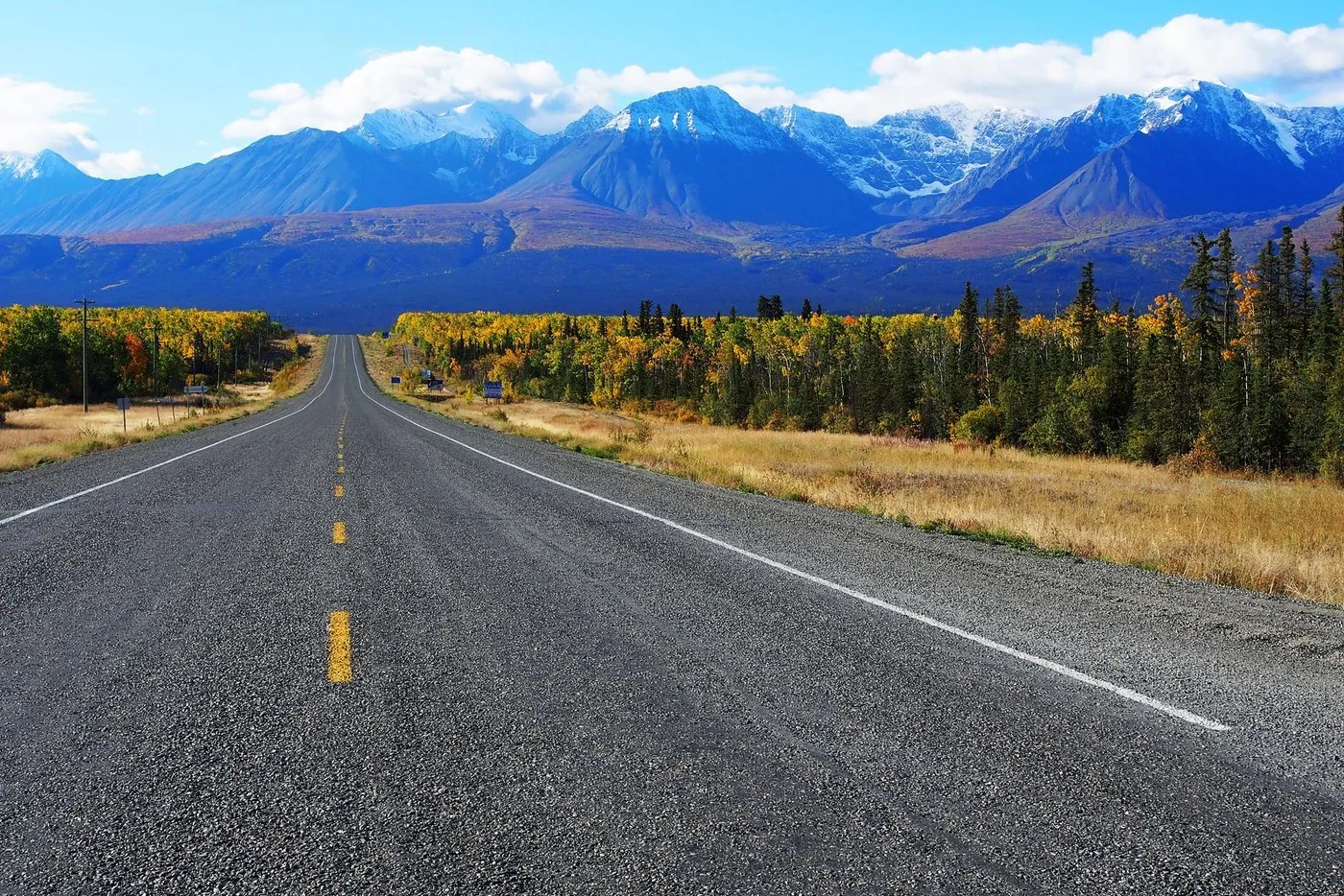
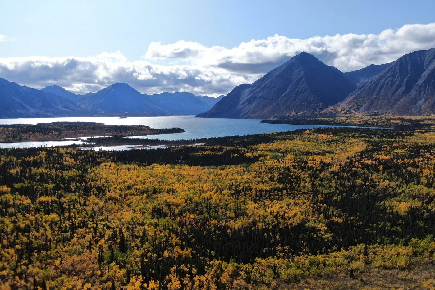
Seventeen of Canada’s twenty highest mountains, and more than eighty per cent of the park under ice. What you can reach on foot is the narrow green fringe.

Photo: Jakub Fryš ↗ · CC BY-SA 4.0 ↗

Kluane at a glance · PDF, 2 pages

Kluane National Park: landscape and origins

Kluane protects 21,980 square kilometres (8,487 sq mi) in the far south-west of the Yukon, and more than eighty per cent of it lies permanently under ice. What travellers set foot on is the narrow green fringe along two roads.

The park lies in the Saint Elias Mountains and holds seventeen of Canada’s twenty highest mountains, including Mount Logan at 5,959 metres (19,551 ft). The range consists of two chains: the Kluane Range, which you see from the Alaska Highway, and behind it the Icefield Ranges, which take up two thirds of the park’s interior.

Between them lie the most extensive icefields on Earth outside the polar regions. The long valley glaciers act as a pressure-release valve for these central ice masses; their flow can suddenly accelerate, which is known as a glacier surge.

Only about a fifth of the park has vegetation. In this Green Belt, mild Pacific air meets dry Arctic air, which allows more than 200 plant species: the greatest plant diversity north of the 60th parallel.

Kluane lies in the traditional territory of the Southern Tutchone, represented by the Champagne and Aishihik First Nations and the Kluane First Nation. Parks Canada and the First Nations governments manage the park together.

Together with Wrangell-St. Elias and Glacier Bay in Alaska and Tatshenshini-Alsek in British Columbia, Kluane forms the largest internationally protected area in the world and is a UNESCO World Heritage Site as a whole.

Establishment, area, geology and World Heritage ↗

The park in numbers

Area
21,980 km² (8,487 sq mi)
Established
1976
Location
South-western Yukon, bordering British Columbia and Alaska
Under ice
over 80 % of the park
Highest mountain
Mount Logan, 5,959 m (19,551 ft), Canada’s highest mountain
Peaks
17 of Canada’s 20 highest mountains
Traditional territory
Southern Tutchone; Champagne and Aishihik First Nations and Kluane First Nation
UNESCO World Heritage Site
together with Wrangell-St. Elias, Glacier Bay and Tatshenshini-Alsek
Climate
June mean 11 °C (52 °F), January −21 °C (−6 °F); up to 19 hours of daylight in summer
Visiting Kluane: overview and planning

01

Over 80 per cent of the park lies under ice

Kluane protects 21,980 square kilometres (8,487 sq mi) in the south-west of the Yukon. The icefields of the Icefield Ranges cover more than four fifths of it; they are the most extensive icefields on Earth outside the polar regions. Only the remaining 20 per cent or so, the so-called Green Belt on the eastern edge, has forest, tundra and trails.

Establishment, area, geology and World Heritage ↗

02

You cannot reach the interior on foot

The park authority puts it plainly: the interior of the park is generally accessible only by flightseeing or on a serious mountaineering or ski-touring expedition. If you want to see Mount Logan and the great glaciers, book a flight, or plan an expedition.

Getting there and planning your visit ↗

03

Haines Junction is your base

The village lies on the eastern edge of the park, 160 kilometres (99 mi) west of Whitehorse. From there the Haines Highway runs south and the Alaska Highway north, both along the park, with access to trails and campgrounds. The main visitor centre is in the Da Kų Cultural Centre in the village.

Getting there and planning your visit ↗

04

No admission fee on the fee list

Kluane’s official fees page lists no daily or annual admission. It starts with camping and then lists backcountry, mountaineering and fishing permits. If you are coming from the Rockies and know the Banff day pass, this is worth knowing: here the costs come from permits, not from a park gate.

Parks Canada: fees ↗

02 · Places

Map and places in the park

The map shows the imbalance: every reachable point on the eastern edge, Mount Logan far to the west. Every point is verified against an OpenStreetMap object.

Photo: Dgp38 ↗ · CC BY 3.0 ↗

Place in the park

Kathleen Lake

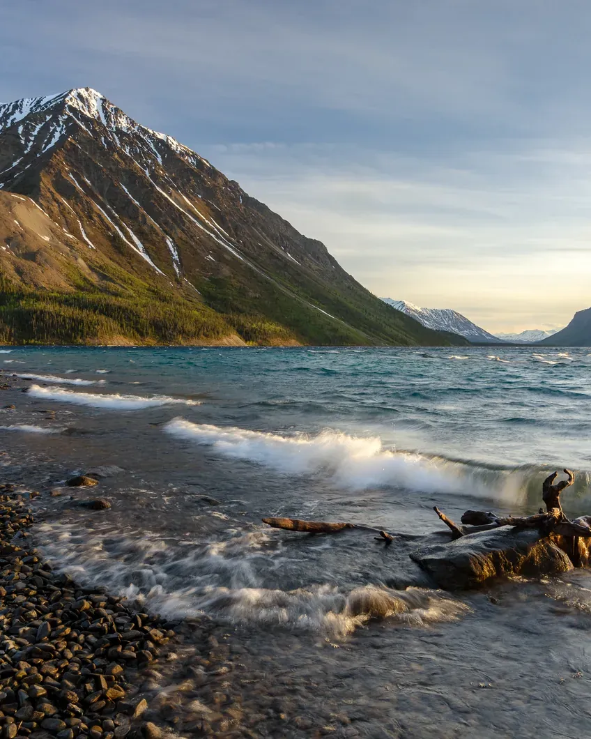
Mät'àtäna Män is where Kluane becomes tangible for ordinary travellers: mountains right behind the water, half a kilometre of boardwalk for everyone, and next to it the climb into a glacial cirque.

Location
A short drive south of Haines Junction on the Haines Highway.
Campground
38 sites, drinking water, firewood, bear-proof food lockers, pit toilets. No showers.
Season 2026
15 May to 20 September, 13:00.
Reservations
Some sites from 20 January 2026, 8:00 MST.
Kokanee Trail
0.5 km of boardwalk, wheelchair accessible, from the day-use area.
King's Throne Trail
5 km (3.1 mi) up into a cirque; beyond that to the summit only unmarked and unmaintained.
Price
30.00 CAD per site per night including firewood.

Kathleen Lake: season, trails and campground ↗

The Kaskawulsh Glacier in Kluane National Park with dark medial moraines through a wide valley, snow-covered peaks all around
Photo: Steffen Schreyer at de.wikipedia ↗ · CC BY-SA 2.0 de ↗

Place in the park

The Icefield Ranges

Two thirds of the park’s interior, completely glaciated. If you do not fly, you see none of it, and if you go in, you are alone for weeks.

Mount Logan
5,959 m (19,551 ft), Canada’s highest mountain.
Other peaks
St. Elias 5,489 m, Lucania 5,226 m, King Peak 5,173 m, Steele 5,073 m, Wood 4,842 m, Vancouver 4,812 m.
Climbing season
generally mid-April to late June.
Closed
15 November to 9 April no travel on the icefields.
Length of an ascent
ten days to three weeks, depending on the route.
Permits
Mountaineering permit 259.00 CAD per year, plus a landing permit for each landing.
Registration
Apply at least one month before departure; registration is mandatory for all climbers.

Mountaineering in the Icefield Ranges ↗

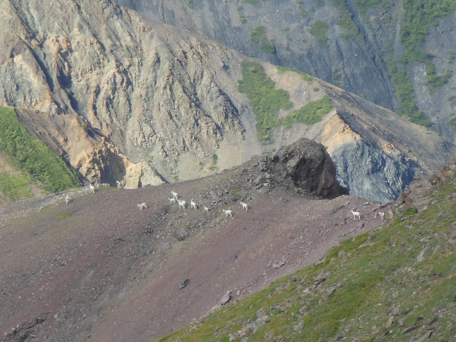
White Dall sheep in Kluane National Park spread across a steep scree slope above a green ridge
Photo: Jsayre64 ↗ · CC BY-SA 4.0 ↗

Place in the park

The Green Belt

The bare fifth of the park without ice. Here lie forest, tundra and every trail, and here lives practically everything you get to see in Kluane.

Share
about 20 % of the park area.
Forest
White spruce, trembling aspen and balsam poplar in the lower valleys.
Treeline
about 1,100 m (3,609 ft); above it willow, alder and dwarf birch.
Alpine tundra
from about 1,400 m (4,593 ft).
Plant diversity
over 200 species, the greatest north of the 60th parallel.
Mammals
Dall sheep as the most common large mammal, plus moose, caribou, mountain goats, grizzly and black bears, wolves, wolverines.
Birds
over 150 species recorded, 118 of them breeding in the park.

Establishment, area, geology and World Heritage ↗

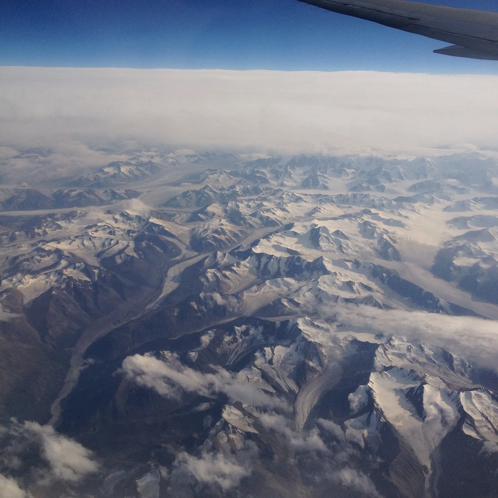
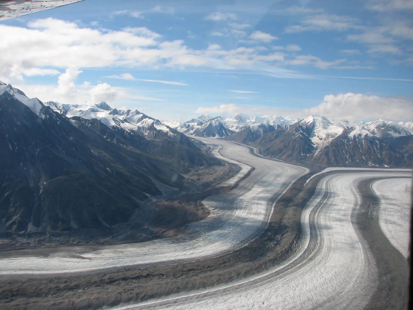
View from an aircraft over endless snow-covered ranges and glaciers in Kluane National Park, the wing at the top of the picture
Photo: Yanjipy ↗ · CC BY-SA 4.0 ↗

Place in the park

Flightseeing over the park

The park authority itself names flightseeing as one of two ways into the interior. The other is an expedition.

Route
over the Icefield Ranges to Canada’s highest mountains and largest icefields.
Why
otherwise the interior is only accessible on a serious mountaineering or ski-touring expedition.
Landings
every landing in the park needs its own landing permit.
Drones
recreational drone use is prohibited in Canada’s national parks.

Flightseeing over the icefields ↗

Map

8 places on the map

The map shows the imbalance: every reachable point on the eastern edge, Mount Logan far to the west. Every point is verified against an OpenStreetMap object.

Open map3D terrain · details and photos for every place
  • Mountains & rock1
  • Water3
  • Arrival1
  • Surroundings3

03 · Out and about

Hikes & things to do in Kluane

From half a kilometre of boardwalk to a three-week glacier expedition.

Photo: Bo Mertz ↗ · CC BY-SA 2.0 ↗

“The long valley glaciers are the pressure-release valve of the central icefields. Their flow can suddenly speed up; the park authority calls this a glacier surge.”

Kluane National Park · Lowell Glacier and Ulu Mountain in the Icefield Ranges

Hikes & things to do in Kluane

Kokanee Trail: 0.5 kilometres, wheelchair accessible

Half a kilometre of boardwalk along the shore of Kathleen Lake, starting at the day-use area. There is also a boat launch, a pebble beach for launching canoes, a spacious shelter and a picnic area overlooking the lake and mountains. Overnight stays in the shelter are not allowed.

Kathleen Lake: season, trails and campground ↗

King's Throne: 5 kilometres (3.1 mi) into a glacial cirque

This demanding trail climbs to a cirque, a kind of natural amphitheatre carved out by glaciers. From the cirque an unmarked and unmaintained route continues to the summit. The park authority recommends sturdy footwear for both.

Kathleen Lake: season, trails and campground ↗

Flightseeing over the icefields

The only realistic way for ordinary visitors to see the interior of the park: over the Icefield Ranges, Canada’s highest peaks and the largest non-polar icefields in the world.

Flightseeing over the icefields ↗

Alsek River

The Alsek rises in Kluane and is fed by meltwater from the second-highest coastal mountain range on Earth. The park authority describes it as a remote wilderness river with cold water, powerful rapids and ice floes: world-class rafting, but nothing you do on a whim.

Rafting on the Alsek River ↗

Mountaineering in the Icefield Ranges

The Icefield Ranges take up two thirds of the park’s interior. Their mountains include Mount Logan at 5,959 m (19,551 ft), Mount St. Elias at 5,489 m (18,009 ft), Mount Lucania at 5,226 m (17,146 ft), King Peak at 5,173 m (16,972 ft) and Mount Steele at 5,073 m (16,644 ft). Climbing the higher peaks requires extended glacier travel and, depending on the route, ten days to three weeks.

Mountaineering in the Icefield Ranges ↗

Winter and dark skies

In winter, ski touring, cross-country skiing and snowmobiling are possible. In September, Mät'àtäna Män (Kathleen Lake) also hosts Northern Nights, the Yukon’s only dark sky festival.

Activities and experiences ↗

Offer photo: Kluane National Park: full-day tour

Arctic Range Adventure · Day tour · into the park

Kluane National Park: full-day tour

Nine hours from Whitehorse to Kathleen Lake, with a 45-minute hike in the park and a visit to the Da Kų Cultural Centre in Haines Junction.

4.9 out of 5 stars12 reviews on GetYourGuidefrom €202.31as of 4 Oct

  • 9 hours
  • 45-minute hike in the park
  • Kathleen Lake
  • Da Kų Cultural Centre

Departure Pickup at 8:30 from your hotel in downtown Whitehorse, be in the lobby 10 minutes early; back at around 17:30.

Included are all transport with a guide, energy bars and water, the hike, the stop at Kathleen Lake and the visit to the cultural centre. Lunch is not included. Not suitable for children under 7 or wheelchair users. Guided in English, Spanish or Japanese. Pets, alcohol and drugs are not allowed.

View tour ↗Ad · partner link · checked 2 Oct 2026

Provider's product photo · GetYourGuide

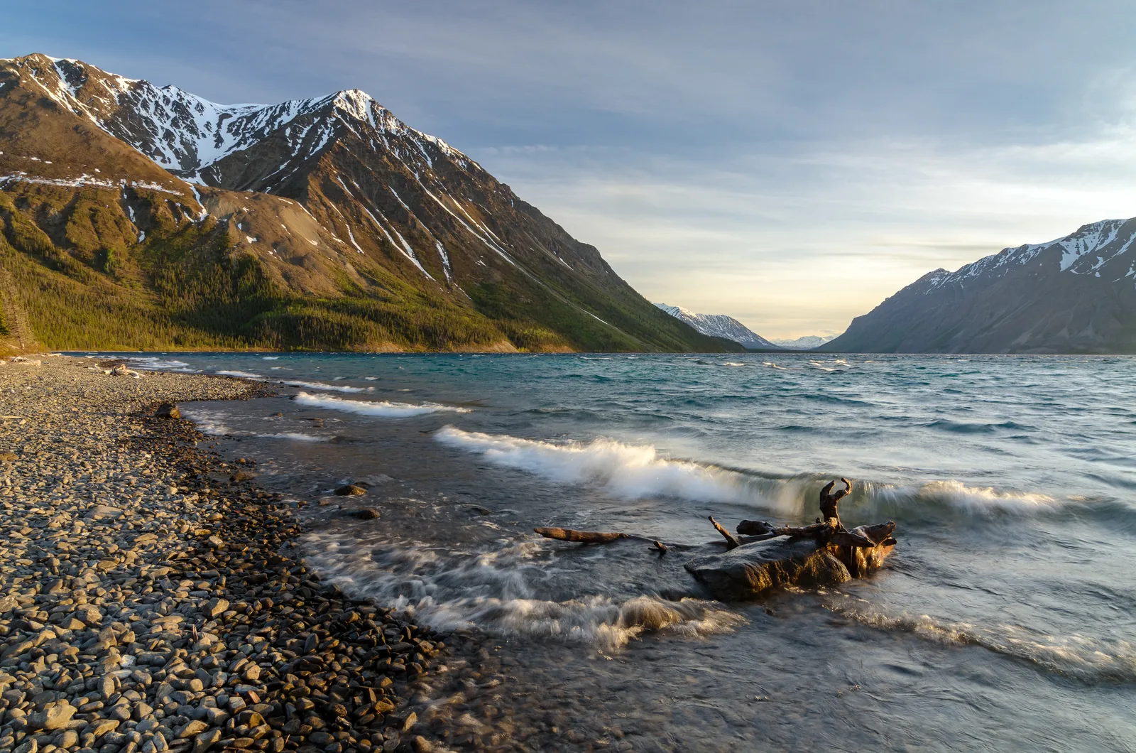
Evening light on Kathleen Lake in Kluane National Park, where the park authority holds campfire talks in summer; behind it the flanks of the Kluane Range

Kluane park authority (Parks Canada) · Park authority programme · summer evenings

Summer evenings with the park authority in Haines Junction and at Kathleen Lake

From mid-June to the end of August, Parks Canada invites you on three evenings a week: on Wednesdays to the “Kluane Evenings” with talks, films and traditional stories at the visitor centre in Haines Junction, on Thursdays and Fridays to campfire talks about history, wildlife and changing ecosystems at the Kathleen Lake campground. On some evenings John Fingland tells of the history and culture of the Champagne and Aishihik First Nations on the lakeshore. At the end of September, Kathleen Lake hosts the “Northern Nights” dark sky festival, with stargazing through the telescopes of the Yukon Astronomical Society.

  • free
  • Mid-June to late August, one hour each
  • Haines Junction and Kathleen Lake
  • Dates in the park authority’s calendar

Meeting point Kluane Evenings at the park visitor centre in the Da Kų Cultural Centre in Haines Junction; campfire talks at the campground, storytelling evenings and Northern Nights at the Kathleen Lake day-use area (Mät’àtäna Män), a short drive south of Haines Junction on the Haines Highway.

According to the park authority, all regular programmes are free; bring your own mug for tea and hot chocolate by the fire. The summer evenings do not take place under dark skies: in June and July it stays light long after 19:00. The park authority only shows the stars at the Northern Nights festival at the end of September, when the nights are dark again; some workshops there require registration. The 2026 programmes have ended, and the park authority announces the next ones for 2027. Whitehorse is about 160 kilometres (99 mi) away; the day tours from Whitehorse are back by evening, so to take part you stay at Kathleen Lake or in Haines Junction.

Park authority page ↗Park authority programme · no partner link · checked 2 Oct 2026

Landscape image, not a provider photo · Photo: Jakub Fryš ↗ · CC BY-SA 4.0 ↗

Ad · we may earn a commission if you book through this partner link – at no extra cost to you. Thank you for supporting the atlas. Offer details checked 2 Oct 2026. See official ticket information.

Nature and culture of Kluane

17 of Canada’s 20 highest mountains

Kluane lies in the Saint Elias Mountains and holds seventeen of the country’s twenty highest mountains, including Mount Logan, Canada’s highest peak. The range consists of two chains separated by a narrow trough, the Duke Depression: the Kluane Range, averaging about 2,500 metres (8,202 ft), and to the west the Icefield Ranges, whose summits rise to around 5,000 metres (16,404 ft).

Nature and science ↗

Young mountains that are still growing

Compared with other mountains in the Yukon, Kluane’s are young and keep rising through plate movement. The long valley glaciers act as a pressure-release valve for the central icefields and carve out U-shaped valleys. The flow of a valley glacier can suddenly speed up: a glacier surge.

Establishment, area, geology and World Heritage ↗

Where Pacific and Arctic air meet

Over Kluane, mild, moist Pacific air overlaps with dry Arctic air from the Yukon interior. The result is one of the richest plant and animal communities in northern Canada: over 200 species in the Green Belt, the greatest plant diversity north of the 60th parallel. The treeline lies at about 1,100 metres (3,609 ft), and alpine tundra begins above 1,400 metres (4,593 ft).

Establishment, area, geology and World Heritage ↗

Dall sheep, grizzlies, 150 bird species

Dall sheep are the park’s most common large mammal, along with plenty of moose and a few caribou and mountain goats. Grizzly and black bears roam the forest and the alpine zone, as do wolves, coyotes, wolverines, martens and marmots. Over 150 bird species have been recorded, 118 of them breeding in the park.

Establishment, area, geology and World Heritage ↗

Dän Keyi: our people’s land

Kluane lies in the traditional territory of the Southern Tutchone, represented in the region by the Champagne and Aishihik First Nations and the Kluane First Nation. For thousands of years the Dän lived here by hunting and gathering. In 1943 the federal government protected the area as a game sanctuary; part of the Kluane Game Sanctuary became today’s park. Parks Canada and the First Nations governments manage it together.

Southern Tutchone culture and history ↗

The largest internationally protected area in the world

Kluane was established in 1976 and borders three other large protected areas: Wrangell-St. Elias and Glacier Bay National Parks in Alaska and Tatshenshini-Alsek Park in British Columbia. Together they form a UNESCO World Heritage Site, and the largest internationally protected area on Earth.

Establishment, area, geology and World Heritage ↗

04 · Before you go

Park film and places nearby

Photo: Jakub Fryš ↗ · CC BY-SA 4.0 ↗

Film by the park authority

Ä́’sía Keyi – Grandfather's Land

Two and a half minutes that the park itself features on its culture page: a song in Southern Tutchone, written and sung by Diyet van Lieshout, a member of the Kluane First Nation, about the connection to this land. No travel information, but the perspective from which the park is managed.

Source: Parks Canada · View channel ↗

Around the park

Kluane Lake and Burwash Landing

Kluane Lake lies north-east of the park, outside it, on the Alaska Highway. On the way you pass the Thechàl Dhâl' Visitor Centre, an hour’s drive north of Haines Junction; Burwash Landing follows further north.

Visitor centres and opening hours ↗

Via the Haines Road to Alaska

To the south, the Haines Road runs along the park to Haines in Alaska, with connections to the Alaska Marine Highway ferries. That makes Kluane a natural link between the Yukon and the Inside Passage.

Getting there and planning your visit ↗

Field book · Kluane National Park

checked 19 Sep 2026

Kluane at a glance · PDF, 2 pages ↓

00My visit

Nothing saved yet. Every place card has a pin, and so does every place on the Map. What you save collects here, with days, notes and a preview you can share.

01Best time to visit Kluane

A short summer with very long days, a long dark winter, and hard calendar limits for every activity.

Mid-May to late September

The Kathleen Lake campground is open from 15 May to 20 September in 2026. The main visitor centre in Haines Junction is open daily from 9:00 to 17:00 from 15 May to 20 September, the Thechàl Dhâl' Visitor Centre daily from 10:00 to 16:00 from 20 May to 6 September.

Visitor centres and opening hours ↗

Daylight: 19 hours in summer, 4 in winter

North of the 60th parallel, summers are warm with up to 19 hours of daylight, while winters are long and dark, sometimes with only 4 hours. The mean temperature is 11 °C (52 °F) in June and −21 °C (−6 °F) in January.

Climate and weather ↗

Mountaineering: mid-April to late June

According to the park authority, the climbing season generally runs from mid-April to the end of June. Travel on the icefields is not permitted between 15 November and 9 April. The park announces the exact start of the season each year; applications should be in at least one month before departure.

Mountaineering in the Icefield Ranges ↗

Dall sheep in spring and autumn

There is a spotting scope on the terrace of the Thechàl Dhâl' Visitor Centre. Dall sheep are most likely to be seen on the neighbouring mountain, Thechàl Dhâl', in spring and autumn.

Visitor centres and opening hours ↗

Mountain weather stays unpredictable

The park authority points out that mountain weather changes quickly and varies greatly from place to place. Rain or snow is possible in any season, frost even in high summer.

Climate and weather ↗

Climate through the year

Weather and climate in Kluane National Park

Mildest months by the climate data: June to August. Average daytime highs of 7 to 9 °C, lows of 0 to 2 °C, 89 to 108 mm of precipitation a month. The wettest month is July (108 mm), the driest February (25 mm).

Climate chart in Kluane National ParkAverage daily highs from −14 °C to 9 °C, lows from −20 °C to 2 °C; monthly precipitation from 25 mm to 108 mm.
All monthly values as a table
Monthly averages 2001–2020, NASA POWER model
MonthHigh °CLow °CPrecipitation mm
January−14.3−20.129
February−12.4−19.725
March−10.7−19.829
April−4.6−13.838
May1.6−5.956
June7.00.3105
July9.42.5108
August8.00.989
September2.8−4.562
October−4.9−11.751
November−12.5−18.237
December−13.7−19.033
Year662

Modelled values, not a weather station: NASA POWER (MERRA-2) for a grid cell of about 55 × 35 km around the map point Thechàl Dhâl' Visitor Centre (61.01° N, 138.53° W), with an average cell elevation of about 1,740 m. Averages for 2001–2020. Higher ground and valleys can differ markedly.

Source: NASA POWER, climatology 2001–2020 ↗ · retrieved 3 Oct 2026

02How to get to Kluane: roads, parking and flights

Two roads along the eastern edge, and an aircraft for everything else.

160 kilometres (99 mi) from Whitehorse

The classic route follows the Alaska Highway 160 kilometres (99 mi) west from Whitehorse to Haines Junction. Whitehorse has scheduled flights, which makes it the starting point for most travellers.

Getting there and planning your visit ↗

By ferry via Alaska

Alternatively, the Alaska Marine Highway ferry runs to Haines or Skagway in Alaska. From Haines you drive north on the Haines Road; from Skagway on the South Klondike Highway to Whitehorse and then west on the Alaska Highway.

Getting there and planning your visit ↗

Two roads, two directions

From Haines Junction the Haines Highway runs south and the Alaska Highway north, both along the eastern edge of the park. Every trail, viewpoint and the campground you can reach without an aircraft lies on one of these two routes.

Getting there and planning your visit ↗

Flightseeing into the interior

Flightseeing tours cross the Icefield Ranges to Canada’s highest mountains and largest icefields. For mountaineers, every landing in the park also needs its own landing permit.

Flightseeing over the icefields ↗

Parking at Thechàl Dhâl: a small lot at the gate

For the Sheep Creek Trail you register at the Thechàl Dhâl visitor centre and then drive or walk 2.6 km (1.6 mi) into the valley of the Ä’äy Chù. There you find a locked gate and a small parking lot; the trail starts about five minutes beyond the gate.

Parks Canada: Sheep Creek Trail ↗

Parking at Kathleen Lake: day-use area on the shore

Kathleen Lake lies 27 km (17 mi) south of Haines Junction on the Haines Road. You park in the day-use area on the lakeshore; the Kokanee Trail starts at the right-hand end of the parking lot as you face the lake.

Parks Canada: Kokanee Trail at Kathleen Lake ↗

EPIC NORTH Tour Experiences Inc. · Highway tour · to the edge of the park

Whitehorse: Kluane wildlife and vistas on the Alaska Highway

Ten hours by minibus along the Alaska Highway beside the Kluane Ranges to Haines Junction and on north to Kluane Lake, with stops for views and possible wildlife sightings; in good weather with a short walk at Sheep Mountain.

4.0 out of 5 stars13 reviews on GetYourGuidefrom €239.44as of 4 Oct

Departure In front of the Best Western Gold Rush Inn in Whitehorse, be there 10 minutes before the start.

This tour drives to the edge of the park, not into it: the operator says so itself, as the interior is closed to vehicles. That is not a weakness of the tour but the nature of Kluane: the park is almost entirely roadless and otherwise reachable only on foot or by air. If you want to go in, the full-day tour with a hike above is the one.

View tour ↗Ad · partner link · checked 2 Oct 2026

Ad · we may earn a commission if you book through this partner link – at no extra cost to you. Thank you for supporting the atlas. Offer details checked 2 Oct 2026. See official ticket information.

03Kluane fees and permits

All amounts in Canadian dollars, retrieved from Parks Canada on 19 September 2026.

Camping at Kathleen Lake

A campsite costs 30.00 CAD per night including firewood; the campground is basic, with no showers. Group sites cost 6.25 CAD per person per night, with firewood there at 10.50 CAD per night. An oTENTik costs 147.50 CAD per night with firewood.

Parks Canada: fees ↗

Backcountry and mountaineering

A backcountry permit costs 15.00 CAD per person per night or 105.00 CAD per year. The Icefield Ranges need a separate mountaineering permit at 259.00 CAD per year; every aircraft landing also needs a landing permit. Bear-resistant food canisters can be rented for 6.00 CAD per canister per night.

Parks Canada: fees ↗

Fishing and reservations

A fishing permit costs 15.00 CAD per day or 51.25 CAD per year. Each reservation, change or cancellation costs an extra 11.50 CAD online or 13.50 CAD by phone.

Parks Canada: fees ↗

Regular prices again since 8 September 2026

According to the park authority, 7 September 2026 was the last day of discounted overnight stays under the Canada Strong Pass. Information from summer 2026 may therefore quote lower camping prices than apply today.

Parks Canada: fees ↗

04Where to stay in Kluane: camping and backcountry

One campground with 38 sites, and beyond that backcountry with mandatory registration.

Kathleen Lake Campground

38 sites at Mät'àtäna Män, with a drinking water tap, firewood, bear-proof food lockers and pit toilets. Fires are allowed in the fire rings at each site. There are no showers. The 2026 season runs from 15 May to 20 September, 13:00.

Kathleen Lake: season, trails and campground ↗

Reservations: only some of the sites

Some of the sites can be booked in advance through the Parks Canada Reservation Service; for 2026 from 20 January 2026, 8:00 MST. The rest are first come, first served.

Kathleen Lake: season, trails and campground ↗

Backcountry: registration is mandatory

For every overnight stay in the backcountry between 1 April and 15 November, a permit, registration and de-registration after your return are required. Approved bear-resistant food canisters are also mandatory.

Mandatory registration for backcountry overnight trips ↗

Accommodation outside the park

Hotels and other services are in Haines Junction and along the Alaska Highway, for example in Burwash Landing. Both lie outside the park.

Getting there and planning your visit ↗

05Rules & safety in Kluane

Remoteness here is not a mood but a condition.

Self-reliance in the backcountry

The park authority says it in so many words: you must be self-sufficient and able to handle emergencies on your own. The same applies again, explicitly, to mountaineering parties. Plan ahead and bring suitable equipment.

Safety and rules ↗

Grizzly and black bears

Both bear species live in Kluane. The park authority requires you to know the principles of travelling safely in bear country; bear-resistant food canisters are mandatory in the backcountry.

Safety and rules ↗

Icefields only in season

Travel on the icefields is not permitted between 15 November and 9 April. Climbers must apply and register in advance; applications should arrive at least one month before departure.

Mountaineering in the Icefield Ranges ↗

No drones

Recreational use of unmanned aircraft is prohibited in Canada’s national parks and national historic sites. Permits may be issued for research or filming; all commercial photography and filming needs a permit anyway.

Mountaineering in the Icefield Ranges ↗

Emergencies and contact

Visitor information 867-634-5134, administration 867-634-7250, kluaneinfo@pc.gc.ca, postal address Haines Junction YT Y0B 1L0. The park’s emergency number is 1-780-852-3100.

Park authority: Kluane ↗

06Frequently asked questions: Kluane National Park

How much is the entrance fee for Kluane National Park?

The park’s official fee list includes no daily or annual admission. Costs come from permits: camping at Kathleen Lake 30.00 CAD per night, backcountry 15.00 CAD per person per night, mountaineering permit 259.00 CAD per year, fishing permit 15.00 CAD per day.

Parks Canada: fees ↗

Can I see Mount Logan without being a mountaineer?

Only from the air. The park authority says the interior is generally accessible only by flightseeing or on a serious mountaineering or ski-touring expedition. From the Alaska Highway you see the Kluane Range in front, not the high peaks behind it.

Getting there and planning your visit ↗

How do I get to Kluane National Park?

Via the Alaska Highway, 160 kilometres (99 mi) west from Whitehorse to Haines Junction; Whitehorse has scheduled flights. Alternatively take the Alaska Marine Highway ferry to Haines or Skagway and continue overland from there.

Getting there and planning your visit ↗

When is Kluane National Park open?

The park itself is accessible all year; the facilities are not. In 2026 the Kathleen Lake campground runs from 15 May to 20 September, as does the visitor centre in Haines Junction, and the Thechàl Dhâl' Visitor Centre from 20 May to 6 September. Travel on the icefields is not permitted between 15 November and 9 April.

Visitor centres and opening hours ↗

Do I need to register for a backcountry overnight stay?

Yes. Between 1 April and 15 November, a permit, registration and de-registration after your return are required for every backcountry overnight stay. Approved bear-resistant food canisters are mandatory; they can be rented for 6.00 CAD per canister per night.

Mandatory registration for backcountry overnight trips ↗

Are there easy hikes in Kluane?

Yes. The Kokanee Trail at Kathleen Lake is half a kilometre of boardwalk and wheelchair accessible. The King's Throne Trail climbs 5 kilometres (3.1 mi) into a glacial cirque and is demanding; the continuation to the summit is unmarked and not maintained.

Kathleen Lake: season, trails and campground ↗

07Sources and date checked

All information comes from the park authority and has been checked with a date.

  1. Park authority: Kluane ↗
  2. Parks Canada: fees ↗
  3. Getting there and planning your visit ↗
  4. Visitor centres and opening hours ↗
  5. Kathleen Lake: season, trails and campground ↗
  6. Activities and experiences ↗
  7. Hiking in Kluane ↗
  8. Mountaineering in the Icefield Ranges ↗
  9. Flightseeing over the icefields ↗
  10. Rafting on the Alsek River ↗
  11. Camping and accommodation ↗
  12. Mandatory registration for backcountry overnight trips ↗
  13. Nature and science ↗
  14. Establishment, area, geology and World Heritage ↗
  15. Southern Tutchone culture and history ↗
  16. Safety and rules ↗
  17. Climate and weather ↗
  18. Parks Canada: Sheep Creek Trail ↗
  19. Parks Canada: Kokanee Trail at Kathleen Lake ↗

How current is this information?

Researched 19 Sep 2026. Not a live status. Dates apply only to the year stated. A successful automatic fetch is not an editorial confirmation; outdated automatic values are hidden and replaced by the source link.

Current information from the park ↗

Image and map credits

Location sources: Every location verified against an OpenStreetMap object; object type checked in each case. Markers do not imply that access is permitted. Base map © OpenStreetMap contributors. Coastlines of the chapter map: Natural Earth.

End of the field book · Park authority ↗