



Entrance fees and special offers
Regular fees are listed under Tickets & entrance fees. Also check the official free-admission offers and exemptions for your travel day.

01 · The first park · Alberta, Canada
Turquoise lakes. High mountains. A visit that starts with the right way in.
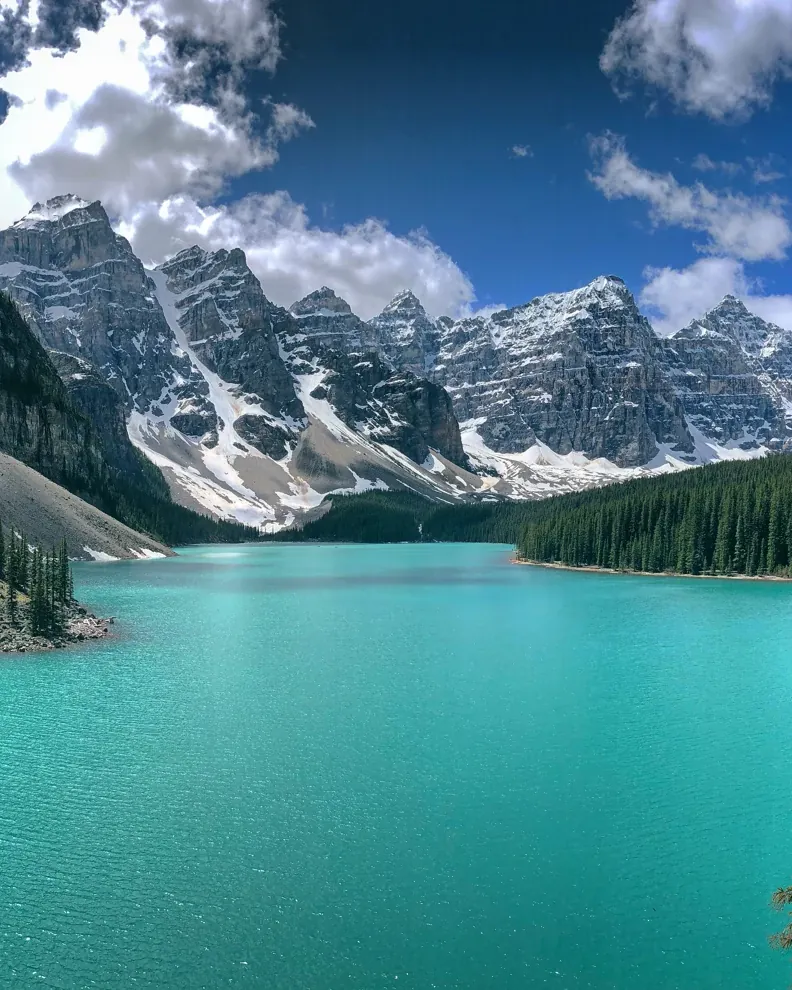
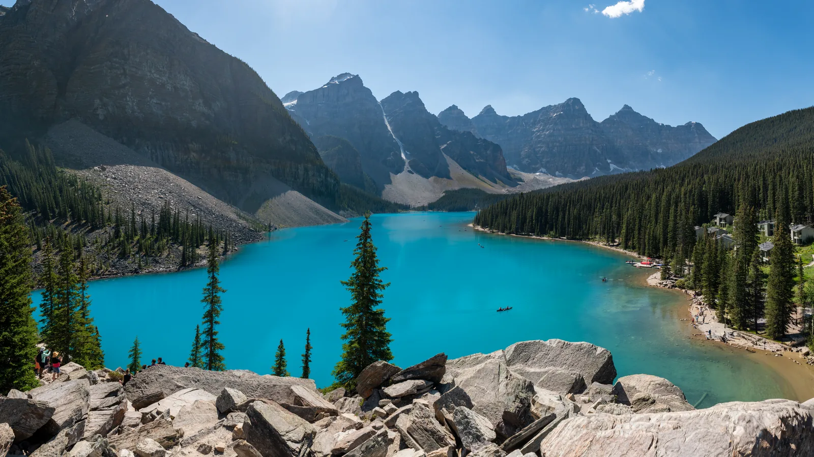
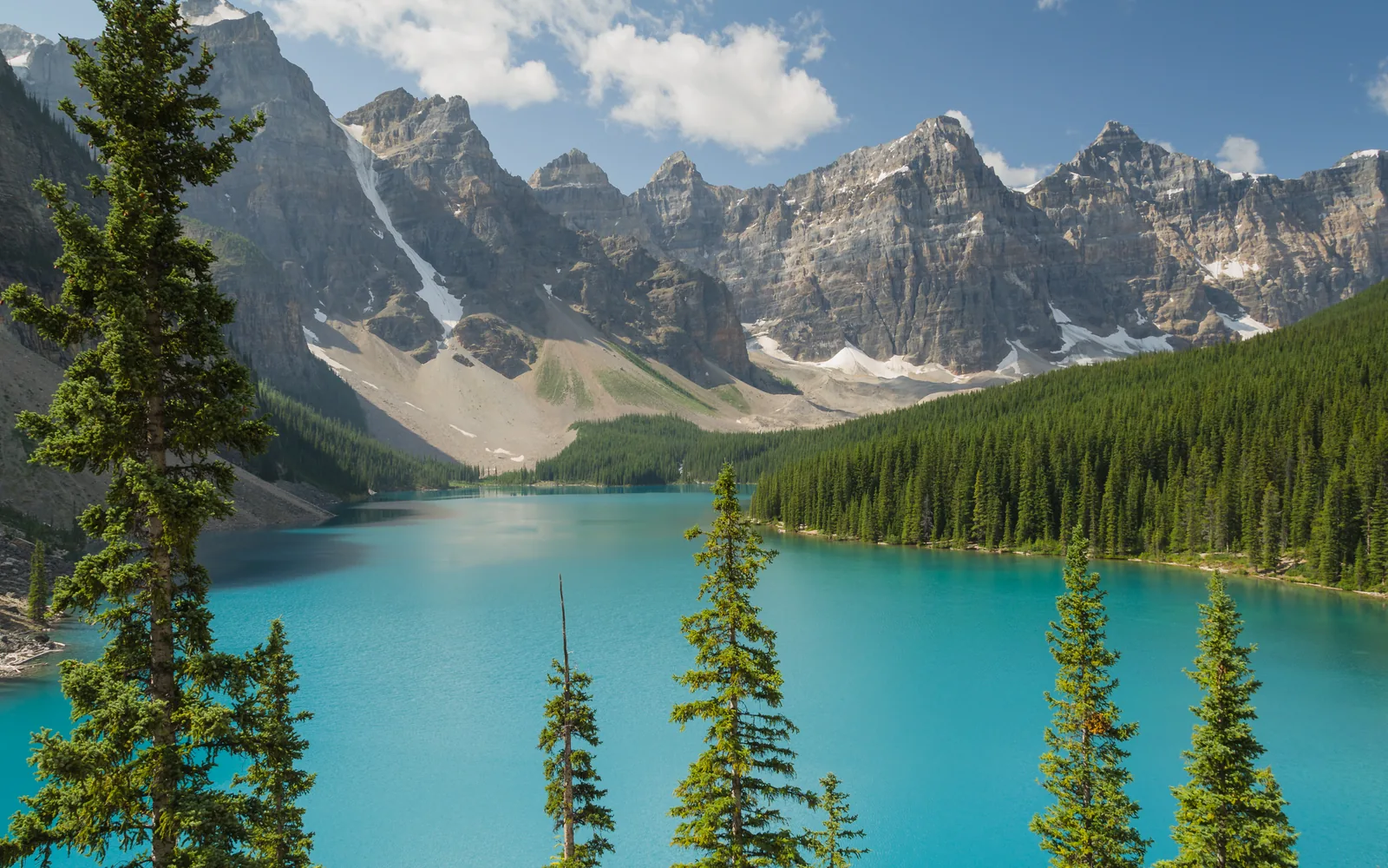
First momentAt Moraine Lake in the Valley of the Ten Peaks: the park's most searched-for place cannot be reached in your own car. The road there is closed to private vehicles all year.
of valleys, peaks, glaciers, forests and rivers
the hot springs at today's Cave and Basin
UNESCO World Heritage, together with six other parks
and more: how long the springs have mattered to Indigenous peoples
Regular fees are listed under Tickets & entrance fees. Also check the official free-admission offers and exemptions for your travel day.
Private vehicles may not drive to Moraine Lake. Registered guests of Moraine Lake Lodge are the exception.
The park authority reports closed trails and campgrounds as they happen. Check the current notices before your trip; the link is in the field guide under Sources.
The Fairy Bus · GetYourGuide
Shared shuttle from Calgary International Airport (YYC) to the town of Banff, around two hours with a few stops on the way. The driver helps with luggage; according to the description, the shuttle stops in the centre of Banff. For arriving without a rental car: both lake shuttles above only start in town, in Banff or Canmore.
Departure Calgary Airport, domestic terminal: Pillar 15 opposite exit door 3 or 4. Be there at least five minutes before the booked departure.
Included are the ride in the shared shuttle, the driver and help with luggage. The page does not list departure times; they only appear when you check availability. Where exactly the shuttle stops in Banff is not on the page either. The page does not mention the national park pass, so plan for it separately (see Tickets & entrance fees). Not suitable for wheelchair users; smoking and drinks are not allowed in the vehicle. Free cancellation up to 24 hours in advance. Check dates and prices with the provider.
View tour ↗Ad · partner link · checked 27 Sep 2026
Provider's product photo · GetYourGuide
02 · Where the park began
In 1883, three railway workers came upon hot springs and claimed them for themselves. The government refused, protected the springs in 1885 and made them Canada's first national park in 1887.
National Historic Site
In 1883, three railway workers claimed these hot springs for themselves. The government refused and created a reserve in 1885, the beginning of Canada's first national park.
Dazu passt Sunset and stars: evening walk from Cave and BasinHot Springs Reserve of 1885
Canada's first national park in 1887
the park has been called Banff
managed by Parks Canada today
Warm water, a rare snail
On Sulphur Mountain, rain and meltwater seep up to three kilometres deep, heat up and rise again: hot at the Upper Hot Springs, warm at Cave and Basin. The endangered snail Physella johnsoni lives in only six of these springs, which is why only the Upper Hot Springs are still open for bathing.
The Hot Springs Reserve around Cave and Basin, created in 1885, became Canada's first national park in 1887. Today Parks Canada manages 48 national parks, 171 national historic sites, five national marine conservation areas and one national urban park, by its own account the largest system of protected places in the world.
Together with Jasper, Kootenay, Yoho and three provincial parks, Banff forms the Canadian Rocky Mountain Parks World Heritage Site: about 400 km (249 mi) long, up to 100 km (62 mi) wide and over 95 % in a natural state. UNESCO highlights icefields, glaciers, karst caves and thermal springs, and notes that glacier retreat due to climate change is visible.
Banff & Canmore Tours · GetYourGuide
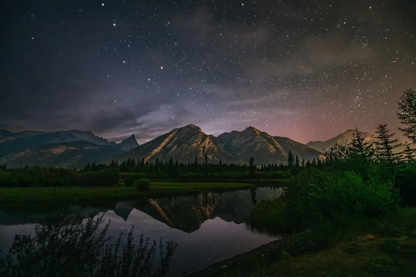
Two hours on foot with a guide into the evening: start shortly after sunset at the Cave and Basin National Historic Site in the town of Banff, easy trails of about five kilometres into the dusk, then constellations and stories about the night sky, watching for shooting stars and northern lights. The provider supplies headlamps.
Departure Cave and Basin National Historic Site parking lot in Banff (311 Cave Ave), in front of the Welcome Building; the guide carries a clipboard. No pick-up. The start time follows sunset and is sent 12 to 24 hours in advance.
Included are the guide, headlamps and ice cleats if needed; hotel pick-up and food and drinks are not. The page does not mention park admission; Cave and Basin is inside the national park. The tour is cancelled in heavy cloud; the provider gets in touch 12 to 24 hours in advance and refunds you. For the same product on Viator, the provider sets the limit at 50 per cent cloud cover at most. Not suitable for children under 8 years, pregnant women, people with medical conditions or after surgery. Contradiction: the key details call the tour wheelchair accessible, while the "Not suitable for" list excludes people with mobility impairments. Clarify with the provider before booking. Free cancellation up to 24 hours in advance. Check dates and prices with the provider.
View tour ↗Ad · partner link · checked 27 Sep 2026
Provider's product photo · GetYourGuide
03 · The town of Banff and the Vermilion Lakes
The town of Banff lies in the middle of the park, with a visitor centre, a hospital and everything a trip needs. Just to the west, the docks at the Vermilion Lakes look out to Mount Rundle, on a shore road that is open all year.
Two towns in the park
Two towns lie inside the park: Banff, with 8,865 residents, a hospital and full services, and Lake Louise, with 500 residents, a clinic and basic services. Both have a Parks Canada visitor centre with maps, permits and reports on weather, trails, avalanches and roads.
By the water all year
A shore road open all year, docks and benches by the water and a view of Mount Rundle, one of Banff's best-known mountains.
Short and flat, but not accessible
1.9 km (1.2 mi) loop, 20 m (66 ft) of ascent, about 40 minutes. Mostly firm ground with rooty sections. Minimum width 62 cm (24 in), maximum gradient 26 %.
The narrow spot and steep sections on the Fenland Loop matter despite its short length. "Easy" does not automatically mean suitable for wheelchairs or pushchairs.
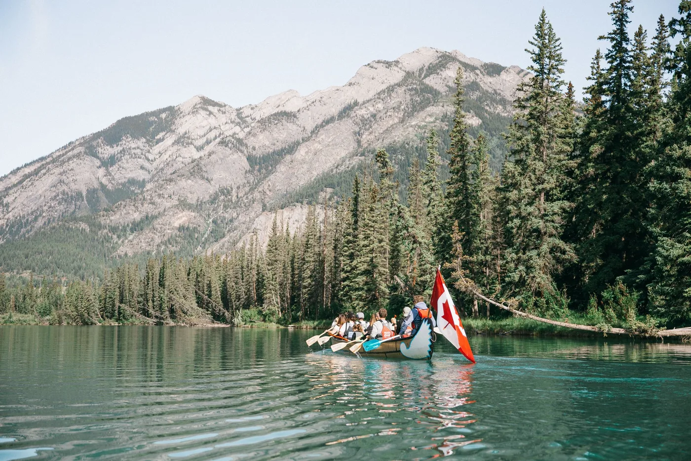
Banff Adventures · GetYourGuide
An hour and a half in a big canoe on the Bow River, from the Banff Canoe Club five minutes' walk upstream from the town centre. The group paddles together while the guide tells the story of the region and of canoeing; keep an eye on the banks for wildlife. No paddling experience needed, suitable for families.
Departure Banff Canoe Club, corner of Wolf Street and Bow Avenue (228 Bow Ave) in Banff, five minutes' walk from the town centre. No pick-up.
Included are the guide, the necessary safety equipment and, according to the inclusions list, "all taxes and fees"; the page does not explicitly name a national park pass. Not included: pick-up, food and drinks, and tips. Contradiction: the description promises a lemonade on the shore after the tour, while the inclusions list excludes food and drinks. Not suitable for children under 2 years and, according to GetYourGuide, for people with mobility impairments; for the same product on Viator the provider lists wheelchair access. Clarify before booking. Bring weather-appropriate clothing. The page gives no season. Free cancellation up to 24 hours in advance. Check dates and prices with the provider.
View tour ↗Ad · partner link · checked 27 Sep 2026
Provider's product photo · GetYourGuide
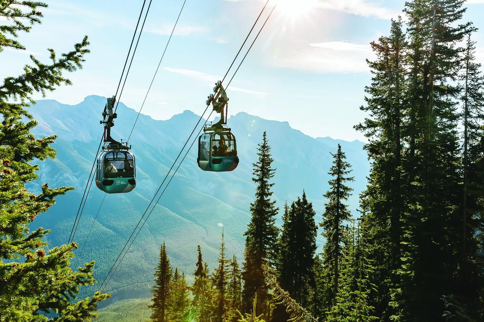
GetYourGuide
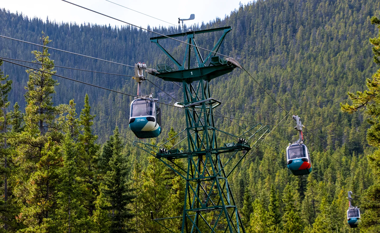
Ticket for the gondola up Sulphur Mountain, above the town of Banff. It is not run by Parks Canada; it does not cover park admission.
Departure Banff Gondola, 100 Mountain Ave, Banff.
According to the provider, the day pass for Banff National Park is not included, nor are food and drinks. The upper station is at 2,281 metres (7,484 ft); restaurant tables should be booked in advance.
View tour ↗Ad · partner link · checked 18 Sep 2026
Provider's product photo · GetYourGuide
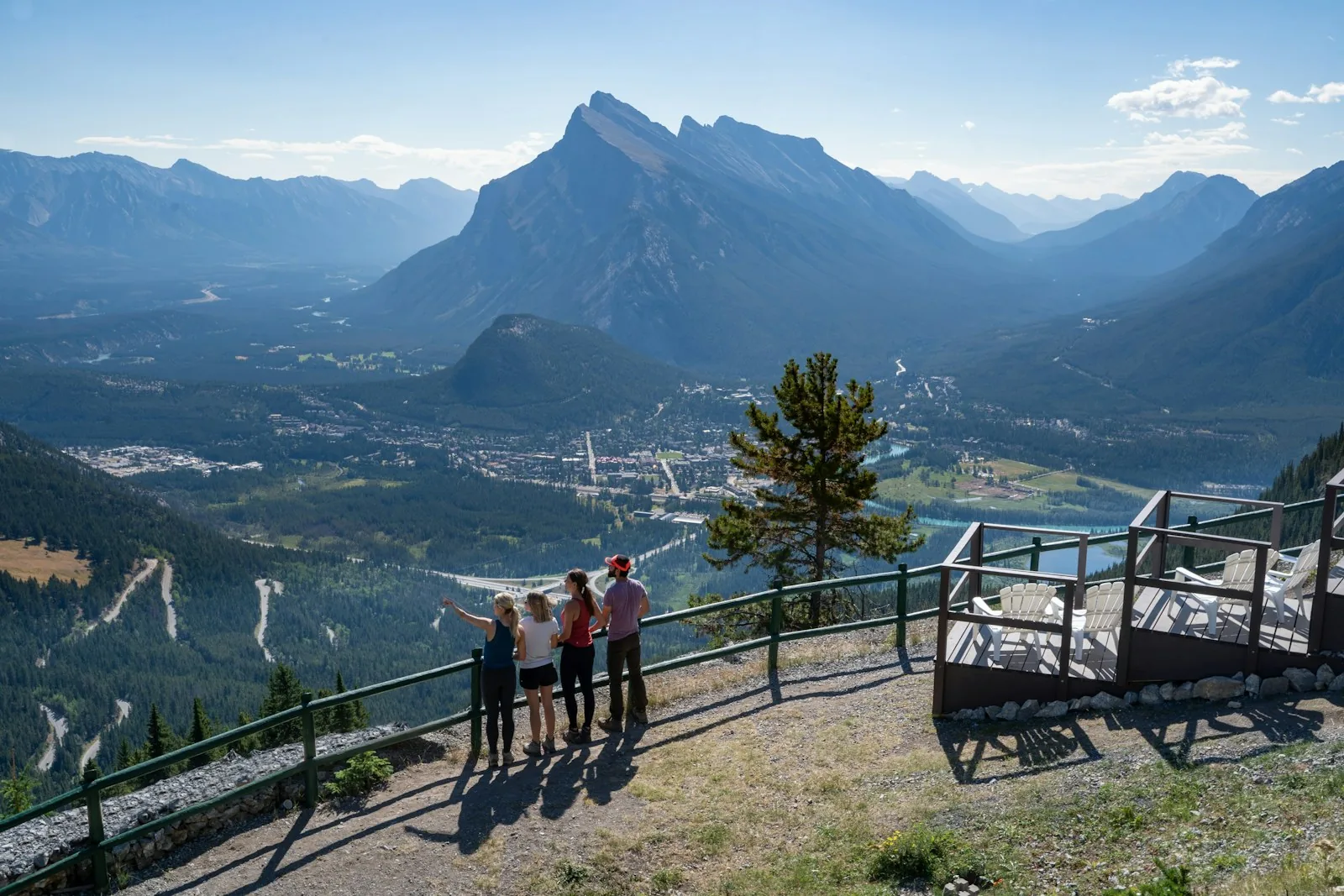
Mount Norquay · Tiqets
By chairlift up Mount Norquay above the town of Banff; at the top, a trail with information panels and a viewing platform. A free shuttle from the town of Banff is included.
Departure Mount Norquay, #2 Mount Norquay Road, Banff; arrive 15 minutes before the start.
Not included: food and drinks at the Cliffhouse Bistro and other activities at the resort. Passengers must weigh between 40 and 140 kilograms. Free cancellation and rebooking up to 24 hours before the visit.
View tour ↗Ad · partner link · checked 21 Sep 2026
Provider's product photo · Tiqets
04 · A lake above a drowned town
18 kilometres (11 mi) long and up to 100 metres (328 ft) deep. Two dams raised the lake and flooded the settlement of Minnewanka Landing; today divers reach its foundations.
The reservoir
A drowned town lies below the surface: two dams raised the water level and flooded the settlement of Minnewanka Landing. Today divers visit its foundations.
Dazu passt Banff: 30-minute helicopter flight over Lake MinnewankaOn the water and along the shore
The only lake in the park where motorboats are allowed; small open motorboats can be rented on site. Your own boat needs an inspection against invasive species, booked in advance. Parks Canada warns of sudden strong winds and waves, especially in the afternoon; the water rarely gets warmer than 10 °C (50 °F).
From the Lake Minnewanka day-use area, 1.6 km (1 mi) along the shore lead to the bridge over Stewart Canyon, about an hour there and back. Beyond the bridge, the Lake Minnewanka Trail, the Aylmer Pass Trail and the backcountry campgrounds on the lake have been closed until further notice since 16 September 2026 (as of 27 Sep 2026). Otherwise the shore trail continues to Aylmer Lookout, a decommissioned fire lookout: 11.6 km (7.2 mi) one way, 770 m (2,526 ft) of ascent, seven to eight hours.
In winter
From November to May, the western section of the Minnewanka Loop Road and Golf Course Road at the Fairmont Banff Springs are closed to cars to give wildlife corridors a rest. The Banff Legacy Trail is not cleared from early autumn to late spring.
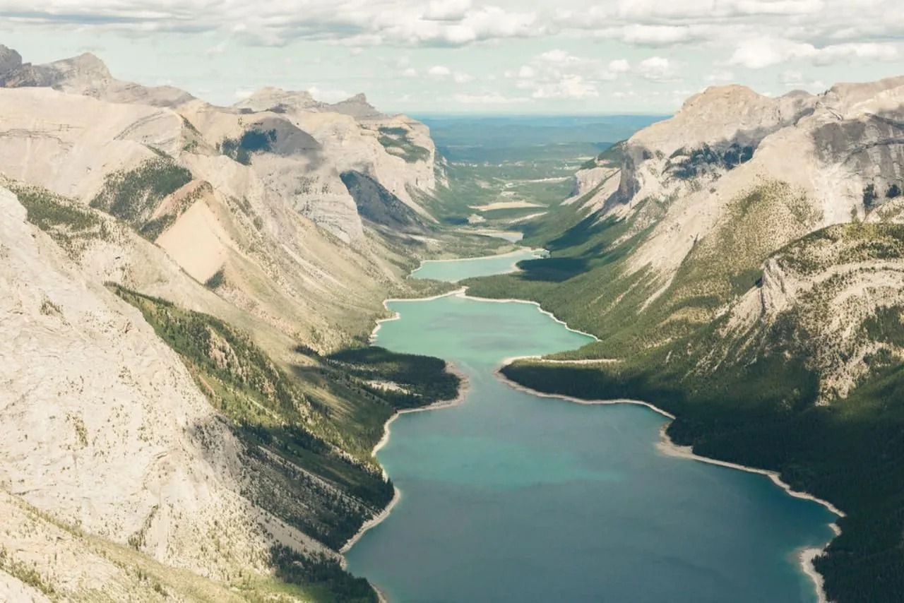
Alpine Helicopters Inc · GetYourGuide
Thirty minutes by helicopter with commentary from the pilot. Take-off and landing are at the base near Morley, east of Canmore, outside the park. The flight heads north along the eastern edge of the Rocky Mountains over the Ghost River and End Mountain into the Lake Minnewanka valley, follows the shore to the middle of the lake and turns between Mount Peechee and Saddle Peak. Only the lake section lies over Banff National Park; there is no landing in the park.
Departure Alpine Helicopters base near Morley in Kananaskis: log building on the right side of the ring road at the Stoney Nakoda Resort and Casino; check in with the staff there. No hotel transfers.
Included are the scenic flight and parking fees (the German and English inclusions lists agree: "Parking fees"); hotel transfers are not. The page does not mention a national park pass; take-off and landing are outside the park. There is a five-minute safety briefing before the flight; the product on Viator gives a total duration of 45 minutes. A flight needs at least two people; solo guests are assigned to another flight. Luggage, large bags, alcohol and drugs are not allowed. Under Canada's National Parks of Canada Aircraft Access Regulations, take-offs and landings in Banff National Park are only permitted as emergency landings at the Banff airstrip or for park management; scenic flights therefore start outside. Parks Canada asks pilots to keep more than 1,000 metres (3,281 ft) from mountain goat and bighorn sheep habitat. Free cancellation up to 24 hours in advance. Check dates and prices with the provider.
View tour ↗Ad · partner link · checked 27 Sep 2026
Provider's product photo · GetYourGuide
05 · 48 kilometres (30 mi) between Banff and Lake Louise
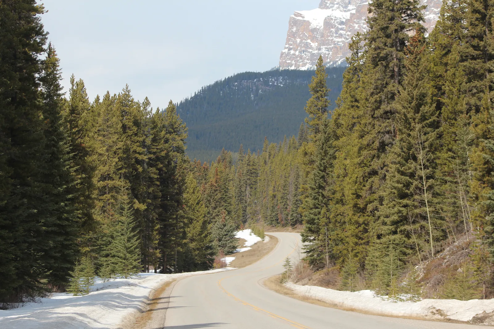
The quiet alternative to the Trans-Canada Highway, with pull-outs and picnic areas. In spring the eastern section belongs to bears and wolves at night: from 1 March to 25 June it is closed between 20:00 and 8:00, even on foot and by bike.
„Around Banff there is far more than the two famous lakes: alpine meadows, canyons and springs that hardly anyone has on their list.“
Banff National Park · alpine meadow at the Ink Pots
Closed at night in spring
The quiet alternative to the Trans-Canada Highway: 48 kilometres (30 mi) of curves, pull-outs and picnic areas between Banff and Lake Louise, right through bear and wolf habitat.
By bike
In spring and autumn, the 17 km (10.6 mi) eastern section between Fireside and Johnston Canyon is at times closed to public car traffic, a pilot project running until 2030. Park at the Banff train station via Mount Norquay Road; e-bikes are allowed. Cyclists are fast and quiet, so they are more likely to surprise bears or wolves.
06 · 44 crossings on the Trans-Canada Highway
Grizzly bears took up to five years to accept the overpasses and underpasses on the highway. For people there are fixed distances: 30 metres (98 ft) from deer and elk, 100 metres (328 ft) from bears and wolves.
for wildlife over the road
under the Trans-Canada Highway
of fencing along the road
and more: that much less often cars hit elk and deer
Who lives here
The Trans-Canada Highway in the park has six overpasses and 38 underpasses for wildlife plus 82 km (51 mi) of fencing, more than anywhere else in the world. Wildlife collisions have since dropped by more than 80 %, and by more than 96 % for elk and deer. Grizzly bears took up to five years to start using the structures.
The montane zone covers only about 3 % of the park but is the most productive: green early, little snow, winter range for grazing animals. The town of Banff and Lake Minnewanka lie here. 53 % is subalpine, with dense forest and avalanche paths, and 44 % alpine: rock, ice and glaciers along the Continental Divide. Mammals include grizzly bears, wolves, cougars and wolverines.
The rules
At least 30 m (98 ft), three bus lengths, from deer, elk, sheep and moose; at least 100 m (328 ft), ten bus lengths, from bears, wolves, cougars and coyotes. Animals by the road: slow down, stay in your car, keep driving. Use a telephoto lens instead of getting closer, and leave the drone at home.
Feeding, attracting or disturbing wildlife is illegal; offences go to court and the fine can be up to 25,000 CAD. Animals can turn up anywhere in the park, including the towns. Parks Canada advises carrying bear spray all year, travelling in groups, making noise on trails and not wearing headphones.
All garbage, recycling and food scraps, even banana peels and apple cores, belong in the wildlife-proof bins, never on the ground, in the fire pit or in the back of a pickup. Animals that eat garbage may start seeking out human food.
Recreational drone flights are banned at all Parks Canada places. Permits are only issued for protecting nature and culture, public safety, law enforcement and park management. Flying without a permit risks a fine of up to 25,000 CAD.
07 · The famous lakes, and how to get there
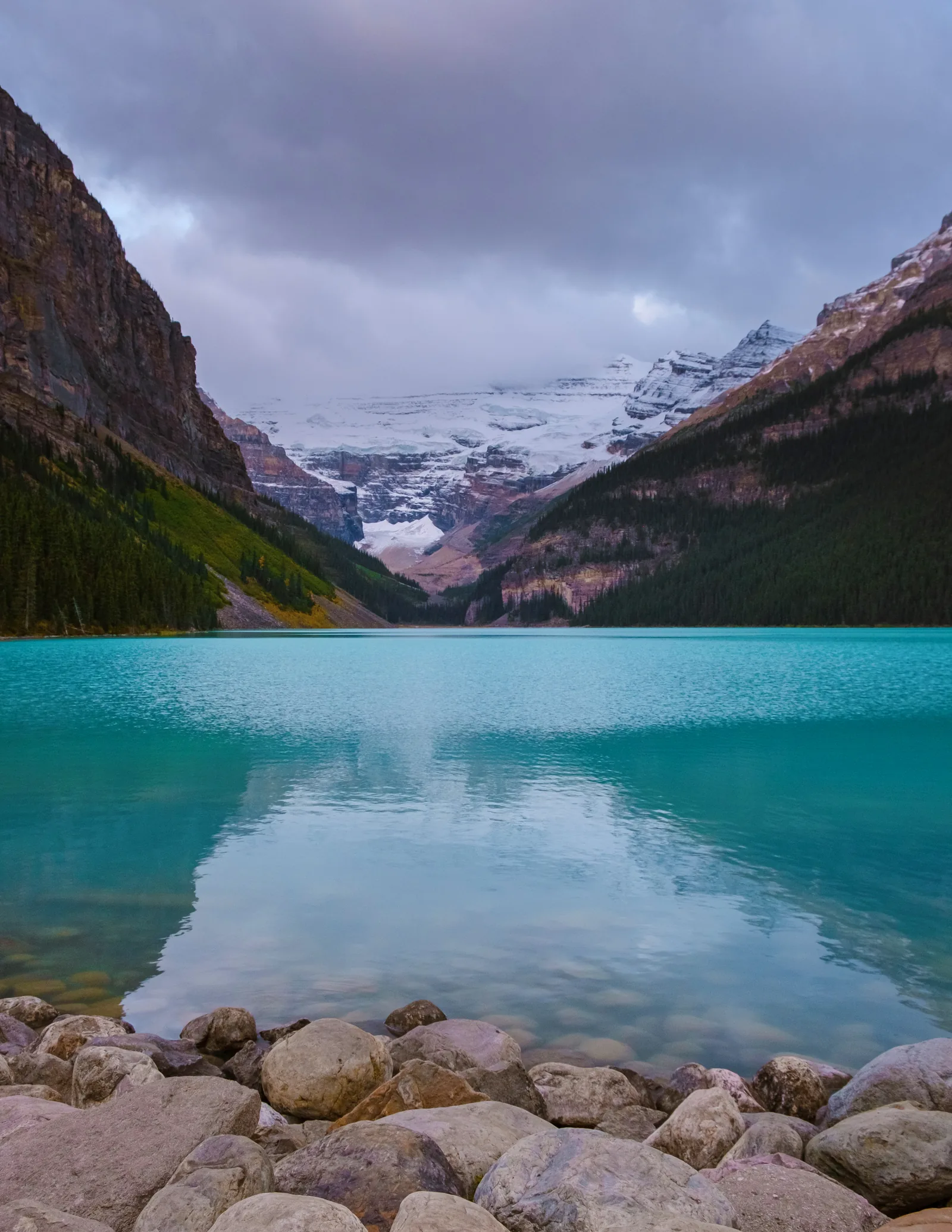
You may drive to Lake Louise, but in summer the parking lot is full by sunrise. Moraine Lake can only be reached by shuttle, with a licensed operator or as a guest of the lodge.
With the hotel on the shore
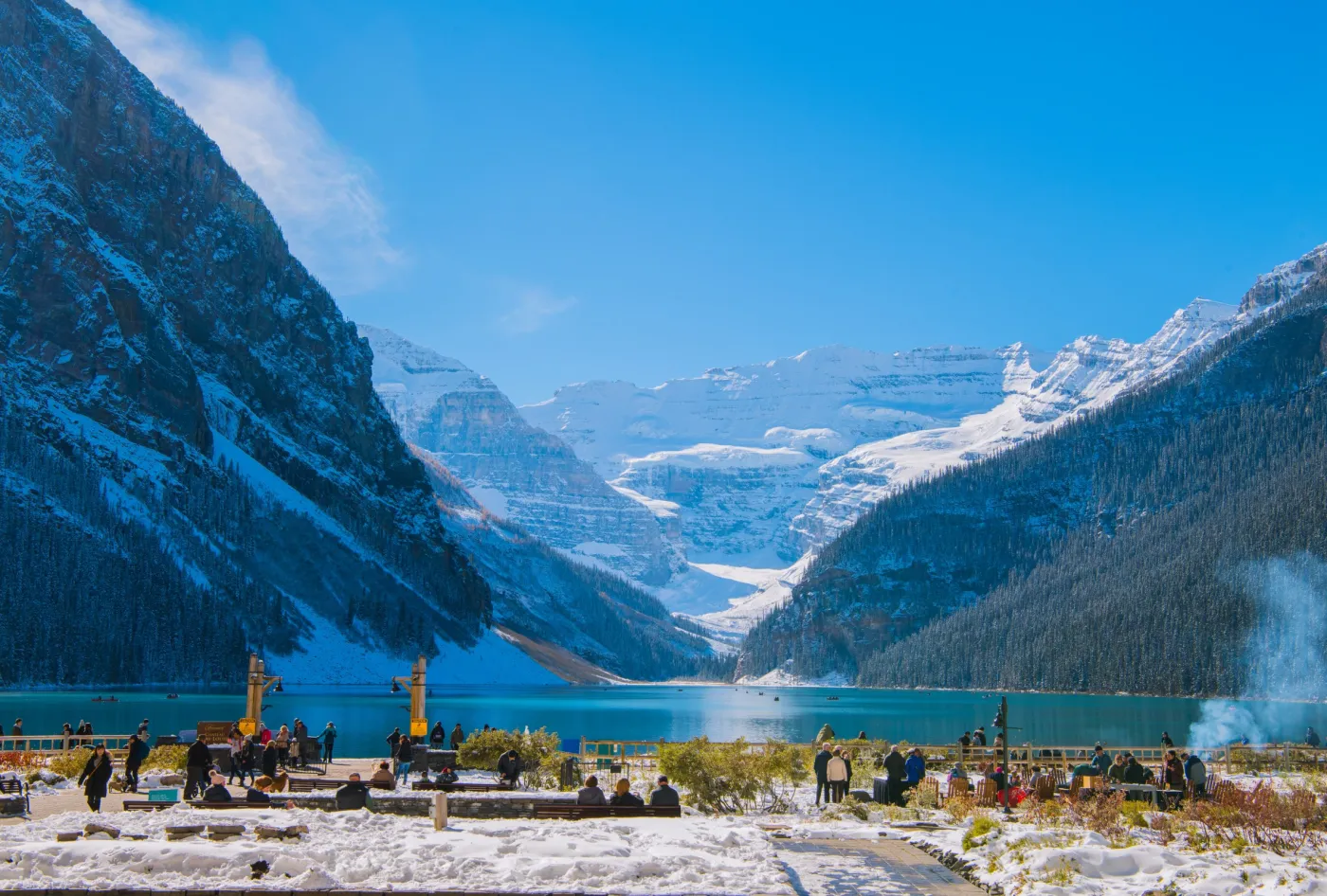
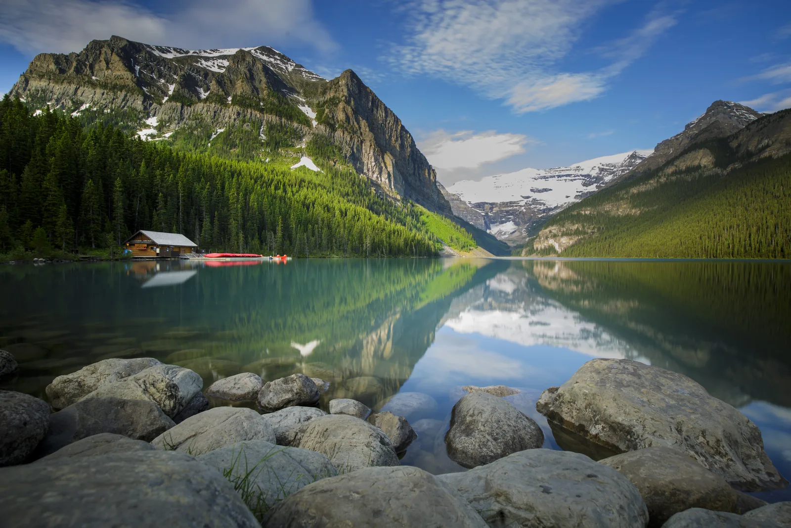
The famous lake with the hotel on the shore. You may drive there in your own car, but during the shuttle season Parks Canada advises against it.
Shuttle only
The turquoise lake in the Valley of the Ten Peaks is the most searched-for place in the park, and the most tightly regulated. Arrive without a plan and you won't get there.
Dazu passt Shuttle from Banff or Canmore to Moraine Lake & Lake LouiseWith the Parks Canada shuttle
Departs from the Park & Ride, 1 Whitehorn Road. Reservation required. In 2026, 40 % of seats were released on 15 April; 60 % each at 8:00 MDT two days before travel.
Departs from Lake Louise Lakeshore, not the ski resort. Season, early departures and the return via the Lake Connector are in the automatically updated timetable. If you arrive by car, you pay extra for parking there.
Parks Canada shuttles run only in the summer season and depending on the weather. Season, departures, frequency and last return are in the automatically updated timetable in the field guide under How to get there.
Both lakes, the Lake Connector and the return trip to the Park & Ride are included. You need park admission on top.
Pets other than service animals must stay in a small carrier for the whole ride, one that can be held on your lap.
For the regular shuttle, arrange an accessible ride with your reservation. Alpine Start is not wheelchair accessible in 2026.
Banff Tours Inc. · GetYourGuide
Return trip to Lake Louise and Moraine Lake with Banff Tours Inc. Fixed return and about 80 minutes at each lake: enough for a lakeside walk; tight for longer hikes.
Departure Depending on the option booked: Mount Royal Hotel in Banff or 2801 Bow Valley Trail in Canmore.
Also listed: a service fee of 10 CAD per person for the driver. Check dates and the chosen option with the provider; no promise of year-round operation.
View tour ↗Ad · partner link · checked 17 Sep 2026
Provider's product photo · GetYourGuide
GetYourGuide
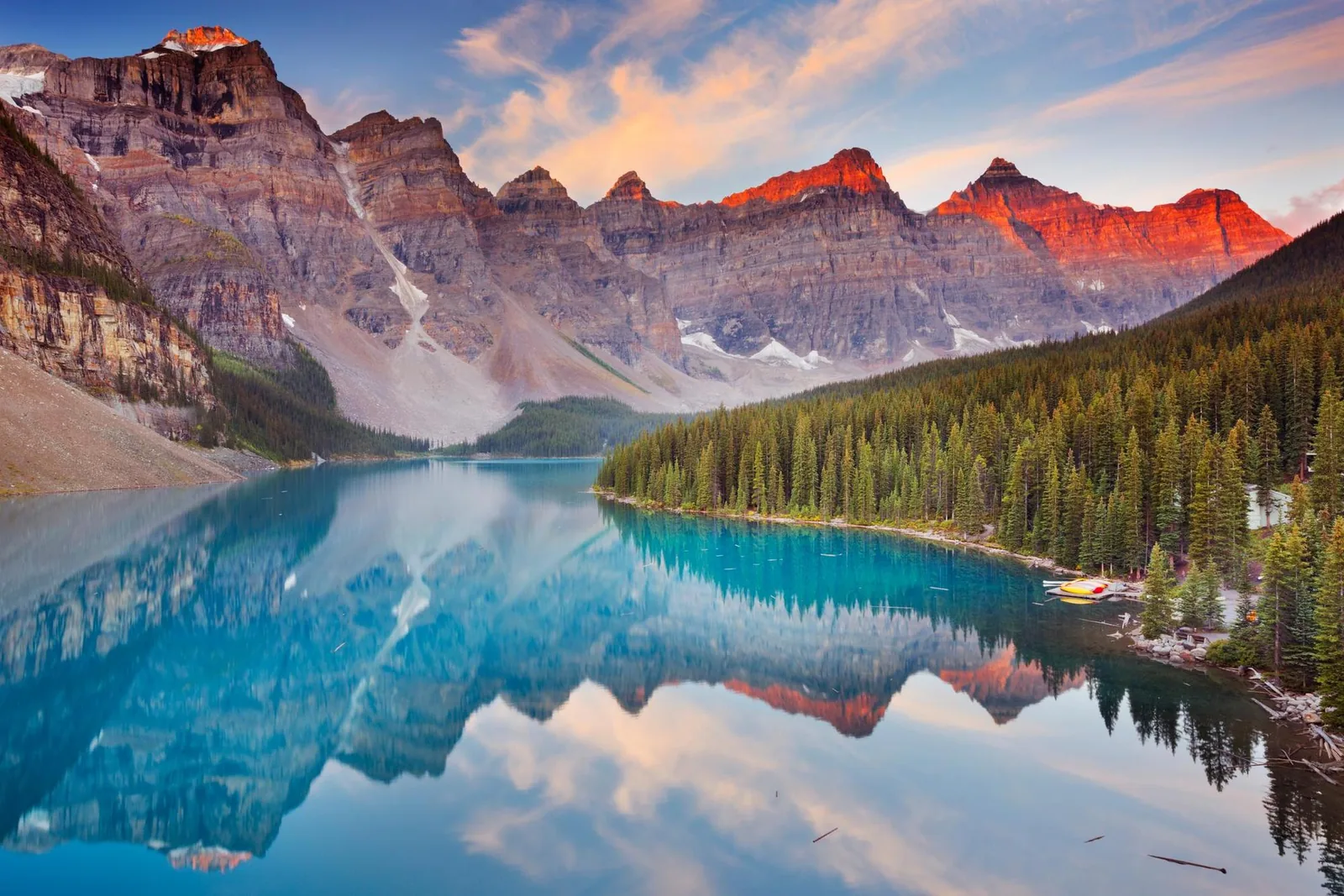
Half-day shuttle to both lakes from Canmore or Banff, an alternative when the Parks Canada shuttle is fully booked.
Departure Designated pick-up point in Canmore or Banff.
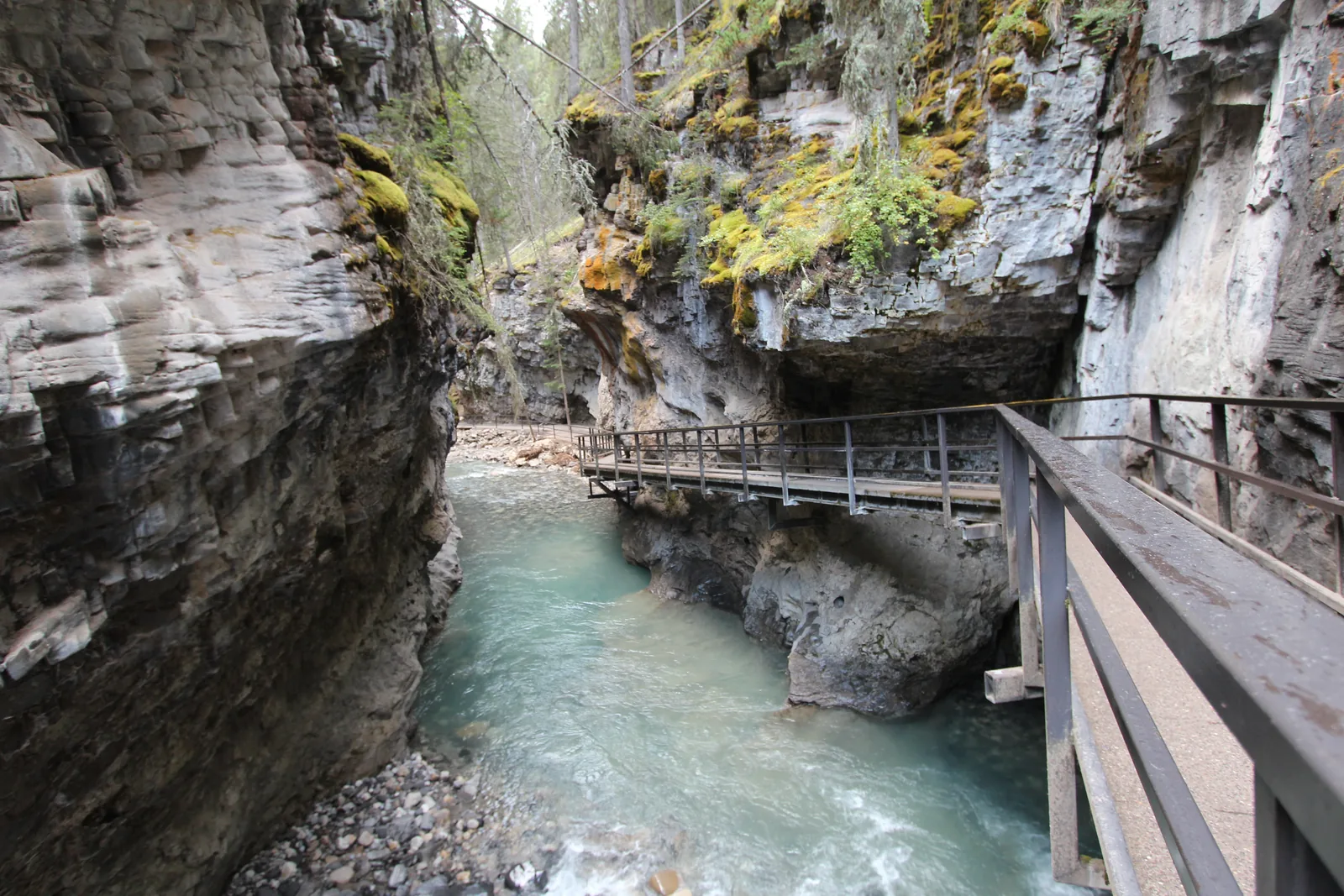
The guide's tip is not included in the price and, according to the provider, is mandatory for groups of six or more. If Moraine Lake is closed, the tour goes to Johnston Canyon instead; its canyon trail is closed for rock slope remediation from 13 October 2026, so ask the provider about the alternative.
View tour ↗Ad · partner link · checked 18 Sep 2026
Provider's product photo · GetYourGuide
Hiking at the lakes
3.9 km (2.4 mi) one way; 495 m (1,624 ft) of ascent and 80 m (262 ft) of descent according to the trail description. Estimated time for the round trip: 2.5–3 hours. Start: Lake Louise Lakeshore.
Parks Canada guided hike in English, 6 km (3.7 mi) return, 120 m (394 ft) elevation gain; shuttle to Moraine Lake included. No pets.
The published dates ran from 13 July to 15 September 2026. For a later trip, check new dates with the organiser first.
Children under five are not allowed on the Consolation Lakes hike; pushchairs and child-carrier backpacks are not suitable. These rules apply to this programme.
08 · Icefields Parkway and Peyto Lake
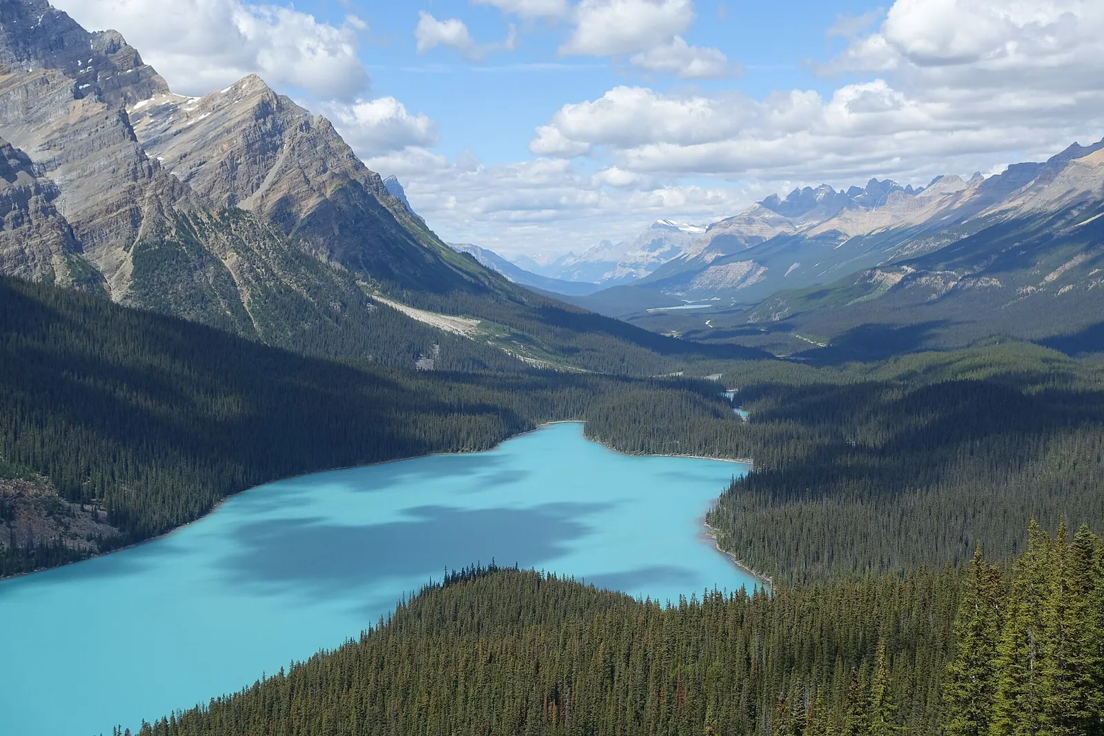
North of Lake Louise the Icefields Parkway begins. After 43 kilometres (27 mi), Peyto Lake lies far below a viewing platform at Bow Summit, at 2,070 metres (6,791 ft) the highest point of the road.
A short climb from the parking lot
A short climb from the parking lot, and the turquoise lake lies far below the viewing platform. Getting down to the shore takes experience: the trail is steep and rough.
On your own
North of Lake Louise, the Icefields Parkway runs 232 km (144 mi) to Jasper. Services are open only from early May to mid-October; the only petrol station, at Saskatchewan River Crossing, opens in summer only, and there is almost no mobile coverage. From 1 November to 31 March, winter tyres or snow chains are mandatory.
Parks Canada names July to mid-September as the main hiking season. High passes can still be under snow until the end of June.
09 · Hotels at the lakes, campgrounds in the park
The Fairmont Château Lake Louise and Moraine Lake Lodge stand right on the two best-known lakes. Then there are the Parks Canada campgrounds, two of them open all year and one at Two Jack Lake.
Hotels and campgrounds
Year-round hotel right on Lake Louise, 111 Lake Louise Drive. Hotel parking is paid. There are explicitly designated accessible room types; confirm the features you need with the hotel before booking.
Seasonal lodge at Moraine Lake. Registered overnight guests may drive up and receive their own access instructions. No pets, no RVs or vehicles over 20 feet. The lodge does not run a shuttle.
Tunnel Mountain Village II and Lake Louise Hard-sided are open all year. Choose the site type and facilities when you book.
Lake Louise Soft-sided: 29 May–23 September. Two Jack Lakeside: 21 May–5 October. Weather-related changes are possible.
Lake Louise with electricity: 40 CAD/night; unserviced: 34 CAD/night. Two Jack Lakeside unserviced: 34 CAD/night. Online campground reservation: 11.50 CAD. Park admission is extra.
Without a car
For visitors staying in the town of Banff, Parks Canada names Roam Public Transit as the year-round connection to the lakes. Parks Canada shuttles and hiking or cycling are limited to the summer months.
10 · Before you go
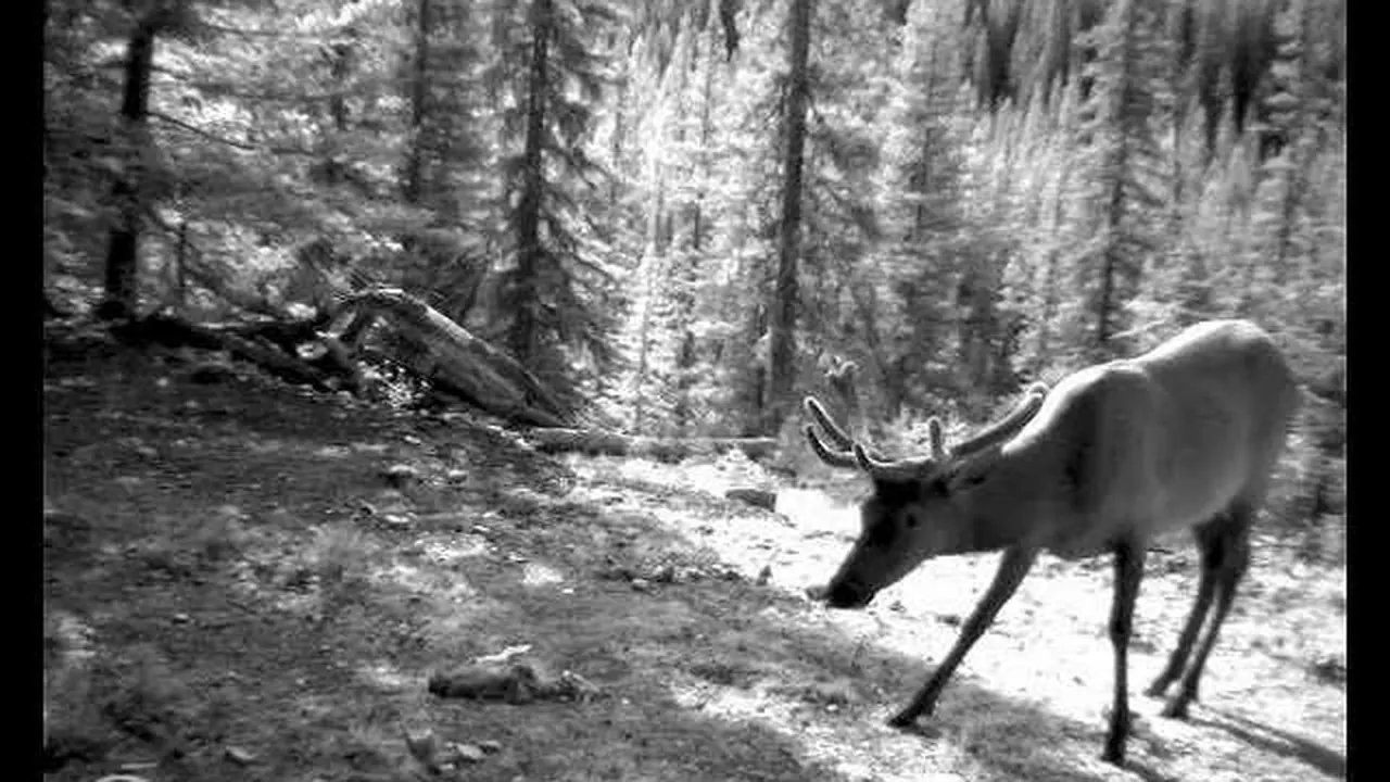
The park authority's film shows a whole year at a single wildlife camera, two and a half hours' walk from the town centre. Four destinations in the park have their own pages.
Film by the park authority
Just under five minutes of time-lapse from Parks Canada's wildlife camera project: a whole year at a single camera site, edited into four seasons. According to Parks Canada, the site is only two and a half hours' walk from the centre of Banff. In English, without narration.
Source: Parks Canada · View channel ↗
Popular destinations
Nothing saved yet. Every place card has a pin, and so does every place on the Map. What you save collects here, with days, notes and a preview you can share.
Reality check
Share
The plan is stored in the link itself. Anyone who opens it sees the preview and can use the plan.
Lake season and mountain season are not the same. A summer timetable does not promise snow-free trails.
Parks Canada names May to September as the busiest period. For current crowds and parking it refers to BanffNow and recommends taking the bus or shuttle rather than your own car.
Climate through the year
Best months by the climate data: July and August. Average daytime highs of 16 to 17 °C, lows of 4 to 5 °C, 73 to 82 mm of precipitation a month. The wettest month is June (126 mm), the driest February (39 mm).
| Month | High °C | Low °C | Precipitation mm |
|---|---|---|---|
| January | −7.0 | −15.6 | 44 |
| February | −6.4 | −16.7 | 39 |
| March | −3.0 | −13.4 | 61 |
| April | 1.0 | −9.1 | 63 |
| May | 7.0 | −3.0 | 85 |
| June | 12.8 | 1.8 | 126 |
| July | 17.0 | 5.0 | 82 |
| August | 16.5 | 4.2 | 73 |
| September | 11.2 | 0.2 | 73 |
| October | 3.4 | −5.8 | 63 |
| November | −4.1 | −12.5 | 58 |
| December | −8.4 | −16.7 | 45 |
| Year | 812 |
Modelled values, not a weather station: NASA POWER (MERRA-2) for a grid cell of about 55 × 45 km around the map point Bow Valley Parkway (51.27° N, 115.92° W), with an average cell elevation of about 1,990 m. Averages for 2001–2020. Higher ground and valleys can differ markedly.
Source: NASA POWER, climatology 2001–2020 ↗ · retrieved 3 Oct 2026
Choose the lake first, then the way in. The regular shuttle and Alpine Start leave from different places.
The Fairy Bus · offer
Shared shuttle from Calgary International Airport (YYC) to the town of Banff, around two hours with a few stops on the way. The driver helps with luggage; according to the description, the shuttle stops in the centre of Banff. For arriving without a rental car: both lake shuttles above only start in town, in Banff or Canmore.
Departure Calgary Airport, domestic terminal: Pillar 15 opposite exit door 3 or 4. Be there at least five minutes before the booked departure.
Included are the ride in the shared shuttle, the driver and help with luggage. The page does not list departure times; they only appear when you check availability. Where exactly the shuttle stops in Banff is not on the page either. The page does not mention the national park pass, so plan for it separately (see Tickets & entrance fees). Not suitable for wheelchair users; smoking and drinks are not allowed in the vehicle. Free cancellation up to 24 hours in advance. Check dates and prices with the provider.
View tour ↗Ad · partner link · checked 27 Sep 2026
Banff Tours Inc. · offer
Return trip to Lake Louise and Moraine Lake with Banff Tours Inc. Fixed return and about 80 minutes at each lake: enough for a lakeside walk; tight for longer hikes.
Departure Depending on the option booked: Mount Royal Hotel in Banff or 2801 Bow Valley Trail in Canmore.
Also listed: a service fee of 10 CAD per person for the driver. Check dates and the chosen option with the provider; no promise of year-round operation.
View tour ↗Ad · partner link · checked 17 Sep 2026
GetYourGuide · offer
Half-day shuttle to both lakes from Canmore or Banff, an alternative when the Parks Canada shuttle is fully booked.
Departure Designated pick-up point in Canmore or Banff.
The guide's tip is not included in the price and, according to the provider, is mandatory for groups of six or more. If Moraine Lake is closed, the tour goes to Johnston Canyon instead; its canyon trail is closed for rock slope remediation from 13 October 2026, so ask the provider about the alternative.
View tour ↗Ad · partner link · checked 18 Sep 2026
Ad · we may earn a commission if you book through this partner link. Offer details checked 27 Sep 2026. See official ticket information.
Plan admission and the shuttle separately. Excerpt of the fees; camping and other services may be extra.
| Area | 6,641 km² (2,564 square miles) |
|---|---|
| Rank | Canada's first national park |
| Mammals | 56 species |
| Birds | 300 species |
| Plants | more than 800 species |
| Hot springs discovered | 1883, at today's Cave and Basin |
| UNESCO World Heritage | since 1984, boundaries changed in 1990 |
| World Heritage criteria | (vii) and (viii) |
| Total World Heritage area | 2,360,000 ha with six other parks |
Banff is Canada's first national park and the flagship of the national park system: 6,641 square kilometres of valleys, mountains, glaciers, forests, meadows and rivers.
Parks Canada puts the park's area at 6,641 square kilometres, or 2,564 square miles. Valleys and mountain ranges, glaciers, forests, alpine meadows and river systems lie side by side within it; the range of elevations and climate zones explains the park's biodiversity.
The dense forests, glacial lakes, high peaks and deep canyons are home to 56 mammal species, 300 bird species and more than 800 plant species. Parks Canada has long carried out research and conservation work here and publishes multi-year data sets, from the Banff Springs snail to pikas and the wildlife crossings.
The park began at a hot spring. In 1883, three railway workers, Frank McCabe and the brothers Tom and William McCardell, came upon the hot springs at today's Cave and Basin; they led to Canada's first national park. The place has been significant to Indigenous peoples for more than ten thousand years and still is today.
Together with Jasper, Kootenay and Yoho and the provincial parks Mount Robson, Mount Assiniboine and Hamber, Banff forms the UNESCO World Heritage Site "Canadian Rocky Mountain Parks". It was inscribed in 1984 and its boundaries were adjusted in 1990; the listing is based on the natural criteria (vii) and (viii).
According to the park’s fee list, daily admission costs $12.25 for adults aged 18 to 64 and $10.75 for seniors aged 65 and over. Families or groups of up to seven people arriving in one vehicle pay $24.50. Youth aged 17 and under get in free. The Discovery Pass for all participating places costs $83.50 for adults.
Besides the daily admission, Parks Canada sells the Discovery Pass for participating places; the official fee list gives the current amount. Whether it pays off depends on the parks, people and days of your trip. Camping and the shuttle remain separate.
Under the Canada Strong Pass, admission to Parks Canada places was free from 19 June to 7 September 2026, and camping was discounted. Regular fees have applied again since 8 September 2026, so trip reports from summer 2026 often quote an admission price that no longer applies.
The Fairy Bus · offer
Shared shuttle from Calgary International Airport (YYC) to the town of Banff, around two hours with a few stops on the way. The driver helps with luggage; according to the description, the shuttle stops in the centre of Banff. For arriving without a rental car: both lake shuttles above only start in town, in Banff or Canmore.
Departure Calgary Airport, domestic terminal: Pillar 15 opposite exit door 3 or 4. Be there at least five minutes before the booked departure.
Included are the ride in the shared shuttle, the driver and help with luggage. The page does not list departure times; they only appear when you check availability. Where exactly the shuttle stops in Banff is not on the page either. The page does not mention the national park pass, so plan for it separately (see Tickets & entrance fees). Not suitable for wheelchair users; smoking and drinks are not allowed in the vehicle. Free cancellation up to 24 hours in advance. Check dates and prices with the provider.
View tour ↗Ad · partner link · checked 27 Sep 2026
Ad · we may earn a commission if you book through this partner link. Offer details checked 27 Sep 2026. See official ticket information.
Stay by the lake or at a campground. Two specific hotels and camping options. Check prices and availability directly with the provider.
Is the visit right for you? Check transport and trail separately.
Banff & Canmore Tours · offer
Two hours on foot with a guide into the evening: start shortly after sunset at the Cave and Basin National Historic Site in the town of Banff, easy trails of about five kilometres into the dusk, then constellations and stories about the night sky, watching for shooting stars and northern lights. The provider supplies headlamps.
Departure Cave and Basin National Historic Site parking lot in Banff (311 Cave Ave), in front of the Welcome Building; the guide carries a clipboard. No pick-up. The start time follows sunset and is sent 12 to 24 hours in advance.
Included are the guide, headlamps and ice cleats if needed; hotel pick-up and food and drinks are not. The page does not mention park admission; Cave and Basin is inside the national park. The tour is cancelled in heavy cloud; the provider gets in touch 12 to 24 hours in advance and refunds you. For the same product on Viator, the provider sets the limit at 50 per cent cloud cover at most. Not suitable for children under 8 years, pregnant women, people with medical conditions or after surgery. Contradiction: the key details call the tour wheelchair accessible, while the "Not suitable for" list excludes people with mobility impairments. Clarify with the provider before booking. Free cancellation up to 24 hours in advance. Check dates and prices with the provider.
View tour ↗Ad · partner link · checked 27 Sep 2026
Ad · we may earn a commission if you book through this partner link. Offer details checked 27 Sep 2026. See official ticket information.
Not by private car: Moraine Lake Road is closed to private vehicles all year. Only Parks Canada shuttles, licensed commercial operators and registered guests of Moraine Lake Lodge may drive up. The shuttle requires a reservation.
Yes, all year, with paid parking from May to October. In summer, however, the Lakeshore parking lot is already full by sunrise and there is nowhere to wait. During the shuttle season, Parks Canada advises against driving there in your own vehicle.
Yes. All Parks Canada shuttles require a reservation. Additional seats are released at 8:00 MDT two days before departure. One ticket covers access to both lakes, the Lake Connector and the return trip to the Park and Ride.
The full fee table is in the Tickets & entrance fees section and is taken daily from the official Parks Canada price list. Park admission, shuttle and reservation are separate charges.
For hiking, July to mid-September: Parks Canada names this as the main hiking season, and high passes can still be under snow until the end of June. May to September is also the busiest period, so plan the bus or shuttle rather than your own car.
Parks Canada advises carrying bear spray all year, travelling in groups, making noise on trails and not wearing headphones. Animals can turn up anywhere in the park, including the towns.
Current conditions & sources. Every fact can be traced back to the original source.
Fetched automatically: 03 Oct 2026 14:06 UTC.
Original Parks Canada notices. The date is the publication date; validity and affected areas are stated in each notice.
Researched 17 Sep 2026. Not a live status. Dates apply only to the year stated. A successful automatic fetch is not an editorial confirmation; outdated automatic values are hidden and replaced by the source link.
Current information from the park ↗
Location sources: Locations from the official provider information and the maps linked there. Markers do not imply that access is permitted. Base map © OpenStreetMap contributors. Coastlines of the chapter map: Natural Earth.
End of the field book · Park authority ↗
Preview