National Parks Atlas
Map

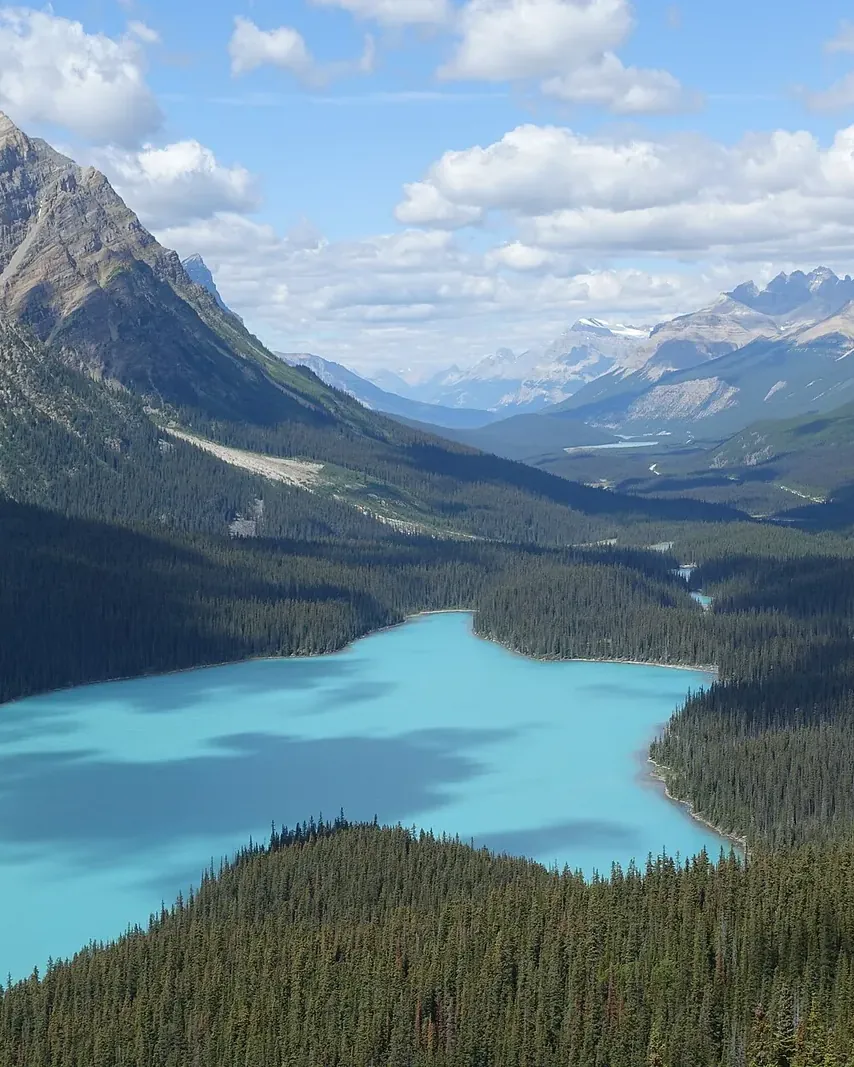
00 · Glacial lake on the Icefields Parkway · Alberta · Banff National Park

Peyto Lake

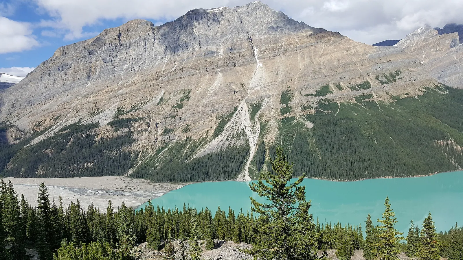
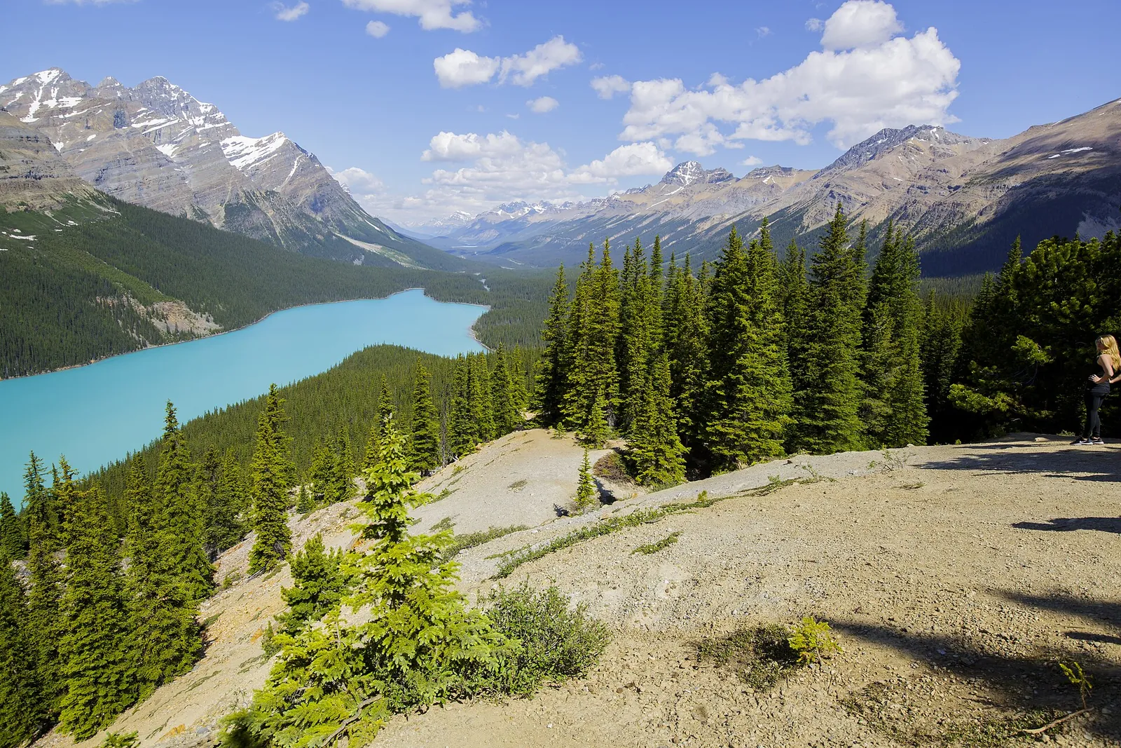
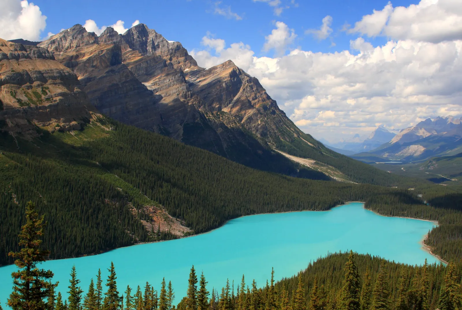
A short walk from the parking lot, and the lake lies far below you.

Fees & park passGetting there & parkingOpening times

View plan

Photo: Douglaspperkins ↗ · CC BY-SA 4.0 ↗

43 kmFrom Lake Louise

(27 mi) on the Icefields Parkway (93N)

0.6 kmTo the platform

30 m (98 ft) up, 30 minutes return

12.25 CADPark entry

per adult per day, free to age 17

Peyto Lake: the view from above

A short walk, a big view, and a steep descent for experienced hikers.

Peyto Lake lies in Banff National Park on the Icefields Parkway, 43 km (27 mi) north of Lake Louise and 190 km (118 mi) south of Jasper. From the parking lot a short trail climbs to a viewing platform high above the turquoise lake; a 0.3 km (0.2 mi) barrier-free path leads there from the upper lot.

The platform is at Bow Summit, at 2,070 m (6,791 ft) the highest point on the Icefields Parkway. If you want more, carry on to the Bow Summit Viewpoint.

There is no mobile coverage on the Parkway. In summer, parking lots often fill early and stay full all day; there is no space to wait for a stall.

Parks Canada: travelling the Icefields Parkway, stops, seasons, services (accessed 3 October 2026) ↗

In numbers

From Lake Louise
43 km (27 mi)
From Jasper
190 km (118 mi)
Bow Summit
2,070 m (6,791 ft)
To the platform
0.6 km, +30 m (98 ft)
Barrier-free path
0.3 km (0.2 mi) from the upper lot
Bow Summit Viewpoint
3 km, +310 m (1,017 ft)
Down to the shore
1.3 km, −240 m (787 ft)
Icefields Parkway
232 km (144 mi)
Winter tyres mandatory
1 November to 31 March

Banff National Park profile

01 · Plan

Fees & park pass

On the Icefields Parkway it is your own car or a tour, and patience with parking.

Photo: Tobias Alt, Tobi 87 ↗ · CC BY-SA 4.0 ↗

Getting there and parking

On the Icefields Parkway it is your own car or a tour, and patience with parking.

Price list

checked 3 Oct 2026

Entry fees and park pass

The park pass is mandatory, even just to drive the Parkway.

Banff National Park entry, as of 3 October 2026
ItemPrice
Daily pass, adults (18–64)12.25 CAD
Daily pass, seniors (65+)10.75 CAD
Daily pass, family/group, up to 7 people in one vehicle24.50 CAD
Children and youth up to 17free
Discovery Pass, adults83.50 CAD
Discovery Pass, seniors71.50 CAD
Discovery Pass, family/group167.50 CAD

A valid national park pass is required to drive the Icefields Parkway. Parks Canada: Banff National Park fees (accessed 3 October 2026) ↗

Park pass for the Parkway

A valid national park pass is required to drive the Icefields Parkway. According to Parks Canada, pass sales support maintenance, plowing, sanding and avalanche control.

Parks Canada: travelling the Icefields Parkway, stops, seasons, services (accessed 3 October 2026) ↗

Banff daily pass

12.25 CAD for adults, 10.75 CAD for seniors, 24.50 CAD for a family or group of up to seven people in one vehicle, free up to age 17.

Parks Canada: Banff National Park fees (accessed 3 October 2026) ↗

Discovery Pass

For several days in the Rockies: 83.50 CAD for adults, 71.50 CAD for seniors, 167.50 CAD for families and groups.

Parks Canada: Banff National Park fees (accessed 3 October 2026) ↗

Best time to visit

The lake only turns turquoise once it has thawed.

02 · On site

Peyto Lake hikes: viewpoint, Bow Summit and the shore

Three trails from the same parking lot, from a stroll to a steep descent.

Photo: Mike from Vancouver, Canada ↗ · CC BY-SA 2.0 ↗

„Snow can fall at any time of year, even in July.“

Peyto Lake on a wet day: weather on the Parkway changes fast.

Peyto Lake hikes: viewpoint, Bow Summit and the shore

Three trails from the same parking lot, from a stroll to a steep descent.

03 · Nearby

Onward from here

Peyto Lake lies in Banff National Park, Canada's first national park. You need a park pass for every day in the park; everything else that applies is in the park profile.

Photo: Douglaspperkins ↗ · CC BY-SA 4.0 ↗

Map

Peyto Lake on the terrain map

Five points, each verified against an OpenStreetMap object. All points are on the Banff National Park map, with details and photos.

Show on mapBanff National Park map · 3D terrain

Field book · Peyto Lake

checked 3 Oct 2026

01Good to know

What often gets missed when planning.

No mobile coverage

There is no year-round mobile coverage on the Icefields Parkway; from May to early October only limited coverage at the Columbia Icefield. Download maps and information in advance.

Parks Canada: travelling the Icefields Parkway, stops, seasons, services (accessed 3 October 2026) ↗

Drones prohibited

Recreational drones are prohibited in all national parks. Flying without a permit can mean fines of up to 25,000 CAD.

Parks Canada: travelling the Icefields Parkway, stops, seasons, services (accessed 3 October 2026) ↗

Dress warmly, even in summer

Parks Canada advises being prepared for cold, wind, rain and snow even in summer, wearing layers and sturdy footwear with good traction.

Parks Canada: travelling the Icefields Parkway, stops, seasons, services (accessed 3 October 2026) ↗

02Peyto Lake: frequently asked questions

Short answers, with sources.

How far is the walk from the parking lot to the Peyto Lake viewpoint?

0.6 km (0.4 mi) with 30 m (98 ft) of climbing; about 30 minutes return. A 0.3 km (0.2 mi) barrier-free path starts at the upper lot, which is reserved for vehicles with an accessible parking permit and buses.

Parks Canada: hiking trails in Banff National Park, Icefields Parkway area (accessed 3 October 2026) ↗

Can you hike down to Peyto Lake?

Yes, on the Peyto Lake Trail: 1.3 km (0.8 mi) and 240 m (787 ft) down from the platform, 2 hours return. Parks Canada rates it difficult, for experienced hikers only.

Parks Canada: hiking trails in Banff National Park, Icefields Parkway area (accessed 3 October 2026) ↗

How far is Peyto Lake from Lake Louise and Jasper?

43 km (27 mi) from Lake Louise and 190 km (118 mi) from Jasper, both via the Icefields Parkway.

Parks Canada: travelling the Icefields Parkway, stops, seasons, services (accessed 3 October 2026) ↗

Do you need a park pass for Peyto Lake?

Yes. A valid national park pass is required to drive the Icefields Parkway.

Parks Canada: travelling the Icefields Parkway, stops, seasons, services (accessed 3 October 2026) ↗

When is Peyto Lake turquoise?

Once it has thawed: according to Parks Canada, lakes on the Parkway typically thaw by late June. Until then there is often still ice.

Parks Canada: travelling the Icefields Parkway, stops, seasons, services (accessed 3 October 2026) ↗

03Sources and last checked

Operator, municipality and park authority, each fact cited individually.

Places on the map

  • Peyto Lake Glacial lake

    The turquoise lake below the Bow Summit platform. Only a steep, rough trail leads down to the shore.

    Location source ↗
  • Peyto Lake – Viewpoint Viewing platform

    0.6 km (0.4 mi) from the parking lot, 30 m (98 ft) up.

    Location source ↗
  • Peyto Lake Parking Parking lot on the Icefields Parkway

    43 km (27 mi) north of Lake Louise. Often full early in summer.

    Location source ↗
  • Bow Summit Upper parking lot

    Only for vehicles with an accessible parking permit and buses; a 0.3 km (0.2 mi) barrier-free path leads to the platform from here.

    Location source ↗
  • Bow Summit Highest point of the Parkway, 2,070 m

    Beyond the platform, an old fire road climbs on to the Bow Summit Viewpoint.

    Location source ↗
  1. Parks Canada: travelling the Icefields Parkway, stops, seasons, services (accessed 3 October 2026) ↗
  2. Parks Canada: hiking trails in Banff National Park, Icefields Parkway area (accessed 3 October 2026) ↗
  3. Parks Canada: Banff National Park fees (accessed 3 October 2026) ↗

How current is this information?

Researched 3 Oct 2026. Not a live status. Prices, timetables and opening hours change; please check with the operator before you travel.

Current information from the operator ↗

Image and map credits

Location sources: every point on the map links to the OpenStreetMap object its coordinate comes from. Markers do not imply that access is permitted.

End of the field book · Park authority ↗