National Parks Atlas
MapPDF

01 · Canada · British Columbia · Columbia Mountains

Mount Revelstoke National Park

The only mountain in Canada’s national park system whose summit you can reach on a short walk from your car, with wildflower meadows at the top and rainforest at the bottom.

Photo: Phil Whitehouse ↗ · CC BY 2.0 ↗

Mount Revelstoke at a glance · PDF, 2 pages

Mount Revelstoke National Park: landscape and origins

Mount Revelstoke was established in 1914 as Canada’s eighth national park, because local residents wanted to protect the wildflower meadows on the mountain. Its 260 square kilometres (100 sq mi) protect mountains, glaciers, mountain lakes, wetlands and subalpine meadows in the Columbia Mountains.

The park lies entirely in the Selkirk Range. The mountains formed around 250 million years ago when the North American and Pacific plates collided; until about 6,000 years ago they were covered by the Cordilleran Ice Sheet, up to 1,400 m (4,593 ft) thick. Water and ice are still at work on the old igneous and metamorphic rock.

Moist Pacific air drops its rain over the Columbia Mountains. In January 150 to 200 cm (59 to 79 in) of snow falls; July is the warmest and driest month. The mean temperature is about −6 °C (21 °F) in January and 18 °C (64 °F) in July, yet rain in winter and snow in summer are still possible.

Three vegetation zones lie one above the other: the inland rainforest up to about 1,300 m (4,265 ft), the subalpine zone with wildflower meadows above it, and above 1,900 m (6,234 ft) the treeless alpine zone.

Black bears, grizzlies, mountain caribou and mountain goats live in the park, along with marmots, pikas, Columbian ground squirrels and several species of bat. 235 bird species use the area in summer.

The land lies within the territory of the Syilx, Sinixt, Ktunaxa and Secwepemc. In 1885 railway construction made the confluence of the Illecillewaet and the Columbia a focal point; the settlement of Farwell became Revelstoke. In 1908 a trail was built to the summit, and later the road.

Parks Canada: park facts and figures ↗

The park in numbers

Established
1914, Canada’s eighth national park
Area
260 km² (100 sq mi)
Natural region
Columbia Mountains, Selkirk Range
Parkway
26 km (16.2 mi) from 470 m (1,542 ft) to 1,835 m (6,020 ft)
Vegetation zones
Rainforest, subalpine, alpine
Cedars
up to 1,000 years old, up to 4 m (13 ft) in diameter
Birds
235 species in summer
Snow in January
150–200 cm (59–79 in)
Ski jumping world records
1915 to the late 1960s

Visiting Mount Revelstoke: overview and planning

01

Right next to town

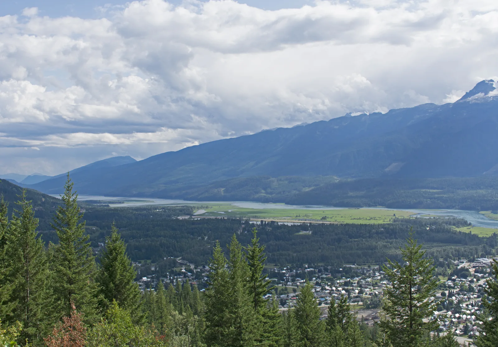
The park is in south-eastern British Columbia on the Trans-Canada Highway, six hours’ drive from Vancouver and four and a half from Calgary. The town of Revelstoke borders the west entrance and makes a practical base.

Parks Canada: plan your visit and directions ↗

02

260 square kilometres (100 sq mi)

The park protects mountains, glaciers, mountain lakes, wetlands and subalpine meadows in the Columbia Mountains. It was established in 1914 as Canada’s eighth national park, because local residents campaigned to protect the wildflower meadows.

Parks Canada: park facts and figures ↗

03

From 8 September 2026: a pass for every stop

An order by the park superintendent makes travel in the park an activity that requires a permit: if you stop, you need a valid park pass. Exempt are those who drive through on Highway 1 without stopping, use a public toilet or stop in an emergency. The maximum fine is 25,000 CAD.

Parks Canada order: park pass for every stop (8 Sep 2026) ↗

04

What is open when

The park is open all year, but many facilities close from October to May. The lower trails at the Nels Nelsen area are accessible all year; the high trails only once the snow has melted.

Parks Canada: opening hours and seasons 2026 ↗

02 · Places

Map and places in the park

Every point is verified against an OpenStreetMap object.

Photo: Ymblanter ↗ · CC BY-SA 4.0 ↗

Place in the park

Meadows in the Sky Parkway

A road that passes through three vegetation zones in 26 km (16.2 mi), from rainforest to wildflower meadows.

Elevation gain
from 470 m (1,542 ft) on the highway to 1,835 m (6,020 ft) at Balsam Lake.
Viewpoints
six, from Revelstoke at km 5 to Panorama Point at km 24.
Not allowed
vehicles over 7.9 m (26 ft) and trailers.
Dogs
only up to the Columbia Viewpoint at km 12.
Last stretch
1 km (0.6 mi) on foot from Balsam Lake to the summit.
Season
opens as the snow melts, closes in early October.

Parks Canada: Meadows in the Sky Parkway ↗

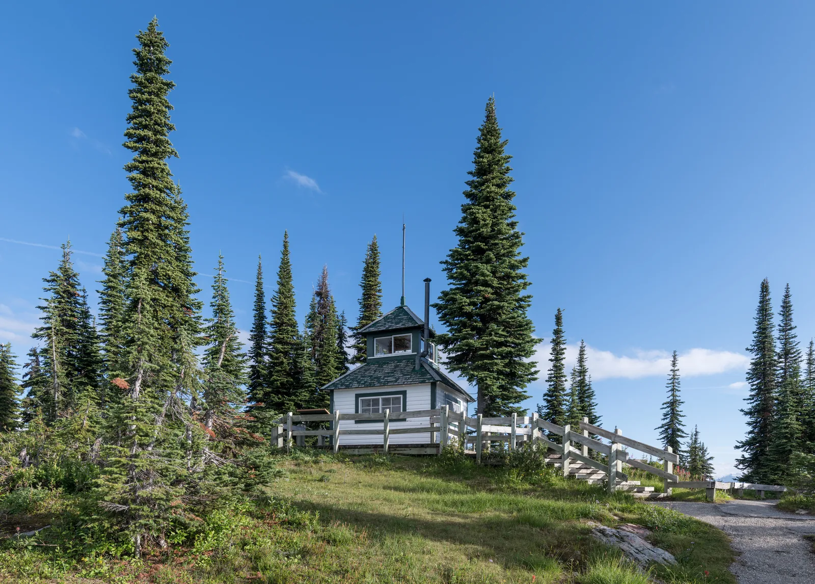
A white wooden fire lookout building stands on the summit meadow in Mount Revelstoke National Park among scattered conifers, with a wooden fence and a path in front.
Photo: DXR ↗ · CC BY-SA 4.0 ↗

Place in the park

The summit

At the top there are short loops through the meadows, a small lake and a historic fire lookout.

Heather Lake
400 m (1,312 ft) loop, 10 minutes.
First Footsteps
750 m (2,461 ft) loop with artworks by the Secwepemc, Ktunaxa and Syilx Okanagan.
Koo Koo Sint
1 km (0.6 mi) loop on the story of the explorer David Thompson.
Fire lookout
500 m (1,640 ft) steeply up; trail closed since 9 July 2026.
Upper Summit
2 km (1.2 mi) from the Balsam Lake parking lot through subalpine forest.
Rule
stay on the marked trails, as the meadows are fragile.

Parks Canada: hiking and camping brochure (PDF) ↗

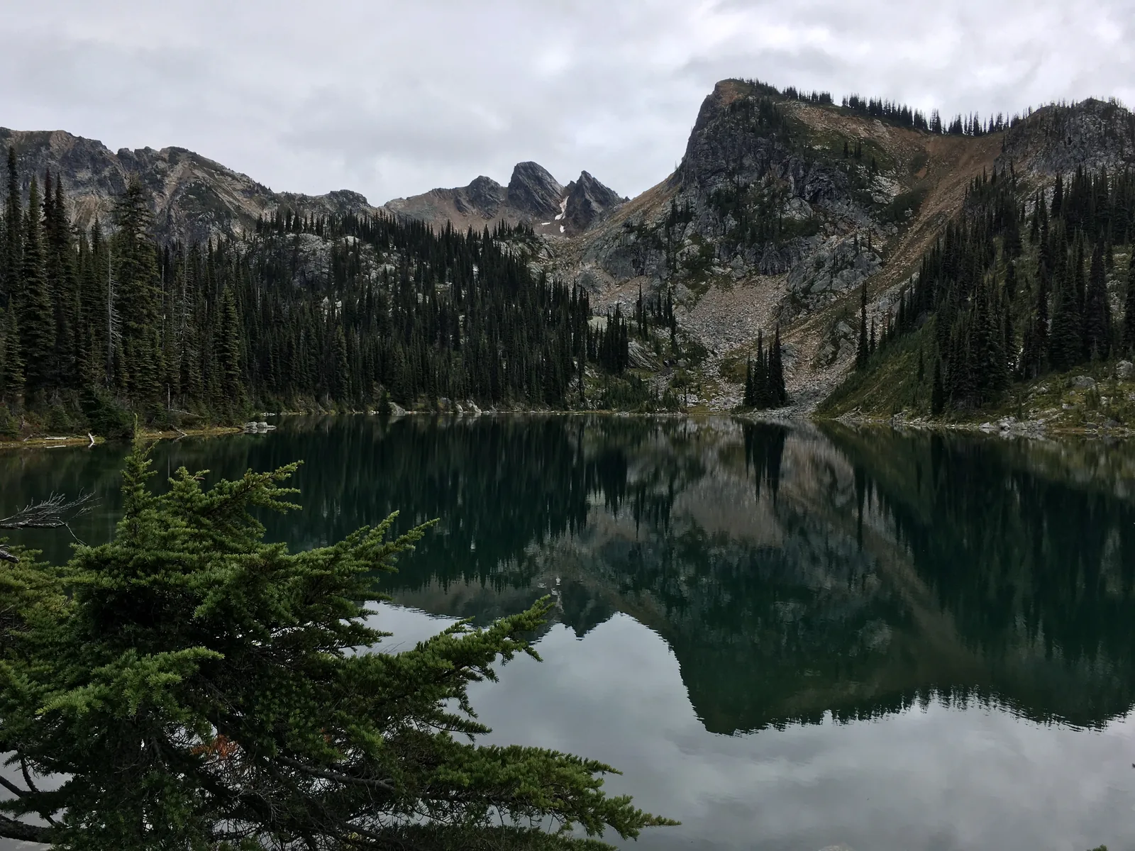
The still Eva Lake in Mount Revelstoke National Park reflects a jagged, partly snow-covered rock wall, with scattered conifers on the shore.
Photo: The Interior ↗ · CC BY-SA 4.0 ↗

Place in the park

The mountain lakes

Four lakes in the alpine zone, reachable without the hard climb, because the road has already done most of the elevation for you.

Miller Lake
11.6 km (7.2 mi) return, 405 m (1,329 ft) of climbing, 4–6 hours.
Eva Lake
14.2 km (8.8 mi), 465 m (1,526 ft) of climbing, 5–7 hours.
Jade Lakes
18.8 km (11.7 mi), 714 m (2,343 ft) of climbing, 6–8 hours, over Jade Pass.
Season
because of snow, usually only from mid-July to September.
Overnight
four tent pads each at Eva Lake and Jade Lakes, reservation required.
Note
mobile reception on these trails is extremely weak.

Parks Canada: hiking and camping brochure (PDF) ↗

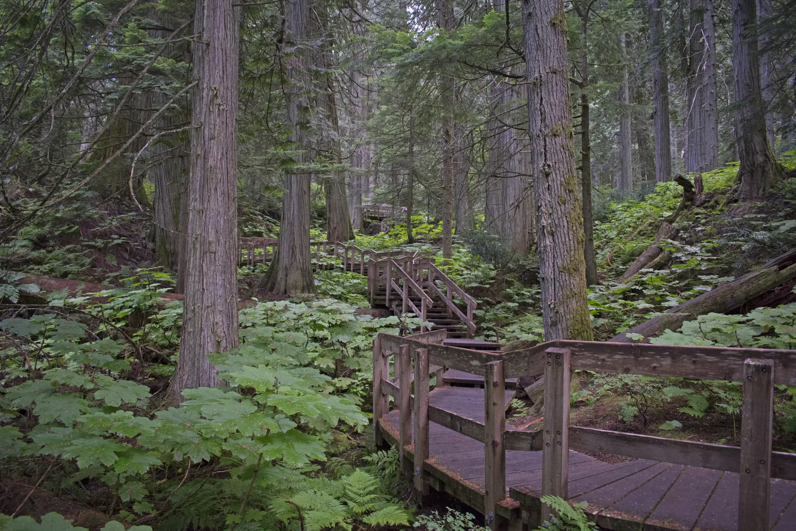
A wooden boardwalk with a railing leads through dense rainforest of massive cedar trunks and large-leaved plants in Mount Revelstoke National Park.
Photo: Ymblanter ↗ · CC BY-SA 4.0 ↗

Place in the park

The inland rainforest

Dense vegetation and big trees that remind many visitors of the Pacific coast, except that the sea is hundreds of kilometres away.

Trees
western red cedar, western hemlock, western white pine.
Understorey
devil’s club, Pacific yew, ferns and mosses.
Age
cedars up to 1,000 years old, up to 4 m (13 ft) in diameter.
Giant Cedars
500 m (1,640 ft) boardwalk to the “cedar theatre”.
Skunk Cabbage
500 m (1,640 ft) to a wetland with a bird-watching platform.
Season
both trails late May to mid-October.

Parks Canada: the inland rainforest of the Columbia Mountains ↗

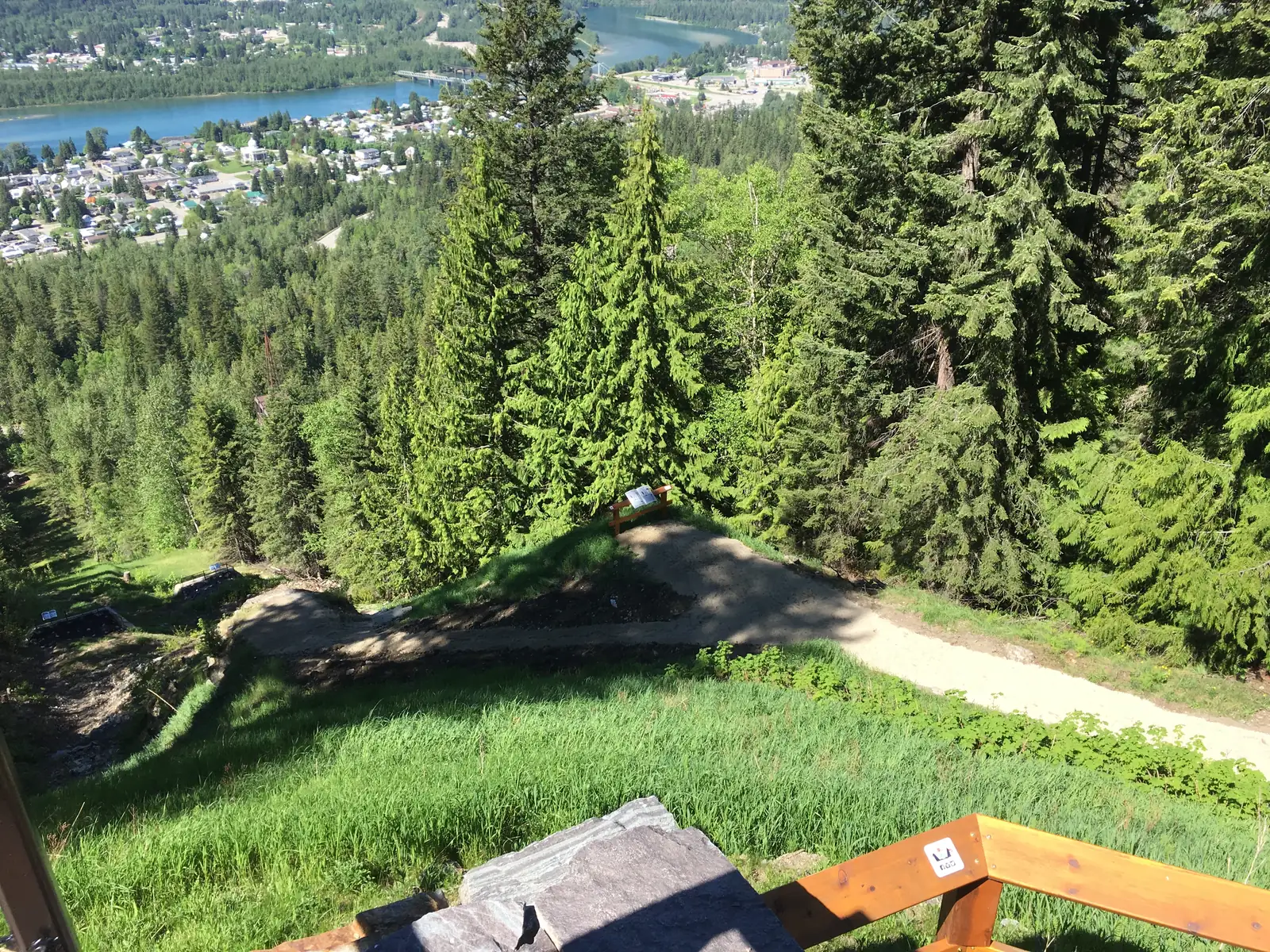
View from the top of the old ski jump in Mount Revelstoke National Park down the overgrown slope to the town of Revelstoke and the river, with a wooden railing in the foreground
Photo: Mikethory ↗ · CC BY-SA 4.0 ↗

Place in the park

The ski jump

At the foot of the mountain lies the longest ski jumping history in Canada, and a viewpoint where you can look over the edge.

Beginnings
in 1892 a miner brought the first skis to Revelstoke; the first ski club was founded in 1893.
Competitions
1915 to the late 1960s, longer than anywhere else in Canada.
World records
Nels Nelsen in 1916 with 183 feet and in 1925 with 240 feet; Bob Lymburne in 1933 with 287 feet.
Spectators
up to 5,000 in a town of 3,000 people.
End
last competition in 1971, 56 years after the first.
Today
judges’ tower and Nels’ Knickers at the viewpoint; designated an event of national historic significance in 2016.

Parks Canada: ski jumping history ↗

Map

11 places on the map

Every point is verified against an OpenStreetMap object.

Open map3D terrain · details and photos for every place
  • Mountains & rock1
  • Water5
  • Trails2
  • Where to stay2
  • Surroundings1

03 · Out and about

Hikes & routes: summit loops, mountain lakes and giant cedars

Short loops at the summit, long trails to mountain lakes, and ancient cedars in the valley.

Photo: Phil Whitehouse ↗ · CC BY 2.0 ↗

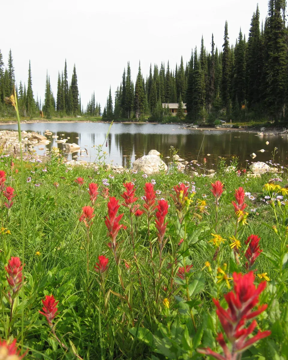
„The growing season up here is short and the meadow plants are extremely fragile. That is why the park authority asks you to stay on the marked trails only.“

Mount Revelstoke National Park · Subalpine wildflower meadows at the summit

Hikes & routes: summit loops, mountain lakes and giant cedars

Short trails at the summit

Several short loops branch off the upper Summit Trail: 400 m (1,312 ft) around Heather Lake; the 750 m (2,461 ft) First Footsteps trail through the meadows, with artworks by the Secwepemc, Ktunaxa and Syilx Okanagan; 1 km (0.6 mi) of Koo Koo Sint on the story of the explorer David Thompson; and 500 m (1,640 ft) steeply up to the historic fire lookout.

Parks Canada: hiking and camping brochure (PDF) ↗

To the mountain lakes

Day hikes lead from the summit to four mountain lakes: Miller Lake, 11.6 km (7.2 mi) return; Eva Lake, 14.2 km (8.8 mi), with a 1920s warden cabin on the shore; and Jade Lakes, 18.8 km (11.7 mi), over Jade Pass. Because of snow they are usually passable only from mid-July.

Parks Canada: hiking and camping brochure (PDF) ↗

Giant cedars and skunk cabbage

On the highway, two short boardwalks lead through the rainforest: the 500 m (1,640 ft) Giant Cedars trail through cedars over 500 years old to a “cedar theatre”, and the 500 m (1,640 ft) Skunk Cabbage trail along the Illecillewaet River to a wetland with a bird-watching platform.

Parks Canada: hiking and camping brochure (PDF) ↗

The whole mountain on foot

If you want the climb: the Summit Trail covers 20 km (12.4 mi) and 1,353 m (4,439 ft) of climbing from the Nels Nelsen parking lot to the summit, crossing the parkway six times. The quieter Lindmark Trail climbs 982 m (3,222 ft) over 15 km (9.3 mi).

Parks Canada: hiking and camping brochure (PDF) ↗

On the historic ski jump

The old ski jump stands at the foot of the mountain. At the top you lean into “Nels’ Knickers”, a pair of metal trousers modelled on those of the champion Nels Nelsen, and look over the edge. The way up is steep over 800 m (2,625 ft) or gentle over 600 m (1,969 ft) from km 4 of the parkway.

Parks Canada: hiking and camping brochure (PDF) ↗

Nature and history: inland rainforest, meadows and ski jumps

A rainforest far inland

British Columbia has one of the world’s only temperate inland rainforests, and it lies entirely within the Columbia Mountains. Moist air from the Pacific drops its rain here. In the valley, western red cedar, western hemlock and western white pine grow above devil’s club and Pacific yew.

Parks Canada: the inland rainforest of the Columbia Mountains ↗

Three zones

Up to about 1,300 m (4,265 ft): rainforest with cedars up to 1,000 years old and up to 4 m (13 ft) in diameter. Above that, the subalpine zone with fir, spruce and the wildflower meadows. Above 1,900 m (6,234 ft) the trees disappear, leaving lichens, heather and sedges on thin soil.

Parks Canada: park facts and figures ↗

How the mountain formed

The park lies entirely in the Selkirk Range of the Columbia Mountains, which formed 250 million years ago when the North American and Pacific plates collided. Until about 6,000 years ago the Cordilleran Ice Sheet, up to 1,400 m (4,593 ft) thick, covered it and left only the highest peaks exposed.

Parks Canada: park facts and figures ↗

One caribou

Of the Columbia South herd, which used Mount Revelstoke and Glacier, only one female was left after the 2022 count; in 1994 there were still about 100. On her own she would have had little chance of survival and no offspring. Experts recommended moving her to a supervised maternal pen near Nakusp.

Parks Canada: caribou, the Columbia South herd ↗

World records on the ski jump

From 1915 to the late 1960s, ski jumping competitions were held here every year, longer than anywhere else in Canada. Nels Nelsen set a world record of 183 feet in 1916 and reached 240 feet in 1925; Bob Lymburne jumped 287 feet in 1933. In 2016 ski jumping at Mount Revelstoke was designated an event of national historic significance.

Parks Canada: ski jumping history ↗

04 · Before you go

Park film and places nearby

Photo: Phil Whitehouse ↗ · CC BY 2.0 ↗

Film by the park authority

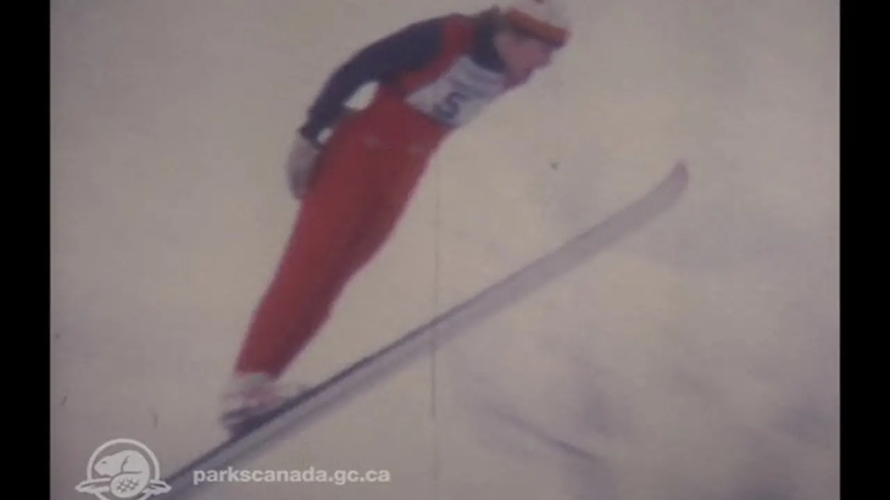
Flying Without Wings – Ski Jumping History of Mount Revelstoke National Park

Seven and a half minutes drawn from six decades of archive footage: between 1915 and the late 1960s, world records were set on the ski jump at Mount Revelstoke. The film opens by saying that it is not a film about skiing, but about flying. In English, without narration.

Source: Parks Canada · View channel ↗

Around the park

Field book · Mount Revelstoke National Park

checked 20 Sep 2026

Mount Revelstoke at a glance · PDF, 2 pages ↓

00My visit

Nothing saved yet. Every place card has a pin, and so does every place on the Map. What you save collects here, with days, notes and a preview you can share.

01Best time to visit: when the parkway is open

The snow decides how far up the road goes.

The parkway season

The road opens section by section in spring as the snow melts, and closes for snow in early October. The parkway kiosk is staffed from 16 May to 25 October, the Snowforest Welcome Centre from 16 May to 11 October.

Parks Canada: opening hours and seasons 2026 ↗

Peak season: July to mid-September

This is when most trails in the summit area are free of snow. In spring there is still snow at the top, sometimes until late July or early August; it is then best to hike lower down.

Parks Canada: hiking and trail conditions ↗

Wildflowers in August

The subalpine meadows reach their peak in August. The growing season is short and the vegetation very fragile, so stay on the marked trails.

Parks Canada: Meadows in the Sky Parkway ↗

Giant cedars from late May

The Giant Cedars and Skunk Cabbage areas on the highway, about 30 km (18.6 mi) to the east, open on the third weekend of May and close in mid-October. In winter they are inaccessible because of the heavy snow.

Parks Canada: opening hours and seasons 2026 ↗

Winter

Snow lies from mid-November. The road is ploughed to the Nels Nelsen parking lot and to the gate at the kiosk. A volunteer club grooms 6.5 km (4 mi) of cross-country ski trail on the parkway up to the Monashee shelter. Winter tyres are required from 1 October to 31 March.

Parks Canada: winter activities and avalanches ↗

Climate through the year

Weather and climate in Mount Revelstoke National Park

Best months by the climate data: July and August. Average daytime highs of around 19 °C, lows of 8 to 9 °C, 48 to 61 mm of precipitation a month. The wettest month is November (127 mm), the driest August (48 mm).

Climate chart in Mount Revelstoke National ParkAverage daily highs from −8 °C to 19 °C, lows from −16 °C to 9 °C; monthly precipitation from 48 mm to 127 mm.
All monthly values as a table
Monthly averages 2001–2020, NASA POWER model
MonthHigh °CLow °CPrecipitation mm
January−6.6−14.4110
February−5.4−15.175
March−2.3−11.0102
April1.2−6.268
May10.10.873
June15.45.495
July19.18.861
August18.78.048
September13.83.676
October5.5−2.4107
November−3.2−10.6127
December−8.2−15.9101
Year1,043

Modelled values, not a weather station: NASA POWER (MERRA-2) for a grid cell of about 55 × 45 km around the map point Mount Revelstoke summit (51.05° N, 118.14° W), with an average cell elevation of about 1,470 m. Averages for 2001–2020. Higher ground and valleys can differ markedly.

Source: NASA POWER, climatology 2001–2020 ↗ · retrieved 3 Oct 2026

02How to get there: the parkway from Highway 1 and parking

The turn-off is on the highway; the rest is a mountain road.

On the Trans-Canada Highway

The access to the Meadows in the Sky Parkway is east of Revelstoke on Highway 1. The road winds up for 26 km (16.2 mi) from 470 m (1,542 ft) to 1,835 m (6,020 ft) at Balsam Lake, through cedar and hemlock forest, spruce and fir, into the wildflower meadows.

Parks Canada: Meadows in the Sky Parkway ↗

Not every vehicle is allowed up

The parkway is narrow with tight switchbacks. Buses, RVs and other vehicles over 7.9 m (26 ft) are not allowed, and neither are trailers. You can leave trailers at the Nels Nelsen area, half a kilometre past the highway.

Parks Canada: Meadows in the Sky Parkway ↗

By shuttle

Two licensed private operators run shuttles to the summit area, which is handy if your vehicle is too large and helps with the scarce parking at the top. The operators publish their own timetables and prices.

Parks Canada: Meadows in the Sky Parkway ↗

The last stretch on foot

From the Balsam Lake parking lot the summit is 1 km (0.6 mi) away, on foot via the trail or the closed road. Accessible parking at the summit is available on request; ask at the kiosk before you drive up.

Parks Canada: Meadows in the Sky Parkway ↗

Without a car

From downtown, the 2.6 km (1.6 mi) Mount Revelstoke trail leads from behind the railway museum into the park, to the Nels Nelsen area. You can also cycle it.

Parks Canada: hiking and camping brochure (PDF) ↗

Parking at Balsam Lake: limited, arrive early

Parking in the summit area is limited; the park authority advises arriving early to avoid disappointment. The shuttle up the Meadows in the Sky Parkway is explicitly meant to reduce parking demand and traffic congestion in the park. Trailers stay at the Nels Nelsen Historic Area, half a kilometre up from the highway.

Parks Canada: Meadows in the Sky Parkway ↗

Revy Rides and Mount Revelstoke Shuttle, authorized by the Mount Revelstoke park authority (Parks Canada) · Shuttle · authorized operators

Summit shuttle from Revelstoke up the Meadows in the Sky Parkway

Two operators authorized by Parks Canada for the parkway drive up the 26 kilometres of the Meadows in the Sky Parkway from the town of Revelstoke to the summit area in summer. That helps anyone whose vehicle is not permitted on the parkway, and saves hunting for one of the scarce parking spaces at the top. Revy Rides uses electric vehicles and carries bikes; Mount Revelstoke Shuttle runs a minibus for 15 passengers to the Balsam Lake parking lot or the summit parking lot. There is no guide; at the top the short loops through the wildflower meadows and the trails to the alpine lakes begin.

Meeting point Revy Rides: pick-up at Grizzly Plaza or at your hotel or campground in Revelstoke. Mount Revelstoke Shuttle: Revelstoke Information and Business Center, Best Western Revelstoke or Snowforest Campground; be there 15 minutes before departure.

Timetables, fares and booking are only available from the operators; the park authority refers to their websites. Since 8 September 2026 every passenger needs a park pass, which you buy yourself. Revy Rides lists four return trips a day; the ride up and the ride down are separate tickets, changes or cancellations up to 48 hours in advance. Mount Revelstoke Shuttle allows about one hour from pick-up to drop-off, and the return trip is included; refunds are only given if the operator cancels, otherwise the booking is moved. Its website gives Monday to Friday, July to October, as its hours; its 2026 season has ended, and bookings for 2027 open in May. Dogs are not allowed above kilometre 12, not even in the vehicle; according to its website, Mount Revelstoke Shuttle accepts service animals.

Park authority page ↗Operators licensed by Parks Canada · no partner link · checked 2 Oct 2026

03Tickets & entrance fees: 12.25 CAD a day

All prices in Canadian dollars, taken from Parks Canada on 20 September 2026.

Day admission

Adults pay 12.25 CAD, seniors aged 65 and over 10.75 CAD, and a family or group of up to seven people in one vehicle 24.50 CAD. Youth aged 17 and under pay nothing. The day pass is valid until 16:00 the following day.

Parks Canada: fees and passes ↗

One pass for eight parks

The day pass is also valid for Glacier, Yoho, Kootenay, Banff, Jasper, Waterton Lakes and Elk Island. If you come more often: the annual pass for Mount Revelstoke and Glacier costs 60.50 CAD, and the Discovery Pass for over 80 places 83.50 CAD for adults.

Parks Canada: fees and passes ↗

Where to get your pass

All year at the Parks Canada office in Revelstoke (301B 3rd Street West), at the machine outside it and at the Rogers Pass Discovery Centre. Seasonally at the Meadows in the Sky Parkway kiosk and at Snowforest Campground.

Parks Canada: opening hours and seasons 2026 ↗

Camping

At Snowforest Campground an unserviced site costs 34.00 CAD, a site with electricity 40.00 CAD and a MicrOcube 147.50 CAD. A fire permit costs 15.25 CAD per day. In the backcountry it is 15.00 CAD per person per night; Caribou Cabin costs 147.50 CAD per night.

Parks Canada: fees and passes ↗

Summer 2026: admission was free

With the Canada Strong Pass, admission was free and overnight stays were discounted until 7 September 2026. Regular fees have applied again from 8 September.

Parks Canada: Mount Revelstoke National Park ↗

04Where to stay: one campground, two lakeside campsites, a winter cabin

A campground at the foot of the mountain, two campsites at mountain lakes, a cabin in winter.

Snowforest Campground

62 sites at the start of the parkway, from walk-in tent sites to pull-through sites for RVs, plus three MicrOcubes. Flush toilets and showers. Dogs are allowed, just not in the MicrOcubes.

Parks Canada: hiking and camping brochure (PDF) ↗

Eva Lake and Jade Lakes

Four tent pads at each of the two lakes, with a pit toilet and bear-proof food storage. You need a reservation and a backcountry permit; campfires are banned. Dogs are not allowed.

Parks Canada: hiking and camping brochure (PDF) ↗

Random camping is limited

Random camping is only allowed in a few areas, and the permit is only available in person at the Snowforest Campground Centre. In winter it is only allowed at least five kilometres from the Trans-Canada Highway and Highway 23N.

Parks Canada: hiking and camping brochure (PDF) ↗

Caribou Cabin in winter

From 1 December to 30 April the park rents out a log cabin at 1,550 m (5,085 ft) to groups of up to six people, for a maximum of three nights. You get there on skis or snowshoes: 8.8 km (5.5 mi) via the Summit Trail or 20 km (12.4 mi) via the parkway, four to six hours. Reservations are only taken at the office in Revelstoke.

Parks Canada: Caribou Cabin in winter ↗

05Rules: what the park requires

Mountains, bears and avalanches, and a clear rule for dogs.

No dogs at the summit

Dogs are banned above the Columbia Viewpoint at km 12, even inside your car. The reason is a rise in encounters between bears and off-leash dogs. Elsewhere in the park dogs must be on a leash; violations can be fined up to 25,000 CAD.

Parks Canada: visiting with dogs ↗

Carry bear spray

Grizzly and black bears, wolves and cougars live in the park. Keep 100 m (328 ft) from large animals and 30 m (98 ft) from deer, carry bear spray on the outside of your pack and make noise as you go. You can rent bear spray at the Balsam Outpost at the summit.

Parks Canada: hiking and trail conditions ↗

Snow into summer

In the summit area snow can lie well into summer. Route-finding then becomes difficult, and hard snow or ice makes walking dangerous. Above the treeline at 2,000 m (6,562 ft) avalanches are possible all year, especially from November to June.

Parks Canada: hiking and trail conditions ↗

No signal

Mobile coverage is limited and there is no Wi-Fi in the park. According to the park authority, reception on the trails to the mountain lakes is extremely weak. Parks Canada emergency dispatch: 1-877-852-3100.

Parks Canada: hiking and camping brochure (PDF) ↗

Current closures

The trail to the fire lookout has been closed since 9 July 2026. There are also permanent bans, for example on drones, paragliders, zip lines and horse riding. Check the alerts before you set off.

Parks Canada: alerts and restrictions ↗

06Frequently asked questions: Mount Revelstoke National Park

How much does it cost to enter Mount Revelstoke National Park?

Day admission costs 12.25 CAD for adults, 10.75 CAD for seniors and 24.50 CAD for a family or group of up to seven people in one vehicle. Youth aged 17 and under pay nothing. The day pass is valid until 16:00 the following day and also in seven other national parks, including Banff, Jasper and Yoho.

Parks Canada: fees and passes ↗

Do I need a park pass if I only stop briefly?

Yes. From 8 September 2026 everyone who stops in the park needs a park pass. You do not need one if you drive through on Highway 1 without stopping, use a public toilet or stop because of an emergency.

Parks Canada order: park pass for every stop (8 Sep 2026) ↗

Can you drive to the top of Mount Revelstoke?

Almost. The Meadows in the Sky Parkway ends after 26 km (16.2 mi) at Balsam Lake at 1,835 m (6,020 ft); the last stretch to the summit is 1 km (0.6 mi) on foot. Vehicles over 7.9 m (26 ft) and trailers are not allowed on the road; shuttles are available instead.

Parks Canada: Meadows in the Sky Parkway ↗

When do the wildflowers bloom?

The bloom peaks in August. Because the snow lingers, the high trails are usually only clear from mid-July, and the road closes again in early October.

Parks Canada: Meadows in the Sky Parkway ↗

Can I bring my dog?

In the lower part of the park, yes, on a leash. Above the Columbia Viewpoint at km 12 dogs are banned all year, even inside your car and on all trails at the summit. The reason is encounters between bears and off-leash dogs.

Parks Canada: visiting with dogs ↗

Where can you stay in the park?

At Snowforest Campground at the foot of the mountain, with 62 sites and three MicrOcubes; at the mountain lakes Eva Lake and Jade Lakes, with four tent pads each; or in winter at Caribou Cabin. For everything except the campground you need a backcountry permit.

Parks Canada: camping and accommodation ↗

07Sources and updates

All information comes from the park authority and has been checked with a date.

Latest Parks Canada notices

Fetched automatically: 03 Oct 2026 14:06 UTC.

Original Parks Canada notices. The date is the publication date; validity and affected areas are stated in each notice. The list also contains standing orders from previous years.

View all official notices ↗

  1. Parks Canada: Mount Revelstoke National Park ↗
  2. Parks Canada: plan your visit and directions ↗
  3. Parks Canada: park facts and figures ↗
  4. Parks Canada: fees and passes ↗
  5. Parks Canada: opening hours and seasons 2026 ↗
  6. Parks Canada: Meadows in the Sky Parkway ↗
  7. Parks Canada: hiking and trail conditions ↗
  8. Parks Canada: hiking and camping brochure (PDF) ↗
  9. Parks Canada: camping and accommodation ↗
  10. Parks Canada: Caribou Cabin in winter ↗
  11. Parks Canada: backcountry and random camping ↗
  12. Parks Canada: winter activities and avalanches ↗
  13. Parks Canada: visiting with dogs ↗
  14. Parks Canada: alerts and restrictions ↗
  15. Parks Canada order: park pass for every stop (8 Sep 2026) ↗
  16. Parks Canada: the inland rainforest of the Columbia Mountains ↗
  17. Parks Canada: habitats of the Columbia Mountains ↗
  18. Parks Canada: caribou, the Columbia South herd ↗
  19. Parks Canada: grizzly bears ↗
  20. Parks Canada: subalpine meadow flowers ↗
  21. Parks Canada: ski jumping history ↗
  22. Parks Canada: history of the park ↗
  23. Parks Canada: ideas for a day in the park ↗
  24. Parks Canada: services in Revelstoke ↗
  25. Parks Canada: contact and park office ↗

How current is this information?

Researched 20 Sep 2026. Not a live status. Dates apply only to the year stated. A successful automatic fetch is not an editorial confirmation; outdated automatic values are hidden and replaced by the source link.

Current information from the park ↗

Image and map credits

Location sources: Every location verified against an OpenStreetMap object; the object type was checked in each case. Markers do not imply that access is permitted. Base map © OpenStreetMap contributors. Coastlines of the chapter map: Natural Earth.

End of the field book · Park authority ↗