National Parks Atlas
MapPDF

01 · Canada · British Columbia · Columbia Mountains

Glacier National Park (Canada)

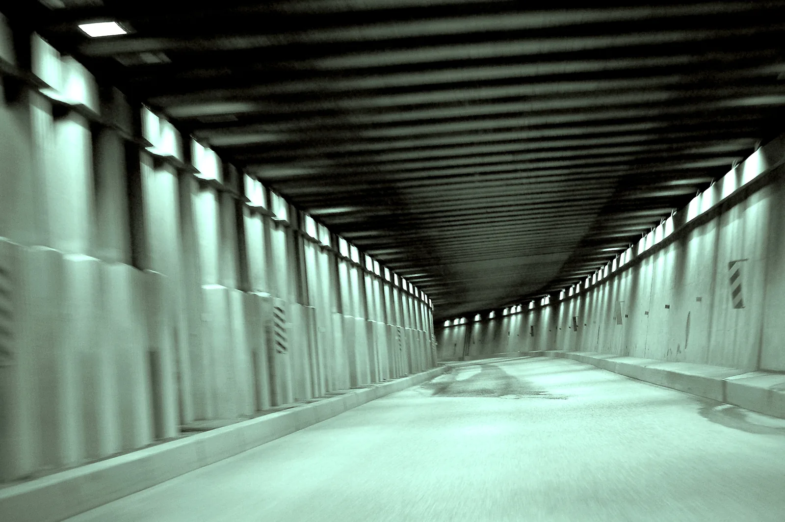
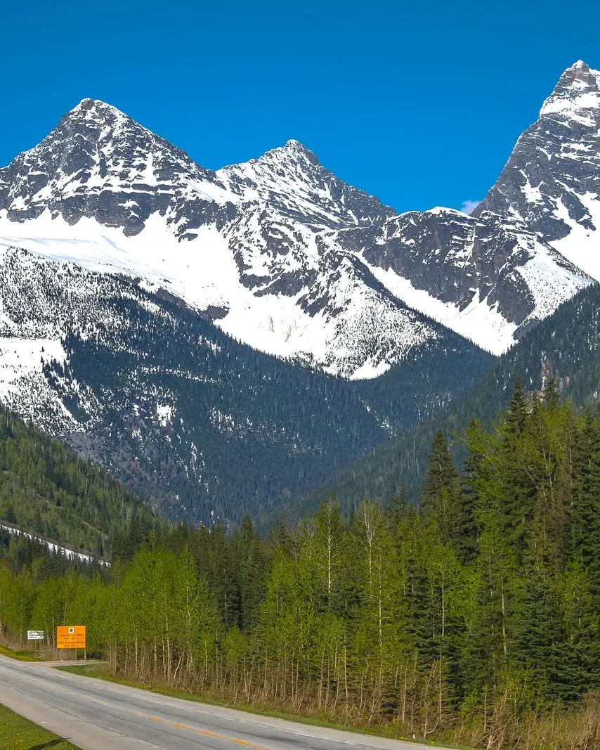
Here the highway passes beneath 135 avalanche paths, kept clear by artillery. After 65 years, that programme is coming to an end.

Photo: Murray Foubister ↗ · CC BY-SA 2.0 ↗

Glacier National Park (Canada) at a glance · PDF, 2 pages

Glacier National Park (Canada): landscape and origins

Steep Selkirk slopes, moist Pacific air and up to ten metres of new snow each winter make a landscape that keeps falling down on itself: over 40 kilometres (25 mi), the Trans-Canada Highway passes beneath 135 avalanche paths.

The park protects the heart of the Selkirk and Purcell Mountains, the highest ranges in the Columbia Mountains system. Moist Pacific air drops its rain and snow here before it reaches the Rocky Mountains. Down below, this produces the world’s only inland cedar rainforest; up above, up to ten metres of new snow. Between the valley floor and the ridges lie more than 2,000 m (6,562 ft) of elevation.

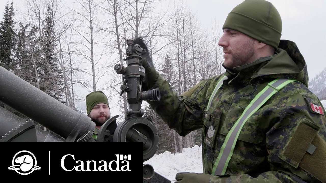
This very combination makes the transport corridor dangerous. Since 1961 the park authority and the Canadian Armed Forces have kept the highway open with artillery fire, the largest mobile avalanche control programme in the world. Avalanche technicians collect weather and snow data every day at study plots at Rogers Pass (1,315 m (4,314 ft)) and on Mount Fidelity (1,905 m (6,250 ft)), dig profile pits up to five metres deep and test the snow layers with the rutschblock test.

If the snowpack is not stable enough, the road is closed and the slopes are shelled. The 105 mm howitzer is fired from 17 fixed positions at 270 pre-set targets; thanks to the pre-calibration, it can hit them even at night and in heavy snowfall. The guns are operated by the Royal Canadian Horse Artillery under the direction of Parks Canada’s senior avalanche officer, as part of Operation PALACI, for which two groups of 15 to 20 gunners each deploy from November to April.

A single March storm shows how much depends on it: 271 rounds fired triggered 37 large avalanches. Without this control, Parks Canada estimates, the highway between Revelstoke and Golden would have been blocked for more than twelve days. Every hour of closure costs the Canadian economy over three million dollars.

At the end of April 2026 the military announced that it would not renew the 65-year-old agreement: it expires on 17 August 2027, citing pressure on resources and the planned retirement of the old artillery systems. Winter 2026/27 is therefore the last with artillery support. Parks Canada and the Department of National Defence are still negotiating what happens after that.

Parks Canada: avalanche control in Glacier National Park ↗

The park in numbers

Established
1886, British Columbia’s first national park
Order
Canada’s second after Banff, at the same time as Yoho
Mountains
Selkirk and Purcell, Columbia Mountains
Rogers Pass
1,315 m (4,314 ft)
New snow
up to 10 m (33 ft) per winter, 14 m (46 ft) on average at the pass
Avalanche paths above the corridor
135
Pre-set artillery targets
270 from 17 gun positions
Avalanche programme
since 1961, ends 17 Aug 2027
Retreat of the Illecillewaet Glacier
about 1.5 km (0.9 mi) in 100 years
Visiting Glacier: the park most people only drive through

01

Not to be confused with Montana

There are two Glacier National Parks. This one is in British Columbia at Rogers Pass; in 1886 it became British Columbia’s first national park and Canada’s second after Banff. The US park of the same name, with the Going-to-the-Sun Road, is in Montana. When you book tours or search for "Glacier National Park", check which of the two parks is meant.

Parks Canada: about the park ↗

02

Driving through is free, stopping is not

Parks Canada has explicitly declared that travel in the park requires a permit. Exempt are those who cross the park on Highway 1 without stopping and those who only use a public toilet. As soon as you stop at a viewpoint or trailhead parking lot, you need a valid park pass. Offences can be fined up to 25,000 CAD.

Parks Canada: alerts and closures ↗

04

Summit Station instead of the visitor centre

The Rogers Pass Centre is being renovated: the exhibition and theatre are closed and other services are limited. As a replacement, Parks Canada has opened Summit Station right next door, with information, park passes, permits, toilets, a picnic area and a charging station. It is on the highway, open all year, and the only service point in the park.

Parks Canada: Rogers Pass Centre and Summit Station ↗

05

No mobile signal, no Wi-Fi

Parks Canada explicitly describes mobile coverage as limited, and there is no Wi-Fi. For emergencies in the backcountry, the Parks Canada dispatch number is 1.877.852.3100; in the backcountry often only satellite devices work.

Parks Canada: safety in the park ↗

06

Read the alerts before you drive

The park keeps its own list of official restrictions, currently 25 entries. It lists the closures, the dog bans and the conditions for individual trails. If you skip the list, you may drive to a trail that is not open this season.

Parks Canada: alerts and closures ↗

02 · Places

Map and places in the park

The pass, visitor points, campgrounds, peaks and glaciers with verified coordinates.

Photo: Kevin Kiefuik ↗ · CC BY-SA 4.0 ↗

Place in the park

Rogers Pass

The summit of the pass is the only place in the park with information, passes and toilets.

Coordinates
51.288531, −117.514371
Elevation
1,315 m (4,314 ft)
Service point
Summit Station, 9520 Trans-Canada Highway
Open
all year, hours vary by season
Visitor centre
under renovation, exhibition and theatre closed
Fuel
none; only in Revelstoke or Golden

Parks Canada: Rogers Pass Centre and Summit Station ↗

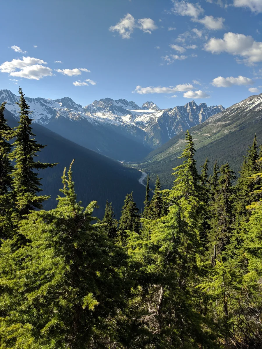
View from a high forest trail in Glacier National Park in Canada across the Illecillewaet valley, with the highway on the valley floor, to glaciated peaks
Photo: TaikiMcTaikiface ↗ · CC BY-SA 4.0 ↗

Place in the park

Illecillewaet

The campground is also the park’s trail hub: seven major hikes start here.

Coordinates
51.265075, −117.494700
Site allocation
first come, first served, no reservations
Price
26.75 CAD per night
Shortest hike
Marion Lake, 6.4 km (4 mi), 425 m (1,394 ft) of climbing
Longest hike
Asulkan Valley, 15.8 km (9.8 mi), 870 m (2,854 ft) of climbing
Steepest hike
Perley Rock, 12.8 km (8 mi), 1,145 m (3,757 ft) of climbing

Parks Canada: day hikes ↗

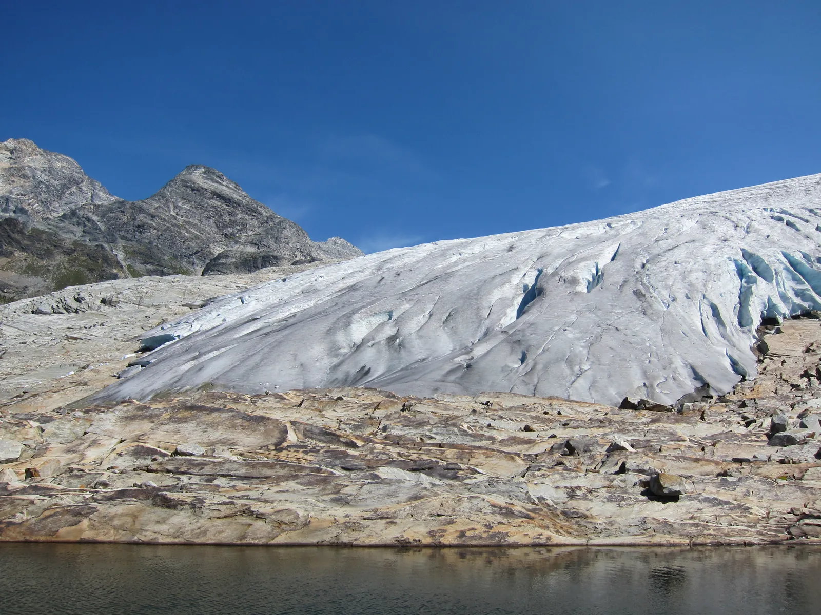
The tongue of the Illecillewaet Glacier in Glacier National Park in Canada ends above polished bare rock, a small glacial lake in front
Photo: The Interior ↗ · CC BY-SA 3.0 ↗

Place in the park

Illecillewaet Glacier

The "Great Glacier" of the 1880s, now one and a half kilometres further up.

Coordinates
51.234224, −117.440614
Trail
Great Glacier, 8.4 km (5.2 mi) return
Climb
320 m (1,050 ft) of elevation, about 2.5 hours
Retreat
about 1.5 km (0.9 mi) over the past century
Caution
Ice caves and overhangs can collapse

Parks Canada: day hikes ↗

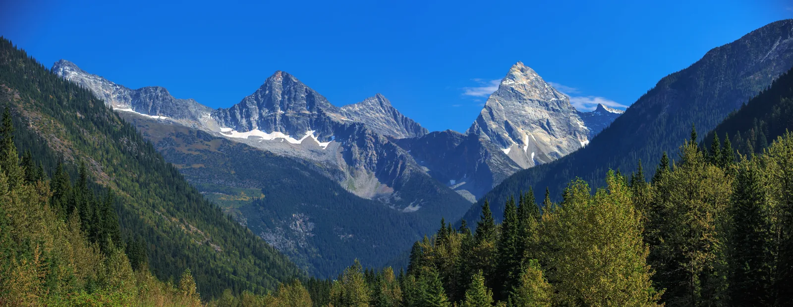
Panorama of the Selkirk Mountains in Glacier National Park in Canada with the pointed rock pyramid of Mount Sir Donald above dark conifer forest
Photo: Murray Foubister ↗ · CC BY-SA 2.0 ↗

Place in the park

Mount Sir Donald

The rock pyramid above the valley, and the mountain where climbing in North America became a pastime.

Coordinates
51.263250, −117.431346
Rock
solid quartzite, long ridge routes
1888
first purely recreational climbing in North America in this area
From 1899
Swiss mountain guides lead guests of Glacier House
Nearest campground
Sir Donald Backcountry, first come, first served

Parks Canada: about the park ↗

Map

18 places on the map

The pass, visitor points, campgrounds, peaks and glaciers with verified coordinates.

Open map3D terrain · details and photos for every place
  • Mountains & rock6
  • Water1
  • Trails2
  • Arrival1
  • Where to stay5
  • History3

03 · Out and about

Hikes & routes: from a 350 m boardwalk to 1,145 m of climbing

The short trails are along the highway; almost all the long ones start at Illecillewaet.

Photo: naserke ↗ · CC BY-SA 2.0 ↗

„Over 40 kilometres (25 mi), the highway passes beneath 135 avalanche paths. It is kept open with artillery fire, for one more winter.“

Glacier National Park (Canada) · Glacial water in the valley near Rogers Pass

Hikes & routes: from a 350 m boardwalk to 1,145 m of climbing

The short trails

The Hemlock Grove Boardwalk (350 m (1,148 ft), 15 minutes) is an accessible boardwalk through rainforest with devil’s club, western red cedars and hemlocks, built as a legacy of Rick Hansen’s Man in Motion World Tour in 1987. The Rockgarden Trail (430 m (1,411 ft)) leads over stepping stones through lichen-covered boulders. Meeting of the Waters (3.3 km (2.1 mi)) ends at the confluence of Asulkan Brook and the Illecillewaet River; at high water you can hear the stones knocking together in the current. Bear Creek Falls (1 km (0.6 mi), 95 m (312 ft) of descent) leads down to a hidden waterfall.

Parks Canada: short trails ↗

Note: two short trails are closed

Sections of the 1885 Trail and the Loop Brook Trail have been closed since 10 June 2026 after avalanches damaged them in winter. Both belong to Rogers Pass National Historic Site and pass the stone bridge piers of the old railway line, which are among the oldest surviving structures in western Canada. Check the status before you go.

Parks Canada: alerts and closures ↗

The day hikes from Illecillewaet

Almost all the major trails start at Illecillewaet Campground: Marion Lake (6.4 km (4 mi), 425 m (1,394 ft) of climbing); Great Glacier (8.4 km (5.2 mi), 320 m (1,050 ft) of climbing); Avalanche Crest (10.2 km (6.3 mi), 795 m (2,608 ft) of climbing); Perley Rock (12.8 km (8 mi), 1,145 m (3,757 ft) of climbing); Glacier Crest (13.4 km (8.3 mi), 960 m (3,150 ft) of climbing); Asulkan Valley (15.8 km (9.8 mi), 870 m (2,854 ft) of climbing); and Abbott Ridge (15.6 km (9.7 mi), 1,030 m (3,379 ft) of climbing). Abbott Ridge leads into true alpine tundra and ends on a narrow ridge.

Parks Canada: day hikes ↗

Balu Pass: groups of four only

On the trail from the Rogers Pass Centre to Balu Pass (12.8 km (8 mi), 780 m (2,559 ft) of climbing), an official restriction applies from 15 July to 30 September: hiking groups must consist of at least four adults, and the distance between two people must not exceed three metres. The reason is grizzly bears; the name comes from the Hindi word "baloo" for bear. Dogs are banned in the entire Connaught Creek drainage. Offences can be fined up to 25,000 CAD.

Parks Canada: alerts and closures ↗

Climbing and mountaineering

Rogers Pass offers long, easy to moderate ridge climbs on solid quartzite. Mount Sir Donald is the best-known peak in the park. Climbing purely for pleasure began here in North America in 1888, and from 1899 hired Swiss mountain guides led beginners onto the glaciers.

Parks Canada: about the park ↗

Ski touring at Rogers Pass

The pass is one of the best-known ski touring areas in North America, with an average of 14 metres (46 ft) of snowfall a year. From mid-November to late April the winter permit system applies: it separates ski tourers from avalanche control by opening individual slopes when no control work is needed. The status of the zones is updated daily. If you cannot check it on a given day, you may only travel in unrestricted zones.

Parks Canada: winter camping and winter permit ↗

View from a forest trail in Glacier National Park, Canada, over the Illecillewaet Valley, where the park authority's guided hike begins, to glaciated peaks of the Selkirk Mountains

Glacier park authority (Parks Canada) · Guided hike · park authority

Guided hike with the park authority: bear signs on the Great Glacier Trail

On selected summer days Parks Canada leads a group from Illecillewaet Campground into the valley below the Illecillewaet Glacier, the “Great Glacier” of the railway era. The hike is about the signs bears leave behind: trails, scat, tracks, and how to move safely in bear country. The guide does not look for bears; if you see one, you are lucky. The trail is 8.5 kilometres return with 320 metres of elevation gain; the park authority allows four to five hours. It is the only guided programme the park authority published for the park in 2026.

  • July and August, selected dates
  • 8.5 km, 320 m elevation gain, 4 to 5 hours
  • English only
  • Registration required in advance

Meeting point Meet at the Illecillewaet Campground kiosk, about 3 kilometres west of Rogers Pass on the Trans-Canada Highway; starts at 9:00 Pacific Time.

Space is limited; registration is only possible in advance with the park authority, by phone or email (contact details on the park authority's page). The hike carries a fee; confirm participation and fee when you register. The park authority does not say whether a park pass is included; anyone who parks in the park has needed one since 8 September 2026 anyway. The 2026 dates (11 and 15 July, 5 and 29 August) are over, and no dates for 2027 have been published yet. Until 2025 the same bear hike went over Balu Pass; the park authority's fee list and the event pages of Revelstoke and Golden still give Balu Pass with a meeting point at Summit Station for some 2026 dates, while the park authority's event page lists all four 2026 dates on the Great Glacier Trail. At the end of the trail a rock step blocks the view of the glacier tongue. Bring your own gear, including bear spray.

Park authority page ↗Park authority programme · no partner link · checked 2 Oct 2026

Landscape image, not a provider photo · Photo: TaikiMcTaikiface ↗ · CC BY-SA 4.0 ↗

Nature: an inland rainforest with glaciers above

The only inland rainforest

The park protects the heart of the Selkirk and Purcell Mountains, the highest ranges of the Columbia Mountains system. In the valleys grows the world’s only inland cedar rainforest: western red cedars and hemlocks with devil’s club beneath. Higher up come Engelmann spruce and subalpine fir, then alpine tundra.

Parks Canada: about the park ↗

The glacier that named the park

The Illecillewaet Glacier used to be called the "Great Glacier" and was the main attraction from the 1880s onwards. Back then it was a short walk from the station to the glacier tongue. Over the past century the ice has retreated about 1.5 kilometres (0.9 mi) up the valley, and the trail to the "Great Glacier" now ends far below it.

Parks Canada: day hikes ↗

A family from Philadelphia documented it

For decades the Vaux family came here from Philadelphia and photographed the glacier again and again from the same points. The result is a valuable visual record of its retreat, one of the oldest photographic glacier observations in North America.

Parks Canada: history of the park ↗

Wildlife

Grizzly and black bears, wolves, cougars, wolverines, mountain goats and caribou. Balu Pass is a favourite feeding area for grizzlies, which is why the trail ends at the pass and nobody may go further.

Parks Canada: hiking in the park ↗

Up to ten metres of new snow

Every winter the park gets up to ten metres of new snow; at Rogers Pass an average of 14 metres (46 ft) falls each year. The avalanche technicians’ snow study plots are at Rogers Pass at 1,315 m (4,314 ft) and on Mount Fidelity at 1,905 m (6,250 ft). A snow profile pit at the pass can be five metres deep.

Parks Canada: avalanche control in Glacier National Park ↗

04 · Before you go

Park film and places nearby

Photo: Murray Foubister ↗ · CC BY-SA 2.0 ↗

Film by the park authority

Serious Snow Business! — Crossing the Columbias, Episode 2

A little over three minutes from Parks Canada on what defines this park: the Trans-Canada Highway passes beneath 135 avalanche paths. The film shows how the park authority and the armed forces run the largest mobile avalanche control programme in the world. Second episode of the series "Crossing the Columbias". In English.

Source: Parks Canada · View channel ↗

Around the park

Golden and Revelstoke

Both towns have petrol stations, accommodation and outdoor gear. Golden lies on the Kicking Horse River, Revelstoke at the foot of the ski resort; both are natural base camps for the park.

Parks Canada: plan your visit and directions ↗

Field book · Glacier National Park (Canada)

checked 22 Sep 2026

Glacier National Park (Canada) at a glance · PDF, 2 pages ↓

00My visit

Nothing saved yet. Every place card has a pin, and so does every place on the Map. What you save collects here, with days, notes and a preview you can share.

01Best time to visit: which trails are open when

The park has two seasons, and there is little in between.

Spring, early May to late June

High trails are under snow and can be exposed to avalanches. Lower down it is muddy; low-elevation walks are best. The day-use areas along the highway open with the snowmelt, usually between early and late June.

Parks Canada: hiking in the park ↗

Summer, early July to mid-September

The main season. Valley trails are usually clear from mid-June, backcountry trails from mid to late July. At higher elevations snow can linger until mid-July. The subalpine flowers typically bloom in August.

Parks Canada: hiking in the park ↗

Autumn, mid-September to early October

Shorter days, cooler air. From late September the seasonal bridges are removed, after which you have to ford creeks. The day-use areas close after Canadian Thanksgiving in early October; only the area at the Rogers Pass Centre stays open.

Parks Canada: opening hours and seasons ↗

Winter, mid-November to late April

The slopes along the highway are closed for avalanche control and can only be accessed with a winter permit. The ski touring season starts in mid-November and lasts until the end of April. In autumn, trails stay open until the snow arrives, usually in mid-October.

Parks Canada: opening hours and seasons ↗

Snow is possible at any time

Parks Canada says it explicitly: in the mountains it can snow in any month of the year. Trails above the treeline at 2,000 m (6,562 ft) can be exposed to avalanches all year, especially from November to June.

Parks Canada: hiking in the park ↗

Climate through the year

Weather and climate in Glacier National Park (Canada)

Best months by the climate data: July and August. Average daytime highs of 16 to 17 °C, lows of 6 to 7 °C, 61 to 76 mm of precipitation a month. The wettest month is November (112 mm), the driest August (61 mm).

Climate chart in Glacier National Park (Canada)Average daily highs from −10 °C to 17 °C, lows from −17 °C to 7 °C; monthly precipitation from 61 mm to 112 mm.
All monthly values as a table
Monthly averages 2001–2020, NASA POWER model
MonthHigh °CLow °CPrecipitation mm
January−8.0−16.095
February−7.1−16.971
March−3.6−13.499
April−0.9−9.070
May6.4−1.576
June13.63.5103
July17.26.876
August16.56.161
September11.71.880
October3.2−4.7103
November−5.2−13.1112
December−9.8−17.484
Year1,030

Modelled values, not a weather station: NASA POWER (MERRA-2) for a grid cell of about 55 × 45 km around the map point Rogers Pass (51.29° N, 117.51° W), with an average cell elevation of about 1,760 m. Averages for 2001–2020. Higher ground and valleys can differ markedly.

Source: NASA POWER, climatology 2001–2020 ↗ · retrieved 3 Oct 2026

02How to get there: one road, two directions

Highway 1 is the only access, and at the same time the main axis of the park.

From the west

Revelstoke is 72 kilometres (45 mi) west of Rogers Pass. The town has a small airport, a petrol station and the Parks Canada administration office. From Vancouver it is 575 kilometres (357 mi) to Revelstoke, about six and a half hours’ drive.

Parks Canada: plan your visit and directions ↗

From the east

Golden is 80 kilometres (50 mi) east of the pass. From Calgary it takes about four hours. If you are coming from Banff or Yoho, you will be on this route anyway.

Parks Canada: plan your visit and directions ↗

Airports

The nearest commercial airports are in Revelstoke, Kamloops, Kelowna and Calgary. The park authority does not mention any public transport into the park; without a car the park is practically unreachable.

Parks Canada: plan your visit and directions ↗

Crossing the pass in winter

During avalanche control the highway is closed, sometimes for hours. Parks Canada puts the cost to the Canadian economy at over three million dollars per hour of closure, so the timing is taken seriously. If you have to cross the pass in winter, build in extra time and check road conditions first.

Parks Canada: avalanche control in Glacier National Park ↗

Parking for hikes: Illecillewaet Valley and Campground

Many trails at Rogers Pass start from one of two parking lots, Illecillewaet Valley or Illecillewaet Campground. If you start at the campground, subtract 2 km from the stated trail length.

Parks Canada: day hikes ↗

Parking in winter: Winter Parking Permit required

Most parking lots in Rogers Pass require a Winter Parking Permit in winter, issued with the Winter Permit, and they open or close daily depending on avalanche control; status is updated at about 7 a.m. Parking at Summit Station is limited to 30 minutes. Vehicles may only stay overnight for backcountry trips, with the free overnight parking permit.

Parks Canada: Winter Permit System and ski touring in Rogers Pass ↗

03Tickets & entrance fees: 12.25 CAD a day, and when a pass pays off

There are three passes to choose from. For a road trip, the maths is clear.

Daily prices

Adults pay 12.25 CAD, seniors 10.75 CAD, and youth aged 17 and under have paid nothing since 2018. A family or group in the same vehicle pays 24.50 CAD. The day pass is also valid for Mount Revelstoke, Yoho, Kootenay, Banff, Jasper, Waterton Lakes and Elk Island.

Parks Canada: fees and passes ↗

The annual pass for both parks

An annual pass for Mount Revelstoke and Glacier only costs 60.50 CAD for adults and 120.75 CAD for a family. It pays off from the fifth day of your visits.

Parks Canada: fees and passes ↗

The Discovery Pass for a road trip

The Discovery Pass, at 83.50 CAD for adults and 167.50 CAD for a family, is valid for one year at over 80 national parks, marine conservation areas and historic sites across Canada. If you are visiting Banff, Jasper or Yoho as well as Glacier, it works out much cheaper than day passes.

Parks Canada: fees and passes ↗

Where to get it

All year at the Rogers Pass Discovery Centre and at the Parks Canada administration office in Revelstoke, 301B 3 St. W. Seasonally also at the Meadows in the Sky Parkway kiosk, at Snowforest Campground and at the Illecillewaet Campground kiosk. There is also a machine outside the Revelstoke office.

Parks Canada: fees and passes ↗

Other fees

Camping at Illecillewaet or Loop Brook costs 26.75 CAD per night, a fire permit 15.25 CAD per day and a night in the backcountry 15 CAD per person. A fishing permit costs 15 CAD a day. The guided hike to Balu Pass is listed in the fee schedule at 97.50 CAD.

Parks Canada: fees and passes ↗

The free admission offer is over

7 September 2026 was the last day of free admission and discounted camping under the Canada Strong Pass. Regular fees have applied again since 8 September 2026.

Parks Canada: plan your visit and directions ↗

04Where to stay: two campgrounds on the highway, four huts in the mountains

There is no hotel in the park; the last one closed in 1925.

Illecillewaet and Loop Brook

Both are on the highway and cost 26.75 CAD per night. Loop Brook can be reserved; Illecillewaet is first come, first served. Illecillewaet is also the starting point for almost all the park’s major trails.

Parks Canada: campgrounds and huts ↗

In the backcountry

Hermit Campground can be reserved; Sir Donald is first come, first served. A night costs 15 CAD per person, and you also need a backcountry permit. Reservations are made via recreation.gc.ca or on 1-877-RESERVE.

Parks Canada: campgrounds and huts ↗

The Alpine Club of Canada huts

Asulkan Cabin, A. O. Wheeler Hut, Sapphire Col Hut and Glacier Circle Cabin are run by the Alpine Club of Canada and only by reservation. Asulkan Cabin stands at the end of the Asulkan Valley trail; if you want to continue from there to Asulkan Pass, you need glacier travel equipment and experience in using it.

Parks Canada: campgrounds and huts ↗

Wild camping in winter

Only allowed in the unrestricted winter zones: at least five kilometres from the highway or a park road, one kilometre from any hut and 50 metres (164 ft) from any water. No more than six people, no more than two nights. Wood fires are banned; gas stoves only. Human waste must be packed out. From mid-November to late May dogs are not allowed in the backcountry.

Parks Canada: winter camping and winter permit ↗

Outside the park

Accommodation and petrol stations are in Revelstoke and Golden. Snowforest Campground at the start of the Meadows in the Sky Parkway already belongs to neighbouring Mount Revelstoke National Park.

Parks Canada: campgrounds and huts ↗

05Rules: what the park requires

Bear country, avalanche terrain and no signal, in that order.

Keep bear spray on your belt

Wolves, cougars, grizzly and black bears live in the park. Parks Canada requires you to keep 100 metres (328 ft) from large animals and 30 metres (98 ft) from deer. Carry bear spray on the outside of your pack, within reach. Make noise, especially in dense bushes and before blind bends. No headphones.

Parks Canada: hiking in the park ↗

Dogs

Dogs are banned on the Balu Pass trail and in the entire Connaught Creek drainage. Elsewhere they must be on a leash. Parks Canada explicitly asks you to consider leaving your dog at home: a dog off the leash can trigger aggressive behaviour in grizzlies.

Parks Canada: hiking in the park ↗

What to bring

The park authority’s packing list for a day hike: map and trail guide, full water bottle, high-energy food, bear spray and insect repellent, sun protection, first aid kit, headlamp with spare batteries, hat and gloves, poles, rain jacket, extra warm clothing and a phone or satellite device.

Parks Canada: hiking in the park ↗

Ticks and snowfields

Ticks carrying Lyme disease occur in the park, so check yourself and your dog after every hike. On high trails snow lies well into summer; route-finding then becomes difficult, and hard snow or ice is dangerous to cross.

Parks Canada: hiking in the park ↗

What is banned here

The park explicitly prohibits paragliding and hang gliding, zip lines, via ferratas, traction kiting, horse riding and drones. If you wade through water in summer, you may not wear felt-soled footwear.

Parks Canada: alerts and closures ↗

06Frequently asked questions: Glacier National Park (Canada)

Is this the Glacier National Park in Montana?

No. There are two parks of this name. This one is in British Columbia, Canada, at Rogers Pass between Revelstoke and Golden, and protects the Selkirk and Purcell Mountains. The better-known Glacier National Park with the Going-to-the-Sun Road is in Montana, USA, about 500 kilometres (311 mi) to the south-east on the border with Alberta. Many search results for "Glacier National Park" lead to the US park; guided tours and rafting trips offered there belong to that park, not this one.

Parks Canada: about the park ↗

Can you drive through Glacier National Park (Canada) without a pass?

Yes. The park authority’s order explicitly exempts anyone who crosses the park on Highway 1 without stopping and anyone who only uses a public toilet. As soon as you stop at a viewpoint, trailhead parking lot or picnic area, you need a valid pass. Offences can be fined up to 25,000 CAD.

Parks Canada: alerts and closures ↗

How much does it cost to enter Glacier National Park (Canada)?

Adults pay 12.25 CAD per day, seniors 10.75 CAD, youth aged 17 and under nothing, and a family in one vehicle 24.50 CAD. The annual pass for Glacier and Mount Revelstoke costs 60.50 CAD, and the Discovery Pass for over 80 places across Canada 83.50 CAD. If your road trip also takes in Banff, Jasper or Yoho, the Discovery Pass is the cheapest option.

Parks Canada: fees and passes ↗

When is the best time to visit?

Early July to mid-September. Valley trails are usually clear from mid-June, backcountry trails from mid to late July, and at higher elevations snow lies until mid-July. The subalpine flowers bloom in August. From late September the seasonal bridges are removed, and in early October the day-use areas close.

Parks Canada: hiking in the park ↗

Where can you stay in the park?

Only at a campground or in a hut; there is no hotel, the last one closed in 1925. Illecillewaet is first come, first served, Loop Brook can be reserved; both cost 26.75 CAD. In the backcountry there are Hermit (reservable) and Sir Donald (first come, first served) for 15 CAD per person. The Alpine Club of Canada runs four huts.

Parks Canada: campgrounds and huts ↗

Is there a petrol station at Rogers Pass?

No. The nearest fuel is in Revelstoke, 72 kilometres (45 mi) to the west, or in Golden, 80 kilometres (50 mi) to the east. Fill up before crossing the pass, especially in winter, when closures for avalanche control can last for hours.

Parks Canada: plan your visit and directions ↗

Why do you have to hike to Balu Pass in a group of four?

Because of grizzly bears. From 15 July to 30 September a park authority order applies: at least four adults per group, no more than three metres between two people, and bear spray strongly recommended. Dogs are banned in the entire Connaught Creek drainage. The name comes from the Hindi word "baloo" for bear.

Parks Canada: alerts and closures ↗

Can you visit the park in winter?

Yes, but only under rules. From mid-November to late April the winter permit system applies: it opens individual slopes when no avalanche control is needed there, separating ski tourers from the shelling. The status is updated daily. If you cannot check it, you may only travel in unrestricted zones. Permits are available at Summit Station.

Parks Canada: winter camping and winter permit ↗

Is the visitor centre open?

Only partly. The Rogers Pass Centre is being renovated; the exhibition and theatre are closed. Information, park passes, permits and a small range of goods are available at Summit Station right next door, open all year.

Parks Canada: Rogers Pass Centre and Summit Station ↗

07Sources and updates

The information comes from Parks Canada, checked on 22 September 2026; details on the end of the artillery programme also come from the Department of National Defence and the regional press.

Latest Parks Canada notices

Fetched automatically: 03 Oct 2026 14:06 UTC.

Original Parks Canada notices. The date is the publication date; validity and affected areas are stated in each notice. The full list also contains standing orders from previous years.

View all official notices ↗

  1. Parks Canada: Glacier National Park ↗
  2. Parks Canada: about the park ↗
  3. Parks Canada: plan your visit and directions ↗
  4. Parks Canada: fees and passes ↗
  5. Parks Canada: opening hours and seasons ↗
  6. Parks Canada: Rogers Pass Centre and Summit Station ↗
  7. Parks Canada: alerts and closures ↗
  8. Parks Canada: hiking in the park ↗
  9. Parks Canada: short trails ↗
  10. Parks Canada: day hikes ↗
  11. Parks Canada: campgrounds and huts ↗
  12. Parks Canada: winter camping and winter permit ↗
  13. Parks Canada: avalanche control in Glacier National Park ↗
  14. Parks Canada: safety in the park ↗
  15. Parks Canada: history of the park ↗
  16. Department of National Defence: Operation PALACI ↗
  17. Revelstoke Review, 30 Apr 2026: military will not renew the avalanche control agreement ↗
  18. Parks Canada: Winter Permit System and ski touring in Rogers Pass ↗

How current is this information?

Researched 22 Sep 2026. Not a live status. Dates apply only to the year stated. A successful automatic fetch is not an editorial confirmation; outdated automatic values are hidden and replaced by the source link.

Current information from the park ↗

Image and map credits

Location sources: Every location verified against an OpenStreetMap object; the object type was checked in each case. The points are for orientation and do not replace the park’s own trail descriptions. Markers do not imply that access is permitted. Base map © OpenStreetMap contributors. Coastlines of the chapter map: Natural Earth.

End of the field book · Park authority ↗