National Parks Atlas
MapPDF

01 · Canada · British Columbia · Canadian Rockies

Yoho National Park

Emerald-green lakes and big waterfalls. Your detour to the western side of the Rockies.

Photo: China Crisis ↗ · CC BY 2.5 ↗

Yoho at a glance · PDF, 2 pages

Yoho National Park: landscape and origins

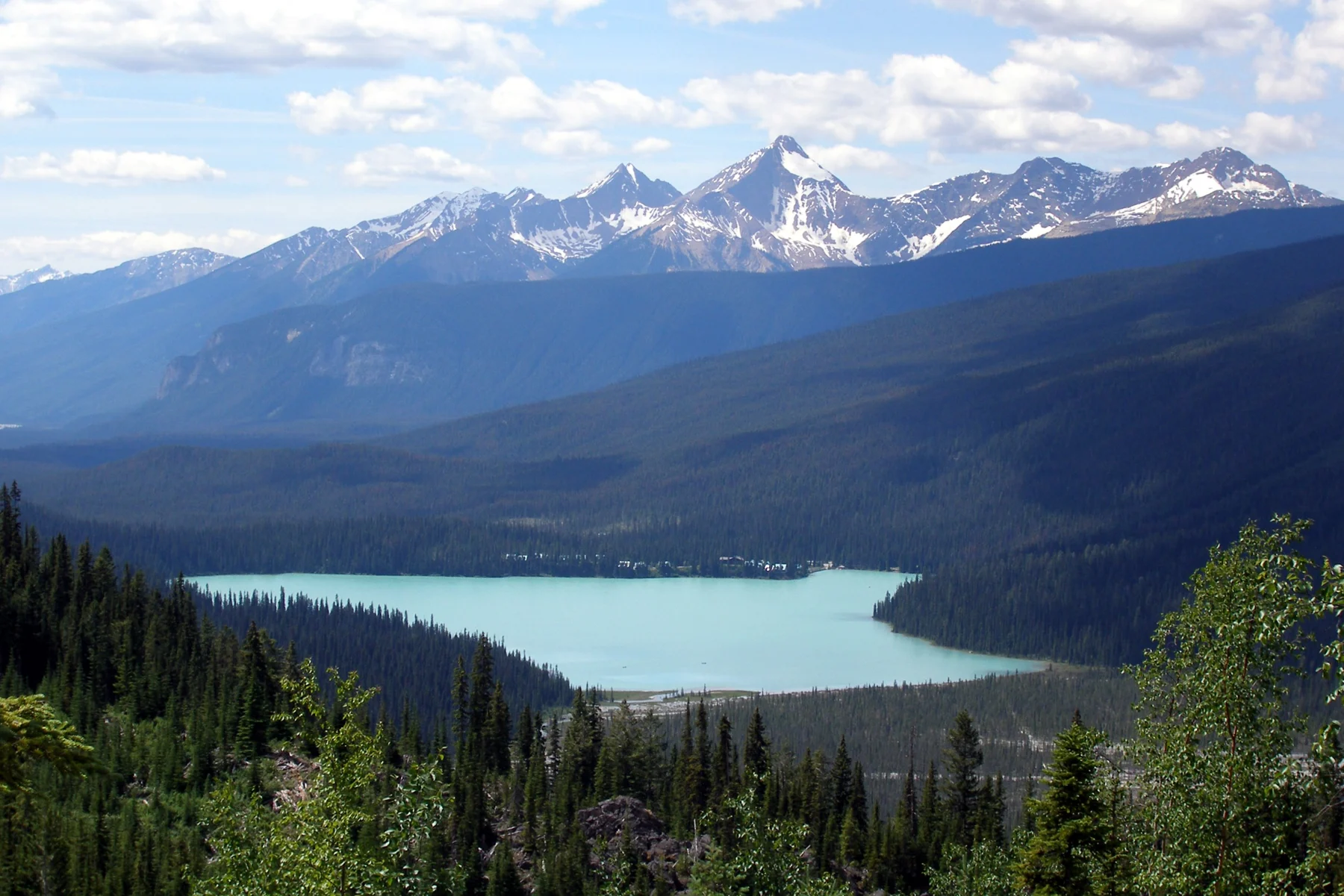
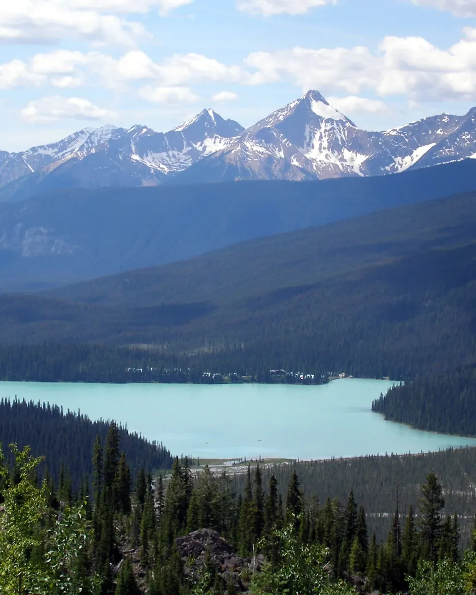
Yoho is the smallest of the four Rocky Mountain national parks, and the one with the oldest fossils: 1,313 square kilometres (507 sq mi) of the western slopes of the Main Ranges.

The park lies in south-eastern British Columbia and protects 1,313 square kilometres (507 sq mi) of the western slopes of the Main Ranges in the Rocky Mountains natural region. Its land, ice and waters are part of the traditional territory of the Ktunaxa and the Secwépemc and are places of ecological, cultural and historical importance.

From river valleys and glaciers to alpine meadows and summits, Yoho holds very different ecosystems. The alpine zone is important habitat for mountain goats, grizzly bears, pikas and whitebark pine. The park is home to at least 224 bird species, 58 mammal species, four native fish species and one reptile species, plus thousands of insect species. Glacial meltwater feeds the waterfalls, the turquoise lakes and the Kicking Horse River.

Yoho is famous for the Burgess Shale. The fossils are over 500 million years old, far older than the dinosaurs. At that time this land lay under a shallow sea; today the remains of that marine world sit in the shale high up in the mountains. Not only shells were preserved but soft body parts: eyes, guts, even brains. The Mount Stephen and Walcott Quarry fossil sites are restricted areas and can only be visited on a guided hike.

The name also comes from the history of exploration: during the Palliser Expedition, James Hector, who was scouting ahead, was kicked in the chest by a horse, and he named the nearby pass Kicking Horse Pass. The Canadian Pacific Railway routed its transcontinental line through this pass and built a hotel with a restaurant at the foot of Mount Stephen so that it would not have to haul heavy dining cars up the mountain. This gave rise to the Mount Stephen Reserve, renamed Yoho National Park in 1901.

Parks Canada: nature and science (Yoho) ↗

The park in numbers

Area
1,313 km² (507 sq mi)
Location
Western slopes of the Main Ranges, south-eastern British Columbia
Current name since
1901, previously Mount Stephen Reserve
Birds
at least 224 species
Mammals
58 species
Native fish
4 species
Reptiles
1 species
Burgess Shale
over 500 million years old
Traditional territory
Ktunaxa and Secwépemc
UNESCO World Heritage
since 1984, part of the Canadian Rocky Mountain Parks
Visiting Yoho: overview and planning

01

Plan your own transport

There is no public transport in the park. Plan on a vehicle or an organised trip with a suitable departure point.

Official directions ↗

02

Water activities restricted

Paddling and fishing are banned in Yoho and Kootenay until 31 March 2027. Exceptions may apply to strictly controlled commercial operators; there is no general permission for canoes.

Current rules for water-based activities ↗

02 · Places

Map and places in the park

Specific places on the map. Verified campground locations to help you plan your night.

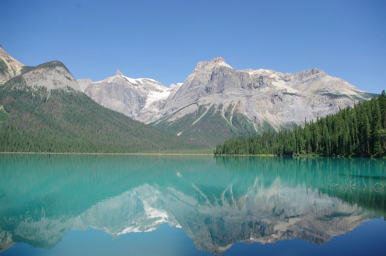
Photo: edb3_16 ↗ · Envato · Projektlizenz ↗

Place in the park

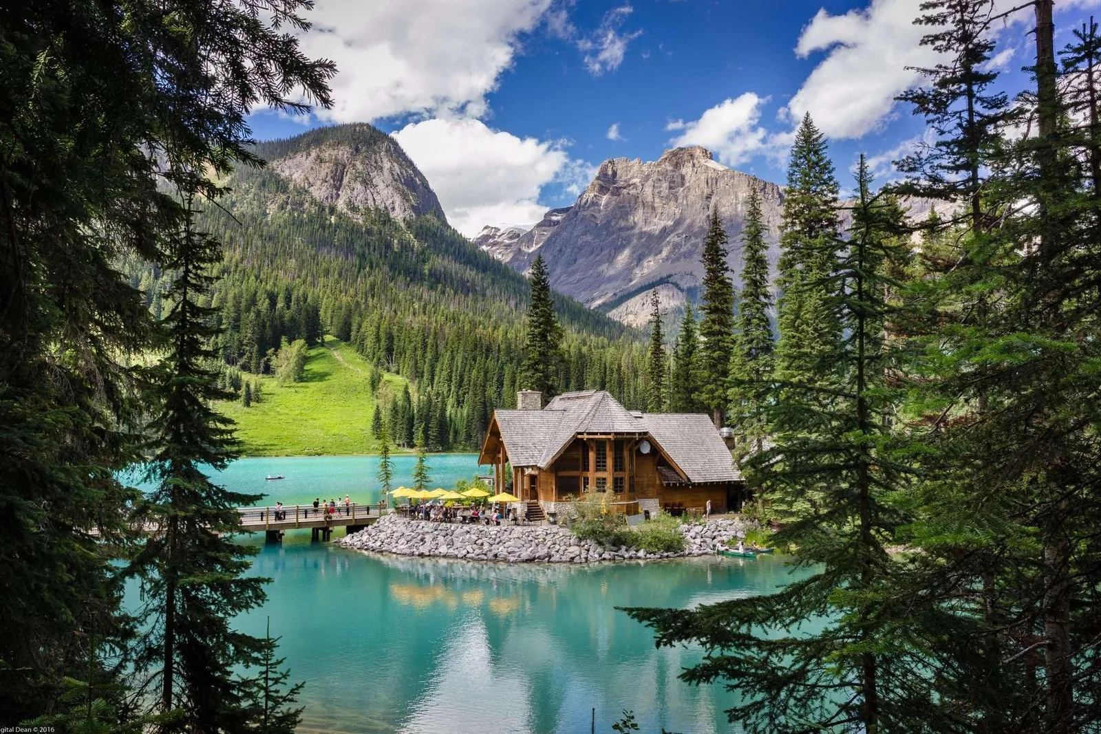
Emerald Lake

The emerald-green lake is the most searched-for place in the park. The lakeshore trail is easy; the parking lot is the bottleneck.

Lakeshore trail
5.2 km (3.2 mi) around the lake, with hardly any elevation change.
Accessible section
Level gravel path from the parking lot to the bridge at the far end of the lake.
Parking
The park authority explicitly describes parking spaces as extremely limited.
Views
Mountain peaks and glaciers, plus wildflowers in summer.
Water sports
All waters in Yoho are closed; see the separate card.

Parks Canada: things to see in Yoho ↗

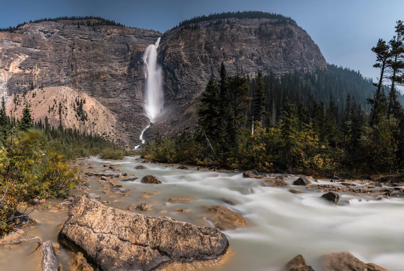
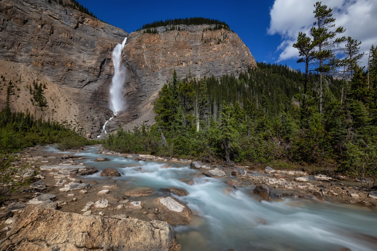
Takakkaw Falls in Yoho National Park plunging over a high rock wall into the Yoho Valley
Photo: edb3_16 ↗ · Envato · Projektlizenz ↗

Place in the park

Takakkaw Falls

One of the highest waterfalls in Canada, reached by a road that not every vehicle can drive.

Access
Yoho Valley Road, a scenic road with tight switchbacks.
Vehicle length
Vehicles over 7 m (23 ft) have to back up in the switchbacks.
Trailers
Not permitted.
Road season
Closed from mid-October to mid-June.
Staying overnight
Takakkaw Falls campground is 300 m (984 ft) from the parking lot.
Further in
Trails lead from here to Laughing Falls, Twin Falls, Yoho Pass, the Iceline and the Little Yoho Valley.

Parks Canada: things to see in Yoho ↗

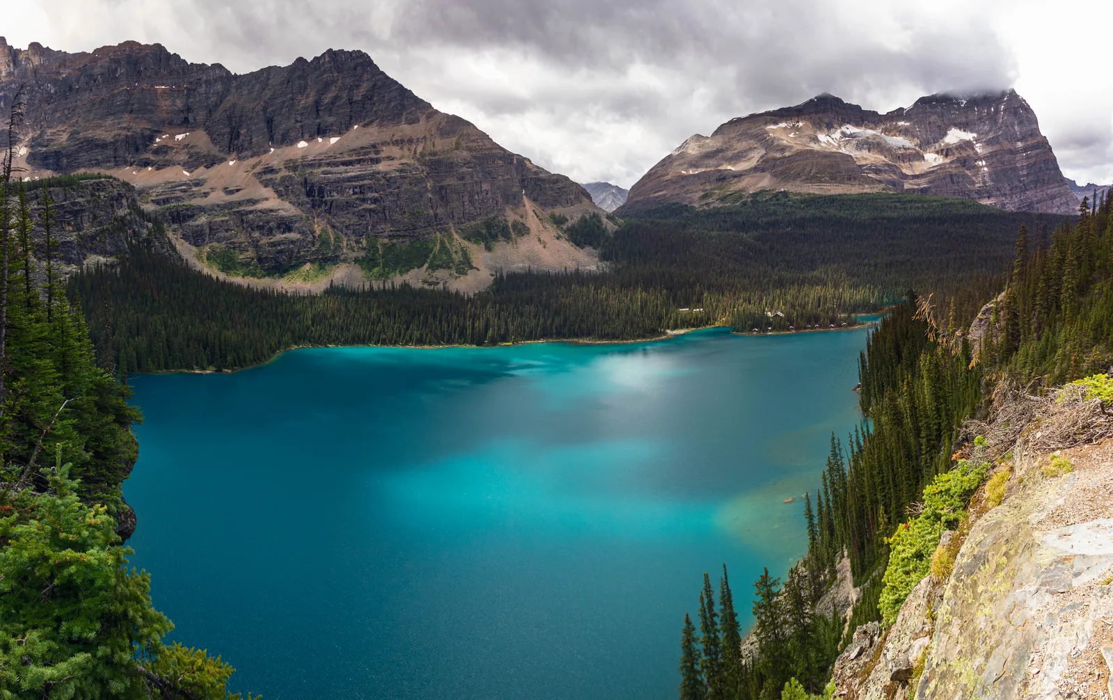
Turquoise Lake O'Hara in Yoho National Park in its rocky basin, surrounded by conifer forest
Photo: jokin.lacalle ↗ · CC BY 4.0 ↗

Place in the park

Lake O’Hara

The hardest place in the park to reach, and the only one where access is decided by lottery. Without a reservation you can only get there on foot.

Access
By the park authority’s shuttle bus, 11 km (6.8 mi) from the Lake O’Hara parking lot. A reservation is required.
Lottery
Day-use seats for 2026 are allocated by lottery; applications from 2 to 23 March 2026.
Shuttle season 2026
19 June to 4 October.
Departures 2026
Up at 8:30 and 10:30; back at 9:30, 11:30, 14:30, 16:30 and 18:30 (MDT).
Group size
No more than six people per reservation; children aged 1 to 16 count.
On foot
You may walk the access road: 22 km (13.7 mi) return, with food, water and bear spray.
Cycling
Not allowed on the access road. Dogs on a leash are allowed on the road, but not on the bus or at the campground.
Hiking season
July to the end of September; until the end of June there is snow at higher elevations, in places with avalanche risk.

Parks Canada: planning a visit to Lake O’Hara ↗

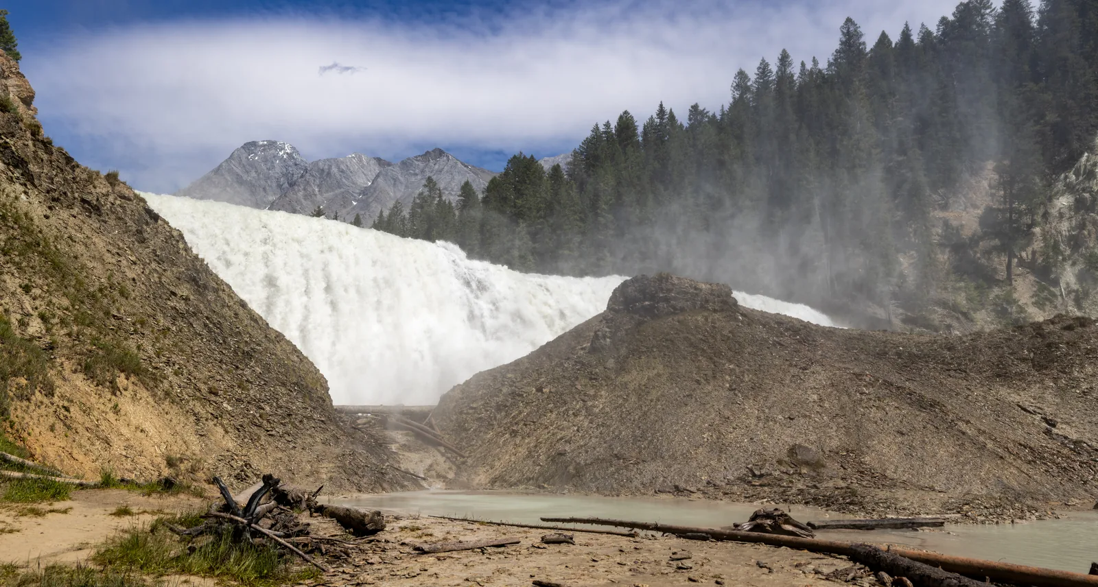
The wide Wapta Falls in Yoho National Park plunging over the rock step in a cloud of spray
Photo: Chris Woodrich ↗ · CC BY-SA 4.0 ↗

Place in the park

Wapta Falls

The largest waterfall on the Kicking Horse River, with a turn-off that is easy to miss when coming from the west.

Size
30 m (98 ft) high, 150 m (492 ft) wide.
Trail
4.6 km (2.9 mi), 30 m (98 ft) of elevation gain, through forest to the viewpoint.
Access road
The 2 km (1.2 mi) road to the parking lot is closed from late October to late May.
Coming from the west
The turn-off is not signed because there is no left-turn lane: drive 5.5 km (3.4 mi) further, turn around at Beaverfoot Road and come back on Highway 1.

Parks Canada: things to see in Yoho ↗

Place in the park

Water closure until 2027

All waters in Yoho and Kootenay are closed to boats and fishing. Older travel reports recommending canoeing on Emerald Lake are out of date.

Scope
All lakes, streams and rivers in Yoho and Kootenay.
Until
31 March 2027.
Reason
Preventing the spread of aquatic invasive species, including whirling disease.
Banned
Canoes, kayaks, SUPs, rowing boats and inflatable boats, inflatable toys and fishing gear of any kind.
Allowed
Swimming and snorkelling, including swimming aids, wetsuits and beach toys.
Commercial operators
Some may continue to operate if they meet the cleaning and disinfection requirements.
Penalties
Fines of up to 25,000 Canadian dollars under the Canada National Parks Act.

Current rules for water-based activities ↗

Map

8 places on the map

Specific places on the map. Verified campground locations to help you plan your night.

Open map3D terrain · details and photos for every place
  • Mountains & rock1
  • Water2
  • Arrival2
  • Where to stay2
  • Nature1

03 · Out and about

Hikes & routes in Yoho

Hiking and experiencing the park. Match tours with the current trail status.

Photo: Chris Woodrich ↗ · CC BY-SA 4.0 ↗

„Wapta Falls carries the most water of any waterfall in the park and is reached by an easy forest trail, while Lake O’Hara requires a reservation.“

Yoho National Park · Wapta Falls on the Kicking Horse River

Hikes & routes in Yoho

Lakes, waterfalls or high trails

The official hiking overview covers short walks, day hikes and multi-day hikes. Choose the route to suit the least experienced person in your group.

Hiking: official park information ↗

Plan Lake O’Hara separately

Lake O’Hara has its own visit and hiking planning. Use the separate section of the park authority instead of assuming the conditions at Emerald Lake apply.

Hiking: official park information ↗

Takakkaw Falls in Yoho National Park plunging over a high rock face into the Yoho Valley

Yoho National Park (Parks Canada) · Fossil hike · Parks Canada

Guided fossil hikes to the Burgess Shale

In summer, Parks Canada interpreters lead hikes to the two Burgess Shale fossil sites in Yoho that are otherwise closed: the Walcott Quarry high above Emerald Lake and the trilobite beds on Mount Stephen above Field. At the sites you can hold fossils more than 500 million years old in your own hand.

  • Walcott Quarry: 24 km (15 mi), 900 m (2,950 ft) of ascent, 11 hours
  • Mount Stephen: 8 km (5 mi), 800 m (2,625 ft) of ascent, 7.5 hours
  • Both difficult, age 8 and over
  • Reservation required, English only

Meeting point Walcott Quarry: 07:00 at the south end of the Takakkaw Falls car park at the end of the Yoho Valley Road, back around 18:00. Mount Stephen: 07:00 in front of the visitor centre in Field, back around 14:30. Book through the Parks Canada Reservation Service, online or on 1-877-737-3783.

Season according to the park: Mount Stephen June to September, Walcott Quarry July to September; the page does not list individual days. The hike is subject to a fee (the park's fee list), and every participant also needs a valid national park pass. The guides do not sell passes, and gates and visitor centres are closed early in the morning: buy the pass the day before, after hours from the vending machines at the Yoho and Lake Louise visitor centres. Children under 8 are not allowed, and children up to 15 only with an adult; for 16- to 18-year-olds a parent or guardian signs a waiver at the trailhead. No pets; hiking poles are mandatory on Mount Stephen. On the road to the Takakkaw Falls car park, vehicles over 7 m (23 ft) must reverse round the switchbacks, and trailers are not allowed. A third, moderate fossil site at Stanley Glacier lies in Kootenay National Park. The non-profit Burgess Shale Geoscience Foundation also guides to both sites in Yoho, meeting at the visitor centre in Field.

Park authority page ↗Park authority programme · no partner link · checked 2 Oct 2026

Landscape image, not a provider photo · Photo: edb3_16 ↗ · Envato · Projektlizenz ↗

Nature and guided tours in Yoho

Burgess Shale

Yoho is known for its fossils. Guided hikes are offered via the official hiking overview; the fossil sites are subject to special access rules.

Hiking: official park information ↗

04 · Before you go

Park film and places nearby

Photo: China Crisis ↗ · CC BY 2.5 ↗

Film by the park authority

Burgess Shale Interpretive Hike – Yoho National Park

Three and a half minutes on what makes Yoho unique in the world: Parks Canada interpreters lead a day hike to the Walcott Quarry, one of the two Burgess Shale sites with 500-million-year-old fossils. The film follows such a hike from the start to the fossil site. In English.

Source: Parks Canada · View channel ↗

Field book · Yoho National Park

checked 17 Sep 2026

Yoho at a glance · PDF, 2 pages ↓

00My visit

Nothing saved yet. Every place card has a pin, and so does every place on the Map. What you save collects here, with days, notes and a preview you can share.

01Best time to visit Yoho

Travel season and opening hours. Visitor centre hours are not general park opening hours.

Hiking season in the mountains

Parks Canada names July to mid-September as the main hiking season. High passes can be snow-covered until the end of June; an open road does not guarantee a walkable trail.

Hiking: official park information ↗

Climate through the year

Weather and climate in Yoho National Park

Most comfortable months by the climate data: July and August. Average daytime highs of around 15 °C, lows of 4 to 5 °C, 70 to 86 mm of precipitation a month. The wettest month is June (117 mm), the driest February (56 mm).

Climate chart in Yoho National ParkAverage daily highs from −10 °C to 15 °C, lows from −19 °C to 5 °C; monthly precipitation from 56 mm to 117 mm.
All monthly values as a table
Monthly averages 2001–2020, NASA POWER model
MonthHigh °CLow °CPrecipitation mm
January−9.0−17.669
February−8.5−18.856
March−5.5−15.589
April−2.3−11.370
May4.4−3.982
June11.41.3117
July15.24.686
August14.63.970
September9.6−0.380
October1.6−7.086
November−6.3−15.090
December−10.5−18.966
Year961

Modelled values, not a weather station: NASA POWER (MERRA-2) for a grid cell of about 55 × 45 km around the map point Kicking Horse (51.42° N, 116.44° W), with an average cell elevation of about 2,100 m. Averages for 2001–2020. Higher ground and valleys can differ markedly.

Source: NASA POWER, climatology 2001–2020 ↗ · retrieved 3 Oct 2026

02How to get there: roads, parking and shuttle

How to reach the park. Your own transport compared with organised trips.

Field as your base

Field lies on the Trans-Canada Highway. Parks Canada gives 30 km (19 mi) from Lake Louise and 85 km (53 mi) from Banff to Field. These distances are not driving-time estimates.

Official directions ↗

Takakkaw Falls: seasonal road access

The Yoho Valley Road is open seasonally. Check the road status before you drive; the park being open in winter does not include this access road.

Visitor centres & opening hours ↗

Explore Banff Tours & Transfers · offer

Banff/Canmore: Emerald Lake & Takakkaw Falls

Organised day trip to Emerald Lake, Natural Bridge and Takakkaw Falls. According to the product description, transport, a guide and national park fees are included.

Departure Pick-up in Banff, Canmore or Harvie Heights, depending on the option.

Depends on the seasonal road opening. Not suitable for children under 6 or wheelchair users. Meals are not included; a canoe is not a guaranteed part of the trip.

View tour ↗Ad · partner link · checked 17 Sep 2026

GetYourGuide · offer

Emerald Lake, Moraine Lake, Lake Louise, Johnston Canyon & Banff Town

Day tour combining Emerald Lake in Yoho with well-known places in Banff. Allow for driving time between the parks.

Departure Pick-up in Calgary (Delta Hotels Calgary Downtown), Canmore (2801 Bow Valley Trail) or Banff (Banff Caribou Lodge).

The page lists no exclusions; you pay for lunch yourself. According to the provider, the lunch break is at the Lake Louise Information Centre.

View tour ↗Ad · partner link · checked 2 Oct 2026

Beyond Banff · Day tour from Golden · 8 hours

Lake Louise, Moraine Lake & Yoho Waterfalls from Golden BC Tour

Minibus day tour with a driver-guide from hotels in Golden, the nearest full-service town west of the park. In Yoho the programme covers Emerald Lake (one hour), a waterfall with a short walk to the edge of the falls (45 minutes) and the Natural Bridge on the Kicking Horse River, followed by Lake Louise and Moraine Lake in Banff National Park (one hour each).

Departure Pick-up at 17 hotels and motels in Golden (BC), about 30 to 60 minutes before the tour starts; the provider confirms the exact time when reconfirming the booking.

According to the provider, the driver-guide, transport in an air-conditioned minibus and national park fees are included; lunch and tips are not. A maximum of 12 people per booking, a good basic level of fitness is needed. Book up to 24 hours before the start, free cancellation up to 24 hours beforehand; the tour may be cancelled for bad weather or too few participants. The road to Takakkaw Falls is closed from mid-October to mid-June; the page gives no season dates, so check dates with the provider. Contradictions: the title names Lake Louise and Moraine Lake, the description only places in Yoho (Takakkaw Falls, Wapta Falls, Field, Natural Bridge, Emerald Lake). The waterfall stop is located at Takakkaw Falls, but its description (“the largest falls in the area”, a short walk to their edge) fits Wapta Falls better. The booking data allow up to 15 people per booking.

View tour ↗Ad · partner link · checked 2 Oct 2026

Ad · we may earn a commission if you book through this partner link. Offer details checked 2 Oct 2026. See official ticket information.

03Tickets & entrance fees: park pass and reservations

Park admission and extras. Regular entrance fees are taken daily from the official park source.

Daily admission: $12.25 per adult

According to the park’s fee list, daily admission costs $12.25 for adults aged 18 to 64 and $10.75 for seniors aged 65 and over. Families or groups of up to seven people arriving in one vehicle pay $24.50. Youth aged 17 and under get in free. The Discovery Pass for all participating places costs $83.50 for adults.

Parks Canada: fees ↗

Park pass and other services

Treat camping, reservations and commercial trips separately. Check temporary admission offers on the official Parks Canada page.

Parks Canada: admission and special offers ↗

Summer 2026: admission was free

Under the Canada Strong Pass, admission to Parks Canada places was free from 19 June to 7 September 2026, and camping was discounted. Regular fees have applied again since 8 September 2026, so trip reports from summer 2026 often quote an admission price that no longer applies.

Parks Canada: admission and special offers ↗

04Where to stay: hotels and camping in Yoho

Staying in the park. The map shows locations, not free sites.

Kicking Horse

Location and facility details are linked on the official camping page. Check the season and booking procedure for this campground before your trip.

Campgrounds: facilities and location ↗

Show on the map

Monarch

Location and facility details are linked on the official camping page. Check the season and booking procedure for this campground before your trip.

Campgrounds: facilities and location ↗

Show on the map

05Rules: dogs and accessibility

Travelling with particular needs. Check specific trails, transport and facilities one by one.

Travelling with a dog

Dogs must be on a leash and under control at all times. Also check closures and special rules for the trail you choose.

Hiking: official park information ↗

Tour with restrictions

The commercial trip linked below is not wheelchair accessible. This says nothing general about the accessibility of the park as a whole.

GetYourGuide: description of the trip · Ad ↗

06Frequently asked questions: Yoho National Park

Can you canoe on Emerald Lake?

No. All waters in Yoho and Kootenay are closed to boats and fishing until 31 March 2027 to prevent the spread of aquatic invasive species, including whirling disease. The closure covers canoes, kayaks, stand-up paddleboards, rowing and inflatable boats, inflatable toys and fishing gear of any kind. Swimming and snorkelling are still allowed. Offences can cost up to 25,000 Canadian dollars under the Canada National Parks Act.

Current rules for water-based activities ↗

How do you get to Lake O’Hara?

By the park authority’s shuttle bus, which requires a reservation, 11 kilometres (6.8 mi) from the Lake O’Hara parking lot. Day-use seats for 2026 are allocated by lottery; applications ran from 2 to 23 March 2026. The shuttle runs from 19 June to 4 October 2026, up at 8:30 and 10:30 and back at 9:30, 11:30, 14:30, 16:30 and 18:30. Without a reservation, the only way in is on foot along the access road: 22 kilometres (13.7 mi) return. Cycling is not allowed there.

Parks Canada: planning a visit to Lake O’Hara ↗

How long is the Emerald Lake loop?

5.2 kilometres (3.2 mi) around the lake, with hardly any elevation change. A level gravel path runs from the parking lot to the bridge at the far end of the lake. The park authority explicitly describes parking at the lake as extremely limited, so plan to arrive early or late.

Parks Canada: things to see in Yoho ↗

Can you drive an RV to Takakkaw Falls?

Only with restrictions. The Yoho Valley Road has tight switchbacks where vehicles over 7 metres (23 ft) long have to back up. Trailers are not permitted. The road is closed from mid-October to mid-June. If you want to stay: Takakkaw Falls campground is 300 metres (984 ft) from the parking lot.

Parks Canada: things to see in Yoho ↗

How old are the Burgess Shale fossils?

Over 500 million years, much older than the dinosaurs. At that time this land lay under a shallow sea. Not only shells were preserved but soft body parts such as eyes, guts and even brains. The Mount Stephen and Walcott Quarry fossil sites are restricted areas and can only be visited on a guided hike.

Parks Canada: Burgess Shale fossils ↗

How much does it cost to enter Yoho National Park?

The full fee table is in the Tickets & entrance fees section and is taken daily from the official Parks Canada price list. Park admission, camping and guided fossil hikes are separate services with their own prices.

Parks Canada: fees ↗

07Sources and updates

Current conditions & sources. Park authority alerts and evidence for each fact.

Latest Parks Canada notices

Fetched automatically: 03 Oct 2026 14:06 UTC.

Original Parks Canada notices. The date is the publication date; validity and affected areas are stated in each notice.

View all official notices ↗

  1. Park authority: Yoho ↗
  2. Parks Canada: fees ↗
  3. Visitor centres & opening hours ↗
  4. Official directions ↗
  5. Campgrounds & booking ↗
  6. Hiking: official park information ↗
  7. Current park alerts ↗
  8. Parks Canada: admission and special offers ↗
  9. Campgrounds: facilities and location ↗
  10. Current rules for water-based activities ↗
  11. GetYourGuide: description of the trip · Ad ↗
  12. Parks Canada: nature and science (Yoho) ↗
  13. Parks Canada: culture and history (Yoho) ↗
  14. Parks Canada: Burgess Shale fossils ↗
  15. UNESCO World Heritage List: Canadian Rocky Mountain Parks ↗
  16. Parks Canada: things to see in Yoho ↗
  17. Parks Canada: planning a visit to Lake O’Hara ↗

How current is this information?

Researched 17 Sep 2026. Not a live status. Dates apply only to the year stated. A successful automatic fetch is not an editorial confirmation; outdated automatic values are hidden and replaced by the source link.

Current information from the park ↗

Image and map credits

Location sources: Official campground map or place coordinates from the maps linked by Parks Canada. Markers do not imply that access is permitted. Base map © OpenStreetMap contributors. Coastlines of the chapter map: Natural Earth.

End of the field book · Park authority ↗