National Parks Atlas
MapPDF

01 · USA · Washington

Olympic

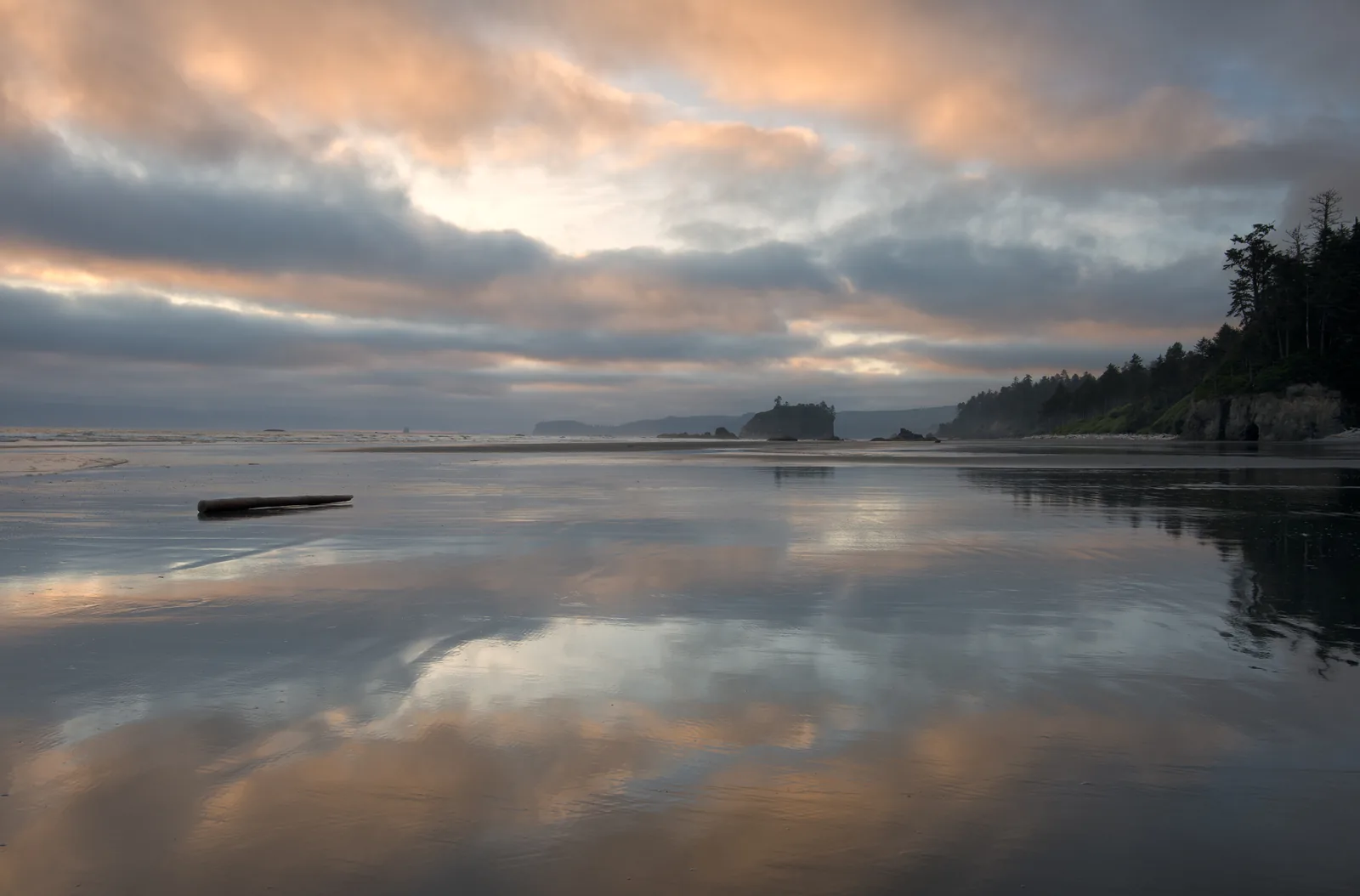
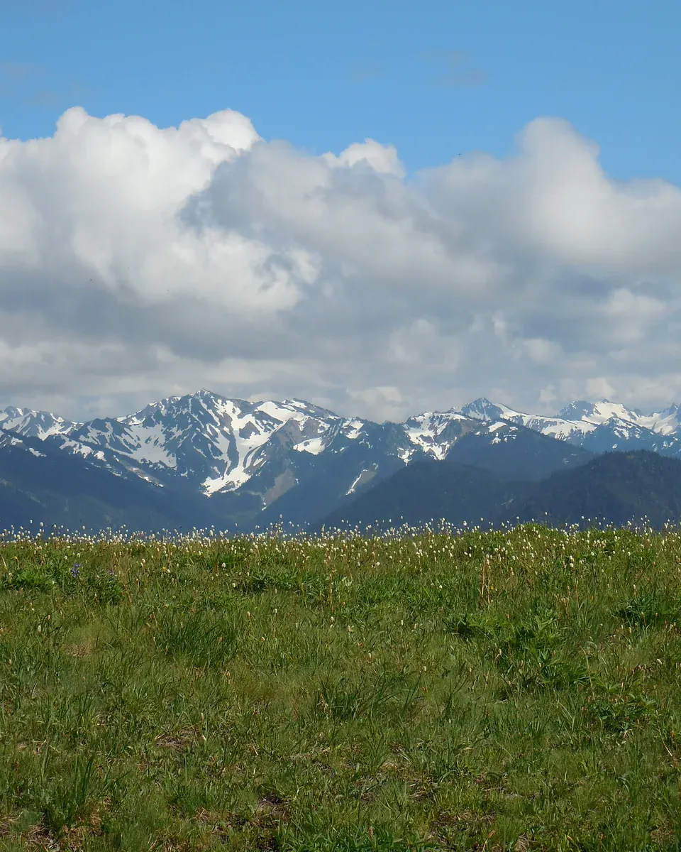
Three parks in one: glaciated mountains, temperate rain forest and 73 miles (117 km) of wilderness coast, linked only by Highway 101 around the peninsula.

Photo: Olympic National Park ↗ · Public domain ↗

Olympic at a glance · PDF, 2 pages

Three parks in one

Glaciated mountains, wilderness coast and temperate rain forest, documented from the park authority's information.

At 922,651 acres (3,734 km²), Olympic is one of the largest parks in the Lower 48 and the most varied on the West Coast: from the glaciated summit of Mount Olympus it is less than 33 miles (53 km) to the Pacific, and in between grows one of the last great temperate rain forests on Earth.

The park authority describes the park as three ecosystems: rugged, glacier-capped mountains, wild Pacific coast and old-growth rain forest. They do not lie one behind the other but side by side, and no road runs through them. Highway 101 circles the peninsula, and each area has its own spur road: Hurricane Ridge from Port Angeles, Sol Duc and Lake Crescent from the 101 in the north, the Hoh from Upper Hoh Road, the beaches from Rialto to Kalaloch from the coastal stretch, Quinault and Staircase from the south and east.

The mountains are young and came from the sea. Some 34 million years ago the Juan de Fuca Plate began to dive beneath North America; the sediments and basalts of the seabed were scraped off, folded and lifted. The ice sheet of the last Ice Age split around them and carved out the Strait of Juan de Fuca and Puget Sound, leaving the peninsula isolated. That explains why pikas and grizzlies are missing and why the Olympic marmot lives only here.

Rain decides everything. Pacific storms unload 140 to 167 inches (3.6 to 4.2 m) a year on the west side; in the valleys of the Hoh, Queets, Quinault and Bogachiel it feeds a rain forest of spruce and hemlock up to 250 ft (76 m) tall, with moss on every branch and trees on stilt roots. In the rain shadow, Port Angeles records only 25 to 30 inches (635 to 760 mm). Hurricane Ridge gets 30 to 35 ft (9 to 11 m) of snow, Mount Olympus 50 to 70 ft (15 to 21 m).

The park exists because of the elk. In 1897 Grover Cleveland had the forests protected as a reserve; in 1909 Theodore Roosevelt made part of it Mount Olympus National Monument to save the dwindling herds, and the animals have been called Roosevelt elk ever since. Franklin D. Roosevelt came to Port Angeles himself in 1937 and signed the park bill the following year. The coastal strip was added in 1953, recognition as a biosphere reserve followed in 1976, World Heritage status in 1981 and wilderness designation in 1988.

People have lived here for 13,500 years. Eight tribes, the Makah, Quileute, Hoh, Quinault, Skokomish, Port Gamble S’Klallam, Jamestown S’Klallam and Lower Elwha Klallam, have never given up their bond with the land and the water. The removal of the two Elwha dams in 2014 returned to the river the salmon that had fed the Klallam for thousands of years; a few months later they spawned in the park for the first time in a hundred years.

NPS: Nature ↗

The park in numbers

Area
922,651 acres, about 3,734 km² (1,442 sq mi)
Highest point
Mount Olympus, 7,980 ft, 2,432 m
Coast
73 miles (117 km) of wilderness coast
Rain
140 to 167 inches (3.6 to 4.2 m) in the rain forest
Snow
30 to 35 ft (9 to 11 m) on Hurricane Ridge
Glaciers
184 in 2009, 266 in 1982
National monument since
1909
National park since
1938
World Heritage Site since
1981

Today in the park

What the National Park Service is reporting right now

  • 2 closures
  • 2 danger
  • 1 Caution
  • 1 Info

Alerts and road conditions on nps.gov ↗

Fetched automatically: 03 Oct 2026 14:06 UTC.

Original National Park Service alerts. The date is the last update of the alert, not a validity period. Closures can change within hours.

Crowds through the year

August is the busiest month, January the quietest

About 5.7 times as many people visit in August as in January.

Tap a month for the number

Visits per month, median of 2023–2025. In 2025 the park recorded 3.58 million visits.

Source: National Park Service, Visitor Use Statistics ↗

Visiting Olympic: mountains, rain forest and coast in one park

01

No road through the middle

No road crosses the park. Highway 101 circles the peninsula, and spur roads branch off it to the individual areas. According to the park authority, the drive between areas takes from half an hour to four hours; the 101 has one lane in each direction.

NPS: Frequently asked questions ↗

02

Two bases

The park authority recommends Port Angeles or Lake Crescent for Hurricane Ridge and Sol Duc, and the area around Forks for the Hoh Rain Forest and the coast. One day is not enough for both; the FAQ says so explicitly.

NPS: Directions, ferries and buses ↗

03

Open around the clock, all year

The park is always open. From October to May, however, some roads, campgrounds and facilities are closed; visitor centres and Hurricane Ridge Road stay closed on Thanksgiving and Christmas. Road status and weather: 360-565-3131.

NPS: Operating hours and seasons ↗

04

Summer queues

On summer weekends, Hurricane Ridge and the Hoh have waits of one to two hours at the entrance, and the car parks at Ruby Beach and Rialto fill up. The park authority's advice: come early or late, since around the solstice it is light from 5:00 until almost 22:00; or come in May or September.

NPS: Frequently asked questions ↗

05

Hurricane Ridge after the fire

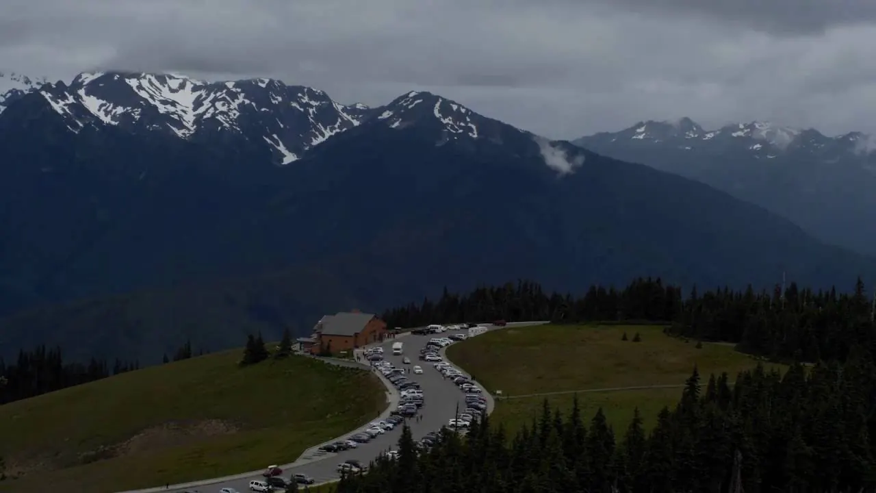
The day lodge on the ridge has burned down. The road is open, the area is staffed only at times, and in 2026 construction work is under way on the car park and the water supply: no drinking water, portable toilets. Bring what you need.

NPS: Hurricane Ridge ↗

06

No signal, no cash

In the Hoh and on the beaches there is little or no mobile reception. The park authority explicitly warns against rental cars that unlock via a mobile connection: you may end up standing in front of a locked car. The park accepts fees only as cashless payments.

NPS: Frequently asked questions ↗

07

The bus up to the ridge

From May to 1 September, Clallam Transit runs from the Gateway Transit Center in Port Angeles up to Hurricane Ridge, $1 each way; the first bus leaves at 8:00 and the last one returns at 17:30. You must pay park entry online beforehand or show a pass.

NPS: Bus to Hurricane Ridge ↗

02 · Places

Map: places in Olympic

Entrance roads, trailheads, beaches and campgrounds, each with a documented location.

Photo: Olympic National Park ↗ · Public domain ↗

Place in the park

Hurricane Ridge

The mountain view for everyone, 17 miles (27 km) beyond Port Angeles, and without a building since the fire.

Elevation
5,242 ft (1,598 m)
Road
17 miles (27 km) from Port Angeles
Bus
May to 1 September, $1
Winter
Friday to Sunday, chains required

NPS: Hurricane Ridge ↗

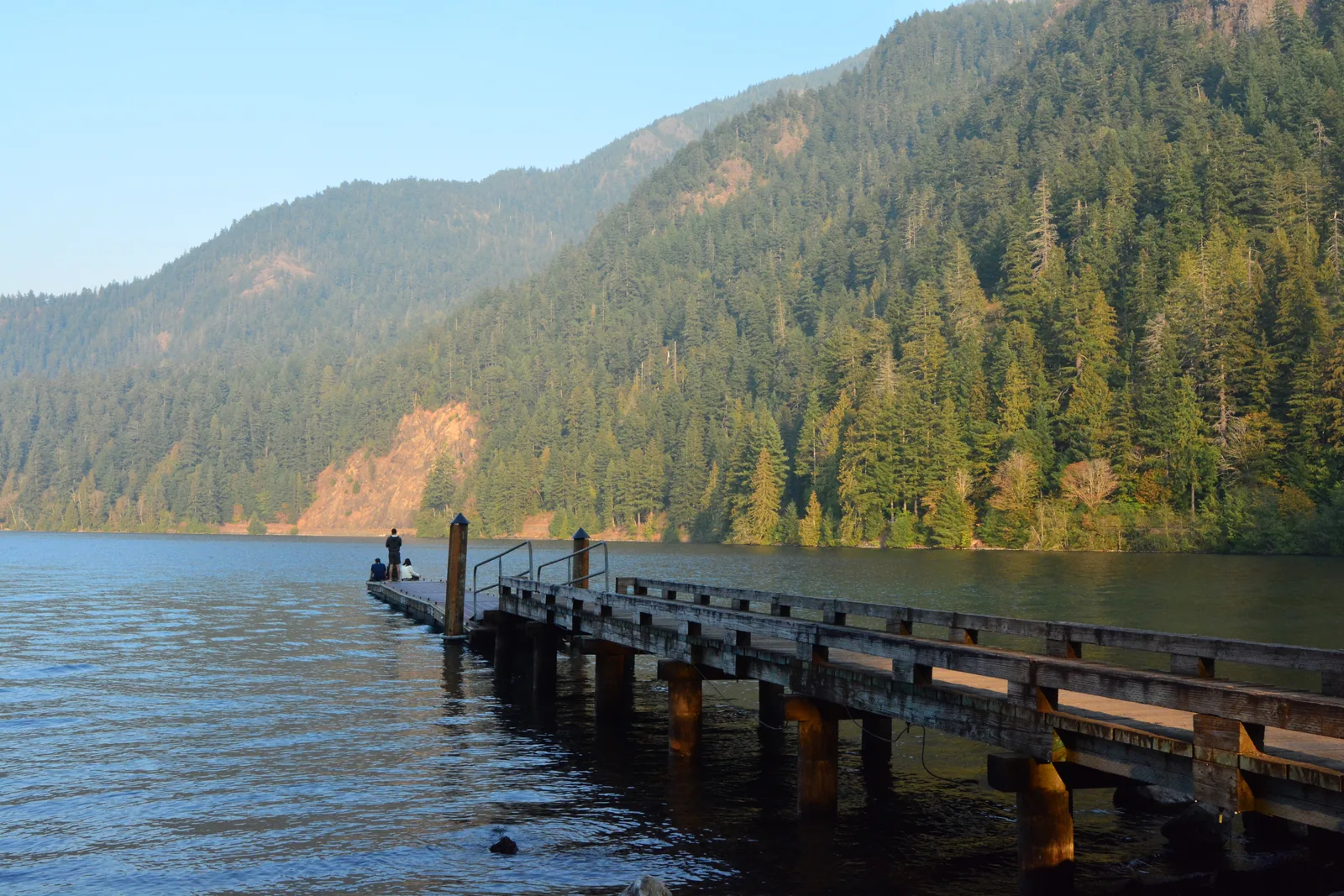
A wooden jetty reaching into the still water of Lake Crescent in Olympic National Park, with forested slopes in the evening light behind
Photo: Joe Mabel ↗ · CC BY-SA 4.0 ↗

Place in the park

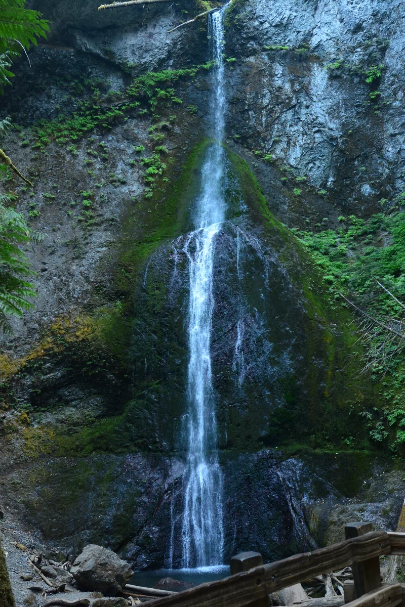
Lake Crescent and Marymere Falls

A glacial lake 624 ft (190 m) deep, cut off from its neighbour 7,000 years ago, with two trout found nowhere else.

Location
18 miles (29 km) west of Port Angeles
Depth
624 ft (190 m)
Lodge
17 April 2026 to 1 January 2027
Fairholme
88 sites, 25 April to 29 September

NPS: Lake Crescent ↗

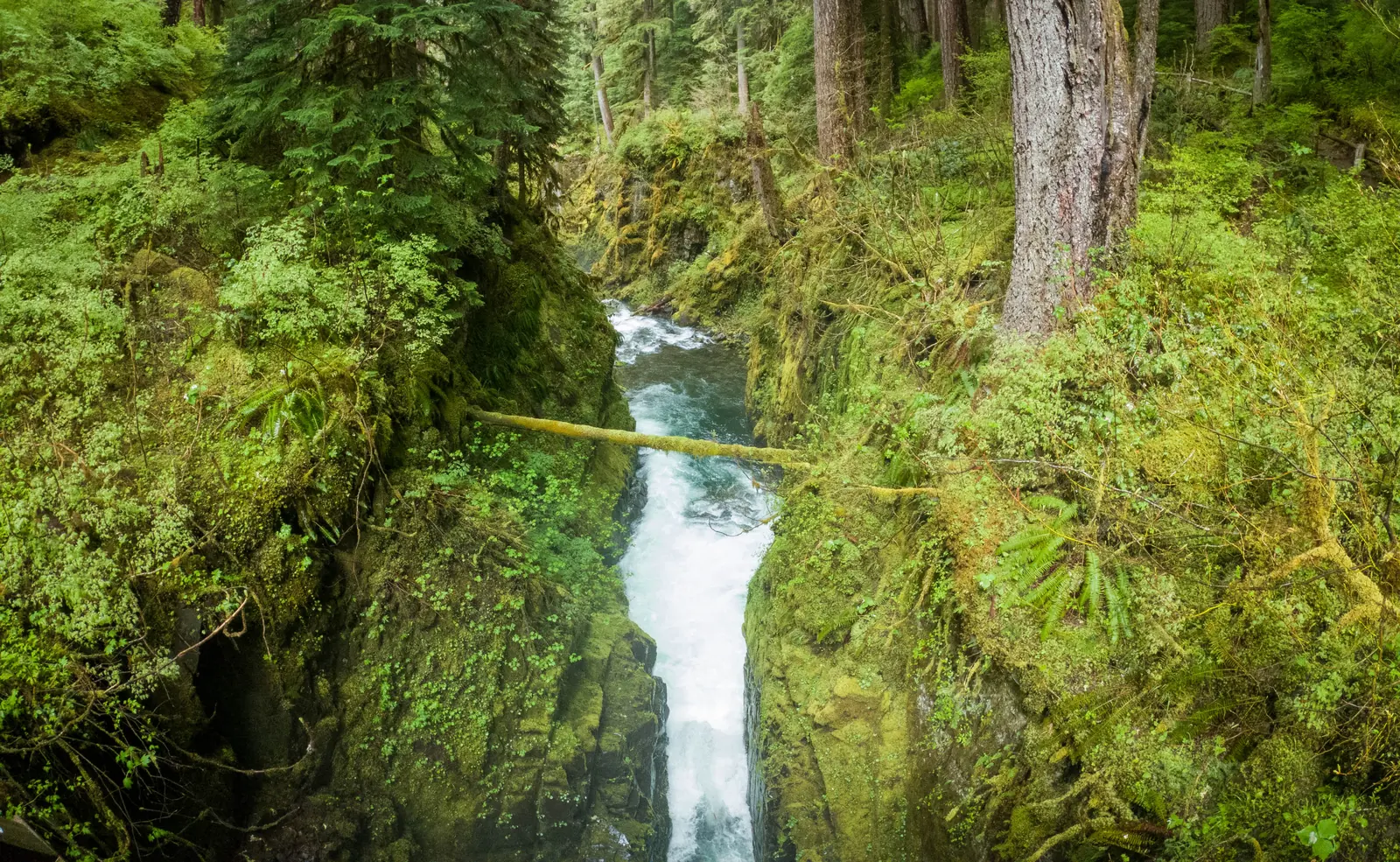
Sol Duc Falls in Olympic National Park plunging into a narrow, moss-green gorge, with a fallen tree trunk above
Photo: Sea Cow ↗ · CC BY-SA 4.0 ↗

Place in the park

The Sol Duc Valley

A waterfall, hot springs and a river with salmon running in every season.

From Port Angeles
40 minutes
To the falls
one mile (1.6 km)
Resort
20 March to 1 November
Salmon Cascades
late October, early November

NPS: The Sol Duc Valley ↗

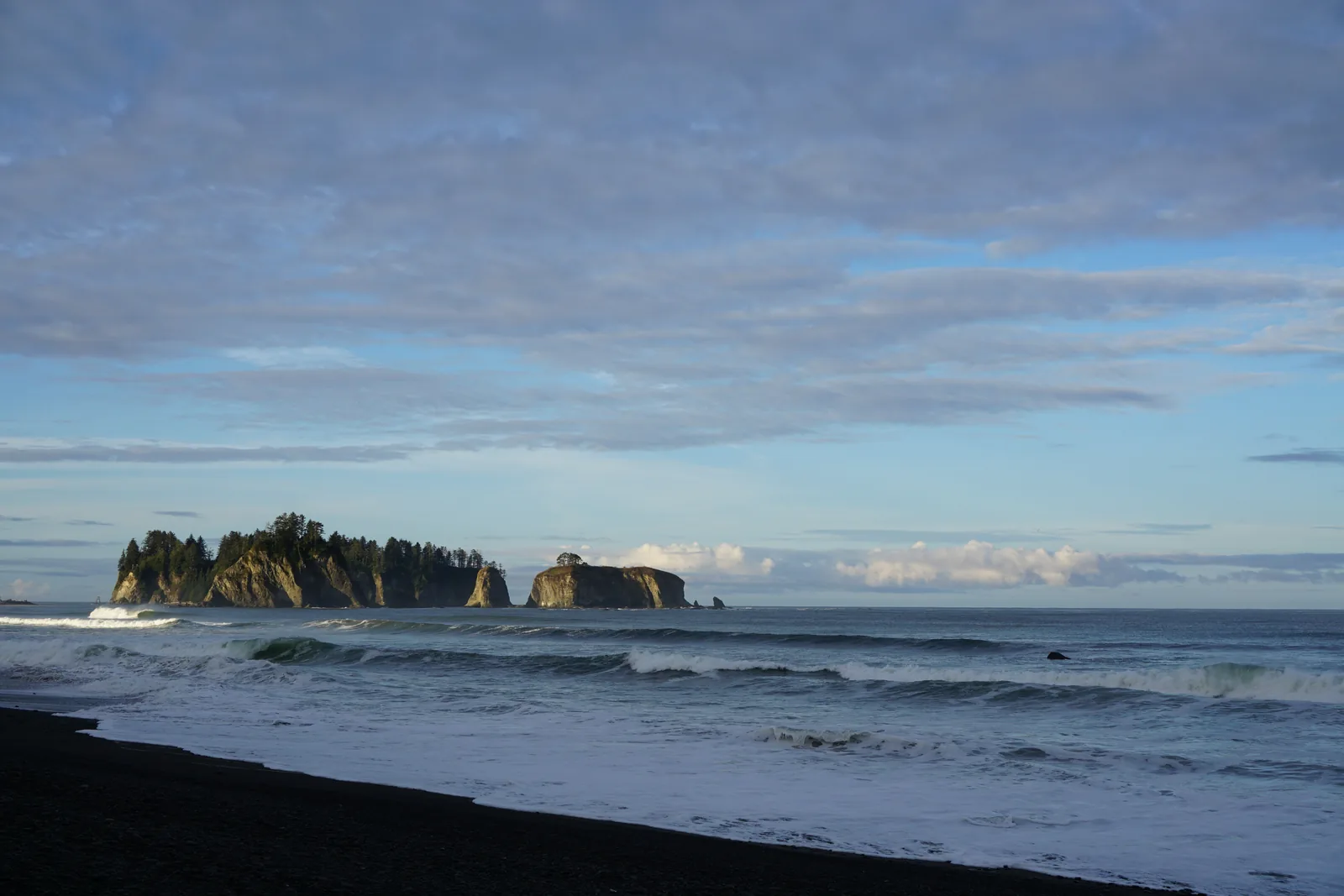
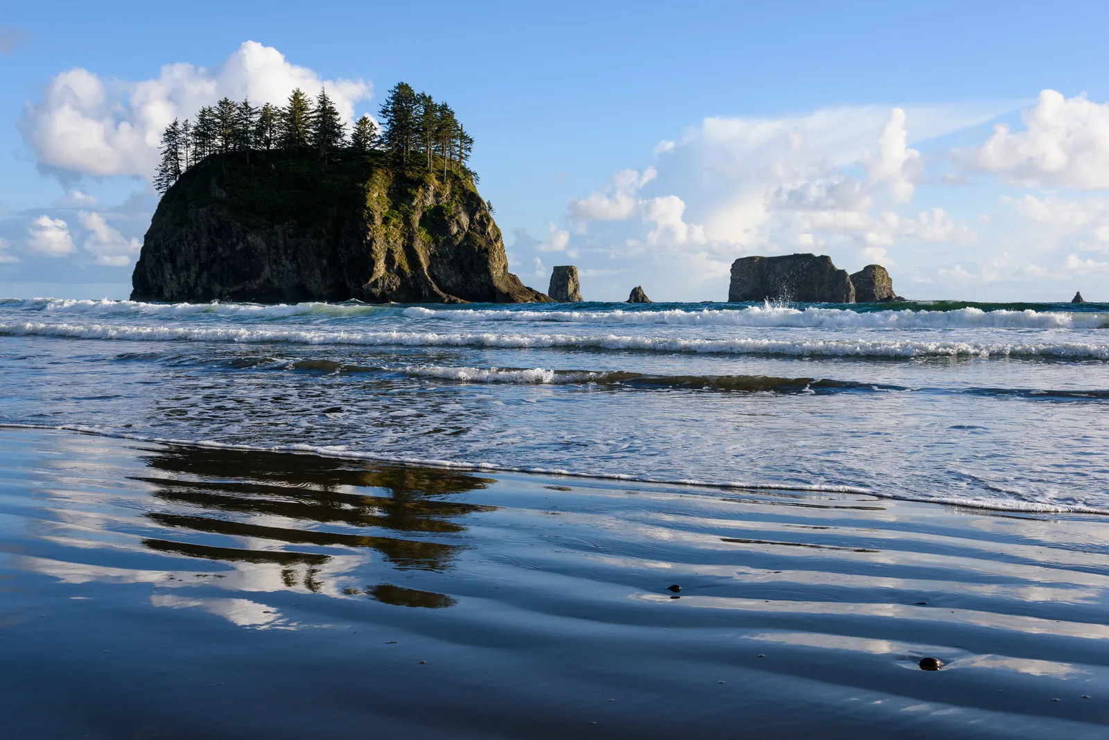
Rialto Beach in Olympic National Park in the morning: a dark pebble beach, surf and the forested rock island of James Island
Photo: Olympic National Park ↗ · Public domain ↗

Place in the park

Rialto Beach and the beaches near La Push

Driftwood, surf, rocky islands, and an arch you can only reach at low tide.

Access
SR 110 and Mora Road
Hole-in-the-Wall
1.5 miles (2.4 km) north
Dogs
only as far as Ellen Creek
Second Beach
0.7-mile (1.1 km) forest trail, 200 ft (61 m) descent

NPS: The beaches ↗

Forested rock islands and sea stacks off Second Beach in Olympic National Park, with the last of the surf running up the sand
Photo: King of Hearts ↗ · CC BY-SA 4.0 ↗

Place in the park

Ozette and the wilderness coast

Nine miles (14.5 km) over boardwalks and beach to a coast where a mudslide preserved a village.

Access
Hoko-Ozette Road from SR 112
Ozette Loop
9 miles (14.5 km)
Campground
15 sites, no reservations
Wilderness coast
73 miles (117 km)

NPS: Ozette ↗

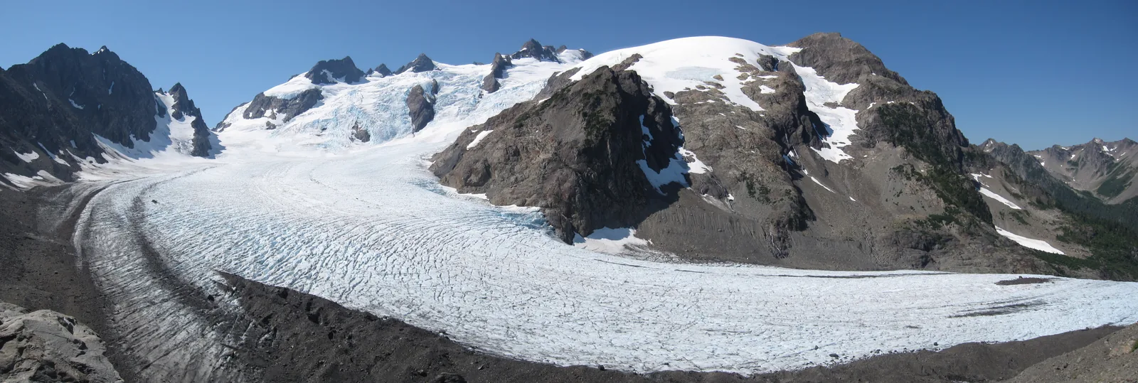
Panorama of the Blue Glacier in Olympic National Park from the lateral moraine: the broad glacier tongue below the rocky summits of Mount Olympus
Photo: Aaron Linville ↗ · CC BY-SA 4.0 ↗

Place in the park

Mount Olympus and the Blue Glacier

The highest mountain on the peninsula, less than 33 miles (53 km) from the sea, and a glacier that moves three feet (0.9 m) a day.

Elevation
7,980 ft, 2,432 m
Blue Glacier
2.6 miles (4.2 km) long, up to 900 ft (274 m) thick
Snow
50 to 70 ft (15 to 21 m) a year
Access
Hoh River Trail, 18.5 miles (29.8 km)

NPS: Glaciers and climate change ↗

Map

34 places on the map

Entrance roads, trailheads, beaches and campgrounds, each with a documented location.

Open map3D terrain · details and photos for every place
  • Viewpoints1
  • Mountains & rock4
  • Water9
  • Trails6
  • Arrival2
  • Where to stay8
  • Nature1
  • Surroundings3

03 · Out and about

Hikes & routes: moss, sea stacks and glacier views

The short trails are the famous ones. The long ones need a permit and a bear canister.

Photo: Joe Mabel ↗ · CC BY-SA 4.0 ↗

„The rain that falls on the west side becomes forest; what comes over the mountains is dry.“

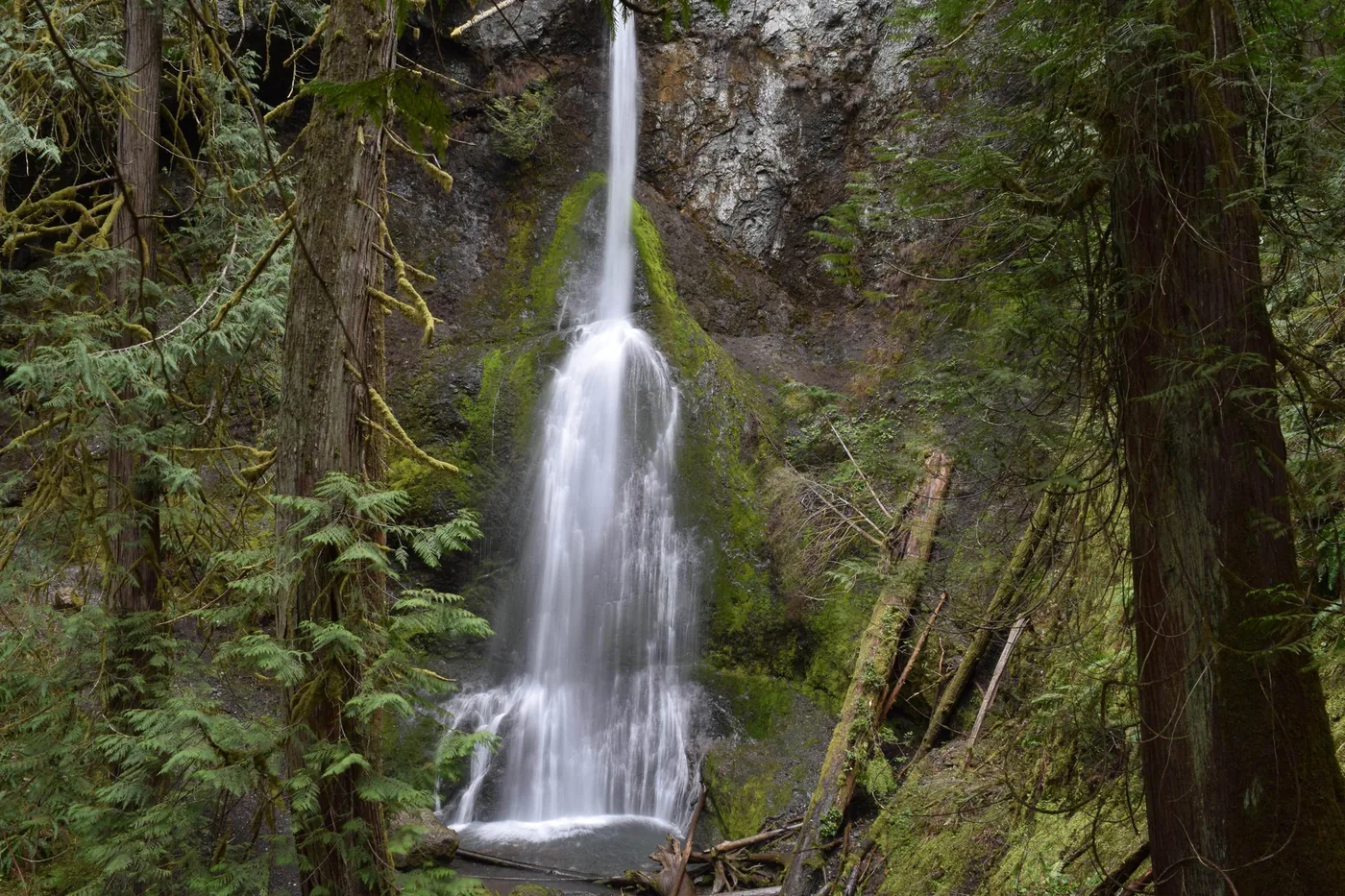
Olympic National Park · Marymere Falls at Lake Crescent

Hikes & routes: moss, sea stacks and glacier views

Hoh: Hall of Mosses

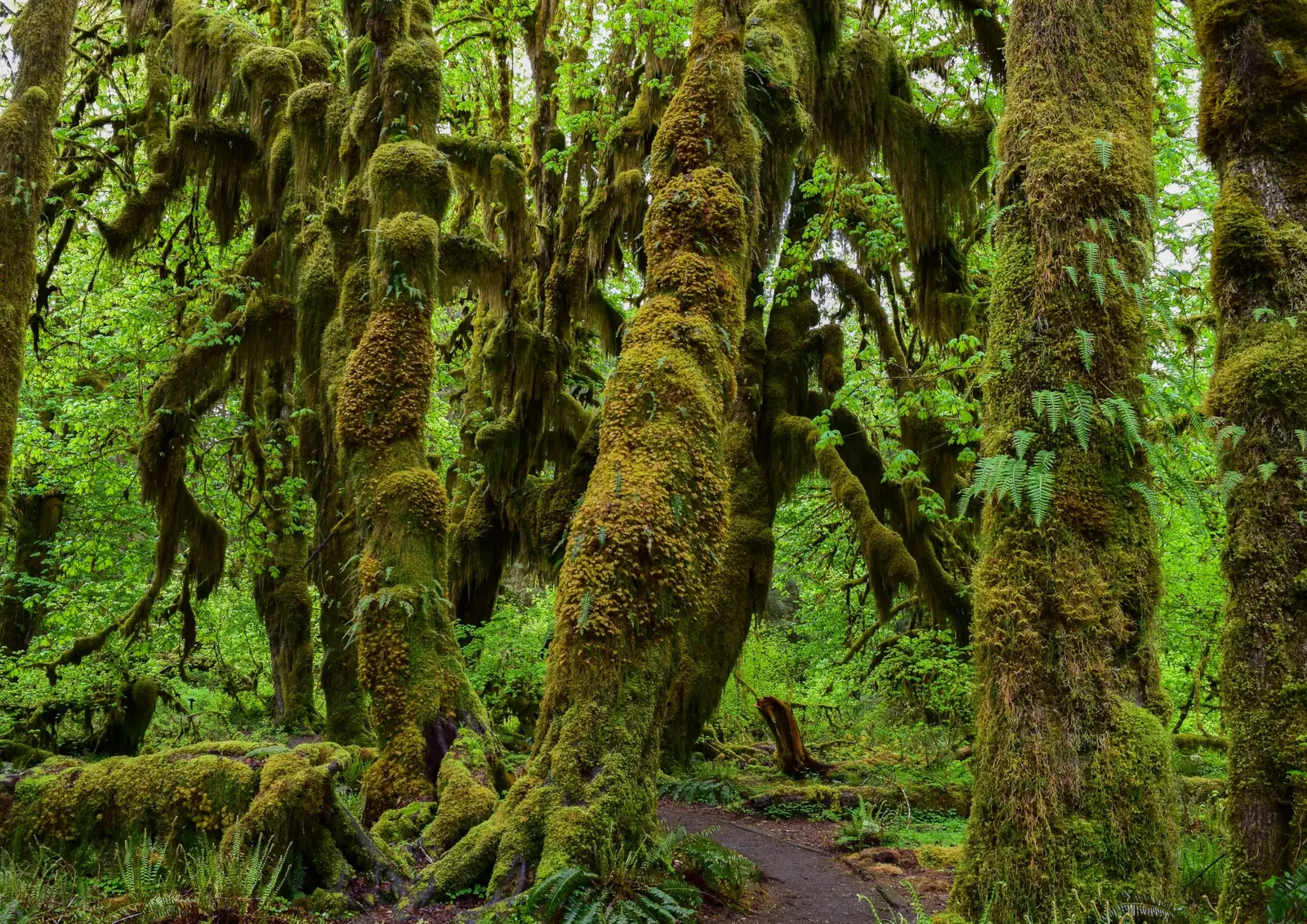
A 0.8-mile (1.3 km) loop from the visitor centre through moss-draped maples, plus the 1.2-mile (1.9 km) Spruce Nature Trail along Taft Creek and the Hoh River. The Hoh River Trail goes as far in as you like: 0.9 miles (1.4 km) to the river, 2.7 (4.3 km) to Mineral Creek Falls, 5 (8 km) to Five Mile Island, 18.5 (29.8 km) to the Blue Glacier.

NPS: The Hoh Rain Forest ↗

Hurricane Ridge

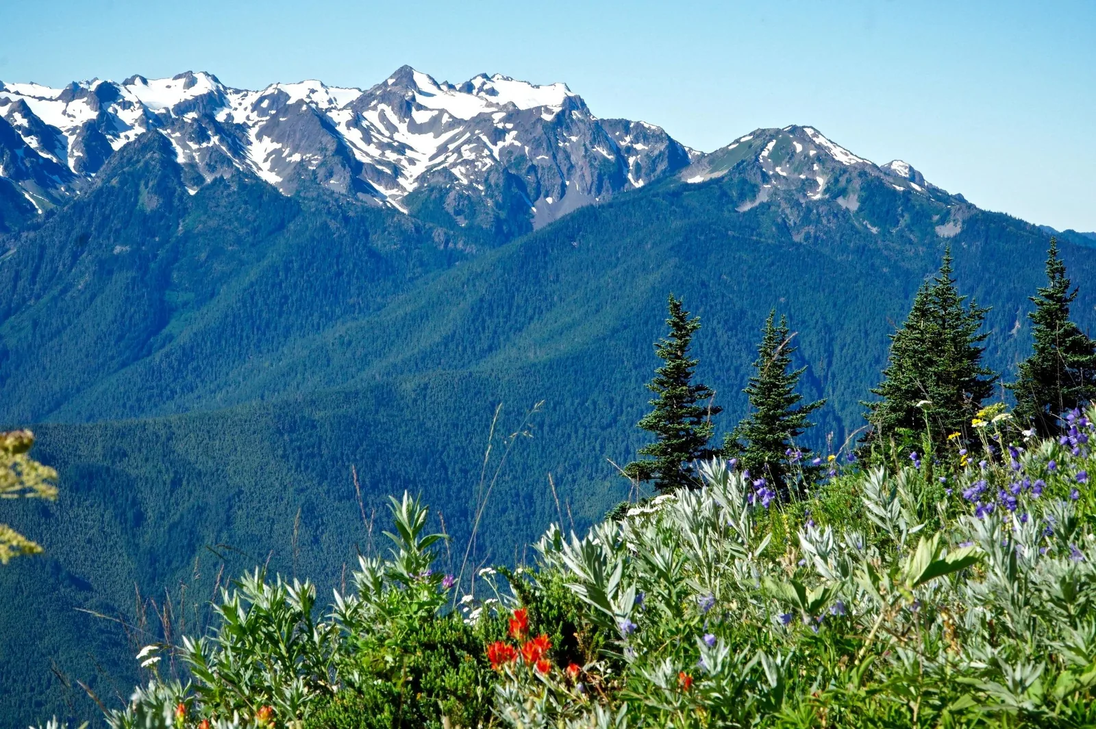
Trails from the ridge crest down to subalpine lakes, plus the road to Hurricane Hill and the gravel road to Obstruction Point. Wildflowers and black-tailed deer in spring, views of Mount Olympus in summer, sunrise and sunset in clear weather.

NPS: Hurricane Ridge ↗

Sol Duc Falls and Lake Crescent

One mile (1.6 km) to the waterfall, six miles (9.7 km) on Lover’s Lane, 5.2 miles (8.4 km) to Mink Lake. At Lake Crescent, the Barnes Creek Trail leads to Marymere Falls and the Spruce Railroad Trail runs along the north shore; the lodge rents out rowing boats.

NPS: The Sol Duc Valley ↗

Beaches you can drive to

Rialto with driftwood, rocky islands and the Hole-in-the-Wall arch after 1.5 miles (2.4 km). Second Beach after a 0.7-mile (1.1 km) forest trail, Third Beach after 1.4 (2.3 km). Kalaloch and Ruby Beach right on the 101, the only ones where dogs are allowed. Never play on driftwood: waves roll the logs.

NPS: The beaches ↗

The wilderness coast

73 miles (117 km) of the most pristine coastline in the Lower 48, reachable almost only on foot. Five to ten miles (8 to 16 km) a day is the measure even for experienced hikers, over sand, gravel, boulders and logs. Permit all year, bear canister required, filter your water, no dogs, no bikes.

NPS: The wilderness coast ↗

Tide pools

Sea stars, anemones, barnacles and nudibranchs at Beach 4, Ruby Beach, Second Beach and near Ozette. Step on bare rock, put stones back, pull nothing off: an animal that clings on is saying no. Seaweed is slippery, and waves come without warning.

NPS: Tidepooling on the Olympic coast ↗

Ozette Loop

Nine miles (14.5 km) as a triangle: 3.1 miles (5 km) of boardwalk to Cape Alava, three miles (4.8 km) of beach, 2.8 miles (4.5 km) of boardwalk back from Sand Point. The boards get slippery when wet or frosty; soft soles grip better than stiff boots. Harbour seals and grey whales during migration months.

NPS: Ozette ↗

Short walks with a dog

Six trails in the whole park: Peabody Creek at the visitor centre, Madison Falls, Spruce Railroad Trail, Rialto as far as Ellen Creek, the Kalaloch beaches, and July Creek at Lake Quinault. Otherwise only campgrounds, car parks and roads, on a six-foot (1.8 m) leash. Different rules apply in the neighbouring Olympic National Forest.

NPS: Visiting with your dog ↗

Seeing salmon

At the Salmon Cascades in the Sol Duc valley, chinook and coho salmon leap in late summer and autumn, steelhead and cutthroat trout in autumn and winter; the Sol Duc is one of the few rivers with a salmon run in every season. Following the dam removal in 2014, salmon now spawn inside the park on the Elwha again.

NPS: Salmon Cascades ↗

Into the backcountry

The High Divide Loop through the Seven Lakes Basin is the classic two- to three-day trip with views of Mount Olympus; the Hoh River Trail leads to the moraine of the Blue Glacier. Every overnight stay needs a permit via Recreation.gov, and the Wilderness Information Center in Port Angeles gives advice.

NPS: The wilderness coast ↗

Offer photo: Hoh Rain Forest and Rialto Beach from Port Angeles

Olympic Hiking Company · Guided hike · 9 hours

Hoh Rain Forest and Rialto Beach from Port Angeles

Nine hours from Port Angeles in a 15-seat van: a two-hour drive to the Hoh, then 3.2 km (2 mi) with a naturalist guide on the two loop trails, a stop in Forks for shopping, a picnic and a beach walk at Rialto Beach, and an hour and a half back. No more than twelve people.

  • 9 hours
  • Maximum 12 participants
  • Park entry included
  • Check-in 7:00 to 7:15

Departure Olympic Hiking Co. Tour Building, 720 Marine Drive, Port Angeles.

According to the list of inclusions, entry, guide and transfer are included; gratuity and picnic are marked with a cross, so you pack your own food or buy it during the stop in Forks. The tour starts at 7:00 in Port Angeles, three hours from Seattle; the provider assumes you stay there the night before.

View tour ↗Ad · partner link · checked 25 Sep 2026

Provider's product photo · GetYourGuide

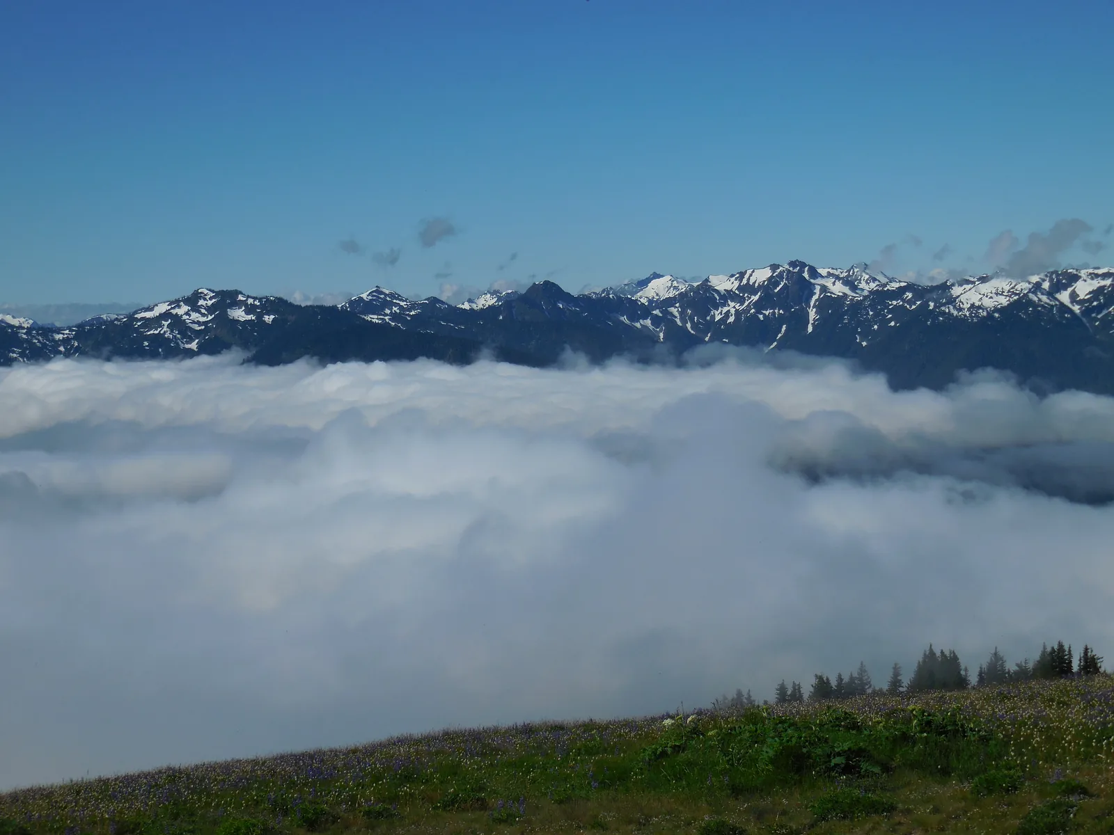
A sea of clouds below Hurricane Ridge in Olympic National Park, with the snowy peaks of the Olympic Mountains under a blue sky behind

Olympic National Park (National Park Service) · Ranger programme · summer evenings

Ranger star nights and evening programmes

In summer the park runs telescope nights on Hurricane Ridge: a Master Observer shows stars, planets, nebulae and galaxies, and telescopes are provided. There are also full-moon hikes up Hurricane Hill and evening programmes at the amphitheatres of Heart O’ the Hills and Kalaloch campgrounds.

  • Summer, roughly June to September
  • Free
  • Hurricane Ridge and two campgrounds
  • Dates in the park calendar

Meeting point Telescope nights at the Hurricane Ridge parking area, full-moon hikes from the Hurricane Hill trailhead, evening programmes at the amphitheatres of Heart O’ the Hills and Kalaloch campgrounds. Dates are in the park calendar and in the summer issue of the park newspaper, the Bugler.

Free according to the park; the telescope nights only take place in clear weather. In high summer they start late in the evening, and it gets cold on the ridge at night: dress warmly. In 2026 there is no drinking water on Hurricane Ridge, only portable toilets. Outside the summer no evening programmes are listed in the calendar; in winter the rangers offer daytime snowshoe walks at weekends. The park does not mention any registration.

Park authority page ↗Park authority programme · no partner link · checked 2 Oct 2026

Landscape image, not a provider photo · Photo: Olympic National Park ↗ · Public domain ↗

Ad · we may earn a commission if you book through this partner link. Offer details checked 25 Sep 2026. See official ticket information.

Nature: raised from the sea, carved by ice, grown over by rain

Mountains from the seabed

The Olympic Mountains are not volcanic. Their rock, basalt and sediments, formed on the ocean floor 18 to 57 million years ago. For around 34 million years the Juan de Fuca Plate has been sliding beneath the North American Plate; what is scraped off folds up into the peaks. They are still rising, while erosion wears them down at the same time.

NPS: Geology ↗

Mount Olympus and the Blue Glacier

7,980 ft, 2,432 metres high, less than 33 miles (53 km) from the Pacific. 50 to 70 ft (15 to 21 m) of snow a year feed the Blue Glacier: 2.6 miles (4.2 km) long, up to 900 ft (274 m) thick, moving three feet (0.9 m) a day at its fastest point. In 1982 the park had 266 glaciers, in 2009 only 184; a third of the ice area was lost in 30 years, and the Anderson Glacier has been gone since 2015.

NPS: Glaciers and climate change ↗

The recipe for a rain forest

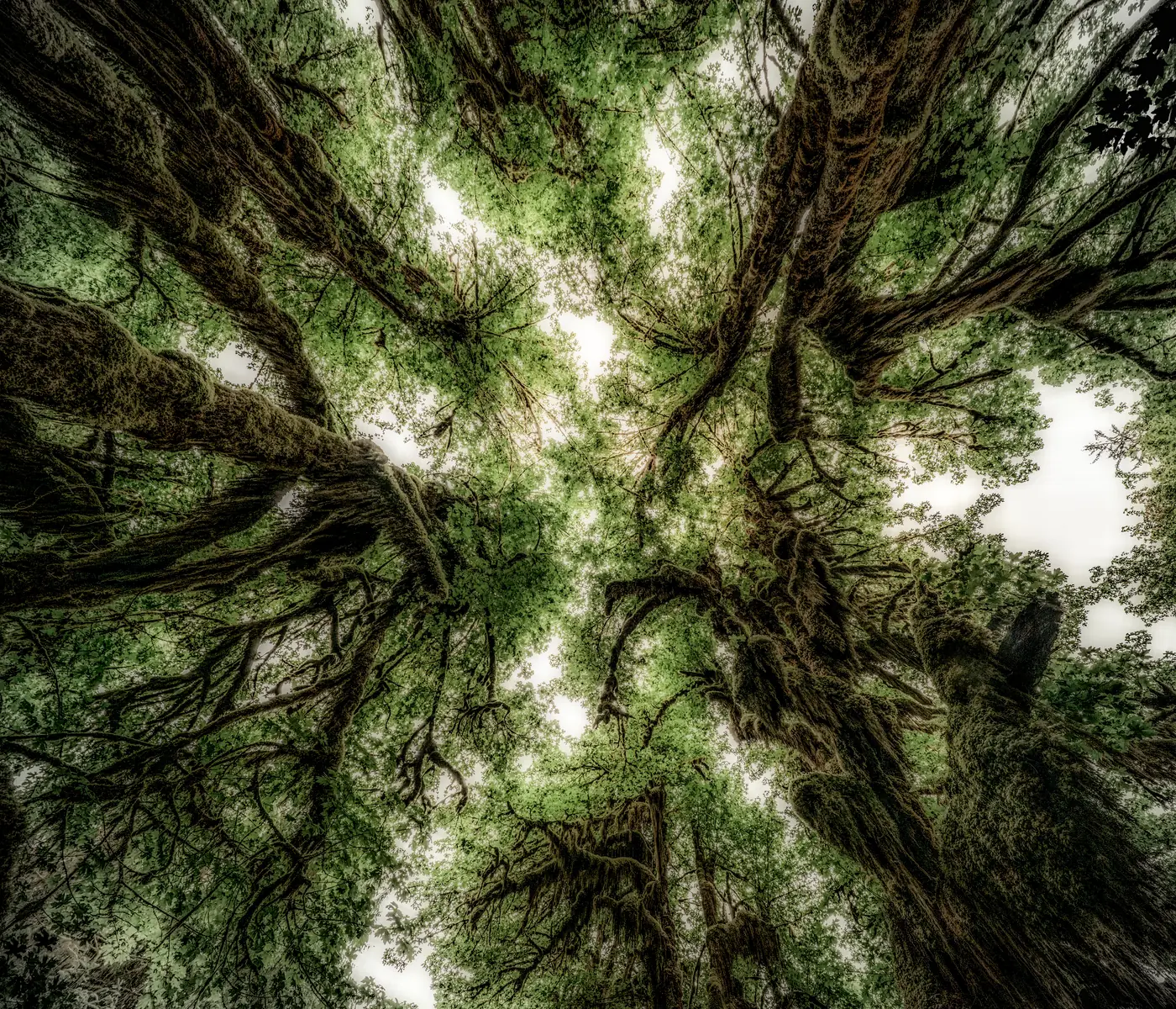
140 to 167 inches (3.6 to 4.2 m) of rain, rarely frost, rarely above 80 °F (27 °C). Sitka spruce and western hemlock up to 250 ft (76 m) tall and 30 to 60 ft (9 to 18 m) around, with mosses, ferns and lichens on every branch. Seedlings sprout on fallen logs; once the log has rotted away, a row of trees is left standing on stilt roots.

NPS: Temperate rain forests ↗

The Ice Age

The continental ice sheet split at the Olympic Mountains: one lobe flowed through what is now the Strait of Juan de Fuca, another through Puget Sound, up to 3,500 ft (1,067 m) thick. It retreated 14,000 years ago and left a peninsula with salt water on three sides. About 7,000 years ago a landslide separated Lake Crescent from Lake Sutherland; two distinct forms of trout are the result.

NPS: Glaciers and climate change ↗

The coast

73 miles (117 km) of wilderness coast, designated as wilderness in 1988, with the Olympic Coast National Marine Sanctuary offshore and protected seabird islands. Cold, nutrient-rich upwelling water supports a food chain from barnacles to whales; the intertidal zones lie in layers one above the other, from the splash zone down to the sea urchin zone.

NPS: The coast ↗

Who is missing and who lives only here

The peninsula was isolated for a long time: pikas, ptarmigans, lynx, red foxes, coyotes, wolverines, grizzly bears and bighorn sheep are absent. Instead, the Olympic marmot, the Olympic snow mole and the Olympic torrent salamander live nowhere else. More than 300 bird species, some of the healthiest salmon runs outside Alaska, and spotted owls and marbled murrelets in the old-growth forests.

NPS: Animals ↗

The largest wild elk herd

Olympic is home to the largest fully wild herd of Roosevelt elk in the Pacific Northwest. Their browsing keeps the rain forest understorey open. The national monument was created for them in 1909, which is why they bear Theodore Roosevelt's name.

NPS: Roosevelt elk ↗

From forest reserve to World Heritage Site

Inhabited for 13,500 years, eight tribes with an enduring connection to the land, more than 650 archaeological sites. 1897 forest reserve, 1909 Mount Olympus National Monument, 1938 national park under Franklin D. Roosevelt after his visit in 1937, 1953 the coast added. 1976 biosphere reserve, 1981 World Heritage Site.

NPS: History and culture ↗

04 · Before you go

Park film and places nearby

Photo: Olympic National Park ↗ · Public domain ↗

Film by the park authority

One Day on Hurricane Ridge (in Two Minutes!)

Two minutes from the park authority's channel: a day on Hurricane Ridge in time-lapse, with clouds, meadows and the view of the mountains. The channel has no introductory film; it also has films on the Elwha dam removal and a guide to the backcountry.

Source: Olympic National Park · View channel ↗

Around the park

Olympic National Forest

The park is surrounded by national forest, with Lake Quinault Lodge and many trails where dogs on a leash are allowed. Different administration, different rules; the park authority points this out itself.

NPS: Visiting with your dog ↗

Field book · Olympic

checked 25 Sep 2026

Olympic at a glance · PDF, 2 pages ↓

00My visit

Nothing saved yet. Every place card has a pin, and so does every place on the Map. What you save collects here, with days, notes and a preview you can share.

01Best time to visit: 12 feet of rain in the west, 25 inches in the east

The rain shadow of the Olympic Mountains turns one park into two climate zones.

The rain shadow

Pacific storms drop their rain on the west side: 100 to 170 inches (2.5 to 4.3 m) a year on the coast and in the western valleys, and 30 to 35 feet (9 to 11 m) of snow on Hurricane Ridge. What crosses the mountains is dry; the headquarters in Port Angeles records 25 to 30 inches (635 to 760 mm), as much as some wine regions.

NPS: Weather and the rain shadow ↗

Summer

July and August are the busiest months. Mild to warm, but with differences of at least ten degrees Fahrenheit (about 6 °C) between coast, valley and high country; rain is always possible, there are thunderstorms in the mountains, and fog can linger on the coast even when it is sunny inland.

NPS: Weather and the rain shadow ↗

Spring

The second most popular season, cool to mild and unpredictable: snow falls at higher elevations until June, and many mountain trails are impassable. The campgrounds open one after another.

NPS: Weather and the rain shadow ↗

Autumn

From late September it can snow in the high country, and from late October rain and storms hit the rain forest and the beaches. In return, salmon leap at the Salmon Cascades, and the elk bugle in September and early October.

NPS: Weather and the rain shadow ↗

Winter

Most precipitation falls from November to April: 140 inches (3.6 m) in the rain forest, 100 (2.5 m) on the coast. Down low it stays cool to mild and rarely drops below freezing; up high the snow is deep. Hurricane Ridge is open for skiing at weekends, with two rope tows and a platter lift run by the local ski club; check the avalanche conditions.

NPS: Weather and the rain shadow ↗

Tides

For tide pools, the water level matters, not the time of day: ideally below zero feet, and be on the beach at least 30 minutes before the lowest point. Tide tables are available at visitor centres and ranger stations and from NOAA.

NPS: Tidepooling on the Olympic coast ↗

Climate through the year

Weather and climate in Olympic National Park

Best months by the climate data: July and August. Average daytime highs of 19 to 20 °C, lows of around 10 °C, 31 to 42 mm of precipitation a month. The wettest month is November (292 mm), the driest July (31 mm).

Climate chart in Olympic National ParkAverage daily highs from 3 °C to 20 °C, lows from −1 °C to 10 °C; monthly precipitation from 31 mm to 292 mm.
All monthly values as a table
Monthly averages 2001–2020, NASA POWER model
MonthHigh °CLow °CPrecipitation mm
January4.00.2286
February4.1−0.6162
March5.50.4224
April8.72.0137
May13.45.086
June15.87.363
July19.49.831
August19.810.342
September16.68.386
October11.24.9198
November6.21.8292
December3.4−0.4270
Year1,877

Modelled values, not a weather station: NASA POWER (MERRA-2) for a grid cell of about 55 × 45 km around the map point Sol Duc Hot Springs (47.97° N, 123.86° W), with an average cell elevation of about 660 m. Averages for 2001–2020. Higher ground and valleys can differ markedly.

Source: NASA POWER, climatology 2001–2020 ↗ · retrieved 3 Oct 2026

02How to get there: ferry, Hood Canal Bridge, Highway 101

From Seattle it takes about three hours to Port Angeles; the park areas then lie up to another three hours apart.

By car

From Olympia, take I-5 to Highway 101; from Tacoma, take State Route 16 to Bremerton, then SR 3 and SR 104 across the Hood Canal Bridge, which closes at times for shipping. Coming from the Oregon coast, you join the 101 in Aberdeen.

NPS: Directions, ferries and buses ↗

By ferry

Washington State Ferries sail from Seattle to Bainbridge Island, to Kingston, and from Whidbey Island to Port Townsend; from there you continue to the 101. From Port Angeles, the Coho ferry sails daily to Victoria in Canada, with views of the Olympic Mountains.

NPS: Directions, ferries and buses ↗

By bus and plane

The nearest major airport is Seattle-Tacoma. The Dungeness Line runs from there to Kingston, Sequim and Port Angeles; Clallam Transit connects the Bainbridge ferry terminal with Port Angeles and serves Forks and destinations along the northern 101. According to the FAQ, most of the park cannot be reached without a car.

NPS: Directions, ferries and buses ↗

Distances in the park

Hurricane Ridge is 17 miles (27 km) beyond Port Angeles, Lake Crescent 18 (29 km), Sol Duc 40 minutes. The Hoh is two hours from Port Angeles and under one from Forks, Kalaloch 45 minutes from the Hoh, Quinault three hours from Port Angeles, and Staircase two hours from Port Angeles and one from Olympia.

NPS: The Hoh Rain Forest ↗

RVs

Most campgrounds take vehicles up to 21 ft (6.4 m), some sites up to 35 ft (10.7 m). Obstruction Point, Hurricane Hill Road, Deer Park, Graves Creek and Queets are unsuitable for RVs and trailers or closed to them. The rule of thumb: there is room on the highway, but not in the valleys.

NPS: Campgrounds 2026 ↗

In winter

In winter, Hurricane Ridge Road is open only Friday to Sunday and on holiday Mondays, weather permitting, and every vehicle must carry snow chains. The rest of the peninsula usually stays free of snow; floods and storms can close roads, and SR 112 to Ozette is often affected.

NPS: Hurricane Ridge ↗

Parking in the Hoh Rain Forest: before 8:00 or after 17:00

Parking at the Hoh Rain Forest is limited in summer. The park recommends arriving before 8 a.m. or after 5 p.m. (17:00) to avoid waits of up to 2 hours at the entrance station.

NPS: Alerts and current conditions ↗

Parking in Port Angeles instead of on Hurricane Ridge

If you take the summer Clallam Transit bus to Hurricane Ridge, you can park for free at the Gateway Transit Center in Port Angeles, 123 E Front Street; a parking garage is nearby. The bus drops passengers at the Hurricane Ridge parking area, and no reservation is needed.

NPS: Bus to Hurricane Ridge ↗

Evergreen Escapes · Day tour from Seattle · 12 hours

Small-group tour from Seattle with ferry, Lake Crescent and coast

Twelve hours from downtown Seattle for no more than ten people: by ferry across Puget Sound, over the Hood Canal Bridge onto the peninsula, Salt Creek, Lake Crescent and one section of the park; depending on weather, season and group, also Hurricane Ridge or the coast. A picnic, snacks and, in winter, snowshoes are included.

Departure Pick-up at hotels in downtown Seattle or at the Sheraton Grand.

According to the list of inclusions, all park entrance fees, transport, picnic and guide are included; only the gratuity is marked with a cross. The route is explicitly not fixed: the guide decides which park areas to visit depending on weather, road conditions and group.

View tour ↗Ad · partner link · checked 25 Sep 2026

Olympic Hiking Company · Half-day tour from Port Angeles · 4 hours

Olympic National Park: Half-Day Tour

Four hours from Port Angeles in a 15-seat van: a 20-minute drive into the Elwha Valley, then a short walk of 0.2 miles (about 300 m) to Madison Falls and viewpoints on the Elwha River. 30 minutes further on at Lake Crescent, the guide leads you through old-growth forest to Marymere Falls; afterwards there is time at the historic Lake Crescent Lodge or on the shore. No more than twelve people.

Departure Olympic Hiking Co. Tour Building, 720 Marine Drive, Port Angeles. If you arrive on the Strait Shot bus from the Seattle–Bainbridge ferry, you can ask the provider for a pick-up at the Gateway Transit Center in Port Angeles.

According to the list of inclusions, the guide and the round trip from Port Angeles are included; meals, snacks, water and gratuities are marked with a cross. The list does not mention park entry, unlike the same provider's Hoh tour; check before booking. According to the description the guided hike is 3 to 5 kilometres (2 to 3 miles) long; bring hiking shoes. Not suitable for people with limited mobility or wheelchair users. The provider runs the tour in the afternoon: according to the provider, you can reach it without a car from Seattle on the morning ferry to Bainbridge and the Strait Shot bus.

View tour ↗Ad · partner link · checked 2 Oct 2026

Ad · we may earn a commission if you book through this partner link. Offer details checked 2 Oct 2026. See official ticket information.

03Tickets & entrance fees: $30 per car, seven days, no surcharge

Olympic is not on the list of eleven surcharge parks. The fees page names no extra charge for non-residents.

The base price

A private vehicle with up to 15 seats and everyone in it costs $30, a motorcycle $25, and one person on foot or by bike $15. All are valid for seven consecutive days; anyone aged 15 or under enters free.

NPS: Fees and passes ↗

No surcharge for international visitors

Unlike Yellowstone, Zion or Acadia, Olympic's fees page lists no extra fee for people without US residence. A couple from abroad in a rental car pays $30 for the week here, not $230.

NPS: Fees and passes ↗

Pay online in advance

The park authority recommends paying the entrance fee on Recreation.gov before you arrive, to shorten the queues at the entrance stations. This applies especially to Hurricane Ridge and the Hoh.

NPS: Fees and passes ↗

Passes

The $55 Olympic annual pass is only available to US residents. The America the Beautiful Pass for non-residents costs $250, covers one vehicle or four individuals and is valid immediately as a digital pass on Recreation.gov. It only pays off if surcharge parks are on your route.

NPS: Fees and passes ↗

Fee-free days

Eight days in 2026 are fee-free, including 25 August, the 110th birthday of the National Park Service. The park authority adds that this applies to US citizens and residents.

NPS: Fees and passes ↗

What costs extra

Camping costs $15 to $24 a night, $33 at the concession-run Sol Duc campground, and the dump station $10. Wilderness permits for all overnight stays away from the campgrounds are issued via Recreation.gov. Commercial vehicles pay by seat count: van $75, minibus $100, coach $200.

NPS: Fees and passes ↗

04Where to stay: fourteen campgrounds, four lodges

The large campgrounds need a reservation in summer; the small ones are first come, first served.

The lodges

Kalaloch Lodge on the beach, all year; Lake Crescent Lodge from 17 April 2026 to 1 January 2027; Log Cabin Resort on Lake Crescent 15 May to 29 September; Sol Duc Hot Springs Resort with its hot spring pools 20 March to 1 November. Book early for July and August.

NPS: Lodging in the park ↗

With a reservation

Hoh 12 June to 6 September, Kalaloch and Mora 15 May to 20 September, Fairholme 15 May to 29 September, Staircase 8 July to 29 September, Sol Duc 20 March to 1 November. Sites are released six months, two weeks and four days ahead on Recreation.gov; unreserved sites are given out on site for one night.

NPS: Campgrounds 2026 ↗

Without a reservation

Heart O’ the Hills with 97 sites all year; Deer Park, Graves Creek, North Fork, Ozette, Queets and South Beach are first come, first served, with self-registration on site. The small campgrounds have pit toilets, and some have no water.

NPS: Campgrounds 2026 ↗

What is not allowed

Food, rubbish and anything with a scent always belong in the car, a food locker or a bear canister, including toothpaste and sun cream. Overnight stays in the ridge car park are not allowed. In the backcountry the canister rule applies everywhere, and explicitly on the coast.

NPS: Wildlife safety ↗

Outside the park

Port Angeles, Sequim and Port Townsend in the north; Forks, La Push, Lake Quinault, Sekiu and Neah Bay in the west; Hoodsport and Quilcene on Hood Canal. The towns on the west side are small and far apart; the chambers of commerce keep the lists.

NPS: Lodging in the park ↗

05Rules & safety: tides, elk and wet boardwalks

People have died on this coast trying to beat the tide. The park authority says so in those words.

The tide

Some headlands can only be rounded at low tide, some never; then an overland trail leads over the top. A topographic map with tide markings, a tide table and a watch are essential, and wind and storms push the water higher than the table says. Do not guess.

NPS: The wilderness coast ↗

Elk

The park authority counts Roosevelt elk among the most dangerous animals in the park: cows weigh up to 700 lb (318 kg), bulls up to 1,100 lb (499 kg). Keep at least 100 ft (30 m) away, never touch calves, and back away slowly if they lay back their ears or grind their teeth. They are especially aggressive during the rut in September.

NPS: Roosevelt elk ↗

Bears and cougars

Black bears and cougars live everywhere from the valleys to the mountain meadows. The park's general distance rule is 50 yards (46 m); elsewhere on the same page it says 75 ft (23 m), and both figures stand side by side there. Report encounters to the park online; trying to rescue stranded marine animals is prohibited.

NPS: Wildlife safety ↗

Boardwalks and logs

The boardwalks near Ozette become extremely slippery when wet or frosty, and driftwood on the beach rolls in the surf. Soft soles, short steps, hands free. If you do not know how rip currents work, stay out of the water.

NPS: The wilderness coast ↗

Altitude and weather

Between the coast and Hurricane Ridge lie 5,000 ft (1,524 m) and often two kinds of weather. Even in summer: rain jacket, layers, food and water on every hike, and plan for thunderstorms in the mountains. Weather line 360-565-3131.

NPS: Weather and the rain shadow ↗

Water

Do not drink from streams. Boil or filter the water, because iodine tablets do not kill Cryptosporidium. Pack out toilet paper, and all rubbish anyway.

NPS: Day hiking ↗

Winter on the ridge

Avalanche danger can change by the hour; read the Northwest Avalanche Center forecast before every ski or snowshoe tour. Snow chains must be in the car, or you will be turned back on the road.

NPS: Weather and the rain shadow ↗

06Frequently asked questions: Olympic

Do I need a reservation to visit Olympic National Park?

No, not for the visit itself, the park authority says. You should book accommodation, campgrounds and backcountry trips, because campgrounds and motels fill up fast in summer and at weekends. There are no timed entry slots here.

NPS: Frequently asked questions ↗

How much is the entrance fee for Olympic National Park?

A private vehicle with everyone in it costs $30, a motorcycle $25, and one person on foot or by bike $15, each valid for seven days. Anyone aged 15 or under enters free. The park does not accept cash; paying online on Recreation.gov shortens the queue.

NPS: Fees and passes ↗

Do foreigners need to pay an extra fee at Olympic?

No. Olympic is not one of the eleven parks that charge a surcharge of $100 per person without US residence in 2026; the fees page lists none. If you go on to Mount Rainier or Yellowstone, check the surcharge list for those parks.

NPS: Fees and passes ↗

How many days do you need in Olympic National Park?

More than one, the FAQ says. The drive between areas takes from half an hour to four hours on a highway with one lane in each direction. The park authority recommends two bases: Port Angeles or Lake Crescent for the mountains, Forks for the rain forest and the coast.

NPS: Frequently asked questions ↗

Can you visit Olympic National Park without a car?

Only to a limited extent. Buses run from Sea-Tac to Port Angeles, from Bainbridge to Port Angeles and Forks, and in summer from Port Angeles up to Hurricane Ridge. According to the FAQ, most of the park cannot be reached without a car; day tours from Seattle and Port Angeles fill the gap.

NPS: Directions, ferries and buses ↗

How do I avoid the queues at the Hoh and Hurricane Ridge?

Come early or late: the park is open around the clock, and around the solstice it is light from 5:00 until almost 22:00. On summer weekends, getting in takes one to two hours. According to the park authority, May and September are busy too, but with shorter queues.

NPS: Frequently asked questions ↗

Can I bring my dog to Olympic National Park?

On six trails: Peabody Creek, Madison Falls, Spruce Railroad Trail, Rialto as far as Ellen Creek, the Kalaloch beaches and July Creek at Lake Quinault, plus campgrounds, car parks and roads, on a six-foot (1.8 m) leash. Not on any other trail, on the wilderness coast or in buildings. Keep off the tide pool rocks: barnacles cut paws.

NPS: Visiting with your dog ↗

Where can I see elk in Olympic?

In the Hoh Rain Forest, all year, most likely at dusk in clearings and along the roads. Keep at least 100 ft (30 m) away; during the rut in September and early October, and when they have calves, the animals are especially aggressive.

NPS: Frequently asked questions ↗

Can I camp in the rain forest?

Yes, the Hoh Campground with 78 sites is open all year, by reservation only via Recreation.gov from 12 June to 6 September, $24, vehicles up to 21 ft (6.4 m), some sites up to 35 ft (10.7 m). Quinault also has two small campgrounds without reservations.

NPS: Campgrounds 2026 ↗

What are the rules on the beaches?

Never go without a tide table and a watch. Some headlands can only be rounded at low tide, some never; storms push the water higher than the table says. Do not climb on driftwood, watch for rip currents, light fires only below the high-tide line and not at all north of Yellow Banks. For overnight stays you need a permit and a bear canister.

NPS: The wilderness coast ↗

Can you drive to Hurricane Ridge in winter?

Friday to Sunday and on holiday Mondays, weather permitting, with snow chains in the car. At the top there is cross-country skiing, snowshoe trails, sledding and, at weekends, two rope tows and a platter lift. Check the road status on 360-565-3131 and the avalanche forecast beforehand.

NPS: Hurricane Ridge ↗

Can foreigners get an America the Beautiful Pass?

Yes. The America the Beautiful Pass for non-residents costs $250, covers one vehicle or four individuals and is valid immediately as a digital pass on Recreation.gov. For Olympic alone it does not pay off, since the park charges no surcharge and a vehicle pays $30 for seven days; it only makes sense if surcharge parks are on your route.

NPS: Fees and passes ↗

07Sources: where the information comes from

All factual information comes from the park authority.

  1. NPS: Olympic National Park ↗
  2. NPS: Basic information ↗
  3. NPS: Fees and passes ↗
  4. NPS: Operating hours and seasons ↗
  5. NPS: Alerts and current conditions ↗
  6. NPS: Directions, ferries and buses ↗
  7. NPS: Weather and the rain shadow ↗
  8. NPS: Frequently asked questions ↗
  9. NPS: Campgrounds 2026 ↗
  10. NPS: Lodging in the park ↗
  11. NPS: Visiting with your dog ↗
  12. NPS: Wildlife safety ↗
  13. NPS: Day hiking ↗
  14. NPS: The wilderness coast ↗
  15. NPS: Hurricane Ridge ↗
  16. NPS: The Hoh Rain Forest ↗
  17. NPS: Lake Crescent ↗
  18. NPS: The Sol Duc Valley ↗
  19. NPS: Kalaloch and Ruby Beach ↗
  20. NPS: Quinault ↗
  21. NPS: Staircase ↗
  22. NPS: Ozette ↗
  23. NPS: Geology ↗
  24. NPS: The mountains ↗
  25. NPS: Glaciers and climate change ↗
  26. NPS: Temperate rain forests ↗
  27. NPS: Roosevelt elk ↗
  28. NPS: Animals ↗
  29. NPS: The coast ↗
  30. NPS: Nature ↗
  31. NPS: History and culture ↗
  32. NPS: Bus to Hurricane Ridge ↗
  33. NPS: Tidepooling on the Olympic coast ↗
  34. NPS: The beaches ↗
  35. NPS: Madison Falls and the Elwha ↗
  36. NPS: Salmon Cascades ↗
  37. NPS: Short walks at the visitor center ↗
  38. Recreation.gov: bookable services in the park ↗

How current is this information?

Researched 25 Sep 2026. Not a live status. Dates apply only to the year stated. A successful automatic fetch is not an editorial confirmation; outdated automatic values are hidden and replaced by the source link.

Current information from the park ↗

Image and map credits

Location sources: The locations come from OpenStreetMap and are documented individually via the object address. The points are for orientation and do not replace a hiking map. Markers do not imply that access is permitted. Base map © OpenStreetMap contributors. Coastlines of the chapter map: Natural Earth.

End of the field book · Park authority ↗