The only national park in New England: granite mountains down to the sea, 45 miles (72 km) of car-free carriage roads and the summit where, in the winter half of the year, the sun rises first in the United States.
No Congress and no president chose this land. It was pieced together; everything here is documented from the park authority.
Acadia is the only national park in New England, and it came about differently from the big parks of the West: piece by piece, from private land that summer visitors, landowners and donors put together, until the federal government accepted it as a national monument in 1916.
The park describes the road to its creation as "anything but a straight line". It began with painters who made the island known in the 19th century, then the "rusticators", wealthy summer visitors who arrived on steamers and yachts. Harvard students of the Champlain Society spent their research summers here; in 1901 landowners founded the Hancock County Trustees of Public Reservations, a land trust from which the park grew.
George B. Dorr drove the project forward and in 1916 became the first superintendent of Sieur de Monts National Monument. In 1919 Congress turned it into Lafayette National Park, and in 1929 it was renamed Acadia. The spring at Sieur de Monts, the "heart of Acadia", is today Dorr's memorial.
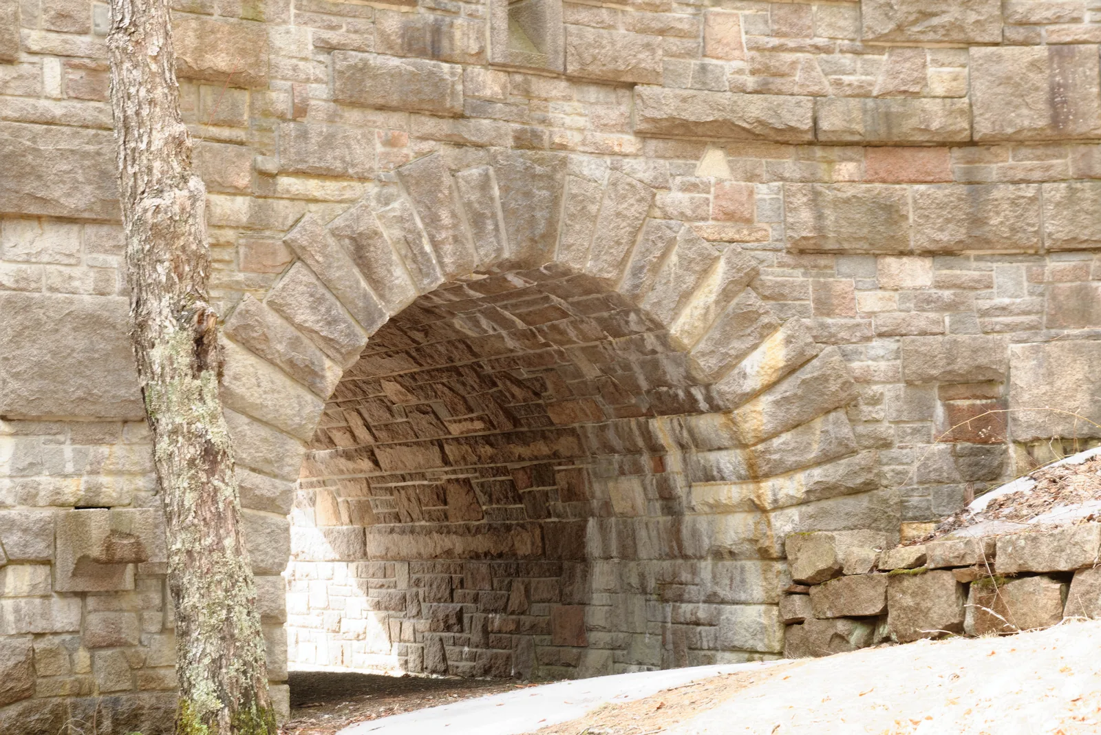
The second gift is the carriage roads. John D. Rockefeller Jr., an experienced rider, wanted to reach the interior of the island by horse and carriage, without cars. From 1913 to 1940 he had 45 miles (72 km) of gravel roads built, 16 feet (4.9 m) wide and fitted into the slopes, with 17 stone bridges and granite blocks along the edge that are now called "Rockefeller's teeth". He also paid for and supervised the construction; the stonemasons came from the area and from Italy.
Today the park is one of the ten most visited in the United States, with over four million visits a year; in ten years the number rose by almost 60 percent. Because it is also one of the smallest, a transportation plan followed in 2019, which led to the Cadillac vehicle reservation and the free Island Explorer. 72 percent of the bus costs are paid from park entrance fees.
What you see is a patchwork of public and private land: the park itself warns against blindly following your satnav, because some access roads cross private property. On Isle au Haut, half the island belongs to the park, the other half to a year-round fishing community and summer residents.
Visiting Acadia: four million visits on 200 square kilometres (77 sq mi)
01
One park, three parts
The main part lies on Mount Desert Island, with Bar Harbor, the Park Loop Road and Cadillac Mountain. The Schoodic Peninsula is the only mainland section, an hour's drive from the visitor centre and deliberately little developed. Isle au Haut can only be reached by ferry from Stonington.
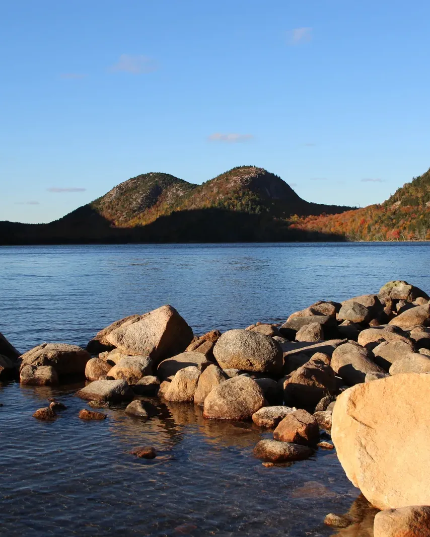
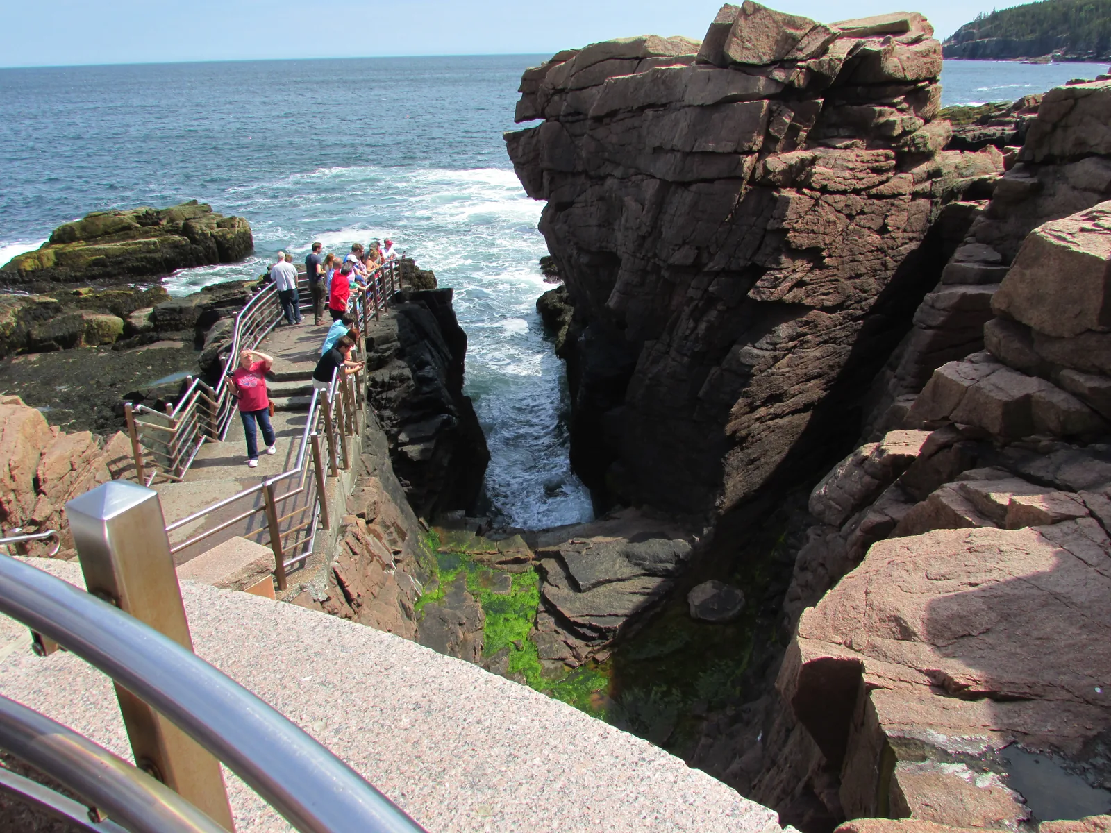
27 miles, about 43 kilometres, from the Hulls Cove Visitor Center: Sieur de Monts, Sand Beach, Thunder Hole, Otter Point, Jordan Pond and the turn-off to Cadillac. Part of it is one-way. The park allows three to four hours for the whole loop with stops. From 1 December to 14 April it is closed except for two short sections.
From 20 May to 25 October 2026, every vehicle on the Cadillac Summit Road needs a reservation: $6, online only on Recreation.gov, not available in the park. 30 percent of the slots are released 90 days ahead, 70 percent two days ahead at 10:00 Eastern Time. No reservation is needed for the rest of the park.
The bus runs between the towns and the park destinations with no ticket, stops on request wherever it is safe, and carries six bikes outside, but no e-bikes. Dogs on a leash may ride on the floor. It does not go to the summit of Cadillac. You still need a park pass.
According to the fees page, since 15 April the park only accepts cards or mobile payment at its sales points. The same page contradicts itself, though: it lists the vehicle pass everywhere as card only, but the motorcycle and individual passes at the Hulls Cove Visitor Center, the Schoodic Institute, the Park Loop Road fee station and, in winter, the Bar Harbor Chamber of Commerce as "Cash or Credit/Debit"; the campgrounds take only cards for these too. Only a card is a safe bet. If you only have cash, buy the pass at chambers of commerce and town offices in the area, for example in Bar Harbor, 2 Cottage Street.
That is how long an average visit lasts, according to the park. Boston is 264 miles (425 km) away, Bangor 50 (80 km). If you drive the east side in one day, you see the Loop Road; the west side, Schoodic and the carriage roads need days of their own.
The park says it in many places: mobile reception is patchy. Save or print reservations with QR codes in advance and carry paper maps. Road and carriage road maps are free at the visitor centre.
„Twice a day, every day, the sea here rises and falls by eight to twelve feet.“
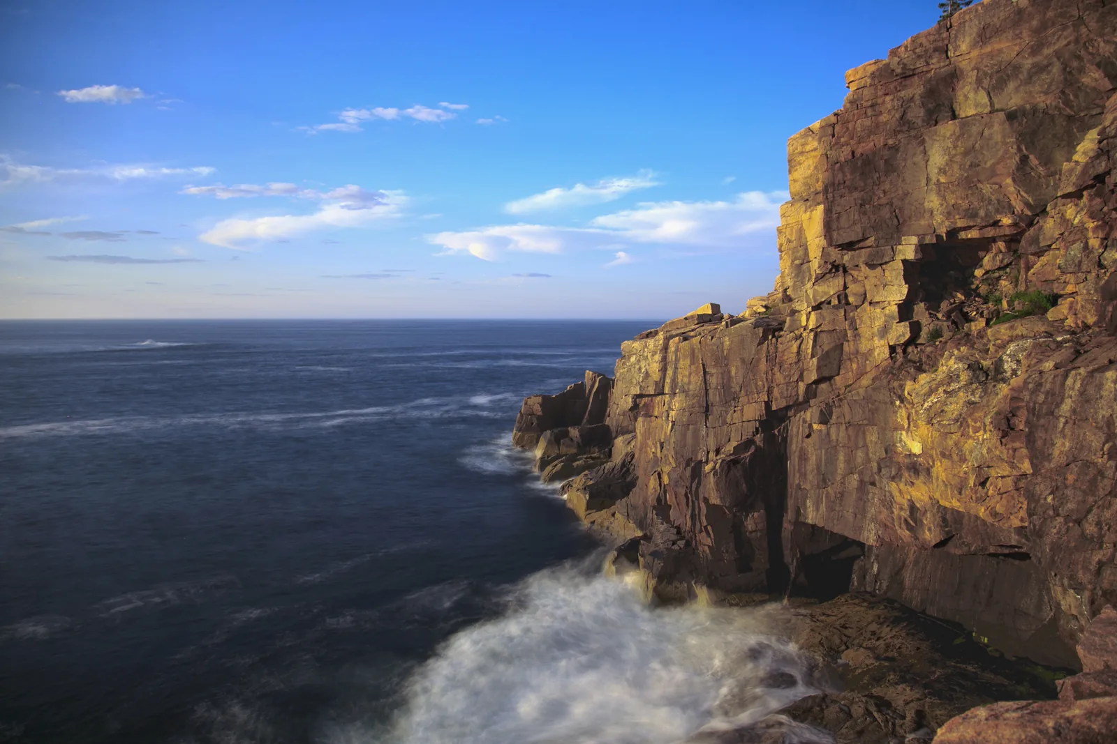
Acadia National Park · Otter Cliff on the Ocean Path
Hikes & routes: iron rungs, carriage roads, tide pools
Ocean Path
2.2 miles (3.5 km) one way from Sand Beach past Thunder Hole and the 110-foot (34 m) Otter Cliffs to Otter Point; the first 0.7 miles (1.1 km) to Thunder Hole are surfaced and gentle. Two staircases around the cliffs, steep drops to the sea. With the Island Explorer you can walk it one way.
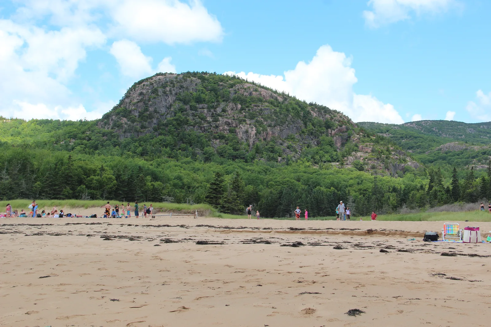
A 1.4-mile (2.3 km) loop from Sand Beach via the Bowl Trail. The climb goes up a 450-foot (137 m) cliff on granite steps and iron rungs without railings. One to three hours, no dogs, dangerous in rain: wet granite gets slippery.
Over 1,000 feet (305 m) of climbing in 0.9 miles (1.4 km), then back via the Champlain North Ridge Trail for a 3.2-mile (5.1 km) loop. Not for children under 12, not if you are afraid of heights, not when wet, and not downhill: according to the park, descending the rungs is dangerous. Closed in spring and early summer because of peregrine falcons; no bus.
3.3 miles (5.3 km) around the lake. The eastern half is level and gravelled; the western half crosses boulders and a boardwalk and is much harder for pushchairs and unsteady feet. Loons call, beavers build, and peregrine falcons nest above the cliffs.
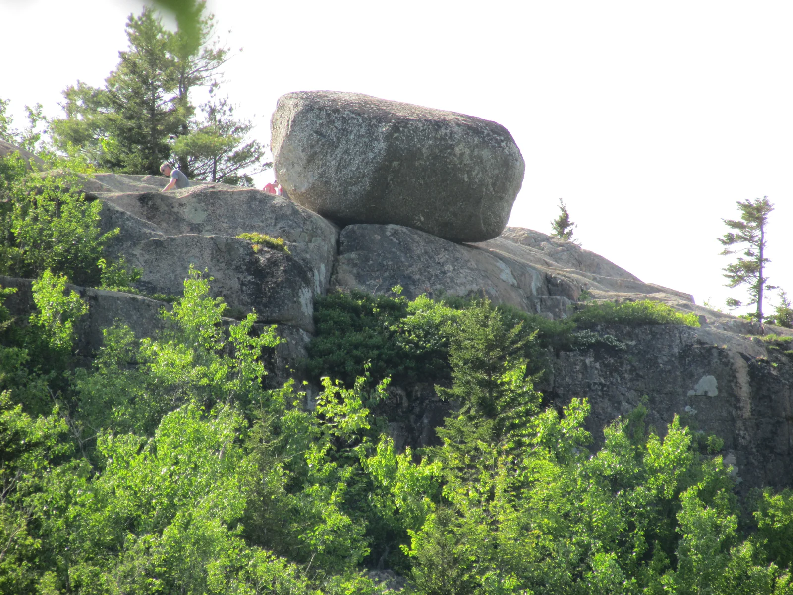
1.5 miles (2.4 km) there and back from the Bubbles car park on the Loop Road: first North Bubble, then South Bubble with the boulder perched on its edge. One to one and a half hours, steep granite slabs, slippery when wet.
If you have no reservation, walk: the North Ridge Trail is 4.4 miles (7.1 km) there and back, mostly over open granite, or the South Ridge Trail 7.1 miles (11.4 km). At the top there is a half-mile (0.8 km) paved loop with views of Frenchman Bay and the Porcupine Islands. The park advises against walking down the road.
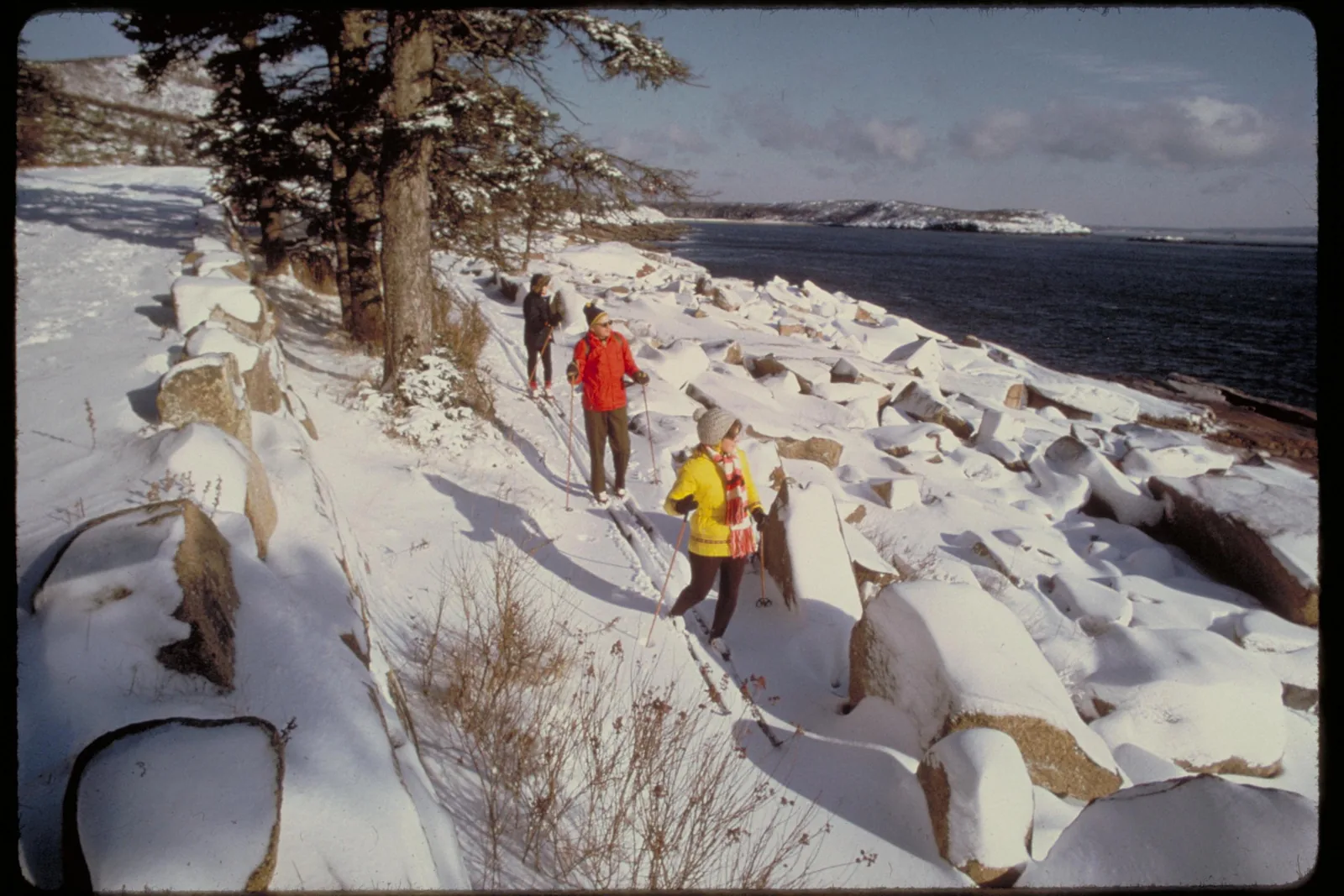
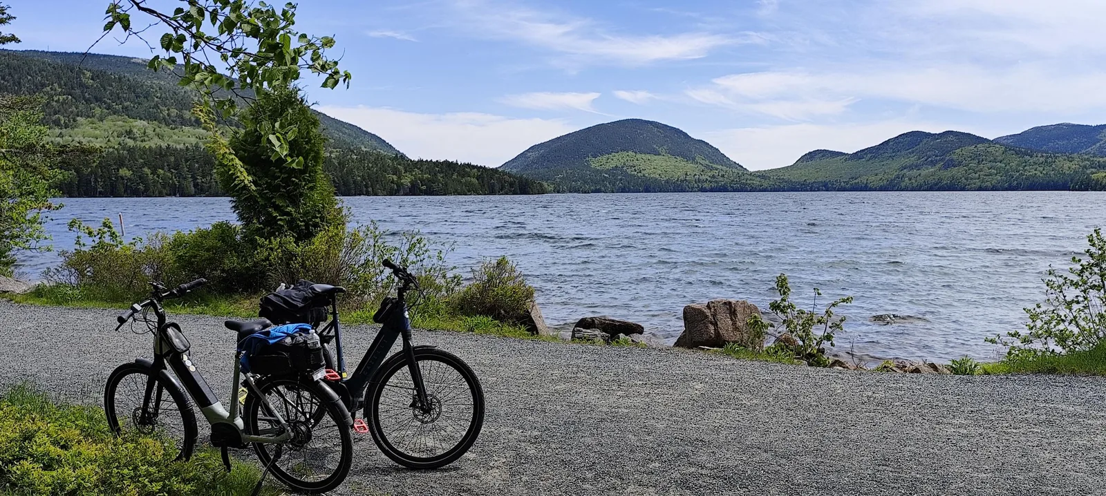
45 miles (72 km) of car-free gravel roads, built from 1913 to 1940 by John D. Rockefeller Jr., 16 feet (4.9 m) wide, with 17 stone bridges and granite blocks as guardrails, known as "Rockefeller's teeth". On foot, by bike, on horseback or by carriage from Wildwood Stables. Maps with intersection numbers are available at the visitor centre.
Class 1 e-bikes are allowed on the carriage roads, Class 2 and 3 are not; the limit is 20 mph (32 km/h), cyclists yield to everyone, everyone yields to horses. The Loop Road has no shoulder; the park advises against riding it between 10:00 and 16:00. The Bicycle Express takes bikes from Bar Harbor to Eagle Lake.
Three places with their own tide tables: Bar Island, Wonderland and Ship Harbor, and the Schoodic Peninsula. Do not wade into the pools, take nothing, wash off sunscreen beforehand, wear sturdy shoes; seaweed and black rock are slippery.
Sand Beach, with no lifeguards and water at 10 to 15 °C (50 to 59 °F); Echo Lake Beach and Lake Wood in fresh water. Eagle Lake, Bubble Pond, Jordan Pond and the Hadlock Ponds are drinking water reservoirs: no swimming, no wading, no dogs.
Pink granite at Otter Cliff, a 60-foot (18 m) sea cliff with fixed anchors at the top, and at the Precipice, with routes up to 5.12 over three pitches. Groups of no more than twelve; organised groups of six or more need a permit at Otter Cliff in summer. Climbing guides are available in Bar Harbor.
The towns around the park rent out canoes, kayaks and boats; on the lakes, motors are limited to 10 hp or banned. Seals are best seen on boat trips from the harbours, four of them accompanied by rangers; whale watching starts in Bar Harbor. Puffins can only be seen on boat trips to offshore islands, not from Mount Desert Island.
From mid-May to mid-October: hikes, boat trips, talks, evening programmes in the amphitheatre, children's programmes, and peregrine falcon and raptor watching. Dates are in the park's calendar.
Island Time Ebike Rentals · E-bike tour · 4.5 hours
Acadia National Park: guided e-bike tour on the carriage roads
Four and a half hours and about 35 kilometres (22 mi) on the car-free carriage roads from the Hulls Cove Visitor Center: Paradise Hill, Witch Hole Pond, Eagle Lake, the historic bridges around Jordan Pond, a break at the Jordan Pond House and back via Bubble Pond. E-bike, helmet, water bottle and phone holder are included.
4.5 hours
About 35 km (22 mi)
Up to 10 participants
Age 16 and over
Departure Hulls Cove Visitor Center, far end of the car park, start at 10:00.
Park admission is explicitly not included, nor are transport to the park and lunch. If you arrive by car, you show the vehicle pass; if you come by bus or taxi, you need an individual pass. For people without US residence, that means the entrance fee plus the $100 surcharge. In rain, the tour is rescheduled or refunded.
View tour ↗Ad · partner link · checked 25 Sep 2026
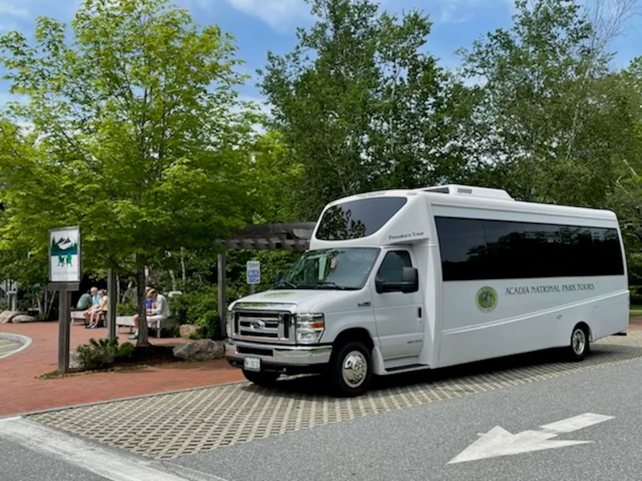
Provider's product photo · GetYourGuide
Acadia National Park Tours · Narrated bus tour · 2.5 or 3.5 hours
Acadia National Park: narrated bus tour to Cadillac, Thunder Hole and Sieur de Monts
The classic bus tour from Bar Harbor in two versions: two and a half hours with three stops or three and a half hours with four, including the summit of Cadillac Mountain, Thunder Hole and Sieur de Monts Spring. A family business, with commentary on board and toilets at every stop.
2.5 or 3.5 hours
Daily, May to October
Cadillac summit included
Folding wheelchairs possible
Departure Testa's Restaurant in downtown Bar Harbor; check in at the kiosk outside the restaurant.
According to the list of inclusions, the park entry fee for the duration of the tour is included, hotel pick-up is not. The page does not say whether this also covers the $100 surcharge per person without US residence; the park's fees page explicitly names participants on commercial tours. Ask before you book. Contradiction on duration: the key details say 3 to 3.5 hours, the description and highlights 2.5 hours (standard) or 3.5 hours (premium).
Good Trip Adventures · Private sunrise tour · 4 to 6 hours
Acadia: Cadillac Mountain sunrise with breakfast and hike
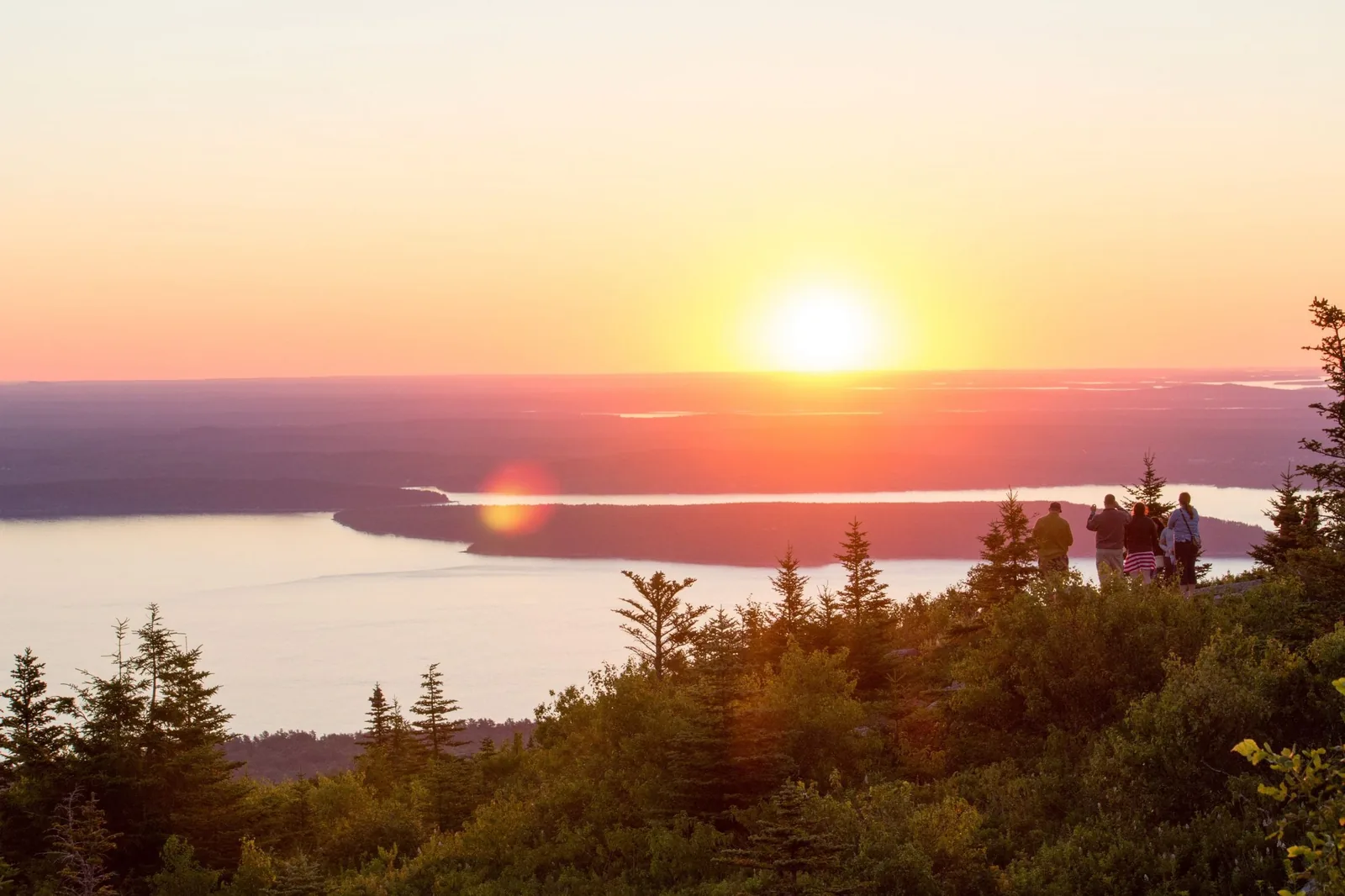
A private tour from your accommodation: up Cadillac by van before sunrise, coffee and a picnic breakfast at the top, then a hike or the well-known sights, as you prefer, before the crowds arrive. Pick-up within an hour of Mount Desert Island, in summer from as early as 3:30.
4 to 6 hours
Private group
Breakfast included
Pick-up from 3:30 possible
Departure Pick-up in Bar Harbor, Ellsworth or Surry, within an hour of the park.
According to the list of inclusions, park entrance fees, transport, guide and breakfast are included, tips are not. The page does not say whether the provider covers the Cadillac reservation and the $100 surcharge per person without US residence; ask before you book. According to the park, commercial operators need their own vehicle reservation (CUA vehicle reservation) for the summit road from 20 May to 25 October; the page does not say whether one is in place. Contradiction on duration: the key details say 4 hours, the description and notes 4 to 6 hours.
Acadia park authority (National Park Service) · Ranger programme · free
Ranger evening programme: Acadia's night sky at Sand Beach
At Sand Beach, rangers explain the night sky over Acadia while visitors sit or lie on the beach. The programme runs whether the sky is clear or cloudy. In season there are also evening programmes in the amphitheatres of Blackwoods and Schoodic Woods campgrounds. If you want to watch without a programme, the park names Sand Beach, Ocean Path, Jordan Pond and Seawall as stargazing spots.
Free
No registration
Dates in the park's calendar
Bring warm clothes and something to lie on
Meeting point Sand Beach on the Park Loop Road, down a flight of stairs to the beach. The campground evening programmes take place in their amphitheatres.
According to the park's calendar, the night-sky programme is free and popular; arrive early to find a parking space and a spot on the beach. Park admission still applies. The way to the beach involves stairs and uneven sand, so bring a flashlight or headlamp and point the beam at the ground. In autumn, the beach is windy and cold. It is cancelled only in severe weather. From the car park, you can only turn left onto the one-way Loop Road. The park gives no fixed weekly times; dates are listed in the events calendar. Driving up Cadillac at night is no alternative: the summit road closes every evening at 21:00 (9 pm) and needs a vehicle reservation in season.
Park authority page ↗Park authority programme · no partner link · checked 2 Oct 2026
Ad · we may earn a commission if you book through this partner link. Offer details checked 2 Oct 2026. See official ticket information.
Nature: fire and ice, pink granite, U-shaped valleys, erratics
The bedrock
Over 500 million years ago, mud, sand and volcanic ash settled in an early ocean; they became the Ellsworth Schist, the oldest rock in the region. About 450 million years ago the microcontinent Avalonia collided with North America, and the Bar Harbor Formation and the Cranberry Island volcanics formed on top.
About 420 million years ago, magma rose and solidified into the Cadillac Mountain granite, the largest granite body on the island. On its eastern edge a shatter zone of collapsed rock fragments remained. Later, black diabase dikes intruded; you can see them on the Cadillac road and at Schoodic Point.
The last glaciation reached its maximum 18,000 years ago, far south of Maine. The ice ground down the mountains, carved U-shaped valleys, left scratches in the rock and carried boulders 20 miles (32 km) and more: Bubble Rock is one such erratic. The weight pushed the land down so far that the sea flooded the valleys; old beaches lie almost 300 feet (90 m) above today's sea level.
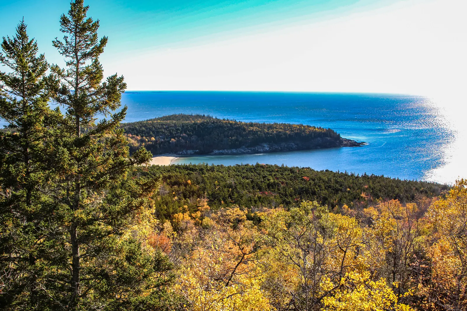
Sand Beach is made mainly of crushed shells and sea urchin fragments; the beaches facing the open sea consist of pebbles, cobbles and boulders, depending on the power of the waves. Water freezes in the joints of the granite and breaks blocks off the cliffs, leaving pink scars. Jordan Pond is dammed behind a ridge of glacial debris.
338 recorded bird species: the park lies on the Atlantic Flyway and is considered one of the best birding areas in the country. Peregrine falcons nest on the Precipice cliffs, which is why the trail is closed in spring. Around 40 mammal species; bat numbers have fallen by over 80 percent.
About 50,000 acres with the highest mountains on the US East Coast, rocky summits and over 1,100 plant species. The park lies in the transition zone between the southern and northern forests, and many species reach the edge of their range here.
The area has been inhabited for over 12,000 years, home of the Wabanaki, the "People of the Dawnland". Samuel de Champlain sailed past in 1604 and named the island after its bare mountains: "Monts Déserts". From the late 19th century came painters, then the wealthy "rusticators" on steamers and yachts.
"Acadia" is now thought to go back to the Mi’kmaq word akadie, a piece of land the French turned into l’Acadie. In 1929 the National Park Service chose the name deliberately, because it is older than any European exploration. Mount Desert is pronounced both ways: as written, or the French way, like "dessert".
Part One: Acadia National Park’s Transportation Plan
Just under six minutes from the park authority's channel, and the most viewed film there: why a park with four million visits reaches its limits on roads and in car parks. The background to the Cadillac reservation; the channel has no introductory film, and parts two and three are there too.
The peninsula belongs to the park but is a different visit: six miles (10 km) of one-way road around granite headlands, 8.3 miles (13.4 km) of bike paths, trails up the 440-foot (134 m) Schoodic Head, ranger programmes in summer. Vehicles over 21 feet (6.4 m) stay at the campground, and their passengers take the bus.
The island, half of which belongs to the park, has 18 miles (29 km) of rough trails, a freshwater lake, five lean-to shelters for overnight stays and almost no services. Visitor numbers are limited, and it is on average 5 °C (10 °F) cooler than on the mainland.
Nothing saved yet. Every place card has a pin, and so does every place on the Map. What you save collects here, with days, notes and a preview you can share.
Reality check
Share
The plan is stored in the link itself. Anyone who opens it sees the preview and can use the plan.
Image for your phone, with stops and map.
01Best time to visit: fog in summer, colours in October
After the Pacific Northwest, the Maine coast has the most precipitation in the United States.
Summer
Daytime 45 to 90 °F (7 to 32 °C); the sea 10 to 16 °C (50 to 61 °F), the lakes 13 to 21 °C (55 to 70 °F). Fog is common in June, July and August. The weather on Cadillac can be completely different from Bar Harbor.
Foggy, −1 to 21 °C (30 to 70 °F). Blackflies are usually at their worst from mid-May to mid-June, and more numerous after a wet spring. In March and April the carriage roads are often closed to everyone because of mud.
The leaves start turning in September, and the peak is usually in mid-October, somewhere between the first and third week. The State of Maine publishes the status on Wednesdays. From 18 August the Island Explorer runs a reduced autumn timetable, until 13 October.
−10 to 2 °C (14 to 36 °F), with an average of 60 inches (152 cm) of snow. On the 45 miles (72 km) of carriage roads people walk and ski; volunteers groom tracks once more than six inches (15 cm) of snow lie. Mountain trails are icy and not recommended. No winter camping, no sleeping in cars.
From 7 October to 6 March, Cadillac is the first place in the United States to see the sunrise. During the reservation period there are separate sunrise windows from 4:00; the sun rises at 4:45 in mid-June and at 6:15 in mid-October. Arrive an hour early; the car parks are often full by then.
Twice a day the sea rises and falls by 8 to 12 feet, up to three and a half metres. Explore tide pools from an hour and a half before to an hour and a half after low tide; Thunder Hole is loudest one to two hours before high tide. The park links tide tables for each location.
For somewhere so close to Portland, Boston and New York, the sky is remarkably dark. The park recommends Sand Beach, Seawall, Jordan Pond and the Ocean Path; the Cadillac road closes at 21:00, but you may go up on foot or by bike. Bring a red-light torch, a blanket and insect repellent.
Best months by the climate data: June to September. Average daytime highs of 18 to 22 °C, lows of 11 to 15 °C, 81 to 112 mm of precipitation a month. The wettest month is October (139 mm), the driest July (81 mm).
−10°0°10°20°
Jan−1−8
Feb0−8
Mar3−4
Apr92
May146
Jun1811
Jul2214
Aug2215
Sep1912
Oct137
Nov82
Dec2−4
High °CLow °C
Daily highDaily lowPrecipitation
All monthly values as a table
Monthly averages 2001–2020, NASA POWER model
Month
High °C
Low °C
Precipitation mm
January
−1.2
−8.5
92
February
−0.4
−7.9
86
March
3.2
−3.6
95
April
8.7
1.5
103
May
13.9
6.3
96
June
18.3
10.8
112
July
22.0
14.5
81
August
22.3
14.7
85
September
19.1
11.6
100
October
13.4
6.7
139
November
7.6
1.5
125
December
2.2
−4.3
135
Year
1,249
Modelled values, not a weather station: NASA POWER (MERRA-2) for a grid cell of about 55 × 50 km around the map point Gorham Mountain (44.33° N, 68.19° W), with an average cell elevation of about 40 m. Averages for 2001–2020. Higher ground and valleys can differ markedly.
02How to get there: 264 miles (425 km) from Boston, an airport ten miles (16 km) from the park
And in summer, unlike almost every other US park, you can manage without a car.
By car
From Boston on I-95 to Augusta, then Route 3 to Ellsworth and onto the island; or I-95 to Bangor, Route 1A to Ellsworth, then Route 3. For the Schoodic Peninsula, take US 1 north from Ellsworth for 17.3 miles (27.8 km), then Highway 186 for 6.5 miles (10.5 km).
Direct flights from Boston Logan land at Hancock County Airport, ten miles (16 km) from the park; the Island Explorer stops there. Bangor International is about an hour away. Both airports have car rental.
While the Island Explorer runs, from late June to early October, you do not need a car, according to the park. The buses link Bar Harbor, Northeast Harbor, Southwest Harbor and the park destinations, including campgrounds and trailheads. Only Cadillac is left out.
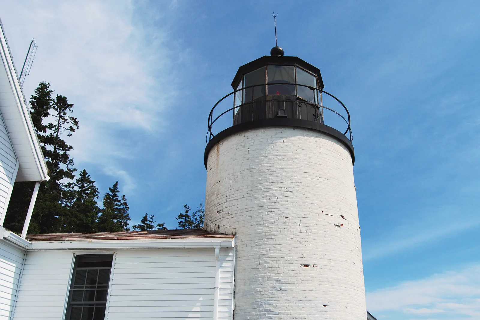
The bridges on the Loop Road have clearances from 3.1 metres (10 ft 2 in), at Stanley Brook. Vehicles over 21 feet (6.4 metres) are banned on the Cadillac Summit Road and the Schoodic Loop Road, and at Bass Harbor lighthouse too. The park has separate information pages for RVs.
A year-round passenger ferry runs from Stonington to the Town Landing, and from mid-June to late September also to Duck Harbor near the campground. No advance sales: first come, first served. Bikes cost extra and only go to the Town Landing. There are almost no services on the island.
From 1 December to 14 April, the Loop Road and Cadillac are closed to cars. Only the Ocean Drive between Schooner Head Road and Otter Cliff Road and the access road to Jordan Pond stay open. The fee station on Schooner Head Road is staffed all year.
Parking on the Park Loop Road: the right lane counts too
Besides the many parking lots, parking is also allowed in the right-hand lane of the Park Loop Road unless signs say otherwise. Watch out for parked cars and for cyclists going around them. According to the park, this area is extremely congested in July and August.
Parking at Jordan Pond: often full in the afternoon
Afternoons at Jordan Pond can be very congested, the park says, especially for hiking trails and carriage road access. If the parking lots are full, come back at a different time; no-parking signs on the Loop Road apply. Accessible paths with views of the pond start at the north lower lot.
Bar Harbor: small-group tour with Cadillac, Thunder Hole and Jordan Pond
Four hours in an air-conditioned vehicle for no more than seven people: Sieur de Monts Spring, Thunder Hole, Otter Cliff, Jordan Pond and Cadillac Mountain, with a meal at Jordan Pond. Pick-up and drop-off in downtown Bar Harbor.
Departure Pick-up at hotels in downtown Bar Harbor.
According to the list of inclusions, park entry and the drive up Cadillac are included. Explicitly not included are the $100 surcharge per person aged 16 or over without US residence and tips; the provider marks the surcharge with a red cross in its list. If you have the $250 pass, bring it. The product page contradicts itself on the food: the highlights list a classic Maine lobster roll "Included in Price", the description speaks of a "lobster roll or popover", and the list of inclusions with its symbols lists no meal. Check before booking what is included.
View tour ↗Ad · partner link · checked 25 Sep 2026
Downeast Transportation, Inc., in cooperation with the Acadia park authority (National Park Service) · Shuttle bus · free
Island Explorer: free bus from Bar Harbor into the park
The buses link Bar Harbor and the other towns on Mount Desert Island, campgrounds, hotels and Bar Harbor–Hancock County airport with destinations in the park: Sand Beach, the Loop Road, Jordan Pond, Blackwoods, the carriage road entrances and many trailheads, plus a separate route on the Schoodic Peninsula. Buses stop at the bus stops and, if you flag them down, anywhere the driver considers safe. There is no guide; the Island Explorer is a public transit service.
Meeting point Hub at the Village Green in Bar Harbor, according to the operator three blocks up Main Street from the Town Pier, where cruise passengers usually arrive by tender. Further routes start at the Acadia Gateway Center in Trenton and at the airport.
According to the park and the operator, the bus is fare-free; anyone riding it into the park still needs a park pass, which for people without US residence includes the $100 surcharge. 2026 season according to the operator: Gateway Center, Loop Road and Schoodic from 20 May, the other routes from 23 June to 12 October, with the autumn timetable from 17 August. Contradiction: the park's page says service runs until 13 October. On cruise ship days, the operator says buses often have standing room only, especially in the late afternoon; allow time to get back to your ship. A maximum of 30 seated and 13 standing passengers, wheelchair accessible with a lift. Dogs on a leash are welcome but must stay on the floor. Timetables in print and on the operator's website.
Park authority page ↗Park authority programme · no partner link · checked 2 Oct 2026
Ad · we may earn a commission if you book through this partner link. Offer details checked 25 Sep 2026. See official ticket information.
03Tickets & entrance fees: $35 per car, plus $100 per person without US residence
Acadia is one of the eleven parks with the non-resident surcharge. A pass is required all year.
A private vehicle with up to 15 seats and everyone in it costs $35, explicitly including rental cars and RVs. A motorcycle costs $30, one person on foot or by bike $20. All are valid for seven days; children under 16 pay nothing. The pass must be displayed behind the windscreen.
Every person aged 16 or over without US residence pays an extra $100, unless they enter with an annual pass or an America the Beautiful Pass. For a couple from abroad in a rental car, $35 becomes $235 for seven days.
Acadia's fees page says it explicitly: the surcharge also applies to people without US residence who enter as part of a commercial tour group, a CUA group or a concessioner tour. If you book a bus tour from Bar Harbor, check the list of inclusions for it.
Since June 2026, operators can prepay the entrance fee and surcharge with a Commercial Site Pass on Recreation.gov and buy digital annual passes for their guests. Whether an operator does this is rarely in its list of inclusions. Ask before you book.
The non-resident America the Beautiful Pass costs $250 and covers one vehicle or four individuals at all federal recreation sites, surcharge included. As a digital pass from Recreation.gov it is valid immediately; the printed version takes up to three weeks by post. In a tour group it covers the pass holder and three more people aged 16 or over.
Acadia sells its own annual pass for $70. The park lists it as "Available to: US citizens and residents", so visitors from abroad cannot buy it. The eight fee-free days in 2026 also apply to US residents only.
The $6 for the Cadillac Summit Road is a separate fee per vehicle, not an entrance fee. The camping fee does not include entry either; the park answers this question in its FAQ with a clear no.
All year at the Park Loop Road fee station near Schooner Head Road and at two machines that work around the clock: in the pavilion at the Hulls Cove Visitor Center and in the gatehouse at the Schoodic Institute. Also at the visitor centre, the campgrounds and online to print out. In winter the Bar Harbor Chamber of Commerce sells passes.
Everything is booked online; there is no front desk in the park for walk-ins.
No lodging in the park
The park has two campgrounds on Mount Desert Island, one on Schoodic and five lean-to shelters on Isle au Haut, nothing else. Hotels, motels and holiday rentals are in Bar Harbor and the other towns; the chambers of commerce keep lists.
Blackwoods on the east side, near the Loop Road and Bar Harbor, from 1 May to 19 October 2026. Seawall on the quieter west side by the coast, from 20 May to 12 October. Neither has electric or water hook-ups; each has a dump station.
Schoodic Woods is the newest campground and the only one with water and electric hook-ups, 20 May to 12 October. Duck Harbor on Isle au Haut, 17 June to 5 October, has five lean-to shelters and no drinking water, and can only be reached by mail boat.
Only on Recreation.gov, including on the same day, never at the campground. For Blackwoods, Seawall and Schoodic Woods, 90 percent of the sites are released six months ahead on the first of the month at 10:00 Eastern Time, the last 10 percent 14 days ahead. Duck Harbor opens in full on 1 April at 10:00.
No backcountry camping, no sleeping in cars or RVs in car parks, no winter camping, anywhere in the park. Bringing your own firewood is discouraged because of invasive insects; you can get it locally.
The dangers in this park are small and close, not big and far away.
Ticks
Ticks are common in the park, especially from late spring to early autumn, and the diseases they carry are increasing in the region. Stay in the middle of the trail, wear light-coloured clothing, tuck trousers into socks, treat shoes and clothing with repellent, and check yourself after every walk.
Poison ivy grows throughout the park, especially along the coast, and is protected as a native plant; it is only cut back along the Ocean Path. Leaves of three, let it be. After contact, wash with soap within 30 minutes, including your dog's fur.
The Beehive, Precipice and Jordan Cliffs trails climb exposed faces on iron rungs and ladders. Not when wet, not if you are afraid of heights, not with small children, and never the Precipice downhill. Dogs are banned on these trails.
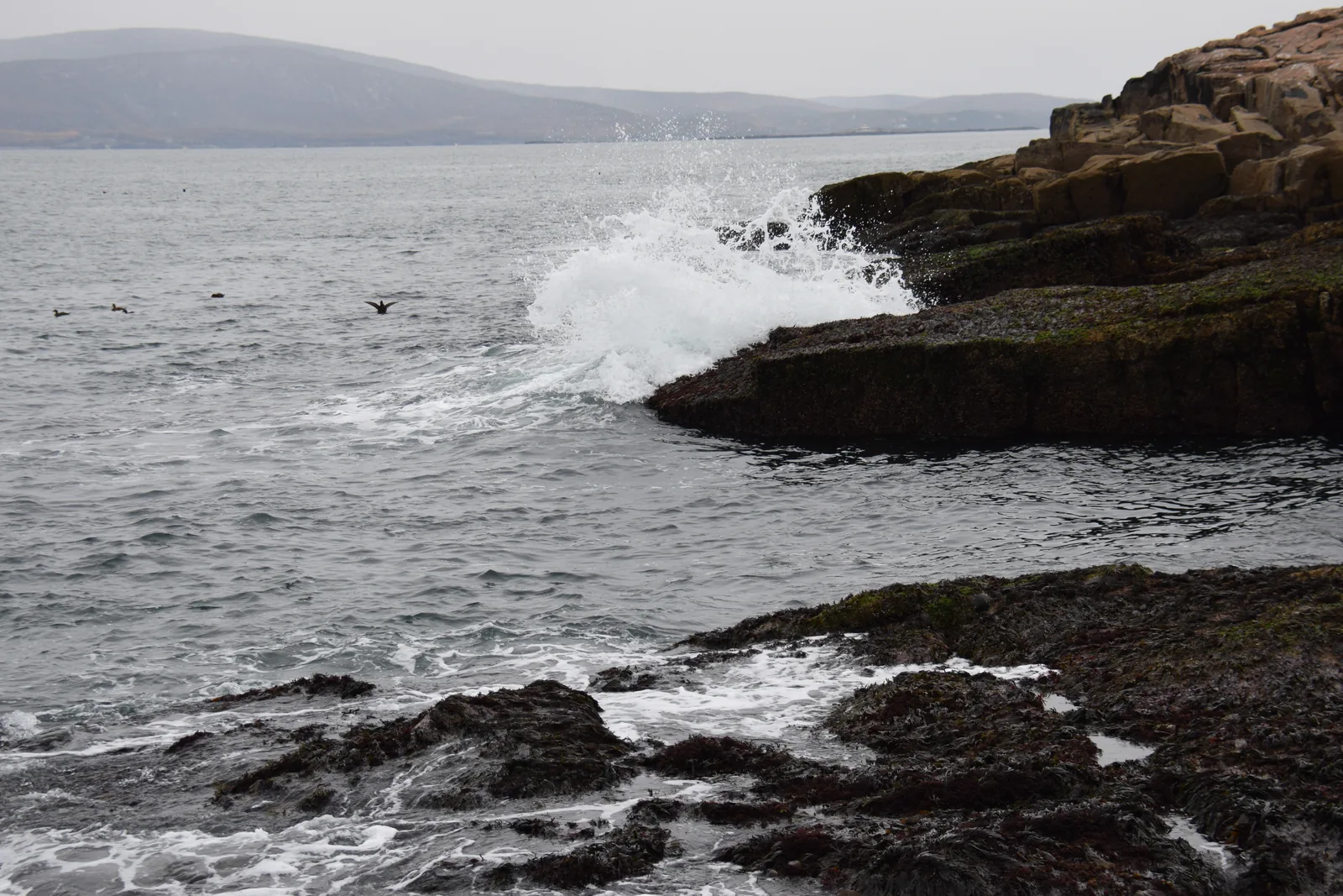
Never turn your back on the sea: even in calm weather, single waves wash over the granite slabs. A rising tide cuts off the way back, at Bar Island for nine hours. At Thunder Hole the spray reaches twelve metres (40 ft); in storms the walkways are closed.
At least 0.6 litres of water, more on warm days; a paper map, because your phone will fail as map and torch; a rain jacket and warm layers; a first-aid kit and a torch. Sturdy shoes: most trails are uneven and slippery when wet.
From warm and sunny to cold and wet in a short time: that is normal here. On Cadillac and the other summits the weather is different from below; wind, rain, fog and cold are possible even in summer.
Moose and bears live on the island but are rarely seen. For dogs, porcupines are the bigger danger. Do not feed anything; if you change an animal's behaviour, you are too close.
Microspikes or crampons are essential on icy trails but do not always help on slick granite. Mountain trails are not recommended in winter; the park points to Ship Harbor, the Ocean Path and the carriage roads. It gets dark early; hiking poles are recommended.
06Frequently asked questions: Acadia National Park
Do I need a reservation for Acadia National Park?
Not to enter the park. You need to reserve the Cadillac Summit Road from 20 May to 25 October, $6 per vehicle, online only on Recreation.gov, and every campground. On foot, by bike or by taxi you can reach Cadillac without a reservation; the Island Explorer does not go up.
A private vehicle with everyone in it costs $35, a motorcycle $30, one person on foot or by bike $20, each for seven days. Children under 16 pay nothing. The pass is required all year and must be displayed in the car. Since 15 April the park no longer wants to accept cash; on site the vehicle pass is card only, while the fees page still lists cash or card for the motorcycle and individual passes at some sales points.
Do international visitors pay the $100 non-resident fee at Acadia?
Yes. Acadia is one of the eleven parks that since 2026 have charged an extra $100 per person aged 16 or over without US residence; according to the fees page, this explicitly includes commercial tour groups, CUA groups and concessioner tours. If you hold an annual pass or the non-resident America the Beautiful Pass for $250, you do not pay it.
30 percent 90 days in advance, 70 percent two days before, each at 10:00 Eastern Time (16:00 in Central Europe). Sunrise windows last 90 minutes, daytime windows 30 minutes. Only one sunrise reservation per seven days. Vehicles over 21 feet (6.4 m) are turned away even with a reservation.
From late June to early October, yes, the park itself says: the free Island Explorer links Bar Harbor, the other towns, the airport, campgrounds and many trailheads, stops when you flag it down and carries bikes and dogs. From Hancock County Airport it is one bus ride. Only the summit of Cadillac has no bus.
What is the best hike in Acadia if I only have a few hours?
The Ocean Path from Sand Beach to Thunder Hole, 0.7 miles (1.1 km) surfaced, or on to Otter Point, 2.2 miles (3.5 km) one way with a bus back. If you want a summit, take the Bubbles: 1.5 miles (2.4 km) with Bubble Rock in one to one and a half hours. The Beehive is short, but it is an iron-rung route up a cliff face.
Yes, on 100 miles (160 km) of hiking trails and all 45 miles (72 km) of carriage roads, on a leash no longer than six feet (1.8 m), and at three of the four campgrounds. Dogs are banned on iron-rung trails such as the Beehive, Precipice and Beech Cliffs, on Sand Beach from 15 June to 8 September, at Echo Lake from 15 May to 15 September, at the drinking water lakes, in buildings, on ranger programmes and at Duck Harbor. On the Island Explorer they may ride on the floor.
Where is the best place to see the sunrise in Acadia?
On Cadillac, the most popular place for it; from 7 October to 6 March the sun rises nowhere earlier in the United States. In season you need a sunrise reservation for a window from 4:00, and 70 percent of the slots appear two days ahead. Without a reservation: the North Ridge Trail with a headlamp, or Sand Beach and the Ocean Path by the sea.
One to two hours before high tide, best in a storm or an onshore wind: then the sea forces the air out of the chasm and the spray rises over twelve metres (40 ft). In a calm sea it is just a pretty rock chasm. At low tide you can walk down the 55 steps to the lower platform.
Only at the four campgrounds, all booked exclusively on Recreation.gov: Blackwoods and Seawall on Mount Desert Island, Schoodic Woods on the peninsula, Duck Harbor on Isle au Haut. There are no lodges or hotels in the park; backcountry camping and sleeping in vehicles are banned. About twelve private campgrounds are on the island.
Only from a boat. Whale watching trips start in Bar Harbor; puffins live on offshore islands that you reach by excursion boat, and you cannot see them from Mount Desert Island. Seals are most likely on boat trips from the harbours, including four with rangers on board.
Yes. The non-resident America the Beautiful Pass costs $250 and covers one vehicle or four individuals at all federal recreation sites, including the $100 surcharge. As a digital pass from Recreation.gov it is valid immediately; the printed card takes up to three weeks by post.
No. According to Acadia's fees page, the eight fee-free days in 2026 apply to US residents only. The park's own annual pass for $70 is also only available to US citizens and residents.
Researched 25 Sep 2026. Not a live status. Dates apply only to the year stated. A successful automatic fetch is not an editorial confirmation; outdated automatic values are hidden and replaced by the source link.