National Parks Atlas
MapPDF

01 · Canada · Newfoundland and Labrador · West coast of Newfoundland

Gros Morne National Park

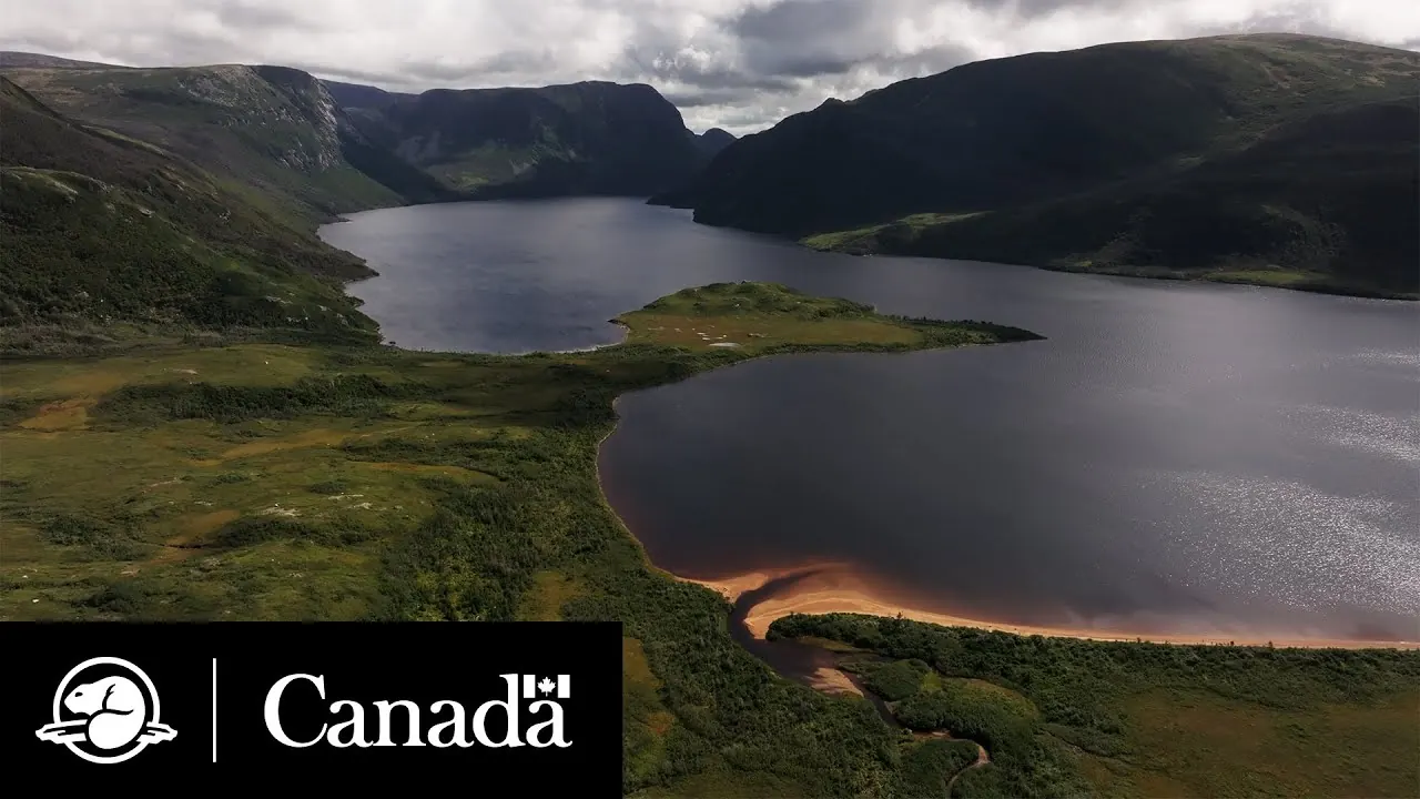
A piece of the Earth’s mantle at the surface, a fjord cut off from the sea and a flat-topped mountain with Arctic tundra — a UNESCO World Heritage Site on Newfoundland’s west coast.

Photo: D. Gordon E. Robertson ↗ · CC BY-SA 3.0 ↗

Gros Morne at a glance · PDF, 2 pages

Gros Morne National Park: landscape and origins

Gros Morne has been a national park since 1973 and covers 1,805 square kilometres (697 sq mi) on Newfoundland’s west coast — a section of the Western Newfoundland Highlands and the eastern part of the St. Lawrence Lowlands.

The park is the only national park representing the Western Newfoundland Highlands and the largest protected area in this natural region. According to the park authority, it includes 284 kilometres (176 mi) of varied coastline, a climate shaped by the Gulf of St. Lawrence and a landscape formed by glaciations over the last two million years.

The result is great diversity: Arctic-alpine tundra on the plateau, boreal forest with balsam fir on the slopes and in the valleys, extensive serpentine barrens and large wetlands. Almost half of the park is forest.

Because it is an island, Newfoundland has only fourteen native land mammals and no native amphibians or reptiles. Over thousands of years, many species have developed into distinct subspecies. Introduced species such as moose put them under pressure.

Since 2020, spruce budworm has been spreading in the park, a native moth whose caterpillars strip firs and spruces bare. After a review by 14 experts and a public consultation, the park authority decided not to include the park in the provincial spraying programme: such outbreaks are part of the natural cycle of the boreal forest.

In 1987 Gros Morne became a UNESCO World Heritage Site. The decisive factors were its exceptional natural beauty and rock formations such as the Tablelands, Green Point, Green Gardens and Western Brook Pond, which show important stages in the Earth’s history.

Conservation and research ↗

The park in numbers

Established
1973
Area
1,805 km² (697 sq mi)
UNESCO World Heritage Site
since 1987
Highest point
Gros Morne, 806 m (2,644 ft)
Coastline
284 km (176 mi) (park authority conservation page)
Trails
over 100 km (62 mi)
Campgrounds
5 campgrounds with 236 sites
Moose
peak of 7,800 animals in 1995, managed since 2011
Red chairs
idea from 2011, 16 sets in the park
Visiting Gros Morne: overview and planning

01

On Newfoundland’s west coast

The park is 30 minutes from Deer Lake Airport and four hours by car from the ferry port of Port aux Basques. You can stay in the park or in the coastal communities of Cow Head, Glenburnie, Norris Point, Rocky Harbour, Trout River and Woody Point.

Plan your visit ↗

02

1,805 square kilometres (697 sq mi)

Gros Morne stretches from the coast of the Gulf of St. Lawrence across a lowland of lakes and bogs to the Long Range Mountains and the Tablelands. Its plants and animals come from temperate, boreal and Arctic-alpine habitats.

Management plan and park description ↗

03

A park pass is required

You need a valid national park pass to visit. Day passes are sold at the Wiltondale entrance kiosk, the Rocky Harbour Visitor Centre, the Discovery Centre in Woody Point and many shops in the surrounding communities.

Passes and permits ↗

04

How much time to allow

The Western Brook Pond boat tour takes two hours, plus a 45-minute walk each way; the Gros Morne summit takes six to eight and a half hours. The park authority advises planning the summit for one of your first days, in case the weather forces you to use a spare day.

Gros Morne Mountain: summit trail ↗

02 · Places

Map: places in the park

Every point is verified against an OpenStreetMap object.

Photo: Paul Gierszewski ↗ · CC BY-SA 3.0 ↗

Place in the park

Western Brook Pond

A fjord carved by glaciers and cut off from the sea — fresh water between rock walls that are a billion years old.

Size
the largest lake in the park.
Cliffs
up to 650 m (2,133 ft) high, seen from Snug Harbour.
Waterfalls
drop from around 600 m (1,969 ft) and often blow away before they reach the lake.
Access
3 km (1.9 mi) trail from the car park, about 45 minutes.
Boat tour
2 hours with commentary, mid-May to mid-October, operated by Bontours.
Hiking
unmarked route to Snug Harbour, 15 km (9.3 mi), 6–8 hours.

Western Brook Pond and boat tour ↗

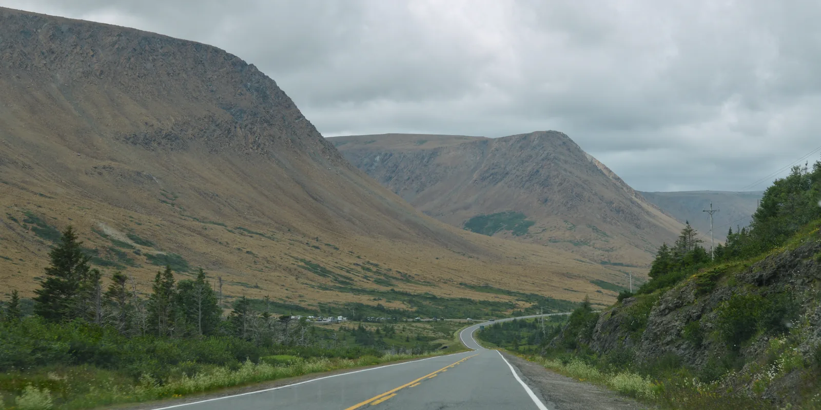
A road leads into a wide valley in Gros Morne National Park; on the left rises the bare, brownish-orange slope of the Tablelands, on the right green conifer forest
Photo: Ryan Hodnett ↗ · CC BY-SA 4.0 ↗

Place in the park

The Tablelands

A mountain from inside the Earth: bare, orange and with rare, tiny plants that you should not step on.

Origin
Earth’s mantle, pushed to the surface around half a billion years ago.
Exposed
by more than 400 million years of erosion.
Trail
Tablelands Trail, 4 km (2.5 mi), easy, into Winter House Brook Canyon.
Guided
“Walk Upon the Earth’s Mantle”, 2 hours, included in admission.
Off trail
unmarked ascent, for experienced hikers only.
In winter
often wind-blasted and icy; avalanche risk in Southwest Gulch and The Bowl.

The Tablelands ↗

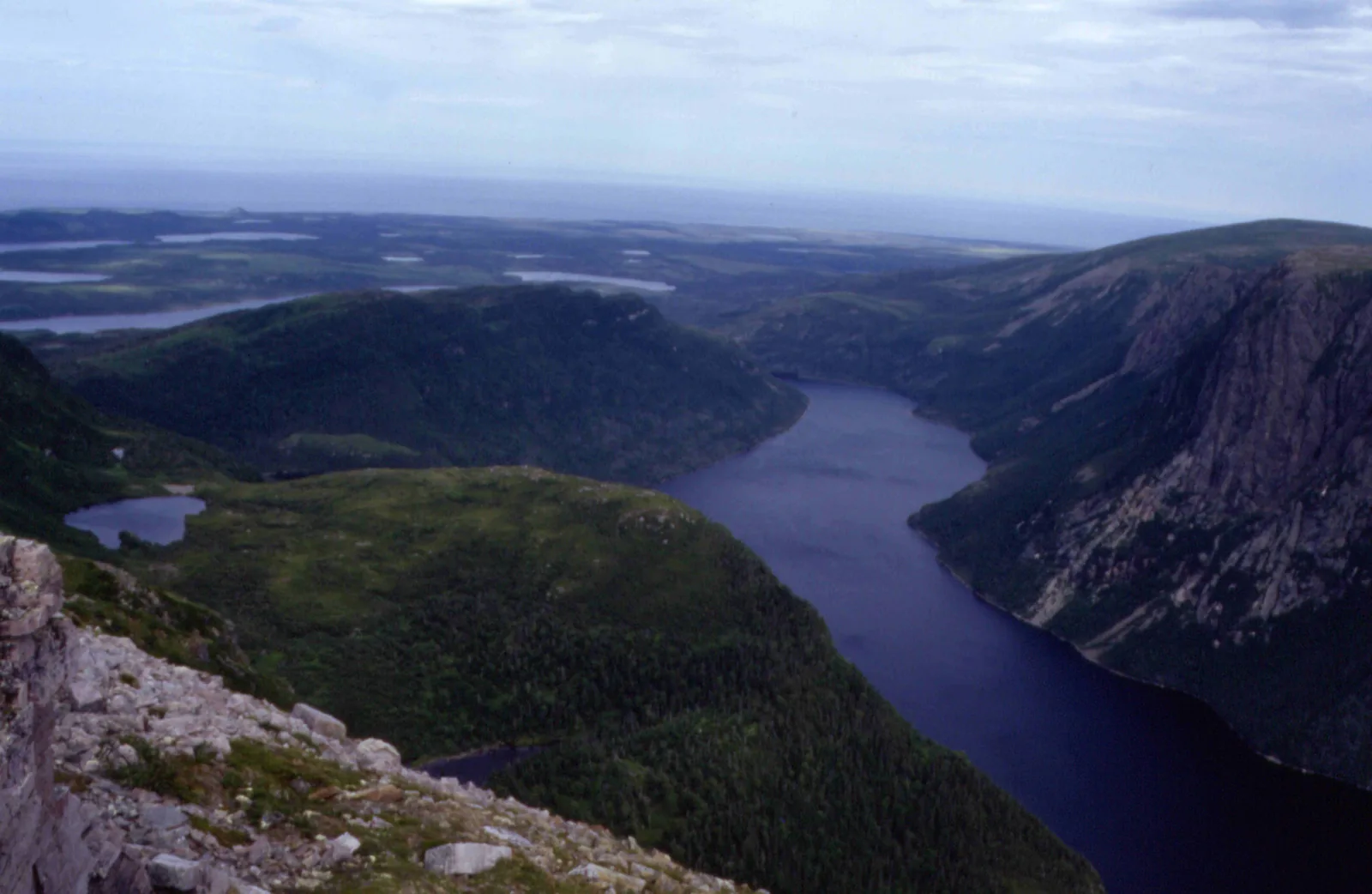
View from the summit plateau of Gros Morne in Gros Morne National Park down to narrow, dark Ten Mile Pond between steep, forested valley sides
Photo: Slimguy ↗ · CC BY-SA 3.0 ↗

Place in the park

Gros Morne Mountain

The mountain that gives the park its name: a flat-topped peak with Arctic tundra on the summit and a scree slope that is better climbed up than down.

Height
806 m (2,644 ft).
Loop
17 km (10.6 mi), 1,000 m (3,281 ft) of ascent, 6–8.5 hours, difficult.
Approach
9 km (5.6 mi) return to the platform, moderate.
Summit loop
8 km (5 mi) clockwise, descent via Ferry Gulch.
Closure
1 May to 27 June to protect caribou and ptarmigan.
Views
of the Long Range Mountains and the gorge of Ten Mile Pond.

Gros Morne Mountain: summit trail ↗

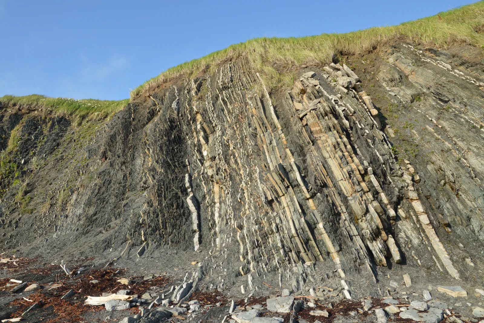
A rock face in Gros Morne National Park of almost vertical, thin grey and pale rock layers, with a grassy edge on top under a blue sky
Photo: Ryan Hodnett ↗ · CC BY-SA 4.0 ↗

Place in the park

Green Point

Rock layers tilted on end by the sea, in which geologists found the boundary between two geological periods.

Age
almost 500 million years, formed on the floor of an ancient ocean.
Significance
fossils mark the boundary between the Cambrian and the Ordovician — a global reference point.
Location
500 m (0.3 mi) north of Green Point Campground on Route 430.
Trails
short path to the shore, cliff trail to the viewpoint.
Guided walk
“A Stroll Through Strata”, 1.5 hours.
Note
visit at low tide, keep away from the cliff edge, rockfall.

Green Point geological site ↗

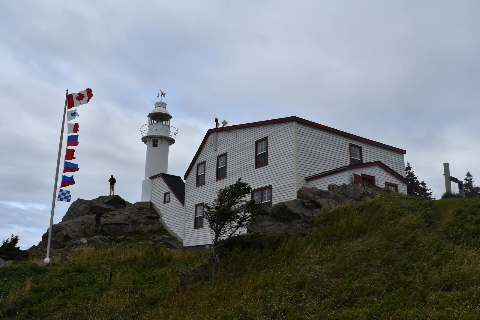
The white Lobster Cove Head lighthouse in Gros Morne National Park with the keeper's house on a rocky headland, in front a flagpole with signal flags
Photo: Adavyd ↗ · CC BY-SA 4.0 ↗

Place in the park

Lobster Cove Head

A hundred-year-old lighthouse at the entrance to Bonne Bay — today the gateway to the park’s cultural history.

Exhibit
15 May to 12 October 2026, daily 9:00–17:00.
Content
historic photos, folk songs, lighthouse keepers’ logbooks.
Trails
short paths through tuckamore forest to viewpoints.
Coast
tidal pools with periwinkles, sea anemones and crabs.
Evenings
according to the park authority, the place for sunsets; sometimes whales.

Lobster Cove Head Lighthouse ↗

Map

10 places on the map

Every point is verified against an OpenStreetMap object.

Open map3D terrain · details and photos for every place
  • Mountains & rock1
  • Water1
  • Trails1
  • Arrival3
  • Where to stay1
  • History1
  • Nature2

03 · Out and about

Hikes & routes: boat tour, Tablelands, summit

Over 100 kilometres (62 mi) of trails, a fjord by boat and geology you can touch.

Photo: Michel Rathwell ↗ · CC BY 2.0 ↗

„On one side lush green, on the other glowing amber — separated, it seems, only by the yellow centre line of the road.“

Gros Morne National Park · View from Norris Point Lookout across Bonne Bay to the Tablelands

Hikes & routes: boat tour, Tablelands, summit

Western Brook Pond boat tour

A three-kilometre (1.9 mi) trail through bog and forest takes about 45 minutes to the dock. The two-hour interpreted cruise passes between rock walls over which waterfalls drop around 600 metres (1,969 ft). The operator is Bontours, mid-May to mid-October; booking is recommended, pets are not allowed.

Western Brook Pond and boat tour ↗

Walking on the Earth’s mantle

The Tablelands Trail is easy, four kilometres (2.5 mi) return, and ends in the glacier-carved Winter House Brook Canyon. If you want more: the Trout River Pond Trail leads 14 kilometres (8.7 mi) into an untouched part of the Tablelands.

The Tablelands ↗

Up Gros Morne Mountain

The highest point of the park (806 metres, 2,644 ft) is a difficult loop: 17 kilometres (10.6 mi), 1,000 metres (3,281 ft) of ascent, six to eight and a half hours. The nine-kilometre (5.6 mi) approach to the viewing platform at the foot of the mountain is worth it on its own.

Gros Morne Mountain: summit trail ↗

Green Point

In the cliffs at Green Point, geologists found fossils that define the boundary between the Cambrian and the Ordovician — a global geological reference point. The rocks formed almost 500 million years ago on the floor of an ocean. Best visited at low tide.

Green Point geological site ↗

The red chairs

The idea of placing red Adirondack chairs at quiet viewpoints comes from Gros Morne, in 2011. Today they stand at more than 100 Parks Canada places, with 16 sets in the park itself — along trails, at pull-offs and in day-use areas.

The red chairs ↗

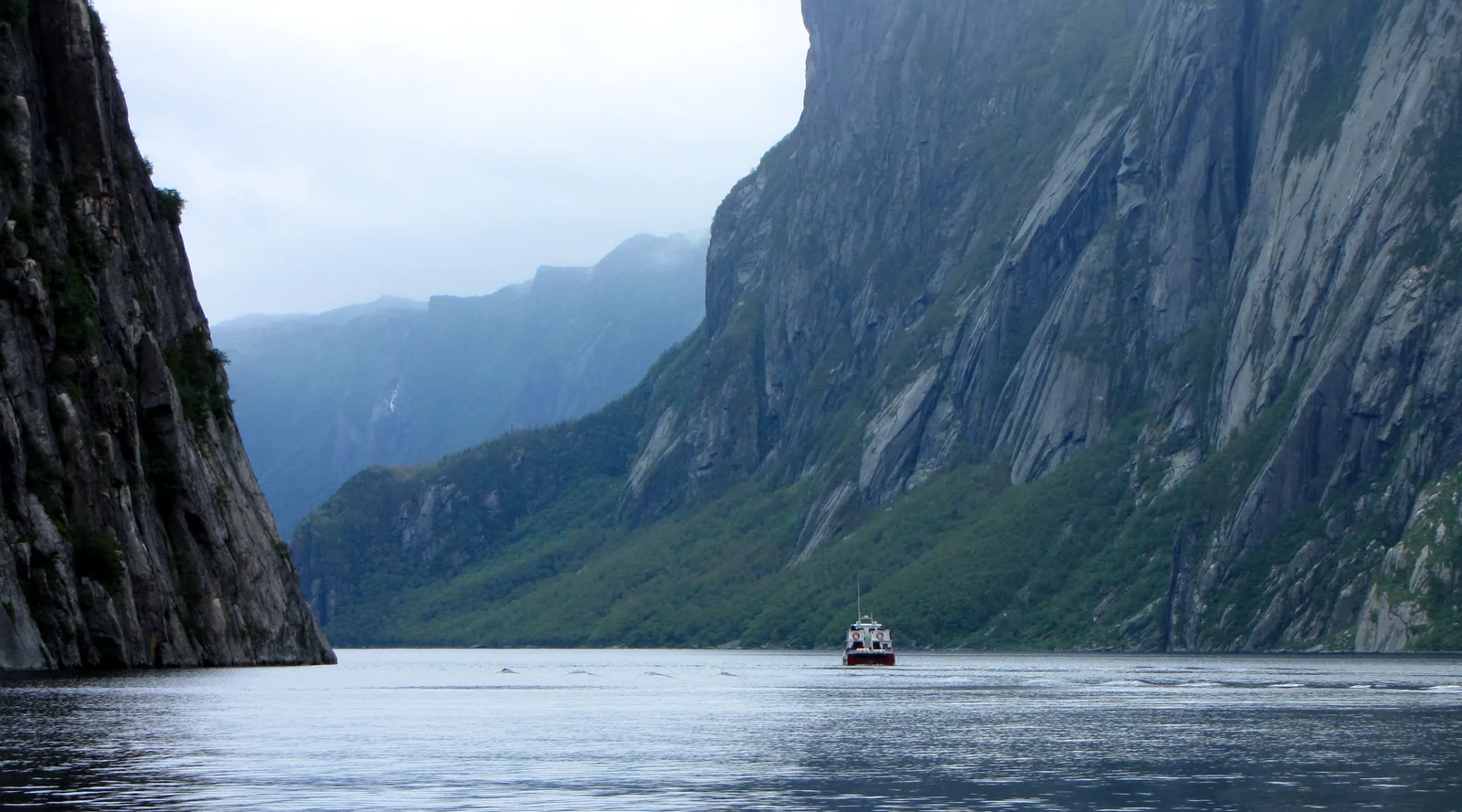
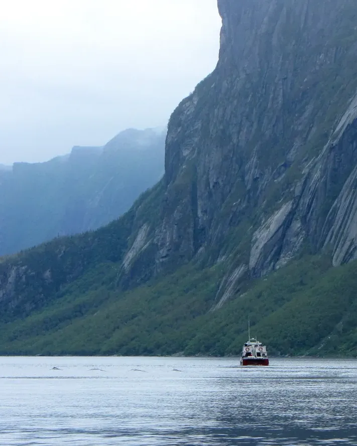
A small tour boat crosses the still water of Western Brook Pond in Gros Morne National Park between sheer, dark cliffs under low clouds

BonTours, a family business from Norris Point · Boat tour · landlocked fjord

Boat tour on Western Brook Pond between the cliffs of the landlocked fjord

Western Brook Pond is a glacier-carved fjord that the sea no longer reaches: 16 kilometres (10 mi) long, up to 165 metres (541 ft) deep, framed by cliffs where waterfalls plunge from the plateau and often turn to mist before they reach the lake. BonTours runs the two-hour boat tour here with live commentary on board; the boats have canopied decks and washrooms. To reach the dock you walk three kilometres from the parking lot on Route 430 along a mostly level gravel path, about 45 minutes.

  • 2 hours
  • Mid May to mid October
  • English and French
  • Reservation recommended

Meeting point Western Brook Pond dock; parking lot on Route 430, 27 kilometres (17 mi) north of Rocky Harbour, then a 3-kilometre (1.9 mi) walk. Tickets also at the BonTours office, 105 Pond Road in Rocky Harbour.

Departures depend on wind and weather, and BonTours only sails with at least 15 guests. Cancellation up to 24 hours in advance. Pets are not allowed on board; there are dog kennels at the dock. For guests with limited mobility a golf cart runs to the dock: it cannot be reserved, is cash only, and you should be at the parking lot 90 minutes before departure. Since 8 September 2026 the regular park admission applies to the tour again. At the dock there is a waiting area, washrooms and a snack bar; mobile reception there is unreliable.

Park authority page ↗Offered by BonTours, featured by Parks Canada · no partner link · checked 2 Oct 2026

Landscape image, not a provider photo · Photo: D. Gordon E. Robertson ↗ · CC BY-SA 3.0 ↗

The white Lobster Cove Head lighthouse in Gros Morne National Park with the keeper's house on a grassy rocky headland, one of the venues of the evening Fireside Sharing Circle

Gros Morne park authority (Parks Canada) · Park authority programme · evening by the fire

Evenings by the campfire: Fireside Sharing Circle on Mi’kmaw culture

On summer evenings Parks Canada invites you to the fireside: in the Fireside Sharing Circle you sit in a circle with a park interpreter and hear, in an open conversation, about the culture, traditions and customs of the Mi’kmaq of Newfoundland. In summer 2026 the circle met on Sundays at Lobster Cove Head Lighthouse, which the park authority names as the place for sunsets in the park, and on Thursdays at Trout River Campground.

  • Evening programme, 1.5 hours
  • High summer, 19:00 to 20:30
  • English
  • No registration

Meeting point In summer 2026 on Sundays at Lobster Cove Head Lighthouse near Rocky Harbour, on Thursdays at Trout River Campground.

No registration; according to the park authority it is included with park admission. For all ages, in English only. Pets are welcome if they are quiet and leashed. The park authority offers guided programmes from June to the end of September; the evening session was only on the peak-season schedule from 1 July to 7 September 2026. The 2026 season is over, the page no longer shows that schedule, and it does not yet give dates for 2027.

Park authority page ↗Park authority programme · no partner link · checked 2 Oct 2026

Landscape image, not a provider photo · Photo: Adavyd ↗ · CC BY-SA 4.0 ↗

A road leads into a wide valley in Gros Morne National Park; on the left rises the barren, brown-orange slope of the Tablelands, where the guided walk on the Earth's mantle takes place

Gros Morne park authority (Parks Canada) · Park authority programme · Earth's mantle

On the Earth's mantle: guided park authority walk through the Tablelands

The Tablelands are rock from the Earth's mantle, which normally lies far below the crust. It was thrust up when continents collided around half a billion years ago, and only more than 400 million years of erosion exposed it: a barren, orange landscape that is the reason Gros Morne is a UNESCO World Heritage Site. On the two-hour walk “Walk Upon the Earth’s Mantle”, Parks Canada guides take you along the Tablelands Trail and explain the geology, the glacier-carved valleys and the plants that grow on this poor ground.

  • 2 hours
  • June to the end of September
  • English, French on some days
  • No registration

Meeting point Tablelands Trail on Route 431, 4 kilometres (2.5 mi) west of the Discovery Centre in Woody Point.

No registration; according to the park authority it is included with park admission. For all ages; dogs are welcome if they are quiet and leashed. In high summer 2026 the walk ran every morning, in the shoulder season in June and September on four days a week. The 2026 season is over; the park authority does not yet give dates for 2027. The trail is easy, 4 kilometres (2.5 mi) return, without shade.

Park authority page ↗Park authority programme · no partner link · checked 2 Oct 2026

Landscape image, not a provider photo · Photo: Ryan Hodnett ↗ · CC BY-SA 4.0 ↗

Nature and history

How the Tablelands reached the surface

The rock formed deep in the Earth’s mantle and was pushed up around half a billion years ago, when continents collided, folded up the Appalachians and formed the supercontinent Pangaea. More than 400 million years of erosion exposed it. The result is a bare, orange landscape — the Earth’s mantle, as exposed as few people have ever seen it.

The Tablelands ↗

World Heritage Site since 1987

UNESCO listed Gros Morne for its exceptional natural beauty and for rock formations that show important stages in the Earth’s evolution. The rocks illustrate plate tectonics, one of the most important ideas of modern science.

Nature and science ↗

The Arctic in the south

The summit of Gros Morne is a patch of Arctic tundra far south of its usual range. Arctic hare, caribou and rock ptarmigan live here; Newfoundland has the southernmost population of Arctic hare. The plants grow so slowly that they cannot survive being trampled repeatedly.

Wildlife and plants ↗

The moose problem

Moose were introduced to Newfoundland more than a hundred years ago. With no natural predators, their number in the park rose to 7,800 animals by 1995 — one moose eats up to 18 kilograms (40 lb) of trees and shrubs a day, and the forest stopped regenerating. Since 2011 the park authority has managed the population; more than one million trees are now meant to grow on the bare areas.

Wildlife and plants ↗

People on the coast

According to oral tradition, Indigenous peoples lived on the island continuously, long before the Europeans. At the mouth of Western Brook, the record goes back to the Groswater culture 2,300 years ago. At Broom Point, the three Mudge brothers and their families spent every summer fishing from 1941 to 1975.

Mi’kmaq history ↗

04 · Before you go

Park film and places nearby

Photo: D. Gordon E. Robertson ↗ · CC BY-SA 3.0 ↗

Film by the park authority

Planting the Future: Restoring Forests in Gros Morne

Just over five minutes from Parks Canada, published in September 2025: introduced moose have stripped whole stretches of forest bare, and the park authority is replanting more than one million native trees there. In English.

Source: Parks Canada · View channel ↗

Around the park

Woody Point and Norris Point

The communities on Bonne Bay lie in the middle of the park. From the Discovery Centre in Woody Point, the Lookout Trail climbs to a plateau with views of Bonne Bay, Gros Morne and the Tablelands.

Discovery Centre, Woody Point ↗

Rocky Harbour

The village has accommodation, groceries, a petrol station, a pharmacy, police and the only swimming pool among the park communities; the visitor centre is on Route 430. On the edge of the village stands the Lobster Cove Head lighthouse.

Communities, shops and services ↗

World Heritage in the north

Parks Canada manages further sites in western Newfoundland and Labrador, including L’Anse aux Meadows and Red Bay, both also UNESCO World Heritage Sites, as well as Port au Choix. In summer a ferry links northern Newfoundland with southern Labrador.

Guided tours and programmes 2026 ↗

Field book · Gros Morne National Park

checked 19 Sep 2026

Gros Morne at a glance · PDF, 2 pages ↓

00My visit

Nothing saved yet. Every place card has a pin, and so does every place on the Map. What you save collects here, with days, notes and a preview you can share.

01Best time to visit Gros Morne

The main season is short — and the summit is closed in spring.

Facilities 2026/27

Rocky Harbour Visitor Centre: open all year — from 13 October 2026 to 13 May 2027 Monday to Friday 10:00–15:00, closed at weekends and on public holidays; from 14 May 2027 again 9:00–17:00. Lobster Cove Head Lighthouse: until 12 October 2026 9:00–17:00, the grounds are accessible all year. Discovery Centre Woody Point: until 12 October 2026 9:00–16:30. Wiltondale entrance kiosk: 15 May to 1 October, 9:00–17:00.

Opening hours 2026 ↗

Summit closed from 1 May to 27 June

To protect young caribou and ptarmigan, the summit trail closes every year from 1 May and reopens on 28 June. The recommended period is 28 June to mid-October; after that, ice, snow and short days make the trail dangerous.

Gros Morne Mountain: summit trail ↗

Guided programmes

Guided programmes run from June to the end of September, daily in the peak season from 1 July to 7 September, for example the two-hour walk on the Tablelands. The programmes are included in admission and need no booking.

Guided tours and programmes 2026 ↗

Early summer in the forest

From June to mid-July, spruce budworm caterpillars currently hang from the trees on silk threads. They are harmless to health — if you find them unpleasant, choose open trails such as the Tablelands Trail, the Coastal Trail or the trail to Western Brook Pond.

Spruce budworm ↗

Winter

Four groomed ski trails, snowshoe routes and two backcountry ski huts. The most reliable snow conditions are from mid-January to the end of March in the Long Range Mountains, around Bonne Bay and on the Tablelands.

Snow and avalanche safety ↗

Climate through the year

Weather and climate in Gros Morne National Park

Best months by the climate data: July and August. Average daytime highs of 17 to 18 °C, lows of 12 to 13 °C, 110 to 118 mm of precipitation a month.

Climate chart in Gros Morne National ParkAverage daily highs from −5 °C to 18 °C, lows from −10 °C to 13 °C; monthly precipitation from 88 mm to 134 mm.
All monthly values as a table
Monthly averages 2001–2020, NASA POWER model
MonthHigh °CLow °CPrecipitation mm
January−4.1−8.8128
February−4.7−9.9113
March−2.9−8.193
April1.7−2.888
May7.62.095
June12.67.094
July17.212.1110
August18.113.4118
September14.09.5134
October8.64.6125
November3.5−0.3134
December−1.1−5.2133
Year1,365

Modelled values, not a weather station: NASA POWER (MERRA-2) for a grid cell of about 55 × 45 km around the map point Berry Hill Campground (49.62° N, 57.92° W), with an average cell elevation of about 160 m. Averages for 2001–2020. Higher ground and valleys can differ markedly.

Source: NASA POWER, climatology 2001–2020 ↗ · retrieved 3 Oct 2026

02How to get to Gros Morne and where to park

Newfoundland is an island — you arrive by plane or by ferry.

Flying to Deer Lake

Deer Lake Regional Airport is 35 kilometres (22 mi) from the southern park boundary. There are daily direct flights from Toronto, Halifax and St. John’s, and from Montréal between May and October. Several major car rental companies operate at the airport.

Getting there: plane, ferry, bus ↗

Ferry from Nova Scotia

Marine Atlantic sails all year from North Sydney in Nova Scotia to Port aux Basques, about six hours. From there it is 300 kilometres (186 mi) or about four hours to the park boundary. The park authority strongly recommends booking the ferry.

Getting there: plane, ferry, bus ↗

Without a car

Trout River, Woody Point, Rocky Harbour, Norris Point and Cow Head are served by local buses and taxis that connect with the island-wide DRL bus. The park authority lists Martin’s Transportation and Pittman’s Taxi.

Getting there: plane, ferry, bus ↗

Two roads through the park

Route 430 runs north from the entrance at Wiltondale via Rocky Harbour to Cow Head. Route 431 branches off west, via Woody Point to the Tablelands and Trout River. Most trails start directly from one of the two roads.

Hiking: over 100 km (62 mi) of trails ↗

Parking for hikes: right on Routes 430 and 431

Trailhead parking lots sit on the park's two roads: Baker's Brook for the Coastal Trail, 10 km (6 mi) north of Rocky Harbour on Route 430, Broom Point 34 km (21 mi) north, and for the Lookout Trail the Discovery Centre parking lot in Woody Point on Route 431. Each trailhead has a map and orientation sign.

Hiking: over 100 km (62 mi) of trails ↗

Parking overnight: not allowed at trailheads

Camping or overnight parking is not permitted in roadside pullouts, at trailheads or in day-use areas. You may only stay overnight in the park's designated campgrounds.

Park regulations ↗

03Tickets & entrance fees

All amounts in Canadian dollars, retrieved from Parks Canada on 19 September 2026.

Daily admission

Adults 12.25 CAD, seniors aged 65 and over 10.75 CAD, family or group 24.50 CAD for up to seven people in one vehicle. Youth aged 17 and under do not pay admission. Commercial groups pay 10.42 CAD per person.

Parks Canada: fees ↗

Cheaper in winter

From 1 November to 15 May a reduced daily rate applies: adults 10.00 CAD, seniors 8.75 CAD, family or group 19.50 CAD.

Parks Canada: fees ↗

Annual pass

The Gros Morne annual pass is valid from 1 January to 31 December and costs 60.50 CAD for adults, 51.50 CAD for seniors and 120.75 CAD for a family or group. According to the fee list, the early-bird price of 30.50 CAD, 25.75 CAD and 60.50 CAD is available until 18 June, in person only. The nationwide Discovery Pass costs 83.50 CAD, 71.50 CAD and 167.50 CAD.

Parks Canada: fees ↗

Summer 2026: admission was free

With the Canada Strong Pass, admission was free and camping and overnight stays were free or discounted until 7 September 2026. Regular fees have applied again since 8 September.

Parks Canada: Gros Morne ↗

Backcountry treks cost extra

The multi-day routes across the Long Range plateau require a reservation and cost per person 124.00 CAD for the Long Range Traverse, 102.25 CAD for the Northern Traverse and 182.25 CAD for both together.

Parks Canada: fees ↗

04Where to stay in Gros Morne: camping and cabins

Five campgrounds, plus oTENTiks, small cabins and backcountry sites.

Five campgrounds

Trout River, Lomond, Berry Hill, Green Point and Shallow Bay have 236 sites between them, open from 22 May to 28 September. All have fire pits, kitchen shelters with wood stoves and hot showers. Trout River and Lomond have no electrical hook-ups.

Camping: five campgrounds, 236 sites ↗

What a night costs

From 12 June to 14 September 2026, a site with water and electricity costs 43.75 CAD, an unserviced site 34.00 CAD. Outside these weeks it is 40.00 CAD and 31.75 CAD. oTENTiks, Rustic Cabins and Tiny Cabins cost 147.50 CAD.

Parks Canada: fees ↗

Green Point in winter

Green Point is open all year. From Thanksgiving in October to the long weekend in May, the campground runs without hook-ups and with self-registration, for 19.50 CAD per night.

Camping: five campgrounds, 236 sites ↗

Primitive sites along the trails

Several trails have primitive tent sites with wooden platforms, bear-proof food lockers and pit toilets, for example at Ferry Gulch, Stanleyville and Old Man Cove. You need a permit, and campfires are banned there — bring a stove.

Camping: five campgrounds, 236 sites ↗

05Rules & safety in Gros Morne

Weather, remoteness and no mobile signal — out here you are on your own.

The summit is serious

At the top it is often windy and much colder than at the base. Carry at least three litres of water per person, five on hot days. Climb clockwise so that you do not have to descend the scree slope, and turn back if clouds cover the summit.

Gros Morne Mountain: summit trail ↗

No reliable signal

Mobile reception is unreliable throughout the park. Tell someone where you are going and when you will be back. Because of weather, darkness or remoteness, help can take many hours. Park emergency line: 1-877-852-3100.

Gros Morne Mountain: summit trail ↗

Long Range for experienced hikers only

There are no built trails on the Long Range plateau, only unmarked routes. If you hike there, you must be able to navigate confidently with map, compass and GPS — animal paths and old tracks are often impossible to tell apart.

Backcountry hiking in the Long Range Mountains ↗

Avalanches in winter

Avalanches occur in steep terrain; the areas named are Southwest Gulch and The Bowl in the Tablelands, as well as the Long Range Mountains. Check the avalanche bulletin and carry a transceiver, probe and shovel.

Snow and avalanche safety ↗

Park rules

Alcohol is allowed only on booked campsites, not on beaches, in day-use areas or on trails. Motorboats are banned, except on Trout River Pond and Deer Arm Pond with less than ten horsepower. Drones are banned in all national parks, and dogs must always be on a leash.

Park regulations ↗

06Frequently asked questions: Gros Morne National Park

How much does it cost to visit Gros Morne National Park?

Daily admission costs 12.25 CAD for adults, 10.75 CAD for seniors and 24.50 CAD for a family or group of up to seven people in one vehicle. Youth aged 17 and under pay nothing. A reduced winter rate applies from 1 November to 15 May.

Parks Canada: fees ↗

How do you get to Gros Morne?

The fastest way is to fly to Deer Lake, 35 kilometres (22 mi) from the southern park boundary. By car, take the ferry from North Sydney in Nova Scotia to Port aux Basques (about six hours), then drive for about four hours. You should book the ferry.

Getting there: plane, ferry, bus ↗

Do you need to book the Western Brook Pond boat tour?

The park authority recommends it. The tour is run by Bontours, from mid-May to mid-October, depending on wind and weather. You walk three kilometres (1.9 mi) to the dock, about 45 minutes. Pets are not allowed on board.

Western Brook Pond and boat tour ↗

When can you hike Gros Morne Mountain?

From 28 June to mid-October. From 1 May to 27 June the summit trail is closed to protect young animals, and in winter the park authority advises against it because of ice, snow and avalanche risk. Allow six to eight and a half hours for 17 kilometres (10.6 mi).

Gros Morne Mountain: summit trail ↗

What are the Tablelands?

A mountain massif of rock from the Earth’s mantle, which normally lies deep beneath the crust. It was pushed up around half a billion years ago when continents collided. The easy Tablelands Trail runs four kilometres (2.5 mi) return along its base.

The Tablelands ↗

Are dogs allowed in Gros Morne?

Yes, but always on a leash. Pets are not allowed on the Western Brook Pond boats or in the oTENTiks, and the park authority explicitly advises against taking them on the Gros Morne summit trail.

Park regulations ↗

07Sources and date checked

All information comes from the park authority and has been checked with a date.

  1. Parks Canada: Gros Morne ↗
  2. Plan your visit ↗
  3. Parks Canada: fees ↗
  4. Opening hours 2026 ↗
  5. Getting there: plane, ferry, bus ↗
  6. Passes and permits ↗
  7. Communities, shops and services ↗
  8. Activities and experiences ↗
  9. Hiking: over 100 km (62 mi) of trails ↗
  10. Gros Morne Mountain: summit trail ↗
  11. The Tablelands ↗
  12. Western Brook Pond and boat tour ↗
  13. Green Point geological site ↗
  14. Lobster Cove Head Lighthouse ↗
  15. Broom Point fishing premises ↗
  16. Discovery Centre, Woody Point ↗
  17. Guided tours and programmes 2026 ↗
  18. Mi’kmaq history ↗
  19. Backcountry hiking in the Long Range Mountains ↗
  20. Camping: five campgrounds, 236 sites ↗
  21. oTENTiks ↗
  22. The red chairs ↗
  23. Winter in Gros Morne ↗
  24. Snow and avalanche safety ↗
  25. Nature and science ↗
  26. Conservation and research ↗
  27. Wildlife and plants ↗
  28. Forest health and moose management ↗
  29. Spruce budworm ↗
  30. Management plan and park description ↗
  31. Park regulations ↗

How current is this information?

Researched 19 Sep 2026. Not a live status. Dates apply only to the year stated. A successful automatic fetch is not an editorial confirmation; outdated automatic values are hidden and replaced by the source link.

Current information from the park ↗

Image and map credits

Location sources: Every location verified against an OpenStreetMap object; object type checked in each case. Markers do not imply that access is permitted. Base map © OpenStreetMap contributors. Coastlines of the chapter map: Natural Earth.

End of the field book · Park authority ↗