National Parks Atlas
MapPDF

01 · Canada · Alberta · Where the prairie meets the Rockies

Waterton Lakes National Park

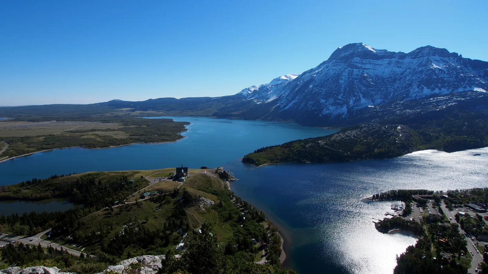
The smallest park in the Canadian Rockies, and the only one where the prairie runs straight into the mountains without foothills.

Photo: Wilson Hui from Calgary, Canada ↗ · CC BY 2.0 ↗

Waterton Lakes at a glance · PDF, 2 pages

Waterton Lakes National Park: landscape and origins

At 505 square kilometres (195 sq mi), Waterton Lakes is the smallest park in the Canadian Rockies, and the only one where the prairie runs straight into the mountain wall without foothills.

The park lies at one of the narrowest points of the Rocky Mountain chain, in the Crown of the Continent ecosystem. The abrupt transition between plains and high mountains produces a diversity of species that the park authority describes as unmatched in Canada for such a small area.

On 30 May 1895 the federal government protected 140 square kilometres (54 sq mi) as Dominion Forest Park, Canada’s fourth national park. Oil had been found here before that: in 1902 the "Original Discovery No. 1" well in the Cameron Valley produced 300 barrels a day, and the oil company’s settlement grew into today’s town.

In 1931 Rotarians from Alberta and Montana met at the Prince of Wales Hotel and voted unanimously to call for an international peace park. In 1932 both countries made it law: the world’s first peace park.

Three more designations have followed since: biosphere reserve in 1979, UNESCO World Heritage Site in 1995 and full certification as a dark sky park in 2021, the first cross-border designation of its kind anywhere.

On 11 September 2017 the Kenow Fire reached the park. It burned about 35,000 hectares, 19,303 hectares of them inside the park boundaries, almost two fifths of its area. The traces are still visible today, and one campground has been closed ever since.

Peace park, World Heritage, biosphere and dark sky park ↗

The park in numbers

Area
505 km² (195 sq mi), the smallest park in the Canadian Rockies
Established
30 May 1895, initially 140 km² (54 sq mi); Canada’s fourth national park
Location
South-western Alberta, on the border with Montana
Peace park
since 1932 together with Glacier National Park, Montana
UNESCO World Heritage
since 6 December 1995, criteria vii and ix
Biosphere reserve
since 1979, Canada’s second
Dark sky park
fully certified in 2021, the first cross-border designation by DarkSky International
Biodiversity
over 250 bird, more than 60 mammal, 24 fish and 10 reptile and amphibian species
Kenow Fire 2017
19,303 hectares burned in the park
Visiting Waterton Lakes: overview and planning

01

Prairie and high mountains with no transition

Waterton lies at one of the narrowest points of the Rocky Mountain chain. The Alberta plains meet the mountain wall here without any foothills, and this abrupt change is why so many species live in such a small area.

Nature and science ↗

02

The smallest park in the Canadian Rockies

505 square kilometres (195 sq mi). For comparison, Banff is about thirteen times as large. Waterton became Canada’s fourth national park in 1895 and started out with 140 square kilometres (54 sq mi) as Dominion Forest Park.

Culture and historic sites ↗

03

Four designations at once

International peace park with Glacier National Park in Montana since 1932, UNESCO biosphere reserve since 1979, UNESCO World Heritage Site since 1995 and a fully certified dark sky park since 2021. Hardly any other park holds so many titles, and each one stands for something different.

Peace park, World Heritage, biosphere and dark sky park ↗

04

Open all year, closed half the year

The park itself is accessible all year. From November to April, however, most facilities in town are closed; heated toilets and running water are then only available at Cameron Falls and at the visitor centre.

Opening hours and visitor centre ↗

02 · Places

Map and places in the park

Almost everything lies within a few kilometres of the town. Every point is verified against an OpenStreetMap object.

Photo: Victor Bustamante ↗ · CC BY-SA 3.0 ↗

Place in the park

Prince of Wales Hotel

The hotel on the rise above the lake is Waterton’s landmark, and the place where the idea of the world’s first peace park was adopted.

Opened
25 July 1927.
Built by
Great Northern Railway; Louis Hill chose the site on the rise in 1913.
Lease
42 years, granted on 1 February 1926.
National historic site
recognised in 1995.
Peace park
On 4 and 5 July 1931, almost a hundred Rotarians from Alberta and Montana resolved here to call for an international peace park.
Historic route
From 1927 by train to Montana, then on the MV International from Goat Haunt across Upper Waterton Lake.

History of the park ↗

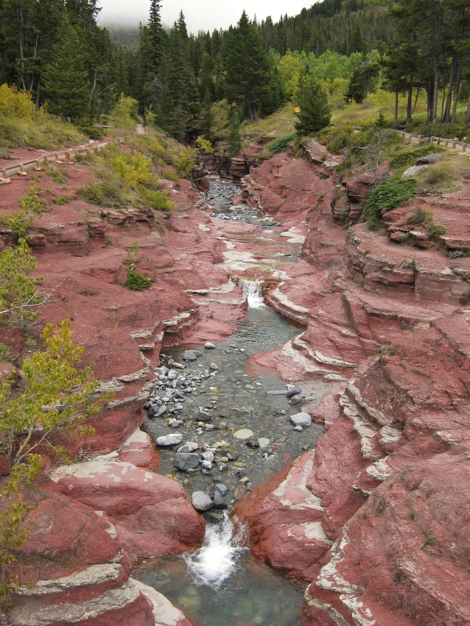
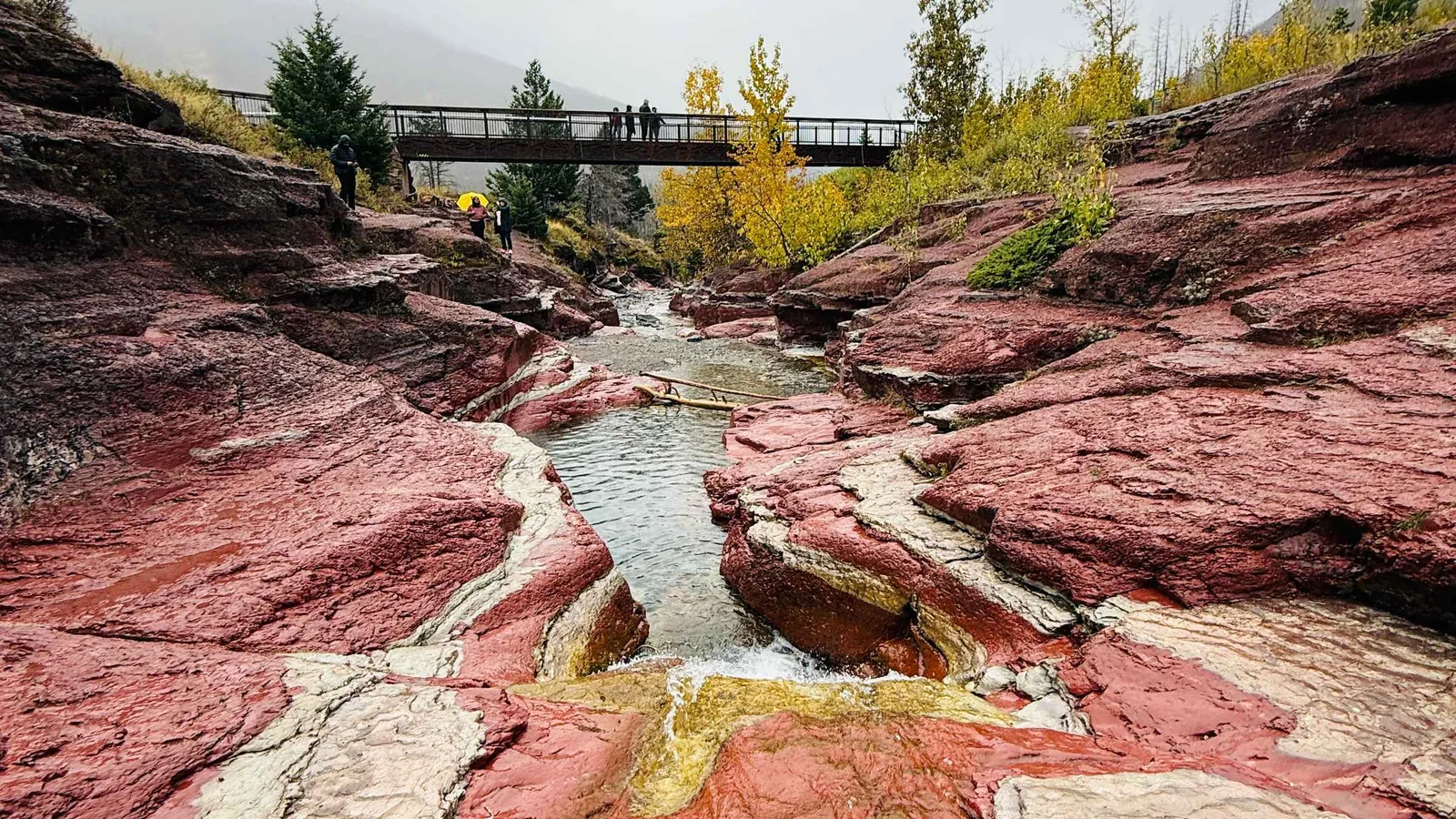
Clear water flowing in Waterton Lakes National Park over the red-coloured rock steps of Red Rock Canyon, conifer forest along the edges
Photo: Mike from Vancouver, Canada ↗ · CC BY-SA 2.0 ↗

Place in the park

Red Rock Canyon

At the end of the Red Rock Parkway, a creek cuts through bright red rock. The contrast of red stone and clear water is the most unusual sight in the park.

Location
At the end of the Red Rock Parkway, in the north of the park.
Access
Short loop trail from the parking lot.
Nearby
The trail to Blakiston Falls starts at the same point.
Road access
Paved, like all major roads in the park.
Fire of 2017
The north of the park lay in the path of the Kenow Fire; the vegetation here is young.

Activities and experiences ↗

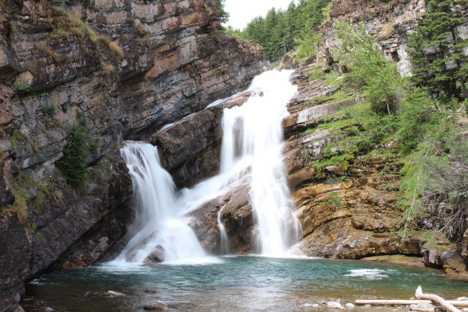
Cameron Falls in Waterton Lakes National Park tumbling in two branches over layered rock into a pool, dense conifer forest all around
Photo: Kkiefuik ↗ · CC BY-SA 4.0 ↗

Place in the park

Cameron Falls

The waterfall is in the middle of town, and in winter it is one of the few places in the park where anything is still open at all.

Location
Right in Waterton Park townsite.
In winter
Heated toilets and running water; otherwise only at the visitor centre.
Visitor centre
404 Cameron Falls Drive, daily 9:00–17:00, closed on 25 December.
Phone
403-859-5133, waterton.info@pc.gc.ca.

Opening hours and visitor centre ↗

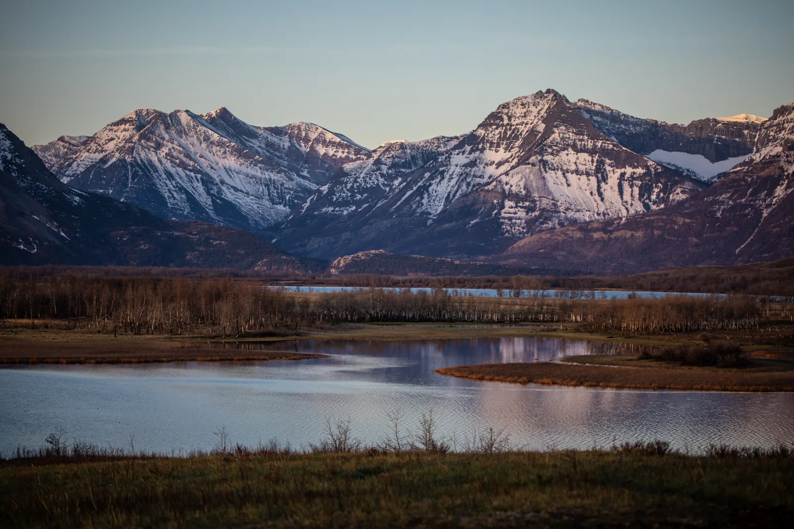
Flat wetland with prairie grass in Waterton Lakes National Park in the foreground, behind it a snow-streaked mountain wall rising abruptly
Photo: GlacierNPS ↗ · Public domain ↗

Place in the park

Where the prairie ends

No other Canadian national park protects so much wildlife in such a small area. The reason is in the landscape: plains and high mountains with no transition.

Ecosystem
Crown of the Continent, 73,000 km² (28,200 sq mi) across Alberta, British Columbia and Montana.
What makes it special
One of the narrowest points of the Rocky Mountain chain.
Birds
over 250 species.
Mammals
more than 60 species.
Fish
24 species.
Reptiles and amphibians
10 species.
Watersheds
The headwaters of three meet in the peace park.

Nature and science ↗

Map

11 places on the map

Almost everything lies within a few kilometres of the town. Every point is verified against an OpenStreetMap object.

Open map3D terrain · details and photos for every place
  • Mountains & rock2
  • Water4
  • Trails1
  • Where to stay2
  • History1
  • Surroundings1

03 · Out and about

Hikes & things to do in Waterton

Short distances to very different places: that is the advantage of a small park.

Photo: Philippe Cabot ↗ · CC BY-SA 4.0 ↗

„Cameron Lake reaches all the way to the border with the United States. There is protected land on both sides, managed as one continuous peace park since 1932.“

Waterton Lakes National Park · Cameron Lake at the end of the Akamina Parkway

Hikes & things to do in Waterton

Red Rock Canyon

A canyon of bright red rock at the end of the Red Rock Parkway, with clear water running through it. The colour comes from iron-rich argillite. It is one of the most unusual places in the park and is reached on a short loop trail.

Activities and experiences ↗

Cameron Lake

At the end of the Akamina Parkway, framed by mountains, with boat rentals and the trailhead of the Carthew-Alderson Trail. The lake reaches all the way to the border with the United States.

Activities and experiences ↗

Boat tour on Upper Waterton Lake

The boat trip across the lake is one of the best-known things to do in the park; historically it ran from Goat Haunt on the US side over to the Prince of Wales Hotel. Before your trip, check whether, and under what conditions, the trip to Goat Haunt is currently possible.

Activities and experiences ↗

Sixteen day-use areas and four red chairs

The park has sixteen designated day-use and picnic areas and four locations with Parks Canada’s red chairs, viewpoints chosen by the park authority itself.

Activities and experiences ↗

No drones

Flying drones for private use is prohibited in the park. The park authority cites fines of up to 25,000 CAD and points out that offences can be prosecuted.

Park authority: Waterton Lakes ↗

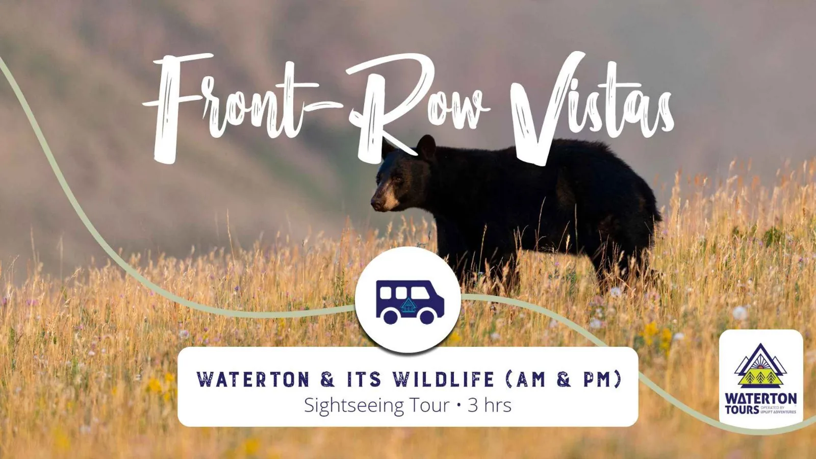
Offer photo: Waterton: Waterton & Its Wildlife Tour

GetYourGuide

Waterton: Waterton & Its Wildlife Tour

Guided tour in the park focused on wildlife watching. Waterton borders directly on Glacier National Park in Montana; together they form the world’s first international peace park.

  • In the park
  • Wildlife watching
  • Guided

Departure Waterton Park; meeting point set by the provider.

Wildlife distance rules apply on guided tours too. Check dates and inclusions with the provider.

View tour ↗Ad · partner link · checked 20 Sep 2026

Provider's product photo · GetYourGuide

Offer photo: Waterton: Red Rock Parkway Highlights by Van

GetYourGuide

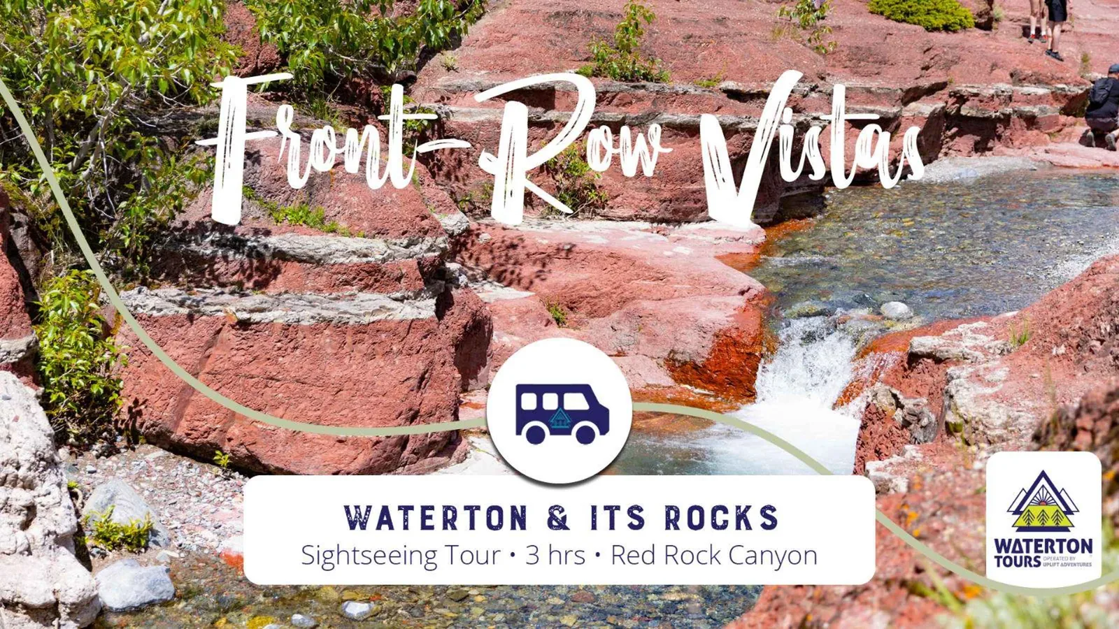
Waterton: Red Rock Parkway Highlights by Van

Drive along the Red Rock Parkway, one of the park’s two spur roads. It leads to Red Rock Canyon with its strikingly red rock.

  • In the park
  • Van
  • Scenic road

Departure Waterton Park; meeting point set by the provider.

The Red Rock Parkway is only open in the summer season. Check dates with the provider.

View tour ↗Ad · partner link · checked 20 Sep 2026

Provider's product photo · GetYourGuide

View from Bear's Hump in Waterton Lakes National Park across Upper Waterton Lake: flat prairie on the left, the snow-streaked mountain wall on the right, the Prince of Wales Hotel on the rise

Waterton Tours · Guided hike · 12.8 km

Waterton: Upper Rowe Lake Hike

A guided day hike with Waterton Tours to Upper Rowe Lake: 12.8 km return with 575 m of elevation gain, along Rowe Creek, across the meadow beyond the Lower Rowe Lakes and up switchbacks to the mountain lake. According to the provider, wildflowers bloom there in July and August and the subalpine larches turn gold at the end of September; bighorn sheep and bears are common in the valley.

  • 6 to 8 hours
  • 12.8 km, 575 m elevation gain
  • Moderate
  • Guided in English

Departure Meeting point in the Waterton Park townsite, where there are toilets. The trail starts 10.5 km up the Akamina Parkway; transport there is not included and, according to the provider, can be added to the booking.

Guide, hiking poles, safety equipment, first aid kit, bear spray and a satellite communication device are included according to the list of inclusions; transport, lunch and snacks, personal gear, the national park pass and gratuities are marked with a cross. There are no toilets along the trail. The tour only runs with at least four participants: if you book alone, your booking stays pending until then or is moved to another date. Under 18s need parental consent, under 15s must be accompanied by an adult. Not suitable for low fitness levels, back or heart problems, reduced mobility or pregnancy. The provider gives the duration as 8 hours in the key details and as 6 to 8 hours in the description. Cancellation up to 24 hours in advance.

View tour ↗Ad · partner link · checked 2 Oct 2026

Landscape image, not a provider photo · Photo: Wilson Hui from Calgary, Canada ↗ · CC BY 2.0 ↗

Ad · we may earn a commission if you book through this partner link. Offer details checked 2 Oct 2026. See official ticket information.

Nature and history of Waterton

Crown of the Continent

Waterton is part of the Crown of the Continent ecosystem, which covers 73,000 square kilometres (28,200 sq mi) in south-western Alberta, south-eastern British Columbia and northern Montana. At this particularly narrow point of the Rockies, unusually varied physical, biological and cultural conditions come together.

Nature and science ↗

More species in less space

The park authority is clear: no other Canadian national park protects so much wildlife in such a small area, and no protected area of similar size in the Rockies has comparable ecological diversity. Fragrant conifer forests, windswept prairie, steep mountains and deep lakes meet here.

Nature and science ↗

The world’s first peace park

On 4 and 5 July 1931, Rotarians from Alberta and Montana met at the Prince of Wales Hotel. Almost a hundred members voted unanimously to call for an international peace park. In 1932 it became law: signed in the USA on 2 May by President Hoover, and in Canada on 16 June. The idea came from the grassroots, not from the governments.

Peace park, World Heritage, biosphere and dark sky park ↗

World Heritage Site since 1995

UNESCO declared Waterton-Glacier International Peace Park a World Heritage Site on 6 December 1995 under two criteria: outstanding natural phenomena and beauty, and ongoing ecological and biological processes. The headwaters of three watersheds lie in the area, which brings very different habitats together in a small space.

Peace park, World Heritage, biosphere and dark sky park ↗

Biosphere reserve and dark sky park

In 1979 the region became Canada’s second biosphere reserve, and Waterton the first Canadian national park in the UNESCO programme: the park as the core zone, surrounded by private ranches and farms as a buffer zone. Full certification as a dark sky park followed in 2021, the first designation of its kind by DarkSky International to span an international border.

Peace park, World Heritage, biosphere and dark sky park ↗

Oil before conservation

In 1902 the first oil flowed at the "Original Discovery No. 1" well in the Cameron Valley, 300 barrels a day. The oil company’s settlement grew into today’s town. As a result the park has two national historic sites within its boundaries: the first oil well in western Canada, recognised in 1968, and the Prince of Wales Hotel, recognised in 1995.

History of the park ↗

04 · Before you go

Park film and places nearby

Photo: Wilson Hui from Calgary, Canada ↗ · CC BY 2.0 ↗

Film by the park authority

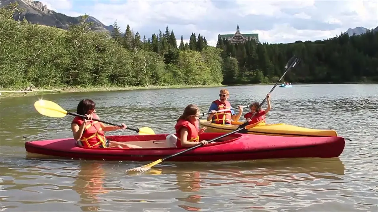
Waterton Lakes, a family experience

Just under a minute of impressions from the park authority: cycling, kayaking, short hikes, horse riding, swimming. Not an information film but a mood piece, and the only one Parks Canada has published about Waterton. In English.

Source: Parks Canada · View channel ↗

Around the park

Lethbridge and Calgary

At 132 kilometres (82 mi), Lethbridge is the nearest larger city; at 271 kilometres (168 mi), Calgary has the nearest international airport. Both have car rental companies.

Directions, distances and border crossings ↗

The surrounding biosphere region

The park is surrounded by a buffer zone of private ranches and farms, and beyond that a wider cooperation area of neighbouring municipalities, towns, First Nations reserves and public land. So protection does not stop at the park boundary.

Peace park, World Heritage, biosphere and dark sky park ↗

Field book · Waterton Lakes National Park

checked 19 Sep 2026

Waterton Lakes at a glance · PDF, 2 pages ↓

00My visit

Nothing saved yet. Every place card has a pin, and so does every place on the Map. What you save collects here, with days, notes and a preview you can share.

01Best time to visit Waterton Lakes

Summer is short and busy, the shoulder season is the better choice, and the weather follows no rules.

July and August are peak season

The park authority explicitly recommends choosing the shoulder season or a weekday: summer weekends are exceptionally busy. If you come in July or August, plan ahead.

Directions, distances and border crossings ↗

Campground: 1 May to 12 October

In 2026 the Townsite Campground runs from 1 May to 12 October, weather permitting. It can be reserved from 8 May to 21 September; before and after that it is first come, first served, with registration at the kiosk. From 1 to 8 May there are no toilets or showers; H-Loop closes on 7 September, B-Loop on 22 September.

Camping and accommodation ↗

Weather you cannot rely on

Daytime highs in spring and summer are between 15 and 30 °C (59 and 86 °F), and at night it can drop below freezing. According to the park authority, rain, snow and hail are possible in every season, so pack warm layers, rain gear, a hat and gloves even in summer.

Camping and accommodation ↗

Winter: open, but empty

From November to April most facilities in town are closed. The visitor centre stays open daily from 9:00 to 17:00, closed only on 25 December. Winter camping is possible at Pass Creek.

Opening hours and visitor centre ↗

The border crossing takes a winter break

The Chief Mountain crossing, 30 kilometres (19 mi) from town and the direct route into Glacier National Park, is seasonal: open from 15 May to 30 September, weather permitting. Carway/Peigan south of Cardston and Roosville south of Fernie are open all year.

Directions, distances and border crossings ↗

Climate through the year

Weather and climate in Waterton Lakes National Park

Best months by the climate data: July and August. Average daytime highs of around 21 °C, lows of around 8 °C, 36 to 42 mm of precipitation a month. The wettest month is June (111 mm), the driest July (36 mm).

Climate chart in Waterton Lakes National ParkAverage daily highs from −6 °C to 21 °C, lows from −14 °C to 8 °C; monthly precipitation from 36 mm to 111 mm.
All monthly values as a table
Monthly averages 2001–2020, NASA POWER model
MonthHigh °CLow °CPrecipitation mm
January−5.3−12.866
February−5.1−13.758
March−1.1−9.370
April4.0−5.170
May11.30.588
June15.74.6111
July20.98.236
August21.07.742
September15.83.455
October7.2−2.362
November−0.8−7.876
December−6.0−13.167
Year801

Modelled values, not a weather station: NASA POWER (MERRA-2) for a grid cell of about 55 × 45 km around the map point Waterton Park (49.05° N, 113.91° W), with an average cell elevation of about 1,630 m. Averages for 2001–2020. Higher ground and valleys can differ markedly.

Source: NASA POWER, climatology 2001–2020 ↗ · retrieved 3 Oct 2026

02How to get there: roads, parking, airports and fuel

A road trip: all roads in and to the park are paved.

Distances to Waterton townsite

Lethbridge 132 km (82 mi), Calgary 271 km (168 mi), Banff 371 km (231 mi), Edmonton 562 km (349 mi). The park authority explicitly names driving as the best way to get here; all major roads in the park and all access roads are paved.

Directions, distances and border crossings ↗

Airports

The nearest airport is Lethbridge, but it only has domestic flights via Calgary. The international airports are Calgary and Edmonton. On the US side there are Glacier Park near Kalispell at 195 km (121 mi) and Great Falls at 323 km (201 mi).

Directions, distances and border crossings ↗

Fuel and charging

In summer there is a petrol station in town, but no diesel. The nearest petrol stations outside the park are in Pincher Creek and Mountain View and are open all year. Five electric vehicle charging points are available in town all year: four at the marina parking lot and one at the public parking lot on Mount View Road.

Directions, distances and border crossings ↗

On to the USA

The Chief Mountain Highway leads 30 kilometres (19 mi) to the border crossing of the same name and on into Glacier National Park. It is only open from 15 May to 30 September. Border post opening hours may differ; check them with the border authorities of both countries before you travel.

Directions, distances and border crossings ↗

A stop on the way

If you drive south from Edmonton or Calgary, you pass the Bar U Ranch, a national historic site on the history of cattle ranching in southern Alberta. The park authority itself recommends it as a stop.

Directions, distances and border crossings ↗

Parking at Cameron Lake and Red Rock Canyon: full early at weekends

In summer, parking lots at popular spots such as Cameron Lake, Red Rock Canyon, Bear's Hump and Emerald Bay often fill by 11 a.m. at weekends. Weekends in July and August are busiest from 10 a.m.; the park authority advises arriving before 10 a.m., in the late afternoon or on a weekday. From 20 June to 7 September 2026 it posts weekend parking status online.

Parks Canada: Parkways and parking lot status ↗

Parking in Waterton village: over 600 stalls

If there is no parking at your chosen destination, the park authority suggests exploring Waterton village first and going to your destination later. The village has over 600 parking stalls, each a short walk from attractions and services.

Parks Canada: Best time to visit ↗

GetYourGuide · offer

Explore Waterton National Park from Calgary: Guided Tour

Day tour from Calgary for anyone travelling without a rental car. Waterton is about two and a half hours’ drive south of the city, right on the border with Montana.

Departure Pick-up at Holiday Inn & Suites Calgary Airport North or Hyatt Regency Calgary (700 Centre St.).

Park admission, transport from Calgary, guide and water are included according to the list of inclusions; meal and personal expenses are marked with a cross. According to the provider, the tour runs from May to October, weather permitting.

View tour ↗Ad · partner link · checked 2 Oct 2026

Ad · we may earn a commission if you book through this partner link. Offer details checked 2 Oct 2026. See official ticket information.

03Tickets & entrance fees

All amounts in Canadian dollars, retrieved from Parks Canada on 19 September 2026.

Daily admission

Adults 12.25 CAD, seniors aged 65 and over 10.75 CAD, family or group 24.50 CAD; a group is up to seven people in one vehicle. Youth aged 17 and under have not paid admission at any Parks Canada place since 2018. Commercial groups pay 10.42 CAD per person.

Parks Canada: fees ↗

Annual pass and Discovery Pass

The annual pass for Waterton costs 60.50 CAD for adults, 51.50 CAD for seniors and 120.75 CAD for a family or group. If you are visiting several parks, look at the Discovery Pass at 83.50 CAD, 71.50 CAD and 167.50 CAD respectively; it is valid at participating Parks Canada places.

Parks Canada: fees ↗

Camping at the Townsite

Fully serviced with water, sewer and electricity 47.25 CAD per night, electricity only 40.00 CAD, unserviced with a site next to your vehicle 34.00 CAD, unserviced walk-in 27.75 CAD. Belly River Campground costs 22.00 CAD, winter camping at Pass Creek 19.50 CAD. Crandell Mountain Campground is closed.

Parks Canada: fees ↗

Backcountry, groups and fishing

Backcountry camping costs 15.00 CAD per person per night and is free for children aged five and under. The group site at Belly River costs 312.50 CAD per night for 25 to 100 people, and a fire permit there 3.75 CAD a day. A fishing permit costs 15.00 CAD a day or 51.25 CAD a year and is also valid in Banff, Jasper, Yoho, Kootenay, Mount Revelstoke and Glacier.

Parks Canada: fees ↗

Regular prices again since 8 September 2026

According to the park authority, 7 September 2026 was the last day of free admission and discounted camping under the Canada Strong Pass. Travel reports from summer 2026 may therefore quote an admission that no longer exists.

Parks Canada: fees ↗

04Where to stay: camping in Waterton

Three campgrounds, and one of them has been closed since the fire.

Townsite Campground

The main campground is right in town, with fully serviced sites, electricity-only sites, unserviced sites and walk-in sites. Season 2026: 1 May to 12 October. It can be reserved from 8 May to 21 September; before and after that it is first come, first served.

Camping and accommodation ↗

Belly River and Pass Creek

Belly River Campground has basic unserviced sites for 22.00 CAD and an exclusive group site for 25 to 100 people. Pass Creek offers winter camping only.

Parks Canada: fees ↗

Crandell Mountain is closed

The park’s third campground is not available. Older guidebooks and blog posts still list it, but the official fee list explicitly marks it as closed.

Parks Canada: fees ↗

Book early

The park authority puts it plainly: Waterton is a popular destination, so always reserve in advance to avoid disappointment. Accommodation outside the campgrounds is handled by the local chamber of commerce.

Camping and accommodation ↗

05Rules: what the park expects of you

Changing weather, wildlife and the after-effects of a very large fire.

Prepared for all four seasons

The park authority gives an explicit packing list for camping: warm layers, a waterproof jacket and trousers, hat and gloves, ground sheet, sleeping pad, warm sleeping bag and extra blankets. Rain, snow and hail are possible at any time.

Camping and accommodation ↗

Bears and other wildlife

Waterton protects an exceptional number of species in a small area: over 250 bird species, more than 60 mammal species, 24 fish species and ten reptile and amphibian species. So know how to behave in bear country and check current warnings before you travel.

Nature and science ↗

Check the wildfire danger

The park authority publishes a continuously updated fire danger rating together with closures, warnings and restricted activities. Check it while preparing your trip, not afterwards.

Safety and rules ↗

The 2017 fire is still visible

The Kenow Fire reached the park on 11 September 2017, raced down the Cameron Valley and spread across the grassland along the access road. In total about 35,000 hectares burned, 19,303 hectares of them in the park, almost two fifths of the park’s area. The park’s buildings were badly damaged.

Wildfires in the park ↗

06Frequently asked questions: Waterton Lakes National Park

How much does it cost to enter Waterton Lakes National Park?

Daily admission costs 12.25 CAD for adults, 10.75 CAD for seniors and 24.50 CAD for a family or group of up to seven people in one vehicle. Youth aged 17 and under pay nothing. The annual pass for Waterton costs 60.50 CAD, and the Discovery Pass, valid across parks, 83.50 CAD.

Parks Canada: fees ↗

When is the best time to visit Waterton?

The park authority explicitly recommends the shoulder season or a weekday, because summer weekends are exceptionally busy. The park is accessible all year, but from November to April most facilities in town are closed.

Directions, distances and border crossings ↗

Can you drive from Waterton to Glacier National Park in Montana?

Yes, via the Chief Mountain border crossing, 30 kilometres (19 mi) from town. It is seasonal, however, and only open from 15 May to 30 September, weather permitting. Carway/Peigan south of Cardston and Roosville south of Fernie are open all year.

Directions, distances and border crossings ↗

What campgrounds are there in Waterton?

The fully serviced Townsite Campground in town, the basic Belly River Campground in the east and winter camping at Pass Creek. Crandell Mountain Campground is closed. Reserve in advance; the park authority explicitly advises it.

Camping and accommodation ↗

Can you still see the 2017 fire?

Yes. The Kenow Fire reached the park on 11 September 2017 and burned 19,303 hectares inside the park boundaries, almost two fifths of its area. It swept down the Cameron Valley and across the grassland along the access road; the park’s buildings were badly damaged.

Wildfires in the park ↗

Why is Waterton called a peace park?

Because Waterton Lakes and Glacier National Park in Montana were jointly declared Waterton-Glacier International Peace Park in 1932, the first in the world. The idea did not come from the governments: almost a hundred Rotarians from Alberta and Montana had adopted it unanimously at the Prince of Wales Hotel in 1931.

Peace park, World Heritage, biosphere and dark sky park ↗

07Sources and updates

All information comes from the park authority and has been checked with a date.

  1. Park authority: Waterton Lakes ↗
  2. Parks Canada: fees ↗
  3. Opening hours and visitor centre ↗
  4. Plan your visit ↗
  5. Directions, distances and border crossings ↗
  6. Activities and experiences ↗
  7. Camping and accommodation ↗
  8. Nature and science ↗
  9. Peace park, World Heritage, biosphere and dark sky park ↗
  10. History of the park ↗
  11. Culture and historic sites ↗
  12. Wildfires in the park ↗
  13. Safety and rules ↗
  14. Parks Canada: Parkways and parking lot status ↗
  15. Parks Canada: Best time to visit ↗

How current is this information?

Researched 19 Sep 2026. Not a live status. Dates apply only to the year stated. A successful automatic fetch is not an editorial confirmation; outdated automatic values are hidden and replaced by the source link.

Current information from the park ↗

Image and map credits

Location sources: Every location verified against an OpenStreetMap object; the object type was checked in each case. Markers do not imply that access is permitted. Base map © OpenStreetMap contributors. Coastlines of the chapter map: Natural Earth.

End of the field book · Park authority ↗