National Parks Atlas
To the park
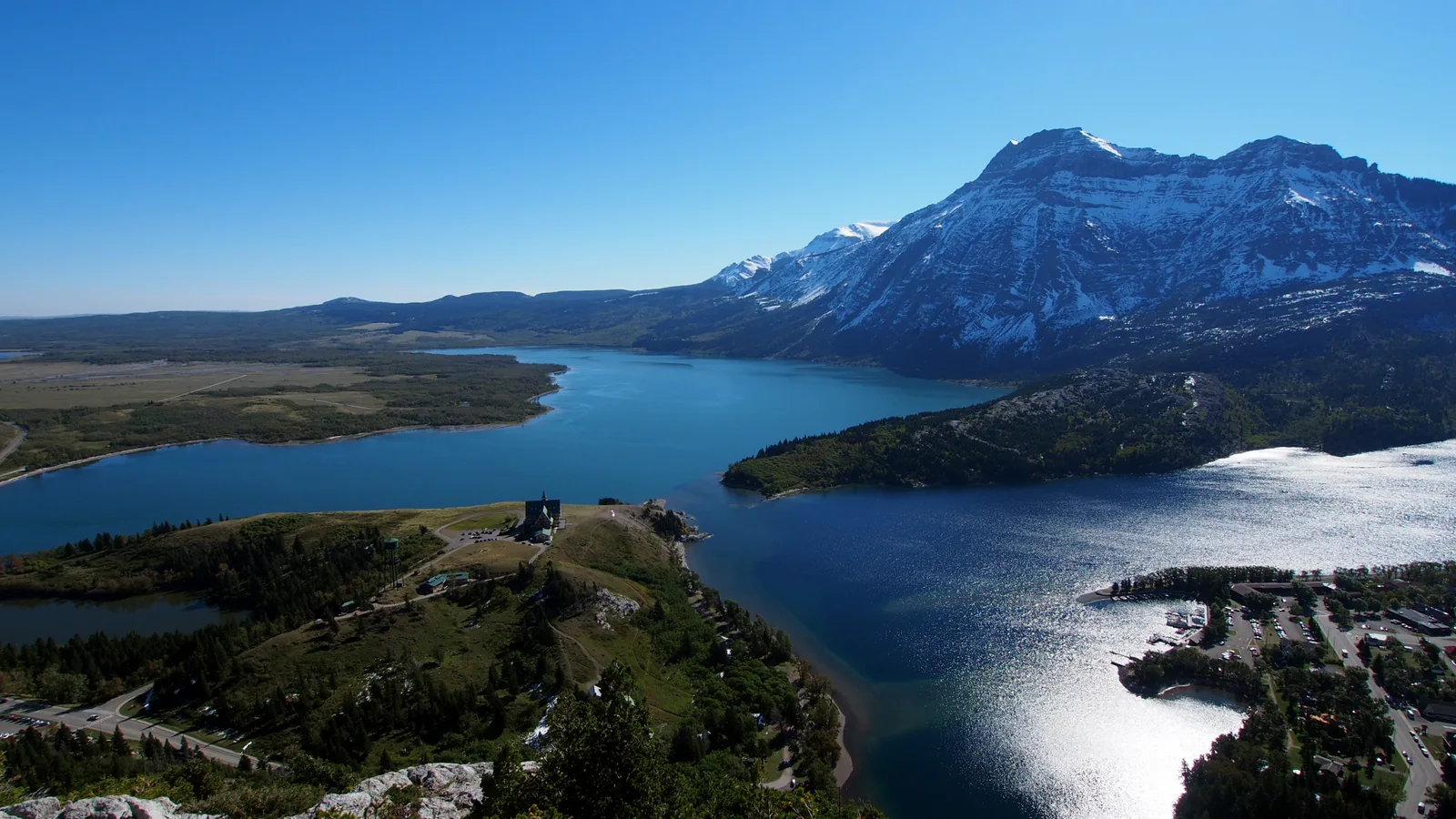
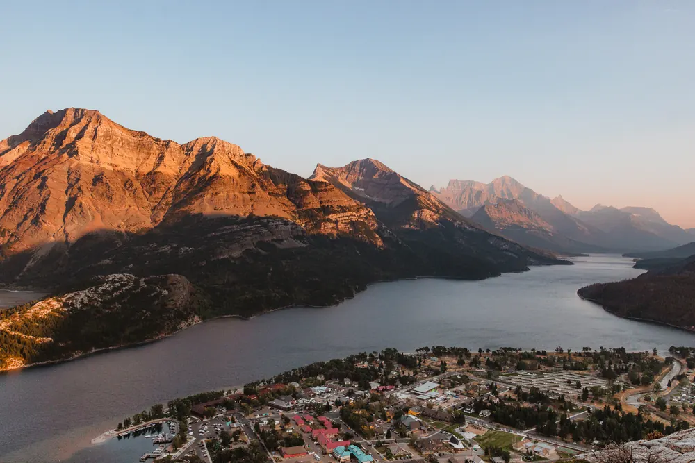
View from Bear's Hump in Waterton Lakes National Park across Upper Waterton Lake: flat prairie on the left, the snow-streaked mountain wall on the right, the Prince of Wales Hotel on the rise

Waterton Lakes National Park: map

11 places with verified coordinates · 9 with photo

Bookable in the park · 4

Ad · partner links: we may earn a commission if you book. Offer details checked 2 Oct 2026; dates and prices with the provider.

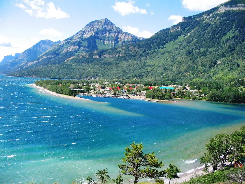
View from the Prince of Wales Hotel in Waterton Lakes National Park of Waterton Park on turquoise Upper Waterton Lake below forested mountains
Photo: Kenneth Hynek from Edmonton, Canada ↗ · CC BY 2.0 ↗

Surroundings · Town in the park

Waterton Park

The town in the park. Visitor centre at 404 Cameron Falls Drive, daily 9:00–17:00, closed on 25 December. From November to April most facilities are closed.

Guided from here · Ad

Partner links: we may earn a commission if you book. Dates and prices with the provider.

Open in OpenStreetMap ↗Location source ↗

49.05092, -113.90702

Where to stay · Campground

Townsite Campground

Main campground in town, season 2026 from 1 May to 12 October. Can be reserved from 8 May to 21 September.

Open in OpenStreetMap ↗Location source ↗

49.04789, -113.91214

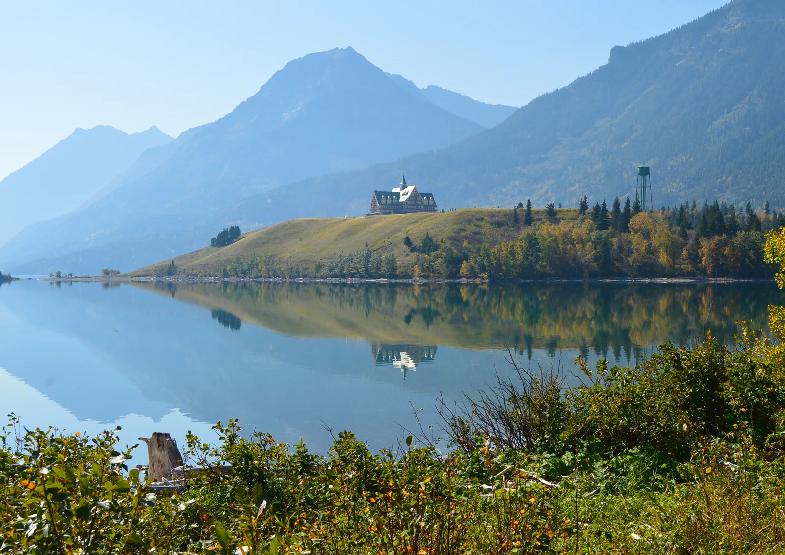
The Prince of Wales Hotel in Waterton Lakes National Park on a rise above the mirror-smooth Waterton lake, mountains behind, autumn shrubs on the shore in front
Photo: Victor Bustamante ↗ · CC BY-SA 3.0 ↗

History · Historic site

Prince of Wales Hotel

Opened on 25 July 1927, a national historic site since 1995. It was here in 1931 that Rotarians from Alberta and Montana resolved to create the world’s first peace park.

The hotel on the rise above the lake is Waterton’s landmark, and the place where the idea of the world’s first peace park was adopted.

Opened
25 July 1927.
Built by
Great Northern Railway; Louis Hill chose the site on the rise in 1913.
Lease
42 years, granted on 1 February 1926.
National historic site
recognised in 1995.
Peace park
On 4 and 5 July 1931, almost a hundred Rotarians from Alberta and Montana resolved here to call for an international peace park.
Historic route
From 1927 by train to Montana, then on the MV International from Goat Haunt across Upper Waterton Lake.

Open in OpenStreetMap ↗Location source ↗

49.05837, -113.90407

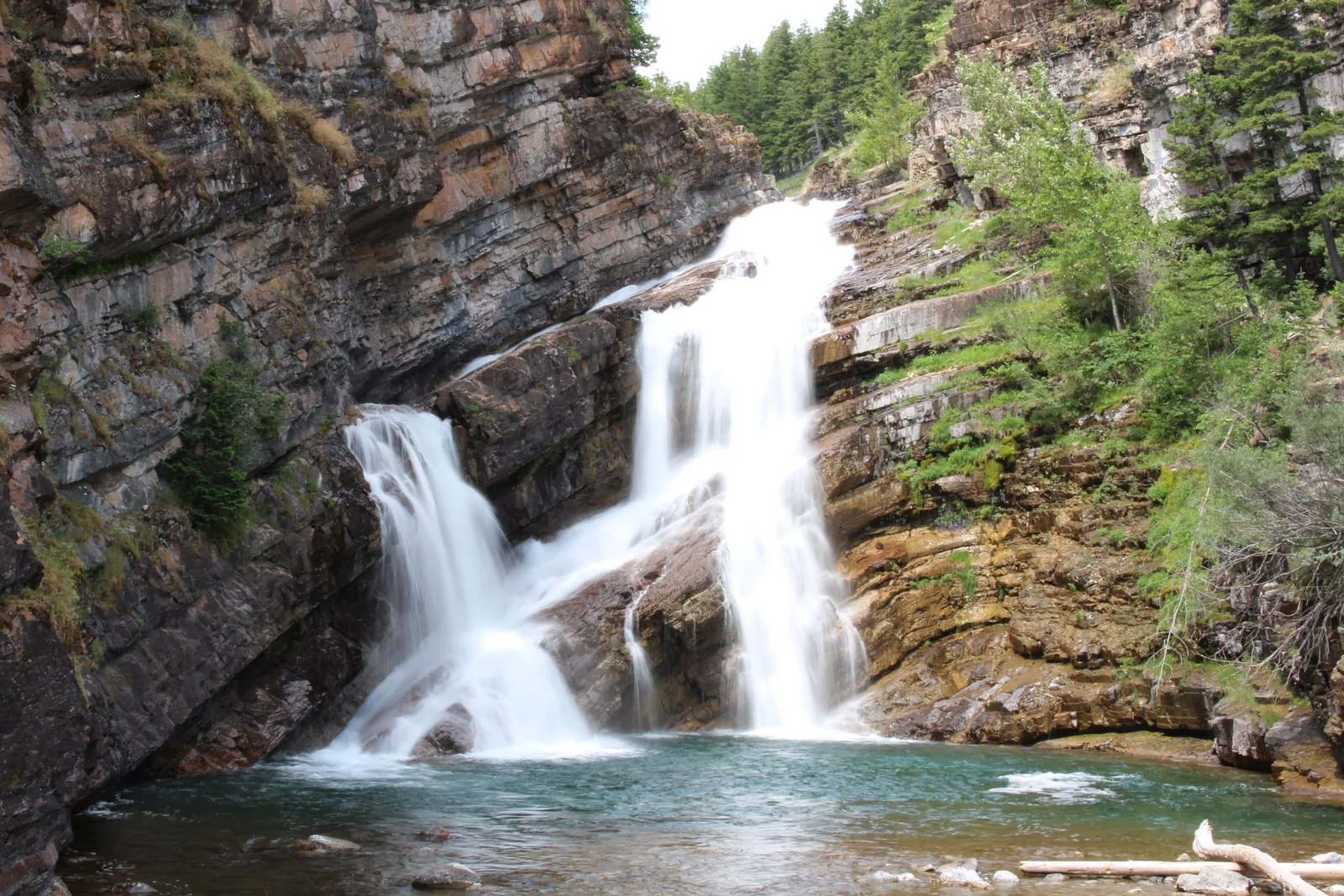
Cameron Falls in Waterton Lakes National Park tumbling in two branches over layered rock into a pool, dense conifer forest all around
Photo: Kkiefuik ↗ · CC BY-SA 4.0 ↗

Water · Waterfall

Cameron Falls

Waterfall right in town. One of the few places with heated toilets and running water even in winter.

The waterfall is in the middle of town, and in winter it is one of the few places in the park where anything is still open at all.

Location
Right in Waterton Park townsite.
In winter
Heated toilets and running water; otherwise only at the visitor centre.
Visitor centre
404 Cameron Falls Drive, daily 9:00–17:00, closed on 25 December.
Phone
403-859-5133, waterton.info@pc.gc.ca.

Open in OpenStreetMap ↗Location source ↗

49.05137, -113.91613

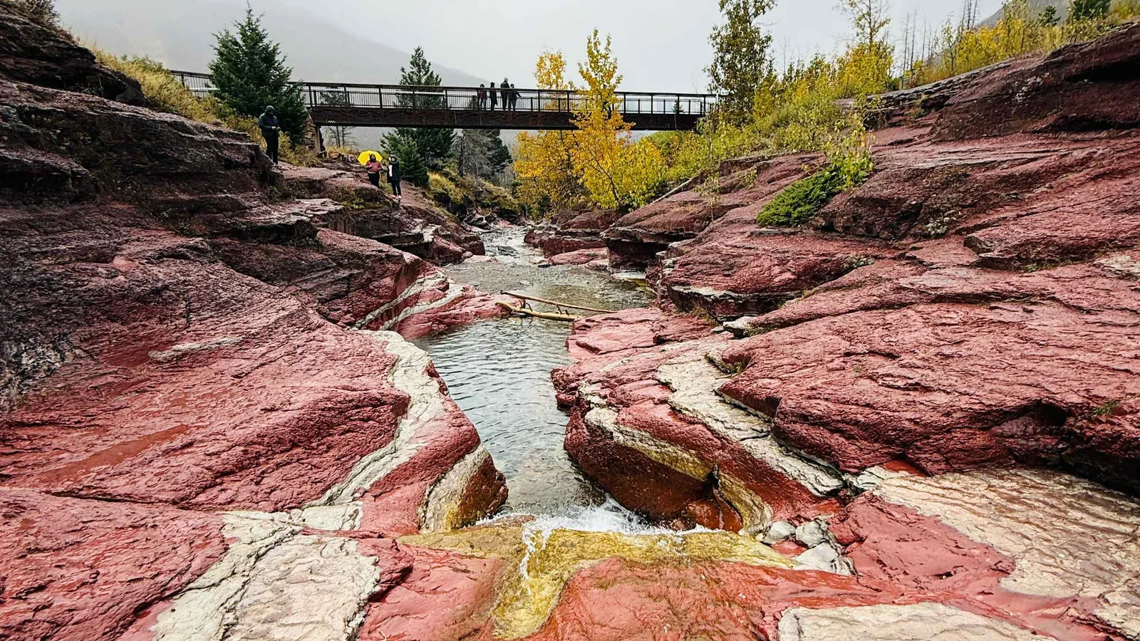
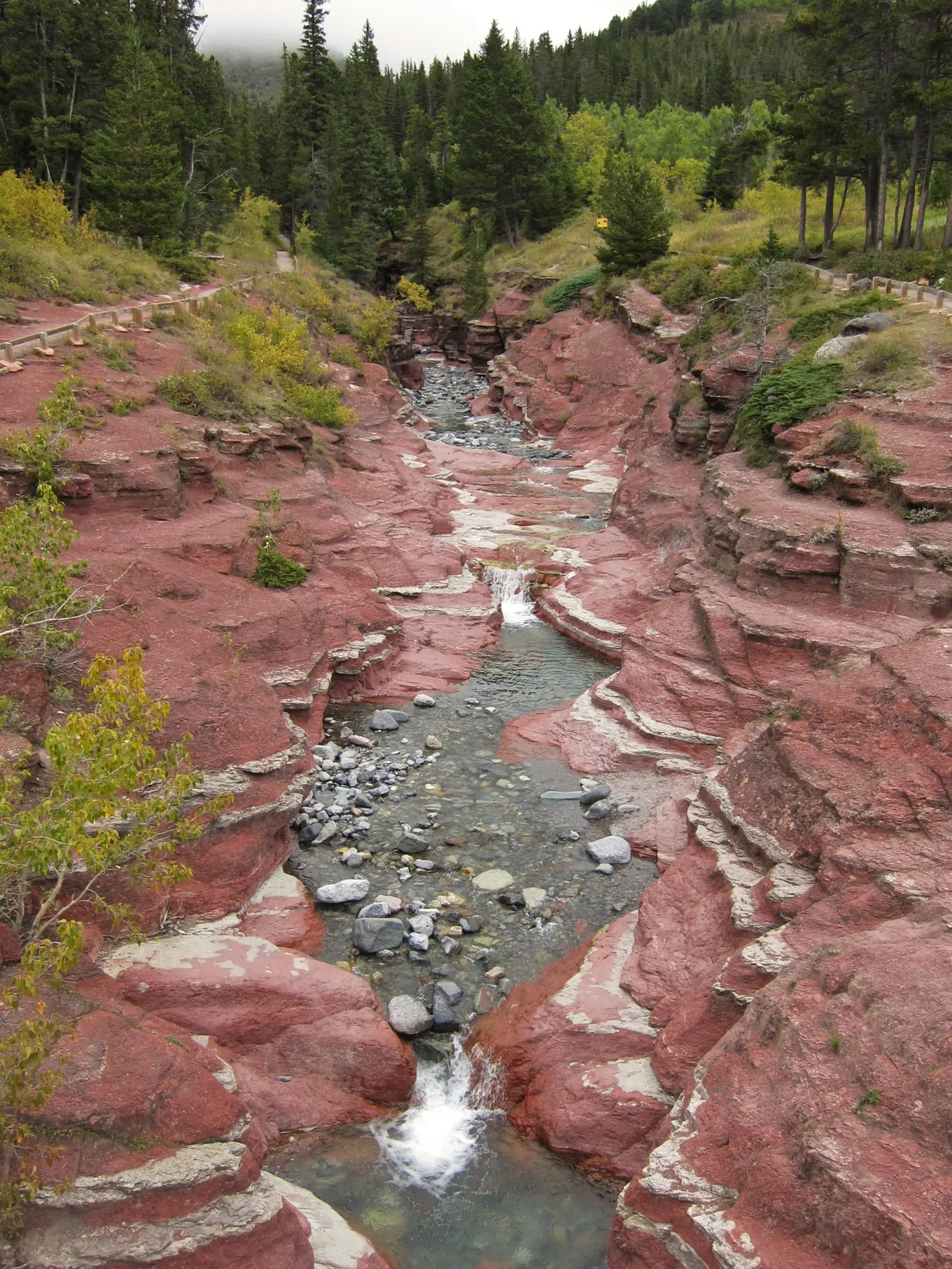
Clear water flowing in Waterton Lakes National Park over the red-coloured rock steps of Red Rock Canyon, conifer forest along the edges
Photo: Mike from Vancouver, Canada ↗ · CC BY-SA 2.0 ↗

Mountains & rock · Canyon

Red Rock Canyon

Canyon of red rock at the end of the Red Rock Parkway, reached on a short loop trail.

At the end of the Red Rock Parkway, a creek cuts through bright red rock. The contrast of red stone and clear water is the most unusual sight in the park.

Location
At the end of the Red Rock Parkway, in the north of the park.
Access
Short loop trail from the parking lot.
Nearby
The trail to Blakiston Falls starts at the same point.
Road access
Paved, like all major roads in the park.
Fire of 2017
The north of the park lay in the path of the Kenow Fire; the vegetation here is young.

Open in OpenStreetMap ↗Location source ↗

49.13219, -114.02618

Where to stay · Campground

Belly River Campground

Basic unserviced campground in the east of the park, 22.00 CAD per night, plus a group site for 25 to 100 people.

Open in OpenStreetMap ↗Location source ↗

49.02505, -113.68672

Locations verified from the linked original sources and OpenStreetMap. The map shows no trails or park boundaries; markers do not imply that access is permitted.

Map: © OpenStreetMap contributors, OpenMapTiles, OpenFreeMap. Elevation: Terrain Tiles (Mapzen, AWS Open Data); 3DEP, GMTED2010 and SRTM courtesy of the U.S. Geological Survey; EU-DEM (Copernicus, European Union); ETOPO1 (NOAA); ArcticDEM (NSF, DigitalGlobe); Geoscience Australia; Open Data Austria (DGM); Open Government Licence – Canada; INEGI; Land Information New Zealand; Kartverket; Environment Agency (UK).

Park photo: Photo: Wilson Hui from Calgary, Canada ↗ · CC BY 2.0 ↗

Loading map …