National Parks Atlas
MapPDF

01 · Canada · Alberta and Northwest Territories · Boreal Plains

Wood Buffalo National Park

Larger than Switzerland, with the world’s largest herd of wood bison, the last natural nesting area of the whooping crane and a sky declared the largest dark sky preserve on Earth.

Photo: Ansgar Walk ↗ · CC BY-SA 2.5 ↗

Wood Buffalo at a glance · PDF, 2 pages

Wood Buffalo National Park: landscape and origins

Wood Buffalo is Canada’s largest national park and one of the largest in the world. It was established in 1922 to protect the free-roaming bison herds of the area.

The park mainly protects part of the Northern Boreal Plains, plus parts of the Southern Boreal Plains and the Northwestern Boreal Uplands. The plain is flat and poorly drained, between 210 and 300 metres (689 and 984 ft) high, and lies on Devonian sedimentary rock: gypsum, rock salt, dolomite and limestone.

Because the rock is permeable and soluble, water seeps away instead of running off above ground. This created karst in the gypsum, salt plains, underground streams, sinkholes and saline creeks. In between lie bogs, meandering rivers, shallow lakes and boreal forest of white and black spruce, jack pine, balsam fir and aspen.

Fire belongs to this forest. The park authority describes it as one of the most important ways the boreal forest renews itself: ash brings minerals into the soil, jack pine needs heat to open its cones, and fireweed is often the first plant to grow back.

Archaeological finds show that people have lived in the area for more than 8,000 years. The communities around the park today are mainly Cree, Chipewyan, Métis and non-Indigenous. It is the traditional territory of the Dene, Cree and Métis.

In 1926 the park was extended beyond the Peace River into the delta to protect bison that had been brought in from the south and had crossed the river.

Natural heritage and World Heritage status ↗

The park in numbers

Established
1922, extended 1926
Area
44,741 to 45,561 km² (17,275 to 17,591 sq mi)
UNESCO World Heritage Site
since 1983
Ramsar sites
two: the Peace-Athabasca Delta and the whooping crane nesting area
Dark Sky Preserve
since 28 June 2013, the largest in the world
Peace-Athabasca Delta
3,900 km², 80 % in the park
2023 fires
929,521 ha, about 20 % of the park area
Beaver dam
almost 800 m (2,625 ft) long, the largest in the world
Indigenous partners
eleven First Nations and Métis communities
Visiting Wood Buffalo: overview and planning

01

Fort Smith is the gateway

The park straddles the border between Alberta and the Northwest Territories, and its administration is based in Fort Smith. The park roads are mainly in the east, with many pull-outs, interpretive trails, a campground and cabins.

About the park ↗

02

After the 2023 fires

In 2023, 929,521 hectares burned in the park, about a fifth of its area. The Wood Buffalo Complex fire affected all hiking trails and the Salt Plains day-use area. Some areas remain closed because of hazard trees and ash pits.

The 2023 wildfires and their effects ↗

03

Check before you go

At the time of our check the park authority reported active fires and keeps a continuously updated list of open and closed areas. The most recent trail closure dates from 28 August 2026. Ask at the Fort Smith visitor centre: 867-872-7960.

Current notices and closures ↗

04

No mobile coverage

The park authority makes a selling point of it: at Pine Lake there is no mobile signal, just starry skies and birdsong. Plan communication and emergencies accordingly; the park authority’s emergency number is 867-872-0404.

Activities and experiences ↗

02 · Places

Map and places in the park

Every point is verified against an OpenStreetMap object.

Photo: Ansgar Walk ↗ · CC BY-SA 2.5 ↗

Place in the park

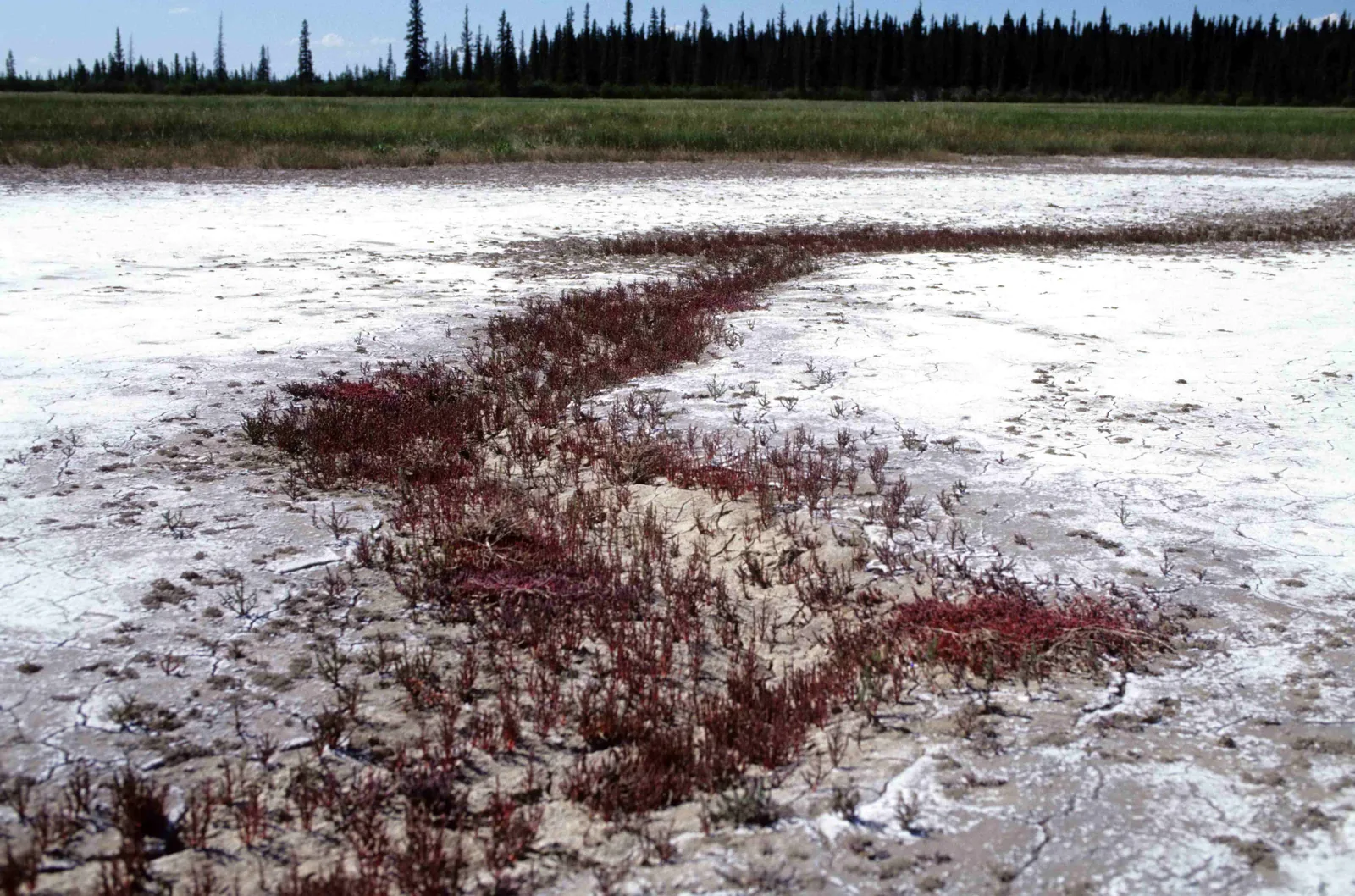
The Salt Plains

White salt crusts, salt mounds and springs in the middle of the boreal forest; unique in Canada, according to the park authority.

Access
350 m steep path from the viewpoint, 700 m there and back.
Experience
barefoot between the salt mounds, a spring at the forest edge.
Wildlife
tracks of cranes, bears and bison; pelicans and swans.
After 2023
the day-use area was affected by the complex fire.
Guided programme
“Fire on the Land” at the viewpoint, on Saturdays in summer 2025.

Hiking trails and trail conditions ↗

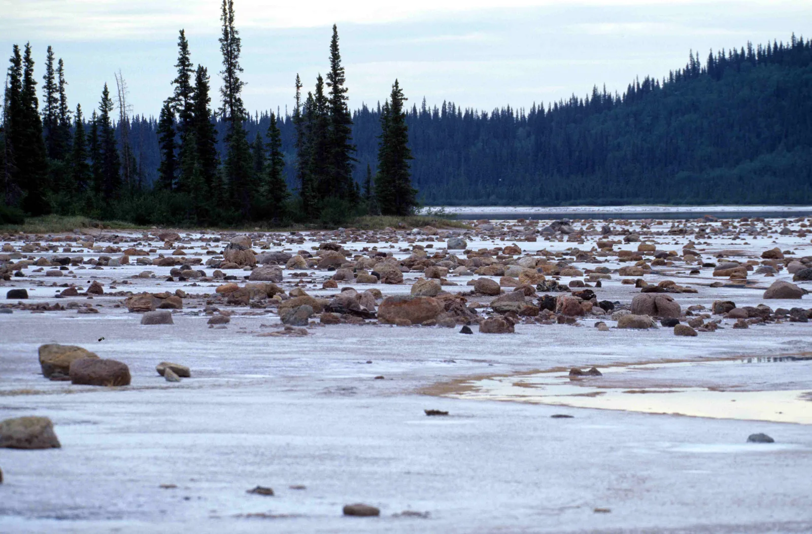
Reddish boulders scattered on a flat, pale salt pan on the shore of Grosbeak Lake in Wood Buffalo National Park, with a fringe of slender spruce and forested hills behind
Photo: Ansgar Walk ↗ · CC BY-SA 2.5 ↗

Place in the park

Grosbeak Lake

A field of boulders shaped by erosion, scattered across a white salt pan; a must, according to the park authority.

Trail
4 km (2.5 mi) loop, moderate.
In winter
Grosbeak Lake loop of the Benchmark Creek Trail, 2.4 km.
As of July 2026
closed because of hazard trees.
Longer hike
Benchmark Creek and Salt Pan Lake as a 15.5 km (9.6 mi) loop, also closed.

Hiking trails and trail conditions ↗

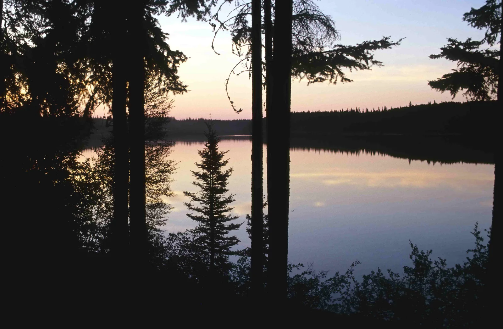
Pine Lake in Wood Buffalo National Park at dusk, silhouetted spruce trunks in the foreground, a pink sky reflected on the smooth water
Photo: Ansgar Walk ↗ · CC BY-SA 2.5 ↗

Place in the park

Pine Lake

A sinkhole full of turquoise water: swimming beach, campground and stargazing spot in one.

Location
60 km (37 mi) south of Fort Smith.
Ice-free
from about mid to late June.
Swimming
usually July to early September; unsupervised, drops off quickly.
Facilities
sandy beach, changing rooms, cooking shelter, playground.
At night
Dark Sky Circle with reclining benches, bats and loons.

Swimming at Pine Lake ↗

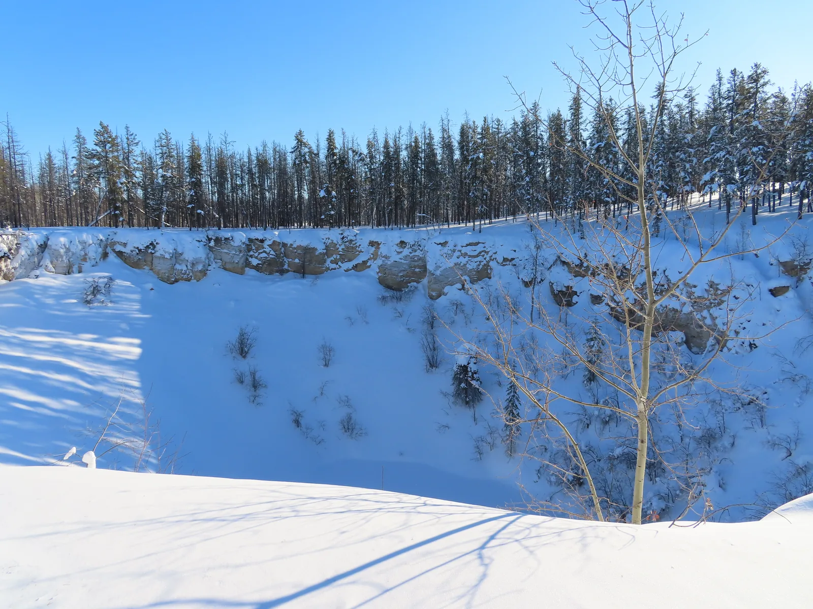
A deep, snow-covered sinkhole in Wood Buffalo National Park with steep walls, bare aspens and conifers at the edge under a blue winter sky
Photo: awmcphee ↗ · CC BY-SA 4.0 ↗

Place in the park

Karst

Soluble gypsum under the forest: the water eats its way down, and the ground collapses.

Rock
Devonian gypsum, rock salt, dolomite and limestone.
Features
sinkholes, underground streams, salt plains, saline creeks.
Karstland Trail
780 m boardwalk; closed because a sinkhole collapsed, new route in progress.
Accessible
the first section of the Karstland Trail at the Salt River Day Use Area.
World Heritage
some of the finest gypsum karst landscapes in North America.

Natural heritage and World Heritage status ↗

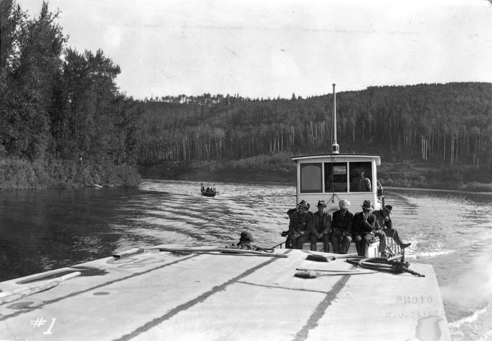
Historic black-and-white photo from Wood Buffalo National Park: a tugboat with men on deck pushes a barge across a river between forested banks
Photo: Provincial Archives of Alberta ↗ · No known copyright restrictions ↗

Place in the park

The bison

The park was established for them, and extended for bison from the south that were brought here by boat.

1922
Established to protect the free-roaming bison.
1926
Extended into the delta for bison from the south.
Today
the largest wood bison population in the world.
Predators
wolves, according to the park authority the largest subspecies of canids in the world.
Viewing
on Pine Lake Road and at Sweetgrass Station in the delta.

History and Indigenous rights ↗

Map

6 places on the map

Every point is verified against an OpenStreetMap object.

Open map3D terrain · details and photos for every place
  • Water2
  • Where to stay1
  • Nature1
  • Surroundings2

03 · Out and about

Things to do in Wood Buffalo

Salt plains, karst lakes, bison by the roadside and a sky without artificial light.

Photo: Ansgar Walk ↗ · CC BY-SA 2.5 ↗

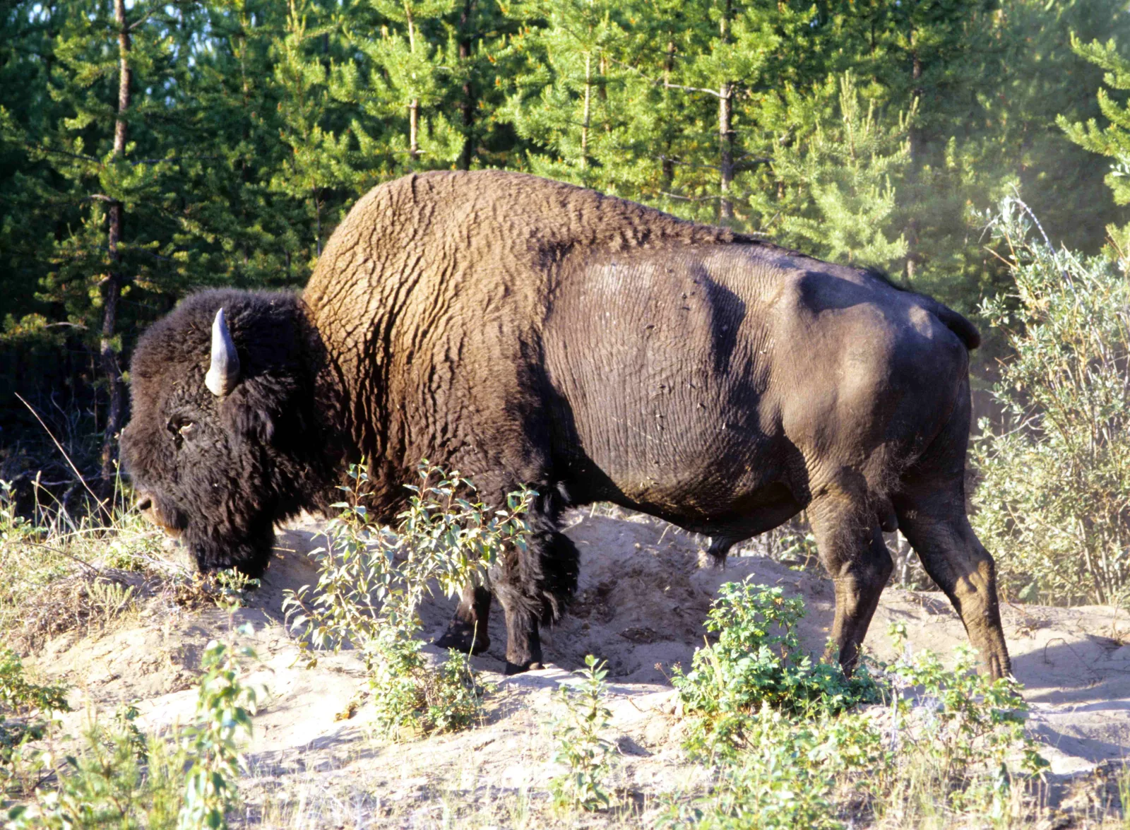
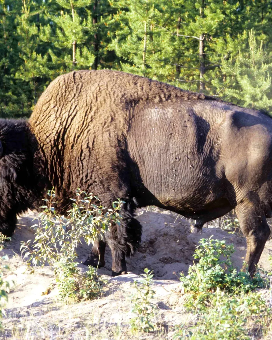
“The largest wood bison population in the world lives here, grazing on the boreal lowlands, always with one eye on the area’s wolves.”

Wood Buffalo National Park · Wood bison in a dust wallow

Things to do in Wood Buffalo

Barefoot across the Salt Plains

A steep path leads 350 metres from the viewpoint down the escarpment to the salt plains. The park authority recommends finding the spring at the forest edge and walking barefoot between the salt mounds. The trail was open at the last update.

Hiking trails and trail conditions ↗

Northern lights in the largest dark sky preserve

Since 28 June 2013 Wood Buffalo has been the largest Dark Sky Preserve in the world. Pine Lake has a “Dark Sky Circle” with reclining benches; the easiest place to reach the sky is the Salt River Day Use Area.

Stargazing and the northern lights ↗

Swimming and paddling at Pine Lake

A water-filled sinkhole with turquoise water and a sandy beach, 60 kilometres (37 mi) south of Fort Smith. Canoes and paddleboards can be rented from mid-May to September at the Fort Smith visitor centre. No lifeguard; the shore drops off quickly.

Swimming at Pine Lake ↗

Wildlife by the road

Bison and bears often walk along the roads or graze in the ditch, bears in May and June often eating dandelions. At Pine Lake a herd often grazes in front of the rental cabins in summer. At the Salt Plains, binoculars are worthwhile for cranes, pelicans and swans.

Wildlife viewing ↗

Garter snakes in spring

At the Salt River Day Use Area, 24 kilometres (15 mi) south of Fort Smith, red-sided garter snakes emerge from their winter dens in late April and early May, the northernmost population of the species.

Salt River Day Use Area ↗

Pine Lake in Wood Buffalo National Park at dusk, silhouetted spruce trunks in the foreground, a pink sky reflected on the smooth water

Thebacha & Wood Buffalo Astronomical Society (TAWBAS), Fort Smith; with Parks Canada and the Town of Fort Smith as contacts · Evening · night sky and northern lights

Dark Sky Festival in Fort Smith on the edge of the world’s largest dark sky preserve · outside the park

When darkness returns after the bright summer nights, Fort Smith celebrates its sky: the local astronomy society holds a festival of several days every year in late August or early September. By day there are talks, hands-on experiments for children and planetarium shows by the park authority; in the evenings there are guest lectures, tours of the observatory in Fort Smith Star Park and stargazing with telescopes, with some luck under the northern lights. The events take place in Fort Smith, on the northern edge of the park; depending on the year, excursions into the park are part of it.

  • several evenings
  • late August or early September
  • in Fort Smith
  • Register with the society

Meeting point Fort Smith: Fort Smith Star Park with the Roberta Bondar Northern Observatory, Northern Life Museum and the Thebacha Campus of Aurora College (2026).

Register through the society’s website, with a pass for all days or for single days. In 2026 the festival ran from 3 to 6 September, with every event in Fort Smith (programme of 2 September 2026: observatory, park authority planetarium shows, evening talks, stargazing until midnight); there were no excursions into the park in 2026. Dates for 2027 have not yet been set. Parks Canada also says on its own page that it holds a dark sky weekend at Pine Lake in the park every August; only the 2025 programme is published there.

Go to the festival website ↗Festival of the Thebacha & Wood Buffalo Astronomical Society · no partner link · checked 2 Oct 2026

Landscape image, not a provider photo · Photo: Ansgar Walk ↗ · CC BY-SA 2.5 ↗

A white, cracked salt crust on the Salt Plains in Wood Buffalo National Park, crossed by a strip of red glasswort, with a flat belt of grass and dark spruce forest behind

Parks Canada, Wood Buffalo National Park · Guided programme · park authority

Park authority guided programmes at the Salt Plains, Salt River and Pine Lake

In summer, Parks Canada interpreters lead programmes at the places you can reach by car: at the Salt Plains viewpoint, the Salt River Day Use Area, Pine Lake and the Fort Smith visitor centre. At the Salt Plains viewpoint a regular guided programme covers fire in the boreal forest, life after the fires and Indigenous knowledge of fire. Groups and families can book private programmes, for example on bison and wolves, on migratory birds such as the whooping crane, on beavers, black bears or the night sky in the dark sky preserve.

  • Guided programme about 1 hour
  • in summer
  • Salt Plains, Salt River, Pine Lake
  • Book at the visitor centre

Meeting point Salt Plains Lookout, Salt River Day Use Area, Pine Lake Day Use Area or Fort Smith visitor centre, 149 McDougal Road.

Private programmes are booked at the visitor centre in Fort Smith (phone 867-872-7960 or by email to the park authority). Only the 2025 programme is published: “Fire on the Land: Life After the Flames” on Saturdays from 14:00 to 15:00 from 5 July at the Salt Plains Lookout, private programmes from 1 June to 31 August; the park authority has not published a programme for 2026. The Town of Fort Smith also offers a guided walk from the visitor centre to the rapids of the Slave River and a town walking tour as part of the same programme. After the 2023 fires several hiking trails were closed.

Park authority page ↗Park authority programme · no partner link · checked 2 Oct 2026

Landscape image, not a provider photo · Photo: Ansgar Walk ↗ · CC BY-SA 2.5 ↗

Nature and history of Wood Buffalo

Why World Heritage

In 1983 Wood Buffalo became Canada’s eighth UNESCO World Heritage Site: for one of the largest free-roaming, self-regulating bison herds in the world, the last natural nesting area of the whooping crane, the Peace-Athabasca Delta, unique salt plains and some of the finest gypsum karst landscapes in North America.

Natural heritage and World Heritage status ↗

The whooping crane

The last natural nesting area of the endangered whooping crane lies in the remote north-central part of the park, a fragile mosaic of marshes, ponds and bogs. It is protected and inaccessible; the best chance of seeing the birds is during migration in spring and autumn.

Wildlife viewing ↗

The delta

At 3,900 square kilometres (1,506 sq mi), the Peace-Athabasca Delta is one of the largest inland freshwater deltas in the world, 80 per cent of it inside the park. It is home to 45 mammal, 214 bird and 20 fish species; migratory birds from all four North American flyways stop here.

The Peace-Athabasca Delta ↗

The world’s largest beaver dam

In the middle of the park, far from any road, a beaver dam almost 800 metres (2,625 ft) long holds back meltwater from the Birch Mountains. It is visible on satellite images; it can only be reached on a hike of several days or by chartered flight.

The world’s largest beaver dam ↗

An unjust founding

When the park was established in 1922, the rights of the Indigenous population were considered extinguished. Only those who were hunting in the park at that time were allowed to hunt; Métis were excluded. The park authority itself calls this history negative and particularly unjust for Indigenous people. Only Supreme Court rulings in 2003 and 2005 changed that; today the park works with eleven Indigenous partners.

History and Indigenous rights ↗

04 · Before you go

Park film and places nearby

Photo: Ansgar Walk ↗ · CC BY-SA 2.5 ↗

Film by the park authority

Highlights of Wood Buffalo National Park

A little over three minutes of footage from Canada’s largest national park and largest World Heritage Site, put together by the staff who know the park best. Parks Canada also calls it the oldest national park in the North. From 2012.

Source: Parks Canada · View channel ↗

Around the park

Fort Smith

Home of the park administration with a visitor centre, open daily in summer from 9:00 to 18:00. From here a guided walk leads to the rapids of the Slave River, the northernmost nesting site of the American white pelican.

Guided programmes ↗

On the river

The Peace, Athabasca and Slave rivers offer wilderness trips for experienced paddlers, and part of the Trans Canada Trail runs on the water. Backcountry permits are available in Fort Chipewyan and Fort Smith.

Paddling ↗

Yellowknife

The capital of the Northwest Territories is about 730 road kilometres (454 mi) away and has direct flights to Fort Smith.

Getting there by road and air ↗

Field book · Wood Buffalo National Park

checked 19 Sep 2026

Wood Buffalo at a glance · PDF, 2 pages ↓

00My visit

Nothing saved yet. Every place card has a pin, and so does every place on the Map. What you save collects here, with days, notes and a preview you can share.

01Best time to visit Wood Buffalo

Midnight sun in June, northern lights from August, and mosquitoes in between.

Camping season

Pine Lake Campground and the Kettle Point group area are open from the Victoria Day long weekend in May to 30 September. The Fort Smith visitor centre is open daily in summer from 9:00 to 18:00.

Camping at Pine Lake ↗

Swimming in July and August

Pine Lake is ice-free from about mid to late June. It usually reaches swimming temperature from July, lasting into early September.

Swimming at Pine Lake ↗

Stars from August

From May to July it hardly gets dark. From August the nights get longer, and the “Dark in the Park” weekend takes place in August. Autumn and winter bring the clearest nights.

Stargazing and the northern lights ↗

Insects

Mosquitoes and other biting insects are most active from late spring into summer, especially near water and at dusk. In spring and late summer, when it freezes at night, there are far fewer.

Mosquitoes and biting flies ↗

Bison rut

From late July to September the bison are in rut and more aggressive. Keep at least 100 metres (328 ft) from bison, bears and wolves, and 30 metres (98 ft) from moose.

Wildlife viewing ↗

Climate through the year

Weather and climate in Wood Buffalo National Park

Best months by the climate data: June to August. Average daytime highs of 20 to 23 °C, lows of 8 to 11 °C, 57 to 69 mm of precipitation a month. The wettest month is July (69 mm), the driest February (17 mm).

Climate chart in Wood Buffalo National ParkAverage daily highs from −20 °C to 23 °C, lows from −28 °C to 11 °C; monthly precipitation from 17 mm to 69 mm.
All monthly values as a table
Monthly averages 2001–2020, NASA POWER model
MonthHigh °CLow °CPrecipitation mm
January−19.7−27.923
February−16.6−26.017
March−9.3−19.126
April2.2−7.729
May14.11.550
June20.28.457
July22.611.169
August20.49.164
September13.83.448
October3.3−3.933
November−10.1−16.625
December−18.0−25.223
Year464

Modelled values, not a weather station: NASA POWER (MERRA-2) for a grid cell of about 55 × 35 km around the map point Pine Lake Campground (59.53° N, 112.23° W), with an average cell elevation of about 270 m. Averages for 2001–2020. Higher ground and valleys can differ markedly.

Source: NASA POWER, climatology 2001–2020 ↗ · retrieved 3 Oct 2026

02How to get to Wood Buffalo: roads and flights

Reachable by road all year, but the distances are northern.

From Yellowknife

Highway 3 south, then Highway 1 to Enterprise, Highway 2 and finally 264 kilometres (164 mi) on Highway 5 to Fort Smith. Altogether that is about 730 kilometres (454 mi).

Getting there by road and air ↗

From Edmonton

North to High Level, on Highway 35 to the Northwest Territories border, then 83 kilometres (52 mi) to Enterprise. From there via Highway 2 and Highway 5 right through the park to Fort Smith.

Getting there by road and air ↗

By air

Direct flights from Edmonton and Yellowknife serve Fort Smith and Fort Chipewyan in Alberta. The park authority still names Northwestern Air Lease; since January 2025 the routes have been flown by Air Tindi.

Cabin Radio: Northwestern Air Lease hands scheduled flights to Air Tindi (18 December 2024, checked 2 October 2026) ↗

Roads in the park

Highway 5 is paved; Pine Lake Road and Moose Island Road are all-weather gravel roads. For Hay Camp Road and Parson’s Lake Road the park authority recommends four-wheel drive, and trailers are not allowed there. Bison often stand on the road.

Road conditions and winter road ↗

Winter road

When the weather allows, a winter road over snow and ice links Fort Smith with Fort Chipewyan and Fort McMurray. The hotline 867-872-7962 gives the current conditions.

Road conditions and winter road ↗

Parking at the day-use areas: Angus, Salt Plains, Pine Lake, Salt River

The four day-use areas Angus, Salt Plains Viewpoint, Pine Lake and Salt River have accessible parking, toilets and picnic tables. On Highway 5 there are also the Nyarling and Whooping Crane pull-outs with wheelchair-accessible information panels.

Accessible facilities ↗

Air Tindi, Yellowknife; successor to Northwestern Air Lease on the routes to Fort Smith and Fort Chipewyan · Getting there by air · scheduled flight

Scheduled flights to Fort Smith and Fort Chipewyan from Edmonton and Yellowknife

The two communities with park visitor centres can only be reached without a long drive by air. Air Tindi flies Dash 8 turboprops several times a week from Yellowknife and Edmonton to Fort Smith in the Northwest Territories and to Fort Chipewyan in Alberta; some flights stop in Hay River on the way. Fort Smith is home to the park administration and the usual starting point for the roads into the park; Fort Chipewyan on Lake Athabasca has no road connection outside winter. From Fort Smith you continue into the park by car.

Meeting point Yellowknife: Air Tindi terminal at Yellowknife airport, 107 Berry Street. Edmonton: Edmonton International Airport. Arrival in Fort Smith (YSM) or Fort Chipewyan (YPY).

Book directly with Air Tindi. According to the schedule from 6 April 2026 to 14 February 2027, Air Tindi flies Yellowknife – Fort Smith – Fort Chipewyan – Edmonton and back on Mondays, Wednesdays and Fridays, additionally Yellowknife – Fort Smith on Tuesdays and Thursdays, and Yellowknife – Hay River – Fort Smith – Edmonton and back on Sundays; the airline reserves the right to make changes and combine flights. Check-in closes 45 minutes before departure. The park authority’s getting-there page still names Northwestern Air Lease; that airline ended its scheduled flights on 16 January 2025, handed them to Air Tindi and has since only flown charters with small Cessna aircraft.

Go to Air Tindi ↗Scheduled flight by Air Tindi · no partner link · checked 2 Oct 2026

03Wood Buffalo fees and permits

All amounts in Canadian dollars, retrieved from Parks Canada on 19 September 2026.

No daily admission on the list

Unlike most parks in the atlas, the Wood Buffalo fee list includes no daily or annual admission. You pay for overnight stays, backcountry permits, fishing permits and rental equipment.

Parks Canada: fees ↗

Camping

A basic site at Pine Lake costs 19.50 CAD per night. The Kettle Point group area costs 6.25 CAD per person per night, minimum two nights, plus a reservation fee.

Parks Canada: fees ↗

Backcountry

Backcountry camping costs 15.00 CAD per person per night or 105.00 CAD for the whole season. The permit is available at the Fort Smith visitor centre or by phone.

Parks Canada: fees ↗

Rent instead of bringing

A canoe costs 51.00 CAD per day, a stand-up paddleboard 50.00 CAD, snowshoes 20.00 CAD, a birdwatching kit 14.00 CAD. Fishing permits cost 15.00 CAD per day or 51.25 CAD per year.

Parks Canada: fees ↗

Drones prohibited

According to the park authority, flying a recreational drone in the park can mean a fine of up to 25,000 CAD.

Park authority: Wood Buffalo ↗

04Where to stay in Wood Buffalo: Pine Lake and backcountry

One campground by the lake, a group area, and free choice of site in the backcountry.

Pine Lake Campground

18 unserviced sites on the shore of the karst lake, including three pull-through and two wheelchair-accessible sites. Fire pits with wood, flush toilets, bear-proof food lockers. The water is not drinkable.

Camping at Pine Lake ↗

Closed since 21 September 2026

The park authority has closed Pine Lake Campground by order: two bear families are feeding on the rich berry crop there, and the closure is meant to avoid disturbance and encounters. The season would have ended on 30 September, so for 2026 it is effectively over. Entering a closed area is an offence.

Current notices and closures ↗

Reserve or turn up

Ten sites can be booked through the Parks Canada Reservation Service, eleven are allocated on arrival: fill in the form at the kiosk, pay in cash or by card, and put the stub on the post.

Camping at Pine Lake ↗

Kettle Point for groups

For eight to 50 people, with a large log cabin with a wood stove, a semi-private beach, fire circle and playground. Reservations open each year on 21 January at 8:00 Mountain Time.

Camping at Pine Lake ↗

Backcountry without fixed sites

With a permit you may camp freely in the backcountry all year: at least 50 metres from water, 100 metres from roads and trails and one kilometre from trailheads. In places the water is muddy or salty.

Backcountry camping ↗

05Rules & safety in Wood Buffalo

Fire, remoteness and large animals: here preparation is part of the visit.

Burned forest

Many trees are still standing after the fire but are weakened or have burned roots and can fall without warning. Ash pits are hard-to-see cavities in the ground where the fire burned underground; they can cause burns.

The 2023 wildfires and their effects ↗

Some trails closed

As of July 2026, Benchmark Creek, Grosbeak Lake, Lane Lake and Salt Pan Lake were closed, Karstland and Lakeside partly. Open were the descent to the Salt Plains and the Salt River Meadows Loop.

Hiking trails and trail conditions ↗

Distance from bison

The park authority requires 100 metres of distance, the length of ten buses, from bison, bears and wolves. If you see animals by the roadside, slow down, stay in your car and drive on. Always keep dogs on a leash.

Wildlife viewing ↗

Reporting fires

Report smoke or fire to the fire service on 867-621-0136. For emergencies call 867-872-0404.

The 2023 wildfires and their effects ↗

06Frequently asked questions: Wood Buffalo National Park

Is there an entrance fee for Wood Buffalo National Park?

The park authority’s fee list includes no daily or annual admission. Costs arise for camping (19.50 CAD per night at Pine Lake), backcountry permits (15.00 CAD per night), fishing permits and rental equipment.

Parks Canada: fees ↗

How do I get to Wood Buffalo National Park?

By road all year: from Yellowknife about 730 kilometres (454 mi) to Fort Smith, from Edmonton via High Level and Highway 5 right through the park. There are direct flights from Edmonton and Yellowknife to Fort Smith and Fort Chipewyan.

Getting there by road and air ↗

Where can I see bison?

Often right by the roads, especially on Pine Lake Road, in summer also in front of the rental cabins at Pine Lake and at Sweetgrass Station in the delta. Keep at least 100 metres away and stay in your car when animals are by the roadside.

Wildlife viewing ↗

Can I see whooping cranes?

Hardly in the nesting area: it lies in the remote north-central part of the park and is inaccessible. Your best chance is during migration in spring and autumn.

Wildlife viewing ↗

When can I see the northern lights?

From May to July it hardly gets dark. From August the nights get longer, and autumn and winter bring the clearest nights. Good viewing spots are the Dark Sky Circle at Pine Lake and the Salt River Day Use Area.

Stargazing and the northern lights ↗

Are the hiking trails open after the fires?

Only partly. As of July 2026 several trails were closed, including Grosbeak Lake and Benchmark Creek. Open were the descent to the Salt Plains and the Salt River Meadows Loop. The park authority keeps the current list.

Hiking trails and trail conditions ↗

07Sources and date checked

The information comes from the park authority, supplemented by individual press reports, and has been checked with a date.

  1. Park authority: Wood Buffalo ↗
  2. About the park ↗
  3. Parks Canada: fees ↗
  4. Getting there by road and air ↗
  5. Road conditions and winter road ↗
  6. Fort Smith and Fort Chipewyan visitor centres ↗
  7. The 2023 wildfires and their effects ↗
  8. Current notices and closures ↗
  9. Mosquitoes and biting flies ↗
  10. Activities and experiences ↗
  11. Camping at Pine Lake ↗
  12. Backcountry camping ↗
  13. Swimming at Pine Lake ↗
  14. Hiking trails and trail conditions ↗
  15. Salt River Day Use Area ↗
  16. Wildlife viewing ↗
  17. Paddling ↗
  18. Stargazing and the northern lights ↗
  19. Snowshoeing in winter ↗
  20. Guided programmes ↗
  21. Natural heritage and World Heritage status ↗
  22. The Peace-Athabasca Delta ↗
  23. The world’s largest beaver dam ↗
  24. History and Indigenous rights ↗
  25. Park management and World Heritage ↗
  26. Accessible facilities ↗
  27. Cabin Radio: Northwestern Air Lease hands scheduled flights to Air Tindi (18 December 2024, checked 2 October 2026) ↗

How current is this information?

Researched 19 Sep 2026. Not a live status. Dates apply only to the year stated. A successful automatic fetch is not an editorial confirmation; outdated automatic values are hidden and replaced by the source link.

Current information from the park ↗

Image and map credits

Location sources: Every location verified against an OpenStreetMap object; object type checked in each case. Markers do not imply that access is permitted. Base map © OpenStreetMap contributors. Coastlines of the chapter map: Natural Earth.

End of the field book · Park authority ↗