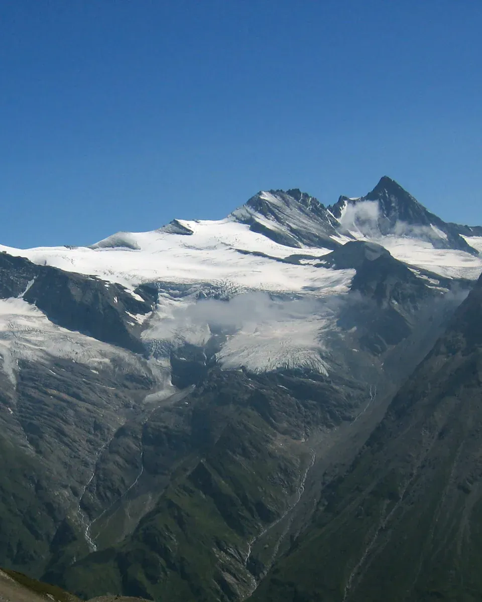


Free and open around the clock
The national park is free and, depending on weather and snow, open around the clock all year. You can enter from many side valleys; most trailheads have car parks with information boards.

01 · Overview · Salzburg, Tyrol, Carinthia
The largest national park in the Alps charges no entrance fee, but the road to the Grossglockner and the trail at the Krimml Waterfalls do.
First momentIf you climb from the valleys at about 1,000 metres (3,281 ft) to the summit of the Grossglockner at 3,798 metres (12,461 ft), you pass, according to the park authority, through every climate zone from Central Europe to the Arctic.
of which 1,213 core zone and 643 outer zone
on the summit of the Grossglockner, from about 1,000 m in the valleys
with a total of 126 km²
national park in Carinthia, 1984 in Salzburg, 1992 in Tyrol
The national park is free and, depending on weather and snow, open around the clock all year. You can enter from many side valleys; most trailheads have car parks with information boards.
The park authority names Mallnitz, Mittersill, Zell am See and Lienz as gateway stations. From there, hiking buses or valley taxis run to the trailheads in many places.
1,856 square kilometres (717 sq mi), of which 1,213 are core zone and 643 outer zone. The park stretches 100 kilometres (62 mi) from west to east and 40 kilometres (25 mi) from north to south, from about 1,000 metres (3,281 ft) to the summit of the Grossglockner.
In Austria, nature conservation is a matter for the federal states. That is why the national park has three laws and three management plans: Carinthia 1981, Salzburg 1984, Tyrol 1992.
The park is managed by three national park authorities, one each in Carinthia, Salzburg and Tyrol; the secretariat of the National Park Council works across all three. General questions go to the council office, questions about one part of the park to the authority of that state.
Hohe Tauern National Park: the three park authorities and the National Park Council ↗
02 · Grossglockner High Alpine Road
The Grossglockner High Alpine Road opened in 1935, decades before the national park. At the Hochtor, at 2,504 metres (8,215 ft), it passes through a short tunnel from Salzburg into Carinthia, and the protected area begins right beside the road. The toll is charged by the road operator, not by the park.
Scenic road since 1935
The scenic road across the main Alpine ridge: a toll road, open only in the summer half of the year.
Grossglockner High Alpine Road: driving safety ↗
Grossglockner High Alpine Road: toll, season & opening times →
What the road costs
A day ticket costs €46.50 for a car, €40 for an electric car and €36.50 for a motorcycle. If you enter after 18:00, a car pays €36.50. With the day ticket you can use the road as often as you like on the same day.
If you only want to go as far as the Kaiser-Franz-Josefs-Höhe or just drive through, you pay the same day rate. The motorway vignette is not valid on the road.
Grossglockner High Alpine Road: frequently asked questions ↗
From 15 September until the end of the season there is an autumn ticket for five consecutive days: €65 for a car, €58 for an electric car or motorcycle, sold only at the toll booth.
Driving in the mountains
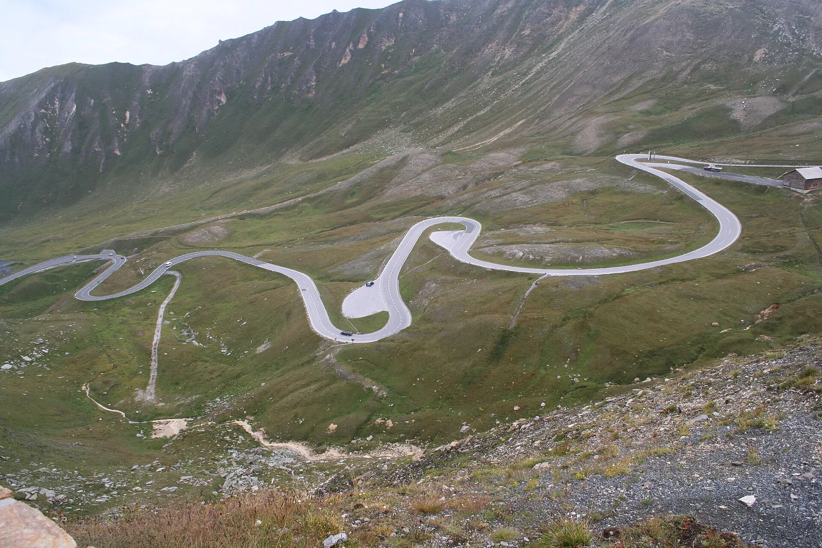
The Grossglockner High Alpine Road climbs through 36 hairpin bends to the Kaiser-Franz-Josefs-Höhe at 2,369 metres (7,772 ft); at the Hochtor, at 2,504 metres (8,215 ft), it crosses from Salzburg into Carinthia. The operator enforces a 70 km/h speed limit and advises using first or second gear downhill.
Motorhomes up to 3.5 tonnes pay the car rate on the High Alpine Road. Camping along the road is prohibited by the authorities, and there are no campsites on it.
When it is open
The Grossglockner High Alpine Road is open from early May to early November. In winter it is closed because of the amount of snow.
Grossglockner High Alpine Road: frequently asked questions ↗
Until 31 May it is open from 6:00 to 20:00, from June to August from 5:30 to 21:00, and from September from 6:00 to 19:30. Last entry is 45 minutes before closing. Outside these hours a night driving ban ordered by the authorities applies, even with a season ticket.
Beside the road
The protected area begins immediately beside the High Alpine Road. Drones are prohibited there, as is flying over or filming people and vehicles; only the national park can grant a special permit. For the same reason you may not spend the night in your car or motorhome along the road.
Grossglockner High Alpine Road: frequently asked questions ↗
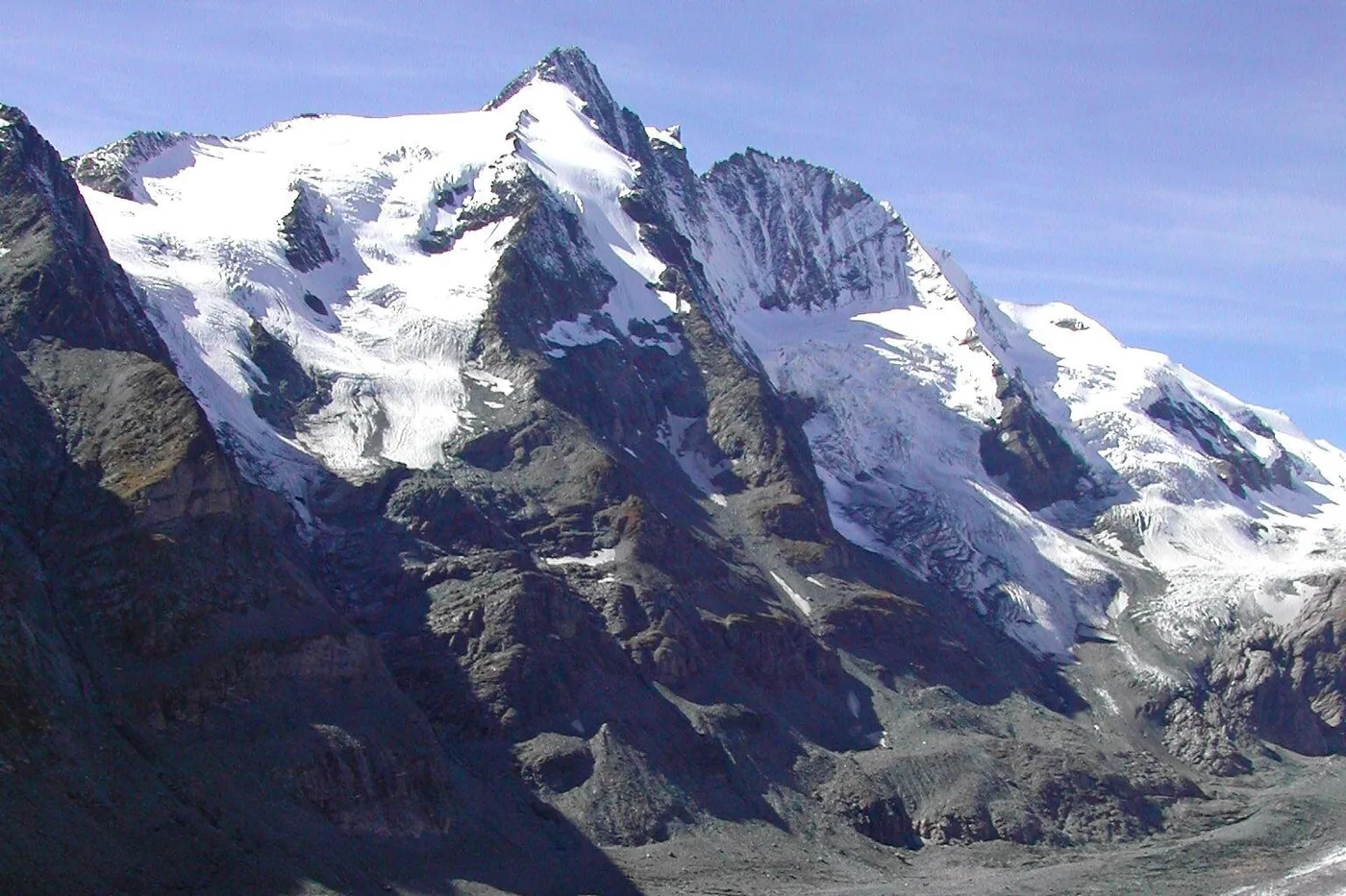
Bob's Special Tours · Viator
Eight to nine hours in a private vehicle from Salzburg over the Grossglockner High Alpine Road to the Kaiser-Franz-Josefs-Höhe, the viewpoint facing the Grossglockner and the longest glacier in the Eastern Alps. There is time for the national park exhibition and lunch at the mountain restaurant.
Departure Pick-up from hotels in the city of Salzburg.
According to the inclusions list, private transport in an air-conditioned vehicle and the road toll are included; food, drinks and tips are not. Starts and ends in the city of Salzburg. Free cancellation up to 24 hours before departure.
View tour ↗Ad · partner link · checked 27 Sep 2026
Provider's product photo · Viator
03 · Kaiser-Franz-Josefs-Höhe and Kals
At the Kaiser-Franz-Josefs-Höhe, 2,369 metres (7,772 ft) up, you stand face to face with the Grossglockner, with the Pasterze, the largest glacier in the Eastern Alps, below you. The exhibition in the park authority's information centre is free. From the south, the Ködnitz Valley near Kals takes you close to the mountain.
At the foot of the highest mountain
Austria's highest mountain above the largest glacier in the Eastern Alps, and the glacier is shrinking.
Dazu passt From Salzburg: private day trip on the Grossglockner High Alpine RoadFrom Kals
From the Lucknerhaus in Kals, the path to the Lucknerhütte is an easy hike; after that it gets demanding. Around the summit block you can watch ibex, marmots and golden eagles.
04 · Glaciers and climate
The Pasterze has been measured every year since 1879. Between 2006 and 2016 its tongue lost about 40 metres (131 ft) a year; where the ice retreats, it leaves moraines that plants and animals have to colonise anew.
is the area of the Pasterze, the largest glacier in the Eastern Alps
is the length of its glacier tongue
retreat of the tongue per year, 2006 to 2016
the change in length has been measured every year
Glaciers and water
The largest glacier in the Eastern Alps covers about 16 square kilometres (6.2 sq mi), and its tongue is four kilometres (2.5 mi) long. It has been measured since 1879; between 2006 and 2016 the tongue lost about 40 metres (131 ft) a year.
The park has more than 300 peaks over 3,000 metres (9,843 ft), 332 glaciers covering 126 square kilometres (49 sq mi) in total and 279 streams, 57 of them glacier-fed. The park authority gives different figures for the number of mountain lakes: 551 on its page “The national park in figures”, “around 500” on its page “Glaciers and water”.
When the ground thaws
Where permafrost thaws because of climate change, rock becomes unstable; the park authority names the Sattelkar in the Obersulzbach Valley and the rock glacier in the Dösen Valley as examples.
The rock beneath
The highest peaks are made of rock that otherwise lies in the deepest layers of the Alps. The window stretches 160 kilometres (99 mi) from the Brenner to the Katschberg.
05 · The waterfalls in the west
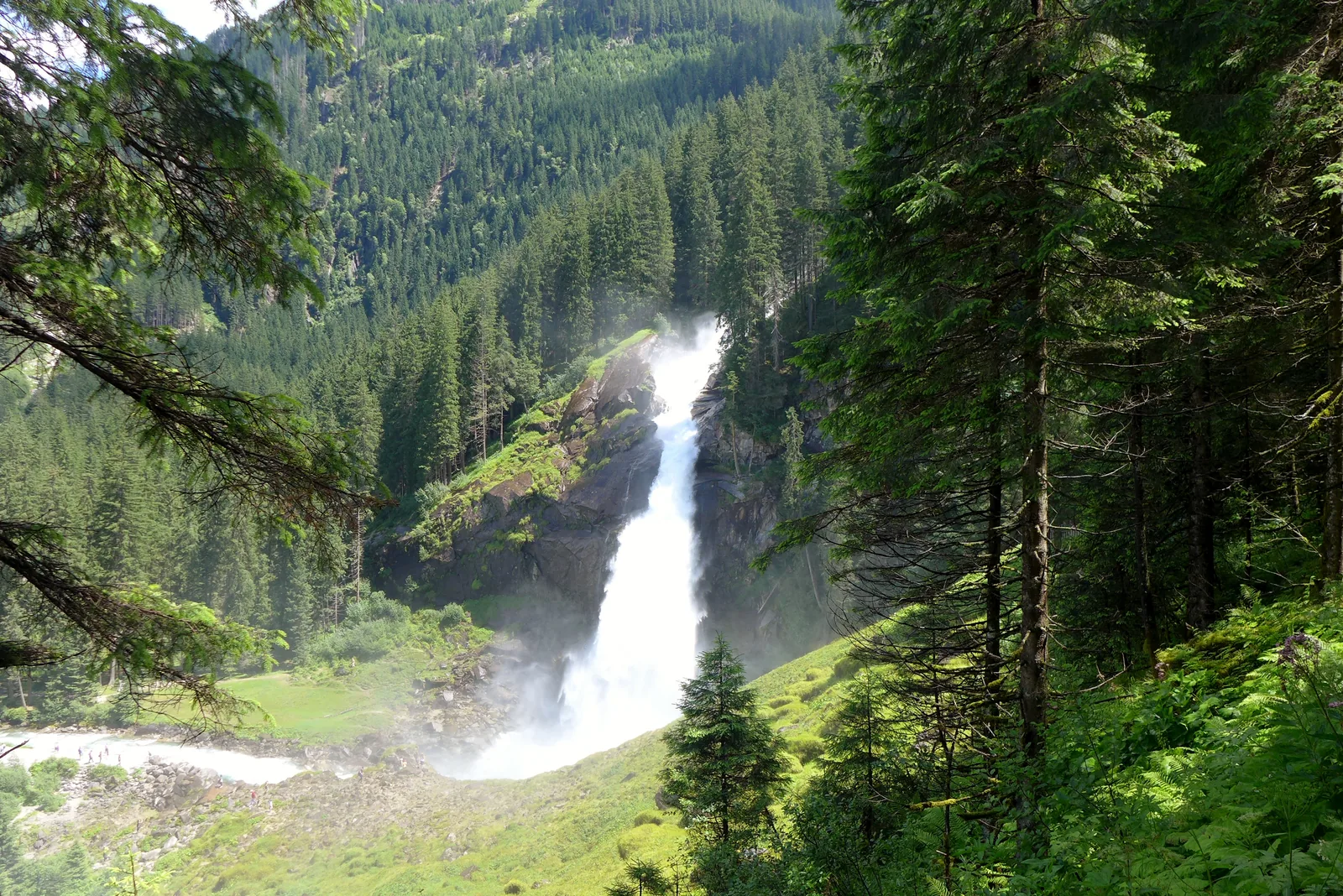
380 metres (1,247 ft) in three tiers. Because meltwater takes nine to twelve hours to flow from the glacier to the falls, the Krimmler Ache carries the most water between 21:00 and 24:00.
Three tiers, 380 metres
Three tiers, 380 metres (1,247 ft), and more water in the evening than in the morning.
Dazu passt From Salzburg: private day trip to the Krimml WaterfallsThe trail beside the falls
From the car park it takes 10 to 15 minutes to reach the lowest fall. The zigzag path from 1900 continues to the highest fall, about one hour and 15 minutes. The trail is barrier-free as far as the Kürsingerplatz.
When to go and what it costs
In June and July the Krimmler Ache carries 30 to 40 times as much water as in February. Because meltwater takes nine to twelve hours to flow from the glacier to the falls, the flow peaks between 21:00 and midnight (24:00).
The trail fee for the waterfall trail is €9 for adults and €4.50 for children aged 6 to 15. Combined with the Krimml WasserWelten, the combination ticket costs €15.90.
Krimml Waterfalls (Austrian Alpine Club, Warnsdorf-Krimml section): tickets ↗
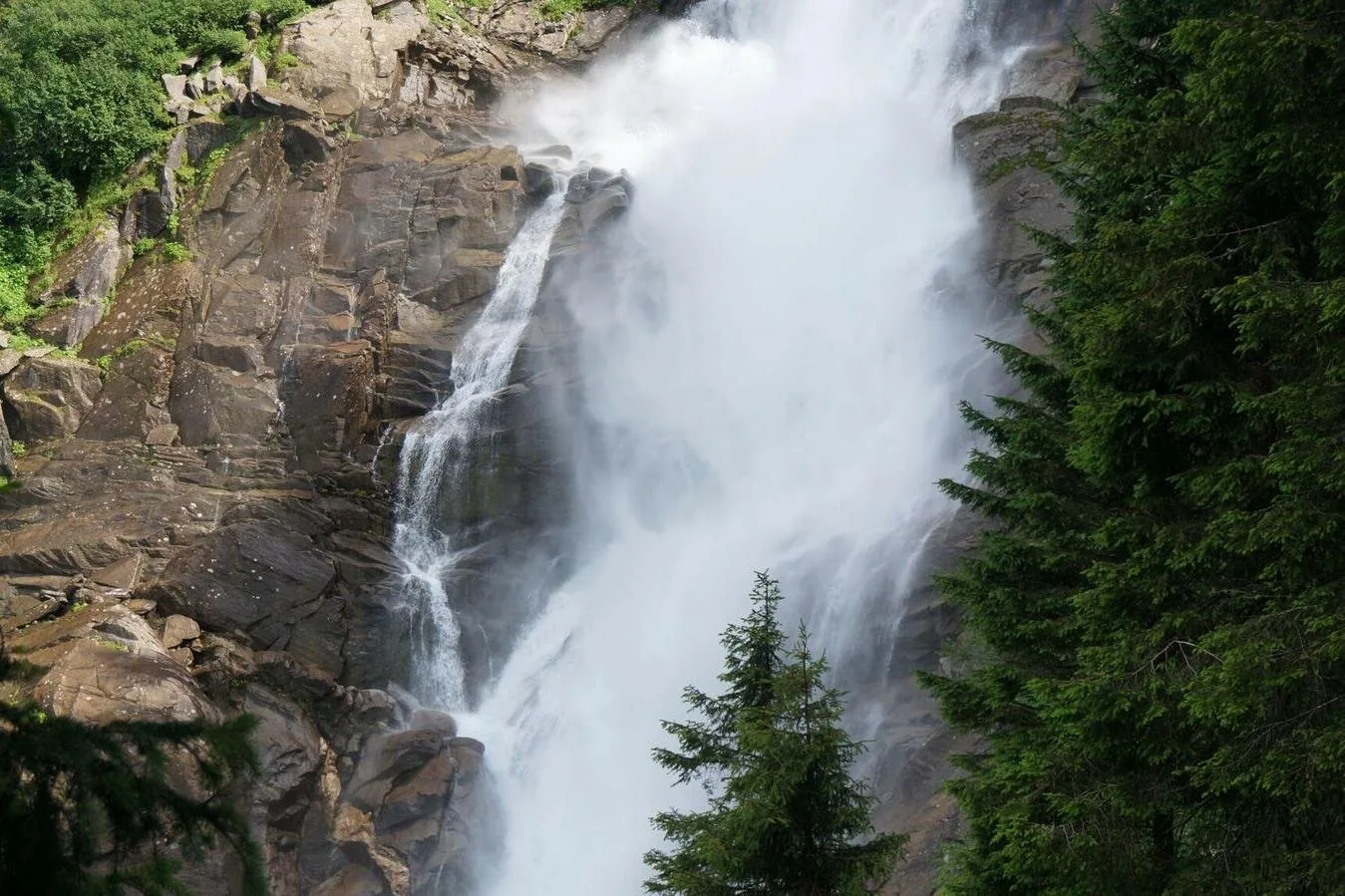
Salzburg Panorama Tours GmbH · Viator
Eight hours with a driver-guide from Salzburg to the Krimml Waterfalls. On site, an easy zigzag path with several viewing platforms leads up beside the falls.
Departure Pick-up at your hotel in Salzburg, otherwise at the Panorama Tours kiosk on Mirabellplatz.
Included are a driver-guide, pick-up and return and, according to the provider, admission to the waterfalls; food and drink are not. Starts and ends in the city of Salzburg. Free cancellation up to 24 hours in advance.
View tour ↗Ad · partner link · checked 27 Sep 2026
Provider's product photo · Viator
06 · Gschlöss Valley and Virgen Valley in East Tyrol
In the Gschlöss Valley in East Tyrol, the glacier trail climbs about 500 metres (1,640 ft) from the alpine hamlet of Innergschlöss to the Salzbodensee and continues to the glacier gate of the Schlatenkees at the foot of the Grossvenediger, into the heart of the core zone. Near Prägraten, the Isel tumbles over the Umbal Falls.
“The national park is free and, depending on weather and snow, open around the clock all year. You pay for roads, trails and car parks, not for nature.”
Hohe Tauern National Park · Schlatenkees on the Grossvenediger
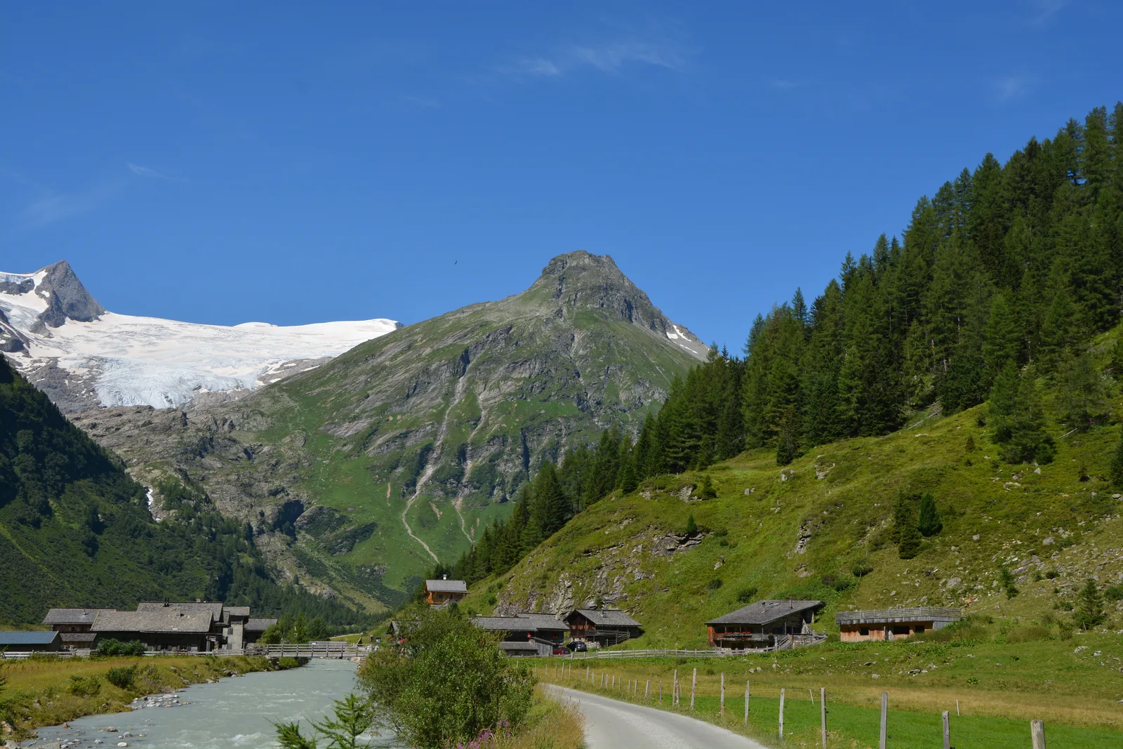
The glacier trail
An alpine hamlet at the head of the valley and a glacier trail into the heart of the core zone.
On the glacier trail
From the Matreier Tauernhaus you walk into Innergschlöss, then climb about 500 metres (1,640 ft) to the Salzbodensee and continue almost on the level to the glacier gate of the Schlatenkees at the foot of the Grossvenediger.
The Innergschlöss glacier trail can be walked from late June to early September.
The Innergschlöss glacier trail has no information boards along the way. According to the park authority, you need the Austrian Alpine Club's natural history guide of the same name.
Trails and emergency numbers
Trails are signposted in yellow throughout. Red mountain trails have narrow, steep sections with fixed safety aids; black ones require alpine experience, sure-footedness and a head for heights. Alpine routes are unsecured, with a risk of falling.
Alpine emergency number of the mountain rescue: 140. Ambulance and emergency helicopter: 144.
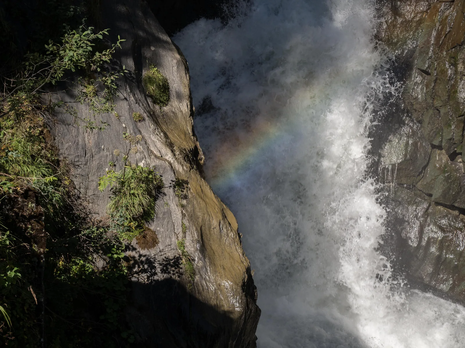
Cascades of the Isel
The Isel tumbles over smoothly polished greenstone: a glacier stream at full force.
From the Ströden car park in Hinterbichl, a water trail with viewing platforms follows the cascades of the Isel: about eight kilometres (5 mi) and three hours there and back.
The visitor centre in East Tyrol
The “Tauernblicke” exhibition in East Tyrol is free; in 2026 it hosts a special exhibition on the Grossvenediger.
07 · Wildlife: ibex, bearded vulture, marmot
The park authority calls the golden eagle, bearded vulture, chamois, ibex and marmot the Big Five of the Hohe Tauern. The ibex returned after a reintroduction in the 1960s, the bearded vulture from 1986 via the Krumltal valley near Rauris.
Back in the Hohe Tauern
After a reintroduction in the 1960s, about 1,100 ibex live in the park again. A male can weigh more than 90 kilograms (198 lb) and carry horns up to one metre long; soft pads with hard rims on its hooves make it a climber on rock.
The reintroduction of the bearded vulture, with a wingspan of up to 2.9 metres (9.5 ft), began in 1986 in the Krumltal valley near Rauris. In addition, about 40 pairs of golden eagles breed in the park.
Since the first release in 1986 in the Krumltal valley near Rauris, more than 260 young bearded vultures have been released in the Alps, 63 of them in Austria (as of 2026). In 2010 the first bearded vulture born in the wild in Austria hatched in the Krumltal; it is named Kruml after the valley.
Hohe Tauern National Park: 40 years of bearded vulture reintroduction ↗
Where to see them
At the Kaiser-Franz-Josefs-Höhe, marmot colonies live above the parking deck, along the path to the “Kristall” observation post. Ibex are most likely to be seen there in the morning. In May and October the marmots may still be, or already be, hibernating.
Grossglockner High Alpine Road: frequently asked questions ↗
Consideration
Throughout the national park: stay on the trails and keep dogs on a lead. Flowers, insects and minerals stay where they are; you carry your rubbish back down to the valley yourself.
08 · Seebach Valley, Rauris, Sulzbach valleys
Not every way into the park leads over the Grossglockner road. Near Mallnitz you head into the Seebach Valley, in Rauris through a rockfall forest with about 80 pools, lakes and bogs, and the 6,728 hectares of the Sulzbach valleys have been recognised as a wilderness area in IUCN category Ib since 2019.
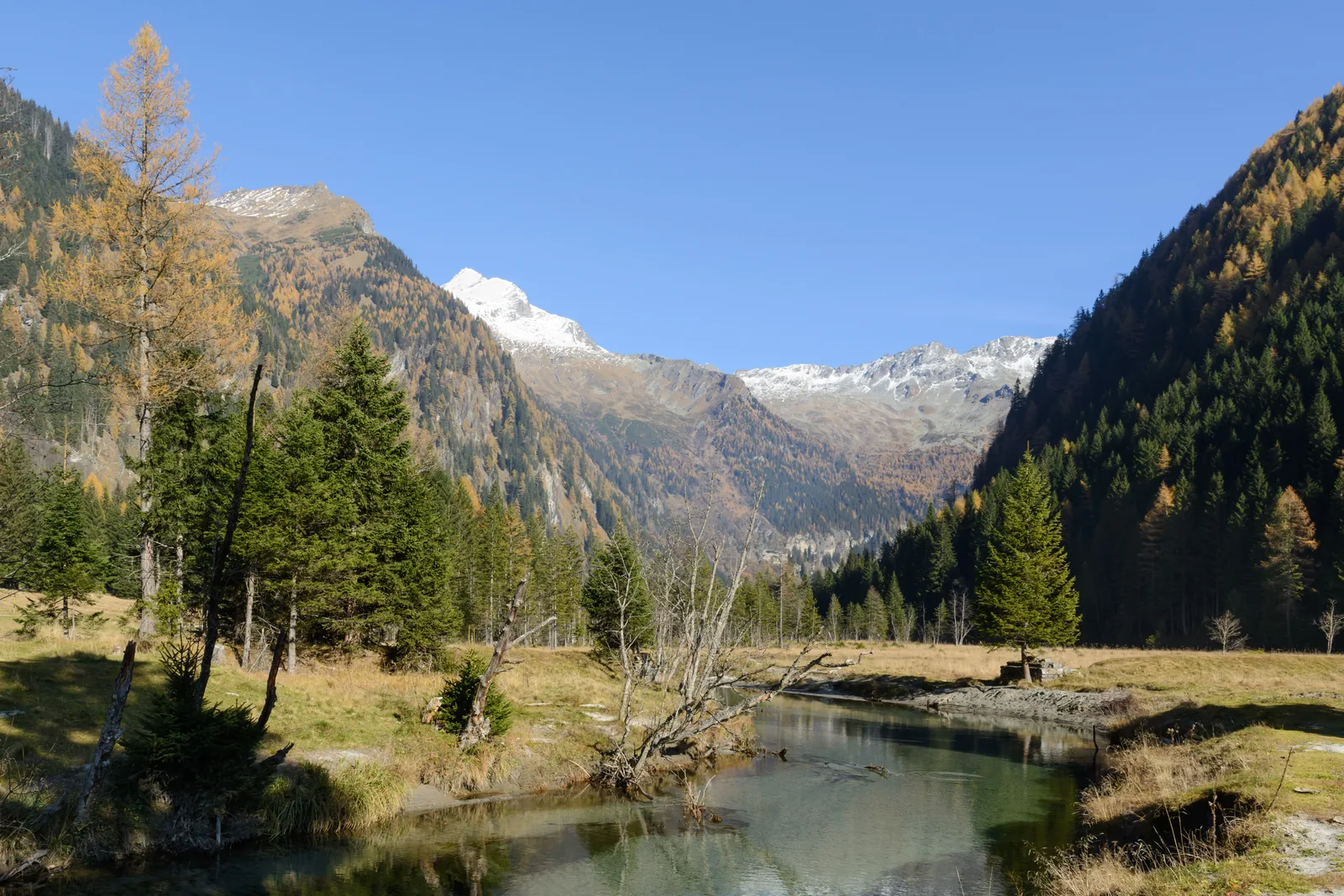
Almost a power station
A high valley near Mallnitz that almost gave way to a power station in the 1970s.
The visitor centre in Carinthia
The Carinthian visitor centre shows the exhibition “univerzoom nationalpark”; the gateway station is Mallnitz. By car from the north, take the car-carrying train from Böckstein.
Hohe Tauern National Park: BIOS National Park Centre Mallnitz ↗
Rauris
The Rauris Primeval Forest is an old rockfall forest at about 1,600 metres (5,249 ft) with pools, lakes and bogs. The themed trail from the Lenzanger car park takes about 45 minutes; bus 640 stops there.
Hohe Tauern National Park: landscape and origins
Hohe Tauern National Park lies between the Grossglockner and the Grossvenediger and reaches from about 1,000 metres to 3,798 metres (3,281 to 12,461 ft), through every climate zone from Central Europe to the Arctic.
More than a third of all plant species recorded in Austria occur in the park, and about half of the mammals, birds, reptiles and amphibians. On top of that, 15,000 to 20,000 animal species are counted.
In the core zone, nature is meant to develop without human influence; in the outer zone, alpine farming continues, and 35 percent of the park is alpine pasture and cultural landscape. This division was the key to international recognition by the IUCN, in 2001 for Carinthia and in 2006 for Salzburg and Tyrol.
The 6,728 hectares of the Sulzbach valleys have been recognised as a wilderness area in IUCN category Ib since 2019.
Hohe Tauern National Park: the national park in figures ↗
The park in numbers
How it all began
In 1913, at the instigation of August Prinzinger, the Verein Naturschutzpark (Nature Park Society) bought land in the Amertal and Stubachtal valleys; in 1918 Albert Wirth donated about 4,072 hectares on the Grossglockner to the Alpine Club. In 1971 the governors of the three states agreed on a joint national park in Heiligenblut.
09 · Train, bus, toll and accommodation
The park authority names Mallnitz, Mittersill, Zell am See and Lienz as gateway stations; from there, hiking buses or valley taxis run to the trailheads in many places. You stay with partner hosts and at campsites in the national park municipalities, not in a tent in the open.
How to get there
From 26 May to 29 September 2026, the Glocknerbus runs every Tuesday, and in July and August also on Thursdays, from Kaprun, Zell am See and Fusch to the Kaiser-Franz-Josefs-Höhe. The day ticket and a national park ranger are included in the price; the bus returns at 15:00.
For cars and motorhomes up to 3.5 tonnes, the 1-day vignette costs €9.60 (digital only), the 10-day vignette €12.80 and the 2-month vignette €32. 2-month and annual vignettes bought online are only valid from the 18th day after purchase.
A single trip through the 5.3-kilometre (3.3 mi) Felbertauern Tunnel costs €13.50 for a car or motorhome. The round-trip ticket for the Felbertauern and Grossglockner roads costs €56 and is valid for 30 days.
Where to stay
Camping and lighting fires in the open are not allowed in the national park. There are campsites in the national park municipalities.
If you stay at an inn or hotel along the High Alpine Road, you pay nothing extra when you leave, even after a longer stay.
The park authority refers to its partner hosts, from farm holidays to four-star hotels, and to the holiday regions in Salzburg, Carinthia and East Tyrol.
With a guest card
If you stay with a participating host in the Salzburg national park region, you get the national park SommerCard from 1 May to 31 October. It includes one attraction a day, a day ticket for the Grossglockner High Alpine Road, the Kolm-Saigurn toll road and a day ticket for the Gerlos Alpine Road.
Overnight guests in the state of Salzburg get the Guest Mobility Ticket for all public transport from the day they arrive, handed out at check-in at their accommodation.
The weather
The park authority describes the high mountains like this: winter is long, spring and autumn hardly exist, and even summer can bring snow.
The visitor centre in Salzburg
The “Nationalparkwelten” in the Salzburg part are open daily, last admission 16:30. The station of the Pinzgau local railway is ten minutes' walk away.
Hohe Tauern National Park: Mittersill National Park Centre ↗
10 · Before you go
The park authority's promotional film shows the mountains, plants and animals of the Hohe Tauern in a good eight and a half minutes. Before any tour: in the high mountains the weather changes quickly, and even summer can bring snow.
Film by the park authority
The park authority's promotional film, a good eight and a half minutes long: mountains, plants and animals of Austria's oldest protected area. In German.
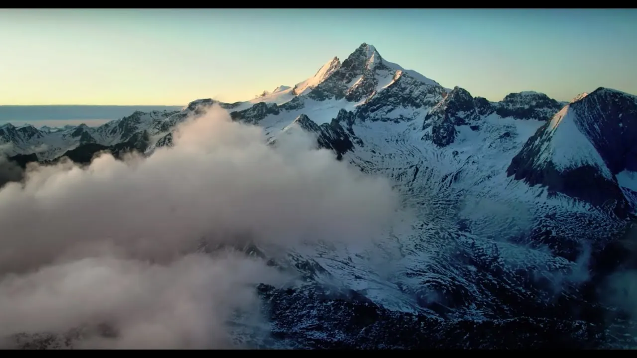
Source: Hohe Tauern National Park · View channel ↗
Popular destinations
Nothing saved yet. Every place card has a pin, and so does every place on the Map. What you save collects here, with days, notes and a preview you can share.
Reality check
Share
The plan is stored in the link itself. Anyone who opens it sees the preview and can use the plan.
The road to the Glockner is closed for half the year.
Climate through the year
Most comfortable months by the climate data: June to August. Average daytime highs of 16 to 17 °C, lows of 6 to 7 °C, 151 to 171 mm of precipitation a month. The wettest month is August (171 mm), the driest February (55 mm).
| Month | High °C | Low °C | Precipitation mm |
|---|---|---|---|
| January | −3.8 | −12.3 | 62 |
| February | −3.2 | −12.1 | 55 |
| March | 0.8 | −8.0 | 72 |
| April | 6.9 | −2.8 | 82 |
| May | 11.7 | 1.3 | 128 |
| June | 15.8 | 5.6 | 151 |
| July | 17.4 | 7.2 | 167 |
| August | 17.1 | 7.2 | 171 |
| September | 12.8 | 3.3 | 118 |
| October | 8.7 | −0.2 | 101 |
| November | 2.5 | −4.5 | 87 |
| December | −2.3 | −10.2 | 69 |
| Year | 1,263 |
Modelled values, not a weather station: NASA POWER (MERRA-2) for a grid cell of about 55 × 45 km around the map point Grossglockner (47.07° N, 12.69° E), with an average cell elevation of about 1,810 m. Averages for 2001–2020. Higher ground and valleys can differ markedly.
Source: NASA POWER, climatology 2001–2020 ↗ · retrieved 3 Oct 2026
If you come by car, you often pay twice in Austria: for the motorway and for the alpine road.
According to the operator, there are many free car parks within the toll section of the Grossglockner High Alpine Road. At the Kaiser-Franz-Josefs-Höhe you may also leave your car for multi-day hikes, with a note behind the windscreen. Vehicles over 3.5 t are not allowed up to the Edelweiss-Spitze; they park below the Fuscher Törl, about 30 minutes' walk away.
Grossglockner High Alpine Road: frequently asked questions ↗
According to the operator, there are enough paid car parks for cars and coaches near the Krimml Waterfalls. A combination ticket for the WasserWelten, the waterfall trail and the parking fee at the WasserWelten car park (P4) is only sold at the Krimml WasserWelten ticket office. Without a car, take the Pinzgau local railway.
Krimml Waterfalls (Austrian Alpine Club, Warnsdorf-Krimml section): tickets ↗
Bob's Special Tours · offer
Eight to nine hours in a private vehicle from Salzburg over the Grossglockner High Alpine Road to the Kaiser-Franz-Josefs-Höhe, the viewpoint facing the Grossglockner and the longest glacier in the Eastern Alps. There is time for the national park exhibition and lunch at the mountain restaurant.
Departure Pick-up from hotels in the city of Salzburg.
According to the inclusions list, private transport in an air-conditioned vehicle and the road toll are included; food, drinks and tips are not. Starts and ends in the city of Salzburg. Free cancellation up to 24 hours before departure.
View tour ↗Ad · partner link · checked 27 Sep 2026
Salzburg Panorama Tours GmbH · offer
Eight hours with a driver-guide from Salzburg to the Krimml Waterfalls. On site, an easy zigzag path with several viewing platforms leads up beside the falls.
Departure Pick-up at your hotel in Salzburg, otherwise at the Panorama Tours kiosk on Mirabellplatz.
Included are a driver-guide, pick-up and return and, according to the provider, admission to the waterfalls; food and drink are not. Starts and ends in the city of Salzburg. Free cancellation up to 24 hours in advance.
View tour ↗Ad · partner link · checked 27 Sep 2026
Ad · we may earn a commission if you book through this partner link – at no extra cost to you. Thank you for supporting the atlas. Offer details checked 27 Sep 2026. See official ticket information.
Amounts in euros, retrieved from the operators on 21 September 2026.
Salzburg Panorama Tours GmbH · offer
Eight hours with a driver-guide from Salzburg to the Krimml Waterfalls. On site, an easy zigzag path with several viewing platforms leads up beside the falls.
Departure Pick-up at your hotel in Salzburg, otherwise at the Panorama Tours kiosk on Mirabellplatz.
Included are a driver-guide, pick-up and return and, according to the provider, admission to the waterfalls; food and drink are not. Starts and ends in the city of Salzburg. Free cancellation up to 24 hours in advance.
View tour ↗Ad · partner link · checked 27 Sep 2026
Ad · we may earn a commission if you book through this partner link – at no extra cost to you. Thank you for supporting the atlas. Offer details checked 27 Sep 2026. See official ticket information.
No. The national park is free and, depending on weather and snow, open around the clock all year. You pay for certain roads and trails, such as the Grossglockner High Alpine Road or the waterfall trail at Krimml.
A day ticket costs €46.50 for a car, €40 for an electric car and €36.50 for a motorcycle. After 18:00 a car pays €36.50. From 15 September there is a five-day autumn ticket for €65.
No. The Grossglockner High Alpine Road is a scenic road, not a motorway; the vignette is not valid there.
Grossglockner High Alpine Road: frequently asked questions ↗
No. There are no tickets for sections of the road or for just driving through; the day ticket applies.
Grossglockner High Alpine Road: frequently asked questions ↗
From early May to early November, and then only during the day; at night a ban on driving ordered by the authorities applies. In winter the road is closed.
Grossglockner High Alpine Road: frequently asked questions ↗
€9 for adults and €4.50 for children aged 6 to 15. With the national park SommerCard, the Krimml guest card and the SalzburgerLand Card, admission is included.
Krimml Waterfalls (Austrian Alpine Club, Warnsdorf-Krimml section): tickets ↗
No. Camping and lighting fires in the open are not allowed. There are campsites in the national park municipalities.
By Glocknerbus: from 26 May to 29 September 2026 on Tuesdays, in July and August also on Thursdays, from Kaprun, Zell am See and Fusch. The day ticket and a ranger are included.
Every fact links to the park authority or to the operator on site.
Researched 21 Sep 2026. Not a live status. Dates apply only to the year stated. A successful automatic fetch is not an editorial confirmation; outdated automatic values are hidden and replaced by the source link.
Current information from the park ↗
Location sources: The park authority does not publish coordinates for these places. Each point was looked up individually in OpenStreetMap; the evidence is given at each point. Markers do not imply that access is permitted. Base map © OpenStreetMap contributors. Coastlines of the chapter map: Natural Earth.
End of the field book · Park authority ↗
Preview