National Parks Atlas
MapPDF

01 · Canada · Québec · Laurentians

La Mauricie National Park

A hundred and fifty lakes in the Laurentian forest, exactly halfway between Montréal and Québec City, and a scenic parkway that runs right through it.

Photo: Chloe Fox ↗ · CC BY-SA 4.0 ↗

La Mauricie at a glance · PDF, 2 pages

La Mauricie National Park: landscape and origins

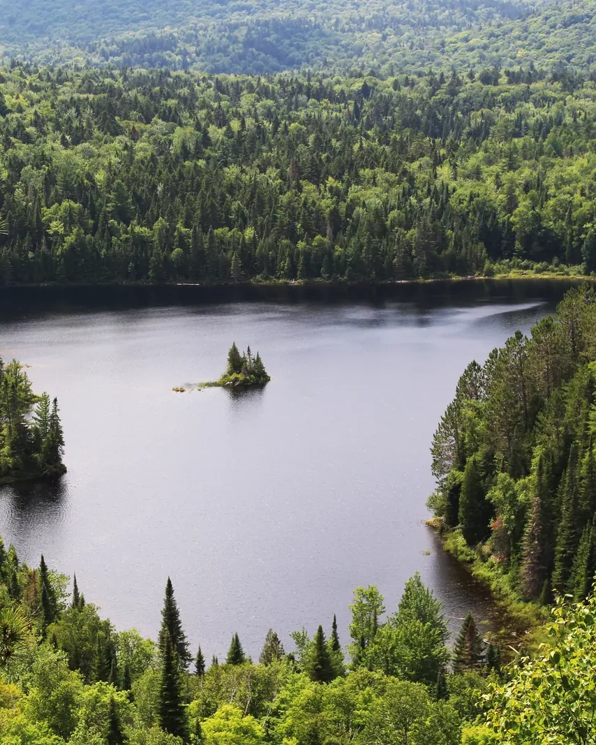
La Mauricie protects a piece of the Laurentians in the heart of Québec: lakes, mixed forest and rounded hills, crossed by rivers, streams and waterfalls.

Some 150 lakes lie in the park, about thirty of them reachable by paddle. The Laurentian forest of conifers and broadleaf trees changes colour in autumn; in spring, meltwater fills the streams and falls.

About 50 mammal species live here. 215 bird species have been recorded so far, 24 of them year-round residents. Brook trout, lake trout, ninespine stickleback and spoonhead sculpin swim in the lakes and rivers. The green frog is the most common amphibian, the garter snake the most common reptile.

People have travelled here for about 5,000 years. Algonquin, Iroquois, Abenaki, Huron and Atikamekw moved across the lakes; archaeologists know about forty sites around Lac Caribou, Lac Waber, Lac Dauphinais and Baie Cobb, with finds dating back to 4,000 BCE.

In the 19th and 20th centuries, log driving and private hunting and fishing clubs shaped the area. The Laurentian Club of 1886 employed many guides and brought more than a million dollars into the regional economy over the years.

The area has been protected since 1970. Today the park authority is working to restore the waters that these uses altered.

Laurentian landscape ↗

The park in numbers

Agreement
22 August 1970
National park
since June 1977, Canada’s 22nd
Inaugurated
6 September 1981
Lakes
about 150, some 30 for paddling
Parkway
63 km (39 mi) paved, right across the park
Trails
over 110 km (68 mi)
Mammals
about 50 species
Birds
215 species, 24 year-round
Backcountry
40 campsites with 132 tent pads on 12 lakes
First people
about 5,000 years ago

Visiting La Mauricie: overview and planning

01

Halfway between Montréal and Québec City

The park lies in the heart of Québec, 60 kilometres (37 mi) north of Trois-Rivières, 200 kilometres (124 mi) from Montréal and 190 kilometres (118 mi) from Québec City. Two entrances lead into the interior, a third only on foot.

Directions and entrances ↗

03

Four seasons

Summer from 14 May to 25 October 2026, winter from 17 December 2026 to 28 March 2027, with two shoulder seasons with limited services in between. In the shoulder season daily admission is cheaper, but the parkway is only open as far as the Rivière à la Pêche parking lot.

Seasons and hours of operation 2026 ↗

04

No mobile coverage

There is no continuous mobile coverage in the park. Tell someone where you are going. The park’s emergency number is 819-536-3180. Drones are prohibited, with fines of up to 25,000 CAD.

Trail network and rules ↗

02 · Places

Map and places in the park

Entrances with the park authority’s coordinates, lakes and falls from OpenStreetMap.

Photo: Mathématicien joyeux ↗ · CC BY-SA 3.0 ↗

Place in the park

Waber Falls

The outing where you first paddle and then walk, and the destination shown in most pictures of the park.

Height
27 metres (89 ft).
Getting there
Wapizagonke parking lot, with boat rental.
Paddling
4.6 km (2.9 mi) across Lac Wapizagonke, about 1.5 hours.
Hiking
4 km (2.5 mi) on the Chute-Waber trail, 213 m of climbing, about 1.5 hours.
Time
6 to 8 hours there and back, intermediate.
Anticagamac
lookout on the same trail out and back only; the connecting trail to the portage at Lac Anticagamac is closed.

Parks Canada: Waber Falls, paddling and hiking (checked 2 October 2026) ↗

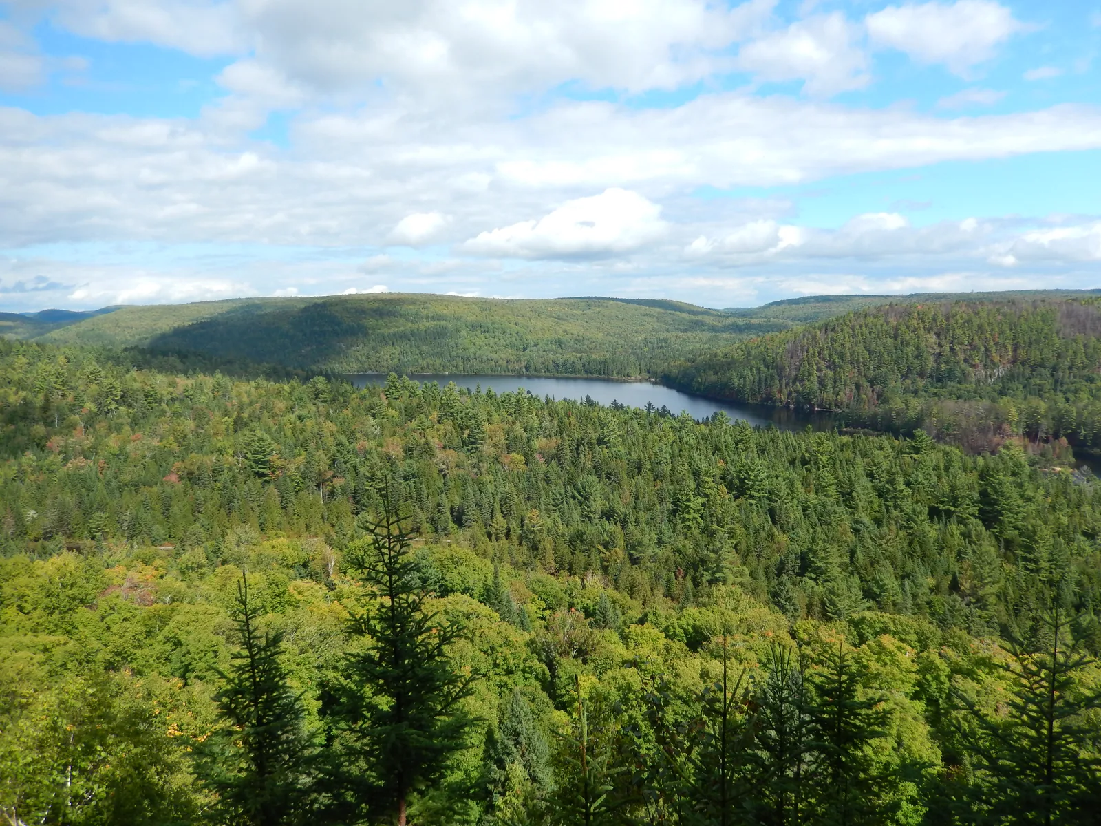
View from the cliff trail in La Mauricie National Park over forested hills to the long Lac Wapizagonke under white clouds
Photo: Fralambert ↗ · CC BY-SA 4.0 ↗

Place in the park

Lac Wapizagonke

The long, narrow lake in the west is the centre of the park, and it bears an Atikamekw name.

Name
refers to a rare kind of duck in the Atikamekw language.
Rock paintings
found on the lake, including a turtle.
Views
Le Passage (being renewed), Île-aux-Pins, Les Falaises.
Paddling
rentals at the Wapizagonke picnic area.
Camping
Wapizagonke campground from 19 June to 7 September 2026.
Note
the “M” bridge at Shewenegan is closed.

Paddling on 150 lakes ↗

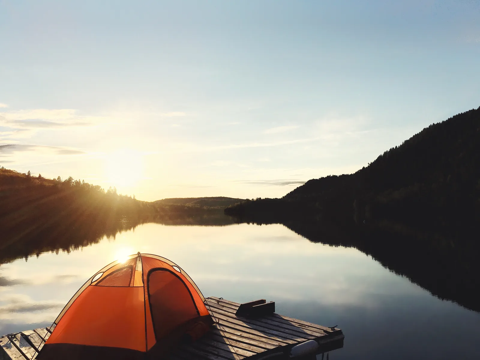
An orange tent stands on a wooden platform on the lakeshore in La Mauricie National Park, the sun rising behind the forested hills and reflected in the still water
Photo: Jonaelbrosseau ↗ · CC BY-SA 4.0 ↗

Place in the park

Canoe camping

Twelve lakes, forty campsites, 132 tent pads, most of which you can only reach by water.

Lakes
Wapizagonke, À la Pêche, Édouard, Caribou, Isaïe, Marie, Waber, Dauphinais, Anticagamac, Des Cinq, Baie Cobb, Baie des Onze Îles.
Facilities
dry toilet and bear-proof food hang at every site.
Fires
prohibited at four lakes; wood only from the park.
Occupancy
two people per tent, children included.
Season
with fire pit 29 May to 12 October, without 12 June to 7 September 2026.
Price
19.50 CAD without, 30.25 CAD with fire pit.

Backcountry canoe camping ↗

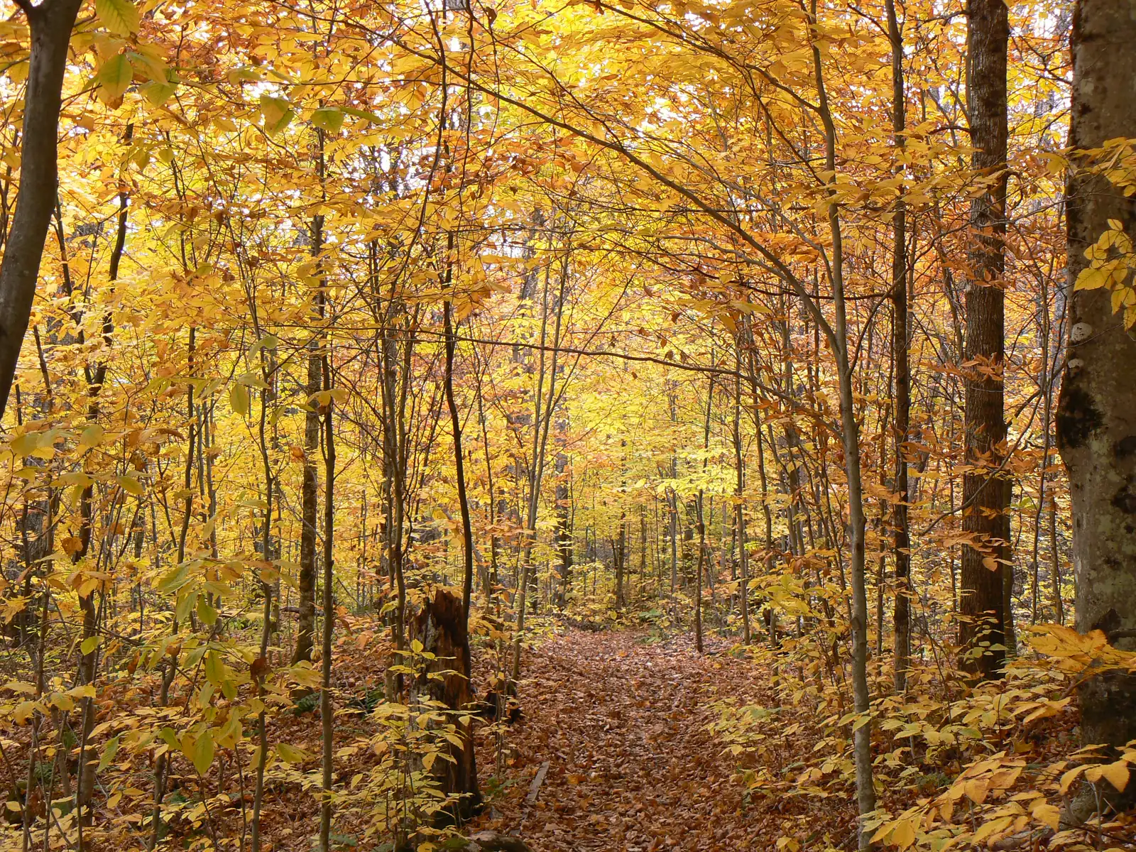
A forest trail in La Mauricie National Park leads through broadleaf trees in yellow and orange, leaves covering the ground
Photo: Kevstan ↗ · CC BY-SA 3.0 ↗

Place in the park

Autumn in the Laurentian forest

Conifers and broadleaf trees side by side; in October they turn into a patchwork of red, yellow and green.

When
summer season until 25 October, with a phased end.
Parkway
fully open until 12 October, then as far as Lac Bouchard.
Route
the park authority suggests a fall colours route of its own.
Refreshments
the pizzeria at Shewenegan opens at weekends in autumn.
Shoulder season
cheaper admission and fewer services from 26 October.

Lookouts in the park ↗

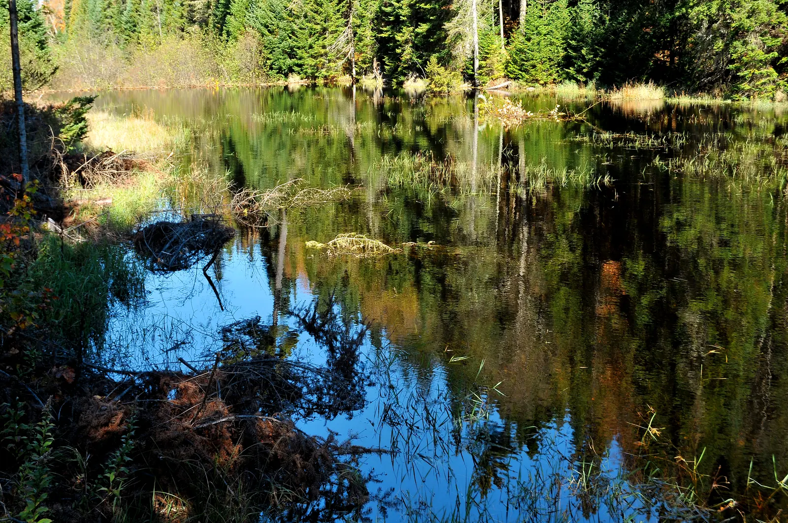
A beaver dam of branches holds back a stream in La Mauricie National Park, forming a still pond that reflects the surrounding forest
Photo: LBM1948 ↗ · CC BY-SA 4.0 ↗

Place in the park

Beavers and waters

The park authority is working to restore lakes and streams altered by log driving and the clubs.

Builders
Beaver dams hold back streams and create new wetlands.
Being watched
Scientists monitor bats and loons, among others.
Fish
brook trout, lake trout, ninespine stickleback, spoonhead sculpin.
Threat
invasive species threaten several lakes; clean your boats.
Film
the park authority shows the restoration in a film of its own.

Nature and science ↗

Map

10 places on the map

Entrances with the park authority’s coordinates, lakes and falls from OpenStreetMap.

Open map3D terrain · details and photos for every place
  • Viewpoints1
  • Water5
  • Arrival3
  • Nature1

03 · Out and about

Hikes & things to do: Waber Falls, lookouts and paddling

Over 110 kilometres of trails, thirty lakes to paddle and a waterfall at the end of the trip.

Photo: LBM1948 ↗ · CC BY-SA 4.0 ↗

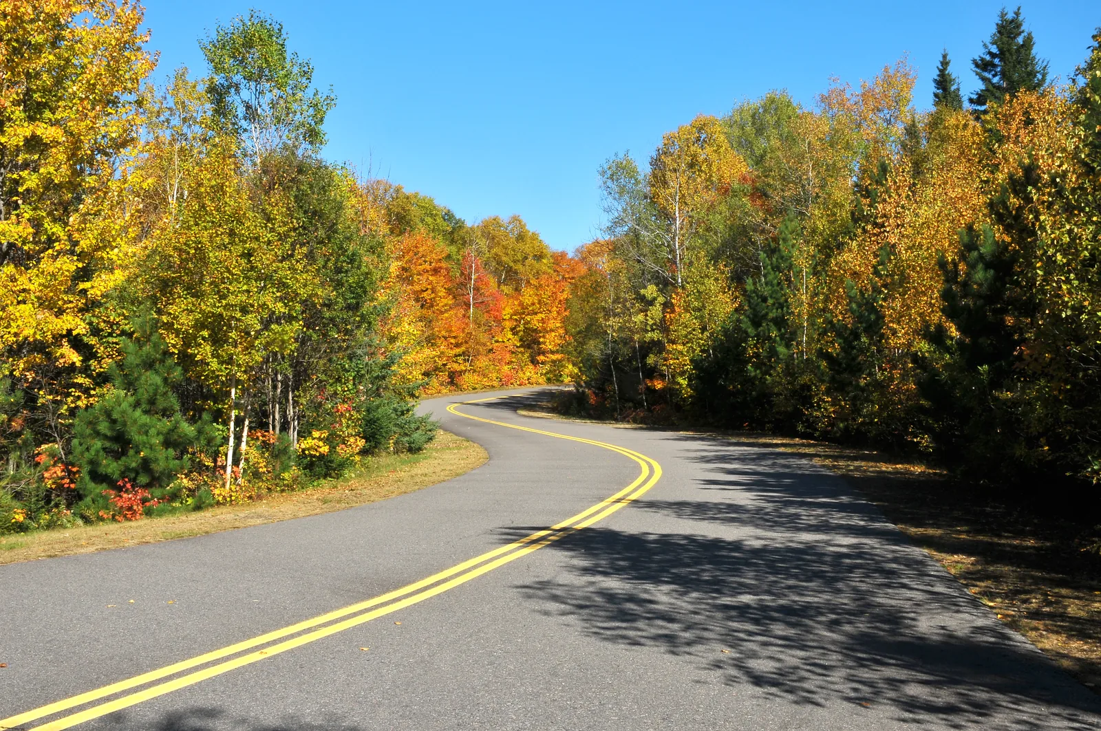
“Four years after the first sod was turned, 12.9 kilometres were finished. Today the parkway runs for 63 paved kilometres from one entrance to the other, right across the park.”

La Mauricie National Park · The parkway in autumn

Hikes & things to do: Waber Falls, lookouts and paddling

To Waber Falls

The park’s best-known outing: paddle 4.6 kilometres (2.9 mi) across Lac Wapizagonke, about an hour and a half, then hike 4 kilometres (2.5 mi) with 213 metres (699 ft) of climbing, and at the end the water plunges 27 metres (89 ft). The Anticagamac lookout on the same trail can only be reached out and back; the connecting trail to the portage at Lac Anticagamac is closed.

Parks Canada: Waber Falls, paddling and hiking (checked 2 October 2026) ↗

Lookouts along the parkway

The 63-kilometre (39 mi) parkway passes several lookouts. The famous Le Passage lookout is being rebuilt and is due to reopen in spring 2027; until then Île-aux-Pins, Vide-Bouteille and Saint-Maurice offer the views.

Lookouts in the park ↗

Paddling on 150 lakes

About thirty lakes can be reached by canoe, kayak or paddleboard. Boats can be rented at the Wapizagonke, Lac Édouard and Shewenegan picnic areas.

Paddling on 150 lakes ↗

Hiking for everyone

Over 110 kilometres (68 mi) of marked trails. For small children, La Tourbière (300 m) and Ruisseau Brodeur (700 m) are suitable; Lac Étienne, La Cache, La Terrasse and multi-use trails 3 and 11 can be done with a jogging stroller. Baby carriers are available free of charge at the service centre.

Hiking: over 110 km of trails ↗

Winter on skis and snowshoes

Groomed ski trails, snowshoe routes and shared multi-use trails. Volunteers from the Canadian Ski Patrol are out and about; talk to them if anything comes up.

Hiking: over 110 km of trails ↗

View from the Les Falaises cliff trail in La Mauricie National Park over forested hills to the long Lac Wapizagonke, across which the paddle to Waber Falls leads

LocationCanot.com (9232-5539 Québec Inc.), boat rental at the picnic areas in the park, named by the La Mauricie park authority (Parks Canada) · Boat rental in the park · self-guided

By rented canoe across Lac Wapizagonke to Waber Falls

At three picnic areas in the park, LocationCanot.com rents canoes, single and double kayaks and paddleboards in summer and autumn; life jackets, paddles and a safety kit are included. The best-known trip starts at the Wapizagonke picnic area: 4.6 kilometres (2.9 mi) across the long, narrow lake, about an hour and a half, then about four kilometres on foot to the 27-metre (89 ft) Waber Falls and back the same way. The park authority rates the day trip as intermediate and allows six to eight hours. For a shorter paddle, start at the Shewenegan picnic area, also on Lac Wapizagonke, or on Lac Édouard.

  • Full-day rental, shorter only on site
  • Canoe, kayak or paddleboard
  • Life jackets and paddles included
  • Waber trip 6 to 8 hours

Meeting point Rental kiosk at the Wapizagonke picnic area, via the Saint-Mathieu entrance (exit 217 from Highway 55); further kiosks at the Shewenegan and Lac Édouard picnic areas.

Full days can be reserved online with LocationCanot.com, hourly and four-hour rentals only at the kiosk; for Waber Falls the park authority recommends reserving in advance. The kiosks are open from late May to mid-October. Set off early and take food and plenty of water. Swimming at the falls is possible, climbing and jumping are prohibited; there is no mobile coverage there, and the emergency phone is at the Wapizagonke campground. The trail from the falls on to the portage at Lac Anticagamac is closed, and the Anticagamac lookout can only be reached out and back. Motorboats are prohibited in the park; clean, drain and dry your own boats before launching.

Go to LocationCanot.com ↗Boat rental in the park, named by Parks Canada · no partner link · checked 2 Oct 2026

Landscape image, not a provider photo · Photo: Fralambert ↗ · CC BY-SA 4.0 ↗

Nature and history of La Mauricie

Lakes, forest and hills

The landscape is typical of the Laurentians: lakes, forests and rounded hills, crossed by rivers, streams and waterfalls. About 50 mammal species live in the park; 215 bird species have been recorded, 24 of them year-round residents.

Laurentian landscape ↗

For 5,000 years

The oldest evidence of people here is about 5,000 years old. Rock paintings were found on Lac Wapizagonke, including a turtle; in the Algonquin story, the Earth was created on the back of the turtle Mékinac. About forty archaeological sites are known.

Indigenous history on Lac Wapizagonke ↗

The land of the Atikamekw

The Saint-Maurice basin has been home to the Atikamekw for thousands of years, hunters, gatherers and fishers who moved with the seasons. After the Trois-Rivières trading post was founded in 1634, war and disease decimated the population; descendants live today in Wemotaci, Obedjiwan and Manawan.

Indigenous history on Lac Wapizagonke ↗

Logging and clubs

Before the park, two uses shaped the area: log driving and private hunting and fishing clubs. The Shawinigan Club was founded in 1883, the Laurentian Club in 1886, the Commodore Club in 1905. A membership in the Laurentian Club cost 135 CAD a year in 1938, and already 250 CAD in 1961.

The hunting and fishing clubs ↗

National park since 1970

On 22 August 1970 the federal and provincial governments signed the agreement. Construction of the parkway began in 1971, in 1977 La Mauricie officially became Canada’s 22nd national park, and it was inaugurated in 1981, by which time the parkway was paved throughout its 63 kilometres.

History of the park since 1970 ↗

04 · Before you go

Park film and places nearby

Photo: Chloe Fox ↗ · CC BY-SA 4.0 ↗

Film by the park authority

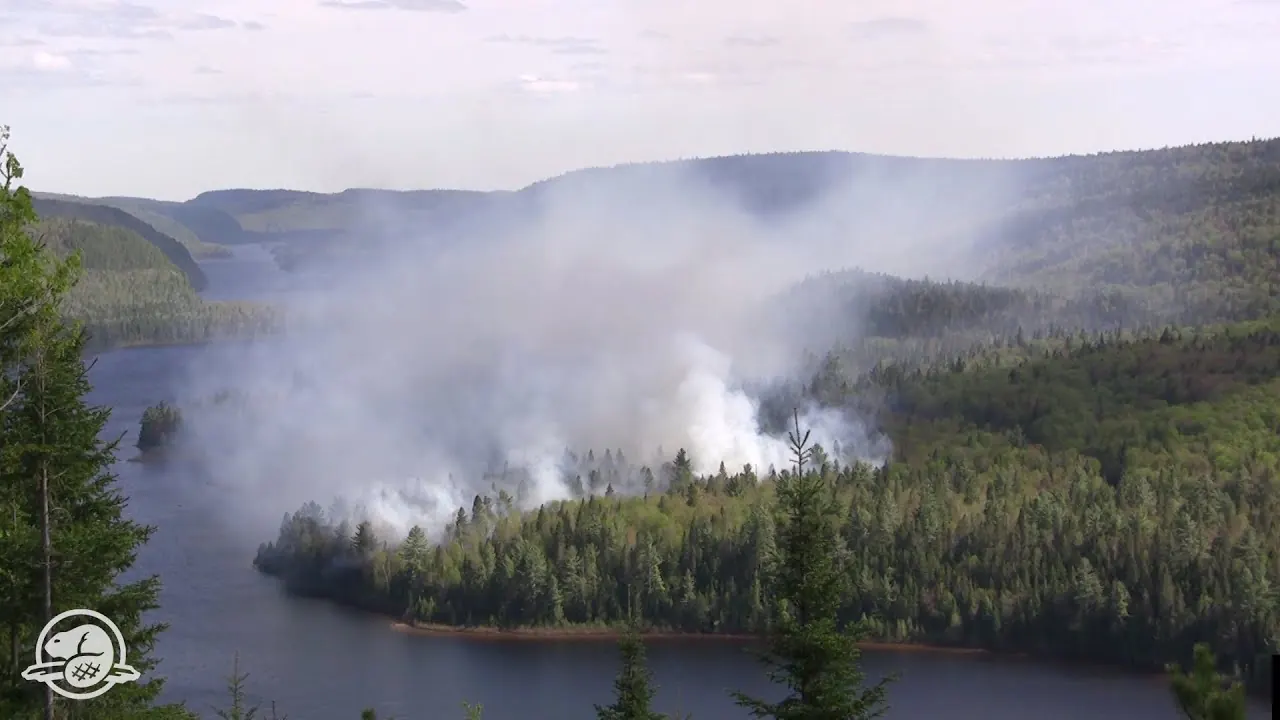
La Mauricie National Park is Being Restored to Health

A little over three minutes from Parks Canada, from 2013: logging, suppressed wildfires and altered waters shaped the ecosystems before the park was established. The film shows how the park authority is restoring them. In English.

Source: Parks Canada · View channel ↗

Around the park

Trois-Rivières

The nearest city lies 60 kilometres (37 mi) to the south, where the Saint-Maurice flows into the St. Lawrence. The trading post that changed the history of the region was founded there in 1634.

Directions and entrances ↗

Montréal and Québec City

Both cities are about the same distance away: 200 kilometres to Montréal, 190 to Québec City. The park lies halfway, a weekend destination for both.

Directions and entrances ↗

The lodges on Lac à la Pêche

W8banaki and Andrew date from the time of the Laurentian Club, founded in 1886, whose members came from Canada and the USA. Today you can stay overnight in the buildings.

The hunting and fishing clubs ↗

The Saint-Maurice

Logs were floated down the river until well into the 20th century. From the Saint-Maurice lookout on the parkway you can see its full width; on the Mékinac trail, boardwalks lead down to the bank.

Lookouts in the park ↗

Field book · La Mauricie National Park

checked 20 Sep 2026

La Mauricie at a glance · PDF, 2 pages ↓

00My visit

Nothing saved yet. Every place card has a pin, and so does every place on the Map. What you save collects here, with days, notes and a preview you can share.

01Best time to visit La Mauricie

The parkway makes the difference between summer and the rest of the year.

Summer

From 14 May to 25 October 2026, with a phased start and end. The whole parkway is open from 28 May to 12 October, after that only as far as Lac Bouchard. The Saint-Mathieu entrance is open from 28 May to 12 October.

Seasons and hours of operation 2026 ↗

Fall colours

In autumn the Laurentian mixed forest changes colour. The park authority has a route of its own for the colours; the pizzeria at the Shewenegan picnic area is still open at weekends then.

Lookouts in the park ↗

Winter

From 17 December 2026 to 28 March 2027. The Saint-Mathieu entrance stays closed, and the parkway is cleared as far as the Rivière à la Pêche parking lot. Groomed ski trails, snowshoe trails, winter camping and heated cabins.

Seasons and hours of operation 2026 ↗

Shoulder season

From 30 March to 13 May and from 26 October to 16 December the park runs with limited services. Admission is cheaper, Saint-Mathieu stays closed, and between 1 April and 18 May the park is not operating, though you may still enter it.

Trail network and rules ↗

Reservations

Camping, accommodation and fishing for summer 2026 opened for booking on 4 February 2026 at 8:00, winter accommodation on 16 September 2026.

Seasons and hours of operation 2026 ↗

Climate through the year

Weather and climate in La Mauricie National Park

Best months by the climate data: May to September. Average daytime highs of 16 to 24 °C, lows of 5 to 14 °C, 88 to 103 mm of precipitation a month. The wettest month is October (104 mm), the driest February (62 mm).

Climate chart in La Mauricie National ParkAverage daily highs from −9 °C to 24 °C, lows from −20 °C to 14 °C; monthly precipitation from 62 mm to 104 mm.
All monthly values as a table
Monthly averages 2001–2020, NASA POWER model
MonthHigh °CLow °CPrecipitation mm
January−9.3−19.567
February−7.3−18.262
March−2.4−12.070
April7.4−2.693
May16.55.188
June21.211.099
July23.714.0103
August22.813.299
September19.38.993
October11.02.4104
November2.8−4.380
December−5.3−14.093
Year1,051

Modelled values, not a weather station: NASA POWER (MERRA-2) for a grid cell of about 55 × 50 km around the map point Lac Wapizagonke (46.71° N, 73.02° W), with an average cell elevation of about 240 m. Averages for 2001–2020. Higher ground and valleys can differ markedly.

Source: NASA POWER, climatology 2001–2020 ↗ · retrieved 3 Oct 2026

02How to get to La Mauricie: entrances and Highway 55

Two exits on Highway 55; your destination decides which one.

Saint-Jean-des-Piles entrance

Exit 226 from Highway 55, then follow the signs to Chemin du Parc-National. The main entrance since 1982; this is where the gateway building and the pay machines are, and from here the parkway is open all year as far as the Rivière à la Pêche parking lot.

Directions and entrances ↗

Saint-Mathieu entrance

Exit 217 from Highway 55, then towards Saint-Mathieu-du-Parc. Open from May to October. If you enter here, you are closer to Lac Wapizagonke and the trails to the Cascades.

Directions and entrances ↗

Check the map before choosing the exit

The two entrances are 64 kilometres (40 mi) apart via the parkway inside the park and 41 kilometres (25 mi) apart via the roads outside. The park authority explicitly advises checking on the map beforehand which entrance suits your destination.

Directions and entrances ↗

Saint-Gérard on foot only

The third entrance, at Saint-Gérard, gives no access to the parkway. You cannot drive into the park there, only reach it on trails.

Directions and entrances ↗

Charging electric vehicles

There are charging stations at the Rivière à la Pêche and Shewenegan parking lots, half with Tesla and half with J-1772 connectors. A full charge takes four to six hours.

Directions and entrances ↗

La Navette Nature inc., named as a partner by the La Mauricie park authority (Parks Canada) · Day trip from Montréal · self-guided

Without a car from Montréal: Navette Nature to La Mauricie National Park

There is no train or scheduled bus into the park. On individual weekend days, however, Navette Nature runs a school bus from the Montréal bus station into the park in the morning and back in the early evening, about two and a half hours each way. The destination is the Rivière à la Pêche parking lot in the east of the park, starting point of a trail network of about 50 kilometres (31 mi) with lookouts over hills, lakes and rivers. In between you have a good six hours to spend on your own; the operator emails suggestions for activities at the destination a few days beforehand.

Meeting point Montréal bus station (Gare d'autocars), 1717 rue Berri, about seven minutes’ walk from Berri-UQAM metro station; departure at 8:00, the operator emails the bay number a few days beforehand. Return from the Rivière à la Pêche parking lot at around 17:10, arriving in Montréal at around 19:30, without guarantee according to the operator.

Dates and booking only through Navette Nature; the bus does not run daily, and according to the operator departures are not guaranteed (cancellations are rare, for example in heavy rain). In autumn 2026 the bus ran every weekend in October. On some days there is also a shorter trip from Trois-Rivières (Université du Québec à Trois-Rivières, Pavillon Ringuet, 3351 boulevard des Forges, about 45 minutes to the Rivière à la Pêche welcome building); there only transport is included in the price. The buses are ordinary school buses without a lift; the operator does not take children under 18 kg (40 lb), never dogs, and bikes only by arrangement for an extra charge. If you miss the return bus, you must get back on your own; there is no mobile coverage everywhere in the park. Full refund for cancellations up to 14 days in advance, name and date changes up to 48 hours in advance. The bus stops in the east of the park; the paddle to Waber Falls starts far to the west at the Wapizagonke picnic area.

Go to Navette Nature ↗Navette Nature, a Parks Canada partner · no partner link · checked 2 Oct 2026

03Tickets & entrance fees

All amounts in Canadian dollars, retrieved from Parks Canada on 20 September 2026.

Daily admission

Adults 10.00 CAD, seniors aged 65 and over 8.75 CAD, family or group 19.50 CAD for up to seven people in one vehicle. Youth aged 17 and under pay nothing. In the shoulder season a day costs 7.25 CAD, 6.25 CAD and 15.00 CAD.

Parks Canada: fees ↗

Seasonal pass and early-bird rate

The seasonal pass costs 48.25 CAD for adults, 42.50 CAD for seniors and 96.75 CAD for a family or group. The early-bird price of 38.75 CAD was only available on site in 2026, from 14 to 31 May at the Saint-Jean-des-Piles entrance. The Discovery Pass at 83.50 CAD is valid all year.

Parks Canada: fees ↗

Cross-country skiing costs extra

For the groomed ski trails you pay 11.25 CAD per day or 109.75 CAD for the season on top of admission. Equipment can be rented: snowshoes 16.00 CAD, a full cross-country ski set 32.00 CAD, crampons 13.00 CAD, half price for youth in each case.

Parks Canada: fees ↗

Camping and cabins

A campsite costs 33.75 CAD without and 38.75 CAD with electricity, a backcountry site 19.50 CAD without and 30.25 CAD with a fire pit. An oTENTik costs 164.50 CAD, in winter 184.50 CAD; a cabin for up to ten people 530.75 CAD.

Parks Canada: fees ↗

Paying at the machines

The daily fee can be paid at the machines at the Saint-Jean-des-Piles and Saint-Gérard entrances, and in summer also at Saint-Mathieu. The seasonal pass is only sold in the park itself.

Seasons and hours of operation 2026 ↗

Summer 2026: admission was free

Under the Canada Strong Pass, admission to Parks Canada places was free from 19 June to 7 September 2026, and camping was discounted. Regular fees have applied again since 8 September 2026. Travel reports from summer 2026 therefore often quote an admission price that no longer applies.

Parks Canada: passes, permits and fees (Canada Strong Pass, checked 3 October 2026) ↗

04Where to stay in La Mauricie: camping, cabins and lodges

From a campsite to a club lodge from 1886, and 132 tent sites by the water.

Three campgrounds

Rivière à la Pêche is open with services from 15 May to 11 October 2026 and then without electricity and drinking water until 25 October. Mistagance runs from 29 May to 12 October, Wapizagonke from 19 June to 7 September. For groups of 15 to 70 people there is La Clairière.

Seasons and hours of operation 2026 ↗

132 backcountry tent sites

Spread across twelve lakes are 40 campsites with a total of 132 tent pads, reachable by canoe, kayak or paddleboard, some also by bike or on foot. Each site has a dry toilet and a bear-proof food hang; fires are prohibited at four lakes.

Backcountry canoe camping ↗

Two people per tent

In the backcountry the rule is: at most two people per tent pad, children included. Some sites are specifically designated for families; otherwise an extra pad must be booked for every two additional people.

Backcountry canoe camping ↗

Cabins and historic lodges

Two modern, accessible cabins stand near the Saint-Jean-des-Piles entrance and sleep up to ten people. There are also the W8banaki and Andrew lodges on Lac à la Pêche, buildings of the former Laurentian Club.

Cabins and historic lodges ↗

Firewood only from the park

Bringing wood from outside is prohibited: a single log can carry diseases and insects. It is sold at the Rivière à la Pêche service centre, at 13.50 CAD a bundle.

Backcountry canoe camping ↗

05Rules & safety in La Mauricie

Dogs stay near the car, fire stays in the fire pit.

Dogs only in the corridor

Pets are only allowed at the serviced campgrounds of Mistagance, Wapizagonke and Rivière à la Pêche and in the parkway corridor with its rest areas, not on trails and not on beaches. Two animals per site, always on a leash.

Pets in the park ↗

Stay on the trails

The park authority asks you not to leave the marked trails, to take nothing and to pack out all your rubbish. Multi-use trails are shared by bikes and walkers, in winter by skiers, and by park vehicles.

Hiking: over 110 km of trails ↗

Fires only in fire pits

Campfires are only allowed in the designated fire pits. Collecting deadwood is prohibited. At four backcountry lakes fires are banned altogether.

Backcountry canoe camping ↗

Construction at Shewenegan

The “M” bridge and the section below it at the Shewenegan picnic area are closed until further notice for safety reasons. The park authority describes how the Cascades and the second basin of Lac Wapizagonke can still be reached.

Park authority: La Mauricie ↗

Full parking lots

On fine days the parking lots fill up. The park authority keeps a page on the status of entrances and parking lots.

Entrance and parking lot capacity ↗

06Frequently asked questions: La Mauricie National Park

How much is the entrance fee for La Mauricie National Park?

Daily admission costs 10.00 CAD for adults, 8.75 CAD for seniors and 19.50 CAD for a family or group of up to seven people in one vehicle. In the shoulder season it is 7.25 CAD, 6.25 CAD and 15.00 CAD. Youth aged 17 and under pay nothing. Cross-country skiing costs an extra 11.25 CAD per day.

Parks Canada: fees ↗

Which entrance should I use?

It depends on your destination: Saint-Jean-des-Piles in the east is open all year, Saint-Mathieu in the west from May to October and closer to Lac Wapizagonke. The two are 64 kilometres apart inside the park and 41 via the roads outside. Saint-Gérard has no road access.

Directions and entrances ↗

How do I get to Waber Falls?

From the Wapizagonke picnic area, paddle 4.6 kilometres across the lake, about an hour and a half, then hike 4 kilometres with 213 metres of climbing. The park authority allows six to eight hours there and back. Boats can be rented on site. The waterfall is 27 metres high.

Parks Canada: Waber Falls, paddling and hiking (checked 2 October 2026) ↗

Can I bring my dog?

Only to a limited extent. Pets are allowed at the Mistagance, Wapizagonke and Rivière à la Pêche campgrounds and in the parkway corridor, always on a leash. They are not allowed on trails or beaches.

Pets in the park ↗

When is La Mauricie National Park open?

Every day of the year; day visitors may stay from sunrise until 22:00. In 2026 the summer season runs from 14 May to 25 October, winter from 17 December to 28 March 2027. In between there are two shoulder seasons with limited services.

Seasons and hours of operation 2026 ↗

Can I camp in the backcountry?

Yes, at twelve lakes with a total of 132 tent pads, most of them only reachable by paddle. Reservations through the Parks Canada booking system; at most two people per tent, children included.

Backcountry canoe camping ↗

07Sources and date checked

All information comes from the park authority and has been checked with a date.

  1. Park authority: La Mauricie ↗
  2. Parks Canada: fees ↗
  3. Seasons and hours of operation 2026 ↗
  4. Directions and entrances ↗
  5. Lookouts in the park ↗
  6. Parks Canada: Waber Falls, paddling and hiking (checked 2 October 2026) ↗
  7. Hiking: over 110 km of trails ↗
  8. Trail network and rules ↗
  9. Paddling on 150 lakes ↗
  10. Backcountry canoe camping ↗
  11. Campgrounds ↗
  12. Cabins and historic lodges ↗
  13. Winter activities ↗
  14. Equipment rental ↗
  15. Pets in the park ↗
  16. Wildlife in the park ↗
  17. Laurentian landscape ↗
  18. Nature and science ↗
  19. History of the park since 1970 ↗
  20. Indigenous history on Lac Wapizagonke ↗
  21. The hunting and fishing clubs ↗
  22. Log driving in the park ↗
  23. Current notices ↗
  24. Entrance and parking lot capacity ↗
  25. Parks Canada: passes, permits and fees (Canada Strong Pass, checked 3 October 2026) ↗

How current is this information?

Researched 20 Sep 2026. Not a live status. Dates apply only to the year stated. A successful automatic fetch is not an editorial confirmation; outdated automatic values are hidden and replaced by the source link.

Current information from the park ↗

Image and map credits

Location sources: The three entrances with the coordinates the park authority itself publishes; the other locations verified against an OpenStreetMap object. Markers do not imply that access is permitted. Base map © OpenStreetMap contributors. Coastlines of the chapter map: Natural Earth.

End of the field book · Park authority ↗