National Parks Atlas
MapPDF

01 · Canada · Nunavut · Ellesmere Island

Quttinirpaaq National Park

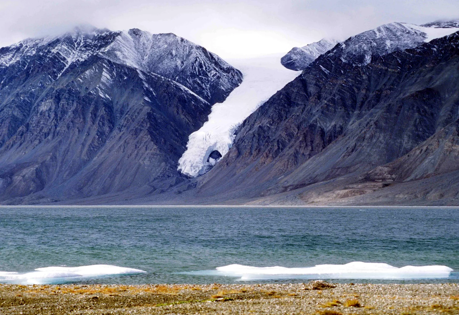
“Land at the top of the world”: 37,775 square kilometres of High Arctic, reachable only by chartered aircraft.

Photo: Ansgar Walk ↗ · CC BY-SA 2.5 ↗

Quttinirpaaq at a glance · PDF, 2 pages

Quttinirpaaq National Park: landscape and origins

Quttinirpaaq means “land at the top of the world” in Inuktitut. The park protects Canada’s eastern High Arctic: ice caps, worn-down mountains, polar desert, and a thermal oasis in between.

More than a third of the area lies under ice. The icefields are up to 900 metres (2,953 ft) thick, and nunataks rise from them, isolated mountains of over 2,500 metres (8,202 ft). Continuous permafrost underlies the entire park; the thaw layer is thin, so plants only grow where moisture remains. Sedges, grasses, mosses and lichens dominate in the mountains.

The Lake Hazen basin is the exception. Sheltered by south-facing mountains, supplied by glacier water and influenced by the West Greenland Current, it is warmer and wetter than anything around it. Here lie extensive wet tundra meadows, and here live Arctic hare, lemming, ermine, Arctic fox, Arctic wolf, muskox and Peary caribou, as well as snow geese, red-throated loons, eiders, rock ptarmigan, snow bunting, turnstones and plovers.

The park authority writes one sentence that says a lot about this place: the animals are so unused to people that they show no fear. Foxes and wolves may come closer out of curiosity, and can transmit rabies. Muskoxen charge if they feel threatened.

Three species are under special watch: Porsild’s bryum, a moss, is considered threatened; the polar bear of special concern; the Peary caribou endangered, with climate change as the greatest threat. People have travelled here for thousands of years; archaeological sites go back up to 4,000 years, often as tent rings, fox traps and food caches, hardly recognisable to untrained eyes.

Ecosystems and habitats ↗

The park in numbers

Established
1988
Area
37,775 km² (14,585 sq mi), Canada’s second-largest park
Marine area
about 2,375 km²
Glaciated
36 per cent
Ice thickness
up to 900 metres (2,953 ft)
Highest mountain
Barbeau Peak, 2,616 m (8,583 ft)
Freshwater fish
one species: Arctic char
Migratory birds
about 30 species
Daylight
24 hours from May to August
Darkness
24 hours from November to February
Archaeological sites
up to 4,000 years old
Nearest health centre
Resolute Bay

Visiting Quttinirpaaq: overview and planning

01

800 kilometres north of Resolute Bay

The park lies on Ellesmere Island in the Qikiqtaaluk Region, about 720 to 800 kilometres (447 to 497 mi) from Resolute Bay according to the park authority’s pages. Scheduled flights only go as far as Resolute Bay; a charter flies the rest.

Plan your visit ↗

02

Registration is mandatory

Every trip into the park must be registered in advance and de-registered after your return. Registration includes an orientation on your route, weather, water levels, closures and recent polar bear sightings.

Visitor guidelines ↗

03

Self-reliant and experienced

Facilities in the park are limited. The park authority explicitly requires visitors to be experienced and self-sufficient. Most come with a tour operator for one to two weeks.

Facilities and equipment in the park ↗

04

Open all year, but staffed only briefly

The park is open all year. The Tanquary Fiord and Lake Hazen stations are only staffed during the field season from early June to late July. The office in Resolute can be reached on weekdays from 8:30 to 12:00 and from 13:00 to 17:00.

Hours of operation and field season ↗

02 · Places

Map and places in the park

Eleven points, each verified against an OpenStreetMap object.

Photo: Ansgar Walk ↗ · CC BY-SA 2.5 ↗

Place in the park

Tanquary Fiord

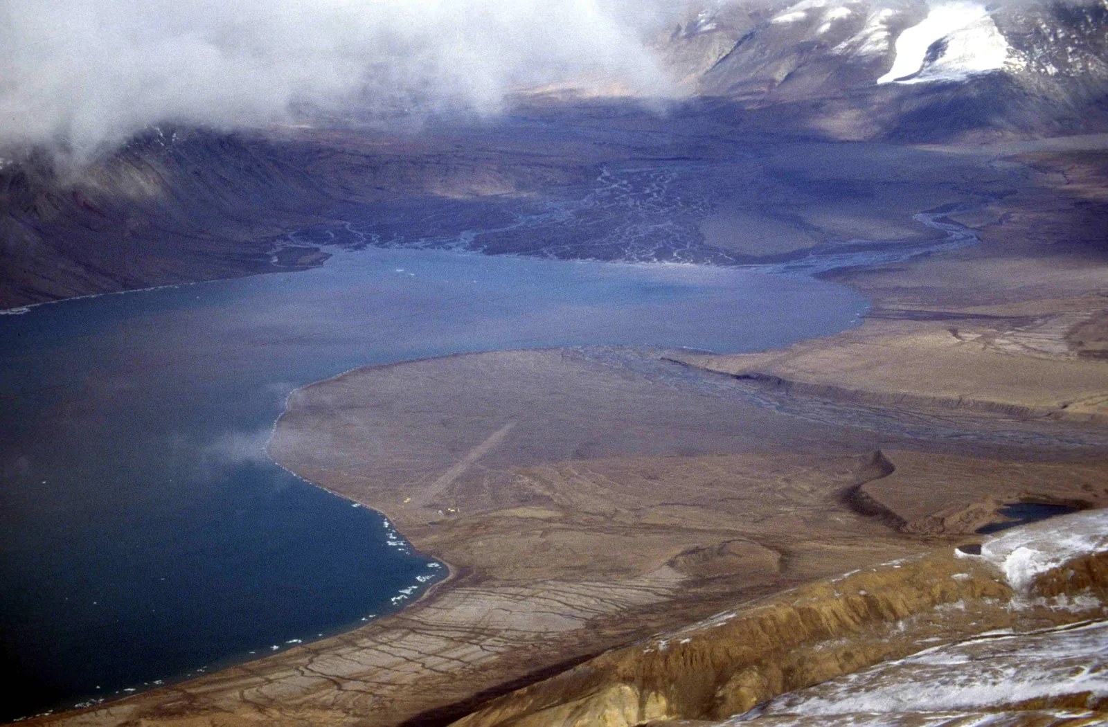
The station at the head of the fiord is the start and end of almost every visit, with a gravel airstrip, kitchen tent and a small museum.

Coordinates
81.400042, −76.821864
Staffed
early June to late July
Accommodation
Weatherhaven with four double rooms
Kitchen
shared tent with gas stove
Water
from the creek, boil it
Emergencies
radio and rescue equipment in the building

Facilities and equipment in the park ↗

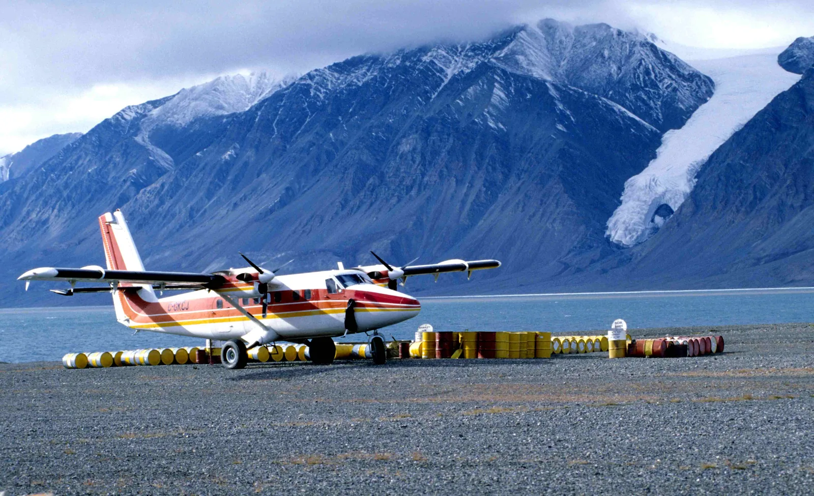
A red and white Twin Otter on a gravel airstrip between rows of fuel drums in Quttinirpaaq National Park, a fiord and glaciated mountains behind
Photo: Ansgar Walk ↗ · CC BY-SA 2.5 ↗

Place in the park

The Twin Otter

There is no scheduled flight into the park. To get there, you charter an aircraft in Resolute Bay, and share the bill.

Aircraft
De Havilland DHC-6 Twin Otter
Seats
eight to nine people
Payload
up to 1,200 kilograms (2,646 lb)
Cost
about 70,000 CAD for the return flight
Operator
Kenn Borek Air from Resolute Bay
Park authority advice
book early, everything is busy in summer

Getting there via Resolute Bay ↗

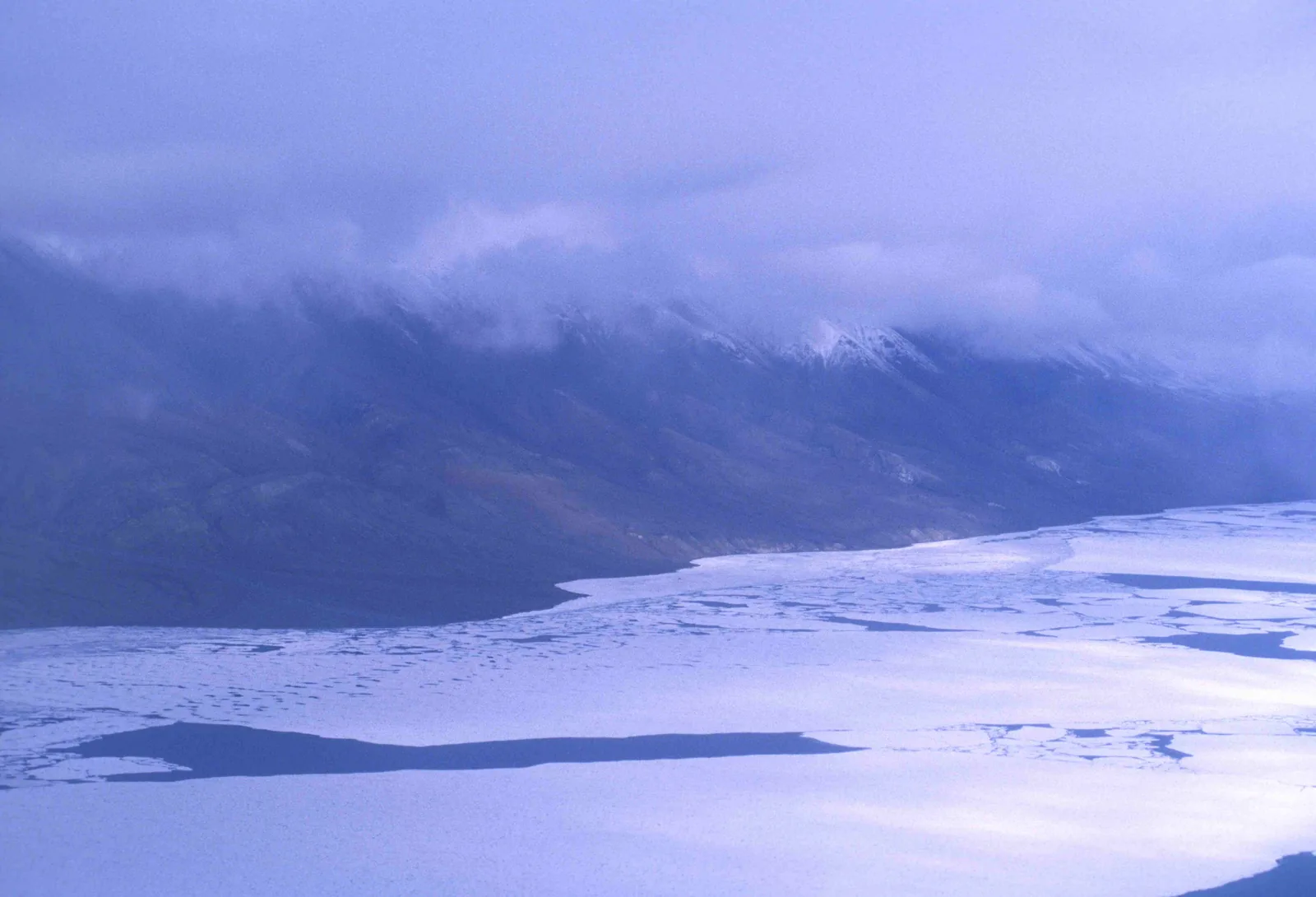
Frozen Lake Hazen in Quttinirpaaq National Park with broken ice floes, a long mountain range behind under low clouds
Photo: Ansgar Walk ↗ · CC BY-SA 2.5 ↗

Place in the park

Lake Hazen

The park’s thermal oasis: one of the largest lakes north of the Arctic Circle, with meadows and more wildlife than anywhere else here.

Coordinates
81.794152, −71.149858
Station
Hazen Camp, 81.824343, −71.320541
Special feature
warmer and wetter than its surroundings
Reason
glacier water, shelter from the mountains, West Greenland Current
Wildlife
Arctic hares in their hundreds, muskoxen, caribou
Research
long-term projects on climate and contaminants

Ecosystems and habitats ↗

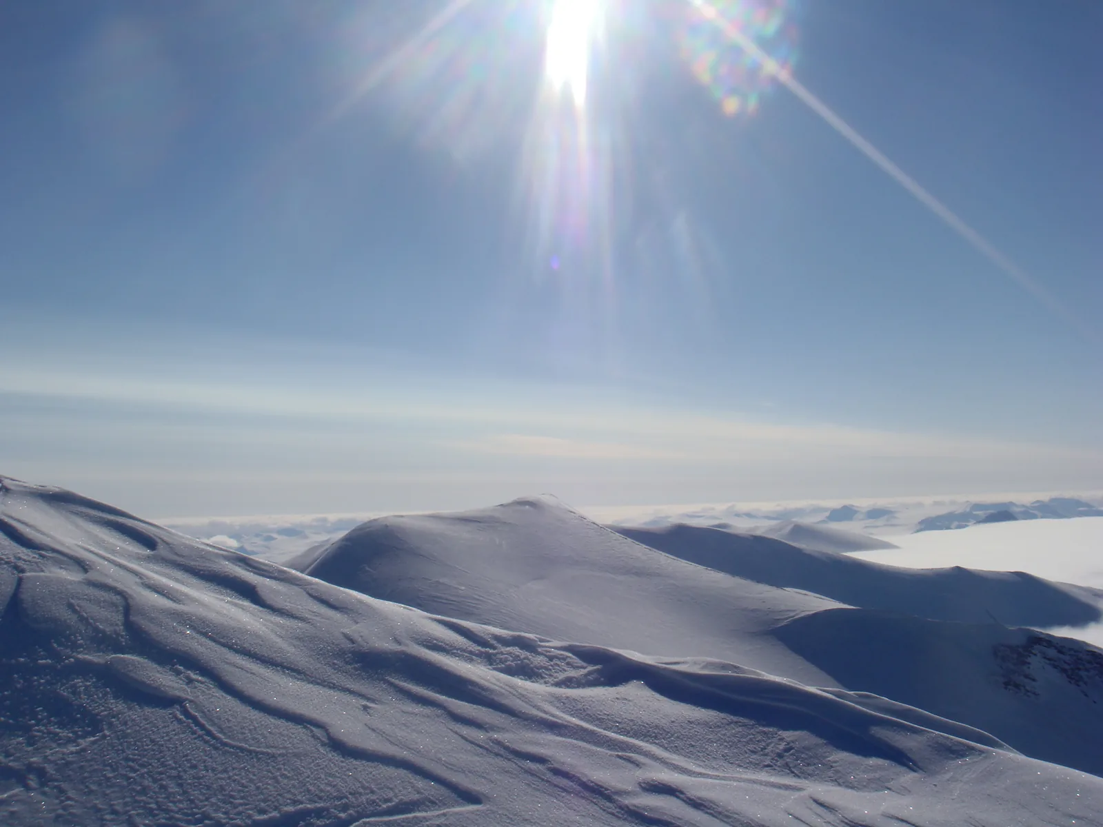
View from the summit in Quttinirpaaq National Park over wind-blown snow ridges to a vast icefield, the low sun in a blue sky above
Photo: FiLo X ↗ · CC BY-SA 3.0 ↗

Place in the park

Barbeau Peak

The highest mountain in eastern North America, and according to the park authority a goal for the few who come on skis in spring.

Height
2,616 metres (8,583 ft)
Coordinates
81.926674, −74.986694
Best time
April and May
Requirements
ski touring, glacier travel, avalanche knowledge
Surroundings
countless unclimbed peaks
Rescue
can take a week or longer

Spring ski traverses ↗

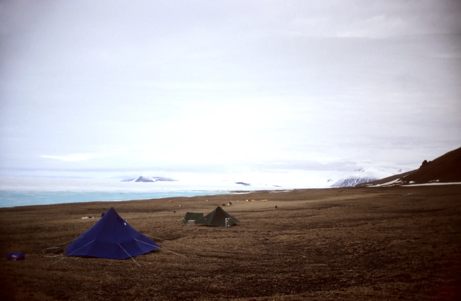
Two tents of a field camp in Quttinirpaaq National Park on brown tundra, the white expanse of the ice shelf and distant mountains behind
Photo: Matti&Keti ↗ · CC BY-SA 4.0 ↗

Place in the park

Ward Hunt Island

The island on the northern edge of the park: research camp, emergency radio, and for some the last stop before the pack ice.

Coordinates
83.099573, −74.208319
Location
North coast of Ellesmere Island
Research
long-term studies for decades
North Pole
starting point; notification in Iqaluit required
Phone Iqaluit
867-975-4673
Emergency radio
available in the building

Setting out for the North Pole ↗

Map

11 places on the map

Eleven points, each verified against an OpenStreetMap object.

Open map3D terrain · details and photos for every place
  • Mountains & rock4
  • Water3
  • Nature3
  • Surroundings1

03 · Out and about

Hikes & things to do in Quttinirpaaq

There are no trails, only routes.

Photo: Ansgar Walk ↗ · CC BY-SA 2.5 ↗

“36 per cent of the park lies under ice. The icefields are up to 900 metres thick, and nunataks rise from them, mountains completely surrounded by ice.”

Quttinirpaaq National Park · View of the British Empire Range

Hikes & things to do in Quttinirpaaq

Hiking

From the Tanquary Fiord station, day hikes and multi-day treks are possible. The best-known route is a nine- to ten-day loop around the Ad Astra and Viking ice caps; there are also several trips of three to five days. There are no built trails anywhere in the park.

Hiking from Tanquary Fiord ↗

The Muskox Way

The park authority mentions a 4,500-year-old route that earlier inhabitants already followed. There are also archaeological sites around Kettle Lake, with their own self-guided walk brochure.

Activities in the park ↗

Ski touring

Thousands of square kilometres of glaciers and ski terrain, plus countless unclimbed peaks. If you bring strong skills in ski touring, glacier travel and avalanche knowledge, you can reach Barbeau Peak or traverse an ice cap.

Spring ski traverses ↗

Glaciers

Because it is cold and dry, the glaciers move slowly; crevasses and icefalls are less common than further south. They are still dangerous. Guides in glacier and technical terrain need full ACMG or IFMGA certification.

Mountains, glaciers, avalanches ↗

North Pole

Ellesmere Island has been a starting point for North Pole attempts since the late 19th century. If you start from within the park, at Ward Hunt Island, McClintock Inlet or Cape Columbia, you must inform the park office in Iqaluit and may have to attend an orientation there in person.

Setting out for the North Pole ↗

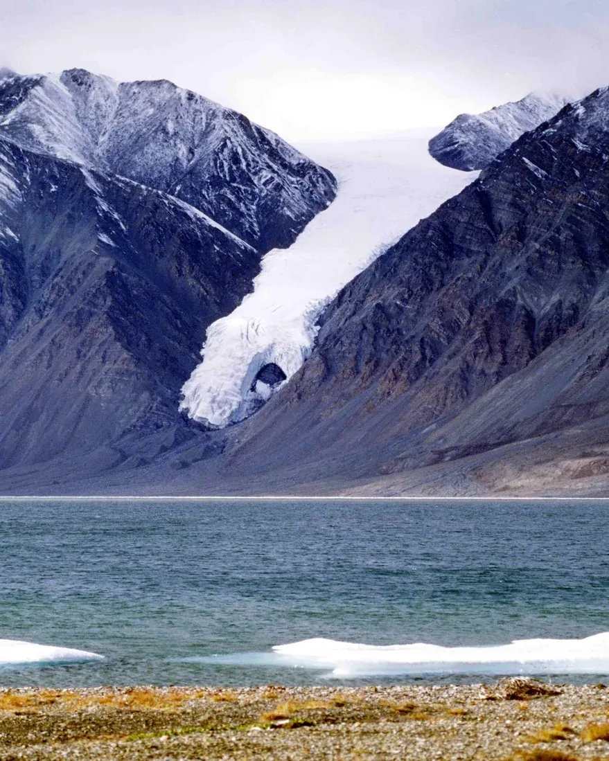
A glacier pushes down to the shore at Tanquary Fiord in Quttinirpaaq National Park between dark mountains, the landscape around the base camp of the guided hiking weeks

Black Feather Wilderness Adventure Company, named by the Quttinirpaaq park authority (Parks Canada) as a tour operator · Guided hiking trip · named tour operator

Guided hiking weeks at a base camp at Tanquary Fiord

In July, Black Feather flies a small group from Resolute Bay to Tanquary Fiord and sets up a tent camp at the park authority’s station. From there, for almost two weeks, you head out on a different route every day: through the Macdonald River valley, up one of the peaks above the fiord or along the coast to the glaciers. The guides give photography tips, and Parks Canada provides the orientation. The trip is designed for people who enjoy camping and want to reach the Arctic without mountaineering experience; the midnight sun comes with it in July.

  • 18 days from Resolute
  • 4 to 6 guests
  • Charter flight included
  • Level 2 of 4

Meeting point Meeting point in Resolute (YRB airport), Nunavut; the first and last nights at the South Camp Inn in Resolute.

According to the trip notes, guides, tents and kitchen, meals in camp, hotel nights in Resolute, a satellite phone and the return charter flight are included. Not included are the park fee, sales tax, travel to Resolute and costs from delays; occasionally a night in Iqaluit at your own expense is needed because of the flight schedule to Resolute. Black Feather asks you to allow for up to a week’s delay on the return and requires trip cancellation and interruption insurance for all trips from Resolute. The trip does not go to Lake Hazen; it stays in the south-west of the park. For sure-footed hikers, Black Feather offers the Ad Astra trip in the same period, a trek of about 120 kilometres (75 mi) from Tanquary Fiord to the glaciers on the Air Force River (level 4 of 4).

Go to Black Feather’s website ↗Tour operator named by Parks Canada · no partner link · checked 2 Oct 2026

Landscape image, not a provider photo · Photo: Ansgar Walk ↗ · CC BY-SA 2.5 ↗

Nature and history of Quttinirpaaq

Canada’s second-largest national park

Quttinirpaaq was established in 1988 and protects 37,775 square kilometres (14,585 sq mi) of the eastern High Arctic. 36 per cent of the area lies under glaciers and ice caps; the icefields are up to 900 metres (2,953 ft) thick.

Science and conservation ↗

The highest mountain in eastern North America

Nunataks rise from the icefields, isolated mountains completely surrounded by ice, over 2,500 metres (8,202 ft) high. Barbeau Peak is 2,616 metres (8,583 ft) high and the highest mountain in eastern North America.

Ecosystems and habitats ↗

The oasis at Lake Hazen

The Lake Hazen basin is warmer and wetter than its surroundings: glacier water, south-facing mountains and the West Greenland Current let meadows and Arctic flowers grow here. Arctic hares gather in their hundreds, along with small herds of muskoxen and Peary caribou, a few Arctic wolves and Arctic foxes and about 30 species of migratory birds.

Ecosystems and habitats ↗

A single freshwater fish

Arctic char is the park’s only freshwater fish species; smaller waters hold only invertebrates. On the ice shelves in the north, epishelf lakes form with their own microorganisms. In the sea, about 2,375 square kilometres of which belong to the park, only species that cope with permanent pack ice live: ringed seal, bearded seal, narwhal, polar bear.

Ecosystems and habitats ↗

Managed together

The park is managed jointly with the Inuit; the 2023 management plan is based on the Nunavut Agreement and the Inuit Impact and Benefit Agreement. Inuit Qaujimajatuqangit, traditional knowledge, feeds into decisions through six guiding principles, including Avatittinnik Kamattiarniq, caring for the environment.

Management plan 2023 ↗

04 · Before you go

Park film and places nearby

Photo: Ansgar Walk ↗ · CC BY-SA 2.5 ↗

Film by the park authority

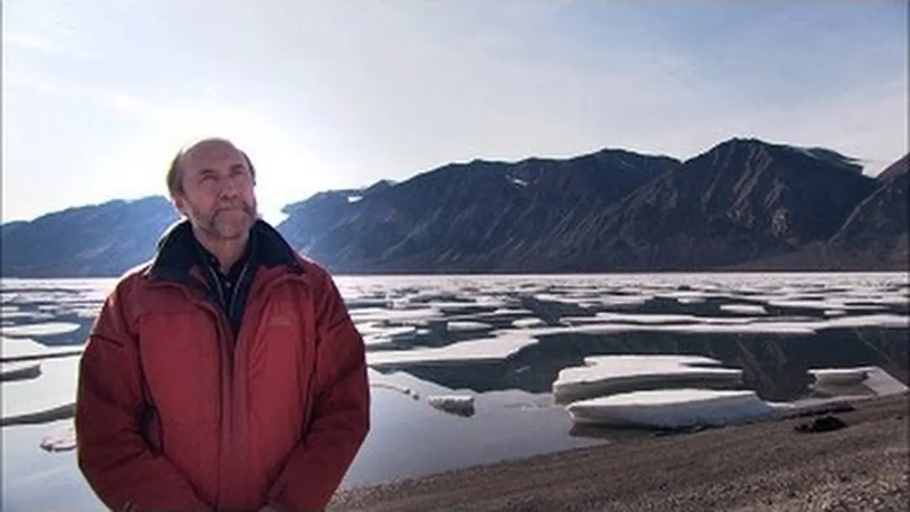
Discovering the Microscopic World of Quttinirpaaq National Park

Just under four minutes from Parks Canada, from 2012: a researcher from Université Laval who has worked on Ward Hunt Island for twelve years shows how much life there is in a landscape that looks sterile at first glance. The transcript is on the park’s nature page. In English.

Source: Parks Canada · View channel ↗

Around the park

Grise Fiord

Canada’s northernmost community, with about 150 residents, called Ausuittuq in Inuktitut, “the place that never thaws”. It lies about 360 kilometres (224 mi) north-east of Resolute Bay on the south coast of Ellesmere Island; Kenn Borek Air flies there.

Getting there via Resolute Bay ↗

Local operators

Both communities are too far from the park. Local operators do, however, run trips in the surrounding area; High Arctic wildlife, culture and history are within reach on a day trip.

Licensed guides and tour operators ↗

Field book · Quttinirpaaq National Park

checked 20 Sep 2026

Quttinirpaaq at a glance · PDF, 2 pages ↓

00My visit

Nothing saved yet. Every place card has a pin, and so does every place on the Map. What you save collects here, with days, notes and a preview you can share.

01Best time to visit Quttinirpaaq and daylight

Between 24 hours of day and 24 hours of night there is hardly a transition.

Late May to mid-August

According to the park authority, this is the best time to visit. From May to August it is light 24 hours a day, from November to February dark 24 hours a day; the change comes fast.

Weather and best time to visit ↗

Spring for ski touring

April and May are considered a good time for ski traverses, because the weather is relatively stable then. If you travel at this time, you must be able to look after yourself for several days in case of a rescue.

Spring ski traverses ↗

Closures possible from mid-July to 1 August

The rivers are fed by glaciers; in warm years they rise high and stay high for a long time. The park authority has therefore closed parts of the park during this period before, including glacier tongues and fords.

River crossings ↗

Polar desert with warm days

The park is a polar desert: cold, dry, with little precipitation. The winters are among the coldest in Canada. The short summers can be surprisingly warm, especially at Lake Hazen. The coasts are cooler and damper than the interior.

High Arctic climate ↗

Snow at any time

The weather changes abruptly and can alter temperature and visibility for several days. Whiteouts are possible in any season. The park authority puts it briefly: be prepared for snow at any time and anywhere.

Weather, hypothermia, frostbite ↗

Climate through the year

Weather and climate in Quttinirpaaq National Park

Mildest months by the climate data: July. Average daytime highs of around 5 °C, lows of around 3 °C, around 26 mm of precipitation a month.

Climate chart in Quttinirpaaq National ParkAverage daily highs from −31 °C to 5 °C, lows from −35 °C to 3 °C; monthly precipitation from 5 mm to 29 mm.
All monthly values as a table
Monthly averages 2001–2020, NASA POWER model
MonthHigh °CLow °CPrecipitation mm
January−30.6−35.06
February−31.1−35.35
March−30.0−34.67
April−21.4−27.57
May−10.1−14.610
June0.5−2.623
July5.32.626
August1.0−2.629
September−10.5−14.416
October−19.5−23.115
November−25.9−29.98
December−28.2−32.57
Year159

Modelled values, not a weather station: NASA POWER (MERRA-2) for a grid cell of about 55 × 10 km around the map point Viking Ice Cap (81.53° N, 75.46° W), with an average cell elevation of about 880 m. Averages for 2001–2020. Higher ground and valleys can differ markedly.

Source: NASA POWER, climatology 2001–2020 ↗ · retrieved 3 Oct 2026

02How to get to Quttinirpaaq: three flights

Ottawa, Montréal or Yellowknife, then Iqaluit, then Resolute Bay, then a charter.

To Resolute Bay

Canadian North flies to Iqaluit from Ottawa, Montréal and Yellowknife and on to Resolute Bay on a scheduled service. Resolute Bay is the starting point for all trips into the park.

Getting there via Resolute Bay ↗

The charter

Kenn Borek Air flies charters with a Twin Otter from Resolute Bay into the park. The charter companies are very busy in summer; the park authority advises booking well in advance.

Getting there via Resolute Bay ↗

Through a tour operator

Transport can also be arranged through a licensed tour operator. The park authority names Black Feather in Ontario and Northwinds Arctic Adventures in Iqaluit; local operators in Resolute and Grise Fiord are too far away to take visitors into the park.

Licensed guides and tour operators ↗

Fuel and deterrents

Bear spray and many noise deterrents are not allowed on aircraft. It is best to buy stove fuel in Resolute Bay or Grise Fiord and leave what is left there; outfitters and the hunters and trappers organisations often take it.

Travelling with fuel and deterrents ↗

Freight takes time

If you ship equipment from abroad, the park authority says you need to allow an extra four to six weeks for customs. And: in the North the weather sets the schedule, not the calendar.

Getting there via Resolute Bay ↗

Kenn Borek Air, named by the Quttinirpaaq park authority (Parks Canada) as a charter operator · Charter flight · named operator

Twin Otter charter flight from Resolute Bay to Tanquary Fiord

The only way into the park is by chartered small aircraft. Parks Canada names Kenn Borek Air for this: the Twin Otter flies from Resolute Bay directly into the park, usually to the gravel airstrip at Tanquary Fiord, five kilometres from the station. One aircraft carries eight to nine people and up to 1,200 kilograms (2,646 lb) of baggage and is booked by the whole group. Other landing sites in the park are possible but cost more. If you do not want to charter yourself, you get the flight as part of a licensed tour operator’s trip.

Meeting point Resolute Bay airport (YRB), Nunavut. Canadian North flies there via Iqaluit, with connections from Ottawa, Montréal and Yellowknife.

There is no schedule: Kenn Borek Air only flies on request, and you get a quote through the operator’s website. The park authority writes that charter operators are very busy in summer and advises planning the trip well in advance; it gives the guide price for a return flight on its getting-there page, which depends on the fuel price. Weather can delay the flights in and out by days, so allow a buffer. Every trip into the park must be registered in advance, with the orientation at the office in Resolute. The stations at Tanquary Fiord and Lake Hazen are only staffed from early June to late July.

Park authority page ↗Charter operator named by Parks Canada · no partner link · checked 2 Oct 2026

03Quttinirpaaq fees and what the flight costs

All amounts in Canadian dollars, retrieved from Parks Canada on 20 September 2026.

A permit instead of admission

The northern parks have no daily admission but a permit per person: 17.75 CAD for a day without an overnight stay, 37.00 CAD per night or 259.00 CAD for a year. It is valid in eleven parks, including Aulavik, Auyuittuq, Ivvavik, Nahanni, Sirmilik, Tuktut Nogait, Vuntut, Qausuittuq and Ukkusiksalik.

Parks Canada: fees ↗

The charter flight

According to the park authority, a return flight from Resolute Bay to Tanquary Fiord costs about 70,000 CAD, depending on the price of fuel; other destinations in the park cost extra. A Twin Otter carries eight to nine people and up to 1,200 kilograms (2,646 lb). The cost is therefore shared by a group.

Getting there via Resolute Bay ↗

Weatherhaven at Tanquary Fiord

The park’s fixed accommodation costs 37.25 CAD per night for single occupancy and 31.00 CAD for double occupancy. There is one unit with four double rooms; a reservation is required, and you cook in the kitchen tent next door.

Parks Canada: fees ↗

Youth pay nothing, almost

Since 1 January 2018, admission for youth aged 17 and under has been free at all Parks Canada places. The backcountry and overnight permit for the northern parks is explicitly excluded from this.

Parks Canada: fees ↗

You pay for medical evacuation yourself

If you do not live in Nunavut, you bear the cost of medical transport yourself; a rescue flight is billed in full. The territory’s health department recommends travel insurance for visitors.

Travelling with fuel and deterrents ↗

04Where to stay in Quttinirpaaq: Weatherhaven and tent

One fixed shelter; otherwise your own tent.

Weatherhaven

At Tanquary Fiord there is an insulated tent cabin with a solid floor: two halves, each with two double rooms and a living area with sofa, desk and heater. Bedding is provided, as are lamps. There is neither a bathroom nor a kitchen in the unit.

Staying in the park and in the communities ↗

What is next to it

Pit toilets and a solar shower, a fully equipped kitchen tent with gas stove, pots and dishes, a visitor centre with power for charging, picnic tables, benches with a view and a small museum with finds from research at Tanquary Fiord in the 1960s.

Staying in the park and in the communities ↗

Water from the creek

You get water from the creek behind the kitchen tent; the park authority advises boiling it first. In the backcountry: filter finely to below 0.5 micrometres, treat chemically or boil.

Camping safely ↗

Camping anywhere, almost

There are no designated campsites. You may camp anywhere except at archaeological sites, in specially protected areas, in rockfall zones and in potential wildlife habitat. Avoid sediment meadows and prefer ground without vegetation.

Staying in the park and in the communities ↗

No fires

Open fires are prohibited in the park. You cook on a stove with white gas. Your tent must withstand cold and strong wind; trenches around the tent and stone wind walls are not allowed.

Visitor guidelines ↗

05Rules & safety in Quttinirpaaq

What is a recommendation in other parks is a condition here.

River crossings are the biggest danger

The park authority explicitly calls them the greatest risk for summer visitors. The rivers come from glaciers: their water level changes over the day and from day to day. In warm spells it is lowest between 2:00 and 7:00 in the morning. You must be prepared to wait for hours or days.

River crossings ↗

Polar bears possible anywhere

Encounters are rare, but possible throughout the park and in any season, even on glaciers. The likelihood is greatest on the coast. The larger the group, the lower the risk. The park keeps deterrents for visitors, because they are hard to buy in the North and banned on aircraft.

Safety in polar bear country ↗

The compass does not help

Quttinirpaaq lies in the zone where a compass is unreliable. GPS is the tool of choice, with a spare unit, batteries kept warm and suitable maps. Topographic maps must be bought before you arrive; 1:250,000 for planning, 1:50,000 for navigating.

Navigating without a compass ↗

Satellite phone, not SPOT

Iridium devices have the most reliable coverage; InReach is recommended, SPOT does not work at this latitude. Satellite phones are not available in Nunavut and must be brought with you. There are emergency radios in the buildings at Tanquary Fiord, Lake Hazen and on Ward Hunt Island.

Communication in the park ↗

Rescue takes time

Quttinirpaaq is one of the most remote parks in North America; rescue capability is very limited. For technical rescues, help has to come from outside Nunavut. If a group is overdue because it has not de-registered, the search may only begin 48 hours after the return date. The emergency number is 1-780-852-3100.

Emergencies and rescue ↗

06Frequently asked questions: Quttinirpaaq National Park

How do I get to Quttinirpaaq National Park?

With three flights. Canadian North flies from Ottawa, Montréal or Yellowknife to Iqaluit and on to Resolute Bay. From there you can only continue by charter: Kenn Borek Air flies into the park with a Twin Otter. There is no road, and no scheduled flight into the park.

Getting there via Resolute Bay ↗

How much does a visit to Quttinirpaaq cost?

The permit costs 17.75 CAD per day without an overnight stay, 37.00 CAD per night or 259.00 CAD per year, per person. According to the park authority, the return flight from Resolute Bay to Tanquary Fiord costs about 70,000 CAD depending on fuel prices, for the whole aircraft with eight to nine seats.

Parks Canada: fees ↗

Do I need to register?

Yes. Every trip into the park must be registered in advance and de-registered after your return. Registration includes an orientation. If you do not de-register, you may trigger a search, but it can only start 48 hours after the return date you gave.

Visitor guidelines ↗

When is the best time to visit Quttinirpaaq?

Late May to mid-August, when it is light 24 hours a day. April and May suit ski touring, because the weather is more stable. From mid-July to 1 August the park authority may close parts of the park because of high water.

Weather and best time to visit ↗

Where can I stay?

At Tanquary Fiord there is a Weatherhaven unit with four double rooms, 37.25 CAD per night for single and 31.00 CAD for double occupancy. Otherwise you camp: there are no designated campsites, and you may camp almost anywhere except at archaeological sites, in protected areas, in rockfall zones and in wildlife habitat.

Staying in the park and in the communities ↗

How dangerous is it?

The park authority calls river crossings the greatest risk for summer visitors: the glacier-fed rivers change their level over the course of the day. Add to that polar bears, which can appear anywhere in the park, abrupt weather changes and a rescue that can take a week or longer. Visitors must be experienced and capable of self-rescue.

River crossings ↗

07Sources and date checked

All information comes from the park authority and has been checked with a date.

  1. Park authority: Quttinirpaaq ↗
  2. Parks Canada: fees ↗
  3. Hours of operation and field season ↗
  4. Getting there via Resolute Bay ↗
  5. Plan your visit ↗
  6. Facilities and equipment in the park ↗
  7. Licensed guides and tour operators ↗
  8. Brochures and topographic maps ↗
  9. Weather and best time to visit ↗
  10. Activities in the park ↗
  11. Hiking from Tanquary Fiord ↗
  12. Spring ski traverses ↗
  13. On the glaciers ↗
  14. Setting out for the North Pole ↗
  15. Staying in the park and in the communities ↗
  16. Safety and rules ↗
  17. Visitor guidelines ↗
  18. Emergencies and rescue ↗
  19. Communication in the park ↗
  20. Camping safely ↗
  21. River crossings ↗
  22. Rockfall and terrain ↗
  23. Mountains, glaciers, avalanches ↗
  24. Navigating without a compass ↗
  25. Weather, hypothermia, frostbite ↗
  26. Safety in polar bear country ↗
  27. Avoiding encounters ↗
  28. When a polar bear approaches ↗
  29. Campsites in bear country ↗
  30. Deterrents and alarm systems ↗
  31. Animals without fear ↗
  32. Travelling with fuel and deterrents ↗
  33. Current orders ↗
  34. Nature and science ↗
  35. The park’s environment ↗
  36. High Arctic climate ↗
  37. Ecosystems and habitats ↗
  38. Science and conservation ↗
  39. Species at risk ↗
  40. Research and monitoring ↗
  41. Inuit Qaujimajatuqangit ↗
  42. Management plan 2023 ↗
  43. Permits and licences ↗
  44. Administration and management ↗

How current is this information?

Researched 20 Sep 2026. Not a live status. Dates apply only to the year stated. A successful automatic fetch is not an editorial confirmation; outdated automatic values are hidden and replaced by the source link.

Current information from the park ↗

Image and map credits

Location sources: The park authority publishes no coordinates for Quttinirpaaq; every point is verified against an OpenStreetMap object. Markers do not imply that access is permitted. Base map © OpenStreetMap contributors. Coastlines of the chapter map: Natural Earth.

End of the field book · Park authority ↗