National Parks Atlas
MapPDF

01 · Canada · Nova Scotia · Cape Breton Island

Cape Breton Highlands National Park

A high plateau between the Gulf and the Atlantic, and the road travellers come to Nova Scotia for runs right through it.

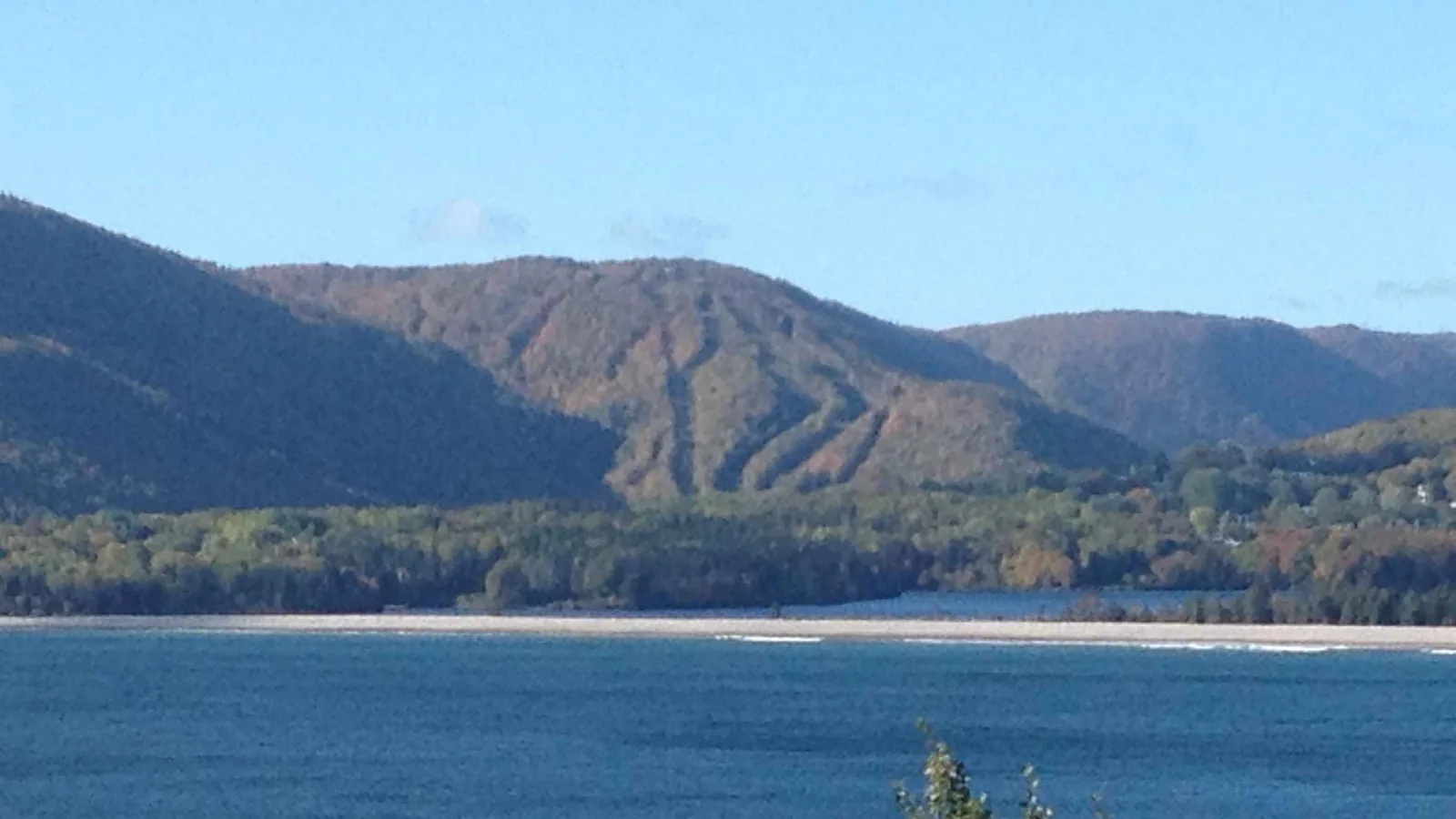
Photo: Tony Webster from San Francisco, California ↗ · CC BY-SA 2.0 ↗

Cape Breton Highlands at a glance · PDF, 2 pages

Cape Breton Highlands National Park: landscape and origins

Since 1936, Cape Breton Highlands has protected about 950 square kilometres (367 sq mi) on the northern tip of Cape Breton Island, roughly a fifth of northern Cape Breton, between the Gulf of St. Lawrence and the Atlantic.

The defining feature is the Highlands themselves: a forested plateau cut by steep cliffs and deep river canyons. A third of the Cabot Trail runs across this plateau and along both coasts; 106 of the nearly 300 kilometres lie in the park.

The cool maritime climate and rugged terrain allow a mix of Acadian, boreal and taiga habitats. According to the park authority, this combination of northern and southern species is found nowhere else in Canada.

Several dozen rare or endangered species live here, along with old-growth forests of international importance. Small populations of Arctic-alpine plants have survived since the last Ice Age.

The park represents the Maritime Acadian Highlands natural region, part of a mixed broadleaf and conifer forest that stretches from the Great Lakes through New England to Canada’s Maritime provinces.

With the Toqi'maliaptmu'k Arrangement, the Mi'kmaq of Nova Scotia and Parks Canada have a formal partnership for the joint management of protected areas.

Nature: establishment, area and habitats ↗

The park in numbers

Established
1936
Area
950 km² (367 sq mi), about 20 % of northern Cape Breton
Location
Northern tip of Cape Breton Island, between the Gulf of St. Lawrence and the Atlantic
Cabot Trail in the park
106 of nearly 300 km
Natural region
Maritime Acadian Highlands
Habitats
Acadian, boreal and taiga; this mix exists nowhere else in Canada
Hiking trails
26
Campgrounds
8
Partnership
Toqi'maliaptmu'k Arrangement with the Mi'kmaq of Nova Scotia
Visiting Cape Breton Highlands: overview and planning

01

106 kilometres of the Cabot Trail lie in the park

The Cabot Trail loops around northern Cape Breton for nearly 300 kilometres (186 mi). About a third of it, 106 kilometres (66 mi), runs inside the park boundary, and a park pass is required for this section. If you drive the loop, you visit the national park, planned or not.

Directions, Cabot Trail and ferry ↗

02

New in 2026: reservations at the Skyline Trail

For the first time, a paid parking reservation applies to the park’s best-known trail from 26 June to 25 October 2026. The park authority states that once all spaces are taken, there is no access to the trail during this period. There are about fifty parking spaces.

Skyline Trail: reservations and time slots ↗

03

Two entrances, two directions

The park has a western entrance at Chéticamp and an eastern one at Ingonish. Whether you drive the Cabot Trail clockwise or anticlockwise changes the scenery considerably, as the park authority explicitly points out.

Directions, Cabot Trail and ferry ↗

04

Between the Gulf and the Atlantic

The park stretches across the northern tip of Cape Breton Island, between the Gulf of St. Lawrence to the west and the Atlantic to the east. Steep cliffs and deep river canyons cut into a forested plateau.

Nature: establishment, area and habitats ↗

02 · Places

Map and places in the park

Visitor centres with the official park authority coordinates, all other points verified against an OpenStreetMap object.

Photo: Larry from Charlottetown, PEI, Canada ↗ · CC BY 2.0 ↗

Place in the park

Skyline Trail

A ridge that ends on a wooden boardwalk above the Atlantic, and since 2026 the only place in the park where you have to book a parking space.

Short version
6.5 km (4 mi) there and back, about 2 hours.
Loop
8.2 km (5.1 mi), about 2.5 to 3 hours.
Reservation
Mandatory from 26 June to 25 October 2026.
Start times
8:00, 9:00, 12:00, 13:00, 16:00 and 17:00, each with four hours of parking.
Arrival window
no earlier than 10 minutes before, no later than one hour after the start time.
Parking spaces
about fifty, including oversize and accessible spaces.
Address
19625 Cabot Trail, Chéticamp, NS.
Without a reservation
November to May: quieter, but with limited services.

Skyline Trail: reservations and time slots ↗

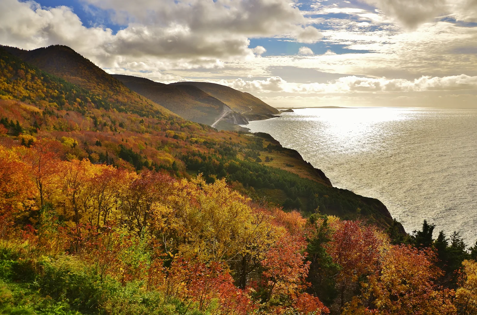
Forest in red and gold autumn colours above the Cabot Trail in Cape Breton Highlands National Park, cutting into the steep coastal slope, with the glittering sea below
Photo: Eric Van Lochem ↗ · CC BY-SA 4.0 ↗

Place in the park

The Cabot Trail

Nearly 300 kilometres around northern Cape Breton, 106 of them in the national park. The park authority calls it one of the most scenic drives in North America.

Total length
nearly 300 km (186 mi) as a loop.
In the park
106 km (66 mi), about a third.
Park pass
required for the park section.
Direction
clockwise or anticlockwise; the scenery differs considerably.
Lookoffs
numerous lookoffs, including the Veterans Monument and MacKenzie Mountain.
All year
the road is always open; the park facilities are not.

Directions, Cabot Trail and ferry ↗

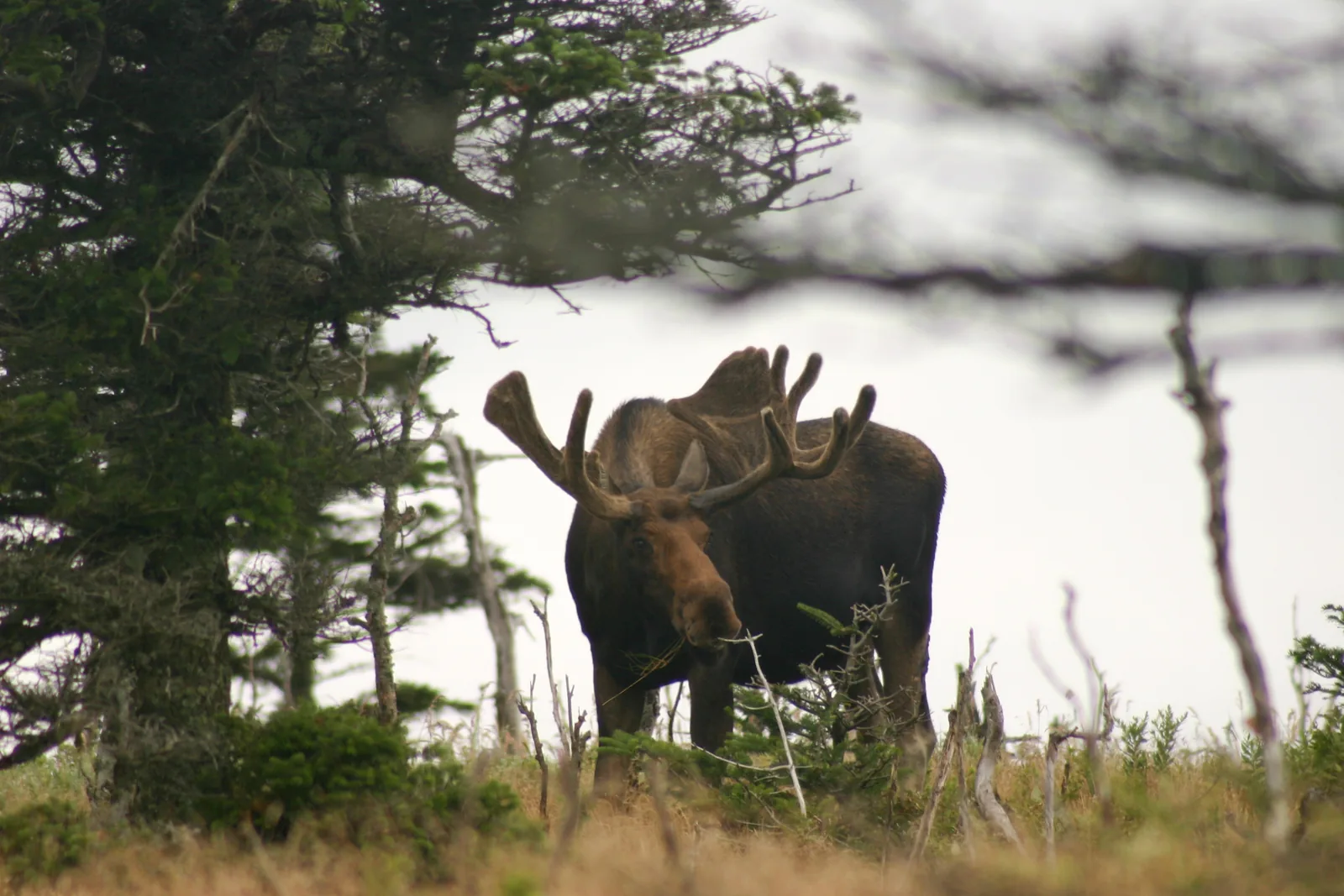
A bull moose with velvet-covered antlers stands among wind-blown spruce at the edge of a clearing in Cape Breton Highlands National Park
Photo: Martin Cathrae ↗ · CC BY-SA 2.0 ↗

Place in the park

Moose and other wildlife

Here the moose is both: the animal you want to see, and the most common real danger on the road.

On the road
hard to see, especially at dusk; be ready to brake hard.
Other large animals
Black bears and coyotes.
Coyotes
do not feed them; Parks Canada works with experts on safety standards here.
In the air
Bald eagles, hawks, cormorants, gannets.
In the water
Seals, and minke and humpback whales.
Rubbish
in bear-proof bins; food in the vehicle.

Safety: moose, coyotes and rip currents ↗

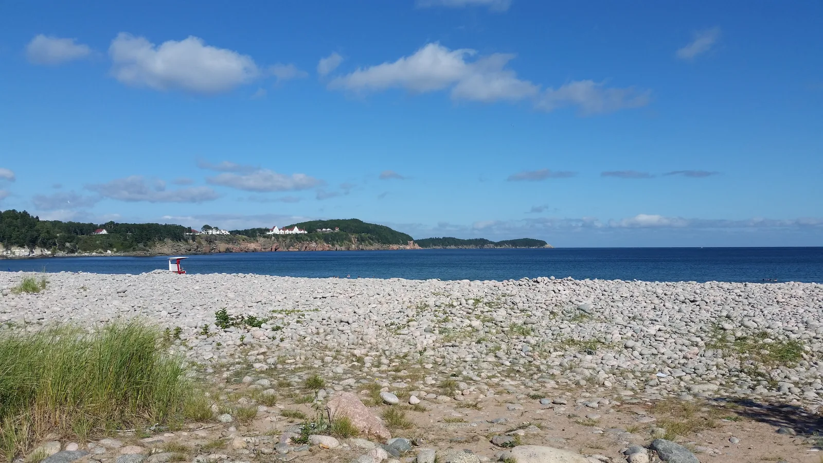
Wide pebble beach at Freshwater Lake in Cape Breton Highlands National Park under a blue sky, with a low forested headland and the open sea behind
Photo: Pi3.124 ↗ · CC BY-SA 4.0 ↗

Place in the park

Ingonish and Freshwater Lake

The eastern entrance: visitor centre, beach and a lake with a lookoff right behind it.

Visitor centre
opened in 2014; passes, programme tickets and information.
Freshwater Lake
directly behind the centre, with a lookoff and loons.
Old centre
a small historic stone building, now home to the park wardens.
Camping
Broad Cove and Ingonish Beach, which also has a Tiny Cabin.
Access
Cabot Trail East via St. Ann's or the Englishtown ferry.

Season and visitor centres ↗

Map

9 places on the map

Visitor centres with the official park authority coordinates, all other points verified against an OpenStreetMap object.

Open map3D terrain · details and photos for every place
  • Trails2
  • Arrival2
  • Where to stay3
  • Surroundings2

03 · Out and about

Hikes & things to do: Skyline Trail and lookoffs

26 trails, a coastal panorama and a forest of 350-year-old maples.

Photo: James R. W. Stewart ↗ · CC BY-SA 4.0 ↗

“The park stretches across the northern tip of the island, with the Gulf of St. Lawrence to the west and the Atlantic to the east. Which coast you see first depends only on which way you drive the Cabot Trail.”

Cape Breton Highlands National Park · Evening on the coast

Hikes & things to do: Skyline Trail and lookoffs

Skyline Trail: 6.5 or 8.2 kilometres

The short version takes about two hours there and back to the viewing boardwalk on the headland. The loop via the marked forest path is 8.2 kilometres (5.1 mi) and takes 2.5 to 3 hours. Both end at the same boardwalk above the Atlantic.

Skyline Trail: reservations and time slots ↗

26 hiking trails with clear details

The park authority lists every trail with length, walking time and elevation range: Acadian 8.4 km (5.2 mi) loop in 3 to 4 hours between 20 and 365 metres, Salmon Pools 9.5 km, Le Chemin du Buttereau 4.6 km, Middle Head 5.3 km in an hour and a half, Franey as a 4.5 km loop or 13 km circuit.

Hiking trails with length, time and elevation ↗

Lookoffs along the road

Numerous lookoffs line the park section of the Cabot Trail. At the Veterans Monument, a plaque for Canadians who died abroad was placed in 1985 for the centenary of Parks Canada, one in each province. From MacKenzie Mountain you look 335 metres (1,099 ft) down onto Fishing Cove.

Lookoffs along the Cabot Trail ↗

Fishing Cove: the only backcountry site

At the foot of MacKenzie Mountain there was once a fishing village where Scottish settlers fished and traded with the French. Today it is the site of the park’s only backcountry campground. The number of overnight campers is limited; registration is mandatory, and you must bring your own stove and drinking water.

Lookoffs along the Cabot Trail ↗

Wildlife on land and at sea

The park authority mentions bears eating blueberries, moose antlers among spruce and fir, bald eagles, hawks and cormorants over the slopes, and on the coast diving gannets, seals, and minke and humpback whales.

Park authority and the Toqi'maliaptmu'k Arrangement ↗

Pebble beach at Freshwater Lake near Ingonish Beach in Cape Breton Highlands National Park, with the Middle Head headland and the Keltic Lodge behind; the east coast tour stops here

majestic tours cape breton ns · GetYourGuide

Cabot Trail & Cape Breton Highlands tour

Six-hour round trip from Sydney along the east side of the Cabot Trail: Seal Island Bridge, St. Ann's Lookoff, Cape Smokey and, in the national park, Ingonish Beach with the Keltic Lodge and a short walk at Green Cove.

4.1 out of 5 stars8 reviews on GetYourGuidefrom €94.78as of 4 Oct

  • 6 hours
  • Cabot Trail
  • In the park
  • Guided

Departure Pickup in Sydney included; the operator confirms the location when you book.

Food and drinks are not included; not suitable for wheelchair users. Guide in English, cancellation up to 24 hours in advance.

View tour ↗Ad · partner link · checked 2 Oct 2026

Landscape image, not a provider photo · Photo: Pi3.124 ↗ · CC BY-SA 4.0 ↗

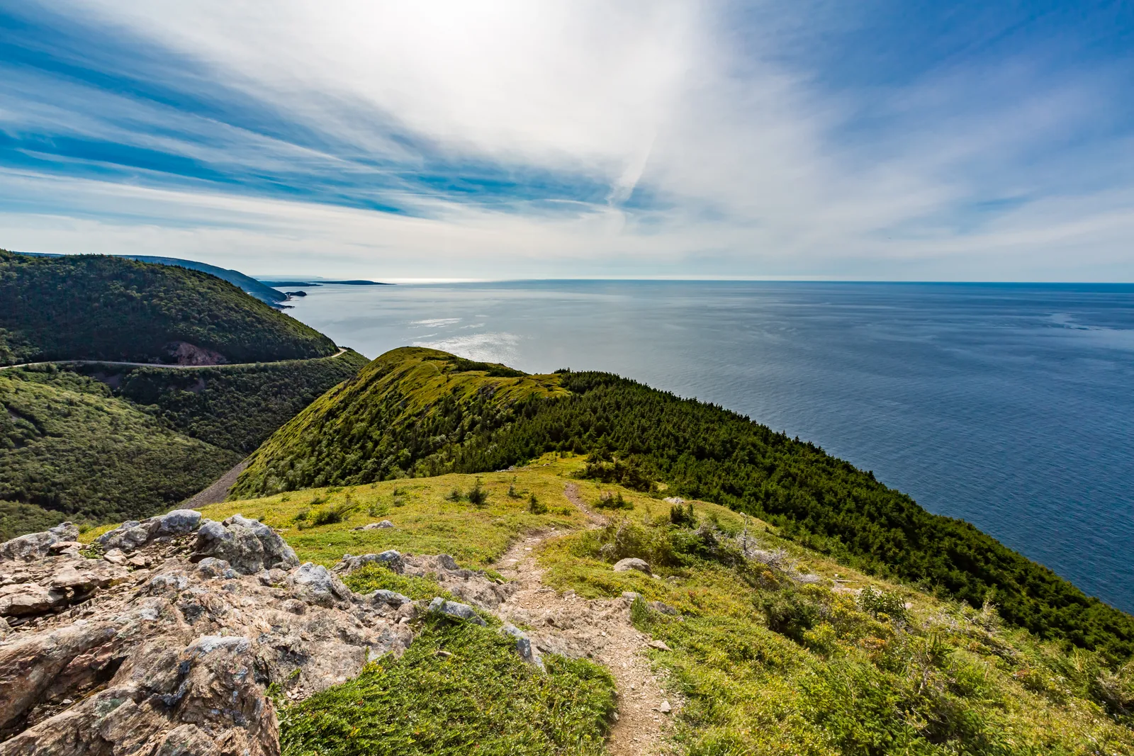
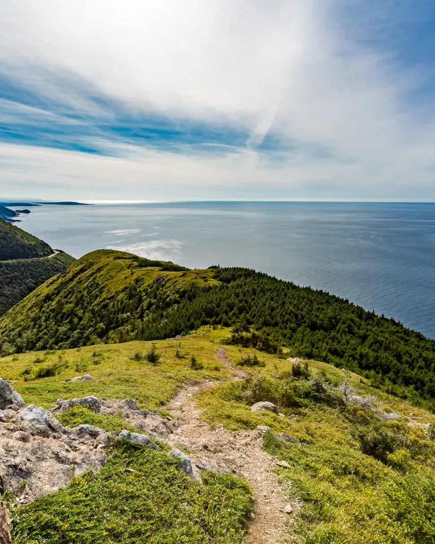
View from the end of the Skyline Trail in Cape Breton Highlands National Park over a green ridge dropping to the Gulf of St. Lawrence; the park authority’s sunset hike leads here

Cape Breton Highlands park authority (Parks Canada) · Park authority programme · sunset

Skyline Trail sunset hike with the park authority

Two hours before sunset, a park authority guide leads you from the Skyline Trail parking lot north of Chéticamp through boreal forest out onto the headland above the Gulf of St. Lawrence, in time to watch the sun set over the sea. Along the way the guide talks about the biodiversity of the Highlands and shows at a viewing platform how browsing by moose is changing the boreal forest. You can stay on the headland as long as you like and walk back alone or with the guide. For the night sky, the park authority runs separate evening programmes in summer at other places: “Stars on the Plateau” on the Mica Hill Trail and the night walk “Seeing in the Dark” at Warren Lake.

  • Daily from late June to early October
  • About 3 hours, about 6.5 km (4 mi) there and back
  • Ages 12 and up, maximum 20 participants
  • Registration required

Meeting point Skyline Trail parking lot (19625 Cabot Trail, Chéticamp), at the gate and sign at the turnaround end of the parking lot; starts two hours before sunset, so the time shifts over the season.

The hike has its own programme fee on top of park admission; registration is through the Parks Canada Reservation Service, online or by phone. The hike runs in almost any weather and is only cancelled for thunderstorms; bring sturdy shoes, drinking water and insect repellent. None of the tours above includes the evening hike: you come in your own car and are best off staying in Chéticamp or at a park campground. For 2026 the park authority lists dates until 10 October.

Park authority page ↗Park authority programme · no partner link · checked 2 Oct 2026

Landscape image, not a provider photo · Photo: Tony Webster from San Francisco, California ↗ · CC BY-SA 2.0 ↗

Ad · we may earn a commission if you book through this partner link – at no extra cost to you. Thank you for supporting the atlas. Offer details checked 2 Oct 2026. See official ticket information.

Nature and partnership in Cape Breton Highlands

Established in 1936, 950 square kilometres

The park protects about 20 per cent of northern Cape Breton and is one of the largest protected wilderness areas in Nova Scotia. It represents the Maritime Acadian Highlands natural region, a mixed forest of broadleaf and conifer trees that stretches from the Great Lakes through New England to Canada’s Maritime provinces.

Nature: establishment, area and habitats ↗

Acadian, boreal and taiga at once

The cool maritime climate and rugged terrain allow a mix of Acadian, boreal and taiga habitats. This particular combination of northern and southern species, the park authority writes, is found nowhere else in Canada.

Nature: establishment, area and habitats ↗

Old-growth forests and Ice Age relics

Several dozen rare or endangered plant and animal species live in the park, along with old-growth forests of international importance. Small populations of Arctic-alpine plants have survived here since the last Ice Age.

Nature: establishment, area and habitats ↗

Bringing back the boreal forest

Ongoing projects include restoring the boreal forest, returning Atlantic salmon to the Clyburn River and work on the Skyline Trail itself. Parks Canada is restoring the boreal forest together with the Unama'ki Institute of Natural Resources.

Nature: establishment, area and habitats ↗

The Toqi'maliaptmu'k Arrangement

There is a formal partnership between the Mi'kmaq of Nova Scotia and Parks Canada for the joint management of protected areas. It is called Toqi'maliaptmu'k. You can also see this in place names in the park such as Mkwesaqtuk/Cap-Rouge.

Park authority and the Toqi'maliaptmu'k Arrangement ↗

04 · Before you go

Park film and places nearby

Photo: Tony Webster from San Francisco, California ↗ · CC BY-SA 2.0 ↗

Film by the park authority

Bring Back the Boreal: A Story About Cape Breton Highlands National Park

A little over three minutes on a four-year project in which Parks Canada, with the Unama'ki Institute of Natural Resources and other partners, is restoring the park’s boreal forest. The film shows how the plateau has changed and what is being done about it. In English.

Source: Parks Canada · View channel ↗

Around the park

The rest of the Cabot Trail

Two thirds of the nearly 300 kilometres lie outside the park, through fishing villages where you stop for a ceilidh or fresh seafood. The park authority itself recommends exactly that as part of the trip.

Park authority and the Toqi'maliaptmu'k Arrangement ↗

Chéticamp

The Acadian village at the western entrance. This is where the renovated visitor centre stands, with the Le Nique nature bookshop run by the partner association Les Amis du Plein Air.

Season and visitor centres ↗

Ingonish

At the eastern entrance, with the visitor centre opened in 2014. Directly behind it lies Freshwater Lake with a lookoff; the old visitor centre, a small historic stone building, now houses the park wardens.

Season and visitor centres ↗

Across the Canso Causeway

All land routes onto the island cross the Canso Causeway; the roundabout in Port Hastings on the island side is the start of Route 19. Coming from the east, you can take the five-minute ferry at Englishtown instead.

Directions, Cabot Trail and ferry ↗

Field book · Cape Breton Highlands National Park

checked 19 Sep 2026

Cape Breton Highlands at a glance · PDF, 2 pages ↓

00My visit

Nothing saved yet. Every place card has a pin, and so does every place on the Map. What you save collects here, with days, notes and a preview you can share.

01Best time to visit Cape Breton Highlands

The road is open all year; the park’s services are not.

Season from May to October

The park’s operating season runs from May to October, with full services in July and August. The Cabot Trail itself can be driven all year; only the facilities are seasonal.

Season and visitor centres ↗

Chéticamp and Ingonish visitor centres

Both open from mid-May to 25 October. In spring and autumn from 9:00 to 17:00, in summer from 8:30 to 19:00. Staff are bilingual; park passes and programme tickets are sold there too.

Season and visitor centres ↗

Skyline Trail: reserve from June to October

From 26 June to 25 October 2026 a reservation is mandatory. From November to May it is not required; the trail is quieter then, but services are limited. The park authority explicitly names this quieter time as a worthwhile alternative.

Skyline Trail: reservations and time slots ↗

Autumn is a reason in itself

The fall colours on the slopes above the Cabot Trail are one of the main reasons to come in October, which is also the end of the season, as the visitor centres close on 25 October.

Season and visitor centres ↗

Climate through the year

Weather and climate in Cape Breton Highlands National Park

Best months by the climate data: July and August. Average daytime highs of 18 to 20 °C, lows of 16 to 17 °C, 82 to 93 mm of precipitation a month.

Climate chart in Cape Breton Highlands National ParkAverage daily highs from −3 °C to 20 °C, lows from −7 °C to 17 °C; monthly precipitation from 82 mm to 126 mm.
All monthly values as a table
Monthly averages 2001–2020, NASA POWER model
MonthHigh °CLow °CPrecipitation mm
January−1.3−5.196
February−2.7−7.089
March−1.2−5.283
April2.4−0.492
May7.04.084
June12.19.394
July18.115.582
August19.717.393
September16.413.695
October11.38.7113
November6.53.4114
December2.0−1.2126
Year1,161

Modelled values, not a weather station: NASA POWER (MERRA-2) for a grid cell of about 55 × 50 km around the map point Skyline Trail (46.76° N, 60.90° W), with an average cell elevation of about 60 m. Averages for 2001–2020. Higher ground and valleys can differ markedly.

Source: NASA POWER, climatology 2001–2020 ↗ · retrieved 3 Oct 2026

02How to get there: Cabot Trail directions and parking

Four ways onto the peninsula, and the direction decides the view.

Clockwise to Chéticamp

Two routes lead to the western entrance: Route 19, the Ceilidh Trail, through Judique, Mabou, Inverness and Margaree Harbour, which starts at the roundabout in Port Hastings on the island side of the Canso Causeway. Or the Cabot Trail West through Middle River, Lake O'Law and Margaree Harbour, reached from exit 7 of Trans-Canada Highway 105 at Nyanza.

Directions, Cabot Trail and ferry ↗

Anticlockwise to Ingonish

The Cabot Trail East via St. Ann's leads to the eastern entrance, from exit 11 of Highway 105 at South Haven. The alternative is the Englishtown ferry on Route 312, from exit 12 at the western foot of Kelly's Mountain, a five-minute crossing. Both routes meet north of the ferry.

Directions, Cabot Trail and ferry ↗

Official coordinates

Chéticamp visitor centre: 46.646414, -60.950784. Ingonish visitor centre: 46.644680, -60.403369. The park authority published both points itself.

Directions, Cabot Trail and ferry ↗

To the Skyline Trail

The trailhead is at 19625 Cabot Trail in Chéticamp. If you have a reservation, you may arrive no earlier than ten minutes before and no later than one hour after your booked start time; after that the reservation lapses.

Skyline Trail: reservations and time slots ↗

Skyline Trail parking: six start times, four hours each

When reserving, you choose one of six start times from 8:00; your space is then valid for four hours, for example from 8:00 to 12:00. You may arrive no earlier than ten minutes before and no later than one hour after. Motorhomes and minibuses over 6 m (20 ft) need one of the few oversize spaces; there are no same-day spaces for vehicles over 9.75 m (32 ft).

Skyline Trail: reservations and time slots ↗

Skyline Trail parking: fee and reservation

On top of park admission, the Skyline Trail has a parking fee of 9.50 CAD per vehicle per day with a reservation, plus a reservation fee of 3.50 CAD online or 5.50 CAD by phone. Reservations are made through the Parks Canada Reservation Service.

Parks Canada: fees ↗

Blackwood Tours Ltd · offer

Highlands National Park: Cabot Trail tour

Six-hour drive with an English-speaking guide from the Sydney cruise port over Kelly's Mountain and by ferry across St. Anns Bay to Smokey Mountain and on to Ingonish with the Keltic Lodge and the Highlands Links golf course on the eastern edge of the national park; back the same way with stops at craft shops.

4.4 out of 5 stars97 reviews on GetYourGuidefrom €119.93as of 4 Oct

Departure At the cruise dock in Sydney: at the main dock on the left after security, at the Liberty Dock at the end of the dock; guide in a red jacket with a Blackwood Tours sign, half an hour after the ship docks.

The tour is aimed at cruise passengers: it runs once per ship and needs at least 4 participants. You pay for lunch yourself. Cancellation up to 24 hours in advance.

View tour ↗Ad · partner link · checked 2 Oct 2026

More checked toursAd · partner link · checked 3 Oct 2026

Cabot Discovery Tours · offer

From Baddeck: the whole Cabot Trail through the national park

Eight- to ten-hour round trip on the roughly 300-kilometre (186 mi) Cabot Trail with a driver and guide. The route crosses Cape Breton Highlands National Park with stops at lookoffs, plus coastal stops and fishing villages. The tour starts in Baddeck, not at the Sydney cruise terminal.

Departure Parking lot of the visitor information centre in Baddeck, next to Tom's Pizza; according to the operator, Baddeck is one hour from Sydney and four hours from Halifax.

Not included: lunch and tips. The operator’s itinerary lists park admission as included. Commentary in English. Cancellation up to 24 hours in advance.

View tour ↗Ad · partner link · checked 26 Sep 2026

More checked toursAd · partner link · checked 3 Oct 2026

Ad · we may earn a commission if you book through this partner link – at no extra cost to you. Thank you for supporting the atlas. Offer details checked 2 Oct 2026. See official ticket information.

03Tickets & entrance fees

All amounts in Canadian dollars, retrieved from Parks Canada on 19 September 2026.

Daily admission

Adults 10.00 CAD, seniors aged 65 and over 8.75 CAD, family or group 19.50 CAD for up to seven people in one vehicle. Youth aged 17 and under pay no admission. Commercial groups pay 8.50 CAD per person.

Parks Canada: fees ↗

Seasonal pass, and the early-bird rate

The seasonal pass costs 48.25 CAD for adults, 42.50 CAD for seniors and 96.75 CAD for a family or group. If you buy between 1 November and 30 June, the early-bird rate is only 24.50 CAD, 22.00 CAD or 60.50 CAD respectively, roughly half. Fundy in New Brunswick has a similar early-bird rate, but with a different deadline and discount.

Parks Canada: fees ↗

What the Skyline Trail adds

The park authority sets it out itself: admission plus a parking fee of 9.50 CAD per vehicle per day plus a reservation fee of 3.50 CAD online or 5.50 CAD by phone.

Skyline Trail: reservations and time slots ↗

Camping by amenities

Big Intervale with pit toilets 22.00 CAD, MacIntosh Brook and Overflow 26.75 CAD, Corney Brook 29.50 CAD, Chéticamp and Broad Cove with showers 31.75 CAD to 34.00 CAD, with electricity 36.75 CAD, fully serviced 43.75 CAD to 47.25 CAD. An oTENTik costs 147.50 CAD, a Tiny Cabin at Ingonish Beach also 147.50 CAD. Backcountry camping costs 15.00 CAD per person per night.

Parks Canada: fees ↗

Small items you rarely find listed

A bundle of firewood costs 9.00 CAD, a shower for non-campers 6.75 CAD, the sani-dump station 47.25 CAD. In winter, snowshoes with poles can be rented for 17.00 CAD a day; a youth pair is free when an adult pair is rented at the same time.

Parks Canada: fees ↗

Summer 2026: admission was free

Under the Canada Strong Pass, admission to Parks Canada places was free from 19 June to 7 September 2026, and camping was discounted. Regular fees have applied again since 8 September 2026. Travel reports from summer 2026 therefore often quote an admission price that no longer applies.

Parks Canada: passes, permits and fees (Canada Strong Pass, checked 3 October 2026) ↗

04Where to stay in Cape Breton Highlands: camping

Eight campgrounds, from pit toilets to a Tiny Cabin by the beach.

Eight campgrounds to choose from

Big Intervale, MacIntosh Brook, Overflow, Corney Brook, Chéticamp, Mkwesaqtuk/Cap-Rouge, Broad Cove and Ingonish Beach. Amenities range from pit toilets and washroom and shower buildings to fully serviced sites with electricity, water and sewer.

Parks Canada: fees ↗

oTENTik and Tiny Cabin

oTENTiks are available at Chéticamp, Mkwesaqtuk/Cap-Rouge, Broad Cove and Ingonish Beach for 147.50 CAD per night. Ingonish Beach also has a Tiny Cabin at the same price.

Parks Canada: fees ↗

Groups and backcountry

Group camping costs 7.25 CAD per person with showers and 6.25 CAD without. The only backcountry campground is at Fishing Cove, reachable only on foot from the plateau down to the sea; 15.00 CAD per person per night.

Lookoffs along the Cabot Trail ↗

Accommodation outside the park

The communities along the Cabot Trail, above all Chéticamp and Ingonish, offer hotels and guesthouses. Both lie outside the park, but right at the entrances.

Plan your visit ↗

05Rules & safety in Cape Breton Highlands

Moose on the road, coyotes on the trail and rip currents in the water.

Moose on the road

The park authority explicitly warns that moose are hard to see on the road, especially at dusk or when they are not facing the vehicle. Be ready to brake hard at any time; on the Cabot Trail this is the most common real danger.

Safety: moose, coyotes and rip currents ↗

Coyotes

In this park, Parks Canada works with experts in coyote behaviour, wildlife management and visitor behaviour on safety standards. The rule is clear: do not feed them, and always clear away rubbish and food scraps. Coyotes that get human food lose their fear.

Safety: moose, coyotes and rip currents ↗

Black bears

The park is home to black bears, moose and coyotes alike. Food and rubbish belong in your vehicle or in the bear-proof bins.

Safety: moose, coyotes and rip currents ↗

Rip currents and rogue waves

For the beaches, the park authority has its own guide on how to escape a rip current and warns of unexpectedly large single waves. The Atlantic here is not a swimming lake.

Safety: moose, coyotes and rip currents ↗

At the Skyline Trail: keep to your arrival window

No earlier than ten minutes before, no later than one hour after your booked start time. If you arrive later, you lose the reservation, and with it access to the trail.

Skyline Trail: reservations and time slots ↗

06Frequently asked questions: Cape Breton Highlands National Park

Do I need a park pass to drive the Cabot Trail?

For the section inside the park, yes: that is 106 of the nearly 300 kilometres, about a third of the loop. If you drive the whole loop, you cannot avoid it.

Directions, Cabot Trail and ferry ↗

Do I need to reserve parking for the Skyline Trail?

From 26 June to 25 October 2026, yes. The park authority states that there is no access to the trail once all spaces are taken; there are about fifty spaces. From November to May no reservation is needed, but services are limited then.

Skyline Trail: reservations and time slots ↗

How much is the entrance fee for Cape Breton Highlands?

Daily admission costs 10.00 CAD for adults, 8.75 CAD for seniors and 19.50 CAD for a family or group of up to seven people in one vehicle. Youth aged 17 and under pay nothing. If you buy the seasonal pass between 1 November and 30 June, the early-bird rate is about half: 24.50 CAD instead of 48.25 CAD.

Parks Canada: fees ↗

When is Cape Breton Highlands National Park open?

The operating season runs from May to October, with full services in July and August. The visitor centres in Chéticamp and Ingonish open from mid-May to 25 October. The Cabot Trail itself can be driven all year.

Season and visitor centres ↗

Can I camp in the backcountry?

Only at Fishing Cove, the park’s only backcountry campground. It lies by the sea 335 metres (1,099 ft) below MacKenzie Mountain; the number of campers is limited, registration is mandatory, and you must bring your own stove and drinking water.

Lookoffs along the Cabot Trail ↗

How dangerous are the moose?

As wild animals they pose the usual risk; the real problem is the road. The park authority warns that moose are hard to see, especially at dusk and when they are not facing the vehicle; be ready to brake hard at any time.

Safety: moose, coyotes and rip currents ↗

07Sources and date checked

All information comes from the park authority and has been checked with a date.

  1. Park authority: Cape Breton Highlands ↗
  2. Parks Canada: fees ↗
  3. Season and visitor centres ↗
  4. Plan your visit ↗
  5. Directions, Cabot Trail and ferry ↗
  6. Skyline Trail: reservations and time slots ↗
  7. Hiking trails with length, time and elevation ↗
  8. Lookoffs along the Cabot Trail ↗
  9. Activities and experiences ↗
  10. Camping and accommodation ↗
  11. Nature: establishment, area and habitats ↗
  12. Park authority and the Toqi'maliaptmu'k Arrangement ↗
  13. Safety: moose, coyotes and rip currents ↗
  14. Parks Canada: passes, permits and fees (Canada Strong Pass, checked 3 October 2026) ↗

How current is this information?

Researched 19 Sep 2026. Not a live status. Dates apply only to the year stated. A successful automatic fetch is not an editorial confirmation; outdated automatic values are hidden and replaced by the source link.

Current information from the park ↗

Image and map credits

Location sources: Visitor centres with the official park authority coordinates; all other points verified against an OpenStreetMap object, type checked in each case. Markers do not imply that access is permitted. Base map © OpenStreetMap contributors. Coastlines of the chapter map: Natural Earth.

End of the field book · Park authority ↗