National Parks Atlas
MapPDF

01 · Canada · Northwest Territories · Nahʔą Dehé

Nahanni National Park Reserve

As large as Belgium, without a single public road. To get here you charter a floatplane, and you register first.

Photo: Dwayne Reilander ↗ · CC BY-SA 4.0 ↗

Nahanni National Park Reserve at a glance · PDF, 2 pages

Nahanni National Park Reserve: landscape and origins

Nahanni protects 30,050 square kilometres (11,602 sq mi) in the Northwest Territories, an area the park authority compares to the size of Belgium, and one without a single public road.

At its centre is the Nahʔą Dehé, the South Nahanni River. It starts as a small, clear stream in the remote Mackenzie Mountains, grows over 580 kilometres (360 mi) to the south-east and at Náįlįcho plunges over a drop that, according to the park authority, is twice the height of Niagara Falls. After that it cuts through a series of gorges that the park authority calls the deepest canyons in Canada.

Add to that landforms found almost nowhere else: the natural labyrinths of the Nahanni Karst, the mineral springs of Gahnįhthah with the largest tufa mounds in Canada, and the granite spires of the Cirque of the Unclimbables.

According to the park authority, in 1978 Nahanni was the first site in the world to be inscribed on the UNESCO World Heritage List, for its natural beauty and for geological processes of global significance. In 1987 the river was also designated a Canadian Heritage River.

The Dene and their ancestors have used this land for up to 10,000 years; it is still hunting ground today. The reserve is managed by the Nahʔą Dehé Consensus Team, jointly by Parks Canada and the Dehcho First Nations.

The park explicitly keeps its reserve status until the region’s outstanding land claims are settled.

Nature: World Heritage, area and the Nahʔą Dehé ↗

The park in numbers

Area
30,050 km² (11,602 sq mi), comparable to Belgium
Expansion
from 4,766 km² to over 30,000 km²
Location
Northwest Territories, Mackenzie Mountains
Access
no public roads; by air or on foot
UNESCO World Heritage Site
1978, according to the park authority the first site in the world
Canadian Heritage River
since 1987, for the Nahʔą Dehé
River
580 km (360 mi) to its confluence with the Liard River
Human history
Dene for up to 10,000 years
Management
Nahʔą Dehé Consensus Team with the Dehcho First Nations
Status
Reserve until land claims are settled
Visiting Nahanni: overview and planning

01

No public roads

The park authority puts it in one sentence: there are no public roads in Nahanni National Park Reserve, and visitors must fly in or hike in. The vast majority arrive by chartered floatplane.

Getting there and planning your visit ↗

02

Registration is mandatory

Every overnight stay in Nahanni or neighbouring Nááts'įhch'oh requires trip registration. The campsites at Náįlįcho (Virginia Falls), Gahnįhthah Mie (Rabbitkettle Lake), Glacier Lake/Fairy Meadows, Nááts'įhch'oh Tué (Mooseponds) and Ǫtaa Tué Fehto (Divide Lake) also need a reservation, the first three explicitly well in advance.

Season, offices and reservation requirements ↗

04

No admission, but a daily fee

The fee list has no daily or annual admission. Instead, a fee for backcountry stays in the northern parks applies: 37.00 CAD per person per day or 259.00 CAD per year, valid in eleven northern parks and park reserves at once.

Parks Canada: fees ↗

02 · Places

Map and places in the park

The distances on this map are flight distances. Every point is verified against an OpenStreetMap object.

Photo: Paul Gierszewski ↗ · Public domain ↗

Place in the park

Náįlįcho: Virginia Falls

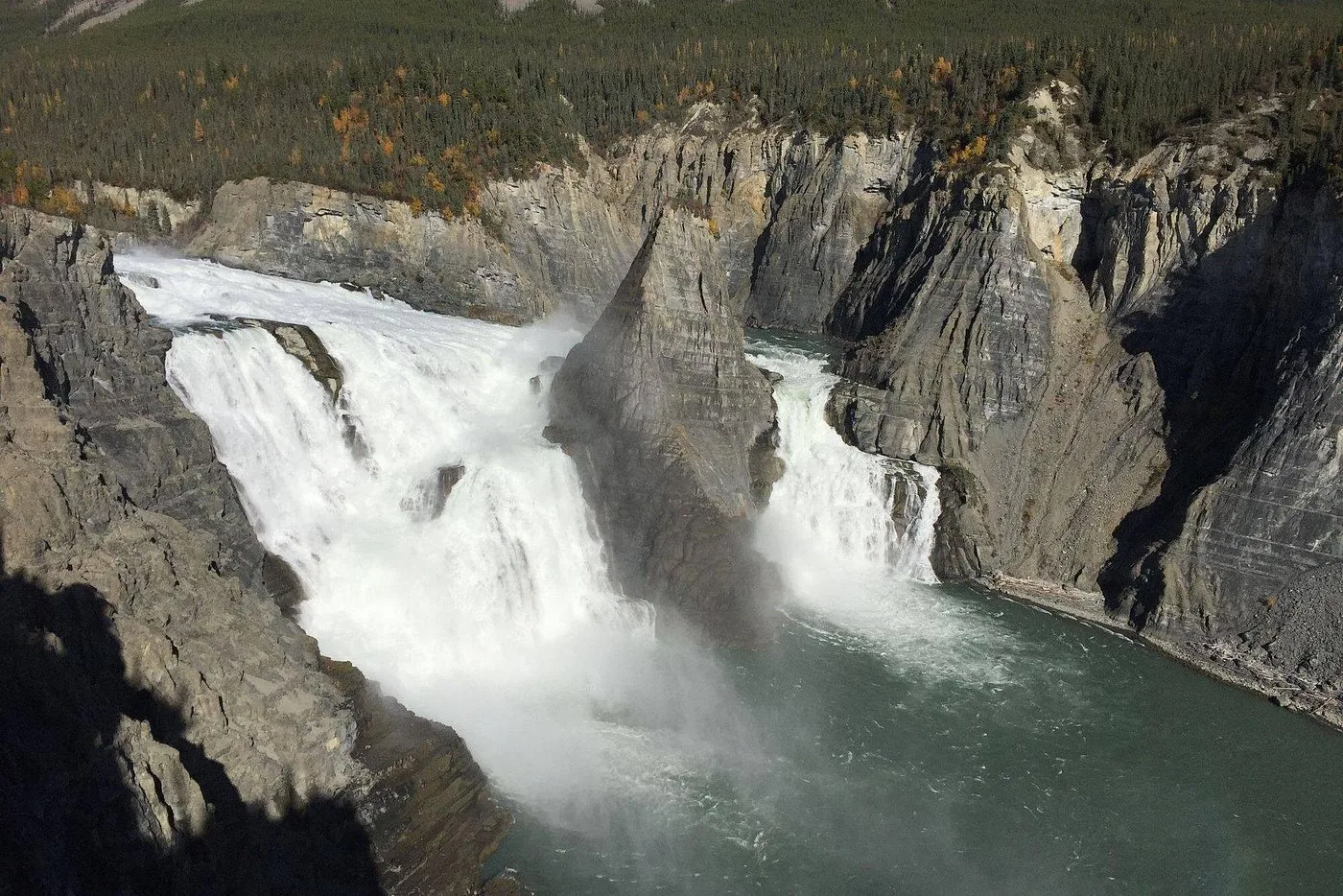
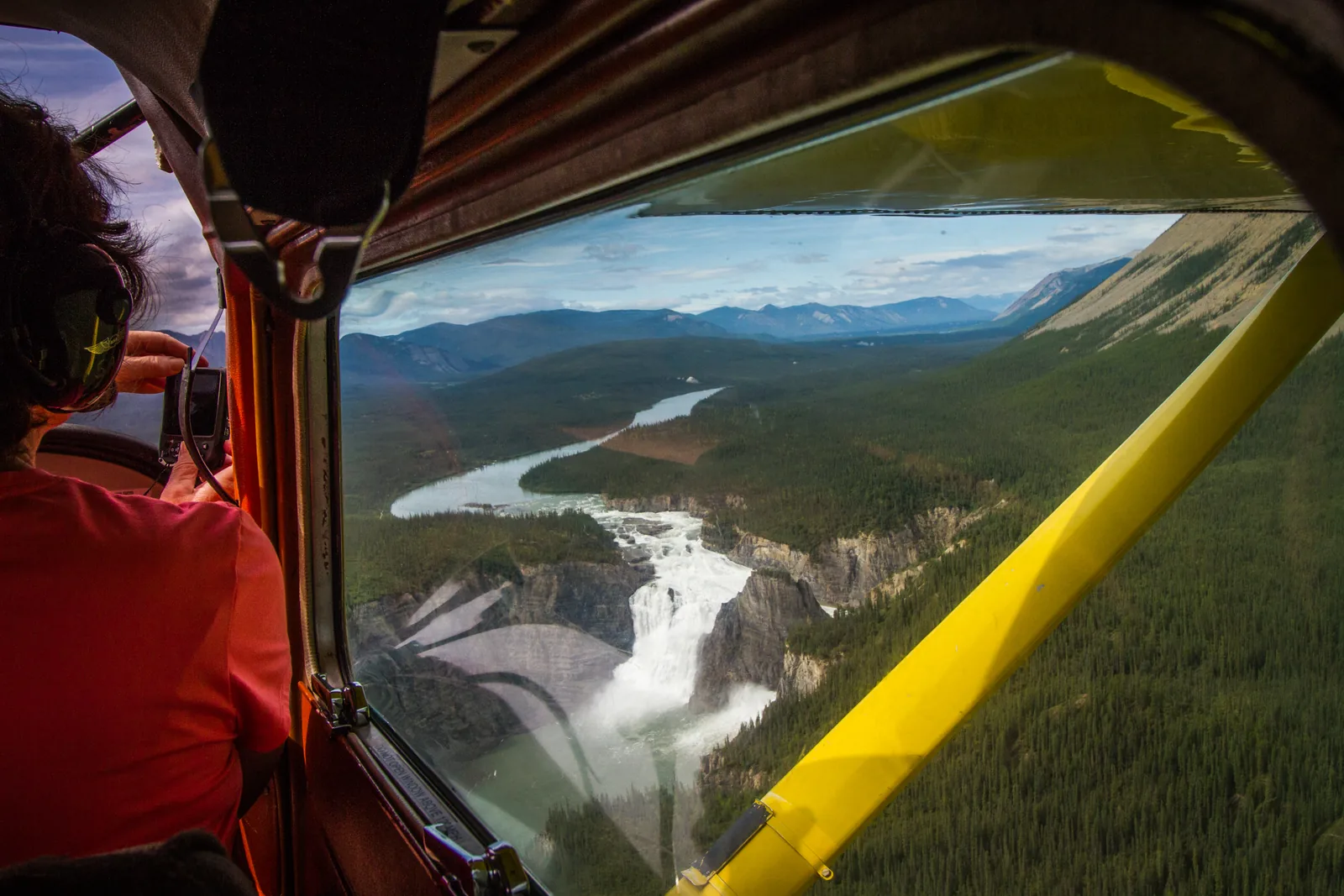
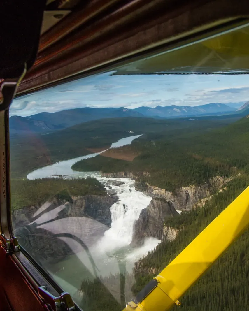
Here the South Nahanni plunges over a drop twice the height of Niagara Falls. For most travellers it is the reason to come at all.

Drop
according to the park authority twice as high as Niagara.
Access
by floatplane or on the river trip.
In summer
staffed.
Campsite
reservation required; early booking explicitly recommended.
Name
Náįlįcho in the Dene language.
River
Nahʔą Dehé, a Canadian Heritage River since 1987.

Park authority: Nahanni ↗

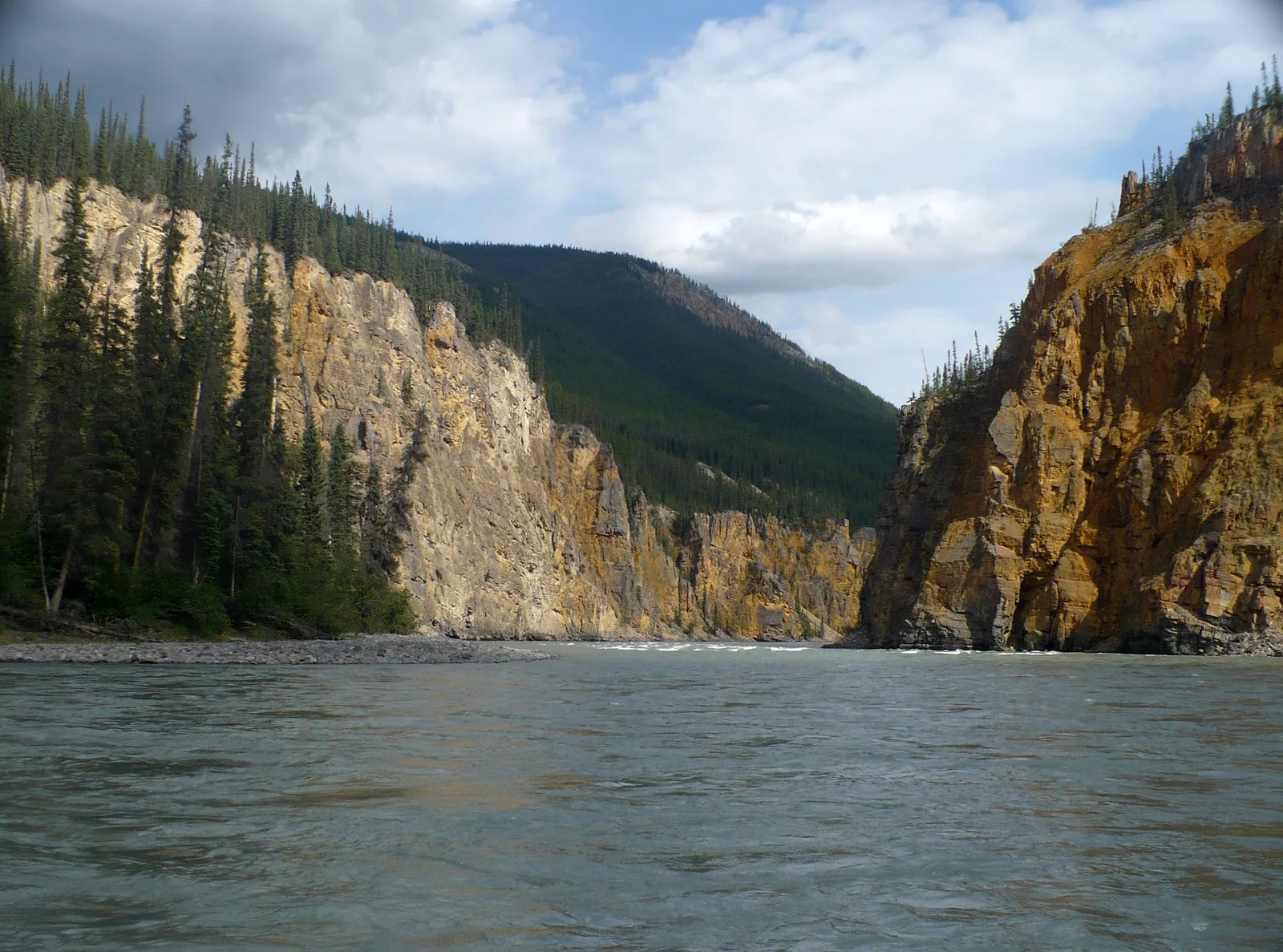
View from the water into Fourth Canyon in Nahanni National Park Reserve: high layered rock walls on both sides, the river flowing calmly between them
Photo: Paul Gierszewski ↗ · Public domain ↗

Place in the park

The canyons

Below the falls, the river runs through a series of canyons that the park authority calls the deepest in Canada. They are numbered so that going downstream you reach the Fourth first.

Numbering
The canyons are numbered upstream; travelling downstream you reach the Fourth first.
Depth
according to the park authority the deepest canyons in Canada.
The Gate
In Second Canyon the river makes a tight loop around a free-standing rock.
Length
The river covers 580 km (360 mi) in total.
Water
silt- and mud-laden, with strongly fluctuating levels.
Hazards
The park authority explicitly names water levels, water temperatures and flash floods.

Nature: World Heritage, area and the Nahʔą Dehé ↗

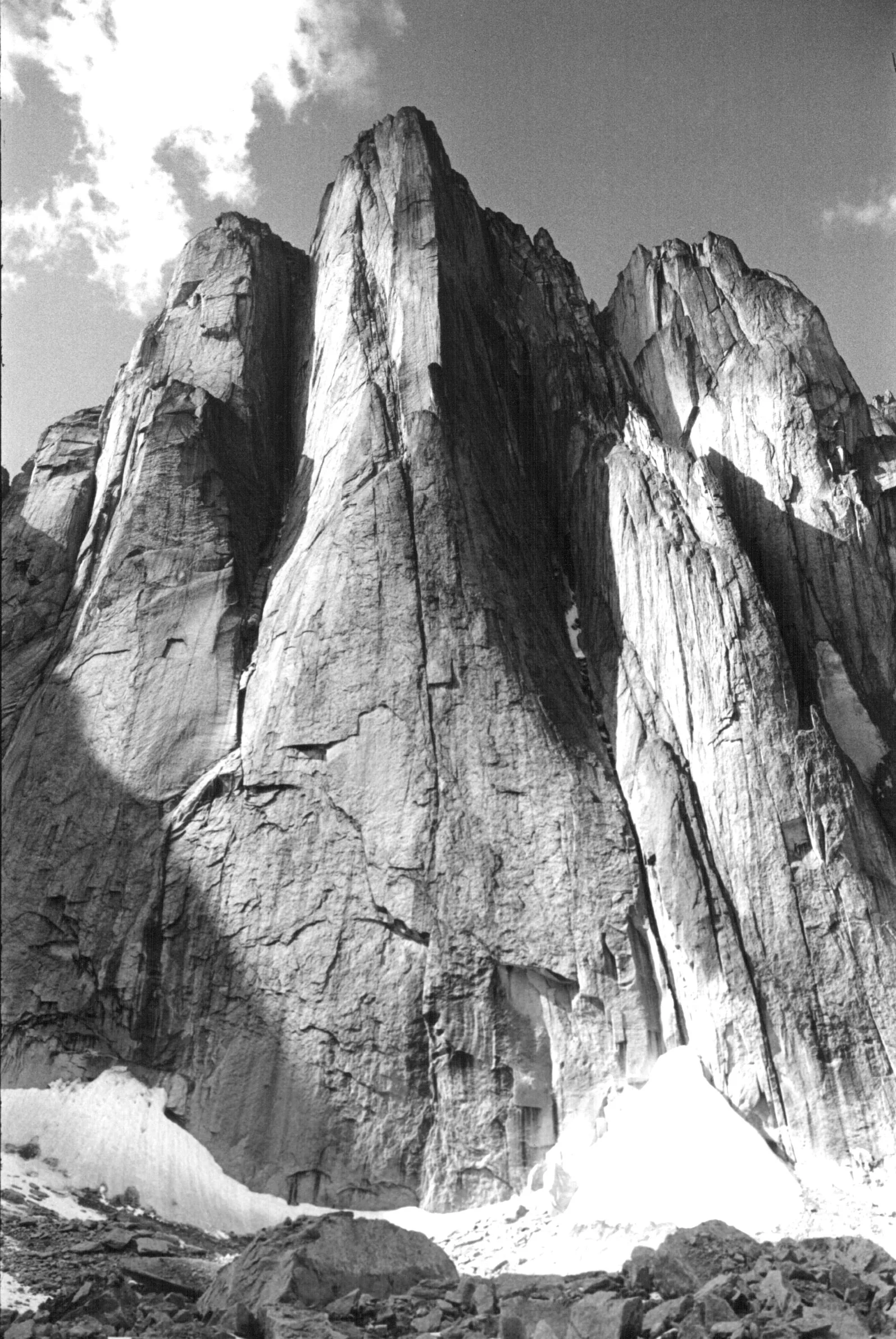
Black-and-white photo of the Lotus Flower Tower in Nahanni National Park Reserve: a huge vertical granite wall rises from a snowfield, with other rock towers beside it
Photo: Tom Frost ↗ · CC BY 3.0 ↗

Place in the park

Cirque of the Unclimbables

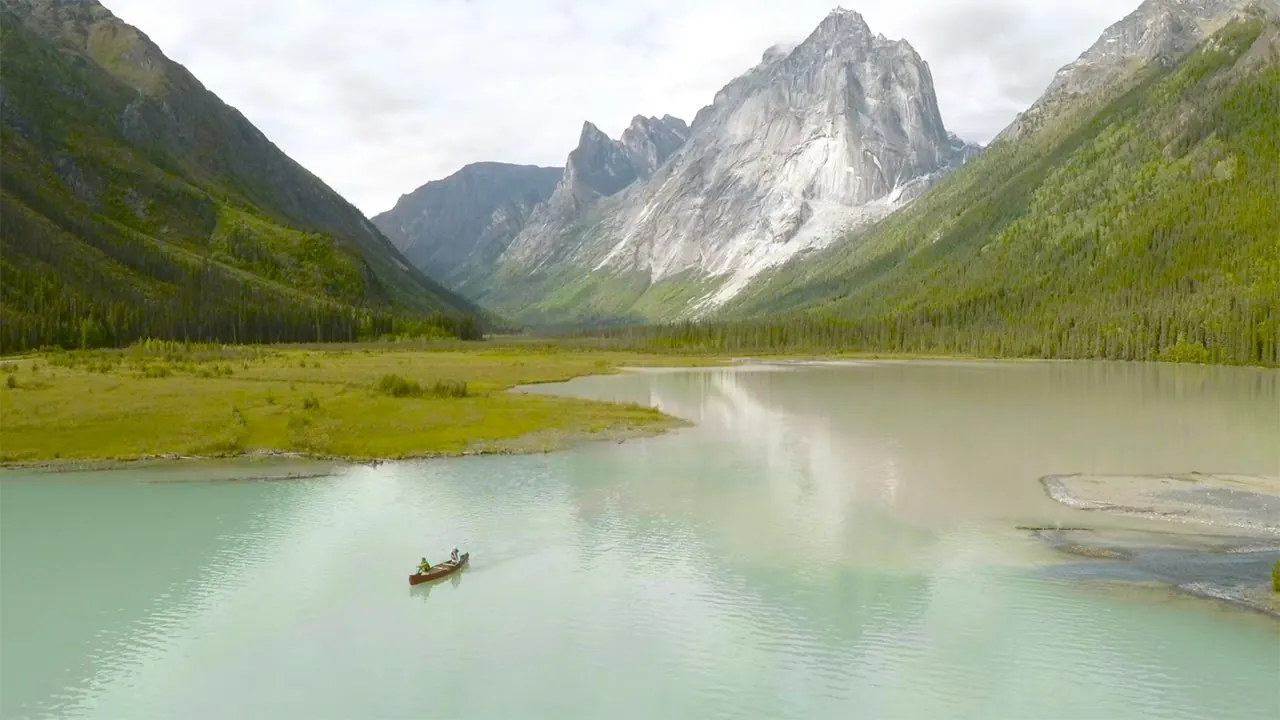
Granite spires rising from an alpine meadow. The Lotus Flower Tower is one of the best-known climbing objectives in the world; this picture dates from 1968.

Location
Ragged Range, Logan Mountains.
Lotus Flower Tower
world-famous granite wall, a goal for elite climbers.
Campsite
Glacier Lake/Fairy Meadows, reservation required.
Trekking
valleys and passes of the Ragged Range, without marked trails.
Access
by floatplane to Glacier Lake, then on foot.
Photo
by Tom Frost, 1968.

River trips, flightseeing and mountaineering ↗

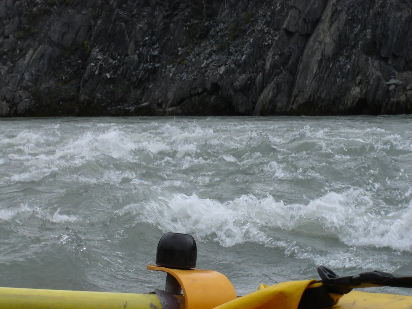
Whitewater on the Nahʔą Dehé in Nahanni National Park Reserve from a raft: foaming waves in front of a dark rock wall, a helmet in the foreground
Photo: Fort Simpson Chamber of Commerce ↗ · CC BY 2.0 ↗

Place in the park

The river trip

National Geographic counts it among the twenty greatest travel adventures in the world. A plane drops you off and you paddle downstream from there.

Rating
among the Top 20 Tourism Adventures in the World according to National Geographic.
Other rivers
Little Nahanni River and Tu Naka Dé (Flat River), for experienced paddlers.
Registration
mandatory for every overnight stay.
Fee
37.00 CAD per person per day in the backcountry.
End
at Nahanni Butte, where the Nahʔą Dehé flows into the Liard River.
Park wardens
on call around the clock from 15 June to 15 September.

River trips, flightseeing and mountaineering ↗

Map

9 places on the map

The distances on this map are flight distances. Every point is verified against an OpenStreetMap object.

Open map3D terrain · details and photos for every place
  • Mountains & rock1
  • Water4
  • Nature2
  • Surroundings2

03 · Out and about

Things to do in Nahanni: river, flights and climbing

Three ways in: on the water, from the air or on foot over the passes.

Photo: Paul Gierszewski ↗ · Public domain ↗

“The dots on the water are canoes. They give the scale: here the walls of Second Canyon rise several hundred metres above the river.”

Nahanni National Park Reserve · The Gate in Second Canyon of the Nahʔą Dehé

Things to do in Nahanni: river, flights and climbing

The river trip

National Geographic counts the trip down the Nahʔą Dehé among the twenty greatest travel adventures in the world. The river runs through mountain valleys and plunges through a series of deep gorges, which the park authority calls the deepest canyons in Canada. Experienced paddlers also run the Little Nahanni River and the Tu Naka Dé (Flat River).

River trips, flightseeing and mountaineering ↗

The day flight

A flightseeing trip takes you to the best-known places of the World Heritage Site and over areas that hardly anyone else gets to see. For travellers without wilderness experience, this is the realistic way into this park.

River trips, flightseeing and mountaineering ↗

Cirque of the Unclimbables

Granite spires rise from an alpine meadow. Elite climbers tackle the world-famous Lotus Flower Tower here; trekkers cross the valleys and passes of the Ragged Range compass in hand.

River trips, flightseeing and mountaineering ↗

Náįlįcho: Virginia Falls

Here the South Nahanni plunges over a drop that, according to the park authority, is twice the height of Niagara Falls. The site is staffed in summer and is one of the campsites that require a reservation.

Park authority: Nahanni ↗

Gahnįhthah: Canada’s largest tufa mounds

The mineral springs of Gahnįhthah form the largest tufa mounds in Canada. It is a sacred place: according to Dene tradition, Yamba Deja, the one who walks the horizon and created Dene law, lives here.

River trips, flightseeing and mountaineering ↗

Offer photo: From Fort Simpson: day flight to Virginia Falls

Goose Flying Service · Viator

From Fort Simpson: day flight to Virginia Falls

Private day trip by floatplane with Goose Flying Service from Fort Simpson into Nahanni National Park Reserve. The flight follows the South Nahanni upstream through First, Second and Third Canyon to Náįlįcho (Virginia Falls), where a hike leads to the top and bottom of the falls. Then you head deeper into the reserve: a landing at Glacier Lake with a view of the Cirque of the Unclimbables, then on to Rabbitkettle Lake with the largest tufa mounds in Canada. The return flight crosses the Ram Plateau and Ram Canyon.

  • 8 hours
  • Private flight
  • Maximum 3 people per booking
  • Lunch not included

Departure Goose Flying Service base in Fort Simpson: along 100 Street (Main Street) to the river, left onto MacKenzie Drive and follow the river to the sign. According to Viator, pickup is also possible at the Deh Cho Suites and Fort Simpson airport.

According to Viator you spend three hours at Virginia Falls, one at Glacier Lake and two at Rabbitkettle Lake. According to the park authority, the tufa mounds at Rabbitkettle Lake can only be visited with park staff. In summer, park authority interpreters welcome day visitors at Virginia Falls and lead them to the viewpoint. According to the inclusions listed on Viator, all fees and taxes are included. Lunch not included. Moderate fitness required; guided in English. Cancellation via Viator up to 24 hours in advance; the operator cancels in bad weather.

View tour ↗Ad · partner link · checked 2 Oct 2026

Provider's product photo · Viator

Whitewater on the Nahʔą Dehé in Nahanni National Park Reserve from a raft: foaming waves in front of a dark rock wall, a helmet in the foreground

River trip outfitters licensed by Parks Canada: Black Feather, Canoe North Adventures, Jackpine Paddle, Nahanni River Adventures and Canadian River Expeditions · Canoe or raft · licensed outfitters

Guided river trip on the Nahʔą Dehé (South Nahanni)

The river trip on the South Nahanni is considered one of the world’s great wilderness journeys. A floatplane drops the group at Rabbitkettle Lake or Virginia Falls, then you travel downstream to Nahanni Butte. Above the falls the river flows calmly through a wide valley; at Náįlįcho there is a portage, followed by class II and III rapids through the deepest canyons in Canada. There is time for hikes along the way, and at Virginia Falls and Rabbitkettle Lake park authority interpreters lead walks and invite you to campfire programmes. The tufa mounds of Gahnįhthah can only be visited with park staff.

  • one to several weeks
  • June to September
  • Canoe or raft
  • with guides and equipment

Meeting point Depends on the outfitter. Nahanni River Adventures, for example, meets in Whitehorse and flies via McEvoy Lake to Rabbitkettle Lake; the return is from Nahanni Butte to Fort Simpson.

Dates, prices and requirements only from the outfitters; the park authority publishes the list of licensed outfitters and refers to them. From Virginia Falls the trip takes seven to ten days, from Rabbitkettle Lake ten to fourteen. For its two-week canoe trip from Rabbitkettle Lake, Nahanni River Adventures lists departures from late June to mid-August and requires solid class II whitewater paddling experience; there are also rafting trips. Canoe North Adventures offers an eight-day trip from Rabbitkettle Lake to Virginia Falls for which basic canoeing skills are enough. Black Feather lists trips from ten days to four weeks. The guided walk to the tufa mounds depends on park staff being available. Water levels and weather determine the course of the trip.

Park authority page ↗Outfitters licensed by Parks Canada · no partner link · checked 2 Oct 2026

Landscape image, not a provider photo · Photo: Fort Simpson Chamber of Commerce ↗ · CC BY 2.0 ↗

Ad · we may earn a commission if you book through this partner link – at no extra cost to you. Thank you for supporting the atlas. Offer details checked 2 Oct 2026. See official ticket information.

Nature and culture of Nahanni

World Heritage Site since 1978

The park authority writes that in 1978 Nahanni was the first site in the world to be inscribed on the UNESCO World Heritage List, for its exceptional natural beauty and for ongoing geological processes of global importance. In 1987 the section of the Nahʔą Dehé protected in the park was also designated a Canadian Heritage River.

Nature: World Heritage, area and the Nahʔą Dehé ↗

What comes together here

The park authority describes the reserve as an outstanding example of northern wild rivers, canyons, gorges, caves, hot springs and alpine tundra. The Nahʔą Dehé starts as a small, clear stream in the remote Mackenzie Mountains and grows over 580 kilometres (360 mi) into a silt-laden river.

Nature: World Heritage, area and the Nahʔą Dehé ↗

Ten thousand years

The Dene and their ancestors have used the land in and around Nahanni for up to 10,000 years. Archaeological finds support what oral tradition tells. Today the area is still hunting ground for the local Indigenous population, who hunt for their own needs.

Dene history and culture ↗

Boats of moose hide

In the late 19th century, the Mountain Dene travelled down the river every spring in moose-skin boats to trade the winter’s furs. These boats were up to twenty metres (66 ft) long: six to ten untanned moose hides stretched over a frame of spruce poles. On arrival the boat was taken apart and the hides were sold too; the return journey was on foot with pack dogs.

Dene history and culture ↗

The Naha

Local tradition tells of the Naha, a mountain people who raided the lowland settlements. When the Dene struck back and surrounded the Naha settlement at night, it was empty: fires were still glowing and sleeping robes lay spread out, but nobody was there. Later it was said that people had suddenly appeared in the far south. Similarities between the Dene dialects and the Navajo language have led to the theory that the Navajo might be descendants of the vanished Naha. The park authority explicitly presents this as tradition and theory, not as documented history.

Dene history and culture ↗

Managed together, still a reserve

The park is managed by the Nahʔą Dehé Consensus Team, a joint body of Parks Canada and the Dehcho First Nations. It explicitly keeps the status of a reserve until the region’s outstanding land claims are settled.

Dene history and culture ↗

04 · Before you go

Park film and places nearby

Photo: Dwayne Reilander ↗ · CC BY-SA 4.0 ↗

Film by the park authority

Experience Nahanni

Just under two minutes that the park authority itself embeds on its activities page: glacial lakes, jagged peaks, rare rock formations and great waterfalls. Among other things you see the tufa mounds of Gahnįhthah. The Dehcho First Nations welcome visitors. In English.

Source: Parks Canada · View channel ↗

Around the park

Fort Simpson

Łįįdłįį Kų́e is the main gateway: the park office is here, and this is where floatplanes can be chartered. The community lies outside the reserve.

Cooperative management and contact ↗

Nahanni Butte

The community at the lower end of the river trip, where the Nahʔą Dehé flows into the Liard River. Parks Canada works closely with the residents to offer insights into Dene culture and history.

River trips, flightseeing and mountaineering ↗

Yellowknife, Muncho Lake, Watson Lake

Floatplanes can also be chartered from Yellowknife in the Northwest Territories, Muncho Lake in British Columbia and Watson Lake in the Yukon. Your choice of departure point shapes the journey and the cost.

Getting there and planning your visit ↗

Field book · Nahanni National Park Reserve

checked 19 Sep 2026

Nahanni National Park Reserve at a glance · PDF, 2 pages ↓

00My visit

Nothing saved yet. Every place card has a pin, and so does every place on the Map. What you save collects here, with days, notes and a preview you can share.

01Best time to visit Nahanni

A very short window, and outside it nobody is there.

July and August

The reserve’s main season is July and August. Only during this time are Gahnįhthah Mie (Rabbitkettle Lake) and Náįlįcho (Virginia Falls) staffed.

Season, offices and reservation requirements ↗

Rangers on call around the clock, for a limited time

Between 15 June and 15 September, a park warden is on call 24 hours a day. Outside this period that is not the case.

Season, offices and reservation requirements ↗

The offices

The main office is in Łįįdłįį Kų́e (Fort Simpson), a second one in Nahanni Butte. From 1 July to 31 August, Fort Simpson is open daily from 8:30 to 12:00 and from 13:00 to 17:00, Nahanni Butte Monday to Friday at the same times. From September to June, Fort Simpson is staffed on weekdays and Nahanni Butte is closed.

Season, offices and reservation requirements ↗

Reserve early

For Náįlįcho, Gahnįhthah Mie and Glacier Lake/Fairy Meadows the park authority explicitly recommends reserving well in advance: demand is high and sites are few.

Season, offices and reservation requirements ↗

Climate through the year

Weather and climate in Nahanni National Park Reserve

Mildest months by the climate data: July and August. Average daytime highs of 11 to 13 °C, lows of 3 to 6 °C, 100 to 128 mm of precipitation a month. The wettest month is June (143 mm), the driest February (16 mm).

Climate chart in Nahanni National Park ReserveAverage daily highs from −17 °C to 13 °C, lows from −24 °C to 6 °C; monthly precipitation from 16 mm to 143 mm.
All monthly values as a table
Monthly averages 2001–2020, NASA POWER model
MonthHigh °CLow °CPrecipitation mm
January−17.4−23.824
February−14.4−23.316
March−10.9−21.824
April−3.4−13.038
May4.5−3.675
June10.93.2143
July13.45.5128
August11.43.2100
September5.4−2.356
October−3.6−11.438
November−14.4−20.927
December−16.9−22.621
Year690

Modelled values, not a weather station: NASA POWER (MERRA-2) for a grid cell of about 55 × 35 km around the map point Nahʔą Dehé (South Nahanni River) (61.87° N, 126.52° W), with an average cell elevation of about 1,390 m. Averages for 2001–2020. Higher ground and valleys can differ markedly.

Source: NASA POWER, climatology 2001–2020 ↗ · retrieved 3 Oct 2026

02How to get to Nahanni: floatplane or on foot

Four places that flights leave from, spread across two provinces and two territories.

By charter plane

The vast majority of travellers reach the park by chartered floatplane. You can charter in many places in the region: in Fort Simpson and Yellowknife in the Northwest Territories, in Muncho Lake in British Columbia and in Watson Lake in the Yukon.

Getting there and planning your visit ↗

Or on foot

The second option the park authority names is hiking in. That is not a day outing but a multi-day wilderness trip with everything you need on your back.

Getting there and planning your visit ↗

The offices are outside the park

Both park offices are in communities outside the reserve: Fort Simpson at 10005 100 Street, PO Box 348, Fort Simpson NT X0E 0N0, phone 867-695-6558, and Nahanni Butte at the confluence of the Nahʔą Dehé and the Liard River.

Cooperative management and contact ↗

The river as the route

For many, getting there is the trip itself: a plane drops you on the upper river and you paddle downstream. The Nahʔą Dehé rises in neighbouring Nááts'įhch'oh and flows 580 kilometres (360 mi) south-east until it joins the Nácháh Dehé (Liard River) at Nahanni Butte.

Nature: World Heritage, area and the Nahʔą Dehé ↗

Air operators licensed by Parks Canada, including Simpson Air, South Nahanni Airways and Goose Flying Service in Fort Simpson, Air Tindi in Yellowknife, Liard Air in Muncho Lake and Northern Rockies Air Charter in Watson Lake · Floatplane · licensed operators

By charter floatplane into the reserve

There are no roads in Nahanni National Park Reserve; almost all visitors arrive by chartered floatplane. The park authority names Fort Simpson and Yellowknife in the Northwest Territories, Muncho Lake in British Columbia and Watson Lake in the Yukon as departure points and keeps a list of air operators with a valid park licence. The planes drop off and pick up river travellers and fly day visitors. Landings are only permitted at designated sites, including Náįlįcho (Virginia Falls), Gahnįhthah Mie (Rabbitkettle Lake) and Glacier Lake; for a day visit, only Virginia Falls and Glacier Lake are possible.

Meeting point Fort Simpson (Simpson Air, South Nahanni Airways, Goose Flying Service; the usual departure point for day flights), Yellowknife (Air Tindi), Muncho Lake (Liard Air) or Watson Lake (Northern Rockies Air Charter).

Flight times, prices and bookings only through the air operators; the park authority refers to its list and names no fixed departures. A flight booking does not replace the park reservation: if you stay overnight, register with the park office in advance and reserve a campsite at Virginia Falls, Rabbitkettle Lake or Glacier Lake/Fairy Meadows, ideally well ahead. At most 24 people a day arrive at Virginia Falls, half of them independently and half with operators. Day visitors also pay the park fee, at the park office or on arrival at Virginia Falls. Other landing sites only with a permit. The main season is July and August; Virginia Falls and Rabbitkettle Lake are staffed in summer. The list also names helicopter operators.

Park authority page ↗Operators licensed by Parks Canada · no partner link · checked 2 Oct 2026

03Nahanni fees and permits

All amounts in Canadian dollars, retrieved from Parks Canada on 19 September 2026.

Backcountry fee instead of admission

37.00 CAD per person per day or 259.00 CAD as an annual fee. It is valid at the same time for Aulavik, Auyuittuq, Ivvavik, Nahanni, Nááts'įhch'oh, Quttinirpaaq, Sirmilik, Tuktut Nogait, Vuntut, Qausuittuq and Ukkusiksalik; if you are visiting several northern parks, work out the annual option.

Parks Canada: fees ↗

Fishing

A fishing permit costs 15.00 CAD per day or 51.25 CAD per year.

Parks Canada: fees ↗

What is not on the fee list

The biggest cost of a Nahanni trip is the flight. Floatplanes are chartered from private operators; the park authority keeps its own list of charter companies and outfitters. Budget this separately from the park fees.

Getting there and planning your visit ↗

Drones are prohibited

Recreational use of unmanned aircraft is prohibited in the reserve. The park authority cites fines of up to 25,000 CAD and points to possible criminal consequences. Photography and filming have their own permit process.

Park authority: Nahanni ↗

04Where to stay in Nahanni: backcountry campsites

Backcountry only, and only with registration.

Five campsites that require a reservation

Náįlįcho (Virginia Falls), Gahnįhthah Mie (Rabbitkettle Lake), Glacier Lake/Fairy Meadows, Nááts'įhch'oh Tué (Mooseponds) and Ǫtaa Tué Fehto (Divide Lake). For the first three the park authority explicitly advises booking early.

Season, offices and reservation requirements ↗

Registration for every overnight stay

Wherever you stay, registration is required for every night in the reserve. It is not just a formality: it is how someone knows where you are.

Season, offices and reservation requirements ↗

Costs

37.00 CAD per person per day for backcountry stays, or alternatively 259.00 CAD per year for all eleven northern parks together.

Parks Canada: fees ↗

Accommodation outside the park

Fixed accommodation only exists in the communities: in Fort Simpson and in Nahanni Butte. Both are outside the reserve.

Cooperative management and contact ↗

05Rules & safety in Nahanni

The park authority has a page of its own on rescue capability. That says enough.

Assess your own abilities realistically

The park authority states the expectation directly: weigh your own abilities, skills and equipment against what you are planning, and always be prepared for emergencies.

Safety: bears, river, fire, rescue ↗

Rescue cannot be taken for granted

One of the topics the park authority covers on its own pages is “emergencies and rescue capability”. In an area the size of Belgium without roads, help is a matter of hours or days, not minutes.

Safety: bears, river, fire, rescue ↗

The river

The park authority names weather, wildfire, bears and river hazards as dangers, explicitly water levels, water temperatures and flash floods. There is a separate guide for rating the river’s difficulty.

Safety: bears, river, fire, rescue ↗

Bears

Bear safety is a separate item in the safety overview. If you camp in the backcountry, you need to know how to behave in bear country.

Safety: bears, river, fire, rescue ↗

Check current closures

The park authority keeps a continuously updated list of warnings, closures and notices. At the time of checking, a riverbank section of the South Nahanni at river kilometres 462 to 464 was closed.

Park authority: Nahanni ↗

06Frequently asked questions: Nahanni National Park Reserve

Can I drive to Nahanni National Park?

No. The park authority says there are no public roads in the reserve; you can only get in by air or on foot. The vast majority of travellers charter a floatplane, in Fort Simpson, Yellowknife, Muncho Lake or Watson Lake.

Getting there and planning your visit ↗

How much does it cost to visit Nahanni?

There is no admission fee. Instead, a backcountry fee of 37.00 CAD per person per day or 259.00 CAD per year applies, valid for eleven northern parks at once. The biggest cost is the charter flight, which private operators charge.

Parks Canada: fees ↗

Do I need to register?

Yes, for every overnight stay in Nahanni or Nááts'įhch'oh. The campsites at Náįlįcho, Gahnįhthah Mie, Glacier Lake/Fairy Meadows, Mooseponds and Divide Lake also require a reservation, the first three explicitly well in advance.

Season, offices and reservation requirements ↗

When is the best time to visit Nahanni?

July and August. Only then are Gahnįhthah Mie and Náįlįcho staffed, and only between 15 June and 15 September is a park warden on call around the clock.

Season, offices and reservation requirements ↗

How high are Virginia Falls?

The park authority gives no figure in metres but a comparison: at Náįlįcho the South Nahanni plunges over a drop twice the height of Niagara Falls.

Park authority: Nahanni ↗

Why is it called a national park reserve?

Because the region’s land claims have not been finally settled. The park keeps reserve status until that happens. In the meantime it is managed jointly by Parks Canada and the Dehcho First Nations in the Nahʔą Dehé Consensus Team.

Dene history and culture ↗

07Sources and date checked

All information comes from the park authority and has been checked with a date.

  1. Park authority: Nahanni ↗
  2. Parks Canada: fees ↗
  3. Season, offices and reservation requirements ↗
  4. Getting there and planning your visit ↗
  5. River trips, flightseeing and mountaineering ↗
  6. Nature: World Heritage, area and the Nahʔą Dehé ↗
  7. Dene history and culture ↗
  8. Safety: bears, river, fire, rescue ↗
  9. Cooperative management and contact ↗

How current is this information?

Researched 19 Sep 2026. Not a live status. Dates apply only to the year stated. A successful automatic fetch is not an editorial confirmation; outdated automatic values are hidden and replaced by the source link.

Current information from the park ↗

Image and map credits

Location sources: Every location verified against an OpenStreetMap object; object type checked in each case. Markers do not imply that access is permitted. Base map © OpenStreetMap contributors. Coastlines of the chapter map: Natural Earth.

End of the field book · Park authority ↗