National Parks Atlas
MapPDF

01 · Canada · Saskatchewan · Mixed-grass prairie

Grasslands National Park

The only park in Canada that protects the mixed-grass prairie, and one of the darkest night skies in the country.

Photo: Peter George ↗ · CC BY-SA 4.0 ↗

Grasslands at a glance · PDF, 2 pages

Grasslands National Park: landscape and origins

Grasslands protects a piece of Canada’s mixed-grass prairie, a landscape that has disappeared under the plough elsewhere.

The shape of the land dates from the last Ice Age. More than 10,000 years ago the ice melted in two lobes; because the northern lobe was higher, meltwater flowed south and was stopped by the southern lobe. Along the ice margin a river carved into the ground: today’s Frenchman River valley. The runoff created coulees, buttes and creeks. The Frenchman River flows south and belongs to the Missouri watershed.

Water defines the land, or more precisely its absence. Little precipitation creates the conditions for prairie. Typical are blue grama, needle-and-thread grass, the prickly pear cactus, which only breathes at night, and the gumbo evening primrose, whose flowers change colour within a day. A hallmark of this ecosystem is that no single species dominates.

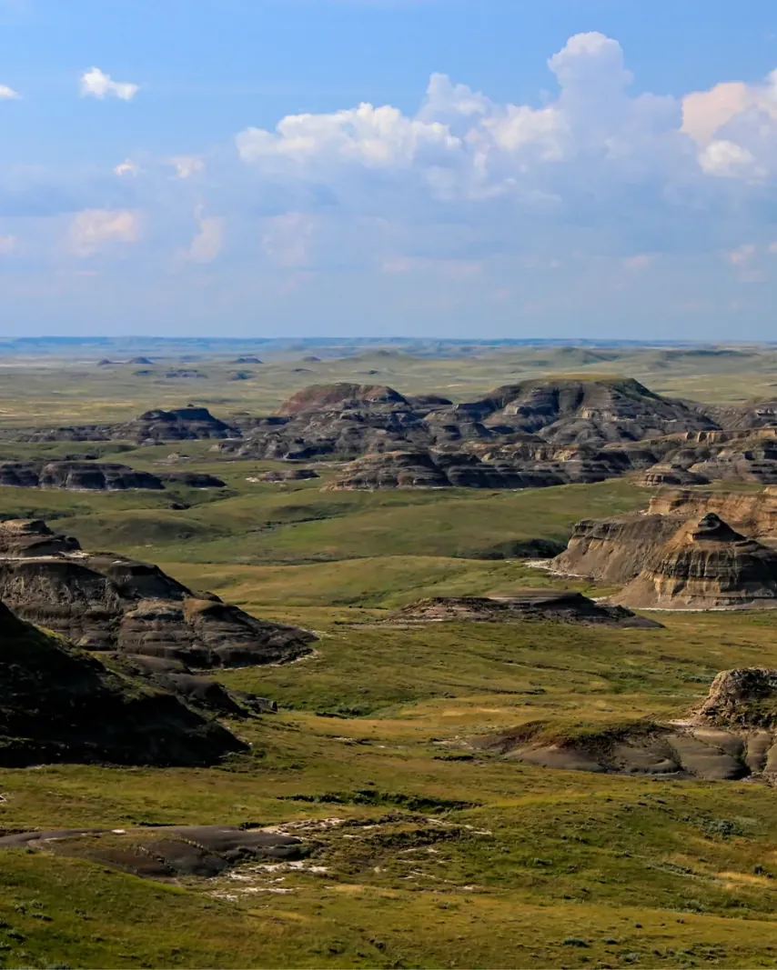
The East Block holds the Rock Creek badlands and the Wood Mountain uplands. Here the Cretaceous-Tertiary boundary is exposed, a thin white layer in the ground that separates the age of the dinosaurs from the age of the mammals. The fossils go back 60 to 80 million years; only recently a new species of ancient bird, Brodavis americanus, was described from here.

The park is young and not yet complete. From 1963 conservationists campaigned for a protected area; in 1981 Canada and Saskatchewan signed the founding agreement, in 1988 a revised version, and on 19 February 2001 Grasslands was officially proclaimed a national park. The planned area covers about 900 square kilometres (347 sq mi), and about 80 per cent has been purchased so far, only from owners willing to sell.

The mixed-grass prairie ↗

The park in numbers

Proclaimed
19 February 2001
First agreement
19 June 1981
Planned area
about 900 km² (347 sq mi) in two blocks
Acquired so far
about 80 per cent
Protected area
over 729 km² (281 sq mi)
Distance between blocks
166 km (103 mi), about 2 hours
Dark sky preserve
since 2009
Bison
400 to 500, since December 2005
Prairie dogs
about 25 colonies, 17,000–23,000 animals
Tipi rings
over 20,000
Ecotour
20 km (12 mi), 7 stops
Badlands Parkway
11 km (6.8 mi), 6 viewpoints

Visiting Grasslands: overview and planning

01

West Block and East Block

The West Block lies on the Frenchman River and is reached via Val Marie on Highways 4 and 18; Val Marie is an hour and a half’s drive south of Swift Current. The East Block, with the Rock Creek badlands and the Wood Mountain uplands, is reached near Wood Mountain on Highway 18. The two blocks are 166 kilometres (103 mi) apart, about two hours’ drive.

Getting to both blocks ↗

02

Gravel only

All access roads to both blocks are gravel. When wet, roads in the park can become impassable, including those to the campgrounds. The park authority explicitly warns that GPS directions are not always right.

Plan ahead ↗

03

No services in the park

Inside the park boundary there is no fuel station, groceries, garage or doctor. The neighbouring communities offer some of these, but with varying opening hours. Fill up whenever you can.

Facilities and services ↗

04

No reliable mobile coverage

Coverage is patchy throughout the park and the region. The park authority recommends map, compass and GPS and advises getting oriented at the visitor centre before setting out.

Plan ahead ↗

02 · Places

Map and places in the park

Twelve points in both blocks, seven of them with the park authority’s coordinates.

Photo: Cephas ↗ · CC BY-SA 4.0 ↗

Place in the park

70 Mile Butte

Two kilometres, one hour, and the view most people come to the West Block for.

Length
2 km loop
Time
1 to 2 hours
Difficulty
difficult
Start
branches off the Eagle Butte Trail
Access
5 km south of Val Marie, then 5 km of gravel
Connection
Bearpaw Sea Trail, 10 km one way

Trails and routes ↗

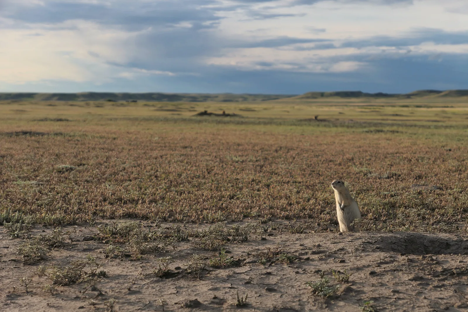
A prairie dog sits upright at the edge of its burrow in Grasslands National Park, flat prairie stretching away under clouds behind
Photo: VinceTraveller ↗ · CC BY 2.0 ↗

Place in the park

The prairie dogs

In and around the West Block lives Canada’s only wild population of black-tailed prairie dogs.

Colonies
about 25, 0.55 to 171.56 hectares
Population
estimated 17,000 to 23,000
Discovered
1927, north of Val Marie
Social unit
one male, 3 to 4 females, young
Best spot
Top Dogtown Trail, 750 m
Rule
dogs are not allowed on the colonies

Black-tailed prairie dogs ↗

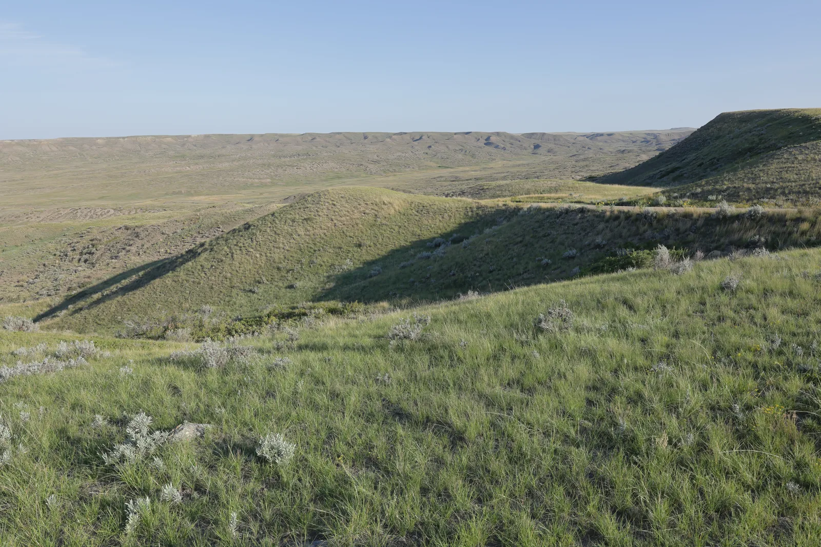
Wide green grassy hills in Grasslands National Park drop into a shallow valley, a long escarpment on the horizon under a clear sky
Photo: Cephas ↗ · CC BY-SA 4.0 ↗

Place in the park

Borderlands Lookout

Viewpoint deep in the south of the West Block, reachable only via the Back Country Loop.

Coordinates
49.02425, −107.23656
Red chairs
yes
Access
Back Country Loop, dirt track
Warning
impassable when wet
Surroundings
camping and hiking allowed
Nearby
just short of the Montana border

The red chairs with coordinates ↗

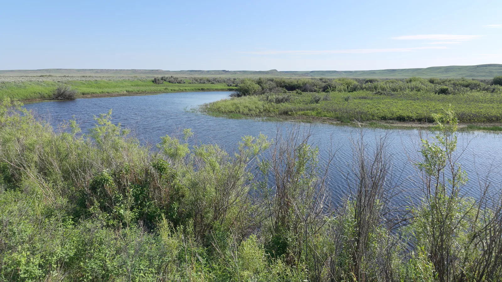
The Frenchman River winds through green grassland with willow shrubs in Grasslands National Park, low buttes on the horizon
Photo: Cephas ↗ · CC BY-SA 4.0 ↗

Place in the park

The Frenchman River

The valley carved by a meltwater river at the edge of the ice, and the lifeline of the West Block.

Origin
at the ice margin, more than 10,000 years ago
Direction
south
Watershed
Missouri
Result
coulees, buttes and creeks
Importance
riparian zone with its own biodiversity
Trail by the water
Riverwalk Trail, 3 km

The mixed-grass prairie ↗

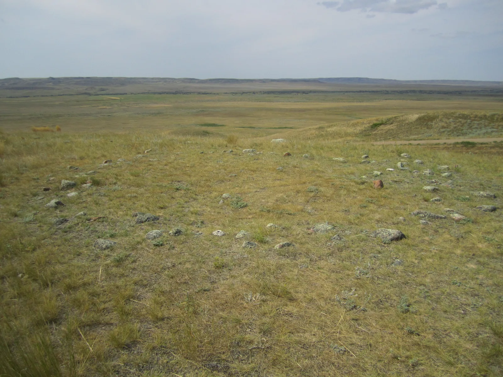
A circle of flat stones, a tipi ring, lies in the dry prairie grass of Grasslands National Park, a wide valley opening behind
Photo: Ed Horner, Fratermanor ↗ · CC BY-SA 4.0 ↗

Place in the park

Tipi rings

Over 20,000 stone circles lie in the park, traces of camps that moved with the bison herds.

Number
over 20,000 tipi rings
Settlement
for about 10,000 years
Peoples
A’aninin, Nakoda, Nehiyawak, Niitsitapi, Dakota, Lakota
Métis
bison hunting, traces at the Pinto Horse Buttes
1876
Sitting Bull and 4,000 Lakota seek refuge
Rule
pick nothing up, move nothing

Indigenous history ↗

Map

12 places on the map

Twelve points in both blocks, seven of them with the park authority’s coordinates.

Open map3D terrain · details and photos for every place
  • Viewpoints3
  • Trails4
  • Arrival1
  • Where to stay2
  • Nature2

03 · Out and about

Things to do: scenic drives, hikes and stargazing

Two scenic drives, fourteen trails, one route.

Photo: Tupulak from Calgary ↗ · CC BY 2.0 ↗

“In December 2005, 71 plains bison arrived from Elk Island National Park: 30 male calves, 30 female calves and 11 yearlings. On 24 May 2006 the park authority opened the gate. After 120 years there were bison on this prairie again.”

Grasslands National Park · Bison in the West Block

Things to do: scenic drives, hikes and stargazing

Ecotour Scenic Drive

Twenty kilometres (12 mi) of self-guided driving through the Frenchman River valley in the West Block, with panels at seven stops; the park authority allows one to three hours. From Val Marie it is about 80 kilometres (50 mi) there and back, so plan enough fuel.

Ecotour Scenic Drive in the West Block ↗

Badlands Parkway

Eleven kilometres of pavement in the East Block, single-lane with two-way traffic and 20 pull-outs, along the rim above the Rock Creek badlands. Six viewpoints, open from 1 May to 31 October and only during the day.

Badlands Parkway in the East Block ↗

Hiking

Ten trails in the West Block and four in the East Block, from 750 metres to 16 kilometres. There is also the 15-kilometre Otter Basin route: very difficult, unmarked, with the highest point of the West Block at 1,006 metres (3,301 ft). Routes are not trails: they are neither signed nor maintained.

Trails and routes ↗

Night sky

Since 2009 the park has been recognised by the Royal Astronomical Society of Canada as a Dark Sky Preserve and is one of the darkest in the country. The Two Trees Trail and both campgrounds are easy to reach by car.

Dark sky preserve since 2009 ↗

Guided programmes

The park authority’s programmes include a native prairie hike for 16.50 CAD, “70 Million in 60 Minutes” for 16.50 CAD, the evening “Beyond the Big Dipper” for 37.00 CAD, a dig day with palaeontologists from the Royal Saskatchewan Museum for 132.00 CAD and a day with burrowing owl experts for 152.75 CAD. All programmes are in English.

Tours and programs ↗

The Frenchman River winds through the wide valley in the West Block of Grasslands National Park, where Frenchman Valley Campground lies, low buttes on the horizon

Grasslands park authority (Parks Canada) · Park authority programme · starry night

Beyond the Big Dipper: a night of telescopes in the Dark Sky Preserve

Grasslands is one of the largest and darkest dark sky preserves in Canada; since 2009 it has been recognised as a Dark Sky Preserve by the Royal Astronomical Society of Canada. On two evenings in high summer, experienced astronomers set up their telescopes at Frenchman Valley Campground in the West Block, start with a presentation and then lead a long night of observing under a sky where even faint deep-sky objects are visible.

  • about 3 hours, from late evening
  • two evenings in high summer
  • West Block, Frenchman Valley Campground
  • English

Meeting point Frenchman Valley Campground in the West Block; access from the visitor centre in Val Marie east on Highway 18 and via the Ecotour Road (gravel).

The 2026 dates were 10 and 11 July, each from 20:30 to 23:30; the season is over, and the park authority has not yet named dates for 2027. Programmes have their own fee; the park authority refers to its fees page. All programmes are in English, French on request by email in advance. The same campground has four oTENTiks (reservable through Parks Canada), so nobody has to drive back to Val Marie over gravel at night after the programme. On summer Fridays at 19:00 the park authority also invites visitors to campfire evenings (Fireside Chats) with stories, stars and music at the Frenchman Valley and Rock Creek campgrounds; according to the park authority at no cost (“Cost: Free”). When wet, the access roads can become impassable; bison and rattlesnakes live on the grounds, and the park authority advises staying near your vehicle at night.

Park authority page ↗Park authority programme · no partner link · checked 2 Oct 2026

Landscape image, not a provider photo · Photo: Cephas ↗ · CC BY-SA 4.0 ↗

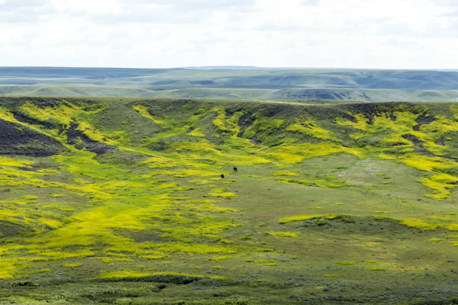
A wide valley in Grasslands National Park with bright yellow flowering patches, in the middle two tiny dark dots: plains bison in the West Block

Grasslands park authority (Parks Canada) · Park authority programme · bison in the backcountry

Bison Backcountry Tour: by all-terrain vehicle with park staff to the plains bison

After 120 years without bison, Parks Canada released plains bison into the West Block again in 2006. On this tour, park staff take at most four guests by all-terrain vehicle through the rugged Frenchman River valley into remote backcountry, where the herd can be watched away from the roads. Along the way you learn about the ecological and cultural importance of bison and about the prairie; lunch is locally sourced and eaten out on the prairie, and you meet people who have been part of the bison’s return.

  • about 4.5 hours, from late morning
  • on a few days in high summer
  • maximum 4 guests, ages 12 and up
  • Register by phone with the visitor centre

Meeting point Coulee Centre at Frenchman Valley Campground in the West Block.

Registration only by phone with the visitor centre in Val Marie; places are very limited. The 2026 dates were 29 July and 4 and 6 August, each from 10:30 to 15:00; the season is over, and the park authority has not yet named dates for 2027. According to the park authority, lunch is part of the tour. Ages 12 and up, no pets, English only. Programmes have their own fee (park authority fees page). Without the off-road drive: from mid-May to early October, the park authority runs the one-hour Native Prairie Hike at the Top Dogtown prairie dog colony (Ecotour stop 2) in the West Block on Tuesdays, Thursdays and Saturdays at 9:00, and “70 Million Years in 60 Minutes” on the Badlands Parkway in the East Block on Tuesdays and Thursdays.

Park authority page ↗Park authority programme · no partner link · checked 2 Oct 2026

Landscape image, not a provider photo · Photo: Tupulak from Calgary ↗ · CC BY 2.0 ↗

Nature and history of Grasslands

Bison back since 2005

In December 2005, 71 plains bison arrived from Elk Island National Park, after an absence of 120 years. On 24 May 2006 they were released into most of the West Block, about 181 square kilometres (70 sq mi). Today the park keeps a herd of 400 to 500 animals.

The return of the plains bison ↗

The only place for prairie dogs

In and around the West Block lives Canada’s only wild population of black-tailed prairie dogs. The first colony was discovered north of Val Marie in 1927. Today the park authority counts about 25 colonies between 0.55 and 171.56 hectares with an estimated 17,000 to 23,000 animals.

Black-tailed prairie dogs ↗

Priority site for species at risk

Because of the large number of species at risk, Parks Canada has made Grasslands one of three priority sites. Five species are endangered, including the burrowing owl, greater sage-grouse and greater short-horned lizard; seven are threatened, including the plains bison, prairie dog and swift fox. Three have disappeared here: the black-footed ferret, greater prairie-chicken and grizzly bear.

Species at risk in the park ↗

Fossils and the K-T boundary

The East Block is one of the few places in the world where the Cretaceous-Tertiary boundary is exposed: a thin white layer, below which lie dinosaur fossils and above which mammal fossils begin. In 1874 the first dinosaur remains in western Canada were found here.

Geology and fossils ↗

20,000 tipi rings

People have lived here for about 10,000 years. The park authority counts over 20,000 tipi rings and thousands of archaeological sites, one of the largest concentrations of undisturbed pre-contact cultural resources in Canada. After the Battle of the Little Bighorn, Sitting Bull and 4,000 Lakota sought refuge here.

Indigenous history ↗

04 · Before you go

Park film and places nearby

Photo: Peter George ↗ · CC BY-SA 4.0 ↗

Film by the park authority

Return of bison to Grasslands National Park

A minute and a half from Parks Canada, from 2020, on the return of plains bison to the West Block. Short, but it is the only film the park authority has published about this park. In English.

Source: Parks Canada · View channel ↗

Around the park

Val Marie and Wood Mountain

Val Marie lies by the West Block, Wood Mountain by the East Block. Both are small; research accommodation, showers, food, fuel, garages and cash machines beforehand.

Plan ahead ↗

To Montana

The park almost borders the US; the Port of West Poplar crossing lies on Highway 2 south of the East Block. Canada Border Services Agency rules apply for entry.

Getting to both blocks ↗

Maps

Topographic maps are available at Prairie Wind and Silver Sage in Val Marie, the park’s friends association, which also sells souvenirs.

Getting to both blocks ↗

Field book · Grasslands National Park

checked 20 Sep 2026

Grasslands at a glance · PDF, 2 pages ↓

00My visit

Nothing saved yet. Every place card has a pin, and so does every place on the Map. What you save collects here, with days, notes and a preview you can share.

01Best time to visit Grasslands and weather

Hot summers, little shade, lots of wind.

Season

The visitor centre and campgrounds operate from 1 May to 12 October 2026: the centre in Val Marie daily from 9:00 to 17:00, the Rock Creek campground office from 10:00 to 18:00. Drinking water is only available from mid-May to 30 September.

Hours of operation 2026 ↗

Spring and autumn are more pleasant

The park authority recommends spring and autumn for hiking: milder temperatures and migrating wildlife. Late May and early June bring plenty of flowers.

Climate and weather ↗

Summer heat

In June, July and August temperatures often reach 40 degrees (104 °F). There is almost no shade in the park or at the campgrounds. The park authority requires at least four litres of water per person per day; surface water is not drinkable because of its salt content, not even boiled or filtered.

Plan ahead ↗

Thunderstorms and wind

A semi-arid climate with 30 to 33 centimetres (12 to 13 in) of precipitation a year; half falls in summer, mostly as short afternoon thunderstorms. Strong wind is dangerous, and shelter is hard to find.

Climate and weather ↗

Winter

From November the Badlands Parkway is closed to cars but open on foot. The campgrounds only reopen on 1 May. Backcountry camping is possible but must be registered by phone; the Timbergulch zone is recommended.

Winter in the park ↗

Climate through the year

Weather and climate in Grasslands National Park

Best months by the climate data: May and June and August and September. Average daytime highs of 18 to 27 °C, lows of 5 to 13 °C, 38 to 74 mm of precipitation a month. The wettest month is June (74 mm), the driest February (13 mm).

Climate chart in Grasslands National ParkAverage daily highs from −3 °C to 29 °C, lows from −12 °C to 15 °C; monthly precipitation from 13 mm to 74 mm.
All monthly values as a table
Monthly averages 2001–2020, NASA POWER model
MonthHigh °CLow °CPrecipitation mm
January−3.0−12.316
February−1.4−11.713
March6.2−5.818
April12.7−0.634
May18.55.164
June23.310.574
July28.914.744
August27.413.243
September21.17.538
October12.10.430
November4.0−5.218
December−2.4−10.515
Year407

Modelled values, not a weather station: NASA POWER (MERRA-2) for a grid cell of about 55 × 45 km around the map point Frenchman Valley Campground (49.15° N, 107.51° W), with an average cell elevation of about 840 m. Averages for 2001–2020. Higher ground and valleys can differ markedly.

Source: NASA POWER, climatology 2001–2020 ↗ · retrieved 3 Oct 2026

02How to get to Grasslands: airports, roads and parking

From three airports, the last stretch always on gravel.

Airports

Regina, Saskatoon and Calgary have international airports. Rental cars are available in Swift Current, Regina and Saskatoon.

Getting to both blocks ↗

To the West Block

From the visitor centre in Val Marie, three access roads lead into the block: the Ecotour Road, 14.5 kilometres east on Highway 18 and then four kilometres of gravel south; the 70 Mile Butte access, five kilometres south on Highway 4, then five kilometres east; and Two Trees, eight kilometres south, then two kilometres of gravel.

Getting to both blocks ↗

Autumn 2026: 70 Mile Butte access closed

The access road to 70 Mile Butte is being rebuilt and is closed for the work, expected to start on 28 September 2026, possibly earlier, and to last one to two weeks; the park authority’s notice runs until 16 October. The 70 Mile Butte and Eagle Butte trailheads are affected.

Current notices ↗

To the East Block

22.4 kilometres (13.9 mi) south of Wood Mountain Regional Park on Highway 18, then 6.4 kilometres west, 6.4 kilometres south and 2.4 kilometres west. Signs to Rock Creek Campground stand at every turn.

Getting to both blocks ↗

Fuel

Fuel stations in the area are not open around the clock and often only take cards. If you are switching between the blocks, fill up first.

Plan ahead ↗

Charging points

The visitor centre in Val Marie has four electric vehicle charging stations, for Tesla and with universal connectors.

Facilities and services ↗

Parking in both blocks: also for RVs and buses

There is parking at the visitor centre and at the day-use areas and campgrounds of both blocks. In the West Block there are seven pull-outs along the Ecotour Scenic Drive, in the East Block six parking areas on the Badlands Parkway. According to the park authority, all of these have room for RVs and buses.

Facilities and services ↗

Parking on the Badlands Parkway: leave trailers first

The Badlands Parkway is an 11 km (6.8 mi), single-lane paved road with two-way traffic and 20 pull-outs. Trailers are left at the designated trailer parking before the drive. The road is for day visits only; overnight stays are at nearby Rock Creek Campground or in the backcountry.

Badlands Parkway in the East Block ↗

03Tickets & entrance fees

All amounts in Canadian dollars, retrieved from Parks Canada on 20 September 2026.

Daily admission

Adults 7.25 CAD, seniors aged 65 and over 6.25 CAD, family or group 15.00 CAD for up to seven people in one vehicle. Youth aged 17 and under pay nothing. This is the cheapest daily admission of all parks in this atlas.

Parks Canada: fees ↗

Annual pass

The annual pass for this park costs 36.75 CAD for adults, 30.50 CAD for seniors and 72.50 CAD for a family or group. The Discovery Pass for over 80 Parks Canada places costs 83.50 CAD, 71.50 CAD and 167.50 CAD.

Parks Canada: fees ↗

Camping

An unserviced site costs 26.75 CAD per night. With electricity it is 40.00 CAD in Frenchman Valley in the main season (June, July, August) and 36.75 CAD before and after; at Rock Creek 36.75 CAD throughout. An oTENTik costs 156.50 CAD, an equestrian site 26.75 CAD. Neither campground has showers.

Parks Canada: fees ↗

Backcountry

Backcountry camping costs 8.50 CAD per person per night. Groups pay 6.25 CAD per person at the group site.

Parks Canada: fees ↗

In winter you pay at self-registration stations

Between November and April the visitor centres are closed. Admission can be paid by phone or at four self-registration stations: 70 Mile Butte, the Ecotour north entrance, the Coulee Centre in Frenchman Valley and Rock Creek Campground.

Winter in the park ↗

Summer 2026: admission was free

Under the Canada Strong Pass, admission to Parks Canada places was free from 19 June to 7 September 2026, and camping was discounted. Regular fees have applied again since 8 September 2026. Travel reports from summer 2026 therefore often quote an admission price that no longer applies.

Parks Canada: passes, permits and fees (Canada Strong Pass, checked 3 October 2026) ↗

04Where to stay in Grasslands: campgrounds and oTENTiks

Two campgrounds, twelve oTENTiks, free camping in the backcountry.

Frenchman Valley Campground

In the West Block, fully reservable: 20 electrical sites, including three pull-through sites and an accessible area, plus four oTENTiks. RVs must fill their tanks beforehand; this is not possible in the West Block.

Tent and RV sites ↗

Rock Creek Campground

In the East Block, also fully reservable: 24 electrical sites, eight oTENTiks, kitchen shelter, communal fire pit and an RV sani-dump.

Tent and RV sites ↗

oTENTiks

Twelve in all, four in the west and eight in the east. They sleep six on three sleeping platforms, with electricity and a small heater, a fire pit and barbecue outside. No cooking inside. For May and September the park authority recommends sleeping bags rated to minus ten degrees (14 °F).

oTENTik accommodation ↗

Backcountry

If you camp in the backcountry, you must register beforehand at the visitor centre or campground office and receive an orientation. There are no designated sites; you camp at least one kilometre away and out of sight of roads and trails. Open fires are never allowed there.

Backcountry camping ↗

Bring water

Drinking water is only available from the May long weekend to 30 September, at the visitor centre and both campgrounds. If you come in early May or in October, bring all your water with you.

Tent and RV sites ↗

05Rules & safety in Grasslands

Rattlesnakes, bison and fire set the rules.

A hundred metres from bison

The park authority uses the length of a football field as the measure. If you meet bison on the Ecotour Road, stay in your car and drive on slowly. Take special care in May and June, when cows have calves, and in July and August during the rut.

Trails and routes ↗

Rattlesnakes

Do not wear headphones, so you can hear the rattle. Wear ankle-high boots and long, loose trousers. Do not step on or over rocks and shrubs, and keep children close.

Trails and routes ↗

Fire bans are possible

Fires are only allowed in the fire pits provided, never in the backcountry. During a fire ban, gas and propane appliances are still allowed in the frontcountry, but in the backcountry no open flame at all; then it is cold camping. An illegal fire can cost up to 25,000 CAD.

Fire ban ↗

Prairie fire

Fires are common and dangerous on the prairie, started by lightning and fanned by strong wind. If you see smoke, call 911 immediately. If a fire cuts off your route: head towards low vegetation, such as gravel roads or prairie dog colonies, or into areas that have already burned.

Trails and routes ↗

Dogs

Dogs must always be on a leash and are not allowed on prairie dog colonies. Fishing is prohibited throughout the park, as are drones without a permit.

Park rules ↗

06Frequently asked questions: Grasslands National Park

How much is the entrance fee for Grasslands National Park?

Daily admission costs 7.25 CAD for adults, 6.25 CAD for seniors and 15.00 CAD for a family or group of up to seven people in one vehicle. Youth aged 17 and under pay nothing. An annual pass for this park costs 36.75 CAD. This is the cheapest daily admission of all parks in this atlas.

Parks Canada: fees ↗

Which block should I visit?

The West Block on the Frenchman River has the Ecotour Scenic Drive, the bison, the prairie dog colonies and most of the trails. The East Block has the Rock Creek badlands, the Badlands Parkway and the fossils. The two are 166 kilometres (103 mi) apart, about two hours’ drive: too much for one day.

Getting to both blocks ↗

Can I get there in a normal car?

All access roads are gravel and can become impassable when wet, including those to the campgrounds. The park authority advises asking about conditions at the visitor centre first and always filling up. GPS directions are not always right.

Plan ahead ↗

Where can I stay?

At two campgrounds: Frenchman Valley in the West Block with 20 electrical sites and four oTENTiks, Rock Creek in the East Block with 24 electrical sites and eight oTENTiks. Both are fully reservable and open from 1 May to 12 October 2026. In the backcountry you may camp almost anywhere after registering.

Tent and RV sites ↗

Will I see bison?

400 to 500 plains bison live in the West Block, since they were brought here from Elk Island National Park in December 2005. They roam freely over about 181 square kilometres (70 sq mi). If you see them, keep 100 metres away; on the Ecotour Road, stay in your car.

The return of the plains bison ↗

Are there rattlesnakes?

Yes, the prairie rattlesnake lives in the park. The park authority advises: do not wear headphones, so you can hear the rattle; wear ankle-high boots and long, loose trousers; do not step on or over rocks and shrubs; and keep children close. For the curious, there is the guided “Rattlesnake Ramble” tour.

Trails and routes ↗

07Sources and date checked

All information comes from the park authority and has been checked with a date.

  1. Park authority: Grasslands ↗
  2. Parks Canada: fees ↗
  3. Hours of operation 2026 ↗
  4. Getting to both blocks ↗
  5. Plan your visit ↗
  6. Park maps with directions ↗
  7. Facilities and services ↗
  8. Plan ahead ↗
  9. Winter in the park ↗
  10. Climate and weather ↗
  11. Reservations and shop ↗
  12. Brochures and publications ↗
  13. Places nearby ↗
  14. Activities in the park ↗
  15. Trails and routes ↗
  16. Trail conditions ↗
  17. Ecotour Scenic Drive in the West Block ↗
  18. Badlands Parkway in the East Block ↗
  19. Stargazing ↗
  20. Birdwatching ↗
  21. Wildlife viewing ↗
  22. Cycling ↗
  23. Horseback riding in the park ↗
  24. Visiting with a dog ↗
  25. Photography ↗
  26. For kids ↗
  27. Tours and programs ↗
  28. Rattlesnake Ramble ↗
  29. The red chairs with coordinates ↗
  30. Camping and accommodation ↗
  31. Tent and RV sites ↗
  32. Backcountry camping ↗
  33. oTENTik accommodation ↗
  34. Equestrian camping ↗
  35. Park rules ↗
  36. General safety ↗
  37. Wildlife safety ↗
  38. Fire ban ↗
  39. Prairie fires ↗
  40. Drones ↗
  41. Current notices ↗
  42. Nature and science ↗
  43. The mixed-grass prairie ↗
  44. Geology and fossils ↗
  45. Dark sky preserve since 2009 ↗
  46. Species at risk in the park ↗
  47. The return of the plains bison ↗
  48. Black-tailed prairie dogs ↗
  49. Burrowing owl ↗
  50. The swift fox ↗
  51. Greater short-horned lizard ↗
  52. Yellow-bellied racers ↗
  53. Greater sage-grouse ↗
  54. Wildlife cameras in the park ↗
  55. Prairie plants ↗
  56. Fire as a tool ↗
  57. Prairie restoration ↗
  58. History of the park ↗
  59. Indigenous history ↗
  60. Cultural landscape ↗
  61. Ranchers and settlers ↗
  62. Parks Canada: passes, permits and fees (Canada Strong Pass, checked 3 October 2026) ↗

How current is this information?

Researched 20 Sep 2026. Not a live status. Dates apply only to the year stated. A successful automatic fetch is not an editorial confirmation; outdated automatic values are hidden and replaced by the source link.

Current information from the park ↗

Image and map credits

Location sources: Seven points with the coordinates the park authority publishes for its red chairs; the rest verified against an OpenStreetMap object. Markers do not imply that access is permitted. Base map © OpenStreetMap contributors. Coastlines of the chapter map: Natural Earth.

End of the field book · Park authority ↗