

Stay on the trails
The park authority puts it plainly: entering the terrain is only allowed on the existing trails. This applies without exception, and in a labyrinth of rock it is also a safety rule.

01 · Opening · Saxony, Germany
Sandstone towers, gorges and more than a hundred viewpoints, about 40 kilometres (25 mi) east of Dresden and reached directly by train.
First momentA cross-border erosion landscape from the Cretaceous that is unique in Europe: that is how the park authority describes the Elbe Sandstone Mountains, with table mountains, rock areas and deep gorges, opened up by more than 100 viewpoints.
of the park has been a quiet zone since 2021, without steering interventions
recorded in the national park
species, also recorded in the national park
of natural area together with Bohemian Switzerland National Park (66 sq mi)
The park authority puts it plainly: entering the terrain is only allowed on the existing trails. This applies without exception, and in a labyrinth of rock it is also a safety rule.
The national park covers 9,350 hectares (23,100 acres) in two separate sections, both on the right bank of the Elbe. Around it lies the landscape protection area of 22,870 hectares; together they form the national park region of 38,100 hectares. Many well-known sights lie in the protection area, not in the park.
The park authority explicitly recommends public transport, because the hikers' car parks in the national park region fill up quickly. From Dresden, the S1 runs every 30 minutes.
STADTRUNDFAHRT DRESDEN GmbH · GetYourGuide
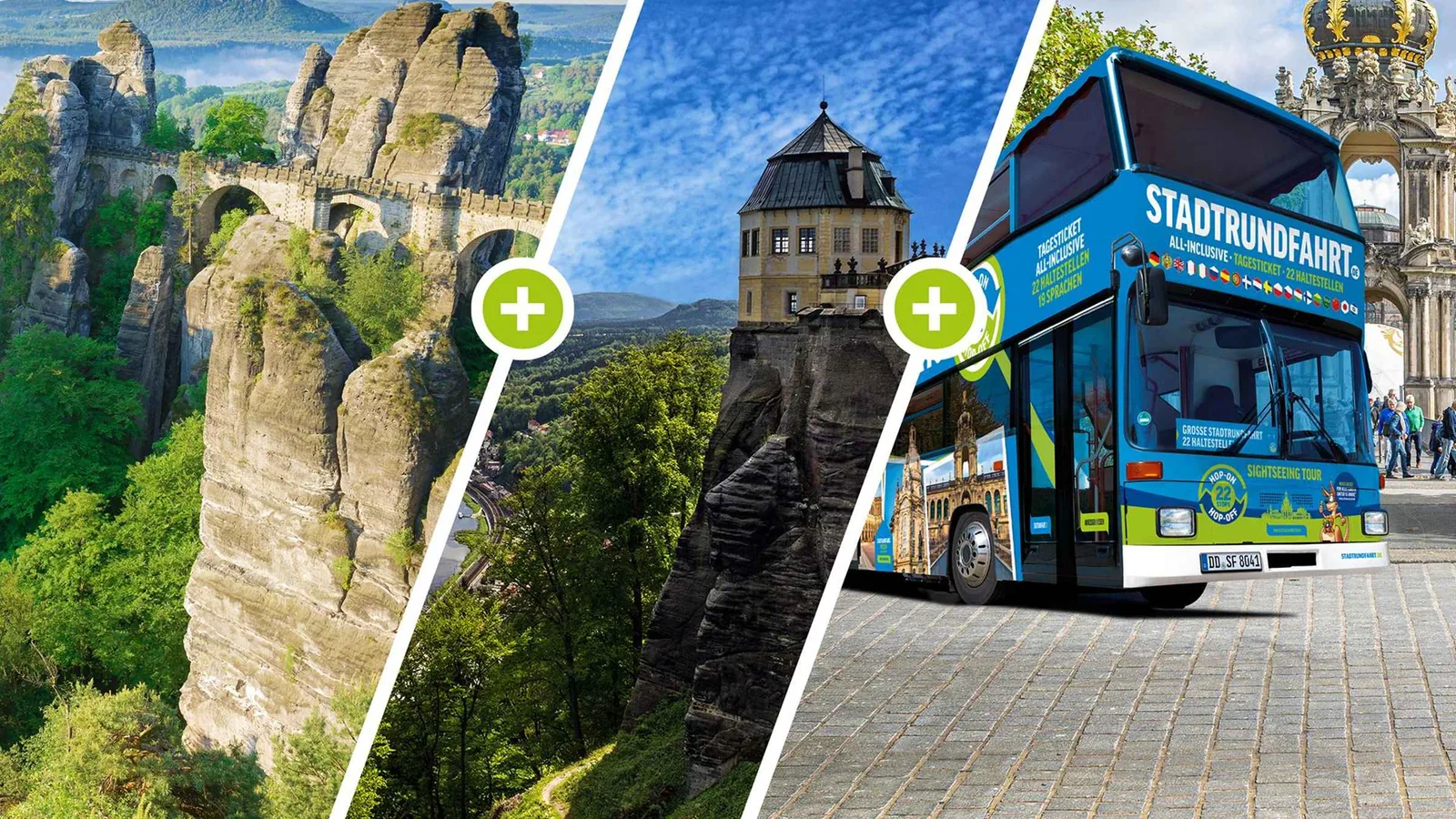
Seven hours in a panoramic double-decker bus from Dresden with a German-speaking guide: to the Bastei lookout rock with the Bastei Bridge and to Königstein Fortress, back by bus or, at your own expense, by paddle steamer.
1,157 reviews on GetYourGuidefrom €30as of 4 Oct
Departure Dresden, at the city tour bus stop (map point 51.0475 / 13.7369); the provider asks you to arrive 15 minutes before the tour starts.
The list of inclusions names “entry to the Bastei lookout rock and the world-famous Bastei Bridge” as included. Not included are entry to Königstein Fortress, which lies outside the national park, the steamer trip and food and drinks. Not suitable for people with mobility impairments. Free cancellation up to 24 hours in advance.
View tour ↗Ad · partner link · checked 27 Sep 2026
More checked toursAd · partner link · checked 3 Oct 2026
4 reviews on GetYourGuidefrom €420 per groupas of 4 Oct
Provider's product photo · GetYourGuide
02 · 194 metres (636 ft) above the Elbe
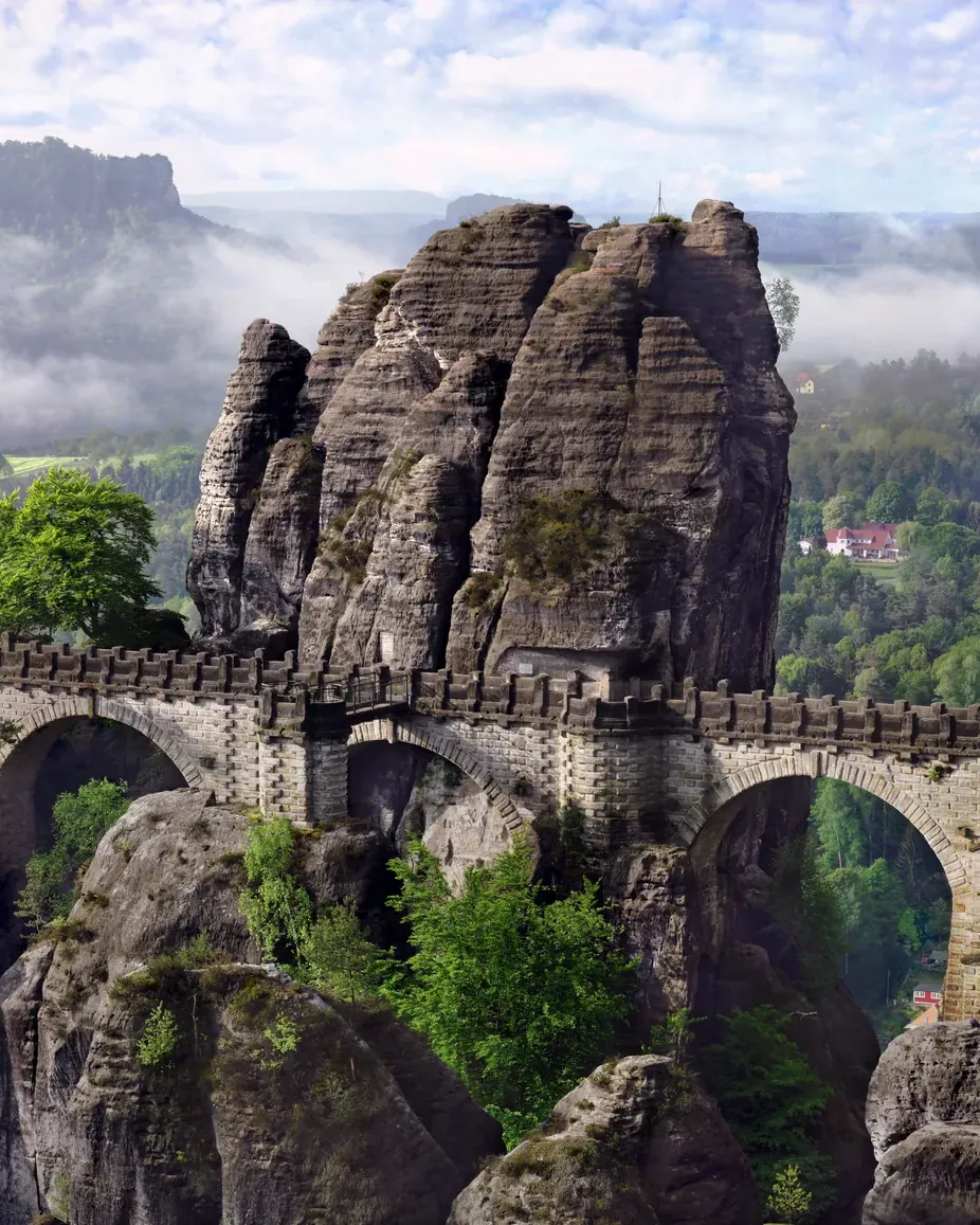
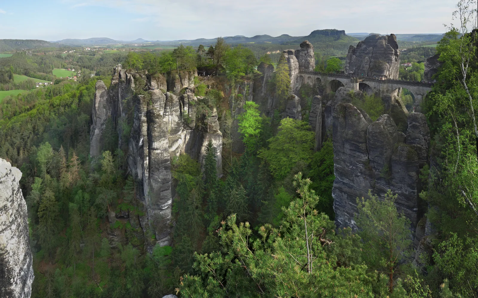
The rock pulpit of the Bastei rises vertically 194 metres (636 ft) above the Elbe, and a stone bridge from 1850/51 links it to the Neurathen rock castle from the 13th century. Without a car, take the S-Bahn to Kurort Rathen and cross the river by ferry.
“The first modest inn for hikers opened at the Bastei as early as 1812. Today's stone bridge was built in 1850/51, in connection with the opening of the railway line in the Elbe valley.”
Saxon Switzerland National Park · The Bastei above the Elbe valley
Rock pulpit and bridge
One of the best-known natural monuments of Saxon Switzerland: a group of rocks above the Elbe, linked by a stone bridge since 1851.
Destinations in the national park ↗
Bastei Bridge: getting there, shuttle bus & current status →
is the height of the Bastei rock pulpit (1,001 ft)
is its vertical drop to the Elbe (636 ft)
the stone Bastei Bridge has stood, built in 1850/51
the Bastei area has been a nature reserve
Saxon Tours · GetYourGuide
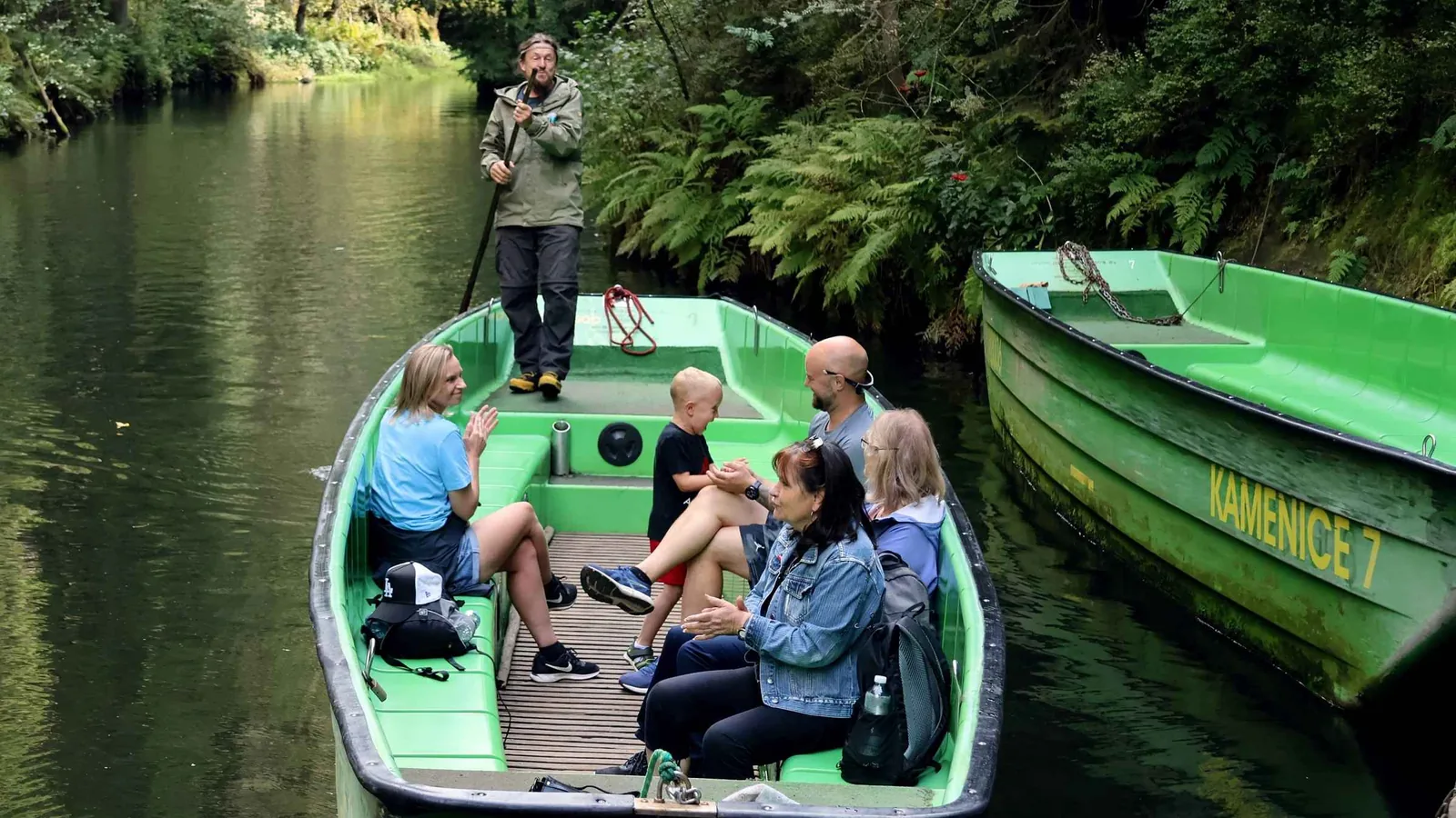
Small-group tour from Dresden with hotel pick-up. The first stop is the Bastei Bridge in the national park; then you cross the border into the Czech Republic for lunch, a boat ride in the Kamenice Gorge and the Tisa Rocks.
51 reviews on GetYourGuidefrom €109.01as of 4 Oct
Departure Dresden, hotel pick-up included
According to the list of inclusions, the guide, all admission fees, hotel pick-up, a Czech lunch with a drink, water, a snack and gear rental are included, gratuities are not. Only the Bastei lies in Saxon Switzerland National Park; the other stops are in the Czech Republic. The boat ride runs only from April to October; from November to March the gorge is left out. Not suitable for people with heart problems or wheelchair users. Free cancellation up to 24 hours in advance.
View tour ↗Ad · partner link · checked 27 Sep 2026
Provider's product photo · GetYourGuide
03 · After the storm of 31 July
From the Bastei, the wild Schwedenlöcher gorge leads down into the Amselgrund valley. A storm on 31 July 2026 brought down around 12,000 trees there; the Schwedenlöcher are open again, while the lower Amselgrund down to Rathen remains closed for now.
Closures and core zone
A local storm on 31 July 2026 hit about 25 hectares of forest between the Bastei, Rathen and Hohnstein, and around 12,000 trees came down. According to the park authority (as of 27 Aug 2026), the Bastei trail, the Bastei Bridge and the Schwedenlöcher gorge are open again; the Amselgrund valley from Rathen to the Schwedenlöcher junction, including Lake Amselsee, remains closed. Check the trail service before you set off.
Park authority: storm damage around Rathen (as of 27 Aug 2026) ↗
Beyond the trails is animal country: in the core zone, which is signposted on site, you may only use marked trails or trails shown by signposts. Resting and sleeping outside buildings are prohibited there.
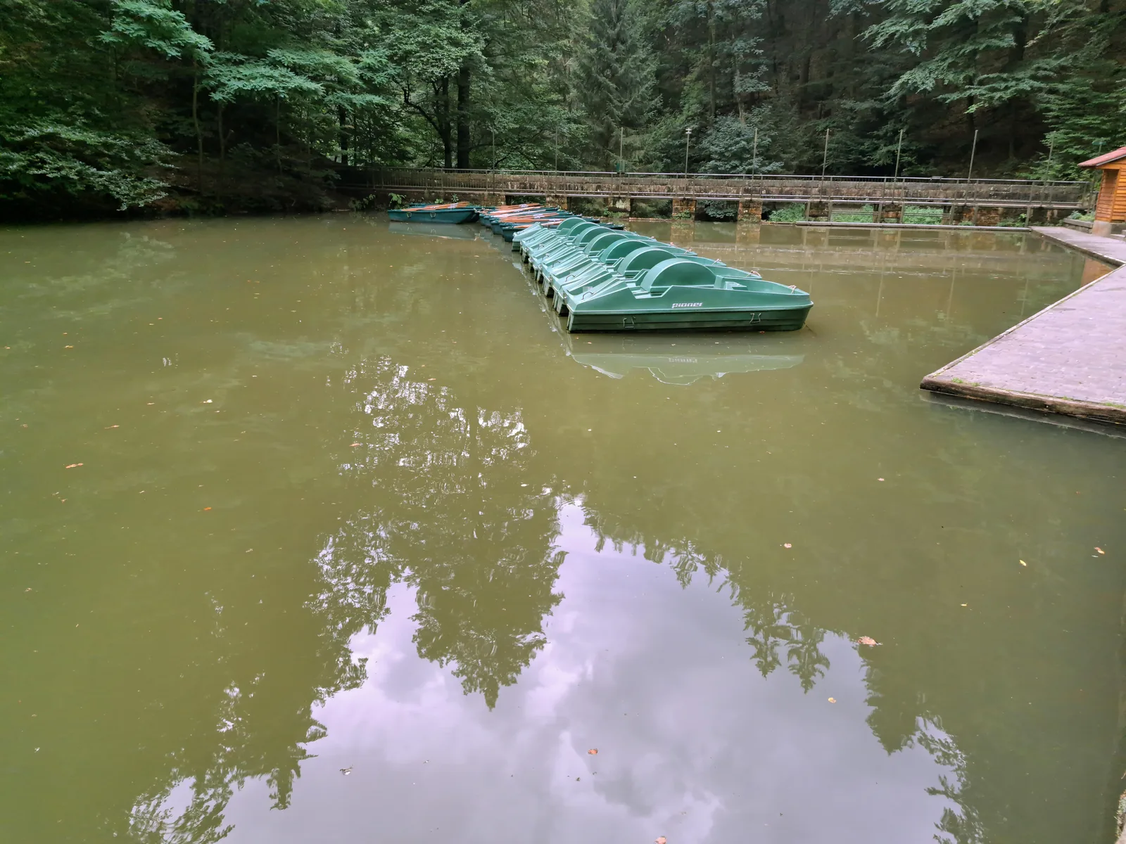
Closed after the storm
A reservoir from 1934 in the Amselgrund valley above Rathen; swimming is prohibited in the national park.
04 · The symbol of the park
The only table mountain on the right bank of the Elbe rises to 415 metres (1,362 ft) and is the logo of the national park. In 1708 Augustus the Strong had steps cut into its south side; the northern ascent was added only in 1900.
Table mountain above the Elbe valley
The table mountain in the middle of the national park: according to the park authority the only one on the right bank of the Elbe, and the park's logo.
With children
A family nature trail of the park authority leads around and up the Lilienstein: 4.3 kilometres (2.7 mi) from the Sellnitz education centre, eight stations with audio files, designed for children aged 5 to 11.
05 · Up the ladders to the ridge
From Bad Schandau you climb about 350 metres (1,150 ft), over steep ladders and steps. At the top a ridge trail passes the Schrammtore, three massive vertical clefts in the rock ridge.
Rock ridge above the Elbe valley
A long, deeply fissured group of rocks east of Bad Schandau, directly above the Elbe valley.
Ladders, stairways, markings
Many trails lead over steps, ladders and iron stairways. Mountain paths marked with a green triangle require sure footing and are not suitable for pushchairs or wheelchairs.
Blue stands for long-distance, red for regional, green and yellow for local trails. A green triangle on a grey background marks mountain paths, which are harder and require sure footing.
06 · By tram into the rear of the park
The only tram line in the national park has run since 1898 from Bad Schandau to the Lichtenhain Waterfall. From there you walk to the Kuhstall, a rock arch 11 metres (36 ft) high and 17 metres (56 ft) wide with a view of the Affensteine.
Into the upper valley
The only tram line in the national park has run since 1898 from Bad Schandau through the Kirnitzsch valley to the Lichtenhain Waterfall; every stop is a trailhead, for example for the Schrammsteine or the Kuhstall.
On the Czech side, Bohemian Switzerland National Park adjoins it. The two park authorities work together; many trails and viewpoints belong together as a landscape, even though two countries are responsible.
07 · The cradle of free climbing
With more than 1,000 approved climbing summits, the Elbe Sandstone Mountains are considered the cradle of free climbing. Climbers wrote down the Saxon climbing rules themselves more than 100 years ago: no chalk, no artificial aids, dry rock only.
approved for climbing in the national park region
from Hinterhermsdorf to the Bielatal valley
approved, only for climbers from 16 June to 31 January
mountaineering here has been intangible cultural heritage
The rules on the rock
Climbing is only permitted on the approved climbing summits. The Elbe Sandstone has its own, very old climbing tradition with strict rules; climbers inform themselves in advance with the park and the Saxon Mountaineering Association.
Chalk is prohibited, climbing is allowed only on dry rock, and protection gear may not be used as a handhold or foothold. These rules, more than 100 years old, are also part of the national park region ordinance; mountaineering in Saxon Switzerland has been intangible cultural heritage since 2024.
Sleeping under the rocks
Sleeping under rock overhangs is a tradition of the Elbe Sandstone. It is only allowed when two conditions are met at the same time.
08 · Letting nature be nature
In August 2022 the largest forest fire so far in Saxon Switzerland destroyed 105 hectares of forest in the national park. How the new forest grows back, diverse again, after bark beetles and fire can be seen on the Path to the Wilderness nature trail.
of forest in the national park burned in August 2022
and more in Bohemian Switzerland National Park
and more of forest fires in Saxony are caused by people
forest fires in the park in 2019 were started by illegal campfires
Saxon Switzerland National Park: landscape and origins
A labyrinth of rock from the Cretaceous: 9,350 hectares of sandstone towers, gorges and table mountains, in two sections on the right bank of the Elbe.
Saxon Switzerland National Park lies in the Elbe Sandstone Mountains south-east of Dresden and covers 9,350 hectares (23,100 acres). It consists of two separate sections, both on the right bank of the Elbe; the table mountains on the left bank belong to the landscape protection area. It is run by the National Park and Forestry Administration Saxon Switzerland, a regional unit of the state forestry enterprise Sachsenforst.
The landscape is the legacy of a Cretaceous sea: the sand deposited there hardened into sandstone, which water and frost then broke up into towers, walls and gorges. More than a hundred viewpoints open up this labyrinth, linked by trails that again and again lead over steps, ladders and iron stairways.
Around it lies the Saxon Switzerland landscape protection area of 22,870 hectares, which legally is not part of the park; together the two form the national park region of 38,100 hectares. The distinction matters in practice: the Forststeig Elbsandstein trail, for example, runs through the protection area, not through the park, and different rules apply there, including permitted bivouac sites.
In the park itself, the most important rule is to stay on the trails: entering the terrain is only allowed on the existing paths. In terrain this confusing, that protects more than nature. A second peculiarity is boofen, sleeping under rock overhangs: it is allowed from 16 June to 31 January, but only for climbers.
On more than three quarters of the area, forestry management has now largely stopped, so that the former commercial forests can become natural forests again. At the Czech border, the same landscape continues in Bohemian Switzerland National Park; the two park authorities work together.
Protected areas of the national park region ↗
The park in numbers
What the park protects
The largest forest fire so far in Saxon Switzerland destroyed 105 hectares of forest in the national park in August 2022; in neighbouring Bohemian Switzerland more than 1,000 hectares burned. An illegal campfire could not be ruled out as the cause. Since then the park authority has relied on a fire protection plan for the whole national park region.
Since May 2021, 76 percent of the park has been a quiet zone: nature is left to itself there, without use or steering, apart from public safety and forest fire prevention. The remaining 24 percent, mostly on the edge of the park, is a management zone.
The park authority describes the Elbe Sandstone Mountains as a cross-border erosion landscape from the Cretaceous that is unique in Europe. Between table mountains and gorges, plants grow at low altitude whose nearest occurrences are often only in the high mountains or in Scandinavia, such as the two-flowered violet.
Fire in the forest
Campfires are only allowed at nine designated fireplaces in the national park, with wood you bring yourself. From forest fire danger level 3, any fire is prohibited there too. If you see fire or smoke anywhere else, call 112 immediately.
Smoking and any other kind of fire are prohibited. Drones are banned throughout the national park, as is entering bodies of water and swimming. Picking or damaging plants is prohibited.
09 · S-Bahn, ferry, paddle steamer, Malerweg
Bad Schandau national park station is an international EuroCity stop, and from Dresden the S1 runs every 30 minutes. Camping is prohibited in the park; if you stay for several days, you sleep in the towns, for example in hotels and guesthouses along the Malerweg.
Without a car
Bad Schandau national park station is a EuroCity stop with direct trains from Berlin, Leipzig, Freiburg, Prague, Brussels, Budapest, Graz and Vienna. From Dresden, the S1 runs every 30 minutes.
The park authority lists eight ferry crossings over the Elbe, and seven Elbe ferries elsewhere on the same page. In addition, a hikers' boat runs four times a day from Bad Schandau to Schmilka and on to Hřensko.
Hiking buses link the well-known starting points, along with the Kirnitzschtal tram from 1898. In summer there are also bike buses.
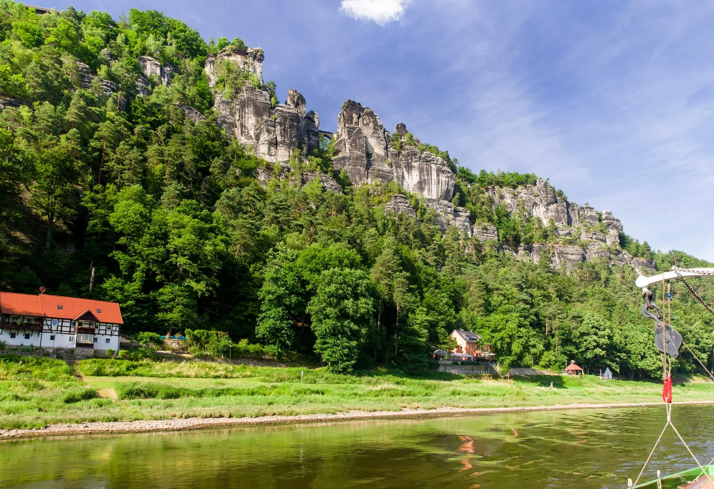
WEIßE FLOTTE SACHSEN GmbH · Paddle steamer · from Bad Schandau
Four to seven hours on a historic paddle steamer: from the pier in Bad Schandau downstream past Königstein Fortress, through the great bend of the Elbe around the Lilienstein and past the Bastei rocks at Kurort Rathen, on past Pirna to the turning point at Pillnitz Palace and back again. If you board in Pillnitz, you travel the route one way to Bad Schandau.
152 reviews on GetYourGuidefrom €28as of 4 Oct
Departure Pier of the Saxon paddle steamer company on the Elbe riverbank in Bad Schandau (map point 50.9166 / 14.1537) for the return trip; the one-way trip starts in Pillnitz (51.0063 / 13.8737).
The steamer travels on the Elbe, which according to the park authority's map belongs to the landscape protection area, not to the national park; the park lies on the slopes and heights to the right of the river, for example at the Lilienstein and the Bastei. According to the list of inclusions, the boat trip (return or one way, depending on the option) and commentary via on-board announcements or app are included; not included are pick-up and drop-off and food and drinks. In case of extremely high or low water levels, the timetable may change or trips may be cancelled. If you book with a student or disability card, you show it on the day; smoking is not allowed. Free cancellation up to 24 hours in advance. Weiße Flotte Sachsen is a national park partner of the park authority.
View tour ↗Ad · partner link · checked 27 Sep 2026
Provider's product photo · GetYourGuide
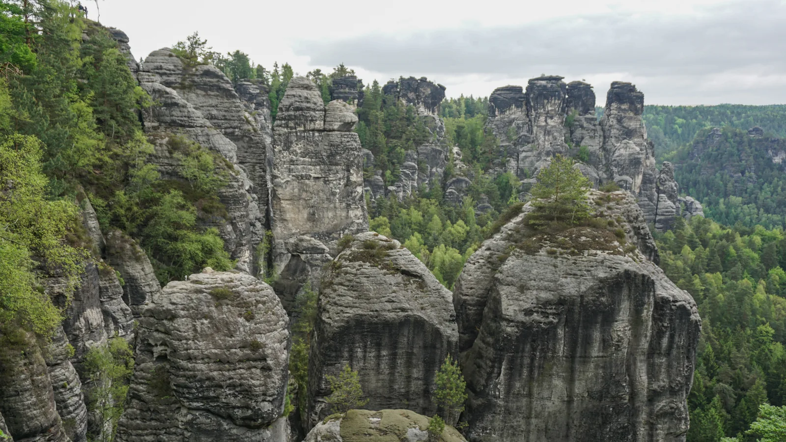
116 kilometres (72 mi) in eight stages
116 kilometres (72 mi) in eight stages: the trail that strings together the highlights of the region.
The Malerweg (Painters' Way) runs for 116 kilometres (72 mi) through the national park region, with nights in hotels and guesthouses. The Forststeig Elbsandstein, 105 kilometres (65 mi) long, runs through the landscape protection area instead, not through the national park, and offers bivouac sites and trekking huts.
Saxon Switzerland tourism association: Malerweg (Painters' Way) ↗
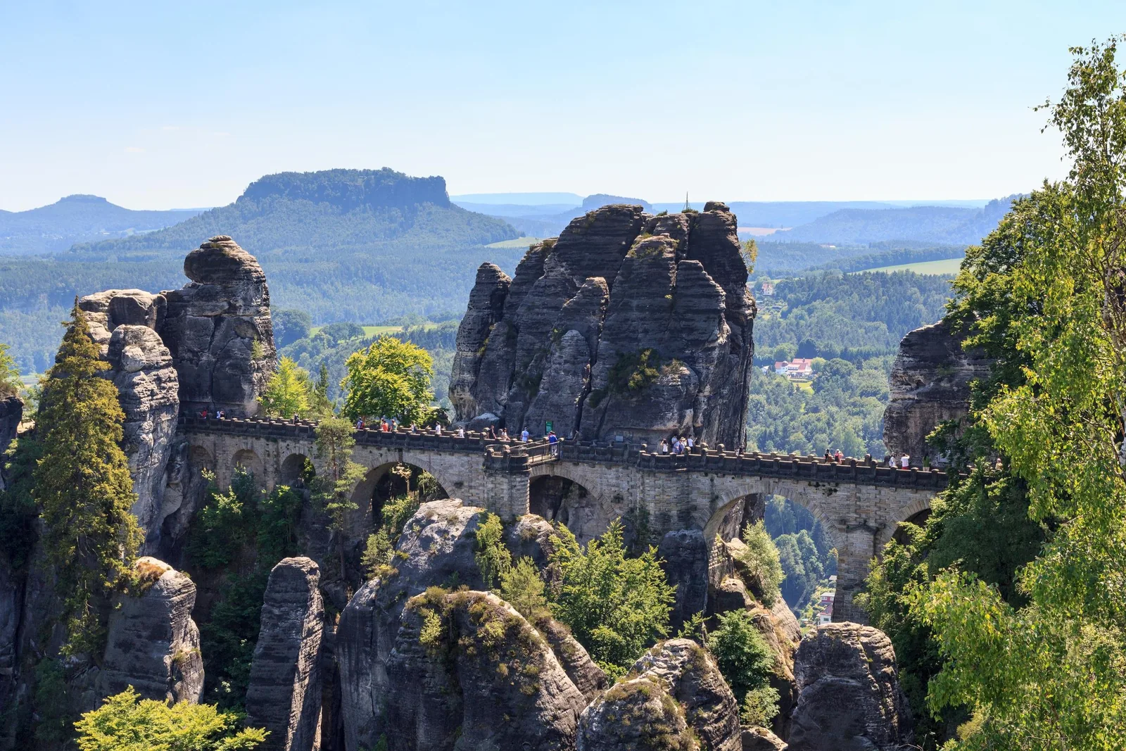
buendía · GetYourGuide
Full-day coach trip from Berlin. In the morning a guided walk through Dresden, in the afternoon a photo stop and free time at the Bastei Bridge. The provider explicitly names Saxon Switzerland National Park.
143 reviews on GetYourGuidefrom €58as of 4 Oct
Departure Berlin, Neptune Fountain (Fuente de Neptuno)
According to the itinerary: three hours by coach to Dresden, four hours of guided tour and free time in Dresden, one hour to the Bastei, 75 minutes there for photos and free time, three and a half hours back. Food and drinks are not included. Free cancellation up to 24 hours in advance.
View tour ↗Ad · partner link · checked 27 Sep 2026
Provider's product photo · GetYourGuide
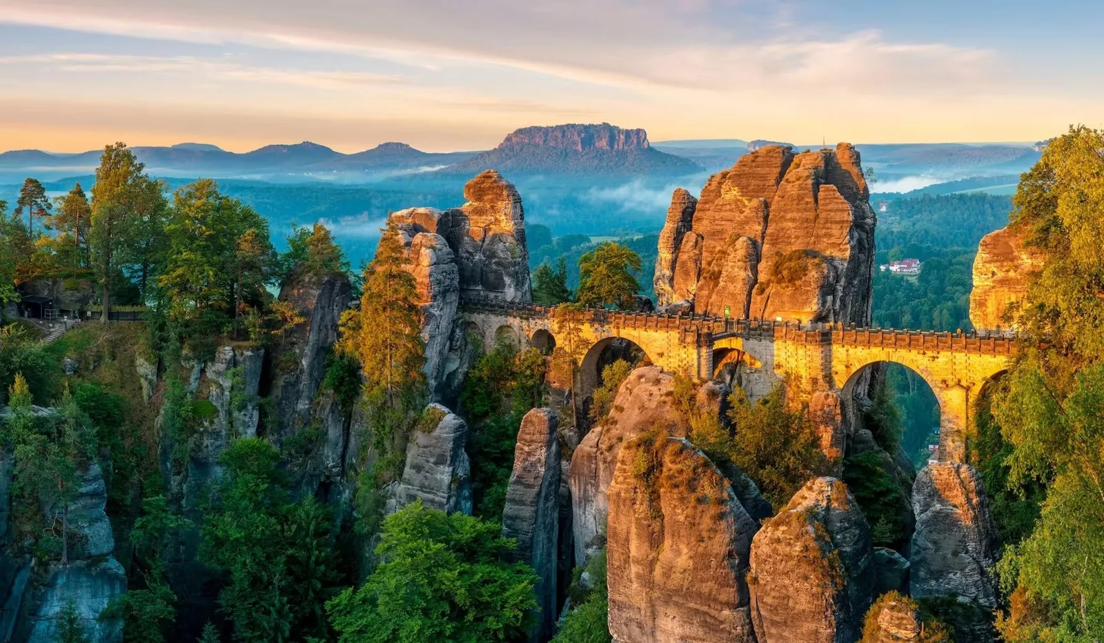
Cultiva tours · GetYourGuide
Day trip from Prague by minivan in a small group. First Dresden with free time, then the Bastei Bridge as a viewpoint above the Elbe.
15 reviews on GetYourGuidefrom €129as of 4 Oct
Departure Prague, pick-up in the city centre (Prague 1)
Included are the guide, transport in an air-conditioned vehicle, pick-up and drop-off in Prague 1 and free time; food and personal expenses are not included. Free cancellation up to 24 hours in advance.
View tour ↗Ad · partner link · checked 27 Sep 2026
Provider's product photo · GetYourGuide
10 · Before you go
The Bastei has its own page with directions, times and the rules on site. Before every hike, check the park authority's trail service, which reports closures and temporarily impassable trails.
Film by the tourism association
The park authority does not run its own video channel. This landscape film comes from the regional tourism association: it shows the park, but it is not an official presentation.
Source: Saxon Switzerland tourism association · View channel ↗
Popular destinations
Field book · Saxon Switzerland National Park
checked 18 Sep 2026
Nothing saved yet. Every place card has a pin, and so does every place on the Map. What you save collects here, with days, notes and a preview you can share.
Reality check
Share
The plan is stored in the link itself. Anyone who opens it sees the preview and can use the plan.
The park is open all year round. Seasonal are the boofen period, the ferries and the Kirnitzschtal tram.
Boofen, sleeping under rock overhangs, is allowed from 16 June to 31 January, and only in connection with rock climbing. Outside this period, and without climbing, sleeping under the rocks is prohibited.
According to the park authority, the Bastei is one of the best-known natural monuments of Saxon Switzerland and very easy to reach by public transport: by S-Bahn to Kurort Rathen, then by ferry across the Elbe. If you come by car, it recommends the Bastei park-and-ride car park; a shuttle bus runs from there every 30 minutes.
Climate through the year
Best months by the climate data: May to September. Average daytime highs of 18 to 24 °C, lows of 8 to 14 °C, 59 to 89 mm of precipitation a month. The wettest month is July (89 mm), the driest April (38 mm).
| Month | High °C | Low °C | Precipitation mm |
|---|---|---|---|
| January | 0.7 | −4.9 | 63 |
| February | 2.6 | −4.1 | 44 |
| March | 7.4 | −1.1 | 51 |
| April | 13.6 | 3.2 | 38 |
| May | 18.0 | 7.8 | 66 |
| June | 22.1 | 11.7 | 75 |
| July | 24.5 | 13.9 | 89 |
| August | 24.4 | 13.6 | 83 |
| September | 19.6 | 9.3 | 59 |
| October | 13.5 | 4.9 | 55 |
| November | 6.9 | 1.0 | 56 |
| December | 2.1 | −2.8 | 56 |
| Year | 735 |
Modelled values, not a weather station: NASA POWER (MERRA-2) for a grid cell of about 55 × 45 km around the map point National Park Centre, Bad Schandau (50.92° N, 14.15° E), with an average cell elevation of about 310 m. Averages for 2001–2020. Higher ground and valleys can differ markedly.
Source: NASA POWER, climatology 2001–2020 ↗ · retrieved 3 Oct 2026
Bad Schandau national park station is an international long-distance stop, so arriving without a car is the norm here.
Guests with a guest card can use all public transport in the national park region free of charge. That makes arriving without a car the better choice financially as well.
STADTRUNDFAHRT DRESDEN GmbH · offer
Seven hours in a panoramic double-decker bus from Dresden with a German-speaking guide: to the Bastei lookout rock with the Bastei Bridge and to Königstein Fortress, back by bus or, at your own expense, by paddle steamer.
1,157 reviews on GetYourGuidefrom €30as of 4 Oct
Departure Dresden, at the city tour bus stop (map point 51.0475 / 13.7369); the provider asks you to arrive 15 minutes before the tour starts.
The list of inclusions names “entry to the Bastei lookout rock and the world-famous Bastei Bridge” as included. Not included are entry to Königstein Fortress, which lies outside the national park, the steamer trip and food and drinks. Not suitable for people with mobility impairments. Free cancellation up to 24 hours in advance.
View tour ↗Ad · partner link · checked 27 Sep 2026
More checked toursAd · partner link · checked 3 Oct 2026
4 reviews on GetYourGuidefrom €420 per groupas of 4 Oct
Saxon Tours · offer
Small-group tour from Dresden with hotel pick-up. The first stop is the Bastei Bridge in the national park; then you cross the border into the Czech Republic for lunch, a boat ride in the Kamenice Gorge and the Tisa Rocks.
51 reviews on GetYourGuidefrom €109.01as of 4 Oct
Departure Dresden, hotel pick-up included
According to the list of inclusions, the guide, all admission fees, hotel pick-up, a Czech lunch with a drink, water, a snack and gear rental are included, gratuities are not. Only the Bastei lies in Saxon Switzerland National Park; the other stops are in the Czech Republic. The boat ride runs only from April to October; from November to March the gorge is left out. Not suitable for people with heart problems or wheelchair users. Free cancellation up to 24 hours in advance.
View tour ↗Ad · partner link · checked 27 Sep 2026
buendía · offer
Full-day coach trip from Berlin. In the morning a guided walk through Dresden, in the afternoon a photo stop and free time at the Bastei Bridge. The provider explicitly names Saxon Switzerland National Park.
143 reviews on GetYourGuidefrom €58as of 4 Oct
Departure Berlin, Neptune Fountain (Fuente de Neptuno)
According to the itinerary: three hours by coach to Dresden, four hours of guided tour and free time in Dresden, one hour to the Bastei, 75 minutes there for photos and free time, three and a half hours back. Food and drinks are not included. Free cancellation up to 24 hours in advance.
View tour ↗Ad · partner link · checked 27 Sep 2026
Cultiva tours · offer
Day trip from Prague by minivan in a small group. First Dresden with free time, then the Bastei Bridge as a viewpoint above the Elbe.
15 reviews on GetYourGuidefrom €129as of 4 Oct
Departure Prague, pick-up in the city centre (Prague 1)
Included are the guide, transport in an air-conditioned vehicle, pick-up and drop-off in Prague 1 and free time; food and personal expenses are not included. Free cancellation up to 24 hours in advance.
View tour ↗Ad · partner link · checked 27 Sep 2026
Ad · we may earn a commission if you book through this partner link – at no extra cost to you. Thank you for supporting the atlas. Offer details checked 27 Sep 2026. See official ticket information.
There is no entrance fee for the national park. You pay for parking and for facilities.
The park authority names no entrance fee on its rules page or its hiking page; the park is freely accessible. Costs arise for car parks, trains and facilities.
Some of the hikers' car parks charge a fee and, according to the park authority, fill up quickly. That is why it recommends coming by train and bus.
The park authority's exhibition in Bad Schandau is the place to start. From April to October it is open daily from 9:00 to 17:00, in February and March Tuesday to Friday. Admission is €4 for adults, €3 reduced and €8.50 for families; special exhibitions are free.
STADTRUNDFAHRT DRESDEN GmbH · offer
Seven hours in a panoramic double-decker bus from Dresden with a German-speaking guide: to the Bastei lookout rock with the Bastei Bridge and to Königstein Fortress, back by bus or, at your own expense, by paddle steamer.
1,157 reviews on GetYourGuidefrom €30as of 4 Oct
Departure Dresden, at the city tour bus stop (map point 51.0475 / 13.7369); the provider asks you to arrive 15 minutes before the tour starts.
The list of inclusions names “entry to the Bastei lookout rock and the world-famous Bastei Bridge” as included. Not included are entry to Königstein Fortress, which lies outside the national park, the steamer trip and food and drinks. Not suitable for people with mobility impairments. Free cancellation up to 24 hours in advance.
View tour ↗Ad · partner link · checked 27 Sep 2026
More checked toursAd · partner link · checked 3 Oct 2026
4 reviews on GetYourGuidefrom €420 per groupas of 4 Oct
Ad · we may earn a commission if you book through this partner link – at no extra cost to you. Thank you for supporting the atlas. Offer details checked 27 Sep 2026. See official ticket information.
Camping is prohibited, boofen only under narrow conditions. Otherwise, stay in the towns along the Elbe.
Camping is not allowed in the national park. If you are out for several days, you stay in the towns and villages, and the Malerweg is designed exactly for that.
Sleeping under rock overhangs is allowed from 16 June to 31 January, but only in connection with rock climbing. If you do not climb, you may not boof.
The Forststeig Elbsandstein offers bivouac sites and trekking huts, but it runs through the landscape protection area, not through the national park. Different rules apply there.
Stay on the trails, keep dogs on a lead, no fires, and separate rules for climbing.
Dogs must always be kept on a lead. This applies throughout the national park without exception.
Cycling is only allowed on the designated cycle routes. The network of hiking trails is not automatically open to bikes.
No, the park is freely accessible; the park authority names no entrance fee on its rules page or its hiking page. You pay at the hikers' car parks, some of which charge a fee, for trains and ferries, and for facilities such as the National Park Centre in Bad Schandau. With a guest card from the region, local public transport is free.
Only if two conditions are met at the same time. According to the park authority, boofen is allowed from 16 June to 31 January only in connection with rock climbing. If you do not climb, you may not sleep under the rocks, even during the permitted period. Camping is prohibited in the national park all year round; bivouac sites exist only on the Forststeig Elbsandstein trail, which runs through the landscape protection area outside the park.
No. Entering the terrain is only allowed on the existing trails. This rule applies throughout the national park without exception, and in a labyrinth of rock it is also a safety rule. Mountain paths are marked with a green triangle on a grey background and require sure footing.
Very easily, and the park authority explicitly recommends it because the hikers' car parks fill up quickly. Bad Schandau national park station is an international EuroCity stop with direct trains from Berlin, Leipzig, Freiburg, Prague, Brussels, Budapest, Graz and Vienna. From Dresden, the S1 runs every 30 minutes. Locally, Elbe ferries, a hikers' boat, hiking buses and the Kirnitzschtal tram from 1898 link the trailheads. With a guest card, local public transport in the region is free; according to the park authority, the cable ferry in Rathen is not included.
Only partly. The Malerweg runs for 116 kilometres (72 mi) through the national park region, that is through the park and the landscape protection area together. The Forststeig Elbsandstein, 105 kilometres (65 mi) long, runs through the landscape protection area instead and not through the national park, which is why it has bivouac sites and trekking huts that would be prohibited in the park.
Yes, but only on the approved climbing summits. The Elbe Sandstone has its own, very old climbing tradition with strict rules, for example on the use of protection gear. If you want to climb here, inform yourself in advance with the park authority and the Saxon Mountaineering Association.
Dogs yes, but they must always be kept on a lead. Cycling is only allowed on the designated cycle routes, not on the whole network of hiking trails. Drones are prohibited throughout the national park, as are fire and smoking, picking or damaging plants, and entering bodies of water and swimming.
The national park itself covers 9,350 hectares in two sections, both on the right bank of the Elbe. Around it lies the Saxon Switzerland landscape protection area of 22,870 hectares, which legally is not part of the park. Together they form the national park region of 38,100 hectares. The difference matters in practice because stricter rules apply in the park, such as staying on the trails and the ban on camping.
All information comes from the Saxon Switzerland National Park authority. Check fares and times before you travel.
Researched 18 Sep 2026. Not a live status. Dates apply only to the year stated. A successful automatic fetch is not an editorial confirmation; outdated automatic values are hidden and replaced by the source link.
Current information from the park ↗
Location sources: Place coordinates determined via OpenStreetMap; each point links to its OSM object as evidence. Markers do not imply that access is permitted. Base map © OpenStreetMap contributors. Coastlines of the chapter map: Natural Earth.
More than a hundred viewpoints, with steps, ladders and iron stairways along the way, and a climbing area with its own rules.
One of the best-known natural monuments of Saxon Switzerland: a group of rocks high above the Elbe, linked by the Bastei Bridge. The Bastei area became a nature reserve in 1938 and is now part of the national park.
A long, deeply fissured group of rocks east of Bad Schandau, directly above the Elbe valley. The way up leads over steep ladders and steps and requires sure footing.
A labyrinth of Cretaceous sandstone, and a forest that still has to become a forest.
The national park covers 9,350 hectares (23,100 acres), split into a front and a rear section, both on the right bank of the Elbe. It is run by the National Park and Forestry Administration Saxon Switzerland, a regional unit of the state forestry enterprise Sachsenforst.
The Saxon Switzerland landscape protection area of 22,870 hectares surrounds the park but legally is not part of it. Together they form the national park region of 38,100 hectares.
End of the field book · Park authority ↗
Preview