National Parks Atlas
To the park
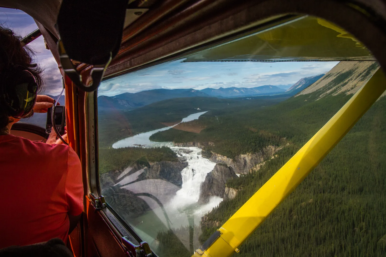
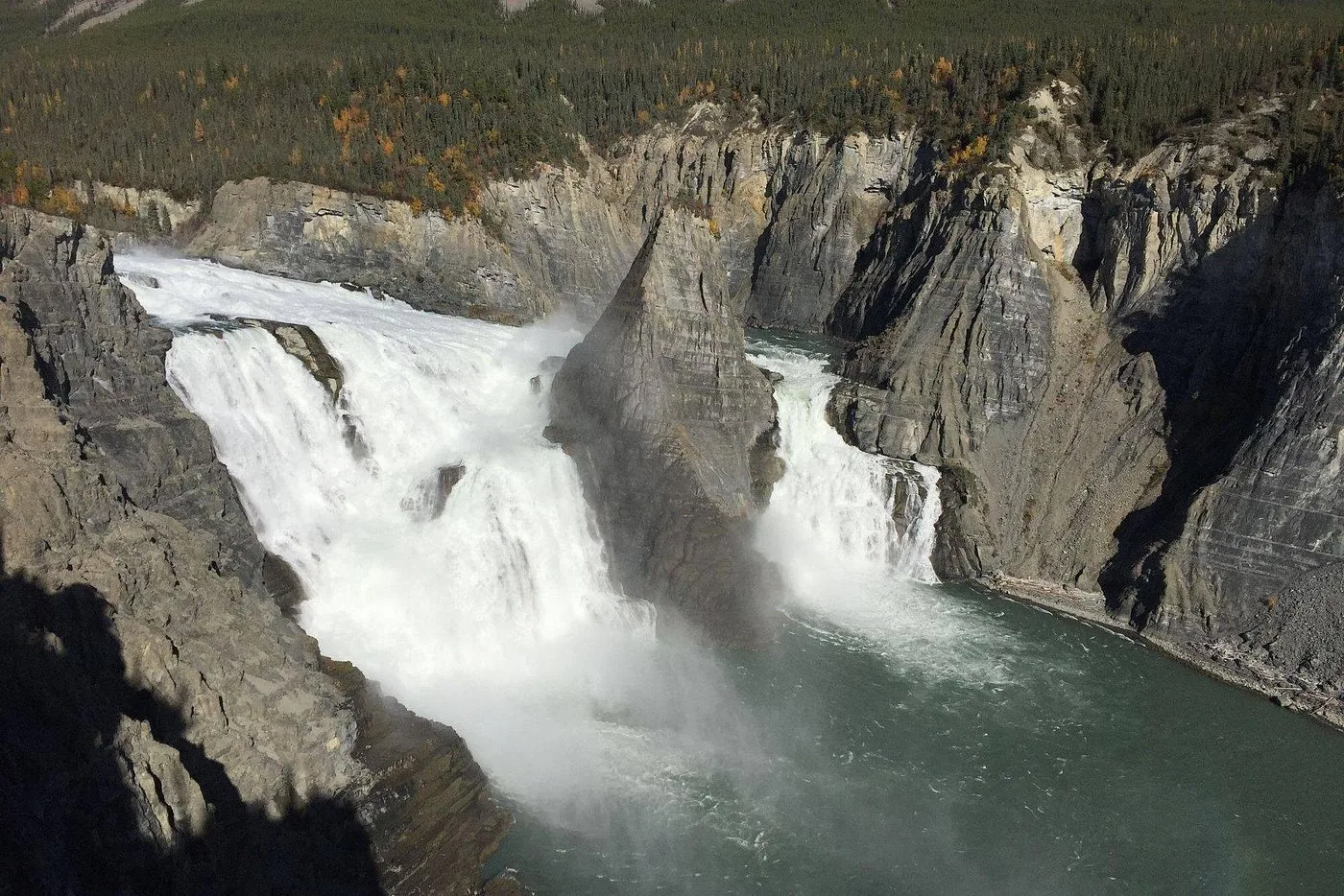
View from the window of a small aircraft in Nahanni National Park Reserve over Náįlįcho (Virginia Falls) and the South Nahanni River, with the pilot and wing strut in the foreground

Nahanni National Park Reserve: map

9 places with verified coordinates · 5 with photo

Offers in the park · 3

  • Offer photo: From Fort Simpson: day flight to Virginia Falls

    Viator

    From Fort Simpson: day flight to Virginia Falls ↗Goose Flying Service base in Fort Simpson: along 100 Street (Main Street) to the river, left onto MacKenzie Drive and follow the river to the sign. According to Viator, pickup is also possible at the Deh Cho Suites and Fort Simpson airport.

  • View from the window of a small aircraft in Nahanni National Park Reserve over Náįlįcho (Virginia Falls) and the South Nahanni River, with the pilot and wing strut in the foreground

    Floatplane · licensed operators · Air operators licensed by Parks Canada, including Simpson Air, South Nahanni Airways and Goose Flying Service in Fort Simpson, Air Tindi in Yellowknife, Liard Air in Muncho Lake and Northern Rockies Air Charter in Watson Lake

    By charter floatplane into the reserve ↗Fort Simpson (Simpson Air, South Nahanni Airways, Goose Flying Service; the usual departure point for day flights), Yellowknife (Air Tindi), Muncho Lake (Liard Air) or Watson Lake (Northern Rockies Air Charter).

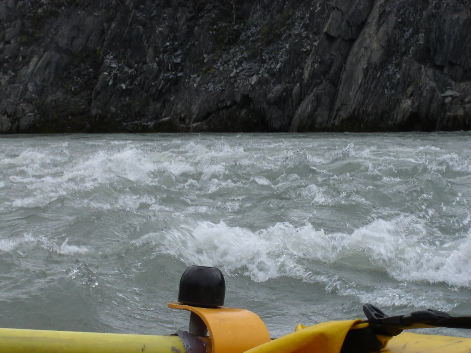
  • Whitewater on the Nahʔą Dehé in Nahanni National Park Reserve from a raft: foaming waves in front of a dark rock wall, a helmet in the foreground

    Canoe or raft · licensed outfitters · River trip outfitters licensed by Parks Canada: Black Feather, Canoe North Adventures, Jackpine Paddle, Nahanni River Adventures and Canadian River Expeditions

    Guided river trip on the Nahʔą Dehé (South Nahanni) ↗Start on the map

Ad · partner links: we may earn a commission if you book – at no extra cost to you. Thank you for supporting the atlas. Offer details checked 2 Oct 2026; dates and prices with the provider.

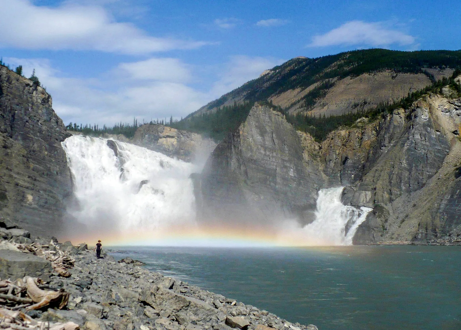
Náįlįcho (Virginia Falls) in Nahanni National Park Reserve seen from the shore: two mighty arms of the waterfall plunge into a gorge, a rainbow hangs in the spray, a tiny figure stands on the bank
Photo: Paul Gierszewski ↗ · Public domain ↗

Water · Waterfall

Náįlįcho (Virginia Falls)

According to the park authority, the drop is twice the height of Niagara Falls. Staffed in summer; the campsite requires a reservation.

Here the South Nahanni plunges over a drop twice the height of Niagara Falls. For most travellers it is the reason to come at all.

Drop
according to the park authority twice as high as Niagara.
Access
by floatplane or on the river trip.
In summer
staffed.
Campsite
reservation required; early booking explicitly recommended.
Name
Náįlįcho in the Dene language.
River
Nahʔą Dehé, a Canadian Heritage River since 1987.

Open in OpenStreetMap ↗Location source ↗

61.60742, -125.73609
Water · Lake and tufa mounds

Gahnįhthah Mie (Rabbitkettle Lake)

The mineral springs here form the largest tufa mounds in Canada. A sacred Dene site. Staffed in summer; the campsite requires a reservation.

Open in OpenStreetMap ↗Location source ↗

61.96297, -127.22258

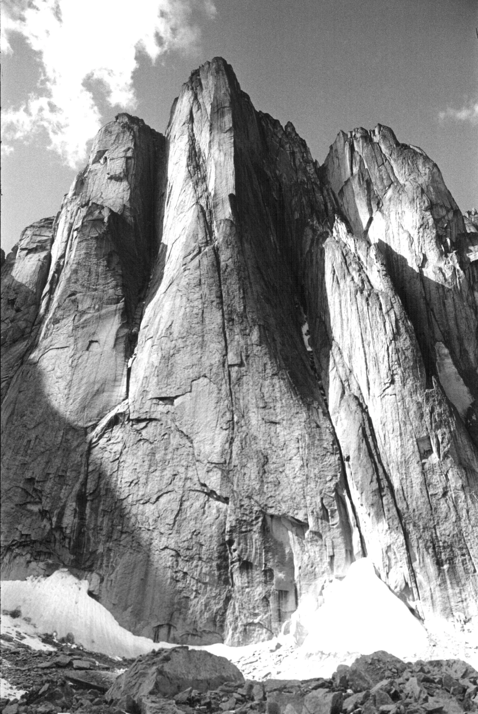
Black-and-white photo of the Lotus Flower Tower in Nahanni National Park Reserve: a huge vertical granite wall rises from a snowfield, with other rock towers beside it
Photo: Tom Frost ↗ · CC BY 3.0 ↗

Nature · Cirque

Cirque of the Unclimbables

Granite spires above an alpine meadow. The Glacier Lake/Fairy Meadows campsite requires a reservation.

Granite spires rising from an alpine meadow. The Lotus Flower Tower is one of the best-known climbing objectives in the world; this picture dates from 1968.

Location
Ragged Range, Logan Mountains.
Lotus Flower Tower
world-famous granite wall, a goal for elite climbers.
Campsite
Glacier Lake/Fairy Meadows, reservation required.
Trekking
valleys and passes of the Ragged Range, without marked trails.
Access
by floatplane to Glacier Lake, then on foot.
Photo
by Tom Frost, 1968.

Open in OpenStreetMap ↗Location source ↗

62.11068, -127.67165

Mountains & rock · Mountain

Lotus Flower Tower

The world-famous granite wall in the Cirque of the Unclimbables, a goal for elite climbers.

Open in OpenStreetMap ↗Location source ↗

62.11446, -127.69753

Nature · Mountain range

Ragged Range

Valleys and passes that trekkers cross with map and compass. No marked trails.

Open in OpenStreetMap ↗Location source ↗

62.02251, -127.47063

Water · River

Tu Naka Dé (Flat River)

The reserve’s second navigable river, for experienced paddlers.

Open in OpenStreetMap ↗Location source ↗

61.47325, -126.95493

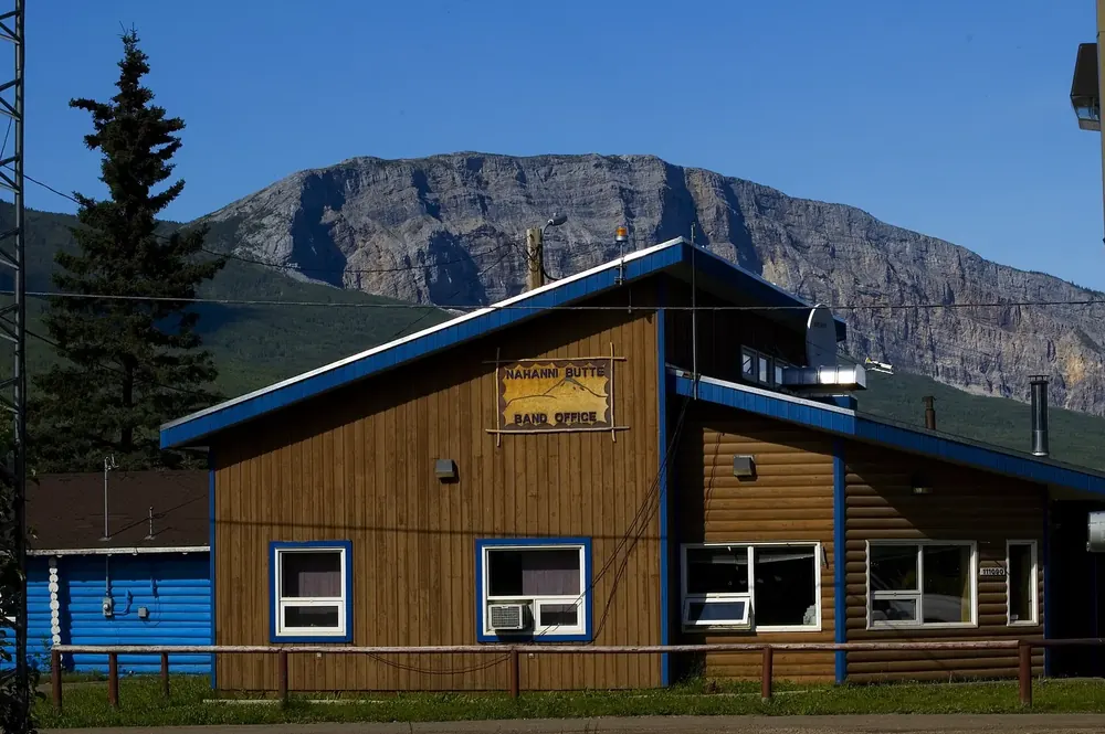
Band office in Nahanni Butte: a wooden house with blue trim in front of the steep rock face of Nahanni Butte mountain
Photo: https://www.flickr.com/people/naturallight/ Leslie Philipp ↗ · CC BY 2.0 ↗

Surroundings · Community outside the park

Nahanni Butte

Community at the confluence of the Nahʔą Dehé and the Liard River, outside the reserve. Second park office, closed in winter.

Guided from here

Park authority programmes, no partner links. Dates on their website.

Open in OpenStreetMap ↗Location source ↗

61.03517, -123.38362

Locations verified from the linked original sources and OpenStreetMap. The map shows no trails or park boundaries; markers do not imply that access is permitted.

Map: © OpenStreetMap contributors, OpenMapTiles, OpenFreeMap. Elevation: Terrain Tiles (Mapzen, AWS Open Data); 3DEP, GMTED2010 and SRTM courtesy of the U.S. Geological Survey; EU-DEM (Copernicus, European Union); ETOPO1 (NOAA); ArcticDEM (NSF, DigitalGlobe); Geoscience Australia; Open Data Austria (DGM); Open Government Licence – Canada; INEGI; Land Information New Zealand; Kartverket; Environment Agency (UK).

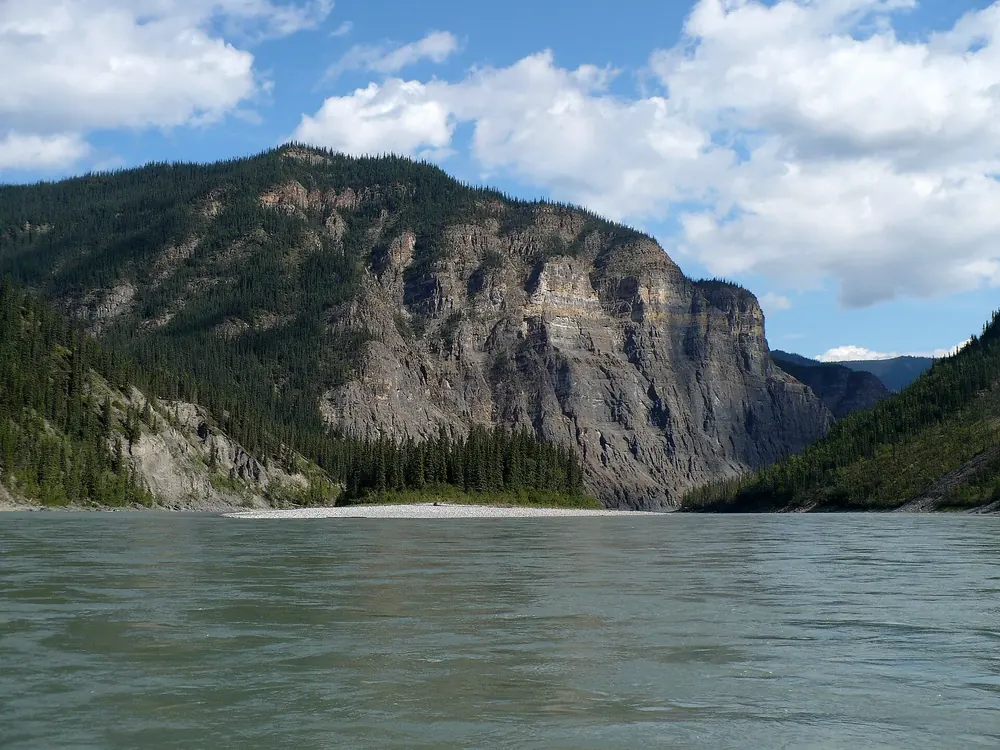
Park photo: Photo: Dwayne Reilander ↗ · CC BY-SA 4.0 ↗

Loading map …