National Parks Atlas
Map

00 · Scenic road beside the national park · Salzburg · Carinthia · beside Hohe Tauern National Park

Grossglockner High Alpine Road

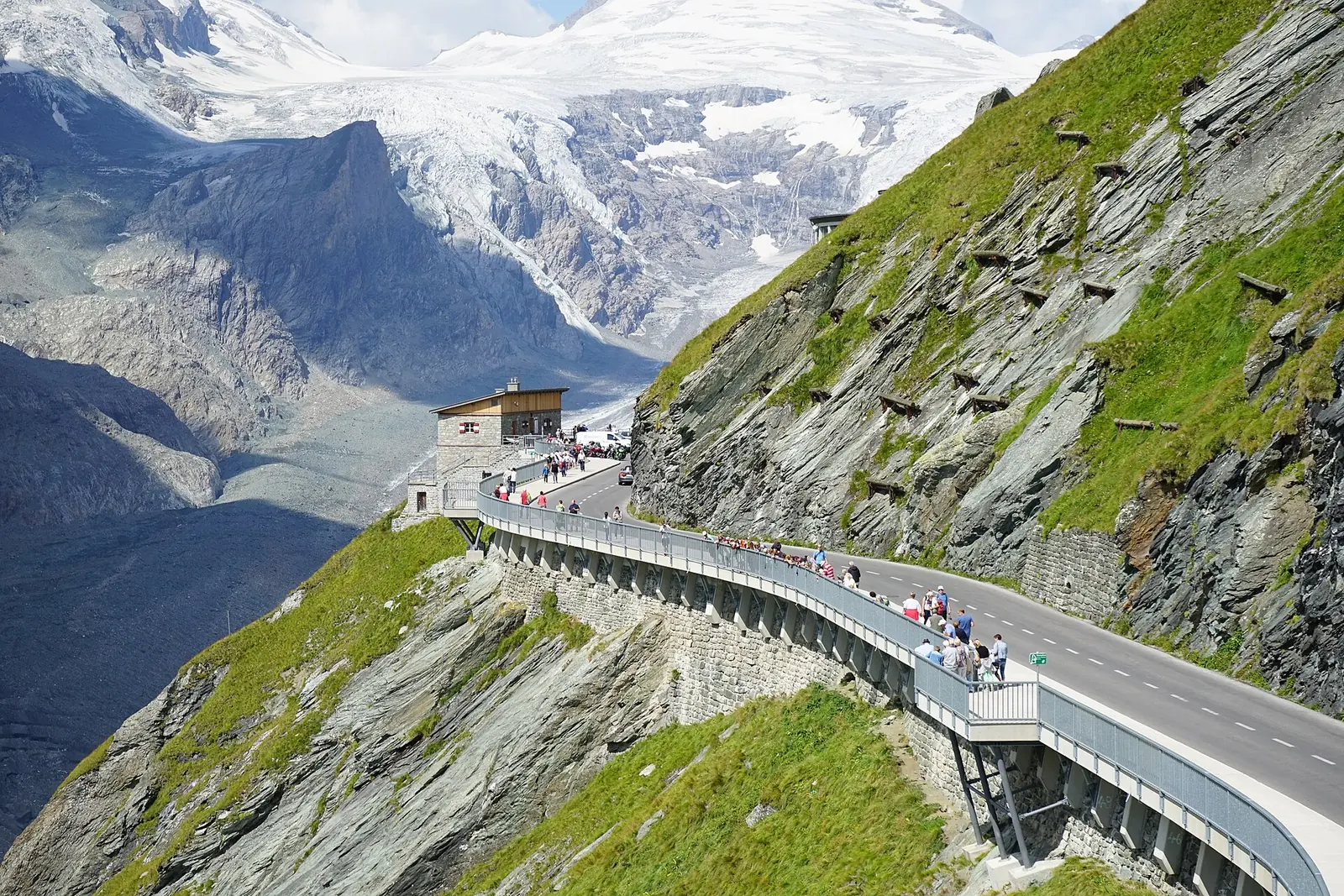
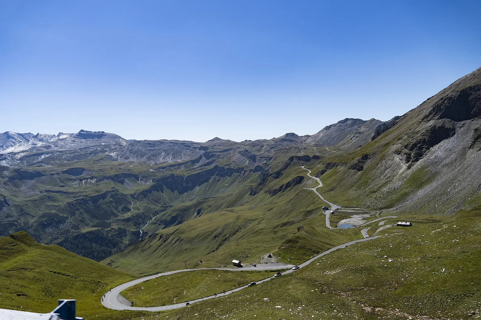
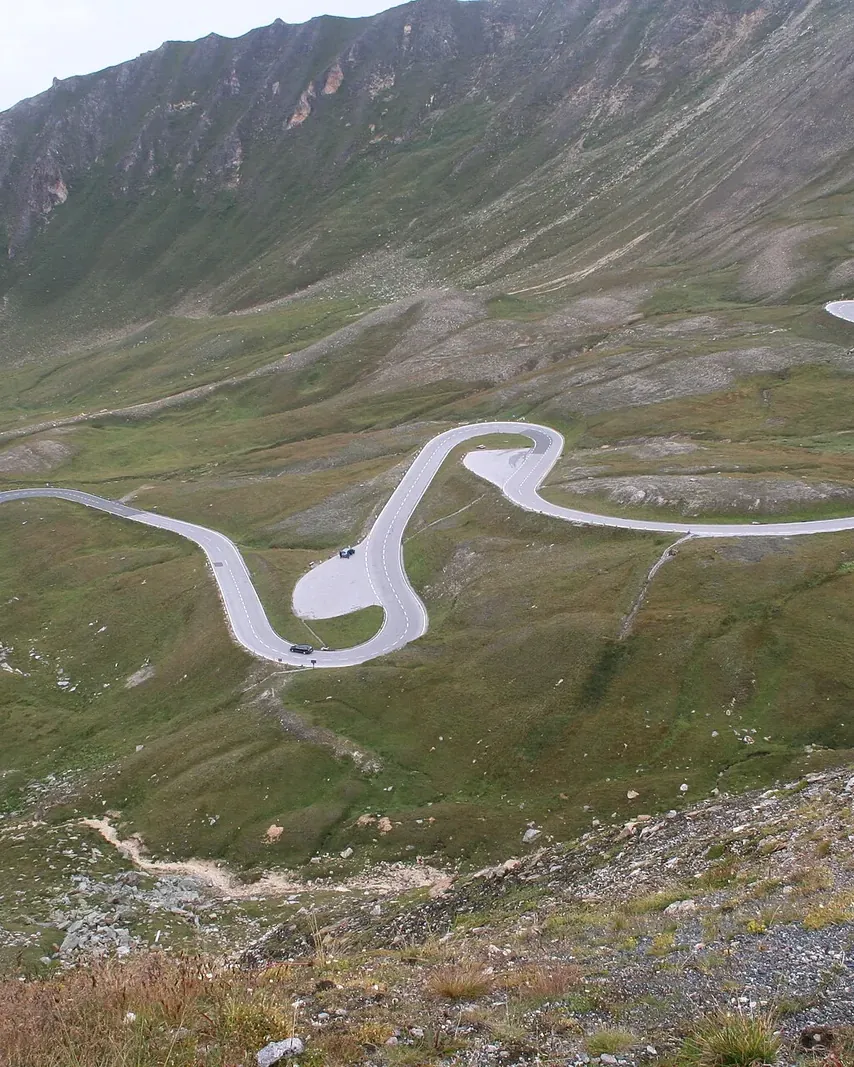
48 kilometres (30 mi), 36 hairpin bends and a view of Austria's highest mountain: the road runs along the national park, not through it.

Toll, season & opening timesGetting there & parkingOpening times

View plan

Photo: Iamthestig ↗ · CC BY-SA 3.0 ↗

€46.50Day ticket, car

Toll 2026, electric car €40.00

48 kmLength

36 hairpin bends up to 2,504 m

May – NovSeason

Early May to early November

The High Alpine Road: along the edge of the national park to the Pasterze

A toll road from 1935 that is now the starting point for nature experiences in the park.

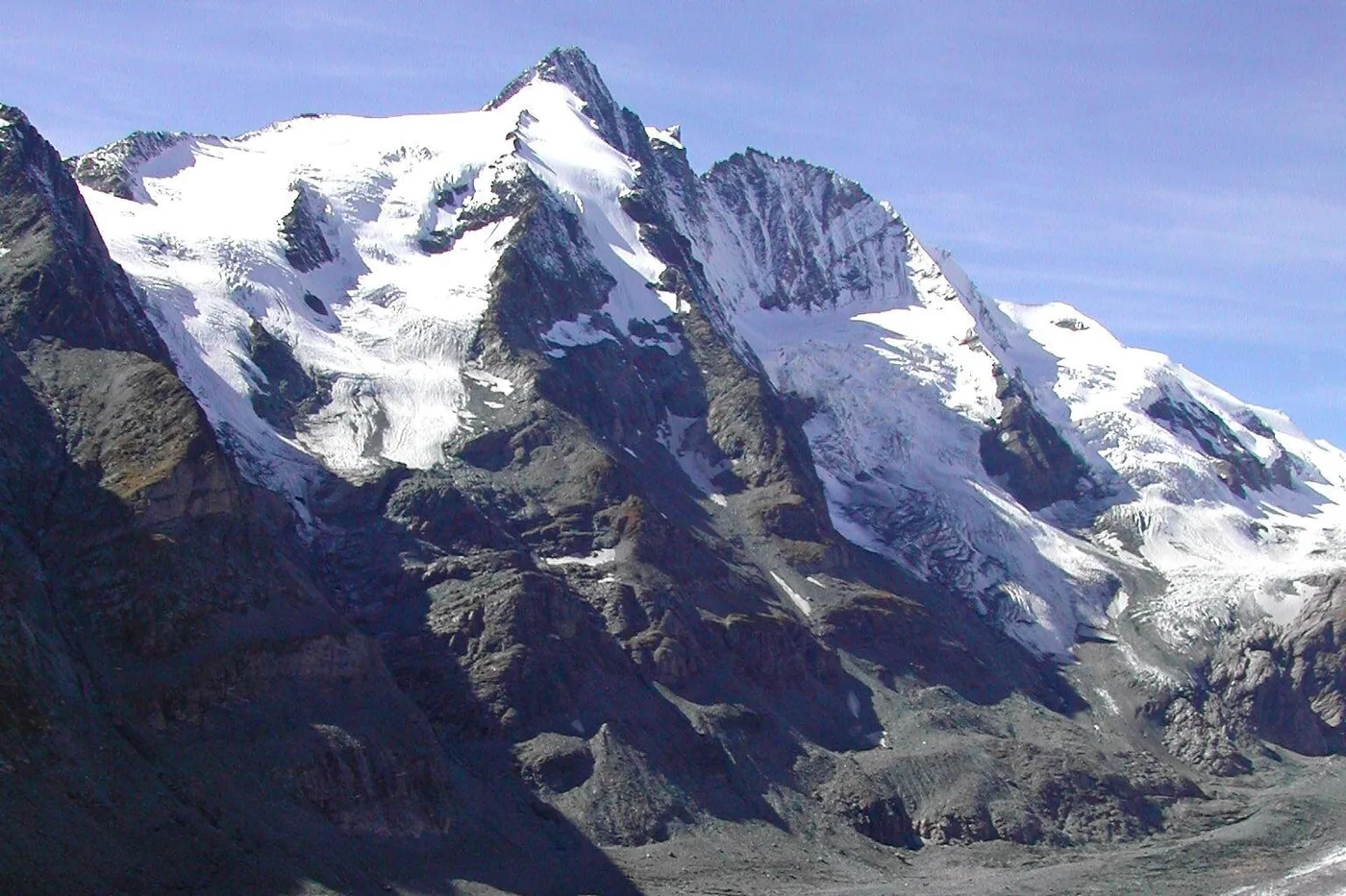
The Grossglockner High Alpine Road links Salzburg and Carinthia over 48 kilometres (30 mi). Through 36 hairpin bends it climbs to the Hochtor at 2,504 metres (8,215 ft), a short tunnel between the two federal states, and, as a spur road, to the Kaiser-Franz-Josefs-Höhe at 2,369 metres (7,772 ft), facing the Grossglockner, at 3,798 metres (12,461 ft) the highest mountain in Austria.

Is the road part of the national park? No. A comparison with the park boundary in OpenStreetMap shows that the road and its stops (Hochtor, Fuscher Törl, Edelweiss-Spitze, the visitor centre at the Kaiser-Franz-Josefs-Höhe, the Glocknerhaus and both toll stations) lie outside, at the pass often only 200 to 300 metres from the boundary. The Pasterze, the Gamsgrube trail and the Grossglockner itself lie inside.

Construction began on 30 August 1930 with up to 4,000 workers, and the road opened on 3 August 1935. It is run by Grossglockner Hochalpenstrassen AG, GROHAG for short. Because wind and avalanches pile up walls of snow up to 20 metres (66 ft) high, it is closed in winter; clearing with the historic Wallack snow blowers usually begins in mid-April.

At the end of the Glacier Road is the Kaiser-Franz-Josefs-Höhe visitor centre with the national park information centre. According to the park authority, the site draws 1.5 million visitors a year, for the view of the Grossglockner and the Pasterze, the largest glacier in the Eastern Alps.

GROHAG: driving safety and road conditions ↗

In numbers

Length
48 km
Hairpin bends
36
Hochtor
2,504 m (8,215 ft)
Edelweiss-Spitze
2,571 m (8,435 ft), highest point you can drive to
Kaiser-Franz-Josefs-Höhe
2,369 m (7,772 ft)
Grossglockner
3,798 m (12,461 ft)
Opened
3 August 1935
Day ticket, car
€46.50

Hohe Tauern National Park profile

01 · Plan

Toll, season & opening times

From the north via Bruck and Ferleiten, from the south via Heiligenblut.

Photo: Bybbisch94, Christian Gebhardt ↗ · CC BY-SA 4.0 ↗

How to get there and parking

From the north via Bruck and Ferleiten, from the south via Heiligenblut.

Two entrances

On the Salzburg side the road starts in Bruck with the Fusch/Ferleiten toll station, on the Carinthian side in Heiligenblut.

GROHAG: getting there ↗

By train and bus

By train via Salzburg to Bruck or Zell am See, then by post bus to the Ferleiten toll station. From late May to late September the Glocknerbus runs from Zell am See, Bruck and Fusch up the road; from the south, line 119 from Heiligenblut, from June to mid-September.

GROHAG: getting there ↗

Parking at the top

According to GROHAG, parking is free in the multi-storey car park at the Kaiser-Franz-Josefs-Höhe and in the car parks up to the Hoher Sattel. EV charging points are on the spaces marked in green.

GROHAG: Kaiser-Franz-Josefs-Höhe ↗

Price list

checked 3 Oct 2026

Toll and tickets

The type of vehicle sets the price; the national park itself costs nothing extra.

Grossglockner High Alpine Road toll 2026
TicketCarMotorcycle
Day ticket€46.50€36.50
Day ticket, electric vehicle€40.00€32.50
Day ticket after 18:00€36.50€30.00
Supplement for a second day€17.50€17.50
3-week ticket€93.00€73.00
Season ticket€130.00€130.00
Autumn ticket (5 days, from 15 Sep)€65.00€58.00

GROHAG prices, retrieved on 3 October 2026. The autumn ticket is only sold at the toll station; €58 applies to motorcycles and electric cars. Discounts cannot be combined. Grossglockner Hochalpenstrassen AG: prices and opening times 2026 ↗

Use the day ticket several times

With the day ticket for a car or motorcycle you may use the road several times on the same day and drive in and out at the toll stations. Your number plate is recorded by camera at the booth.

Grossglockner Hochalpenstrassen AG: prices and opening times 2026 ↗

Late drivers and electric rate

After 18:00 the car day ticket costs €36.50 and the motorcycle day ticket €30. Electric and hydrogen vehicles pay less; hybrids do not count as electric vehicles.

Grossglockner Hochalpenstrassen AG: prices and opening times 2026 ↗

Staying overnight on the road

If you stay at an inn or hotel on the road, you pay nothing extra when you leave, even after a longer stay. Camping along the road is not permitted by the authorities.

Grossglockner Hochalpenstrassen AG: prices and opening times 2026 ↗

Coach passengers

On a coach, adults pay €7.30 and children aged 6 to 15 pay €3.60; the return trip on the same day is free.

Grossglockner Hochalpenstrassen AG: prices and opening times 2026 ↗

Seasonal calendar

When the road is open

Road, visitor centre and ranger programme through the year, based on information from GROHAG and the national park.

whole monthpart of the monthnot

In winter the road is closed because of the amount of snow. GROHAG posts current road conditions on its home page. Grossglockner Hochalpenstrassen AG: prices and opening times 2026 ↗

Times of day

When you may drive

Outside opening hours, a night driving ban ordered by the authorities applies.

Road until 31 Maylast entry 19:15

Road 1 June to 31 Augustlast entry 20:15

Road from 1 Septemberlast entry 18:45

Kaiser-Franz-Josefs-Höhe visitor centredaily

Ranger panorama tourStarts 10:30 and 13:30

Orange mark: last entry at the toll station. For trips after 18:00 the reduced late-driver rate applies. Grossglockner Hochalpenstrassen AG: prices and opening times 2026 ↗

Elevation profile

From 1,620 to 2,571 metres (5,315 to 8,435 ft)

GROHAG's attractions along the road, in order from the north, with their altitude.

  1. PiffkarNature trail, 30 min1.620 m
  2. HochmaisInformation point1.850 m
  3. Haus Alpine NaturschauMuseum2.260 m
  4. Edelweiss-SpitzeSpur road, highest point2.571 m
  5. Fuscher Törlfirst view of the Glockner2.428 m
  6. Fuscher LackeLake, 10 min circular walk2.262 m
  7. HochtorPass, tunnel2.504 m
  8. SchöneckGlocknerwiesen exhibition1.953 m
  9. Kaiser-Franz-Josefs-Höhevia the Glacier Road2.369 m

Altitudes according to GROHAG (attractions and Kaiser-Franz-Josefs-Höhe); the spacing between the points is not to scale. GROHAG: attractions along the road ↗

Opening times and best time to visit

A season of about six months with fixed daily hours.

Best time

Shortly after the road opens in early May, you drive between walls of snow metres high left by the clearing crews. In autumn, from 15 September, the autumn ticket for five consecutive days applies.

GROHAG: snow clearing ↗

Climate through the year

Weather and climate on the Grossglockner High Alpine Road

Most comfortable months by the climate data: June to August. Average daytime highs of 16 to 17 °C, lows of 6 to 7 °C, 151 to 171 mm of precipitation a month. The wettest month is August (171 mm), the driest February (55 mm).

Climate chart on the Grossglockner High Alpine RoadAverage daily highs from −4 °C to 17 °C, lows from −12 °C to 7 °C; monthly precipitation from 55 mm to 171 mm.
All monthly values as a table
Monthly averages 2001–2020, NASA POWER model
MonthHigh °CLow °CPrecipitation mm
January−3.8−12.362
February−3.2−12.155
March0.8−8.072
April6.9−2.882
May11.71.3128
June15.85.6151
July17.47.2167
August17.17.2171
September12.83.3118
October8.7−0.2101
November2.5−4.587
December−2.3−10.269
Year1,263

Modelled values, not a weather station: NASA POWER (MERRA-2) for a grid cell of about 55 × 45 km around the map point Kaiser-Franz-Josefs-Höhe (47.08° N, 12.75° E), with an average cell elevation of about 1,810 m. Averages for 2001–2020. Higher ground and valleys can differ markedly.

Source: NASA POWER, climatology 2001–2020 ↗ · retrieved 4 Oct 2026

02 · On site

Hikes along the High Alpine Road

Short walks beside the road, and the step into the national park.

Photo: Bahnfrend ↗ · CC BY-SA 4.0 ↗

“The road ends at 2,369 metres (7,772 ft), and the national park begins a few steps further on.”

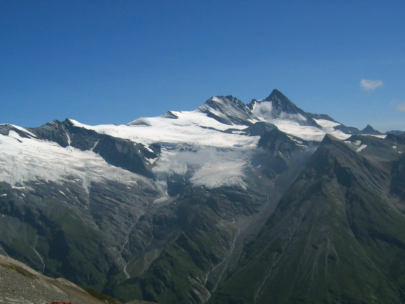
View from the Fuscher Törl to the peaks of the Glockner group.

Hikes along the High Alpine Road

Short walks beside the road, and the step into the national park.

Ranger panorama tour (official programme)

Hohe Tauern National Park Carinthia runs a guided panorama tour from the Kaiser-Franz-Josefs-Höhe visitor centre: about 1 hour, 1.4 kilometres (0.9 mi), 59 metres (194 ft) of ascent, starting at 10:30 and 13:30. In 2026 daily from 6 July to 12 September, on Fridays and Saturdays from 18 September to 31 October. Free according to the programme, toll not included; groups register in advance.

Hohe Tauern National Park Carinthia: summer programme 2026 (PDF) ↗

Glacier trail to the Pasterze

A secured alpine path leads down from the Kaiser-Franz-Josefs-Höhe to the Pasterze glacier: about 30 minutes down, about an hour back up. GROHAG expressly recommends sturdy footwear.

GROHAG: Kaiser-Franz-Josefs-Höhe ↗

Pasterze trail to the Glocknerhaus

From the glacier tongue, the Pasterze trail with its cairns leads past the Margaritze reservoir to the Glocknerhaus; walking time about 1.5 hours.

GROHAG: Kaiser-Franz-Josefs-Höhe ↗

Panorama trail and Kaiserstein

The Kaiser-Franz-Josef panorama trail, about 1.4 kilometres (0.9 mi) long, leads to the Kaiserstein viewpoint and the Kristall observation post; the post is about ten minutes' walk away.

GROHAG: Kaiser-Franz-Josefs-Höhe ↗

Short walks along the way

At the Piffkar, a nature trail through the special protection area with larch meadows (approx. 30 minutes); at the Fuscher Lacke, a circular walk round the lake (approx. 10 minutes); at the Hochtor, the Celts', Muleteers' and Romans' Trail (approx. 30 minutes).

GROHAG: attractions along the road ↗

Guided on site

You pay the toll to the road operator; prices are listed above. Through our partner you can book a private day trip from Salzburg to the Kaiser-Franz-Josefs-Höhe.

Offer photo: From Salzburg: private day trip on the Grossglockner High Alpine Road

Private tour from Salzburg · offer via Viator

From Salzburg: private day trip on the Grossglockner High Alpine Road

Eight to nine hours in a private vehicle from Salzburg over the Grossglockner High Alpine Road to the Kaiser-Franz-Josefs-Höhe, the viewpoint facing the Grossglockner and the longest glacier in the Eastern Alps. There is time for the national park exhibition and lunch at the mountain restaurant.

  • 8–9 hours
  • Private tour
  • German or English
  • Road toll included

Start Pick-up from hotels in the city of Salzburg.

View offer ↗Ad · partner link · checked 4 Oct 2026

According to the inclusions list, private transport in an air-conditioned vehicle and the road toll are included; food, drinks and tips are not. Starts and ends in the city of Salzburg. Free cancellation up to 24 hours before departure. Provider's product photo · Viator

Ad · we may earn a commission if you book through this partner link – at no extra cost to you. Thank you for supporting the atlas. Offer details checked 4 Oct 2026. See official prices.

03 · Nearby

Onward from here

The High Alpine Road runs along Hohe Tauern National Park; the Pasterze, the Gamsgrube and the Grossglockner lie inside the park. More places, trails and rules are in the park profile.

Photo: Iamthestig ↗ · CC BY-SA 3.0 ↗

Map

Grossglockner High Alpine Road on the terrain map

Eight points between the toll stations, each documented by an OpenStreetMap object. All points are on the Hohe Tauern National Park map, with details and photos.

Show on mapHohe Tauern National Park map · 3D terrain

Field book · Grossglockner High Alpine Road

checked 3 Oct 2026

01Good to know

Boundary, history and what you find at the top.

Road and park boundary

The road itself is not part of the national park. According to OpenStreetMap, the toll stations, Hochtor, Fuscher Törl, Edelweiss-Spitze and the visitor centre lie outside; the Pasterze, the Gamsgrube trail and the Grossglockner inside.

OpenStreetMap: boundary of Hohe Tauern National Park ↗

National park information centre

In the visitor centre at the Kaiser-Franz-Josefs-Höhe, the national park presents nature and regions on more than 300 square metres (3,229 sq ft), with a cinema and touchscreen terminals.

Hohe Tauern National Park: Kaiser-Franz-Josefs-Höhe information centre ↗

First crossing in 1934

On 22 September 1934, state governor Franz Rehrl and road builder Franz Wallack crossed the Hochtor on the unfinished road in a converted Steyr 100. A year later, on 3 August 1935, the road opened.

GROHAG: history of the High Alpine Road ↗

Exhibitions

The Kaiser-Franz-Josefs-Höhe visitor centre is open daily from 10:00 to 17:00, the other exhibitions along the road from 9:00 to 17:00, and the Kristall observation post from 10:00 to 16:00.

Grossglockner Hochalpenstrassen AG: prices and opening times 2026 ↗

02Grossglockner High Alpine Road: frequently asked questions

Short answers, with sources.

How much is the Grossglockner High Alpine Road toll in 2026?

A day ticket costs €46.50 for a car, €40.00 for an electric car and €36.50 for a motorcycle. After 18:00 the late-driver rate of €36.50 for cars and €30.00 for motorcycles applies.

Grossglockner Hochalpenstrassen AG: prices and opening times 2026 ↗

What are the Grossglockner High Alpine Road opening times?

From early May to early November. Until 31 May from 6:00 to 20:00, in June, July and August from 5:30 to 21:00, from 1 September from 6:00 to 19:30; last entry is 45 minutes before closing.

Grossglockner Hochalpenstrassen AG: prices and opening times 2026 ↗

How long is the Grossglockner High Alpine Road?

48 kilometres (30 mi) with 36 hairpin bends. The highest point of the pass road is the Hochtor at 2,504 metres (8,215 ft); the highest point you can drive to is the Edelweiss-Spitze at 2,571 metres (8,435 ft).

GROHAG: driving safety and road conditions ↗

Is the Grossglockner High Alpine Road in Hohe Tauern National Park?

No. According to the park boundary in OpenStreetMap, the road runs outside, in places only a few hundred metres from the boundary. The Pasterze, the Gamsgrube trail and the Grossglockner are inside the national park.

OpenStreetMap: boundary of Hohe Tauern National Park ↗

Is parking free at the Kaiser-Franz-Josefs-Höhe?

Yes. According to GROHAG, parking in the multi-storey car park at the Kaiser-Franz-Josefs-Höhe and in the car parks up to the Hoher Sattel is free; you still pay the road toll.

GROHAG: Kaiser-Franz-Josefs-Höhe ↗

Can you get to the Grossglockner road without a car?

From late May to late September the Glocknerbus runs from Zell am See, Bruck and Fusch, and from June to mid-September line 119 runs from Heiligenblut to the Kaiser-Franz-Josefs-Höhe.

GROHAG: getting there ↗

How far is it to the Pasterze glacier?

On the secured glacier trail it takes about 30 minutes from the Kaiser-Franz-Josefs-Höhe down to the glacier and about an hour back up.

GROHAG: Kaiser-Franz-Josefs-Höhe ↗

03Sources and last checked

Operator, municipality and park authority, each fact cited individually.

Places on the map

  • Kaiser-Franz-Josefs-Höhe Visitor centre, 2,369 m

    End of the Glacier Road with the visitor centre and national park information centre. Point-in-polygon check against the OpenStreetMap boundary: outside, about 65 metres from the park boundary.

    Location source ↗
  • Pasterze Glacier in the national park

    Largest glacier in the Eastern Alps, inside the national park; reached by the glacier trail from the Kaiser-Franz-Josefs-Höhe.

    Location source ↗
  • Hochtor Pass, 2,504 m

    Highest point of the road and border between Salzburg and Carinthia; outside the park, about 300 metres from the boundary.

    Location source ↗
  • Edelweiss-Spitze Viewpoint, 2,571 m

    Highest point you can drive to, on a spur road; not suitable for coaches and vehicles over 3.5 tonnes.

    Location source ↗
  • Fuscher Törl Viewpoint, 2,428 m

    First view of the Grossglockner from the north, with a memorial to the workers who died building the road.

    Location source ↗
  • Fuscher Lacke Mountain lake, 2,262 m

    Small lake you can walk round in about ten minutes; exhibition on building the road in the old road keeper's house.

    Location source ↗
  • Ferleiten toll station North toll station

    Toll station on the Salzburg side in Fusch; last stop of the post bus from Zell am See.

    Location source ↗
  • Heiligenblut toll station South toll station

    Toll station on the Carinthian side above Heiligenblut.

    Location source ↗
  1. Grossglockner Hochalpenstrassen AG: prices and opening times 2026 ↗
  2. GROHAG: driving safety and road conditions ↗
  3. GROHAG: history of the High Alpine Road ↗
  4. GROHAG: attractions along the road ↗
  5. GROHAG: Kaiser-Franz-Josefs-Höhe ↗
  6. GROHAG: getting there ↗
  7. GROHAG: snow clearing ↗
  8. Hohe Tauern National Park: Kaiser-Franz-Josefs-Höhe information centre ↗
  9. Hohe Tauern National Park Carinthia: summer programme 2026 (PDF) ↗
  10. OpenStreetMap: boundary of Hohe Tauern National Park ↗

How current is this information?

Researched 3 Oct 2026. Not a live status. Prices, timetables and opening hours change; please check with the operator before you travel.

Current information from the operator ↗

Image and map credits

Location sources: every point on the map links to the OpenStreetMap object its coordinate comes from. Markers do not imply that access is permitted.

End of the field book · Park authority ↗