National Parks Atlas
MapPDF

01 · France · Marseille · Cassis · La Ciotat

Calanques National Park

Limestone cliffs, turquoise coves and a marine area that makes up nine tenths of the park – on the edge of Marseille.

Photo: Mmullie (WMF) ↗ · CC BY-SA 4.0 ↗

Calanques at a glance · PDF, 2 pages

Calanques National Park: landscape and origins

Calanques National Park charges no entrance fee. What is regulated is access on wildfire days and the Calanque de Sugiton in high summer.

In its FAQ, the park authority states explicitly that entry to the national park is free. Costs only arise outside the park: for buses, trains, parking in the towns and boat trips.

On peak summer days, the Calanque de Sugiton and the Pierres Tombées require a free reservation via the park’s website; the confirmation email is checked in the calanque. Luminy, the path and the Belvédère remain freely accessible. In 2026 the requirement applied on selected days from 20 June to 13 September; the park has extended it until 2027.

From 1 June to 30 September the prefecture rates the Massifs Calanques, Cap Canaille and Grand Caunet every evening for the following day: green means access allowed, red means access prohibited. On red days all Sugiton reservations become void.

Parc national des Calanques: FAQ – free entry, open 24 hours, dogs on a lead (French) ↗

The park in numbers

Entrance
free
Open
24 hours a day, except on red days
Sugiton and Pierres Tombées
High summer only with a free reservation
Reservation
from 3 days before at 9:00 until 18:00 the day before
Group per reservation
5 people at most
Children under 3
no reservation needed
Wildfire season
1 June to 30 September
Shuttle Cassis, Presqu’île
€1.60 return

Calanques National Park: limestone cliffs between Marseille and Cassis

02 · Places

Map: Sugiton, En-Vau, Cassis and the islands

Twenty points between Callelongue and La Ciotat, each referenced via OpenStreetMap.

Photo: Tobi 87 ↗ · CC BY-SA 3.0 ↗

Map

33 places on the map

Twenty points between Callelongue and La Ciotat, each referenced via OpenStreetMap.

Open map3D terrain · details and photos for every place
  • Viewpoints3
  • Mountains & rock5
  • Water11
  • Trails1
  • Arrival9
  • Where to stay1
  • Nature3

03 · Out and about

Things to do: hiking, boat trips, kayaking

On foot to the Calanques or from the water, in the marine area of the park.

Photo: DanielMichaelPerry ↗ · CC0 ↗

“Nine tenths of the core zone lie at sea – if you take a boat into the Calanques, you are right in the middle of the national park.”

Calanques National Park · excursion boat off the Calanque d’En-Vau

Things to do: hiking, boat trips, kayaking

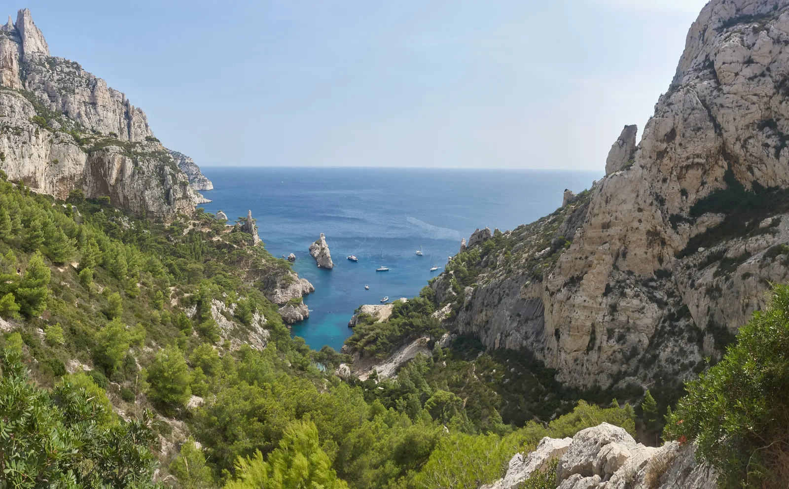
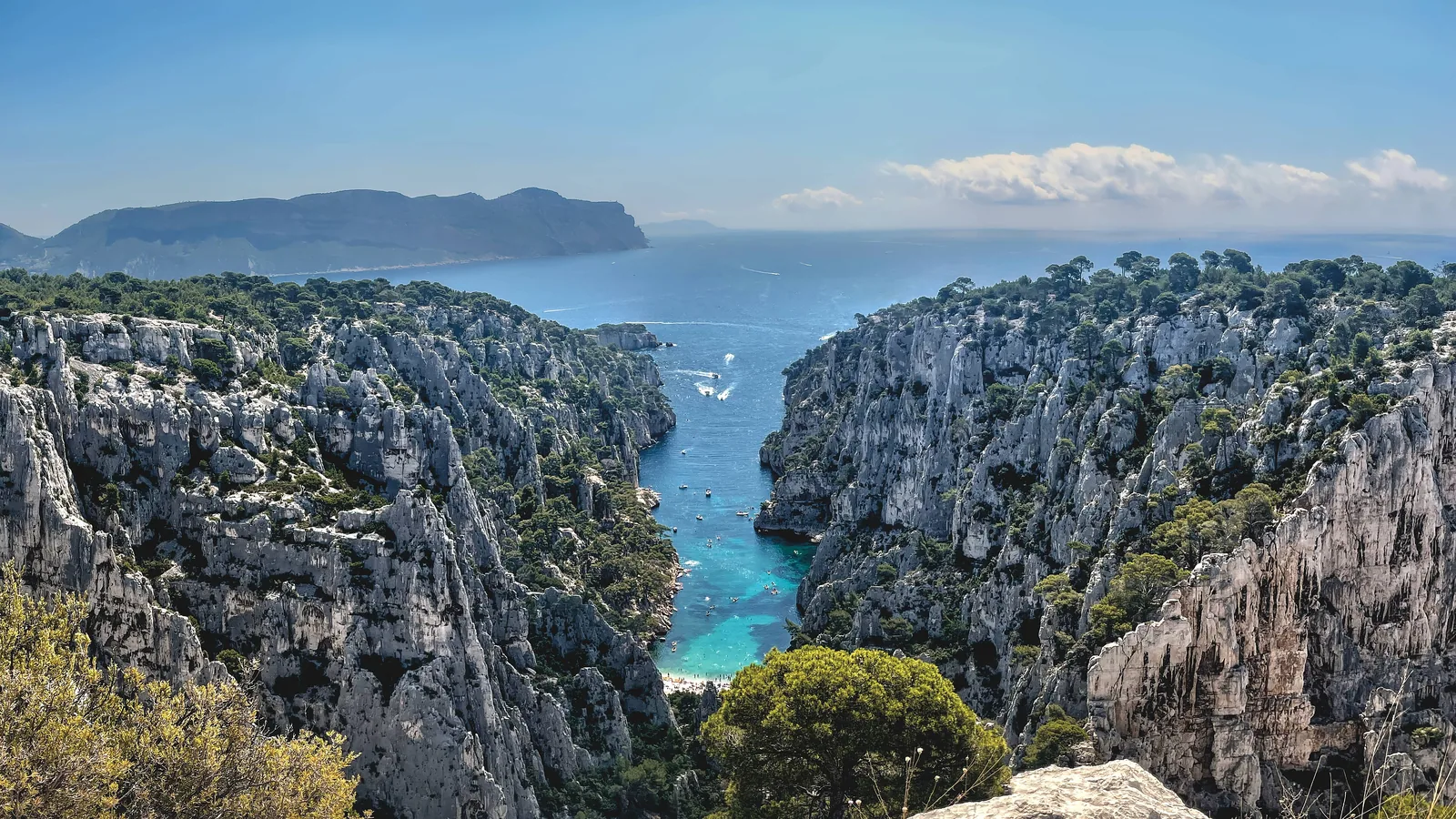
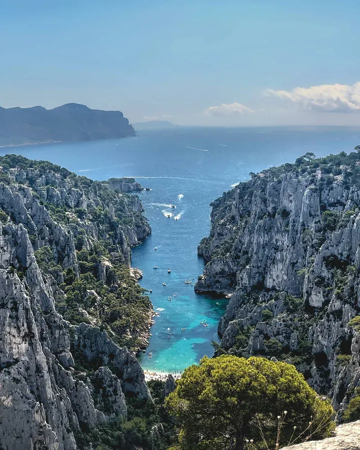
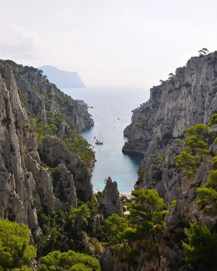
View from the Belvédère d’En-Vau in Calanques National Park: steep limestone walls with the turquoise cove of En-Vau between them, the sea and Cap Canaille behind

kayak aventure · Sea kayak from Cassis · 4 hours · Port-Miou, Port-Pin, En-Vau

Cassis: Half-Day Sea Kayaking in the Calanques National Park

By sea kayak from Port-Miou to the Port-Pin and En-Vau calanques, with an English-speaking guide, a short swimming break at Port-Pin and one hour on the beach at En-Vau.

5.0 out of 5 stars126 reviews on GetYourGuidefrom €78as of 5 Oct

  • 4 hours
  • 8:30–12:30
  • 12 guests at most
  • Guide English/Spanish

Departure Kayak hire at the end of the Presqu’île car park in Cassis, by the tennis courts; return to the same point.

According to the list of inclusions: sea kayak, paddle, life jacket, waterproof bag and a guide; not included are picnic, water bottle, sun cream, waterproof phone case and towel. Instead of Port-Pin, the tour sometimes goes to the Calanque de l’Oule and its blue grotto. Not suitable for children under 7. Free cancellation up to 24 hours in advance.

View tour ↗Ad · partner link · checked 5 Oct 2026

More checked toursAd · partner link · checked 5 Oct 2026

  • From Marseille: Calanques National Park Guided Hike ↗Planetazur · 4–5 hours · GetYourGuideMeeting point in Luminy (you arrange your own transport), around 7.5 km (4.7 mi) and over 250 m (820 ft) of ascent with a guide, picnic and swimming break; trekking poles included.

    4.7 out of 5 stars624 reviews on GetYourGuidefrom €35as of 5 Oct

Landscape image, not a provider photo · Photo: Mmullie (WMF) ↗ · CC BY-SA 4.0 ↗

View from the Belvédère d’En-Vau in Calanques National Park: steep limestone walls with the turquoise cove of En-Vau between them, the sea and Cap Canaille behind

Goélette Alliance · Evening on the schooner · 3.5 hours · Frioul islands

Marseille: Sunset Sailing Cruise with Dinner and Wine

On a traditional wooden schooner from the Vieux-Port to the Frioul archipelago, which belongs to the national park: a swimming stop in a cove, a vegetarian cold buffet and a glass of rosé at sunset.

4.8 out of 5 stars534 reviews on GetYourGuidefrom €72as of 5 Oct

  • around 3.5 hours
  • from the Vieux-Port
  • Dinner included
  • Swimming stop

Departure Quai du Port 70, Marseille, opposite the town hall at pontoon PH2; return to the Vieux-Port.

According to the list of inclusions: boat tour, cold buffet and a glass of rosé; pick-up and drop-off are not included. Departure at 19:00 from June to August, at 18:00 in May, September and October. According to the park, the Frioul islands remain accessible even on red wildfire days. Free cancellation up to 24 hours in advance.

View tour ↗Ad · partner link · checked 5 Oct 2026

Landscape image, not a provider photo · Photo: Mmullie (WMF) ↗ · CC BY-SA 4.0 ↗

Ad · we may earn a commission if you book through this partner link – at no extra cost to you. Thank you for supporting the atlas. Offer details checked 5 Oct 2026. See official ticket information.

Nature: limestone, seagrass and islands

04 · Before you go

Places nearby

Photo: Mmullie (WMF) ↗ · CC BY-SA 4.0 ↗

Around the park

Field book · Calanques National Park

checked 5 Oct 2026

Calanques at a glance · PDF, 2 pages ↓

00My visit

Nothing saved yet. Every place card has a pin, and so does every place on the Map. What you save collects here, with days, notes and a preview you can share.

01When to go: spring, autumn and the red days

What the park sets out on season, heat and closures.

Summer: wildfire risk

In 2026 the Massif des Calanques was red on 11 of the 122 days of the season, including three days in a row from 21 to 23 July.

Bouches-du-Rhône prefecture: map of access to the massifs – daily closures due to wildfire risk, Massifs Calanques, Cap Canaille, Grand Caunet ↗

Check the evening before

The prefecture map, the phone message on 0811 20 13 13 and the park’s “Mes Calanques” app give the status for the next day.

Parc national des Calanques: rules on land and road closures at Sormiou, Morgiou, Callelongue 2026 (French) ↗

Peaks in high summer

At Sugiton the park counted up to 2,500 visitors a day; at En-Vau there are up to 1,200 people at once in summer, in a space where 400 towels would fit comfortably.

Parc national des Calanques: Sugiton and Pierres Tombées reservation 2026 – free, dates, closure on red days (French) ↗

Show on the map

Shade in the afternoon

En-Vau lies between high walls; according to the park, the calanque falls increasingly into shade in the afternoon.

Parc national des Calanques: Belvédère and Calanque d’En-Vau – access, landing ban, closures due to wildfire risk (French) ↗

Show on the map

Water often cold

The park points out that the water in the Calanques is often cold. In summer only Sormiou and Saint-Estève have lifeguards.

Parc national des Calanques: swimming – only Sormiou and Saint-Estève have lifeguards (French) ↗

Show on the map

Port-Miou until June 2027

Because of works at the Cassis water reservoir, the path between Col de la Gardiole and Port-Miou runs via Port-Pin; the park estimates one extra hour.

Parc national des Calanques: notice – works at Port-Miou until June 2027, detour via Port-Pin, path closure (French) ↗

Show on the map

02Getting there: Marseille, Luminy and Cassis

You reach the Calanques by city bus, train and on foot – or from the water.

Bus B1 to Luminy

RTM line B1 (521 in the evening) runs towards the Campus de Luminy to the stop “Luminy – PN des Calanques”. The path to Sugiton starts there.

Parc national des Calanques: Belvédère and Calanque de Sugiton – getting there by bus B1, walking times (French) ↗

Show on the map

Buses 22 and 23 to Sormiou and Morgiou

Take bus 23 to La Cayolle or bus 22 to Les Baumettes, then walk around 45 minutes to Sormiou and one hour to Morgiou.

Parc national des Calanques: Calanque de Sormiou – getting there and road closure (French) ↗

Show on the map

Roads closed in summer

In 2026 the access roads to Sormiou, Morgiou and Callelongue were closed to cars daily from 12 June to 30 August, from 7:00 to 19:00.

Parc national des Calanques: rules on land and road closures at Sormiou, Morgiou, Callelongue 2026 (French) ↗

Show on the map

Train to Cassis

Direct trains from Marseille run roughly every 30 minutes. Cassis station is 3 km (1.9 mi) from the centre, around 40 minutes on foot; bus 78 runs from Castellane straight to the centre.

Office de Tourisme Cassis: getting there by train and bus (English) ↗

Show on the map

Cassis: parking and shuttle

At the entrance to the town is the free Gorguettes car park with 220 spaces. In summer a shuttle runs to the “Calanques” stop for Port-Miou.

Ville de Cassis: Gorguettes car park and shuttle to the Calanques – operating hours (French) ↗

Show on the map

By boat

Boat trips into the marine area of the park leave from Cassis and the Vieux-Port in Marseille. Only boats authorised by the park are allowed; you can recognise them by the orange flag.

Parc national des Calanques: passenger boat services only with park authorisation (French) ↗

Show on the map

Bleu Evasion · Boat trip from Marseille · 3.5–4.5 hours · marine area of the park

From Marseille: Iconic Calanques Boat Tour with Swimming

In a small motorboat from the Vieux-Port or Port de la Pointe Rouge along the Sormiou, Morgiou and Sugiton calanques, in the afternoon as far as En-Vau, Port-Pin and Port-Miou, with swimming and snorkelling stops.

4.7 out of 5 stars1,727 reviews on GetYourGuidefrom €79as of 5 Oct

Departure Vieux-Port or Port de la Pointe Rouge in Marseille, depending on the option chosen; return to the starting point.

According to the list of inclusions: skipper, boat tour, swimming stops, snorkelling gear, soft drinks, wetsuits when the water is cold, GoPro camera and a “Calanques tax”; there is no park entrance fee. According to the operator, only the afternoon tour goes to En-Vau, Port-Pin and Port-Miou. The route depends on weather and swimming conditions. On red wildfire days landing in the park is prohibited. Free cancellation up to 24 hours in advance.

View tour ↗Ad · partner link · checked 5 Oct 2026

Ad · we may earn a commission if you book through this partner link – at no extra cost to you. Thank you for supporting the atlas. Offer details checked 5 Oct 2026. See official ticket information.

03Calanques National Park entrance: free, but not always open

No ticket for the park, a reservation for Sugiton in high summer and closure days when wildfire risk is high.

Free entry

The park charges no entrance fee: “l’entrée au Parc national est gratuite”, the park authority writes. It is open 24 hours a day, except on red days.

Parc national des Calanques: FAQ – free entry, open 24 hours, dogs on a lead (French) ↗

Sugiton: reservation in high summer

In 2026 the requirement applied on 20 and 21 June, daily from 27 June to 30 August and on the weekends of 5/6 and 12/13 September. The reservation is free.

Parc national des Calanques: Sugiton and Pierres Tombées reservation 2026 – free, dates, closure on red days (French) ↗

Show on the mapSugiton: reservation & path →

En-Vau without reservation

There is no reservation for the Calanque d’En-Vau; the requirement only applies to Sugiton and the Pierres Tombées. Like the whole park, it is closed on red days.

Parc national des Calanques: Belvédère and Calanque d’En-Vau – access, landing ban, closures due to wildfire risk (French) ↗

Show on the mapEn-Vau: path from Cassis →

Red days: no access over land

From 1 June to 30 September the prefecture decides daily between 17:00 and 18:00 for the following day. On red days the park is closed to land access and the Route des Crêtes is shut.

Parc national des Calanques: access during wildfire risk – closures on red days, 1 June to 30 September (French) ↗

Boat trips even on red days

On red days you can still see the Calanques from the water, but landing is then prohibited. The Frioul islands remain accessible.

Parc national des Calanques: access during wildfire risk – closures on red days, 1 June to 30 September (French) ↗

Costs only outside the park

You pay for parking, buses and boat trips. In Cassis the Gorguettes car park is free; according to the town, the shuttle to the Presqu’île costs €1.60 return.

Ville de Cassis: Gorguettes car park and shuttle to the Calanques – operating hours (French) ↗

04Where to stay: Marseille, Cassis or La Ciotat

There are no huts and no campsite inside the park itself.

Camping and bivouacking prohibited

Camping, bivouacking and overnight stays in campervans are prohibited in the core zone, as are fires, barbecues and smoking.

Parc national des Calanques: rules on land and road closures at Sormiou, Morgiou, Callelongue 2026 (French) ↗

Cassis as a base

From Cassis you reach Port-Miou in around 30 minutes on foot, Port-Pin in 45 minutes and En-Vau in 1.5 to 2 hours.

Parc national des Calanques: Calanque de Port-Miou (French) ↗

Show on the map

Marseille as a base

From the city, buses B1, 22 and 23 run to the starting points at Luminy, Les Baumettes and La Cayolle.

Parc national des Calanques: rules on land and road closures at Sormiou, Morgiou, Callelongue 2026 (French) ↗

Show on the map

Maison du Parc in La Ciotat

The park’s visitor centre is in the Villa Michel Simon at the entrance to the core zone in La Ciotat.

Parc national des Calanques: Maison du Parc in the Villa Michel Simon, La Ciotat – opening hours (French) ↗

Show on the map

05Rules: dogs, drones, fire, water

What the park authority explicitly prohibits or requires.

Dogs on a lead

Dogs are allowed, but only on a lead. They are banned entirely on Riou island.

Parc national des Calanques: FAQ – free entry, open 24 hours, dogs on a lead (French) ↗

No drones

Drones and model aircraft are prohibited, as are motorised overflights below 1,000 m (3,281 ft) above ground.

Parc national des Calanques: airspace – drones and overflights below 1,000 m (3,281 ft) prohibited (French) ↗

No fire, no smoking

Campfires, barbecues, cigarettes and shisha are prohibited in the core zone.

Parc national des Calanques: rules on land and road closures at Sormiou, Morgiou, Callelongue 2026 (French) ↗

Bring your own water

There is no drinking water along the way, and no toilets, shops or bins. The park recommends at least 1.5 litres per person per half day.

Parc national des Calanques: before your visit – no water, no toilets, emergency number 112 (French) ↗

Stay on the paths

Nobody may walk away from the marked paths and tracks; picking plants and feeding animals is prohibited.

Parc national des Calanques: rules on land and road closures at Sormiou, Morgiou, Callelongue 2026 (French) ↗

Seven no-take zones

In seven zones totalling 4,634 ha, around a tenth of the marine area, all taking of marine life is prohibited, including fishing.

Parc national des Calanques: seven no-take zones, 4,634 ha (French) ↗

06Frequently asked questions: Calanques National Park

Is there an entrance fee for Calanques National Park?

No. According to the park authority, entry is free and the park is open 24 hours a day – except on days when the prefecture closes access because of wildfire risk.

Parc national des Calanques: FAQ – free entry, open 24 hours, dogs on a lead (French) ↗

Do I need to book Sugiton?

Yes, on peak summer days. In 2026 the free reservation for Sugiton and the Pierres Tombées applied on 20/21 June, from 27 June to 30 August and on two weekends in September. You can book from three days before at 9:00 until 18:00 the day before.

Parc national des Calanques: Sugiton and Pierres Tombées reservation 2026 – free, dates, closure on red days (French) ↗

Do you need a reservation for En-Vau?

No. The reservation only applies to Sugiton and the Pierres Tombées. En-Vau is accessible all year, except when the massifs are closed because of wildfire risk.

Parc national des Calanques: Belvédère and Calanque d’En-Vau – access, landing ban, closures due to wildfire risk (French) ↗

When are the Calanques closed?

On red days from 1 June to 30 September. The prefecture decides daily between 17:00 and 18:00 for the following day; the park is then closed to land access. Boat trips remain possible, but landing is prohibited.

Parc national des Calanques: access during wildfire risk – closures on red days, 1 June to 30 September (French) ↗

How do I get to the Calanques without a car?

In Marseille, take bus B1 to “Luminy – PN des Calanques” for Sugiton, or buses 22 and 23 for Sormiou and Morgiou. Trains to Cassis run roughly every 30 minutes; the station is 3 km (1.9 mi) from the centre.

Parc national des Calanques: Belvédère and Calanque de Sugiton – getting there by bus B1, walking times (French) ↗

How long is the hike to En-Vau?

Via Port-Pin, the park gives 7.8 km (4.8 mi) return, three hours and 360 m (1,181 ft) of ascent. From the centre of Cassis it takes 1.5 to 2 hours each way.

Parc national des Calanques: hike to the Calanque d’En-Vau via Port-Pin – 7.8 km (4.8 mi), 3 hours, 360 m (1,181 ft) (French) ↗

Can I bring my dog?

Yes, but only on a lead. Dogs are banned on Riou island.

Parc national des Calanques: FAQ – free entry, open 24 hours, dogs on a lead (French) ↗

Are the boat trips part of the national park?

Yes. The marine area covers 43,500 ha and 90 % of the core zone. Passenger boats may only operate with the park’s authorisation; their flag is orange.

Parc national des Calanques: park identity – founded 2012, 8,500 ha of land, 43,500 ha of sea, Mont Carpiagne 646 m (2,119 ft) (French) ↗

Can you camp or have a barbecue in the Calanques?

No. Camping, bivouacking, fires, barbecues and smoking are prohibited in the core zone.

Parc national des Calanques: rules on land and road closures at Sormiou, Morgiou, Callelongue 2026 (French) ↗

07Where the information comes from

Key figures, rules and paths from the park authority, closure days from the Bouches-du-Rhône prefecture, travel information from RTM, Ville de Cassis and the Office de Tourisme, boat trips from the Bateliers Cassidens association.

  1. Parc national des Calanques: park identity – founded 2012, 8,500 ha of land, 43,500 ha of sea, Mont Carpiagne 646 m (2,119 ft) (French) ↗
  2. Légifrance: Decree No. 2012-507 of 18 April 2012 establishing Calanques National Park ↗
  3. Parc national des Calanques: FAQ – free entry, open 24 hours, dogs on a lead (French) ↗
  4. Parc national des Calanques: Sugiton and Pierres Tombées reservation 2026 – free, dates, closure on red days (French) ↗
  5. Parc national des Calanques: access during wildfire risk – closures on red days, 1 June to 30 September (French) ↗
  6. Bouches-du-Rhône prefecture: map of access to the massifs – daily closures due to wildfire risk, Massifs Calanques, Cap Canaille, Grand Caunet ↗
  7. Parc national des Calanques: rules on land and road closures at Sormiou, Morgiou, Callelongue 2026 (French) ↗
  8. Parc national des Calanques: rules at sea – passenger boats, anchoring, fishing (French) ↗
  9. Parc national des Calanques: airspace – drones and overflights below 1,000 m (3,281 ft) prohibited (French) ↗
  10. Parc national des Calanques: with your own boat – 5 knots in the 300 m (984 ft) strip (French) ↗
  11. Parc national des Calanques: passenger boat services only with park authorisation (French) ↗
  12. Parc national des Calanques: visiting by boat – flags, boat hire (French) ↗
  13. Parc national des Calanques: seven no-take zones, 4,634 ha (French) ↗
  14. Parc national des Calanques: climbing – permanent and seasonal closures (French) ↗
  15. Parc national des Calanques: swimming – only Sormiou and Saint-Estève have lifeguards (French) ↗
  16. Parc national des Calanques: before your visit – no water, no toilets, emergency number 112 (French) ↗
  17. Parc national des Calanques: Belvédère and Calanque d’En-Vau – access, landing ban, closures due to wildfire risk (French) ↗
  18. Parc national des Calanques: Belvédère and Calanque de Sugiton – getting there by bus B1, walking times (French) ↗
  19. Parc national des Calanques: hike to the Calanque d’En-Vau via Port-Pin – 7.8 km (4.8 mi), 3 hours, 360 m (1,181 ft) (French) ↗
  20. Parc national des Calanques: notice – works at Port-Miou until June 2027, detour via Port-Pin, path closure (French) ↗
  21. Parc national des Calanques: Calanque de Port-Miou (French) ↗
  22. Parc national des Calanques: Calanque de Sormiou – getting there and road closure (French) ↗
  23. Parc national des Calanques: Calanque de Morgiou – getting there and road closure (French) ↗
  24. Parc national des Calanques: Cap Canaille and Route des Crêtes (French) ↗
  25. Parc national des Calanques: Frioul islands (French) ↗
  26. Parc national des Calanques: Riou archipelago, print version (French; the page address has returned error 500 since August 2026, accessed 5 October 2026) ↗
  27. Parc national des Calanques: Maison du Parc in the Villa Michel Simon, La Ciotat – opening hours (French) ↗
  28. Ville de Cassis: Gorguettes car park and shuttle to the Calanques – operating hours (French) ↗
  29. Office de Tourisme Cassis: getting there by train and bus (English) ↗
  30. RTM Marseille: route map of bus B1 to Luminy (PDF, French) ↗
  31. GIE des Bateliers Cassidens: boat trips from Cassis, tours and duration (English) ↗
  32. Parcs nationaux de France: the eleven national parks with year of foundation (French) ↗

How current is this information?

Researched 5 Oct 2026. Not a live status. Dates apply only to the year stated. A successful automatic fetch is not an editorial confirmation; outdated automatic values are hidden and replaced by the source link.

Current information from the park ↗

Image and map credits

Location sources: All points come from OpenStreetMap and are individually referenced by their object ID. The Vieux-Port in Marseille and Cassis harbour lie outside the park and are shown as starting points. Elevations according to the park authority and OpenStreetMap. Markers do not imply that access is permitted. Base map © OpenStreetMap contributors. Coastlines of the chapter map: Natural Earth.

End of the field book · Park authority ↗