National Parks Atlas
MapPDF

01 · United Kingdom · Scotland · Stirling, Argyll and Bute, West Dunbartonshire

Loch Lomond & The Trossachs National Park

Britain’s largest lake, 21 Munros and the line between Lowlands and Highlands.

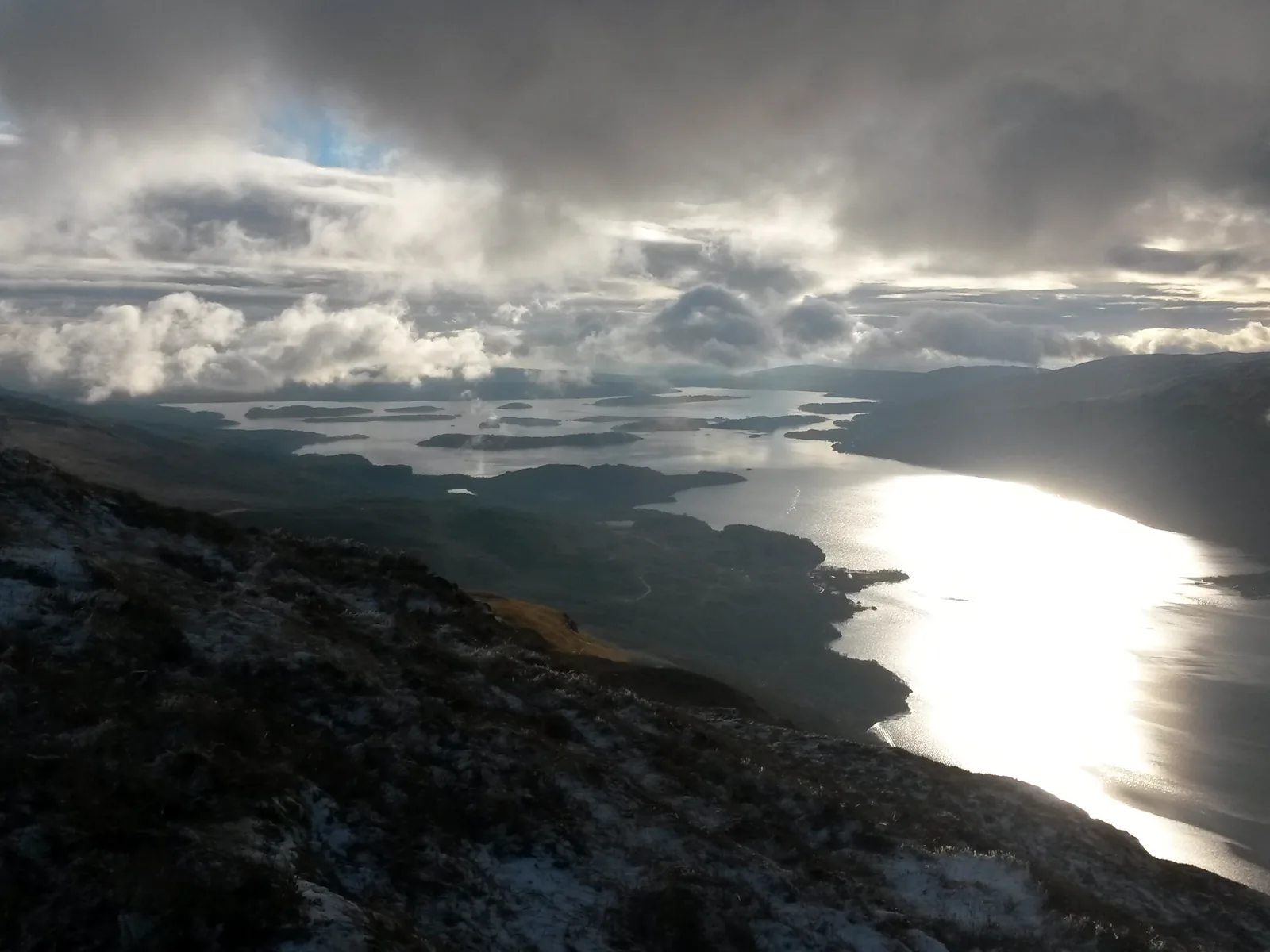
Photo: Craigmacl ↗ · CC BY-SA 4.0 ↗

Loch Lomond & The Trossachs at a glance · PDF, 2 pages

Loch Lomond & The Trossachs National Park: landscape and origins

At Loch Lomond you need a permit to camp on the shore in summer – Scotland’s exception to the right of access.

Under the Scottish Outdoor Access Code you may wild camp responsibly almost anywhere in Scotland. Because large numbers of visitors and antisocial behaviour damaged the park’s busiest lochshores, byelaws have applied there since March 2017: in the Camping Management Zones you need a permit or a pitch at a campsite from March to September.

A permit is valid for a whole permit area, not a set pitch; there are no toilets or water. Every tent needs its own permit. Motorhomes may stay in designated areas from 19:00 to 10:00.

From 1 October 2026 to 28 February 2027 the byelaws do not apply; only the Access Code applies then. The National Park Authority’s campsites are closed in winter.

LLTNPA: Get a permit (Camping Management Zones, £4.50, season) ↗

The park in numbers

Applies
March to September
Fare
£4.50 per tent per night
Maximum
3 nights per area
Booking
up to 4 weeks ahead
Arrival
from 13:00
Departure
by 11:00
Motorhomes
19:00 to 10:00
Winter 2026/27
no permit needed

Visiting Loch Lomond & The Trossachs: lochs, Munros and forest

02 · Places

Map: Balloch, Luss, Balmaha, Ben Lomond and Loch Katrine

Stations, piers, hills and visitor centres, each point referenced in OpenStreetMap.

Photo: Peter S ↗ · CC BY-SA 2.0 ↗

Map

14 places on the map

Stations, piers, hills and visitor centres, each point referenced in OpenStreetMap.

Open map3D terrain · details and photos for every place
  • Mountains & rock2
  • Water2
  • Arrival7
  • Nature2
  • Surroundings1

03 · Out and about

Things to do: boats, Munros and wee hills

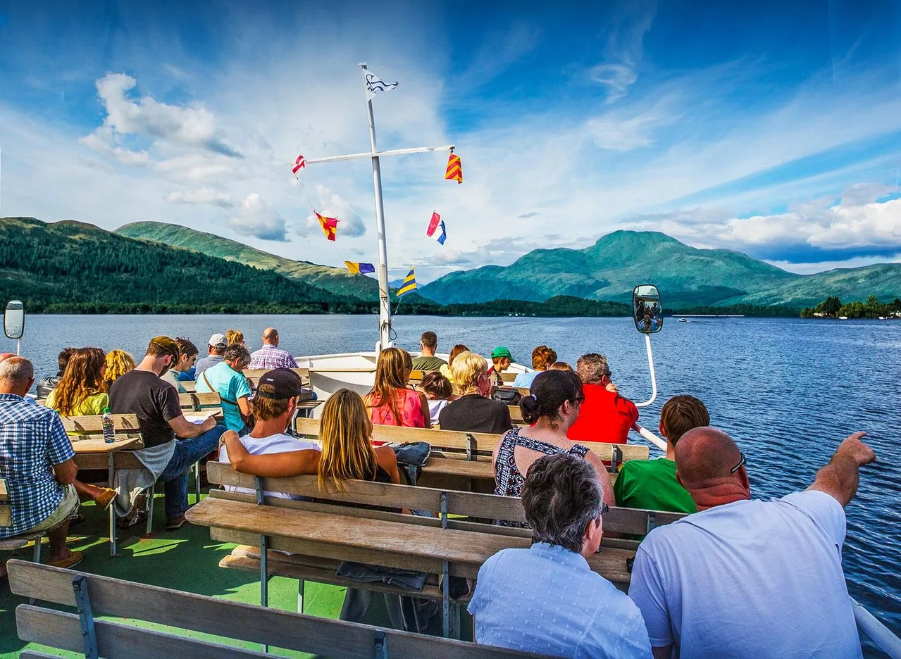
From the waterbus to the most southerly Munro.

Photo: Clem_nat ↗ · CC BY-SA 4.0 ↗

“A right of access to almost all land – and a £4.50 permit on the shores.”

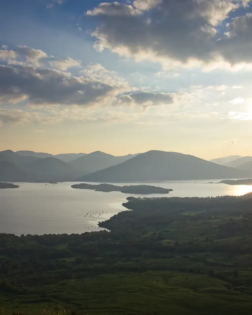
Loch Lomond · view from the path up Conic Hill

Things to do: boats, Munros and wee hills

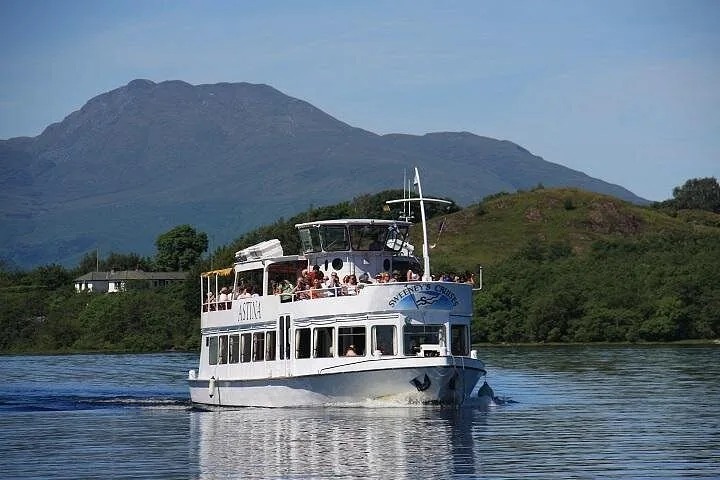
Offer photo: Loch Lomond: one-hour cruise from Balloch

Sweeney’s Cruise Co Ltd · Boat from Balloch · 1 hour

Loch Lomond: one-hour cruise from Balloch

From Balloch village across the Highland line: past old mansions, with views of Ben Lomond, to the island of Inchmurrin and the ruins of Lennox Castle.

4.6 out of 5 stars2,098 reviews on GetYourGuidefrom €23.01as of 8 Oct

  • 1 hour
  • From Balloch
  • Commentary on board
  • Dogs allowed

Departure At the operator’s pier in Balloch village, near the station; arrive 15 minutes early.

According to the inclusions list: the cruise, live commentary and a guide. There is a bar on board; bring cash and weatherproof clothing. Children up to 4 travel free but need a ticket. Electric wheelchairs cannot be carried. Free cancellation up to 24 hours in advance.

View tour ↗Ad · partner link · checked 8 Oct 2026

Provider's product photo · GetYourGuide

Ad · we may earn a commission if you book through this partner link – at no extra cost to you. Thank you for supporting the atlas. Offer details checked 8 Oct 2026. See official ticket information.

Nature and culture: oak woods, islands, Gaelic

04 · Before you go

Park film and places nearby

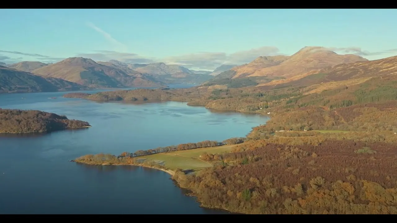
Photo: Craigmacl ↗ · CC BY-SA 4.0 ↗

Film by the park authority

Loch Lomond & The Trossachs – Here. Now. All of us.

Just under two minutes from the National Park Authority’s channel, published in 2024: aerial views of the loch, people who live and work in the park, and a call to protect climate and nature together. In English.

Source: Loch Lomond & The Trossachs National Park Authority · View channel ↗

Around the park

Field book · Loch Lomond & The Trossachs National Park

checked 8 Oct 2026

Loch Lomond & The Trossachs at a glance · PDF, 2 pages ↓

00My visit

Nothing saved yet. Every place card has a pin, and so does every place on the Map. What you save collects here, with days, notes and a preview you can share.

01Best time to visit: spring to autumn, watch out for ticks

Many services run only from March to October.

Camping season March to September

During this period the camping byelaws apply on the busiest shores; the National Park Authority’s campsites close in winter.

LLTNPA: Get a permit (Camping Management Zones, £4.50, season) ↗

Waterbus March to October

Waterbus services from Balmaha and Luss to Inchcailloch run from March to October according to the National Park Authority.

LLTNPA: Inchcailloch (nature reserve, walks, getting there) ↗

Ticks in spring and summer

There are ticks in the park that can carry Lyme disease, especially in spring and summer.

LLTNPA: Get a permit (Camping Management Zones, £4.50, season) ↗

Inchcailloch in every season

In spring the island is carpeted in bluebells; in autumn and winter migrating wildfowl rest here.

LLTNPA: Inchcailloch (nature reserve, walks, getting there) ↗

Show on the map

02How to get there: by train from Glasgow to Balloch or Tarbet

Two railway lines and two coach routes serve the park.

Glasgow – Balloch

ScotRail runs direct from Glasgow Queen Street to Balloch, in about 50 minutes and roughly every 30 minutes according to the National Park Authority. From the station it is a few steps to the boats.

LLTNPA: Getting to the Park (free entry, train, bus, car, seaplane) ↗

Show on the map

West Highland Line

The Glasgow – Oban/Fort William line stops at Arrochar & Tarbet, Ardlui, Crianlarich and Tyndrum. From Tarbet and Ardlui a waterbus crosses to the east shore.

LLTNPA: Getting to the Park (free entry, train, bus, car, seaplane) ↗

Show on the map

By car

From Glasgow via the M8, the Erskine Bridge and the A82; about 35 minutes to Balloch according to the National Park Authority, about 90 minutes from Edinburgh.

LLTNPA: Getting to the Park (free entry, train, bus, car, seaplane) ↗

Bus 309 to Balmaha

From Balloch station McGill’s bus 309 takes about 30 minutes to Balmaha on the east shore.

LLTNPA: Inchcailloch (nature reserve, walks, getting there) ↗

Timberbush Tours · Day tour from Glasgow · 8.5 hours

From Glasgow: Loch Lomond, the Trossachs and Stirling Castle

From Glasgow to the southern shore of Loch Lomond for a one-hour cruise or time at Loch Lomond Shores, then through the Trossachs and finally to Stirling.

Departure Outside the Royal Scottish National Orchestra opposite Buchanan Bus Station, Glasgow; arrive 15 minutes early.

According to the inclusions list: air-conditioned vehicle, live commentary and driver-guide. Cruise, admission, food and drink are not included. Minimum numbers apply; if cancelled, an alternative or a full refund. Free cancellation up to 24 hours in advance.

View tour ↗Ad · partner link · checked 8 Oct 2026

Ad · we may earn a commission if you book through this partner link – at no extra cost to you. Thank you for supporting the atlas. Offer details checked 8 Oct 2026. See official ticket information.

03Free entry – you pay for parking, boats and permits

Like all UK national parks, Loch Lomond charges no entrance fee.

No entrance fee

According to the National Park Authority, entry to the national park is free, as it is to all national parks in the UK.

LLTNPA: Getting to the Park (free entry, train, bus, car, seaplane) ↗

Parking charged per car park

Car parks are run by councils, the National Park Authority, Forestry and Land Scotland and private owners, each with its own charges. At Rowardennan below Ben Lomond, Forestry and Land Scotland charges £2 for one hour and £5 for the day.

Forestry and Land Scotland: Rowardennan, parking charges ↗

Show on the map

Camping permit £4.50

From March to September a permit in the Camping Management Zones costs £4.50 per tent or motorhome per night. From 1 October 2026 to 28 February 2027 you need none.

LLTNPA: Get a permit (Camping Management Zones, £4.50, season) ↗

Boats cost extra

Three private companies run cruises on Loch Lomond and Loch Katrine, with their own fares.

LLTNPA: Loch cruises (Balloch, Luss, Tarbet, Loch Katrine) ↗

Visiting Loch Lomond & The Trossachs: lochs, Munros and forest

Half of Scotland’s population lives within an hour’s drive.

1,865 km²

That is the park’s size according to the National Park Authority, with a boundary of 350 km (220 mi). It stretches from the gentle south to high mountains in the north.

LLTNPA: Key facts (area, established 2002, Munros, lochs) ↗

Since July 2002

The park became fully operational on 19 July 2002; Princess Anne officially opened it on 24 July 2002.

LLTNPA: Key facts (area, established 2002, Munros, lochs) ↗

21 Munros, 22 large lochs

The highest mountain is Ben More at 1,174 metres (3,852 ft); plus 19 Corbetts and about 50 rivers and large burns.

LLTNPA: Key facts (area, established 2002, Munros, lochs) ↗

Britain’s largest lake

Loch Lomond is the largest body of fresh water on the British mainland and stretches 24 miles north from Balloch; more than 30 islands lie in it.

LLTNPA: Loch Lomond (length, islands, paths, Highland Boundary Fault) ↗

Contact: Balmaha

The National Park Authority’s visitor centre in Balmaha on the east shore is open daily 9:30 to 17:00 from April to September, until 16:00 in October and at weekends only from November to March.

LLTNPA: Visitor Centres (Balmaha, Duke’s Pass, Glen Finglas) ↗

Show on the map

Things to do: boats, Munros and wee hills

From the waterbus to the most southerly Munro.

Boats on two lochs

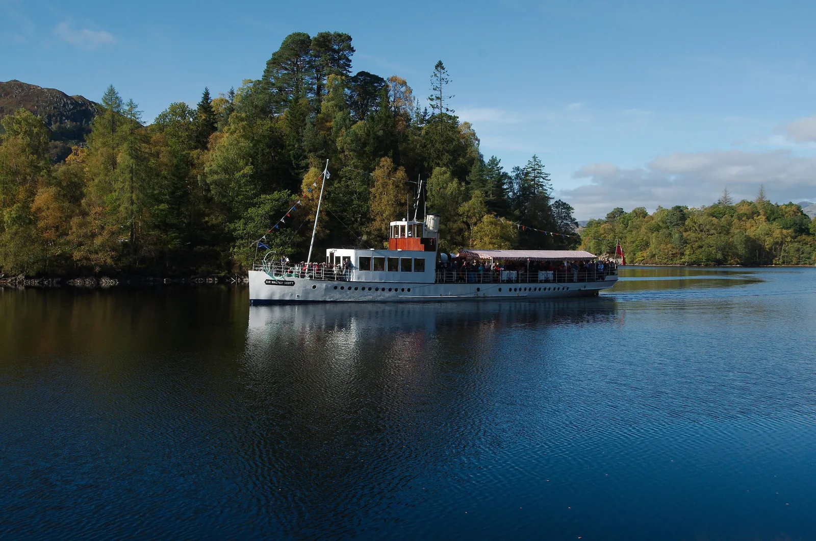
Sweeney’s Cruise sails from Balloch, Cruise Loch Lomond from Luss, Tarbet and Balmaha. On Loch Katrine the steamship Sir Walter Scott and the Lady of the Lake run one-hour cruises from Trossachs Pier.

LLTNPA: Loch cruises (Balloch, Luss, Tarbet, Loch Katrine) ↗

Show on the map

Ben Lomond: 974 metres

Scotland’s most southerly Munro; the main path from Rowardennan is 13 kilometres there and back and takes 4 to 6 hours. The National Trust for Scotland looks after the upper mountain.

National Trust for Scotland: Ben Lomond (974 m, open all year, free) ↗

Show on the map

Conic Hill

A short, rewarding climb from Balmaha with views over the islands; this is where Lowlands meet Highlands.

LLTNPA: Loch Lomond (length, islands, paths, Highland Boundary Fault) ↗

Show on the map

Inchcailloch

The island is part of the Loch Lomond National Nature Reserve. Three walks of 30 to 45 minutes each lead through oak woodland and up to the top, Tom na Nigheanan.

LLTNPA: Inchcailloch (nature reserve, walks, getting there) ↗

Show on the map

West Loch Lomond Cycle Path

A traffic-free cycle path runs along the west shore from Balloch to Tarbet.

LLTNPA: Loch Lomond (length, islands, paths, Highland Boundary Fault) ↗

By seaplane

According to the National Park Authority the UK’s only seaplane airline is based on Loch Lomond and offers aerial tours over the park.

LLTNPA: Getting to the Park (free entry, train, bus, car, seaplane) ↗

Nature and culture: oak woods, islands, Gaelic

Atlantic oak woodland, eagles and a fault line across the loch.

Highland Boundary Fault

The geological line crosses the loch from Conic Hill to Ben Bowie and separates the Lowlands in the south from the Highlands in the north.

LLTNPA: Loch Lomond (length, islands, paths, Highland Boundary Fault) ↗

Atlantic oak woodland

Large oak woods surround the loch and cover many of its islands. The hills are home to black grouse, ptarmigan, eagles, pine martens, red deer and mountain hares.

LLTNPA: Loch Lomond (length, islands, paths, Highland Boundary Fault) ↗

Inchcailloch and the saint

The Irish missionary Kentigerna settled on the island and died here in 734. The island’s church and burial ground are the only scheduled ancient monument around Loch Lomond.

LLTNPA: Inchcailloch (nature reserve, walks, getting there) ↗

Great Trossachs Forest

The park contains one of the UK’s largest National Nature Reserves, The Great Trossachs Forest.

LLTNPA: Key facts (area, established 2002, Munros, lochs) ↗

04Where to stay: campsite, permit area or wild

Scotland allows wild camping – except in the Camping Management Zones during the season.

Camping Management Zones

Since March 2017 byelaws apply on the busiest lochshores: from March to September you may only camp there at a campsite or with a permit. Permits can be booked up to four weeks ahead for a maximum of three nights.

LLTNPA: Get a permit (Camping Management Zones, £4.50, season) ↗

National Park campsites

Simple campsites are at Loch Chon, Loch Achray, Loch Lubnaig, Sallochy and on Inchcailloch; they close in winter.

LLTNPA: Camping – what you need to know (byelaws since 2017) ↗

Byelaws under review

The National Park Authority is reviewing the camping byelaws in 2026; the public consultation ran from July to September 2026.

LLTNPA: Camping (byelaws review, consultation 2026) ↗

05Rules at Loch Lomond: access rights, boating rules, permits

Scotland has the Scottish Outdoor Access Code – a right of access, not a free pass.

Right of access

Under the Land Reform (Scotland) Act 2003 you may access almost all land and inland water on foot or without a motor, as long as you do so responsibly. The Scottish Outdoor Access Code explains how. Unlike in England and Wales, this applies to almost all land, not just to rights of way and access land.

LLTNPA: Access Authority (Land Reform (Scotland) Act 2003, Scottish Outdoor Access Code) ↗

Buoyancy aids under 16

Since 1 November 2024 anyone under 16 must wear a life jacket or buoyancy aid on any moving boat, canoe or board on Loch Lomond; they must be carried on board for everyone.

LLTNPA: Loch Lomond Byelaws 2023 (in force since 1 Nov 2024) ↗

Registration for powered boats

Anyone in charge of a boat with an engine, including a jet ski, must register with the National Park Authority first.

LLTNPA: Loch Lomond Byelaws 2023 (in force since 1 Nov 2024) ↗

6 km/h at bathing spots

Off Balloch Castle Country Park, Duck Bay, Manse Bay, Milarrochy Bay, Luss, Sallochy and Rowardennan a slow, no-wake speed applies.

LLTNPA: Loch Lomond Byelaws 2023 (in force since 1 Nov 2024) ↗

Fires only responsibly

If you plan a campfire, bring wood and a fire pit; cutting trees or gathering dead wood damages wildlife habitats.

LLTNPA: Camping – what you need to know (byelaws since 2017) ↗

Where to go next

The West Highland Line continues north.

West Highland Line

The railway from Glasgow runs on through the park to Oban and Fort William; according to the National Park Authority one of the most scenic lines in the country.

LLTNPA: Getting to the Park (free entry, train, bus, car, seaplane) ↗

06Frequently asked questions: Loch Lomond & The Trossachs National Park

Is there an entrance fee for Loch Lomond National Park?

No. Like all UK national parks it is free to enter. You pay for car parks, boats and, from March to September, camping permits.

LLTNPA: Getting to the Park (free entry, train, bus, car, seaplane) ↗

How do I get from Glasgow to Loch Lomond?

By ScotRail from Glasgow Queen Street to Balloch in about 50 minutes, roughly every 30 minutes. By car via the M8, Erskine Bridge and A82 in about 35 minutes.

LLTNPA: Getting to the Park (free entry, train, bus, car, seaplane) ↗

Do I need a camping permit at Loch Lomond?

In the Camping Management Zones from March to September, yes: £4.50 per tent per night, maximum three nights. Not from 1 October 2026 to 28 February 2027.

LLTNPA: Get a permit (Camping Management Zones, £4.50, season) ↗

Can you wild camp in Scotland?

Generally yes, responsibly and under the Scottish Outdoor Access Code. In the park the seasonal camping byelaws also apply on the lochshores.

LLTNPA: Access Authority (Land Reform (Scotland) Act 2003, Scottish Outdoor Access Code) ↗

How high is Ben Lomond?

974 metres (3,193 ft). It is Scotland’s most southerly Munro; there and back is 13 kilometres in 4 to 6 hours.

National Trust for Scotland: Ben Lomond (974 m, open all year, free) ↗

How big is Loch Lomond?

It is the largest body of fresh water on the British mainland, stretches 24 miles north from Balloch and has more than 30 islands.

LLTNPA: Loch Lomond (length, islands, paths, Highland Boundary Fault) ↗

Are there rules for boats on Loch Lomond?

Yes. Anyone in charge of a powered boat must register; buoyancy aids are compulsory for under-16s, and a 6 km/h limit applies off seven shores.

LLTNPA: Loch Lomond Byelaws 2023 (in force since 1 Nov 2024) ↗

07Where this information comes from

Loch Lomond & The Trossachs National Park Authority, National Trust for Scotland, Forestry and Land Scotland, NatureScot and National Parks UK; tours checked with the providers.

  1. Loch Lomond & The Trossachs National Park Authority: home page ↗
  2. LLTNPA: Key facts (area, established 2002, Munros, lochs) ↗
  3. LLTNPA: Getting to the Park (free entry, train, bus, car, seaplane) ↗
  4. LLTNPA: Getting around the Park ↗
  5. LLTNPA: Visitor Centres (Balmaha, Duke’s Pass, Glen Finglas) ↗
  6. LLTNPA: Get a permit (Camping Management Zones, £4.50, season) ↗
  7. LLTNPA: Camping – what you need to know (byelaws since 2017) ↗
  8. LLTNPA: Camping (byelaws review, consultation 2026) ↗
  9. LLTNPA: Access Authority (Land Reform (Scotland) Act 2003, Scottish Outdoor Access Code) ↗
  10. NatureScot: Scottish Outdoor Access Code ↗
  11. LLTNPA: Loch Lomond Byelaws 2023 (in force since 1 Nov 2024) ↗
  12. LLTNPA: Boating on Loch Lomond (registration) ↗
  13. LLTNPA: Loch Lomond (length, islands, paths, Highland Boundary Fault) ↗
  14. LLTNPA: Loch cruises (Balloch, Luss, Tarbet, Loch Katrine) ↗
  15. LLTNPA: Waterbus ↗
  16. LLTNPA: Inchcailloch (nature reserve, walks, getting there) ↗
  17. LLTNPA: Hillwalking (21 Munros, 19 Corbetts) ↗
  18. National Trust for Scotland: Ben Lomond (974 m, open all year, free) ↗
  19. Forestry and Land Scotland: Rowardennan, parking charges ↗
  20. National Parks UK: “Anyone can visit at any time for free” ↗

How current is this information?

Researched 8 Oct 2026. Not a live status. Dates apply only to the year stated. A successful automatic fetch is not an editorial confirmation; outdated automatic values are hidden and replaced by the source link.

Current information from the park ↗

Image and map credits

Location sources: Every point comes from OpenStreetMap and is referenced by its object number. Locations are checked against the OpenStreetMap boundary of Loch Lomond & The Trossachs National Park (relation 1957067): all points, including Balloch station, lie inside. Markers do not imply that access is permitted. Base map © OpenStreetMap contributors. Coastlines of the chapter map: Natural Earth.

End of the field book · Park authority ↗