National Parks Atlas
MapPDF

01 · Australia · New South Wales

Blue Mountains National Park

Sandstone cliffs, blue valleys and eucalypt forest – two hours by train from Sydney.

Photo: Yuanchen Chen ↗ · CC BY-SA 4.0 ↗

Blue Mountains at a glance · PDF, 2 pages

Blue Mountains National Park: landscape and origins

The Grand Canyon Track is one of the few canyons you can walk through without ropes or a harness.

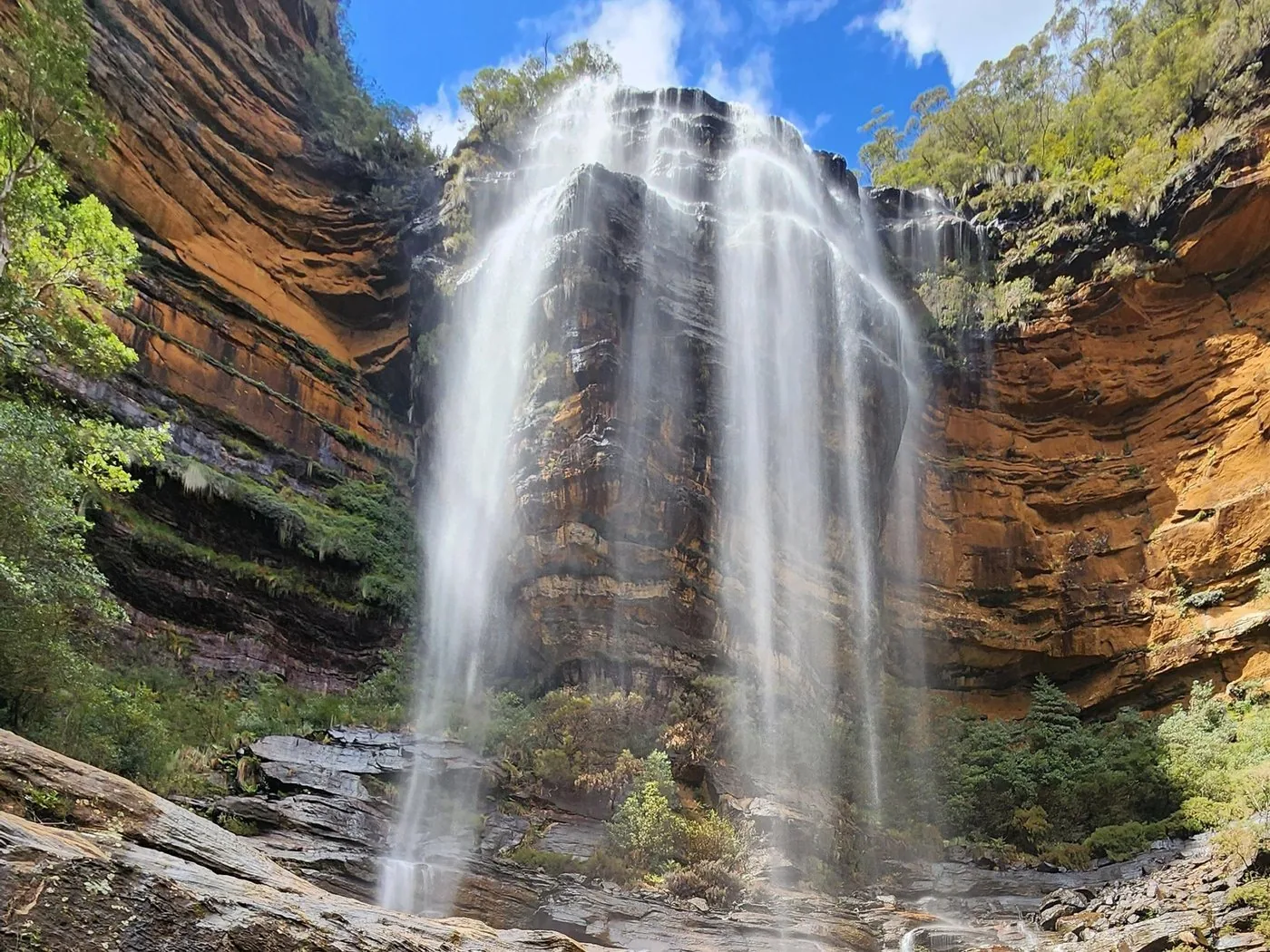
From the Grand Canyon Carpark near Blackheath the track descends into the gorge of Greaves Creek. Banksias and mountain devil grow at the top, ferns and rainforest at the bottom; the track stays mostly shady.

In the canyon, waterfalls, creek crossings and rock ledges follow one another. The track is demanding but needs no climbing gear – comfortable walking shoes are enough.

The way back climbs to Evans Lookout, a barrier-free lookout. The park authority warns: never enter a canyon before, during or after heavy rain; check the weather and alerts beforehand.

NPWS: Grand Canyon Track ↗

The park in numbers

Length
6.3 km loop
Duration
3–4 hours
Difficulty
Grade 3
Start
Grand Canyon Carpark near Blackheath
End
via Evans Lookout
Walked since
1907
Bring
Water, hat, sturdy shoes
In rain
do not go

Visiting the Blue Mountains: cliffs, valleys and waterfalls

02 · Places

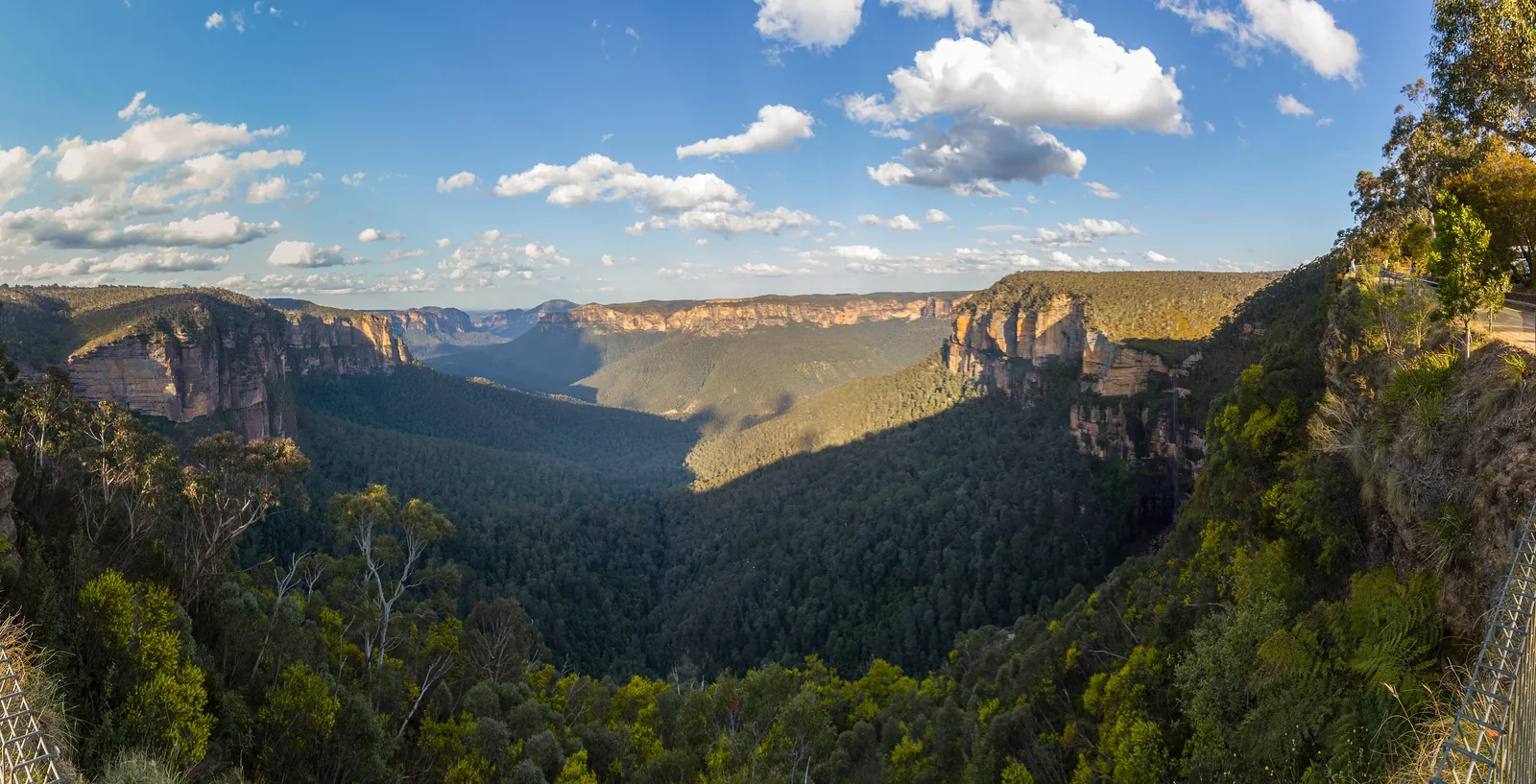
Map: Katoomba, Wentworth Falls and Blackheath

Lookouts, walks and railway stations, each point referenced to OpenStreetMap.

Photo: Abracadebra68 ↗ · CC BY-SA 4.0 ↗

Map

14 places on the map

Lookouts, walks and railway stations, each point referenced to OpenStreetMap.

Open map3D terrain · details and photos for every place
  • Viewpoints5
  • Mountains & rock1
  • Trails2
  • Arrival2
  • History1
  • Nature2
  • Surroundings1

03 · Out and about

Activities: cliff walks, Grand Canyon, waterfalls

The best walks start on the edge of the towns – and lead down into the valleys.

Photo: Boyd159 ↗ · CC BY-SA 4.0 ↗

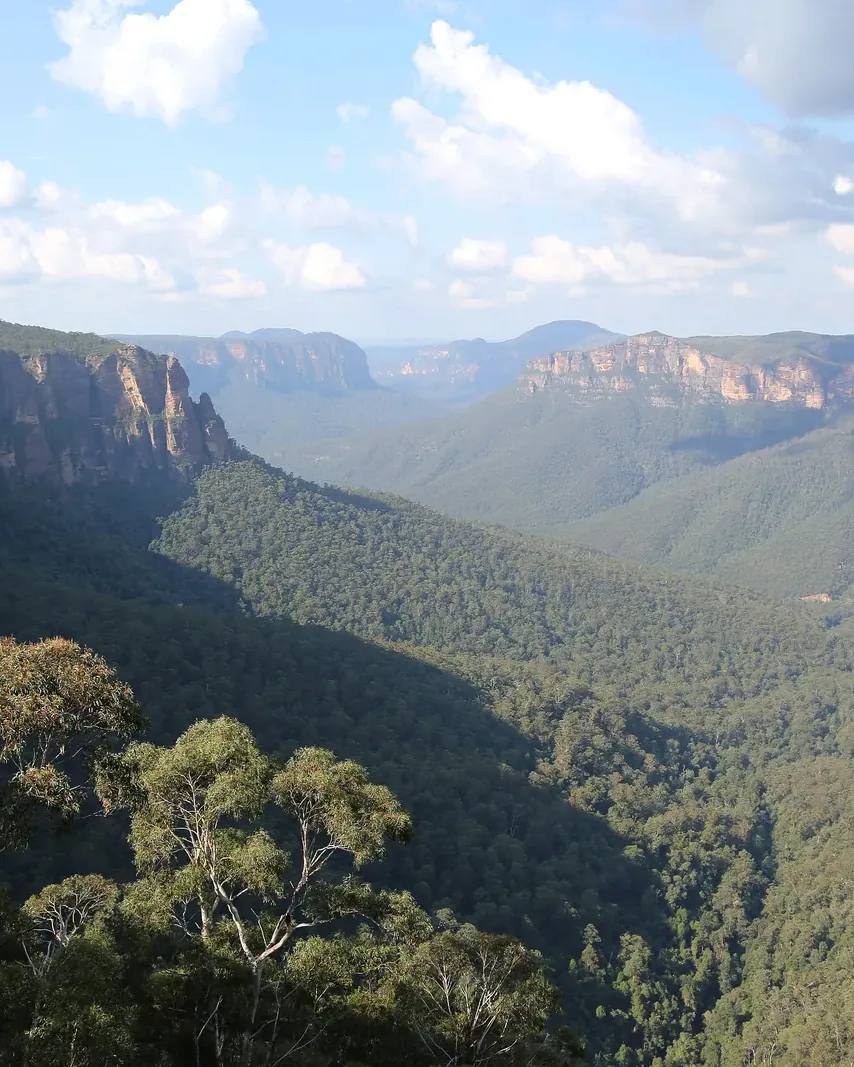
“From above, eucalypts to the horizon – and below, gorges full of ferns.”

Blue Mountains National Park · the Jamison Valley in the morning

Activities: cliff walks, Grand Canyon, waterfalls

Grand Canyon Track: 6.3 kilometres

A loop of three to four hours, grade 3, through a gorge with waterfalls, ferns and rainforest. It has been walked since 1907; the way back climbs up to Evans Lookout.

NPWS: Grand Canyon Track ↗

Show on the map

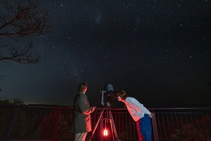
Offer photo: Wentworth Falls: stargazing with a telescope and an astronomer

Blue Mountains Stargazing · In the evening · 90 minutes

Wentworth Falls: stargazing with a telescope and an astronomer

At the picnic area above Wentworth Falls, inside the park, an astrophysicist shows you the southern sky: with the naked eye, binoculars and a telescope, depending on the night the Moon, planets, star clusters or the Orion Nebula. With hot chocolate and, in winter, blankets.

  • 90 minutes
  • Meeting point in the park
  • Telescope and binoculars
  • Wheelchair-accessible

Departure Wentworth Falls Picnic Area at Wentworth Falls Lookout, 10 minutes' drive from Katoomba, 3 to 5 minutes on foot from the car park.

According to the list of inclusions, the tour covers binoculars, a professional telescope, warm blankets and hot chocolate. If the sky is cloudy, the operator gets in touch by 13:00: you then get a voucher or a planetarium session indoors; there is no refund for bad weather.

View tour ↗Ad · partner link · checked 8 Oct 2026

More checked toursAd · partner link · checked 8 Oct 2026

Provider's product photo · Viator

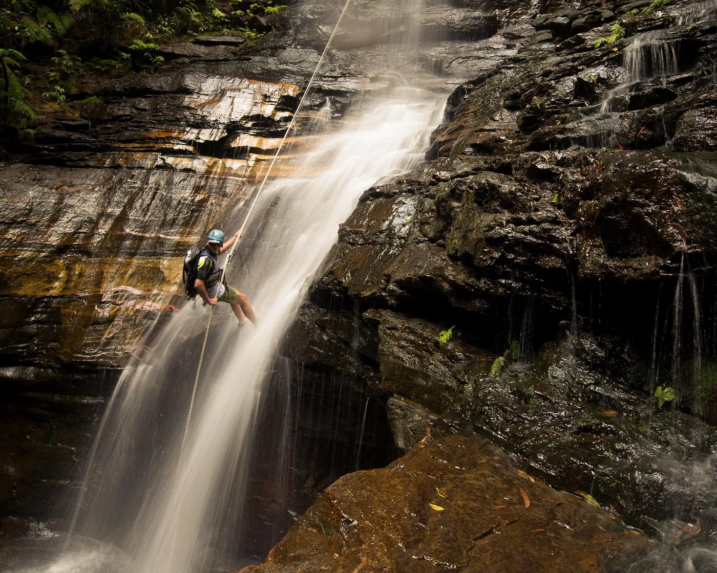
Offer photo: Blue Mountains: a day of abseiling and canyoning in a small group

High and Wild Mountain Adventures · Abseiling and canyoning · 7.5 hours

Blue Mountains: a day of abseiling and canyoning in a small group

In the morning abseiling on the cliffs, first 5, later up to 30 metres, with views into the World Heritage wilderness. After lunch into a narrow canyon: jump, swim, slide – and finally 30 metres down the waterfall into the rock pool.

4.9 out of 5 stars74 reviews on GetYourGuidefrom €214.55as of 8 Oct

  • 7.5 hours
  • At most 10 guests
  • Equipment included
  • From age 14

Departure Operator's office in the youth hostel, 207 Katoomba Street, Katoomba.

According to the list of inclusions, the tour covers technical equipment with helmet, harness and wetsuit, transport from the meeting point to the sites, national park entry fees, a waterproof camera and lunch. Basic swimming skills are required; not for pregnant women, people afraid of heights or children under 14. The page does not name the exact canyon. Free cancellation up to 24 hours in advance.

View tour ↗Ad · partner link · checked 8 Oct 2026

More checked toursAd · partner link · checked 8 Oct 2026

  • From Sydney: three guided walks along the cliffs ↗TOURSTORY Australia · 9.5–10 hours · GetYourGuidePrince Henry Cliff Walk, Katoomba Falls and the Cliff Top Track at Govetts Leap; park entry included according to the list of inclusions.

    4.8 out of 5 stars56 reviews on GetYourGuidefrom €65.91as of 8 Oct

Provider's product photo · GetYourGuide

Ad · we may earn a commission if you book through this partner link – at no extra cost to you. Thank you for supporting the atlas. Offer details checked 8 Oct 2026. See official ticket information.

Nature and culture: eucalypts, sandstone and six peoples

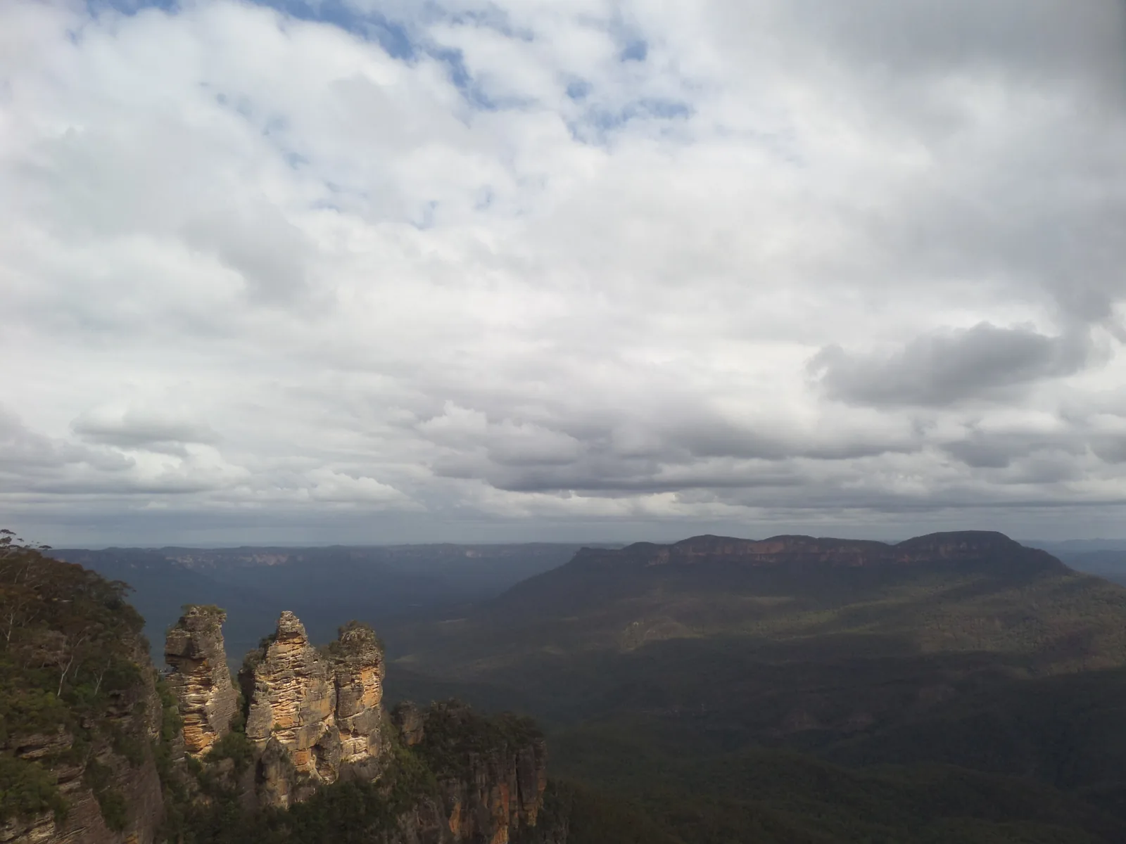
Three Sisters: Aboriginal Place

The three rock towers stand on Gundungurra and Darug Country and are an officially declared Aboriginal Place. There are different versions of their story.

NPWS: Echo Point Lookout (Three Sisters) ↗

Lyrebird and king parrot

On the Three Sisters Walk you can see lyrebirds and crimson rosellas, at Govetts Leap king parrots and yellow-tailed black cockatoos.

NPWS: Govetts Leap Lookout ↗

04 · Before you go

Park film and places nearby

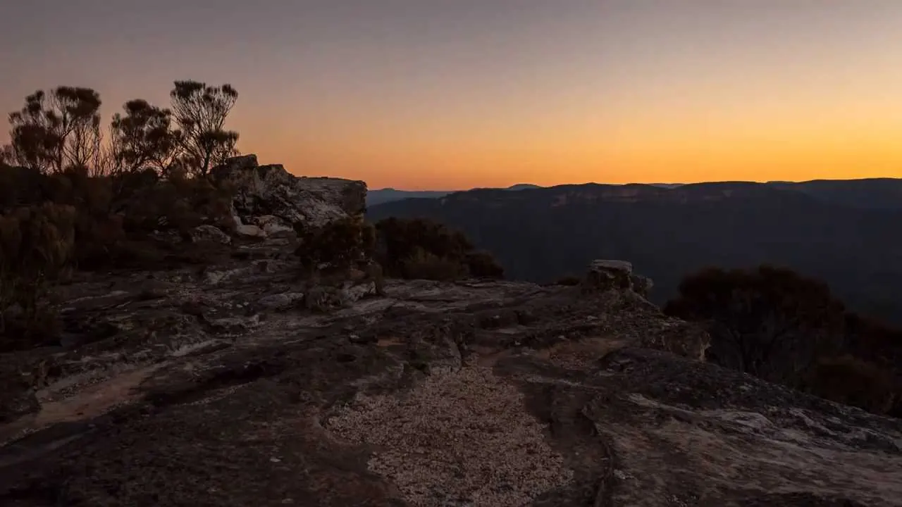
Photo: Yuanchen Chen ↗ · CC BY-SA 4.0 ↗

Film by the NSW park authority

The Blue Mountains in time-lapse

Just over two minutes of time-lapse from the park authority's channel: clouds, smoke and the night sky above the park's valleys, without narration. Published 2013.

Source: NSW National Parks and Wildlife Service · View channel ↗

Field book · Blue Mountains National Park

checked 8 Oct 2026

Blue Mountains at a glance · PDF, 2 pages ↓

00My visit

Nothing saved yet. Every place card has a pin, and so does every place on the Map. What you save collects here, with days, notes and a preview you can share.

01When to go: all year – with an eye on the weather

It is colder in the mountains than in Sydney, and canyons become dangerous after rain.

Colder than Sydney

The weather in the Blue Mountains can be quite different from Sydney's. The park authority advises you to expect cooler temperatures and sudden changes in the weather.

NPWS: Three Sisters Walk ↗

Never enter canyons in heavy rain

The creek in the Grand Canyon can rise after heavy rain. Never enter a canyon before, during or after heavy rain.

NPWS: Grand Canyon Track ↗

Fire ban from October to March

From 1 October 2026 to 31 March 2027, campfires and wood or charcoal barbecues are banned in the park; gas and electric barbecues are allowed. Some campgrounds such as Euroka are exempt. Stricter rules apply on Total Fire Ban days.

NPWS: Current alerts and closures in the park (retrieved 8 October 2026) ↗

Quieter on weekdays

According to the park authority, roads are busy on summer weekends and public holidays. If you want peace and quiet, come on a weekday.

NPWS: Visitor information (getting there, fees, safety, prohibitions) ↗

Always open, sometimes closed

The park is always open but may close in bad weather or high fire danger. Some sites close at night.

NPWS: Visitor information (getting there, fees, safety, prohibitions) ↗

02Getting there: by train from Sydney in about two hours

The Blue Mountains Line stops at Glenbrook, Wentworth Falls, Leura, Katoomba and Blackheath.

Train from Sydney Central

According to the Blue Mountains Line timetable (valid from 19 April 2026), the train from Central to Katoomba takes about two hours; on weekdays it runs roughly hourly during the day.

Transport for NSW: Blue Mountains Line timetable, valid from 19 April 2026 (PDF) ↗

Show on the map

Stations close to the walks

Depending on where you are going, get off at Glenbrook, Woodford, Faulconbridge, Leura, Wentworth Falls, Katoomba or Blackheath. For planning, the park authority refers you to transportnsw.info.

NPWS: Visitor information (getting there, fees, safety, prohibitions) ↗

By car via the M4

From Sydney via the M4 and the Great Western Highway to Glenbrook, Katoomba and Blackheath; the Mount Wilson area via the Bells Line of Road. Roads are busy at weekends and on public holidays in summer.

NPWS: Visitor information (getting there, fees, safety, prohibitions) ↗

From Katoomba station

According to the operator, Scenic World is 3 km from Katoomba station. The Explorer Bus stops at both and at other lookouts.

Scenic World: Getting here (3 km from Katoomba station) ↗

Coast Warriors Travel Australia · Day trip from Sydney · 10.5 hours

From Sydney: Blue Mountains with a walk at Wentworth Falls and lunch

Two hours west into the national park, then on foot: a 90-minute walk between the waterfalls at Wentworth Falls, down to the foot of the big falls if you wish, plus the Three Sisters in Katoomba and other lookouts. A picnic at lunchtime.

4.8 out of 5 stars3,032 reviews on GetYourGuidefrom €74.76as of 8 Oct

Departure Meeting point 812 George Street, Haymarket, in front of St Laurence Church, a good 3 minutes from Central station; departure 7:30, back around 17:30.

According to the list of inclusions, the tour covers lunch, the 90-minute walk, pickup and drop-off in Sydney City, an air-conditioned vehicle and a guide. The description, however, says hotel pickup has been removed; everyone meets on George Street. Drinks are not included. Groups of about 20 to 27 people; not for children under 14. Because of the closures at Wentworth Falls, the walk to the foot of the falls may be dropped; the product page does not say so. Free cancellation up to 24 hours in advance.

View tour ↗Ad · partner link · checked 8 Oct 2026

More checked toursAd · partner link · checked 8 Oct 2026

  • Katoomba: hop-on hop-off bus from the station ↗Blue Mountains Explorer Bus · 1 day · GetYourGuideFor everyone arriving by train: hourly from Katoomba to Echo Point, cliff walks and waterfalls.

    4.5 out of 5 stars312 reviews on GetYourGuidefrom €34.20as of 8 Oct

Ad · we may earn a commission if you book through this partner link – at no extra cost to you. Thank you for supporting the atlas. Offer details checked 8 Oct 2026. See official ticket information.

03Fees: mostly free, A$8 per car around Glenbrook

The park costs nothing almost everywhere – you only pay in the east and with private operators.

No entry fee in Katoomba and Blackheath

According to the park authority, a park fee applies only at the sites in the Glenbrook area. The well-known lookouts and walks around Katoomba, Wentworth Falls and Blackheath are free.

NPWS: Visitor information (getting there, fees, safety, prohibitions) ↗

Glenbrook: A$8 per vehicle per day

The fee is charged at the Bruce Road entrance to the Glenbrook area, for example for Red Hands Cave. You can also pay with the “Park’nPay” app. The booth at the entrance is only staffed at weekends, on public holidays and in the school holidays.

NPWS: Red Hands Cave and Glenbrook area (fee, gate times) ↗

Annual passes for NSW

If you visit many parks in New South Wales, you can buy an annual pass: Multi Parks Pass A$65 for one year (excluding Kosciuszko), All Parks Pass A$190.

NPWS: Visitor information (getting there, fees, safety, prohibitions) ↗

Scenic World costs extra

The Scenic World railway, cableways and boardwalk are not part of the park. The Hammon family business has run them since 1945 on the site of an old coal mine on the edge of Katoomba.

Scenic World: About us (Hammon family business, since 1945) ↗

Show on the map

Visiting the Blue Mountains: cliffs, valleys and waterfalls

On Sydney's doorstep – and part of a World Heritage Area of more than a million hectares.

Over 247,000 hectares

That is the size of the park according to the park authority's plan of management. It stretches from Glenbrook in the east to Mount Victoria in the west, and from Mount Wilson in the north to the Wombeyan Caves in the south.

NPWS: Blue Mountains National Park Plan of Management, May 2001 (PDF; area, established 1959) ↗

A national park since 1959

In 1959 the first 62,000 hectares were dedicated as Blue Mountains National Park. Today it is about four times that size.

NPWS: Blue Mountains National Park Plan of Management, May 2001 (PDF; area, established 1959) ↗

World Heritage since 2000

Together with seven other protected areas, the park forms the Greater Blue Mountains World Heritage Area, a rugged sandstone plateau of more than a million hectares.

NSW Environment and Heritage: Greater Blue Mountains Area (World Heritage) ↗

Six areas

The park authority divides the park into six areas: Katoomba, Blackheath, Glenbrook, Lower Grose Valley, Mount Wilson and Southern Blue Mountains.

NSW National Parks and Wildlife Service (NPWS): Blue Mountains National Park ↗

Over 140 kilometres of walks

From a short stroll to a lookout to the two-day Grand Cliff Top Walk: according to the park authority, the park is a paradise for walkers.

NSW National Parks and Wildlife Service (NPWS): Blue Mountains National Park ↗

Contact: Heritage Centre

Blue Mountains Heritage Centre, 270 Govetts Leap Road, Blackheath, daily 9:00 to 16:00, closed on 25 December. Phone +61 2 4787 8877.

NPWS: Visitor information (getting there, fees, safety, prohibitions) ↗

Show on the map

Activities: cliff walks, Grand Canyon, waterfalls

The best walks start on the edge of the towns – and lead down into the valleys.

Three Sisters Walk: 0.8 kilometres

From Echo Point in 25 to 45 minutes return to the Oreades and Lady Game lookouts. The Honeymoon Bridge to the first sister is currently closed because of rockfall risk.

NPWS: Current alerts and closures in the park (retrieved 8 October 2026) ↗

Show on the map

Grand Canyon Track: 6.3 kilometres

A loop of three to four hours, grade 3, through a gorge with waterfalls, ferns and rainforest. It has been walked since 1907; the way back climbs up to Evans Lookout.

NPWS: Grand Canyon Track ↗

Show on the map

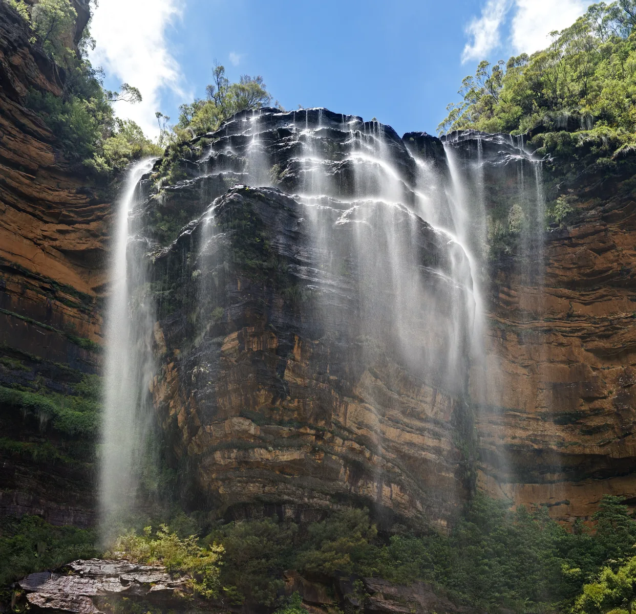
Govetts Leap and Bridal Veil Falls

From the lookout near Blackheath you see Bridal Veil Falls drop 180 m (590 ft) and look out over the Grose Valley. The path is barrier-free.

NPWS: Govetts Leap Lookout ↗

Show on the map

Wentworth Falls: walks partly closed

Part of the National Pass west of the middle crossing is closed after a major landslide, as are the Wentworth Pass and Slacks Stairs; the Valley of the Waters is closed below Sylvia Falls. The upper lookouts remain open.

NPWS: Current alerts and closures in the park (retrieved 8 October 2026) ↗

Show on the map

Grand Cliff Top Walk: 19 kilometres

Over two days from Wentworth Falls via Leura to Katoomba, always along the cliff edge.

NSW National Parks and Wildlife Service (NPWS): Blue Mountains National Park ↗

Abseiling and canyoning

Abseiling, climbing and canyoning are possible with licensed operators. Commercial groups need a licence from the park authority.

NSW National Parks and Wildlife Service (NPWS): Blue Mountains National Park ↗

Nature and culture: eucalypts, sandstone and six peoples

Eucalypt forests as far as the eye can see.

96 eucalypt species

96 eucalypt species grow in the Greater Blue Mountains World Heritage Area, 13 per cent of all known species. There are also rare plants such as the Wollemi pine.

NSW Environment and Heritage: Greater Blue Mountains Area (World Heritage) ↗

Country of six peoples

The World Heritage Area covers the Country of the Darkinjung, Dharawal, Dharug, Gundungurra, Wiradjuri and Wonnarua peoples.

NSW Environment and Heritage: Greater Blue Mountains Area (World Heritage) ↗

Three Sisters: Aboriginal Place

The three rock towers stand on Gundungurra and Darug Country and are an officially declared Aboriginal Place. There are different versions of their story.

NPWS: Echo Point Lookout (Three Sisters) ↗

Red Hands Cave

Hand stencils in red, yellow and white, probably 500 to 1,600 years old; at Camp Fire Creek there are grinding grooves for stone axes.

NPWS: Red Hands Cave and Glenbrook area (fee, gate times) ↗

Lyrebird and king parrot

On the Three Sisters Walk you can see lyrebirds and crimson rosellas, at Govetts Leap king parrots and yellow-tailed black cockatoos.

NPWS: Govetts Leap Lookout ↗

04Where to stay: in Katoomba and Blackheath or in a tent

The towns lie right on the edge of the park; there are campgrounds in the park.

Towns on the edge

According to the park authority, Katoomba is 3 km from the park; Leura, Wentworth Falls and Blackheath also border it.

NPWS: Visitor information (getting there, fees, safety, prohibitions) ↗

Twelve campgrounds

According to the park authority, there are twelve campgrounds in the park, such as Euroka near Glenbrook. Bookings are made through the park authority.

NSW National Parks and Wildlife Service (NPWS): Blue Mountains National Park ↗

Check closures

The Galong Cabins are closed in 2026, and Dunphys campground from 12 to 26 October 2026 because of roadworks.

NPWS: Current alerts and closures in the park (retrieved 8 October 2026) ↗

05Rules in the Blue Mountains: keep back from cliffs, no dogs

The biggest dangers are cliff edges and sudden changes in the weather.

Keep back from cliffs and waterfalls

The park authority asks you to always keep well back from cliff edges and waterfalls, especially when taking photos, and to stay on the tracks.

NPWS: Visitor information (getting there, fees, safety, prohibitions) ↗

Long walks: form and beacon

If you are out for a long time, off track or overnight, you should fill in a trip intention form and carry a personal locator beacon (PLB). They can be borrowed from the park authority in Blackheath and from the police in Katoomba and Springwood.

NPWS: Visitor information (getting there, fees, safety, prohibitions) ↗

No pets, no smoking

Dogs and other pets are not allowed, except assistance dogs. National parks in New South Wales are smoke-free.

NPWS: Visitor information (getting there, fees, safety, prohibitions) ↗

Little mobile reception

There is reception only in places in the park. The emergency number is 000; the “Emergency Plus” app helps you give your location.

NPWS: Visitor information (getting there, fees, safety, prohibitions) ↗

Do not touch the rock art

At Red Hands Cave the park authority asks you not to touch the paintings and to take photos without flash.

NPWS: Red Hands Cave and Glenbrook area (fee, gate times) ↗

Show on the map

06Frequently asked questions: Blue Mountains National Park

Is there an entry fee for Blue Mountains National Park?

Mostly not. A fee of A$8 per vehicle per day applies only at the sites in the Glenbrook area. Lookouts and walks around Katoomba, Wentworth Falls and Blackheath are free.

NPWS: Visitor information (getting there, fees, safety, prohibitions) ↗

How do I get from Sydney to the Blue Mountains?

The easiest way is the Blue Mountains Line train from Sydney Central: about two hours to Katoomba, roughly hourly during the day. By car via the M4 and the Great Western Highway.

Transport for NSW: Blue Mountains Line timetable, valid from 19 April 2026 (PDF) ↗

Are the Three Sisters in the national park?

The rocks are, the lookout not quite: Echo Point belongs to Blue Mountains City Council and, according to the park authority, lies just outside, on the edge of the park.

NPWS: Echo Point Lookout (Three Sisters) ↗

Is Scenic World part of the national park?

No. Scenic World is a Hammon family business, founded in 1945 on the site of an old coal mine in Katoomba. You pay admission there for the railway and cableways.

Scenic World: About us (Hammon family business, since 1945) ↗

How long is the Grand Canyon Track?

A 6.3 km (3.9 mi) loop, three to four hours, grade 3. It starts at the Grand Canyon Carpark near Blackheath. Do not walk it during or after heavy rain.

NPWS: Grand Canyon Track ↗

Are dogs allowed?

No. Pets are not allowed in the park, except certified assistance dogs.

NPWS: Visitor information (getting there, fees, safety, prohibitions) ↗

Where can I find current closures?

On the park authority's alerts page. On 8 October 2026 it listed eleven alerts, including the fire ban and closed tracks such as parts of the National Pass and the Honeymoon Bridge.

NPWS: Current alerts and closures in the park (retrieved 8 October 2026) ↗

07Where the information comes from

NSW National Parks and Wildlife Service, Transport for NSW, UNESCO and OpenStreetMap; offers checked with the providers.

  1. NSW National Parks and Wildlife Service (NPWS): Blue Mountains National Park ↗
  2. NPWS: Visitor information (getting there, fees, safety, prohibitions) ↗
  3. NPWS: Current alerts and closures in the park (retrieved 8 October 2026) ↗
  4. NPWS: Echo Point Lookout (Three Sisters) ↗
  5. NPWS: Three Sisters Walk ↗
  6. NPWS: Govetts Leap Lookout ↗
  7. NPWS: Grand Canyon Track ↗
  8. NPWS: National Pass (partly closed) ↗
  9. NPWS: Red Hands Cave and Glenbrook area (fee, gate times) ↗
  10. NPWS: Blue Mountains Heritage Centre ↗
  11. NPWS: Blue Mountains National Park Plan of Management, May 2001 (PDF; area, established 1959) ↗
  12. NSW Environment and Heritage: Greater Blue Mountains Area (World Heritage) ↗
  13. UNESCO World Heritage Centre: Greater Blue Mountains Area (2000, 1,032,649 ha) ↗
  14. Transport for NSW: Blue Mountains Line timetable, valid from 19 April 2026 (PDF) ↗
  15. Scenic World: About us (Hammon family business, since 1945) ↗
  16. Scenic World: Getting here (3 km from Katoomba station) ↗

How current is this information?

Researched 8 Oct 2026. Not a live status. Dates apply only to the year stated. A successful automatic fetch is not an editorial confirmation; outdated automatic values are hidden and replaced by the source link.

Current information from the park ↗

Image and map credits

Location sources: All points come from OpenStreetMap and are individually referenced by their object number. Whether they lie inside the park was checked against the OpenStreetMap boundary of Blue Mountains National Park (relation 5909718): Echo Point, Scenic World and Katoomba station are outside, the Three Sisters and all other points inside. Markers do not imply that access is permitted. Base map © OpenStreetMap contributors. Coastlines of the chapter map: Natural Earth.

End of the field book · Park authority ↗