National Parks Atlas
To the park
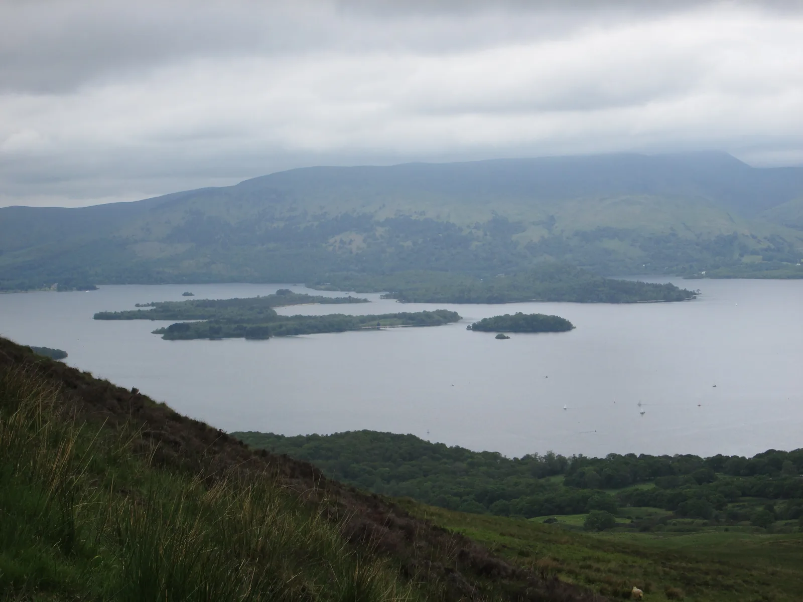
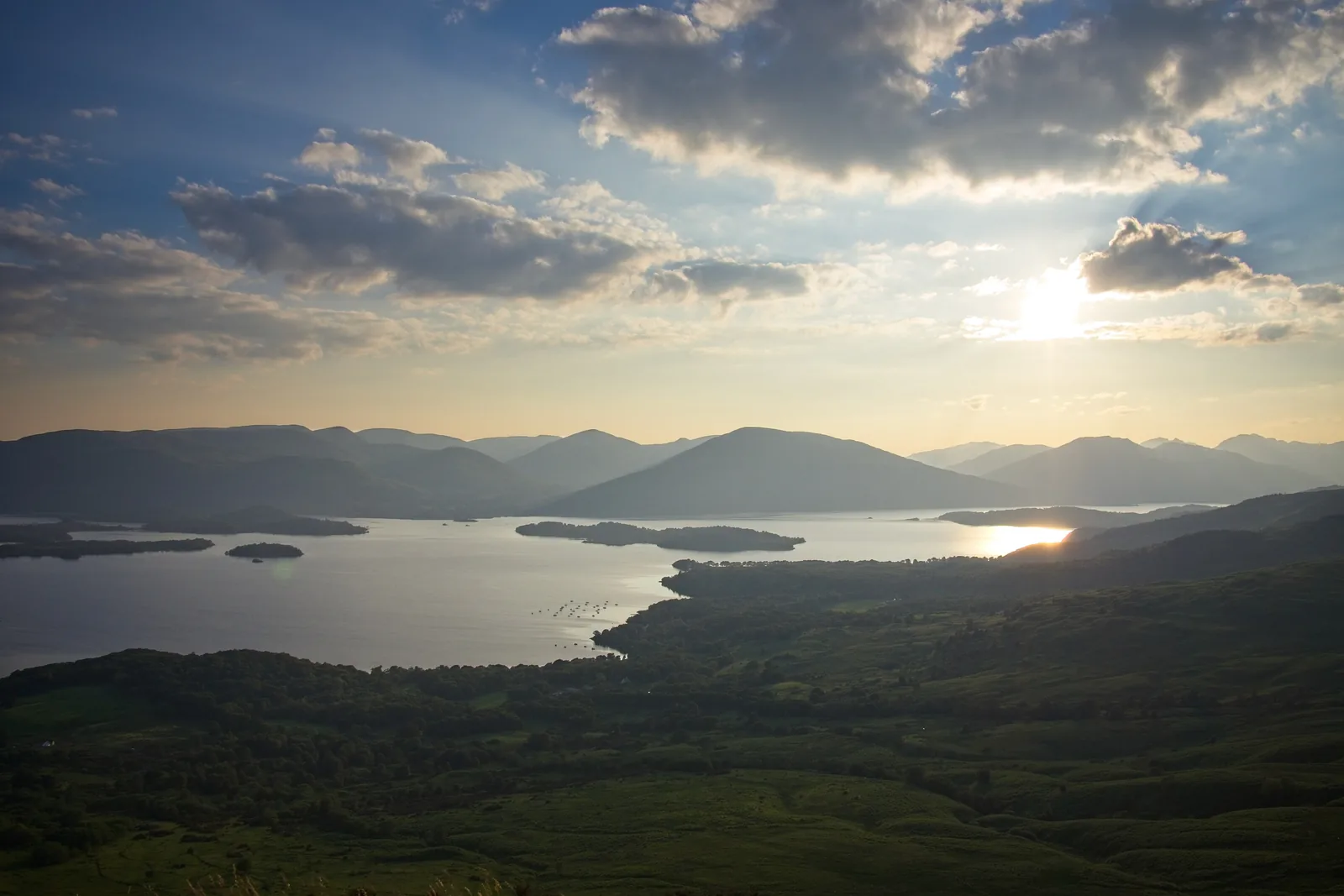
Loch Lomond and its islands in evening light, seen from Conic Hill in Loch Lomond & The Trossachs National Park

Loch Lomond & The Trossachs National Park: map

14 places with verified coordinates · 3 with photo

Bookable in the park · 2

Ad · partner links: we may earn a commission if you book – at no extra cost to you. Thank you for supporting the atlas. Offer details checked 8 Oct 2026; dates and prices with the provider.

Arrival · Railway station at the southern end of the loch

Balloch

About 50 minutes from Glasgow Queen Street, roughly every 30 minutes.

How to get there: by train from Glasgow to Balloch or Tarbet

Glasgow – Balloch

ScotRail runs direct from Glasgow Queen Street to Balloch, in about 50 minutes and roughly every 30 minutes according to the National Park Authority. From the station it is a few steps to the boats.

LLTNPA: Getting to the Park (free entry, train, bus, car, seaplane) ↗

Guided from here · Ad

Partner links: we may earn a commission if you book – at no extra cost to you. Thank you for supporting the atlas. Dates and prices with the provider.

Open in OpenStreetMap ↗Location source ↗

56.00236, -4.58328

Arrival · Leisure hub with a pontoon

Loch Lomond Shores

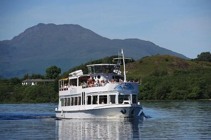
Sweeney’s Cruise boats also depart from here.

Open in OpenStreetMap ↗Location source ↗

56.00591, -4.59221

Surroundings · Village and pier on the west shore

Luss

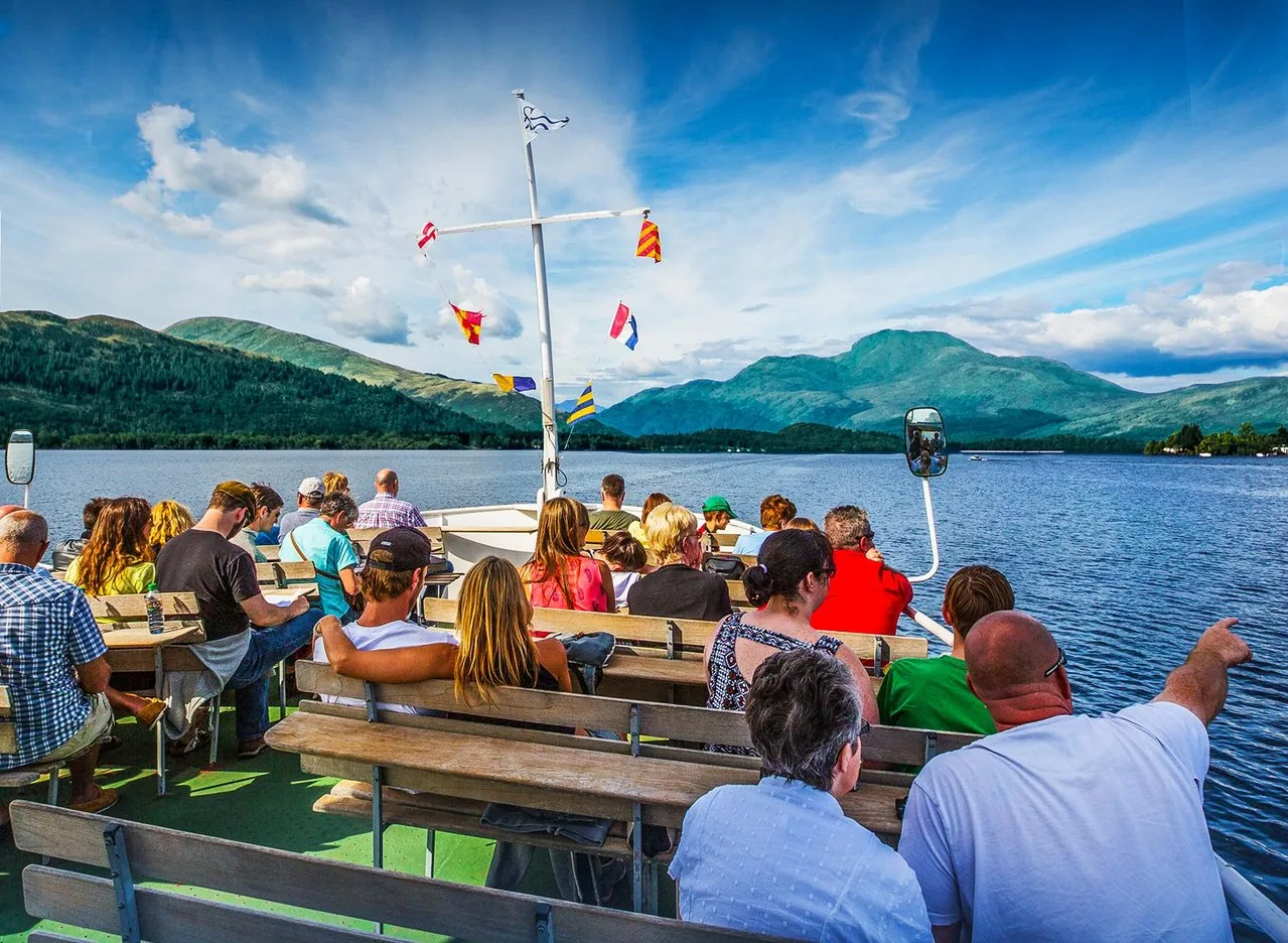
Waterbus to Inchcailloch and Rowardennan in season.

Own page

Ben Lomond

Scotland’s most southerly Munro – with Loch Lomond at its feet and, on clear days, Ben Nevis on the horizon.

Path & getting there

Open in OpenStreetMap ↗Location source ↗

56.10225, -4.63623

Arrival · National Park visitor centre

National Park Centre Balmaha

April to September daily 9:30 to 17:00; in October until 16:00.

Own page

Ben Lomond

Scotland’s most southerly Munro – with Loch Lomond at its feet and, on clear days, Ben Nevis on the horizon.

Path & getting there

Visiting Loch Lomond & The Trossachs: lochs, Munros and forest

Contact: Balmaha

The National Park Authority’s visitor centre in Balmaha on the east shore is open daily 9:30 to 17:00 from April to September, until 16:00 in October and at weekends only from November to March.

LLTNPA: Visitor Centres (Balmaha, Duke’s Pass, Glen Finglas) ↗

Open in OpenStreetMap ↗Location source ↗

56.08501, -4.53890

View from Conic Hill in Loch Lomond & The Trossachs National Park over Loch Lomond and its wooded islands
Photo: Peter S ↗ · CC BY-SA 2.0 ↗

Mountains & rock · Viewpoint hill above Balmaha

Conic Hill

The Highland Boundary Fault crosses the loch here.

The view over the islands – right on the Highland line.

Bus
309 from Balloch, about 30 min
Visitor centre
National Park Centre
Ferry
to Inchcailloch
Path
West Highland Way

Things to do: boats, Munros and wee hills

Conic Hill

A short, rewarding climb from Balmaha with views over the islands; this is where Lowlands meet Highlands.

LLTNPA: Loch Lomond (length, islands, paths, Highland Boundary Fault) ↗

Open in OpenStreetMap ↗Location source ↗

56.09869, -4.52071

Water · Island in a nature reserve

Inchcailloch

Ferry from Balmaha; three walks of 30 to 45 minutes each.

Best time to visit: spring to autumn, watch out for ticks

Inchcailloch in every season

In spring the island is carpeted in bluebells; in autumn and winter migrating wildfowl rest here.

LLTNPA: Inchcailloch (nature reserve, walks, getting there) ↗

Things to do: boats, Munros and wee hills

Inchcailloch

The island is part of the Loch Lomond National Nature Reserve. Three walks of 30 to 45 minutes each lead through oak woodland and up to the top, Tom na Nigheanan.

LLTNPA: Inchcailloch (nature reserve, walks, getting there) ↗

Open in OpenStreetMap ↗Location source ↗

56.07805, -4.55774

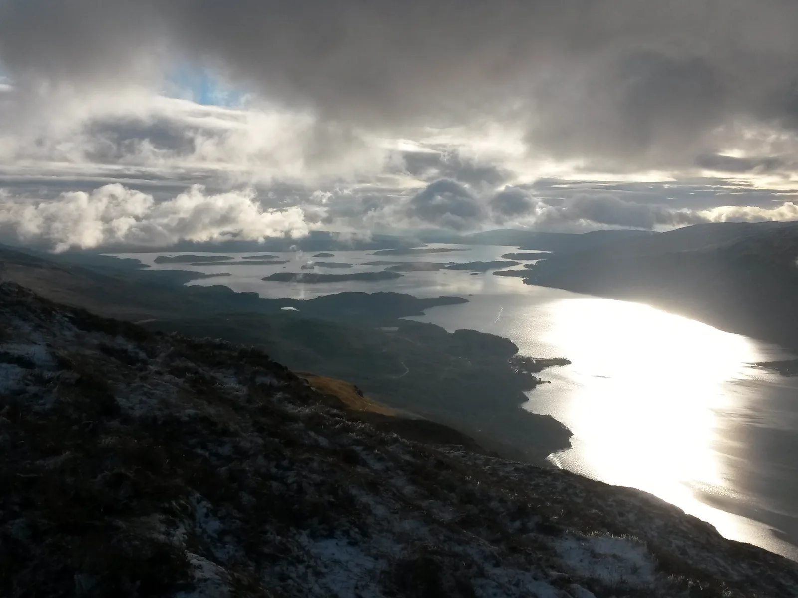
View from the slopes of Ben Lomond in Loch Lomond & The Trossachs National Park to sunlit Loch Lomond under clouds
Photo: Grinner ↗ · CC BY-SA 4.0 ↗

Arrival · Car park at Ben Lomond (Forestry and Land Scotland)

Rowardennan

£2 for one hour, £5 for the day. Start of the path up Ben Lomond.

The most southerly Munro – free to climb, all year.

Height
974 m (3,193 ft)
Path
13 km (8 mi) there and back
Time
4–6 hours
Parking
£5 a day

Own page

Ben Lomond

Scotland’s most southerly Munro – with Loch Lomond at its feet and, on clear days, Ben Nevis on the horizon.

Path & getting there

Free entry – you pay for parking, boats and permits

Parking charged per car park

Car parks are run by councils, the National Park Authority, Forestry and Land Scotland and private owners, each with its own charges. At Rowardennan below Ben Lomond, Forestry and Land Scotland charges £2 for one hour and £5 for the day.

Forestry and Land Scotland: Rowardennan, parking charges ↗

Open in OpenStreetMap ↗Location source ↗

56.15214, -4.64236

View from the slopes of Ben Lomond to sunlit Loch Lomond under clouds, Loch Lomond & The Trossachs National Park
Photo: Grinner ↗ · CC BY-SA 4.0 ↗

Nature · Most southerly Munro, 974 m (3,193 ft)

Ben Lomond

Main path 13 km (8 mi) there and back, 4 to 6 hours.

Own page

Ben Lomond

Scotland’s most southerly Munro – with Loch Lomond at its feet and, on clear days, Ben Nevis on the horizon.

Path & getting there

Things to do: boats, Munros and wee hills

Ben Lomond: 974 metres

Scotland’s most southerly Munro; the main path from Rowardennan is 13 kilometres there and back and takes 4 to 6 hours. The National Trust for Scotland looks after the upper mountain.

National Trust for Scotland: Ben Lomond (974 m, open all year, free) ↗

Guided from here · Ad

Partner links: we may earn a commission if you book – at no extra cost to you. Thank you for supporting the atlas. Dates and prices with the provider.

Open in OpenStreetMap ↗Location source ↗

56.19036, -4.63329

Arrival · Pier on the west shore

Tarbet

Waterbus across the loch; Arrochar & Tarbet station nearby.

Own page

Ben Lomond

Scotland’s most southerly Munro – with Loch Lomond at its feet and, on clear days, Ben Nevis on the horizon.

Path & getting there

Open in OpenStreetMap ↗Location source ↗

56.20277, -4.70758

Arrival · Station on the West Highland Line

Arrochar and Tarbet

Trains Glasgow – Oban/Fort William.

How to get there: by train from Glasgow to Balloch or Tarbet

West Highland Line

The Glasgow – Oban/Fort William line stops at Arrochar & Tarbet, Ardlui, Crianlarich and Tyndrum. From Tarbet and Ardlui a waterbus crosses to the east shore.

LLTNPA: Getting to the Park (free entry, train, bus, car, seaplane) ↗

Open in OpenStreetMap ↗Location source ↗

56.20330, -4.72312

Arrival · Pier on Loch Katrine

Trossachs Pier

Steamship Sir Walter Scott and Lady of the Lake, one-hour cruise.

Things to do: boats, Munros and wee hills

Boats on two lochs

Sweeney’s Cruise sails from Balloch, Cruise Loch Lomond from Luss, Tarbet and Balmaha. On Loch Katrine the steamship Sir Walter Scott and the Lady of the Lake run one-hour cruises from Trossachs Pier.

LLTNPA: Loch cruises (Balloch, Luss, Tarbet, Loch Katrine) ↗

Open in OpenStreetMap ↗Location source ↗

56.23374, -4.42899

Mountains & rock · Small hill above Loch Katrine

Ben A’an

One of the National Park Authority’s “wee hills with big views”.

Open in OpenStreetMap ↗Location source ↗

56.24268, -4.41875

Water · Waterfall in Glen Falloch

Falls of Falloch

With the National Park Authority’s artwork “Woven Sound”.

Open in OpenStreetMap ↗Location source ↗

56.35025, -4.69239

Locations verified from the linked original sources and OpenStreetMap. The map shows no trails or park boundaries; markers do not imply that access is permitted.

Map: © OpenStreetMap contributors, OpenMapTiles, OpenFreeMap. Elevation: Terrain Tiles (Mapzen, AWS Open Data); 3DEP, GMTED2010 and SRTM courtesy of the U.S. Geological Survey; EU-DEM (Copernicus, European Union); ETOPO1 (NOAA); ArcticDEM (NSF, DigitalGlobe); Geoscience Australia; Open Data Austria (DGM); Open Government Licence – Canada; INEGI; Land Information New Zealand; Kartverket; Environment Agency (UK).

Park photo: Photo: Craigmacl ↗ · CC BY-SA 4.0 ↗

Loading map …