National Parks Atlas
Map

00 · Rock arch in the national park · Saxony · Saxon Switzerland National Park

Kuhstall

The second-largest rock arch in the Elbe Sandstone Mountains, a staircase through a crevice and a view of the Affensteine.

Getting there, trails & timesGetting there & parkingOpening times

View plan

Photo: Meyres ↗ · CC BY-SA 4.0 ↗

17 m (56 ft)Rock arch

wide, 11 metres (36 ft) high

3.42 km (2.1 mi)Shortest loop

from the Lichtenhain Waterfall

173 m (568 ft)Ascent

about two hours there and back

The Kuhstall: a cave with a view

An arch in the rock, a narrow staircase to the top and an inn next door since 1824.

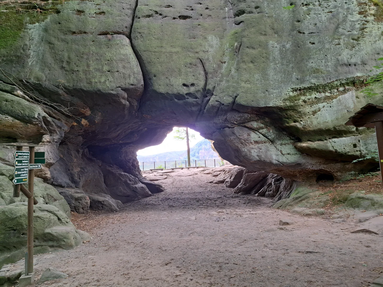
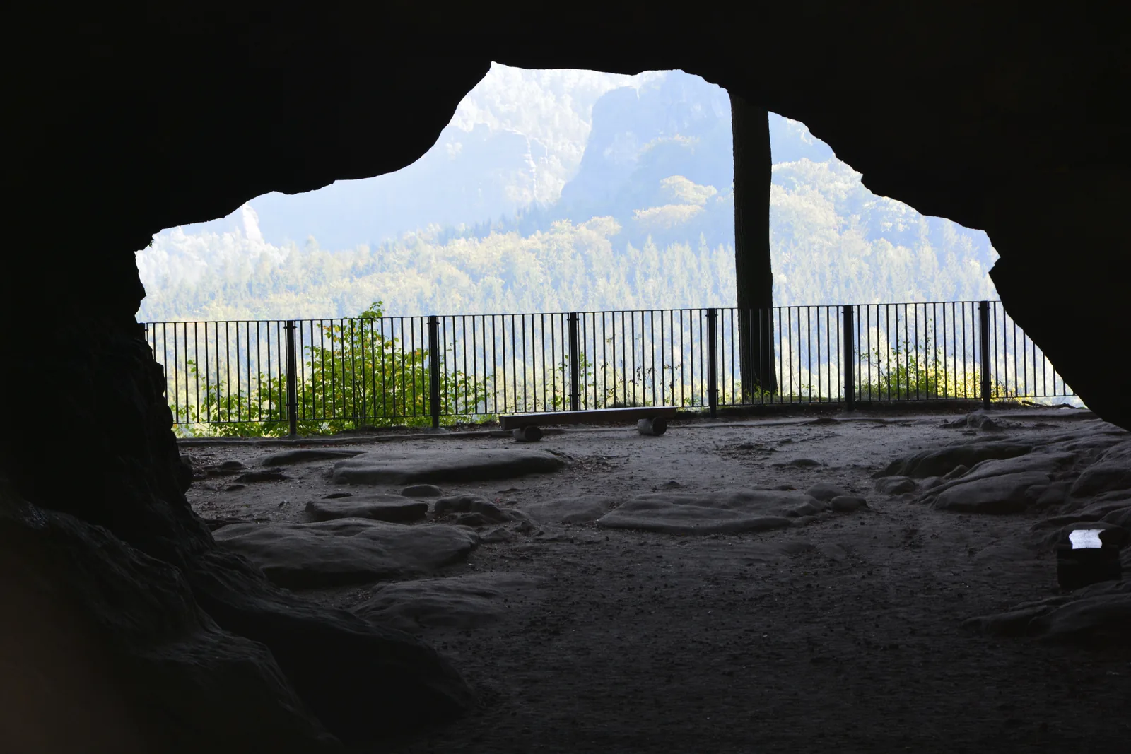
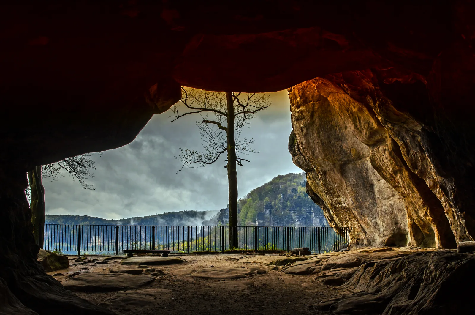
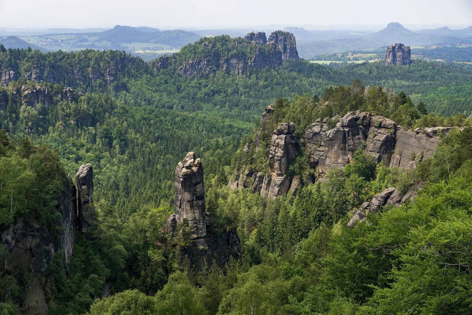
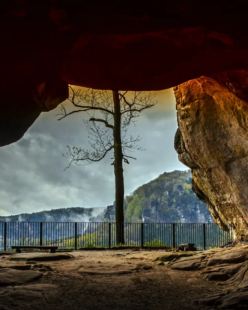
The Kuhstall ("cowshed") is a massive rock arch in the Neuer Wildenstein, in the rear part of Saxon Switzerland, 11 metres (36 ft) high and 17 metres (56 ft) wide. Walk through it and you stand on a viewpoint above the Affensteine massif. The national park authority counts it among the park's most popular destinations.

The name comes from a legend: in times of war, the cave and the rugged rocks around it are said to have hidden the people of the surrounding villages and their animals from plundering armies. On the plateau above lie the remains of a 15th-century castle of the Wildenstein lordship.

The Himmelsleiter ("stairway to heaven"), a narrow staircase between two rock walls, leads up. It branches off to the left of the rock arch railing and ends at another viewpoint. Broad shoulders and a large rucksack make it noticeably tighter.

An inn was built at the Kuhstall as early as 1824. It still exists today and is a national park partner. Neither the authority nor the tourism association names an entrance fee or opening hours for the rock itself; you pay for getting there and parking.

The Kuhstall lies in the middle of the national park: based on the park boundary in OpenStreetMap, about one and a half kilometres inside. That is why the authority's rule applies: you may only walk on the existing paths.

National park authority: sights in the national park ↗

In numbers

Height of the arch
11 m (36 ft)
Width of the arch
17 m (56 ft)
Inn since
1824
Castle remains
15th century
Loop from the waterfall
3.42 km · 173 m ascent
Lowest / highest point
160 m / 329 m
From Schmilka
11.04 km · 649 m ascent

Saxon Switzerland National Park profile

01 · Plan

Getting there, trails & times

By tram or bus to the Lichtenhain Waterfall, then on foot.

Photo: Dr. Bernd Gross ↗ · CC BY-SA 3.0 ↗

How to get there and where to park

By tram or bus to the Lichtenhain Waterfall, then on foot.

Price list

checked 3 Oct 2026

Entrance fees & opening hours

Nobody names a price for the rock arch, but getting there costs money.

No ticket office

Neither the national park authority nor the tourism association names an entrance fee or opening hours for the Kuhstall. The way there is a marked hiking trail in the national park.

National park authority: sights in the national park ↗

Food and drink at the arch

The Berggasthaus at the Kuhstall has its own opening hours; they are on the inn's website.

Berggasthaus Kuhstall mountain inn (national park partner) ↗

Getting there costs

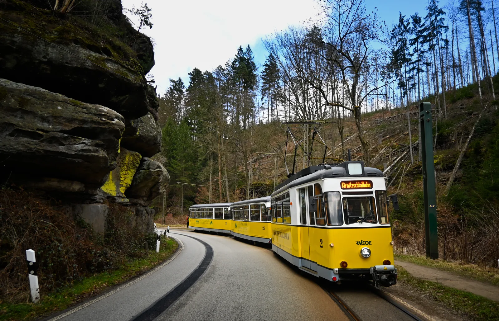
You pay for the tram, bus or car park. Families can use the Kirnitzschtal tram's family day ticket for €25.

RVSOE: Kirnitzschtal tram timetable and fares ↗

Three routes

How far it is to the Kuhstall

Official route data from the Saxon Switzerland tourism association, side by side.

Loop from the Lichtenhain Waterfall

Start and finish at the Kirnitzschtal tram terminus. Difficulty: easy.

Distance
3.42 km
Ascent
173 m
Walking time
2:00 hrs

One-way route from Schmilka via the Winterberg

From the Elbe over the Großer Winterberg and the Kuhstall into the Kirnitzsch valley. Difficulty: moderate.

Distance
11.04 km
Ascent
649 m
Walking time
4:00 hrs

Altitudes of the short loop

Lowest and highest point according to the route description.

Lowest point
160 m
Highest point
329 m
Descent
177 m

Route data retrieved on 3 October 2026; walking times without breaks. Saxon Switzerland tourism association: loop to the Kuhstall ↗

Best time to visit

Light, crowds and weather at the rock arch.

Early or late

The Kuhstall is one of the most popular destinations in the rear part of the park, and according to the authority the car parks in the valley usually fill up quickly. If you come early by tram, you do not need to look for a parking space.

National park authority: sights in the national park ↗

Keep an eye on the last tram

The Kirnitzschtal tram runs on its summer timetable until 1 November 2026; after that the winter timetable applies, with fewer services. Plan your return from the waterfall accordingly.

RVSOE: Kirnitzschtal tram timetable and fares ↗

02 · On site

Hikes & routes to the Kuhstall

The short loop, the long route and the Malerweg.

Photo: Molgreen ↗ · CC BY-SA 4.0 ↗

“Step through the arch, and suddenly the rear of Saxon Switzerland lies before you.”

The Kuhstall in the Neuer Wildenstein, 11 metres high and 17 metres wide.

Hikes & routes to the Kuhstall

The short loop, the long route and the Malerweg.

The loop from the waterfall

Behind the car park, cross the small bridge, follow the Malerweg to the left and climb steadily to the rock arch. Return via the steps to the left in front of the arch and the Hinterer Kuhstallweg, marked with a red stripe. In total 3.42 kilometres (2.1 mi) and 173 metres of ascent, about two hours.

Saxon Switzerland tourism association: loop to the Kuhstall ↗

On the Malerweg

Then as now, the Malerweg (Painters' Way) leads to the Kuhstall. The painters of the Romantic era came here; according to the tourism association, Caspar David Friedrich visited the rock arch several times, and his drawing dates from around 1818.

National park authority: sights in the national park ↗

Guided on site

Through our partner you can book a scavenger hunt through Bad Schandau and the Kirnitzsch valley that includes the Kuhstall as a detour if time allows.

View through the Kuhstall rock arch in Saxon Switzerland National Park to the wooded Affensteine, with the viewpoint railing in the foreground – landscape illustration

Scavenger hunt · Kuhstall as a detour · offer via GetYourGuide

Bad Schandau: scavenger hunt with the Kirnitzschtal tram and Lichtenhain Waterfall

Puzzle box for a self-guided day: from the national park railway station in Bad Schandau by ferry into town, up in the historic passenger lift, then by Kirnitzschtal tram to the Lichtenhain Waterfall. The route includes the climb to the Kuhstall rock arch as a detour if time allows; it is not a fixed stop. Eleven sealed envelopes with puzzles lead you from stop to stop.

4.3 out of 5 stars42 reviews on GetYourGuidefrom €39.90 per groupas of 8 Oct

  • about 4 hours
  • no guide
  • box sent by post
  • Provider: Stadtspiel Schnitzeljagd

Start National park railway station in Bad Schandau; start on any day with the box sent to you.

View offer ↗Ad · partner link · checked 3 Oct 2026

The box is posted; according to the provider, delivery takes up to 4 working days within Germany and it is sent no earlier than 2 weeks before your chosen date; it cannot be collected in Bad Schandau. The box, 11 puzzle envelopes and a solution envelope are included; Kirnitzschtal tram tickets, admission fees, travel and food are not. Free cancellation up to 24 hours in advance. Landscape image, not a provider photo · Photo: Meyres ↗ · CC BY-SA 4.0 ↗

Ad · we may earn a commission if you book through this partner link – at no extra cost to you. Thank you for supporting the atlas. Offer details checked 3 Oct 2026. See official prices.

03 · Nearby

Onward from here

The Kuhstall lies in the middle of Saxon Switzerland National Park. Rules, trails and the park's other sights are in the park profile.

Photo: Meyres ↗ · CC BY-SA 4.0 ↗

Map

Kuhstall on the terrain map

Six points between the Kirnitzsch valley and the Neuer Wildenstein, each verified against an OpenStreetMap object. All points are on the Saxon Switzerland National Park map, with details and photos.

Show on mapSaxon Switzerland National Park map · 3D terrain

Field book · Kuhstall

checked 3 Oct 2026

01Rules: good to know

What applies at the rock arch.

In the national park

The Kuhstall lies in the national park. You may only walk on the existing paths, and in the core zone only on marked or signposted paths.

National park authority: conduct in the national park ↗

Check closures

The authority publishes current closures and diversions in its trail service. Rangers also signpost diversions on site.

National park authority: trail service with closures ↗

A cave with a history

Tourism in the Elbe Sandstone Mountains began with the Romantic era at the start of the 19th century; painters and writers made places like the Kuhstall famous.

National park authority: sights in the national park ↗

Location relative to the park boundary

Based on the OpenStreetMap boundary, the rock arch, the Himmelsleiter and the inn lie about one and a half kilometres inside the national park.

OpenStreetMap: boundary of Saxon Switzerland National Park ↗

02Kuhstall: frequently asked questions

Short answers, with sources.

How long is the hike to the Kuhstall?

From the Lichtenhain Waterfall, the loop to the Kuhstall and back is 3.42 kilometres (2.1 mi) long and, according to the tourism association, takes about two hours. It involves 173 metres of ascent.

Saxon Switzerland tourism association: loop to the Kuhstall ↗

Where do you park for the Kuhstall?

There is a car park at the Lichtenhain Waterfall. However, the national park authority recommends the bus or Kirnitzschtal tram from Bad Schandau, because the car parks in the Kirnitzsch valley usually fill up quickly.

National park authority: sights in the national park ↗

Is there an entrance fee for the Kuhstall?

Neither the national park authority nor the tourism association names an entrance fee or opening hours for the rock arch. You pay for getting there and parking.

National park authority: sights in the national park ↗

How big is the Kuhstall?

The rock arch is 11 metres (36 ft) high and 17 metres (56 ft) wide. Through the arch you reach a viewpoint over the Affensteine massif.

National park authority: sights in the national park ↗

What is the Himmelsleiter at the Kuhstall?

A narrow staircase between two rock walls that branches off to the left of the rock arch railing. It leads to the plateau of the Neuer Wildenstein with another viewpoint and the remains of a 15th-century castle.

Saxon Switzerland tourism association: loop to the Kuhstall ↗

Is the Kuhstall in Saxon Switzerland National Park?

Yes. Based on the park boundary in OpenStreetMap, the Kuhstall lies about one and a half kilometres inside the national park, in the rear part of the protected area.

OpenStreetMap: boundary of Saxon Switzerland National Park ↗

03Sources and last checked

Operator, municipality and park authority, each fact cited individually.

Places on the map

  • Kuhstall Rock arch, 11 × 17 m

    The rock arch in the Neuer Wildenstein. Point-in-polygon check against the OpenStreetMap boundary: inside the national park, about 1.5 kilometres (0.9 mi) from the boundary.

    Location source ↗
  • Kuhstall viewpoint Viewpoint

    The view after walking through the arch, across to the Affensteine massif.

    Location source ↗
  • Himmelsleiter Staircase

    Narrow staircase between two rock walls up to the plateau of the Neuer Wildenstein.

    Location source ↗
  • Neuer Wildenstein castle remains Ruin

    Remains of the castle of the Wildenstein lordship from the 15th century.

    Location source ↗
  • Kuhstall inn Food and drink

    An inn since 1824, today a national park partner.

    Location source ↗
  • Lichtenhain Waterfall Start of the shortest loop

    Terminus of the Kirnitzschtal tram with a car park. The loop to the Kuhstall starts here.

    Location source ↗
  1. National park authority: sights in the national park ↗
  2. National park authority: conduct in the national park ↗
  3. National park authority: trail service with closures ↗
  4. OpenStreetMap: boundary of Saxon Switzerland National Park ↗
  5. Saxon Switzerland tourism association: loop to the Kuhstall ↗
  6. Saxon Switzerland tourism association: Schmilka – Winterberg – Kuhstall – Lichtenhain Waterfall ↗
  7. RVSOE: Kirnitzschtal tram timetable and fares ↗
  8. Berggasthaus Kuhstall mountain inn (national park partner) ↗

How current is this information?

Researched 3 Oct 2026. Not a live status. Prices, timetables and opening hours change; please check with the operator before you travel.

Current information from the operator ↗

Image and map credits

Location sources: every point on the map links to the OpenStreetMap object its coordinate comes from. Markers do not imply that access is permitted.

End of the field book · Park authority ↗