National Parks Atlas
Map

00 · Rock area in the national park · Saxony · Saxon Switzerland National Park

Affensteine & Carolafelsen

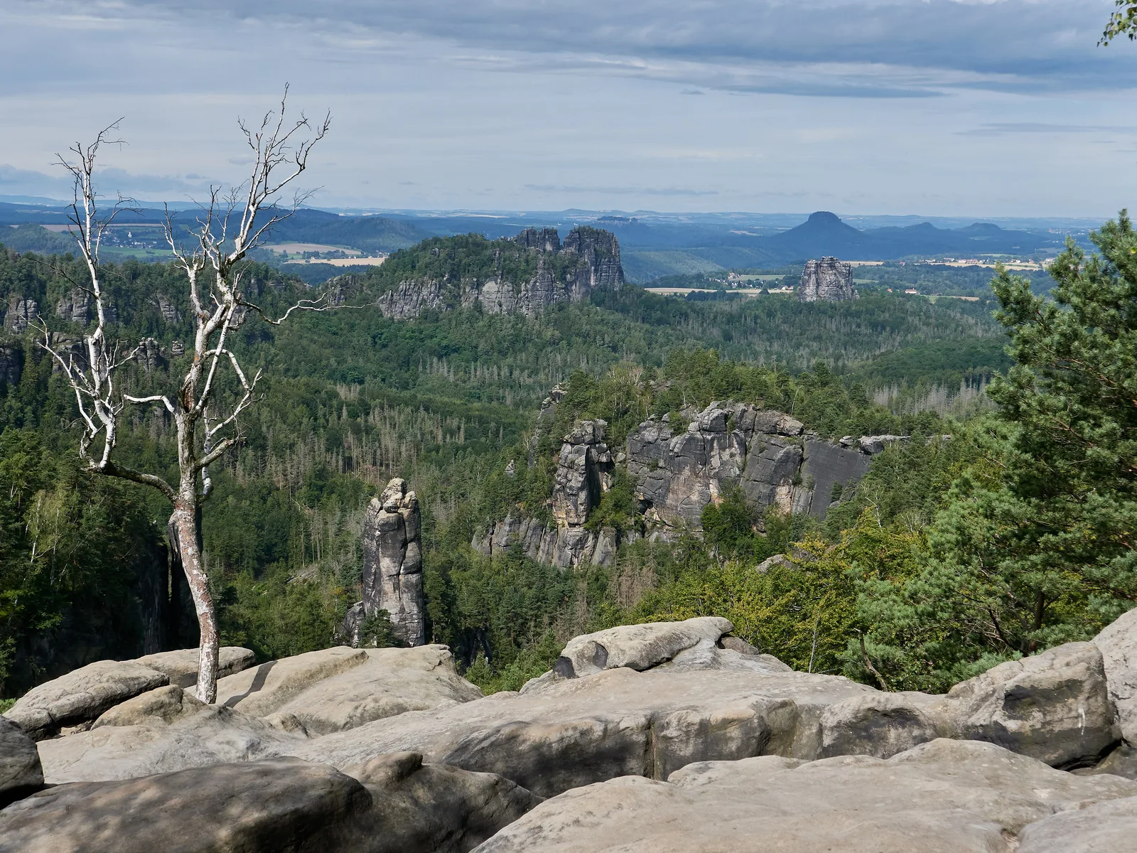
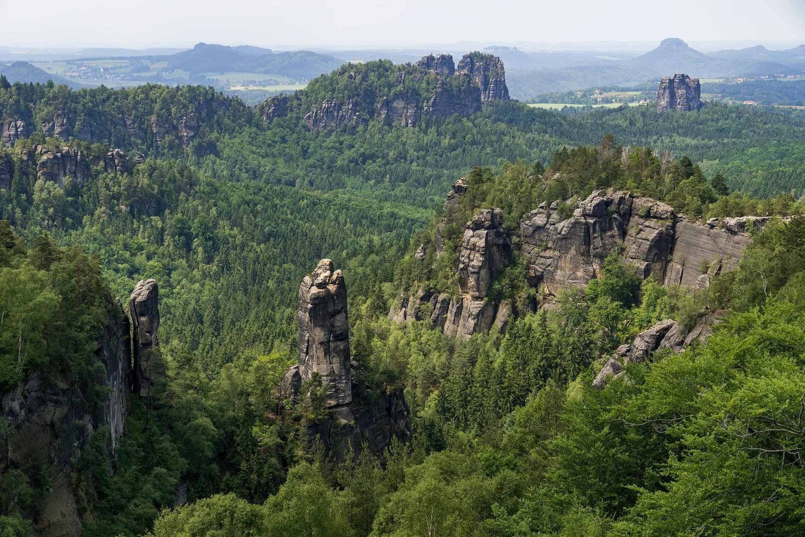
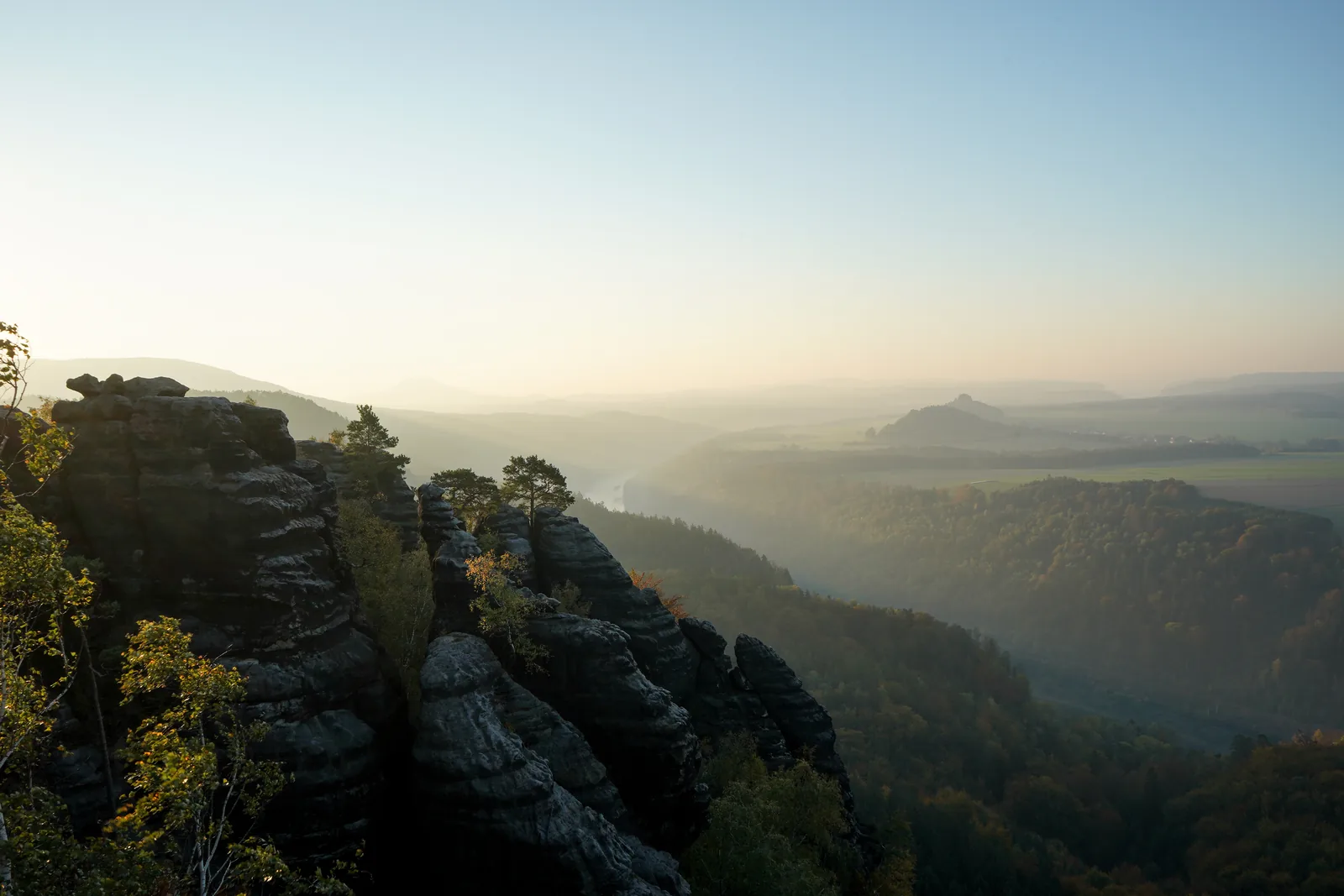
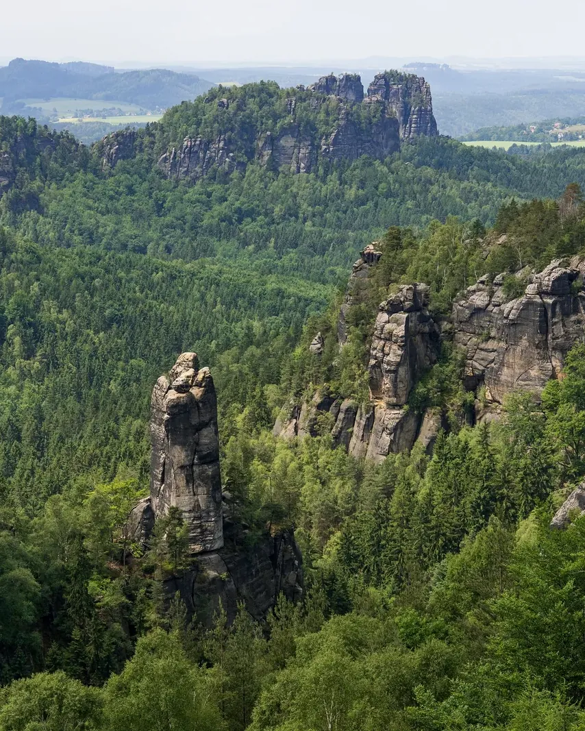
The great viewpoint of the Affensteine, looking across the Großer Dom to the Schrammsteine, reached by steps, iron rungs and the only ladder route with a steel cable.

Trails, ladders & getting thereGetting there & parkingOpening times

View plan

Photo: René Schröder ↗ · CC BY-SA 4.0 ↗

7.10 km (4.4 mi)Loop from Nasser Grund

340 m ascent, 2:30 hrs

FreeEntry

Viewpoint open all year

OpenTrail status

Eulentilke impassable

The Affensteine: a viewpoint, a gorge called Hell and a ladder route with a steel cable

Why the Carolafelsen can only be reached on foot, and which of the routes up suits whom.

The Affensteine are the group of rocks between the Schrammsteine and the Kirnitzsch valley, in the middle of Saxon Switzerland National Park. Their best-known viewpoint is the Carolafelsen, named after Carola, Saxony's last queen. From the plateau the view stretches across the rock bowl of the Großer Dom to the Schrammsteine ridge, the Falkenstein and as far as the Lilienstein.

No road leads up. The tourism association describes the viewpoint as reachable only on a hike, over steps and narrow passages. It costs nothing to visit and is open all year. The official "Heaven and Hell" loop starts at the Nasser Grund stop in the Kirnitzsch valley: 7.10 kilometres (4.4 mi), 340 metres (1,115 ft) of ascent, about two and a half hours.

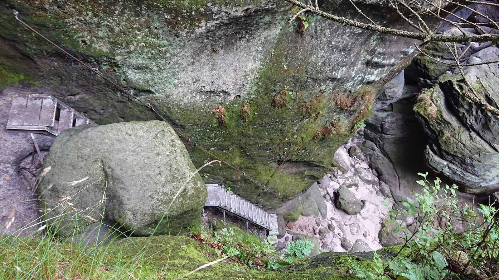
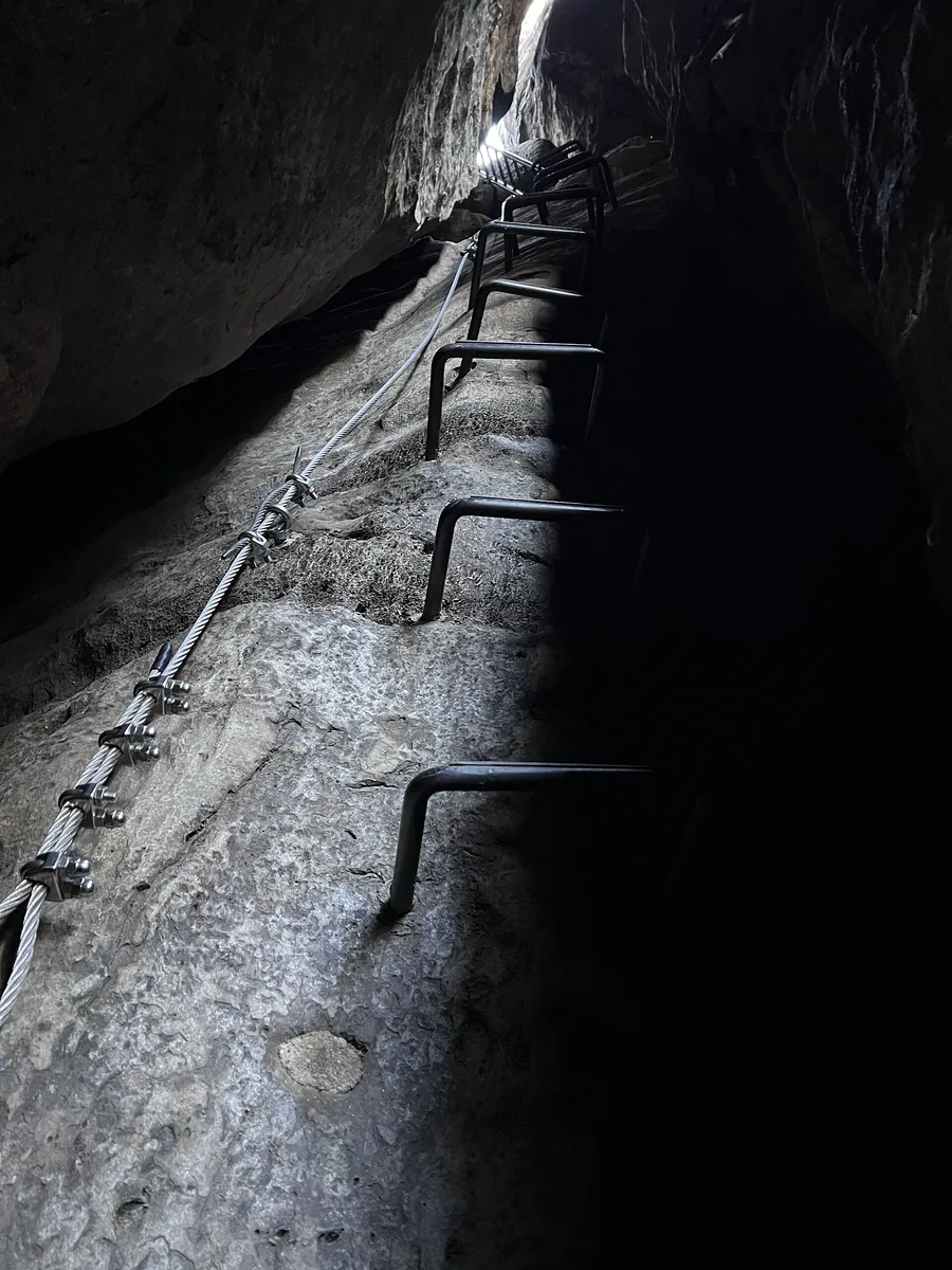
The way down leads through the Wilde Hölle, a narrow gorge with iron rungs at the difficult spots. If you want more, climb up the Häntzschelstiege a good half kilometre further north; according to the tourism association it is the only Stiege (ladder route) in Saxon Switzerland where you can clip in with a via ferrata set as in the Alps.

The Affensteine were not affected by the storm in summer 2026; the authority's forest closure applies between Rathen and Hohnstein. Since the end of 2025, however, the Eulentilke, the classic return route of the loop, has been impassable. The tourism association recommends the Jordanweg instead.

Based on the park boundary in OpenStreetMap, the Carolafelsen lies about 1.7 kilometres (1.1 mi) inside the national park and the Häntzschelstiege a good two kilometres. According to OpenStreetMap both lie outside the core zone, a good 1.3 kilometres from it; this fits with the authority listing approved boofen (overhang bivouac sites) here, which only exist outside the core zone. Even so, you must not leave the paths anywhere in the park.

Saxon Switzerland tourism association: Carolafelsen viewpoint ↗

In numbers

Heaven and Hell loop
7.10 km · 340 m ascent · 2:30 hrs
Highest point of the loop
452 m (1,483 ft)
Lowest point (Nasser Grund)
147 m (482 ft)
Häntzschelstiege via ferrata
Grade B
Tour to the Häntzschelstiege
5.7 km · 315 m ascent · 3:00 hrs
Approved boofen in the Affensteine
10
Kirnitzschtal tram, single ticket
€7.00

Saxon Switzerland National Park profile

01 · Plan

Trails, ladders & getting there

Into the Kirnitzsch valley by tram or bus; the car park fills up fast.

Photo: Lukas Beck ↗ · CC BY 4.0 ↗

How to get there and where to park

Into the Kirnitzsch valley by tram or bus; the car park fills up fast.

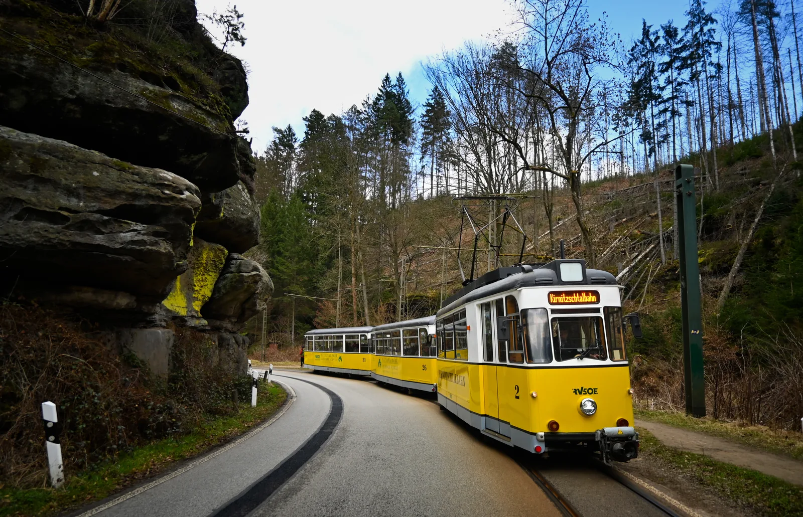
By Kirnitzschtal tram

The tram runs from the spa gardens in Bad Schandau into the Kirnitzsch valley and stops at Nasser Grund and Beuthenfall, the two starting points into the Affensteine.

RVSOE: Kirnitzschtal tram ↗

Price list

checked 3 Oct 2026

Entrance fees & equipment

The viewpoint costs nothing; at most you pay for protection on the ladder route.

No entrance fee

There is no charge for the Carolafelsen viewpoint; it is always open.

Saxon Switzerland tourism association: Carolafelsen viewpoint ↗

Via ferrata set for the Häntzschelstiege

In Saxon Switzerland, clipping in as in the Alps is essentially only possible on the Häntzschelstiege. The tourism association advises getting advice at the tourist information office beforehand.

Saxon Switzerland tourism association, Elbe Sandstone blog: what exactly is a Stiege? ↗

Renting a set

The Aktiv Zentrum in Bad Schandau rents out via ferrata sets with helmets, as well as walking poles and child carriers.

Town of Bad Schandau, Aktiv Zentrum: rental of via ferrata sets with helmet ↗

Day ticket for the tram

A single ticket is valid without breaks in the journey. For the way there and back, the day ticket at €10.00 is cheaper than two single rides; it is valid from validation until the end of service.

RVSOE: Kirnitzschtal tram timetable and fares ↗

Trail status

What is open in the Affensteine

The paths around the Carolafelsen, checked against all active notices in the national park authority's trail service.

  1. Nasser Grund to the Jordanweg junctionopen

    No closure reported for Nasser Grund; the tourism association's loop starts here.

  2. Jordanweg, Kleine Domstiege and Zurückesteigopen

    The loop's ascent to the Carolafelsen; no notice in the trail service.

  3. Carolafelsen viewpointopen

    Freely accessible all year; in icy conditions only with suitable equipment.

  4. Wilde Hölleopen

    No closure reported. Iron rungs at the difficult spots; you need to be sure-footed and have a head for heights.

  5. Häntzschelstiegeopen

    No closure reported. In winter the route description by the Alpine Club's Dresden section advises against it because of ice.

  6. Eulentilkeimpassable

    Listed as impassable since November 2025 because of the risk of falling trees; return via the Jordanweg.

  7. Storm closure Rathen–Hohnsteinnot affected

    The forest closure after the storm of 31 July 2026 lies further west and does not touch the Affensteine.

Checked against the national park authority's active notices, retrieved on 3 October 2026. National park authority: all active trail closures ↗

The loop

Heaven and Hell in figures

The tourism association's loop from Nasser Grund via the Kleine Domstiege to the Carolafelsen and back through the Wilde Hölle.

Loop from Nasser Grund

Moderate difficulty, moderate fitness. Not suitable for small children or dogs.

Distance
7.10 km
Ascent
340 m
Walking time
2:30 hrs

Altitudes of the loop

Lowest and highest point according to the route description.

Lowest point
147 m
Highest point
452 m
Descent
340 m

Route data retrieved on 3 October 2026; walking time without breaks. The return through the Eulentilke is currently impassable; the authority refers to the Jordanweg. Saxon Switzerland tourism association: "Heaven and Hell" (loop from Nasser Grund) ↗

Best time to visit and seasons

When the view is at its best and what applies in spring.

02 · On site

Hikes & routes in the Affensteine

Three routes to the Carolafelsen and onto the heights, from an easy ascent to a via ferrata.

Photo: Lukas Beck ↗ · CC BY 4.0 ↗

“Up through a crevice on iron rungs, with the Schrammsteine and the Hohe Liebe in view at the top.”

View from the Häntzschelstiege in the Affensteine, Saxon Switzerland National Park.

Hikes & routes in the Affensteine

Three routes to the Carolafelsen and onto the heights, from an easy ascent to a via ferrata.

Guided on site

None of our partner's tours goes into the Affensteine, up the Häntzschelstiege or to the Carolafelsen. You can book a scavenger hunt with the Kirnitzschtal tram, the way into the area, and a paddle steamer trip from Bad Schandau; both are different experiences in the same park.

View from the Carolafelsen across the wooded Affensteine and rock towers to the Schrammsteine ridge in Saxon Switzerland National Park – landscape illustration

Scavenger hunt in the Kirnitzsch valley · not in the Affensteine · offer via GetYourGuide

Bad Schandau: scavenger hunt with the Kirnitzschtal tram and Lichtenhain Waterfall

Puzzle box for a self-guided day: from the national park railway station in Bad Schandau by ferry into town, up in the historic passenger lift, then by Kirnitzschtal tram to the Lichtenhain Waterfall. If time allows, you continue up to the Kuhstall rock arch. Eleven sealed envelopes with puzzles lead you from stop to stop.

4.3 out of 5 stars42 reviews on GetYourGuidefrom €39.90 per groupas of 8 Oct

  • about 4 hours
  • no guide
  • box sent by post
  • Provider: Stadtspiel Schnitzeljagd

Start National park railway station in Bad Schandau; start on any day with the box sent to you.

View offer ↗Ad · partner link · checked 3 Oct 2026

The box is posted; according to the provider, delivery takes up to 4 working days within Germany and it is sent no earlier than 2 weeks before your chosen date; it cannot be collected in Bad Schandau. The box, 11 puzzle envelopes and a solution envelope are included; Kirnitzschtal tram tickets, admission fees, travel and food are not. Free cancellation up to 24 hours in advance. Landscape image, not a provider photo · Photo: René Schröder ↗ · CC BY-SA 4.0 ↗

Offer photo: Bad Schandau: end-of-the-day paddle steamer round trip (line 33)

Paddle steamer from Bad Schandau · a different experience in the same park · offer via GetYourGuide

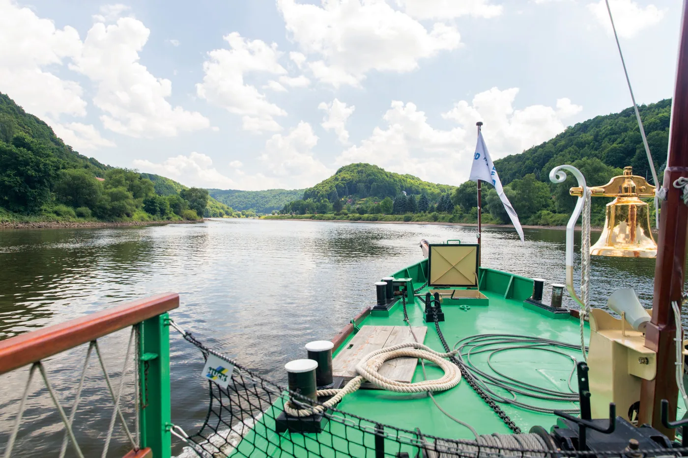
Bad Schandau: end-of-the-day paddle steamer round trip (line 33)

An hour and a half on a historic paddle steamer of the Weiße Flotte from Bad Schandau. Depending on the water level, the boat passes the Schrammsteine and the Seven Brothers houses in Postelwitz; otherwise it heads for Königstein with a view of the fortress and the Lilienstein.

4.3 out of 5 stars115 reviews on GetYourGuidefrom €28as of 8 Oct

  • 1.5 hours
  • Fridays and Saturdays, May to October
  • Audio commentary on board
  • Provider: Weiße Flotte Sachsen

Start Bad Schandau, pier below Dampfschiffstraße; the trip runs as line 33.

View offer ↗Ad · partner link · checked 3 Oct 2026

You see the rocks from the water; there is no shore excursion. The trip with audio commentary via on-board announcements or app is included, travel to the pier is not. In very high or low water, the timetable, route or direction can change or trips can be cancelled. Free cancellation up to 24 hours in advance. Provider's product photo · GetYourGuide

Ad · we may earn a commission if you book through this partner link – at no extra cost to you. Thank you for supporting the atlas. Offer details checked 3 Oct 2026. See official prices.

03 · Nearby

Onward from here

The Affensteine lie in Saxon Switzerland National Park between the Schrammsteine and the Kirnitzsch valley. Rules, trails and the park's other sights are in the park profile.

Photo: René Schröder ↗ · CC BY-SA 4.0 ↗

Map

Affensteine & Carolafelsen on the terrain map

Eight points between the Kirnitzsch valley and the Carolafelsen, each verified against an OpenStreetMap object. All points are on the Saxon Switzerland National Park map, with details and photos.

Show on mapSaxon Switzerland National Park map · 3D terrain

Field book · Affensteine & Carolafelsen

checked 3 Oct 2026

01Rules: good to know

What applies in the Affensteine.

Stay on the paths

The loop lies in the national park: you must not leave the paths, and dogs stay on a lead. Violations can be fined.

Saxon Switzerland tourism association: "Heaven and Hell" (loop from Nasser Grund) ↗

Climbers' access paths are not hiking trails

Black triangles on a white background mark access paths to the climbing rocks. They are meant for climbers, not for hikers.

National park authority: climbing in the national park ↗

Ten boofen for climbers

The authority lists ten approved boofen in the Affensteine. Sleeping there is only allowed from 16 June to 31 January and only in connection with climbing; fire, including stoves, is prohibited.

National park authority: list of approved boofen (PDF) ↗

Location relative to the park boundary

Based on the park boundary in OpenStreetMap, the Carolafelsen, the Wilde Hölle, the Häntzschelstiege and the Nasser Grund and Beuthenfall stops lie inside the national park. According to OpenStreetMap the Carolafelsen lies outside the core zone.

OpenStreetMap: boundary of Saxon Switzerland National Park ↗

02Affensteine & Carolafelsen: frequently asked questions

Short answers, with sources.

How do I get to the Carolafelsen?

Only on foot. The tourism association's loop starts at the Nasser Grund stop in the Kirnitzsch valley, reached by the Kirnitzschtal tram or bus 241, and climbs via the Jordanweg, Kleine Domstiege and Zurückesteig.

Saxon Switzerland tourism association: "Heaven and Hell" (loop from Nasser Grund) ↗

How long is the hike to the Carolafelsen?

The "Heaven and Hell" loop is 7.10 kilometres (4.4 mi) long with 340 metres of ascent and takes about 2:30 hours. Its highest point is at 452 metres.

Saxon Switzerland tourism association: "Heaven and Hell" (loop from Nasser Grund) ↗

Do you need a via ferrata set for the Häntzschelstiege?

According to the tourism association, the Häntzschelstiege is the only ladder route in Saxon Switzerland where you can clip in with a via ferrata set as in the Alps. The Aktiv Zentrum in Bad Schandau rents out sets with helmets.

Saxon Switzerland tourism association, Elbe Sandstone blog: what exactly is a Stiege? ↗

Is the Wilde Hölle suitable for children?

Not for small children or dogs. The tourism association mentions scrambling passages with a risk of falling and requires a head for heights and sure footing, especially when wet.

Saxon Switzerland tourism association: "Heaven and Hell" (loop from Nasser Grund) ↗

Are the Affensteine closed after the 2026 storm?

No. The forest closure after the storm of 31 July 2026 affects the area between Rathen and Hohnstein. In the Affensteine only the Eulentilke is reported as impassable; the Jordanweg is the alternative route.

National park authority: all active trail closures ↗

Is there an entrance fee for the Carolafelsen?

No. The viewpoint is freely accessible and always open. You only pay for getting there and parking, for example €7.00 for a single ride on the Kirnitzschtal tram.

Saxon Switzerland tourism association: Carolafelsen viewpoint ↗

03Sources and last checked

Operator, municipality and park authority, each fact cited individually.

Places on the map

  • Carolafelsen Viewpoint

    The great viewpoint of the Affensteine, above the Großer Dom. Point-in-polygon check against the OpenStreetMap boundary: inside the national park, about 1.7 kilometres (1.1 mi) from the boundary. According to OpenStreetMap outside the core zone.

    Location source ↗
  • Wilde Hölle, upper exit Gorge with iron rungs

    The national park authority's rescue point at the upper end of the gorge, just under 100 metres from the Carolafelsen. Steps and iron rungs lead down.

    Location source ↗
  • Häntzschelstiege Via ferrata, grade B

    Two-part ladder route up from the foot of the Bloßstock, secured with a steel cable. Inside the national park, a good two kilometres from the boundary.

    Location source ↗
  • Obere Affensteinpromenade High-level path

    The high-level path across the Affensteine. According to OpenStreetMap it meets the Häntzschelstiege between the lower and upper sections; the ascent through the Wilde Hölle also crosses it.

    Location source ↗
  • Eulentilke junction Impassable

    Since its notice of 25 November 2025 the authority has listed the Eulentilke as impassable because of the risk of falling trees; the alternative is the Jordanweg.

    Location source ↗
  • Nasser Grund stop Start of the loop

    Stop for the Kirnitzschtal tram and bus 241, with a pay car park; start and finish of the tourism association's loop. Inside the national park.

    Location source ↗
  • Beuthenfall stop Kirnitzschtal tram

    The next tram stop up the valley, named after the small waterfall next to it. Inside the national park.

    Location source ↗
  • Affensteine Climbing area

    The Affensteine climbing area with numerous summits; some are closed during the breeding season.

    Location source ↗
  1. Saxon Switzerland tourism association: Carolafelsen viewpoint ↗
  2. Saxon Switzerland tourism association: "Heaven and Hell" (loop from Nasser Grund) ↗
  3. Saxon Switzerland tourism association, Elbe Sandstone blog: what exactly is a Stiege? ↗
  4. German Alpine Club, Dresden section (Outdooractive): short via ferrata tour to the Häntzschelstiege ↗
  5. Town of Bad Schandau, Aktiv Zentrum: rental of via ferrata sets with helmet ↗
  6. National park authority: all active trail closures ↗
  7. National park authority: Eulentilke impassable (notice of 25 Nov 2025) ↗
  8. National park authority: forest closure after the storm between Rathen and Hohnstein ↗
  9. National park authority: summit closures for species protection (as of 6 Jul 2026, PDF) ↗
  10. National park authority: sleeping outdoors and boofen ↗
  11. National park authority: list of approved boofen (PDF) ↗
  12. National park authority: climbing in the national park ↗
  13. RVSOE: Kirnitzschtal tram ↗
  14. RVSOE: Kirnitzschtal tram timetable and fares ↗
  15. OpenStreetMap: boundary of Saxon Switzerland National Park ↗
  16. RVSOE: Kirnitzschtal tram summer timetable 28 Mar–1 Nov 2026 (PDF) ↗
  17. OpenStreetMap: core zone of Saxon Switzerland National Park ↗

How current is this information?

Researched 3 Oct 2026. Not a live status. Prices, timetables and opening hours change; please check with the operator before you travel.

Current information from the operator ↗

Image and map credits

Location sources: every point on the map links to the OpenStreetMap object its coordinate comes from. Markers do not imply that access is permitted.

End of the field book · Park authority ↗