National Parks Atlas
To the park
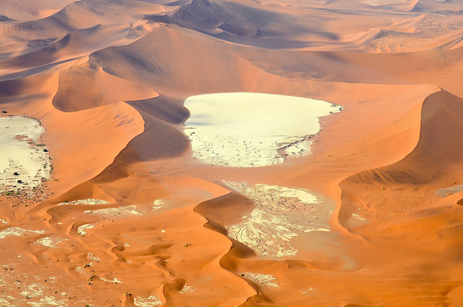
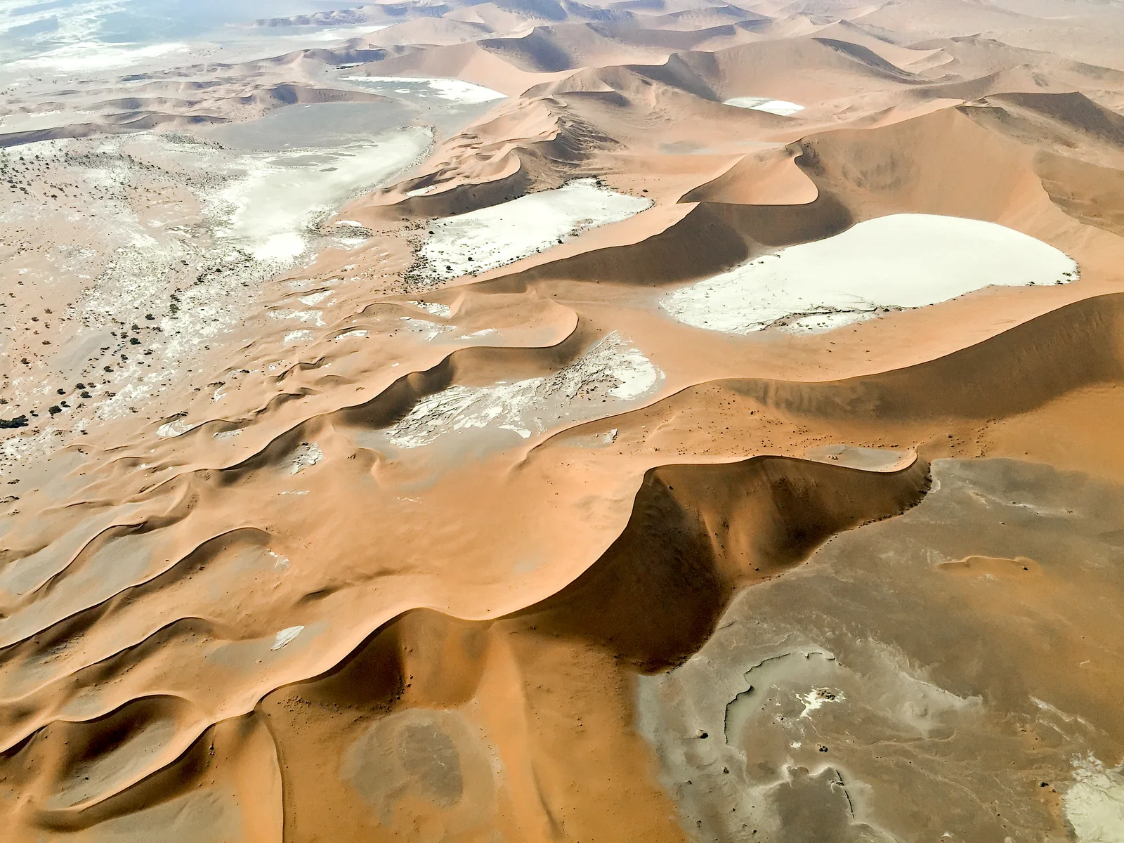
Aerial view of Sossusvlei in Namib-Naukluft National Park: pale clay pans between red star dunes

Sossusvlei (Namib-Naukluft National Park): map

14 places with verified coordinates · 4 with photo

Offers in the park · 3

Ad · partner links: we may earn a commission if you book – at no extra cost to you. Thank you for supporting the atlas. Offer details checked 9 Oct 2026; dates and prices with the provider.

Arrival · The only entrance to Sossusvlei

Sesriem gate

The road to the vlei starts here. The environment ministry’s office next to it issues the permit.

Own page

Deadvlei

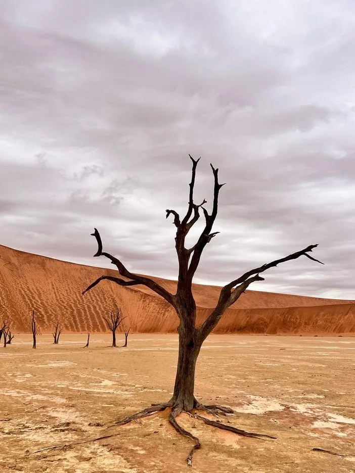
White clay, black tree skeletons, red dunes: the camel thorn trees of Deadvlei are 500 to 600 years old.

Getting there & walk

Visiting Sossusvlei: gate, road, sand

One gate, one road

Everything starts at the Sesriem gate. From there a road runs around 60 kilometres (37 mi) west to the 2×4 car park; according to Namibia’s report to UNESCO, the Roads Authority has managed it as a paved road since March 2005.

Namibia to UNESCO: Periodic Report Namib Sand Sea (visitor numbers, permitted dunes) ↗

Sossusvlei entry fees: N$280 per day, N$60 per car

Rates since 1 April 2026

The ministry’s fee table puts Namib-Naukluft National Park (except Sandwich Harbour) in the most expensive group. Foreign visitors aged 16 and over pay N$140 park entry plus N$140 conservation fee, N$280 in total. Children above 8 and under 16 pay N$180; up to 8 years, entry is free.

MEFT: Park Entrance and Conservation Fees from 1 April 2026 (PDF, read from the table image on 9 Oct 2026) ↗

Best time: sunrise, and never in the midday heat

Gate times: sunrise to sunset

According to NWR’s terms and conditions, park gates open at sunrise and close at sunset. Neither the ministry nor NWR publishes fixed clock times for Sesriem; they follow the sun.

NWR: terms and conditions, section 23.4 park fees and gates ↗

Park rules: roads, daylight, respect

Not after sunset

Leaving a camp before sunrise or reaching it after sunset is prohibited, as is crossing the park boundary in between.

MEFT: park regulations, Part F Conditions (PDF) ↗

Open in OpenStreetMap ↗Location source ↗

-24.48648, 15.79887

Nature · Environment ministry office

Sesriem permit office

According to the ministry, the office at Sesriem issues permits for Namib-Naukluft National Park.

Sossusvlei entry fees: N$280 per day, N$60 per car

Permits only at the gate

All Namibian national parks issue the permit on arrival, says the ministry; the office at Sesriem is responsible for Namib-Naukluft National Park. NWR itself does not issue permits.

MEFT: FAQs, section on park permits ↗

Park rules: roads, daylight, respect

Report your arrival

The regulations require you to report your arrival in the park immediately at the nearest park office. At Sesriem this happens when you get your permit at the gate.

MEFT: park regulations, Part F Conditions (PDF) ↗

Open in OpenStreetMap ↗Location source ↗

-24.48620, 15.79922

Where to stay · NWR campsite at the gate

Sesriem Campsite

44 pitches for up to eight people each, plus a shop and filling station.

Getting to Sesriem: rental car and gravel roads

334 kilometres from Windhoek

NWR gives 334 kilometres (208 mi) from Windhoek to Sesriem Campsite, 340 to Sossus Dune Lodge and 253 kilometres to Naukluft Camp.

NWR: Sesriem Campsite (pitches, filling station, shuttle, rates July 2026 to June 2027) ↗

Getting to Sesriem: rental car and gravel roads

Do not leave fuel to chance

The German Foreign Office warns that fuel at NWR lodges is not guaranteed. NWR lists a filling station at Sesriem Campsite; fill up beforehand anyway.

German Foreign Office: Namibia, travel and safety advice (valid since 17 Sep 2026) ↗

Where to stay inside the park: three NWR camps

Sesriem Campsite

44 pitches for up to eight people and six overflow pitches, with a shop and filling station. NWR charges N$670 per person per night, the same from July 2026 to June 2027.

NWR: Sesriem Campsite (pitches, filling station, shuttle, rates July 2026 to June 2027) ↗

Open in OpenStreetMap ↗Location source ↗

-24.48493, 15.79739

Where to stay · NWR lodge inside the park

Sossus Dune Lodge

25 chalets facing the dunes or the canyon. According to NWR its guests reach the vlei before sunrise.

Best time: sunrise, and never in the midday heat

Earlier entry only with a room inside the park

NWR writes that guests of Sossus Dune Lodge inside the park can reach the vlei before sunrise and stay until after sunset. We found no official time for this inner gate from either the ministry or NWR.

NWR: Sossus Dune Lodge (location inside the park, excursions, rates) ↗

Where to stay inside the park: three NWR camps

Sossus Dune Lodge

23 chalets and two honeymoon suites, with breakfast and dinner. From July to October 2026 a chalet costs N$7,000 per person sharing, from November 2026 to June 2027 N$4,030.

NWR: Sossus Dune Lodge (location inside the park, excursions, rates) ↗

Open in OpenStreetMap ↗Location source ↗

-24.50672, 15.78905

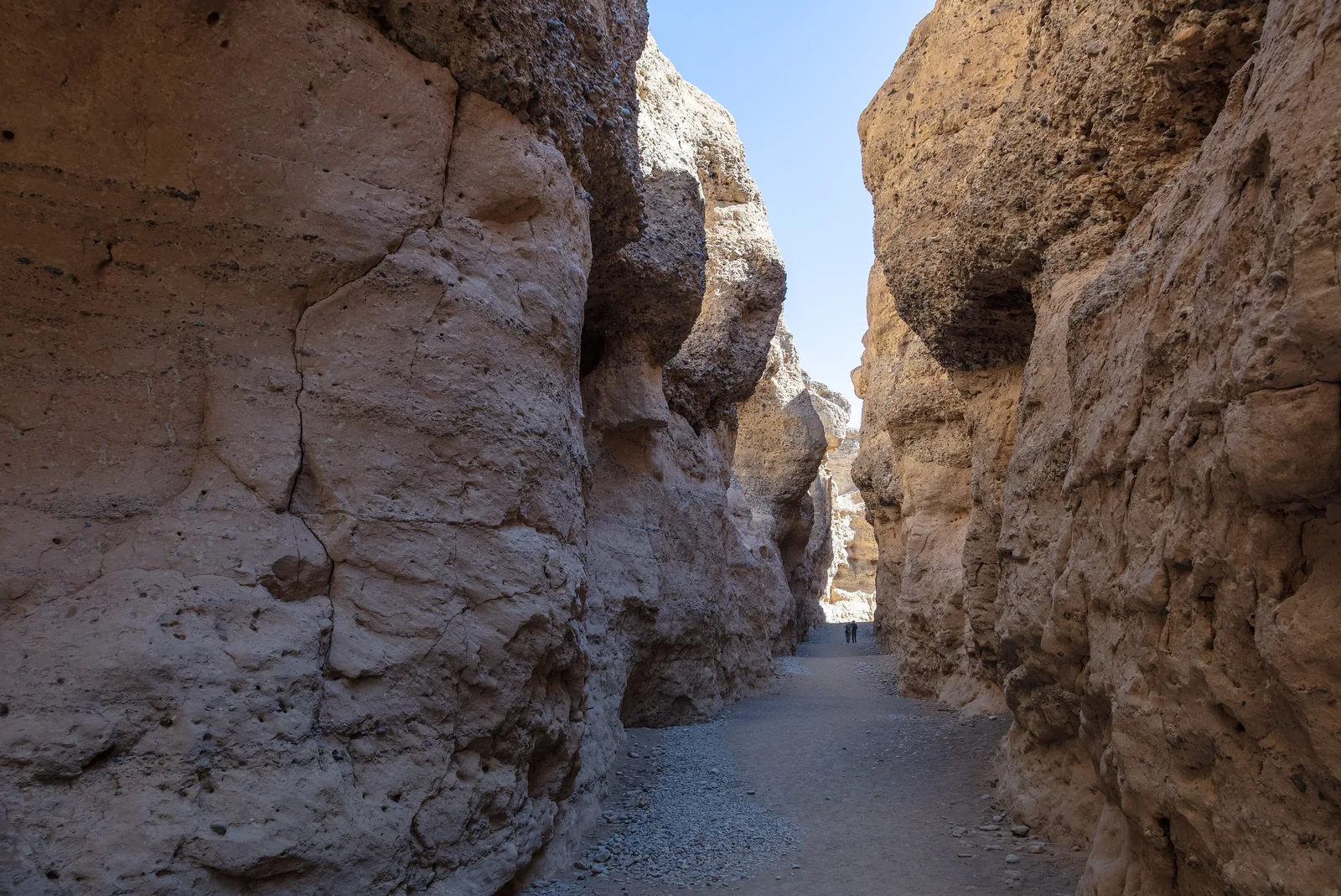
Steep conglomerate walls in Sesriem Canyon in Namib-Naukluft National Park, a dry riverbed at the bottom
Photo: Diego Delso ↗ · CC BY-SA 4.0 ↗

Mountains & rock · Gorge of the Tsauchab

Sesriem Canyon

About one kilometre long and 30 to 40 metres deep, with pools after good rains.

A narrow gorge cut into the gravel by the Tsauchab.

Length
about 1 km (0.6 mi)
Depth
30 to 40 m (98 to 131 ft)
Name
six thongs
Location
near the Sesriem gate

Deadvlei, Dune 45, Sesriem Canyon: walks and tours

Sesriem Canyon

According to NWR the gorge is about one kilometre long and 30 to 40 metres deep; after good rains there are pools at the bottom. It was named by settlers who knotted six rawhide thongs (riems) together to draw up water.

NWR: Sesriem Campsite (pitches, filling station, shuttle, rates July 2026 to June 2027) ↗

Open in OpenStreetMap ↗Location source ↗

-24.51914, 15.79893

Mountains & rock · Dune near Sesriem

Elim Dune

NWR drives here in the evening from Sesriem Campsite.

Deadvlei, Dune 45, Sesriem Canyon: walks and tours

NWR excursions

At Sesriem Campsite NWR sells a sunset drive to Elim Dune for N$300, a canyon drive for N$200, guided morning drives for N$600 (N$700 with breakfast) and a shuttle for 2×4 drivers to Deadvlei for N$180 per person.

NWR: Sesriem Campsite (pitches, filling station, shuttle, rates July 2026 to June 2027) ↗

Open in OpenStreetMap ↗Location source ↗

-24.45048, 15.76658

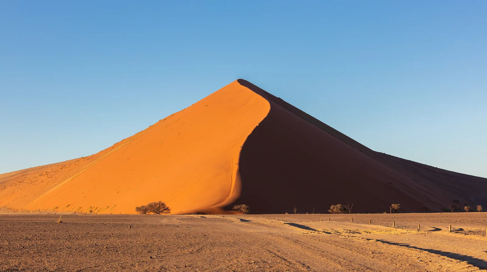
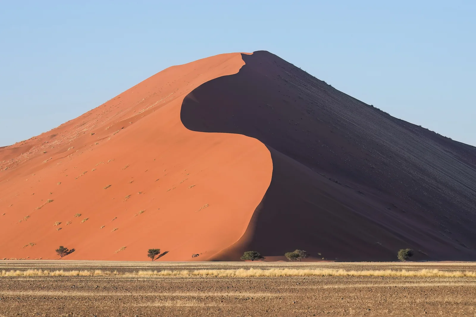
The red star dune Dune 45 in Namib-Naukluft National Park at sunrise, one side in shadow, flat plain in front
Photo: Giles Laurent ↗ · CC BY-SA 4.0 ↗

Mountains & rock · Star dune right by the road

Dune 45

About 45 kilometres beyond the gate. One of the four dunes the ministry allows visitors to climb.

The permitted dune right by the road.

Location
around 45 km (28 mi) beyond the gate
Climbing
permitted
Access
normal car
Relief
Dune 40 planned

Deadvlei, Dune 45, Sesriem Canyon: walks and tours

Only four dunes may be climbed

According to the report to UNESCO, the ministry allows visitors only on Dune 45, Big Daddy, Big Mama and Sossusvlei; Dune 40 is to be added to relieve Dune 45. Please do not climb other dunes.

Namibia to UNESCO: Periodic Report Namib Sand Sea (visitor numbers, permitted dunes) ↗

Open in OpenStreetMap ↗Location source ↗

-24.72957, 15.47196

Trails · End of the road for normal cars

2×4 car park

The tar and two-wheel drive end here. Beyond, you continue by 4×4 or shuttle.

Own page

Deadvlei

White clay, black tree skeletons, red dunes: the camel thorn trees of Deadvlei are 500 to 600 years old.

Getting there & walk

Visiting Sossusvlei: gate, road, sand

The last stretch is sand

Beyond the 2×4 car park, deep sand continues to the 4×4 car park near Deadvlei. According to the concessionaire you can only continue in a 4×4; without one, take the shuttle.

Concessionaire About Adelt Sossusvlei Concession Management: FAQ (read in the browser on 9 Oct 2026) ↗

Deadvlei, Dune 45, Sesriem Canyon: walks and tours

Shuttle from the 2×4 car park

The concessionaire drives 4×4 vehicles from the 2×4 car park to Deadvlei. You book online with a date and time slot, or on site depending on availability; in peak season it recommends booking ahead.

Concessionaire About Adelt Sossusvlei Concession Management: FAQ (read in the browser on 9 Oct 2026) ↗

Park rules: roads, daylight, respect

Since May 2026: 4×4 or shuttle

According to the ministry’s public notice of 2 May 2026, self-drivers in 4×4 vehicles and registered tour guides may drive to Deadvlei; the shuttle is optional, buses and trucks are excluded. A version from the day before had still excluded self-drivers.

Tourism Update: MEFT public notice of 2 May 2026 on access to Deadvlei ↗

Open in OpenStreetMap ↗Location source ↗

-24.73004, 15.32261

Water · Pan away from the road

Hidden Vlei

On foot from the 2×4 car park through the dunes.

Own page

Deadvlei

White clay, black tree skeletons, red dunes: the camel thorn trees of Deadvlei are 500 to 600 years old.

Getting there & walk

Open in OpenStreetMap ↗Location source ↗

-24.75345, 15.32816

Water · The pan at the end of the Tsauchab

Sossusvlei

Fills only when the Tsauchab flows this far after heavy rain.

Own page

Deadvlei

White clay, black tree skeletons, red dunes: the camel thorn trees of Deadvlei are 500 to 600 years old.

Getting there & walk

Visiting Sossusvlei: gate, road, sand

Dunes up to 325 metres

According to NWR the star dunes at Sossusvlei are among the highest in the world, up to 325 metres (1,066 ft) measured from their base. They are highest where the Tsauchab River enters the vlei.

NWR: Namib-Naukluft Park (dunes up to 325 m, Deadvlei, Naukluft) ↗

Best time: sunrise, and never in the midday heat

When the vlei fills

When there is enough rain inland, the Tsauchab flows all the way into Sossusvlei and fills the main pan; then, according to NWR, flamingos and other water birds arrive.

NWR: Namib-Naukluft Park (dunes up to 325 m, Deadvlei, Naukluft) ↗

Open in OpenStreetMap ↗Location source ↗

-24.73950, 15.29017

Trails · Starting point for Deadvlei

Deadvlei 4×4 car park

End of the sand track and the shuttle; from here on foot to Deadvlei and up Big Daddy.

Own page

Deadvlei

White clay, black tree skeletons, red dunes: the camel thorn trees of Deadvlei are 500 to 600 years old.

Getting there & walk

Open in OpenStreetMap ↗Location source ↗

-24.74765, 15.29066

Deadvlei in Namib-Naukluft National Park from the air: a white clay pan with dark dots of trees between red dunes
Photo: Olga Ernst & Hp.Baumeler ↗ · CC BY-SA 4.0 ↗

Water · White clay pan with dead camel thorn trees

Deadvlei

According to NWR the trees are 500 to 600 years old.

A white clay pan, black tree skeletons, red dunes behind.

Age of the trees
500 to 600 years
Tree species
Camel thorn
Access
4×4 or shuttle
Dune next to it
Big Daddy

Own page

Deadvlei

White clay, black tree skeletons, red dunes: the camel thorn trees of Deadvlei are 500 to 600 years old.

What a day at Deadvlei costs
Park fee, foreign visitors aged 16 and over, per dayN$280
Children above 8 and under 16, per dayN$180
SADC nationals / Namibians, adults, per dayN$180 / N$60

Getting there & walk

Best time: sunrise, and never in the midday heat

Light and heat

Water, a hat and sun protection belong in every backpack: the German Foreign Office warns of intense sunlight in Namibia. Staying inside the park gets you to the vlei earlier and helps you avoid the midday hours.

German Foreign Office: Namibia, travel and safety advice (valid since 17 Sep 2026) ↗

Deadvlei, Dune 45, Sesriem Canyon: walks and tours

Deadvlei on foot

From the 4×4 car park you walk across the sand into the white pan with the dead camel thorn trees. Everything about the route is on its own page.

NWR: Namib-Naukluft Park (dunes up to 325 m, Deadvlei, Naukluft) ↗

Park rules: roads, daylight, respect

Take nothing, leave nothing

Picking or digging up plants, disturbing animals and dropping litter are prohibited. In Deadvlei that means: do not touch or climb the trees.

MEFT: park regulations, Part F Conditions (PDF) ↗

Open in OpenStreetMap ↗Location source ↗

-24.76293, 15.29488

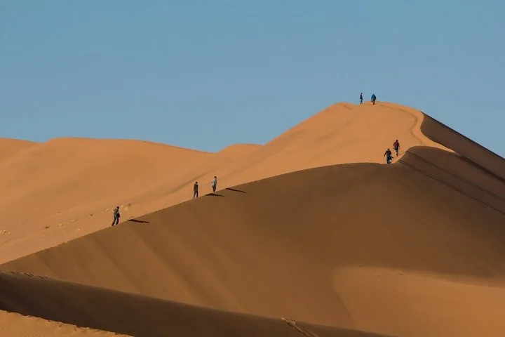
The long crest of the Big Daddy dune in Namib-Naukluft National Park, with the Deadvlei pan at its foot
Photo: Eric Bézine ↗ · CC BY-SA 3.0 ↗

Mountains & rock · Dune above Deadvlei

Big Daddy

Open for climbing, up along the crest.

The great dune above Deadvlei.

Climbing
permitted
Start
4×4 car park
Next to it
Deadvlei
Official height
not given

Own page

Deadvlei

White clay, black tree skeletons, red dunes: the camel thorn trees of Deadvlei are 500 to 600 years old.

Getting there & walk

Open in OpenStreetMap ↗Location source ↗

-24.76848, 15.30304

Where to stay · NWR camp in the Naukluft Mountains

Naukluft Camp

Starting point of the hiking trails in the Naukluft section, 100 kilometres (62 mi) from Sossusvlei according to NWR.

Deadvlei, Dune 45, Sesriem Canyon: walks and tours

Naukluft on foot

In the mountain section of the park, the Olive Trail, 10 kilometres (6.2 mi) in about four hours, and the Waterkluft Trail, 17 kilometres (10.6 mi) in six to seven hours, start at Naukluft Camp. The Naukluft Hiking Trail takes four or eight days, for three to twelve people.

NWR: Naukluft Camp (hiking trails, rates) ↗

Where to stay inside the park: three NWR camps

Naukluft Camp

Six chalets and 21 pitches in the mountains. The Bush Chalet costs N$2,000 per person sharing with breakfast (from November N$1,450), a pitch N$460 per person.

NWR: Naukluft Camp (hiking trails, rates) ↗

Nature: sand dunes, fog and oryx

The Naukluft Mountains

The mountain section was created as a sanctuary for Hartmann’s mountain zebra. NWR describes folded layers of quartzite, dolomite and shale; black eagles nest on the cliffs.

NWR: Namib-Naukluft Park (dunes up to 325 m, Deadvlei, Naukluft) ↗

Open in OpenStreetMap ↗Location source ↗

-24.26551, 16.23918

Locations verified from the linked original sources and OpenStreetMap. The map shows no trails or park boundaries; markers do not imply that access is permitted.

Map: © OpenStreetMap contributors, OpenMapTiles, OpenFreeMap. Elevation: Terrain Tiles (Mapzen, AWS Open Data); 3DEP, GMTED2010 and SRTM courtesy of the U.S. Geological Survey; EU-DEM (Copernicus, European Union); ETOPO1 (NOAA); ArcticDEM (NSF, DigitalGlobe); Geoscience Australia; Open Data Austria (DGM); Open Government Licence – Canada; INEGI; Land Information New Zealand; Kartverket; Environment Agency (UK).

Park photo: Photo: Hp.Baumeler & Dominique Bucher ↗ · CC BY-SA 4.0 ↗

Loading map …