National Parks Atlas
To the park
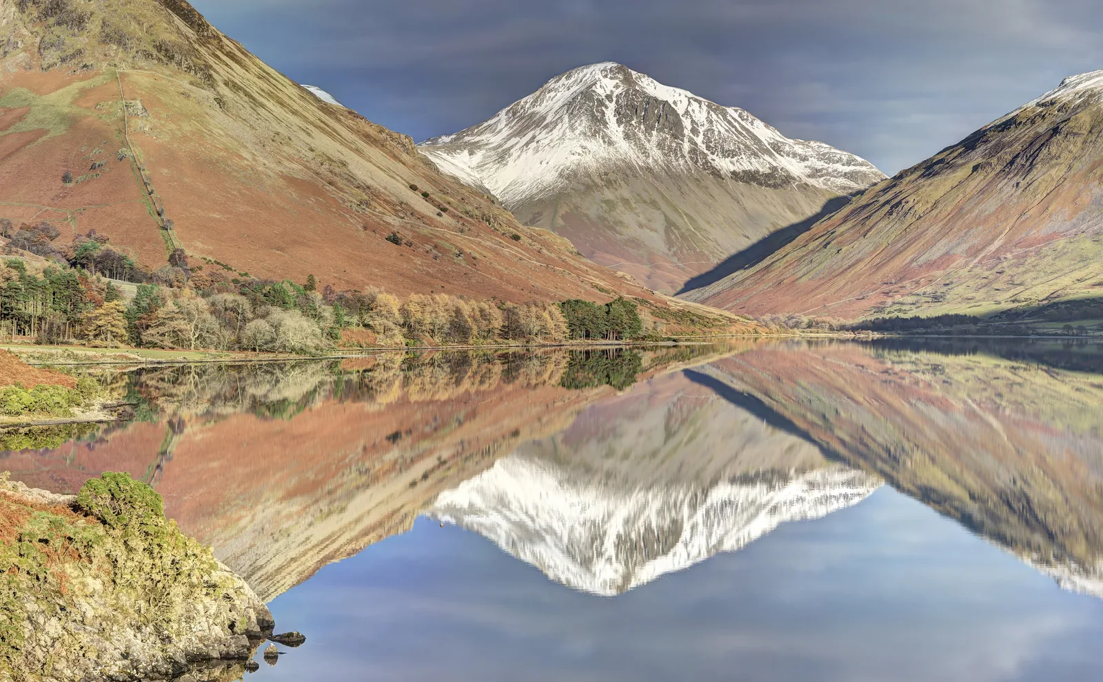
Wast Water in the Lake District National Park reflecting the fells at Wasdale Head, with the snow-covered summit of Great Gable in the centre

Lake District National Park: map

16 places with verified coordinates · 2 with photo

Bookable in the park · 4

Ad · partner links: we may earn a commission if you book – at no extra cost to you. Thank you for supporting the atlas. Offer details checked 8 Oct 2026; dates and prices with the provider.

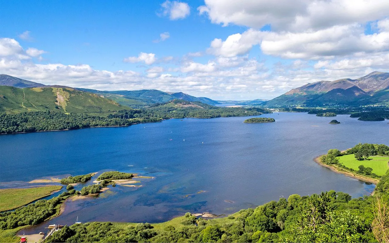
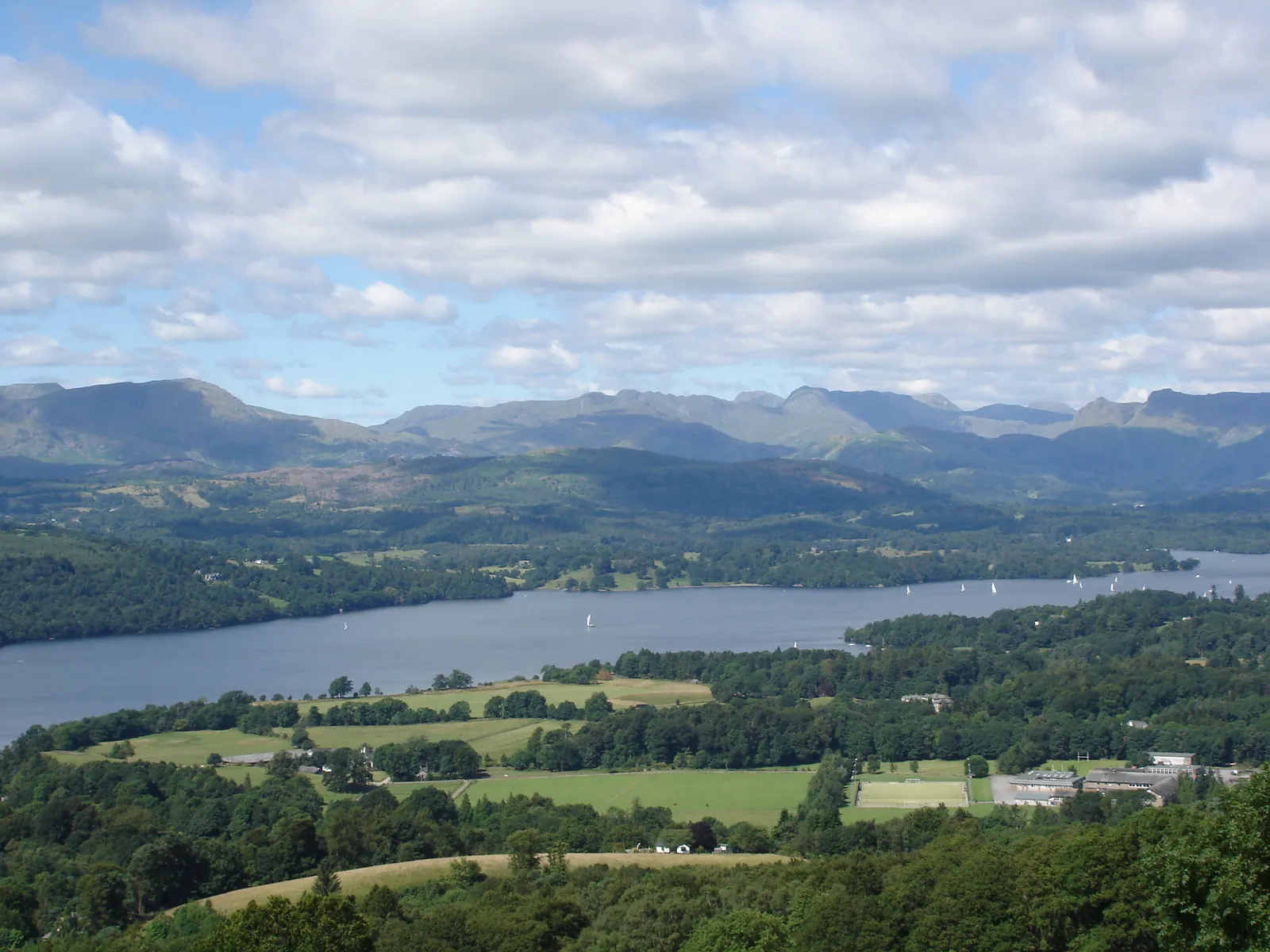
View from a hill over Windermere in the Lake District National Park, with meadows, woods and the fells beyond
Photo: Abbasi1111 ↗ · CC BY 3.0 ↗

Arrival · Railway station, end of the branch line from Oxenholme

Windermere

About half an hour from Oxenholme; just over 2 km to the lake, or take bus 599.

England’s longest natural lake – and where most visitors arrive.

Length
10.5 miles (17–18 km)
Depth
64 m (210 ft)
Islands
18
Boats
Windermere Lake Cruises

Own page

Windermere

England’s largest natural lake – with steamers, islands and the railway station just above the shore.

Windermere Lake Cruises sailings, valid 28 Mar to 1 Nov 2026
Red Cruise Bowness – Ambleside, return19,20 £ / 11,60 £ / 55 £
Islands (Blue) Cruise from Bowness, 45 minutes14,80 £ / 7,40 £ / 40 £

Boats & getting there

How to get there: by train via Oxenholme to Windermere

Train to Windermere

Change at Oxenholme on the West Coast Main Line; the branch line to Windermere takes about half an hour according to the National Park Authority. There is a direct train from Manchester to Windermere.

LDNPA: Explore Windermere and Ambleside (lake, Oxenholme–Windermere line, ferry) ↗

Guided from here · Ad

Partner links: we may earn a commission if you book – at no extra cost to you. Thank you for supporting the atlas. Dates and prices with the provider.

Open in OpenStreetMap ↗Location source ↗

54.37954, -2.90328

Arrival · Windermere Lake Cruises pier

Bowness Pier

The busiest pier on the lake, two minutes from Bowness village.

Own page

Windermere

England’s largest natural lake – with steamers, islands and the railway station just above the shore.

Boats & getting there

Free entry – you pay for parking

Boats cost extra

The Red Cruise between Bowness and Ambleside costs £19.20 return for adults, £11.60 for children and £55 for families (28 March to 1 November 2026). Windermere Lake Cruises is a private company.

Windermere Lake Cruises: Red Cruise, fares 28 Mar–1 Nov 2026 ↗

Things to do: lakes, fells and circular walks

Boats on Windermere

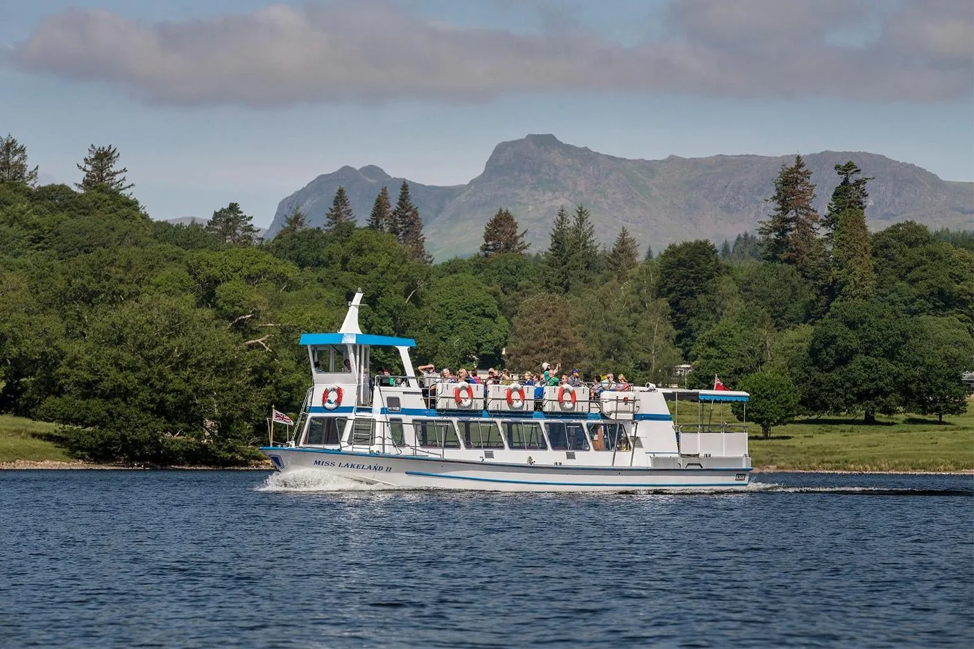
Windermere Lake Cruises calls at Lakeside, Bowness, Brockhole and Ambleside. The Red Cruise takes 35 minutes from Bowness to Ambleside; the non-stop round trip takes 75 minutes.

Windermere Lake Cruises: Red Cruise, fares 28 Mar–1 Nov 2026 ↗

Open in OpenStreetMap ↗Location source ↗

54.36284, -2.92286

Arrival · National Park information centre

Bowness Bay Information Centre

Glebe Road; daily in summer, 9:30 to 17:30.

Own page

Windermere

England’s largest natural lake – with steamers, islands and the railway station just above the shore.

Boats & getting there

Visiting the Lake District: lakes, fells and valleys

Contact: four information centres

The National Park Authority runs information centres in Bowness-on-Windermere, Glenridding by Ullswater, Hawkshead and Coniston, plus a pop-up in Keswick until the end of October 2026.

LDNPA: Information Centres (opening times 2026) ↗

Open in OpenStreetMap ↗Location source ↗

54.36193, -2.92325

Arrival · Pier at the northern end of the lake

Ambleside Pier (Waterhead)

Destination of the Red Cruise from Bowness, half a mile from Ambleside.

Own page

Windermere

England’s largest natural lake – with steamers, islands and the railway station just above the shore.

Boats & getting there

Open in OpenStreetMap ↗Location source ↗

54.41970, -2.96233

Arrival · Visitor centre on the east shore

Brockhole on Windermere

Lakeside gardens with a pier; boat passengers get free entry to the grounds.

Own page

Windermere

England’s largest natural lake – with steamers, islands and the railway station just above the shore.

Boats & getting there

Open in OpenStreetMap ↗Location source ↗

54.40006, -2.94306

Viewpoint · Viewpoint above Windermere

Orrest Head

Short climb from Windermere town.

Own page

Windermere

England’s largest natural lake – with steamers, islands and the railway station just above the shore.

Boats & getting there

Open in OpenStreetMap ↗Location source ↗

54.38632, -2.90352

Trails · 3.3 km (2 mi) circular walk around a man-made tarn

Tarn Hows

About 1.5 hours, suitable for many wheelchairs. Bus 505 to Hawkshead Hill.

Things to do: lakes, fells and circular walks

Tarn Hows: 3.3 km

A circular walk of about 1.5 hours around a tarn dammed in Victorian times, with views of the Coniston fells and the Langdale Pikes. Firm surface, steep in places.

LDNPA: Tarn Hows, circular route (Miles without Stiles) ↗

Open in OpenStreetMap ↗Location source ↗

54.39166, -3.03194

Mountains & rock · England’s highest mountain, 978 m (3,209 ft)

Scafell Pike

Above Wasdale and Wast Water; the road into the valley is narrow and single-track.

Things to do: lakes, fells and circular walks

Scafell Pike: 978 metres

England’s highest mountain looks down on Wast Water, England’s deepest lake at 74 m (243 ft). Wasdale can only be reached on narrow single-track roads; in summer the Wasdale Explorer bus runs.

LDNPA: Explore Wasdale, Wastwater and West Coast ↗

Open in OpenStreetMap ↗Location source ↗

54.45426, -3.21165

Nature · Hamlet at the head of Wast Water

Wasdale Head

Pub, St Olaf’s church and a starting point for the fells.

Open in OpenStreetMap ↗Location source ↗

54.46769, -3.25621

Arrival · Boat landing on Derwentwater

Keswick Launch

50-minute round trip around the lake with eight landing stages.

Open in OpenStreetMap ↗Location source ↗

54.59433, -3.14494

Mountains & rock · Small fell above Derwentwater

Cat Bells

Easy to combine with the boat from Keswick and parking in town.

Open in OpenStreetMap ↗Location source ↗

54.56835, -3.17066

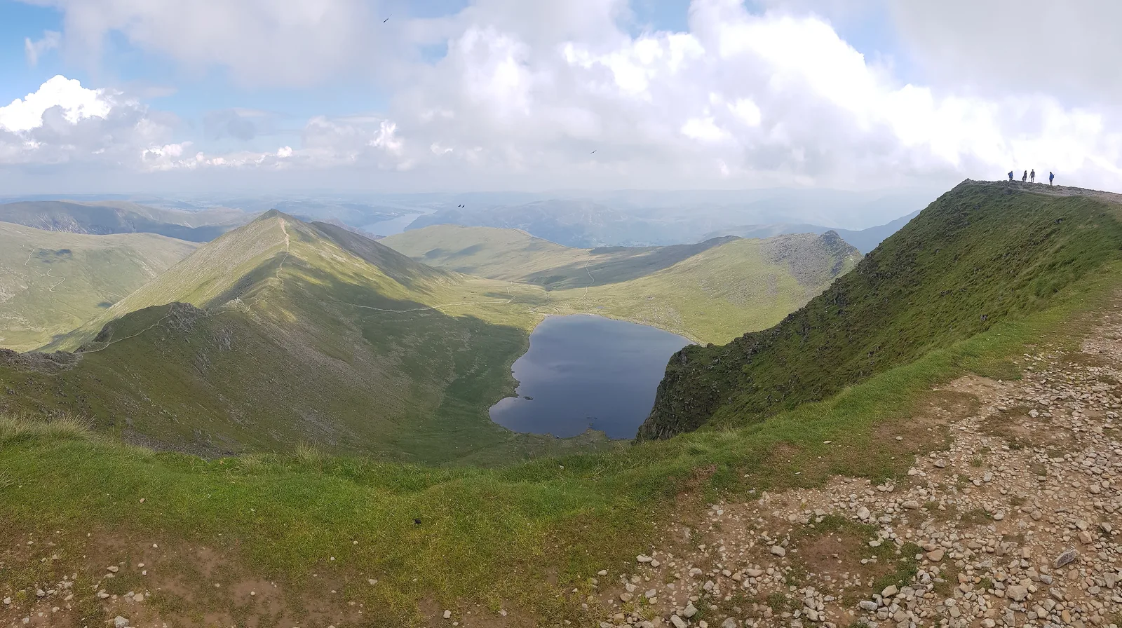
View from Helvellyn in the Lake District National Park down to the tarn Red Tarn between the ridges Swirral Edge and Striding Edge
Photo: Amakuru ↗ · CC BY-SA 4.0 ↗

Mountains & rock · Fell, 950 m (3,117 ft)

Helvellyn

In winter the National Park Authority reports summit conditions every day.

The fell where the National Park Authority records the weather every day in winter.

Helvellyn
950 m (3,117 ft)
Weatherline
December to April
Lake
Ullswater, 8.9 km²
Information centre
Glenridding

Best time to visit: March to October – with a waterproof

Winter on the fells

From December to April the National Park Authority’s Weatherline reports conditions on Helvellyn every day. In snow you need crampons, an ice axe and the experience to use them.

LDNPA: Lake District weather (seasons, Weatherline) ↗

Open in OpenStreetMap ↗Location source ↗

54.52697, -3.01754

Arrival · National Park information centre

Ullswater Information Centre

Beckside Car Park, Glenridding; daily in summer, 9:30 to 17:30.

Open in OpenStreetMap ↗Location source ↗

54.54376, -2.95060

Arrival · Ferry landing on the west shore

Ash Landing

The Windermere Ferry links Ferry Nab with the west shore.

Own page

Windermere

England’s largest natural lake – with steamers, islands and the railway station just above the shore.

Boats & getting there

Open in OpenStreetMap ↗Location source ↗

54.34943, -2.94333

History · Castle on the west shore

Wray Castle

Beatrix Potter spent childhood holidays here; parking with coins or app only.

Own page

Windermere

England’s largest natural lake – with steamers, islands and the railway station just above the shore.

Boats & getting there

Open in OpenStreetMap ↗Location source ↗

54.40061, -2.96432

Locations verified from the linked original sources and OpenStreetMap. The map shows no trails or park boundaries; markers do not imply that access is permitted.

Map: © OpenStreetMap contributors, OpenMapTiles, OpenFreeMap. Elevation: Terrain Tiles (Mapzen, AWS Open Data); 3DEP, GMTED2010 and SRTM courtesy of the U.S. Geological Survey; EU-DEM (Copernicus, European Union); ETOPO1 (NOAA); ArcticDEM (NSF, DigitalGlobe); Geoscience Australia; Open Data Austria (DGM); Open Government Licence – Canada; INEGI; Land Information New Zealand; Kartverket; Environment Agency (UK).

Park photo: Photo: John260660 ↗ · CC BY-SA 4.0 ↗

Loading map …