National Parks Atlas
To the park
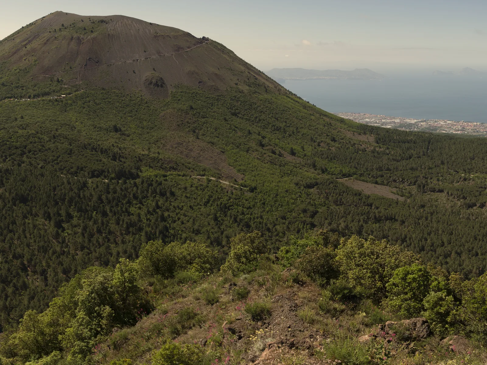
The cone of Vesuvius in Vesuvius National Park, seen from Monte Somma, with the Bay of Naples behind

Vesuvius: map

14 places with verified coordinates · 3 with photo

Bookable in the park · 3

Ad · partner links: we may earn a commission if you book – at no extra cost to you. Thank you for supporting the atlas. Offer details checked 8 Oct 2026; dates and prices with the provider.

Arrival · Volcanic cone, summit 1,277 m according to the park authority

Gran Cono (Vesuvius)

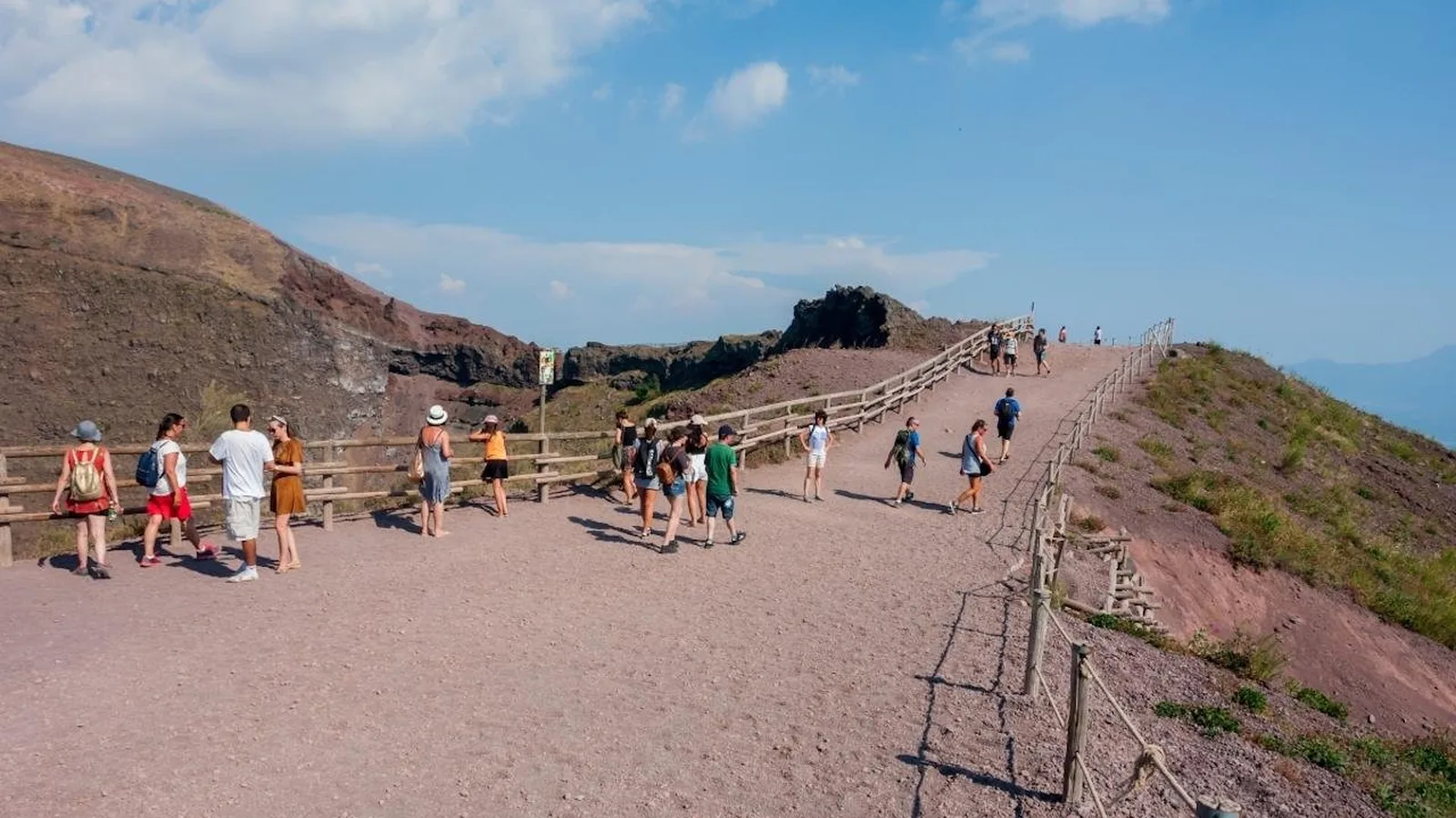
The cone inside the old crater of Monte Somma; visitors reach the crater rim at 1,175 m (3,855 ft).

Vesuvius National Park: the volcano above the Bay of Naples

The crater is only one part

Most visitors come for crater trail no. 5. The park has eleven trails over 54 km (34 mi), from the lava field into the woods of Monte Somma.

Park authority: the park's eleven trails and current closures (Italian) ↗

Tickets & entrance fees: free park, crater with a timed ticket

Crater trail: €11.68 online

Tickets for the Gran Cono are sold online only at vesuviopark.vivaticket.it, according to the park authority the only authorised seller: €11.68 full price, €9.55 reduced. The base price is €10 or €8.

Park authority: Il Gran Cono – tickets online only, time slots, entry times, directions, trail no. 5 (Italian) ↗

Rules on the crater trail and in the park

Summit closed

The upper crater rim on the north and east sides stays closed to visitors for safety and conservation reasons; only people authorised by the park authority may enter it.

Park authority: protocol for trail no. 5, annex to resolution no. 24 of 29 Jun 2026 (Italian, PDF) ↗

Open in OpenStreetMap ↗Location source ↗

40.82261, 14.42924

Arrival · Entrance to trail no. 5, terminus of bus 808

Piazzale Quota 1000

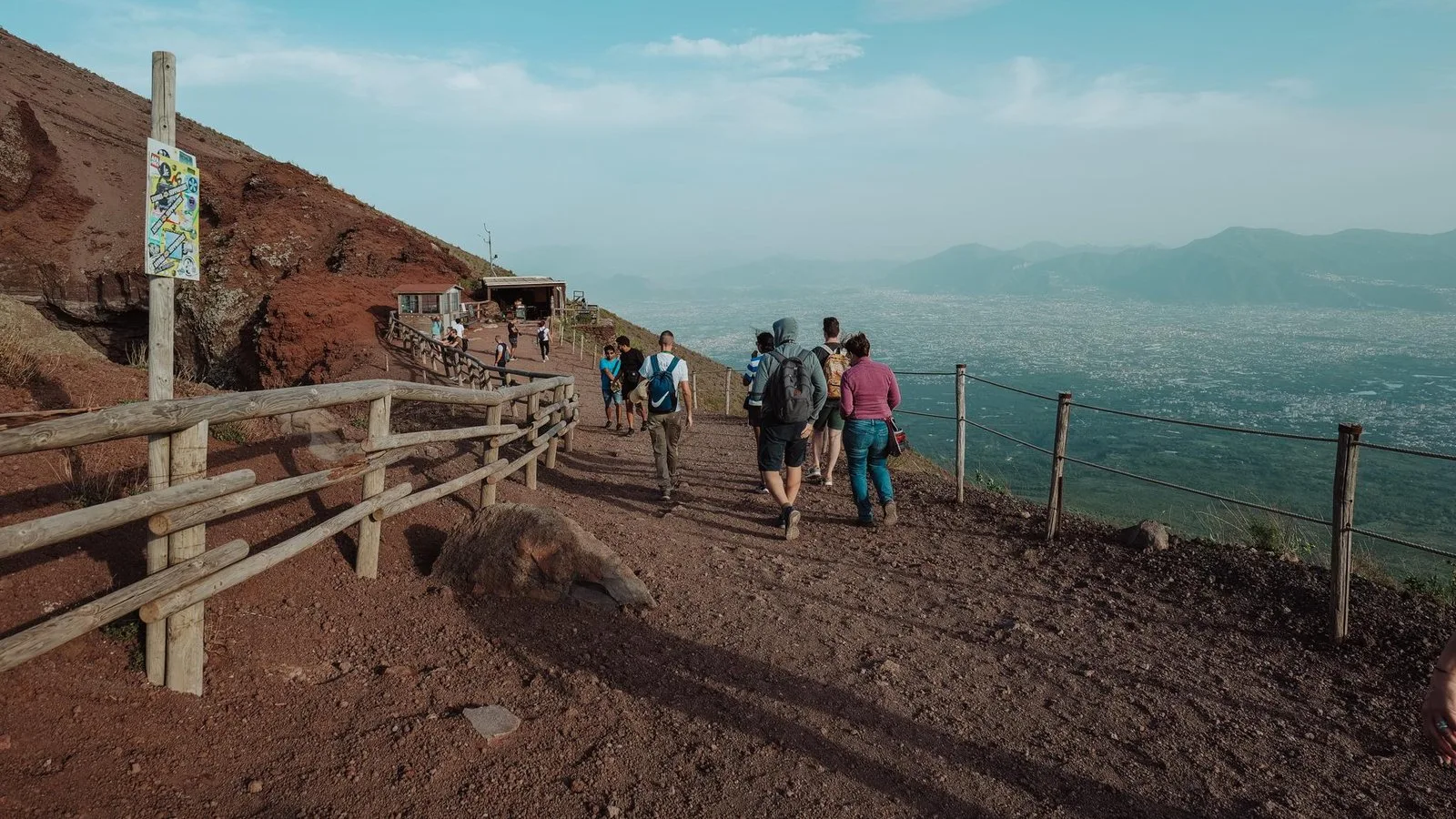
Turnstile to the crater; no parking, currently no public toilets.

How to get there: Circumvesuviana, bus 808 or car to Quota 800

Shuttle bus or 30 minutes on foot

From Quota 800 to the entrance, a shuttle bus run by the town of Ercolano takes about four minutes for €1 each way. On foot it is 1.8 km (1.1 mi) along the road, about 30 minutes.

Park authority: Il Gran Cono – tickets online only, time slots, entry times, directions, trail no. 5 (Italian) ↗

Best time to visit: spring and autumn

Entry from 9:00

Last entry to the crater is at 15:00 in January, February, November and December, at 16:00 in March and October, at 17:00 from April to June and in September, and at 18:00 in July and August.

Park authority: Il Gran Cono – tickets online only, time slots, entry times, directions, trail no. 5 (Italian) ↗

Where to stay near Vesuvius

Day trip only at the crater

Parking is not allowed at Piazzale Quota 1000, and the park authority currently reports no public toilets there. The crater is an excursion, not a place to stay.

Park authority: Il Gran Cono – tickets online only, time slots, entry times, directions, trail no. 5 (Italian) ↗

Open in OpenStreetMap ↗Location source ↗

40.82830, 14.42682

Nature · Car parks and shuttle bus

Bivio Quota 800

Private cars stop here; continue by shuttle bus or 1.8 km (1.1 mi) on foot.

How to get there: Circumvesuviana, bus 808 or car to Quota 800

By car to Quota 800

From the A3 motorway, exit Torre del Greco, the SP144 takes you to the car parks at Quota 800 in 15 minutes. Between Quota 800 and 1000 the road is closed to private cars; buses, taxis, hire cars with driver and motorcycles may continue.

Parking on Via Osservatorio (Ercolano municipality): rates, maximum 4 hours, traffic ban beyond Quota 800 (Italian) ↗

How to get there: Circumvesuviana, bus 808 or car to Quota 800

Parking: €7, maximum 4 hours

You buy the parking space in advance on parkingsuvio.it: cars with up to eight seats €7, motorcycles €3.50, for a maximum of four hours. The park authority advises buying the crater ticket first and the parking second.

Parking on Via Osservatorio (Ercolano municipality): rates, maximum 4 hours, traffic ban beyond Quota 800 (Italian) ↗

Open in OpenStreetMap ↗Location source ↗

40.82832, 14.41505

Mountains & rock · Nearest goal on the crater rim, 1,170 m

La Capannuccia

This is where the section of trail no. 5 that most visitors walk ends.

Hikes & routes: crater trail no. 5 and ten more

Trail no. 5: Il Gran Cono

4,010 m (2.5 mi) return, up to 1,175 m (3,855 ft), two and a half hours, easy but steep according to the park authority. Above 1,000 m everyone walks in groups of 20 with the guides of the Presidio Permanente Vulcano Vesuvio; this is included in the ticket.

Park authority: Il Gran Cono – tickets online only, time slots, entry times, directions, trail no. 5 (Italian) ↗

Open in OpenStreetMap ↗Location source ↗

40.81886, 14.42754

Where to stay · Former hut on trail no. 5

Rifugio Imbò

Junction of trails no. 5, 6 and 1.

Hikes & routes: crater trail no. 5 and ten more

Trail no. 6: La Strada Matrone

14.2 km (8.8 mi) on the old road built by the Matrone brothers from Trecase to the cone, on foot and by bike, free of charge. After the 2025 fire it has been open to bikes again since November 2025.

Park authority, 20 Nov 2025: trail no. 6 open again on foot and by bike (Italian) ↗

Open in OpenStreetMap ↗Location source ↗

40.82904, 14.43044

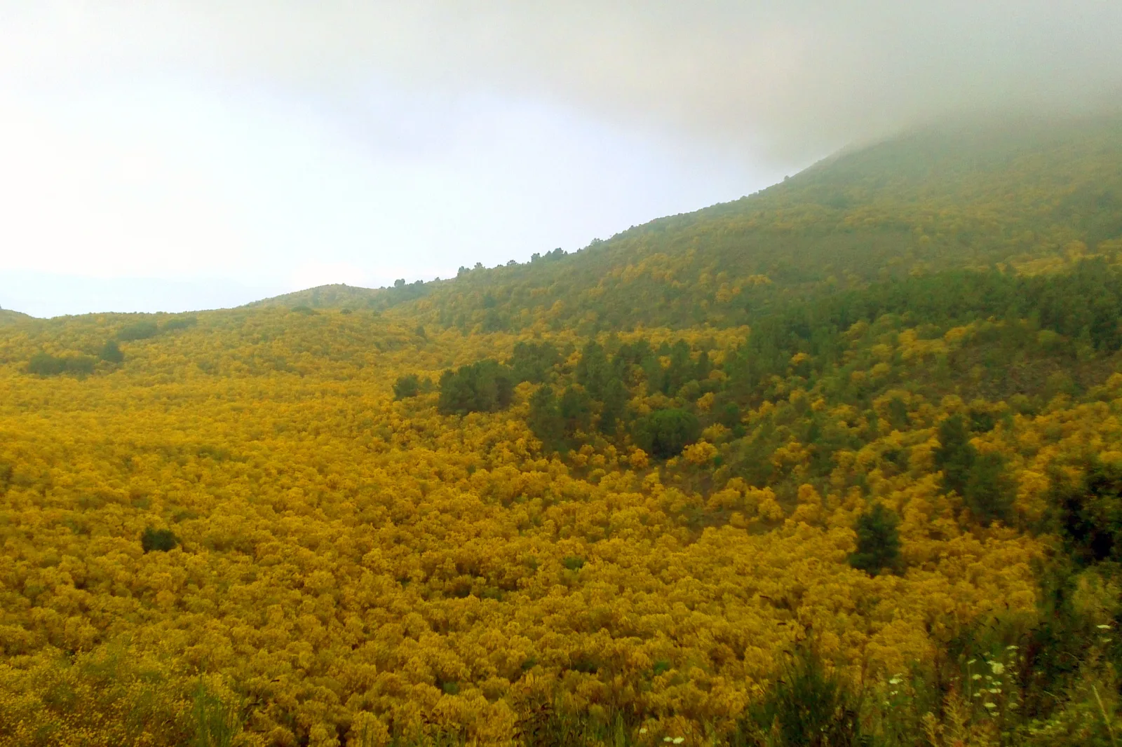
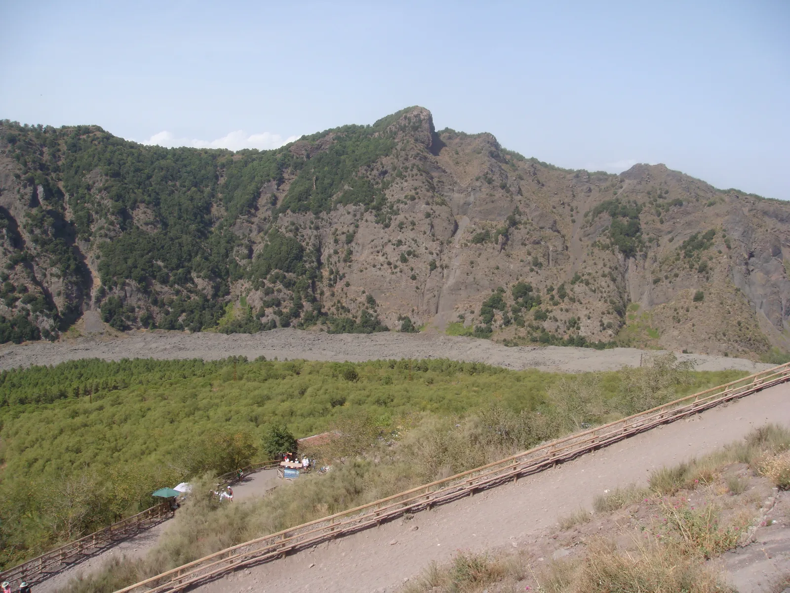
Flowering broom covers the Valle dell'Inferno in Vesuvius National Park, with the wooded slope above
Photo: Giuseppe Vernieri ↗ · CC BY 3.0 ↗

Nature · Valley between the cone and Monte Somma

Valle dell'Inferno

Broom, lava and rock walls on trail no. 1.

The valley between the cone and Monte Somma, yellow with broom in spring.

Coordinates
40.821372, 14.444398
Trail no. 1
12,390 m (7.7 mi) return
Walking time
7 hours
Start
Ottaviano

Best time to visit: spring and autumn

Broom in early summer

In spring, broom turns the slopes yellow. Spanish broom (ginestra odorosa) flowers from May to July, common broom from August to October.

Park authority: broom on Vesuvius (Italian) ↗

Hikes & routes: crater trail no. 5 and ten more

Trail no. 1: Valle dell'Inferno

12.4 km (7.7 mi), seven hours, hard because of its length: from Ottaviano through broom into the valley between the cone and Monte Somma, past the lava dome of 1937.

Park authority: trail no. 1 "La Valle dell'Inferno" (Italian) ↗

Open in OpenStreetMap ↗Location source ↗

40.82137, 14.44440

Nature · Western part of the Valle del Gigante

Atrio del Cavallo

Lava from the 1944 eruption lies here.

Nature: broom, lichens and peregrine falcons

Two volcanoes in one

Vesuvius is a volcano inside a volcano: the cone grew in the crater of the older Monte Somma, separated by the Valle del Gigante with the Atrio del Cavallo and the Valle dell'Inferno. The cone probably formed during the eruption of AD 79.

Park authority: the volcano – Somma-Vesuvius, summit 1,277 m, crater 450 m wide and 300 m deep (Italian) ↗

Open in OpenStreetMap ↗Location source ↗

40.83066, 14.41451

Punta del Nasone, the highest summit of Monte Somma in Vesuvius National Park, seen from the cone of Vesuvius
Photo: Lobufalo ↗ · CC BY-SA 3.0 ↗

Mountains & rock · Highest summit of Monte Somma

Punta del Nasone

Goal of trail no. 3, 1,132 m (3,714 ft) high according to the park authority.

The older volcano, whose crater rim encloses Vesuvius to the north.

Coordinates
40.83719, 14.427985
Punta del Nasone
1,132 m (3,714 ft)
Trail no. 3
7,650 m (4.8 mi) return
Walking time
5 hours

Hikes & routes: crater trail no. 5 and ten more

Trail no. 3: Monte Somma

7.7 km (4.8 mi), five hours, hard, to Punta del Nasone at 1,132 m (3,714 ft). According to the park authority the section from Somma Vesuviana is temporarily closed.

Park authority: trail no. 3 "Il Monte Somma" (Italian) ↗

Open in OpenStreetMap ↗Location source ↗

40.83719, 14.42798

Mountains & rock · Ridge of Monte Somma, 1,112 m

Cognoli di Ottaviano

Highest point of trail no. 2 "Lungo i Cognoli".

Best time to visit: spring and autumn

Summer: wildfire risk

After the major fire in summer 2025, a new wildfire protection plan of the park applies for 2026. The Campania region sets the period of highest fire risk.

Park authority, 18 Jun 2026: wildfire protection plan AIB 2026 (Italian) ↗

Open in OpenStreetMap ↗Location source ↗

40.83483, 14.43899

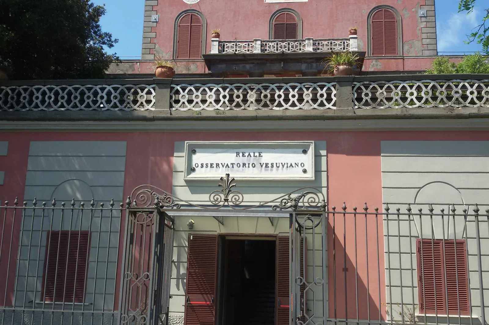
Entrance of the Reale Osservatorio Vesuviano in Vesuvius National Park, with a pink facade and wrought-iron gate
Photo: Carlomorino ↗ · CC BY-SA 4.0 ↗

Nature · Oldest volcano observatory in the world

Museo del Reale Osservatorio Vesuviano

Historic seat from 1841 with a museum, on the road to the crater.

On the mountain since 1841: the oldest volcano observatory in the world.

Coordinates
40.827973, 14.397476
Founded
1841
Opened
1845
Distance to the crater
2 km (1.2 mi)

Hikes & routes: crater trail no. 5 and ten more

Trail no. 9: Il Fiume di Lava

Just over a kilometre return, one hour, easy: onto the 1944 lava flow, covered with the grey lichen Stereocaulon vesuvianum. Start on Via Contrada Osservatorio.

Park authority: trail no. 9 "Il Fiume di Lava" (Italian) ↗

Nature: broom, lichens and peregrine falcons

The lichen comes first

On cooled lava the grey lichen Stereocaulon vesuvianum settles first; red valerian, curry plant and broom follow. Trail no. 9 is the best place to see this.

Park authority: pioneer species on the lava (Italian) ↗

Nature: broom, lichens and peregrine falcons

The first observatory

In 1841 Ferdinand II founded the Osservatorio Vesuviano, the oldest volcano observatory in the world. The historic building, two kilometres from the crater, now houses a museum.

Park authority: Osservatorio Vesuviano, founded 1841 (Italian) ↗

Open in OpenStreetMap ↗Location source ↗

40.82797, 14.39748

Nature · Forestry huts in the Riserva Tirone

Baracche Forestali

Nearest goal of trail no. 4 through the Tirone-Alto Vesuvio forest reserve.

Hikes & routes: crater trail no. 5 and ten more

Trail no. 4: Riserva Tirone

Open again since 19 September 2026, on Saturdays and Sundays from 9:00 to 16:30, free with registration at the entrance: 2.6 km (1.6 mi) to the Casa di Amelia. Bikes at up to 20 km/h, dogs not allowed.

Park authority, 16 Sep 2026: trail no. 4 open again from 19 September, Saturdays and Sundays (Italian) ↗

Rules on the crater trail and in the park

No dogs in the Riserva Tirone

Trail no. 4 lies in the strictest protection zone A. Dogs are not allowed there, not even on a lead.

Park authority, 16 Sep 2026: trail no. 4 open again from 19 September, Saturdays and Sundays (Italian) ↗

Open in OpenStreetMap ↗Location source ↗

40.81083, 14.41079

Arrival · Circumvesuviana

Ercolano Scavi station

Taxis and private shuttles leave here for the crater.

How to get there: Circumvesuviana, bus 808 or car to Quota 800

By Circumvesuviana

From Napoli Garibaldi, Circumvesuviana trains run towards Sorrento or Poggiomarino. At Ercolano Scavi taxis and private shuttles wait; from Pompei Scavi – Villa dei Misteri the public bus runs.

Park authority: Il Gran Cono – tickets online only, time slots, entry times, directions, trail no. 5 (Italian) ↗

Where to stay near Vesuvius

Towns on the railway

Ercolano with Ercolano Scavi station and Pompei with the Villa dei Misteri stop lie on the Circumvesuviana and on the two routes to the crater.

Park authority: Il Gran Cono – tickets online only, time slots, entry times, directions, trail no. 5 (Italian) ↗

Guided from here · Ad

Partner links: we may earn a commission if you book – at no extra cost to you. Thank you for supporting the atlas. Dates and prices with the provider.

Open in OpenStreetMap ↗Location source ↗

40.80852, 14.35546

Arrival · Circumvesuviana, bus 808 stop

Pompei Scavi – Villa dei Misteri station

Starting point of EAV line 808 to Piazzale Quota 1000; the town lies outside the park.

How to get there: Circumvesuviana, bus 808 or car to Quota 800

Bus 808 from Pompei

According to the timetable from 1 October 2026, EAV line 808 runs nine times a day from Pompei to Piazzale Quota 1000, the first at 8:30 from Piazza Anfiteatro, arriving 9:25. Last return from the crater: 16:50.

EAV: bus line 808 Pompei – Vesuvio, timetable from 1 October 2026 (Italian) ↗

Open in OpenStreetMap ↗Location source ↗

40.74879, 14.48090

Arrival · Park authority headquarters

Palazzo Mediceo, Ottaviano

Seat of the park authority since 2003, a building confiscated from the Camorra.

Open in OpenStreetMap ↗Location source ↗

40.84501, 14.46977

Locations verified from the linked original sources and OpenStreetMap. The map shows no trails or park boundaries; markers do not imply that access is permitted.

Map: © OpenStreetMap contributors, OpenMapTiles, OpenFreeMap. Elevation: Terrain Tiles (Mapzen, AWS Open Data); 3DEP, GMTED2010 and SRTM courtesy of the U.S. Geological Survey; EU-DEM (Copernicus, European Union); ETOPO1 (NOAA); ArcticDEM (NSF, DigitalGlobe); Geoscience Australia; Open Data Austria (DGM); Open Government Licence – Canada; INEGI; Land Information New Zealand; Kartverket; Environment Agency (UK).

Park photo: Photo: Ekrem Canli ↗ · CC BY-SA 4.0 ↗

Loading map …