National Parks Atlas
To the park
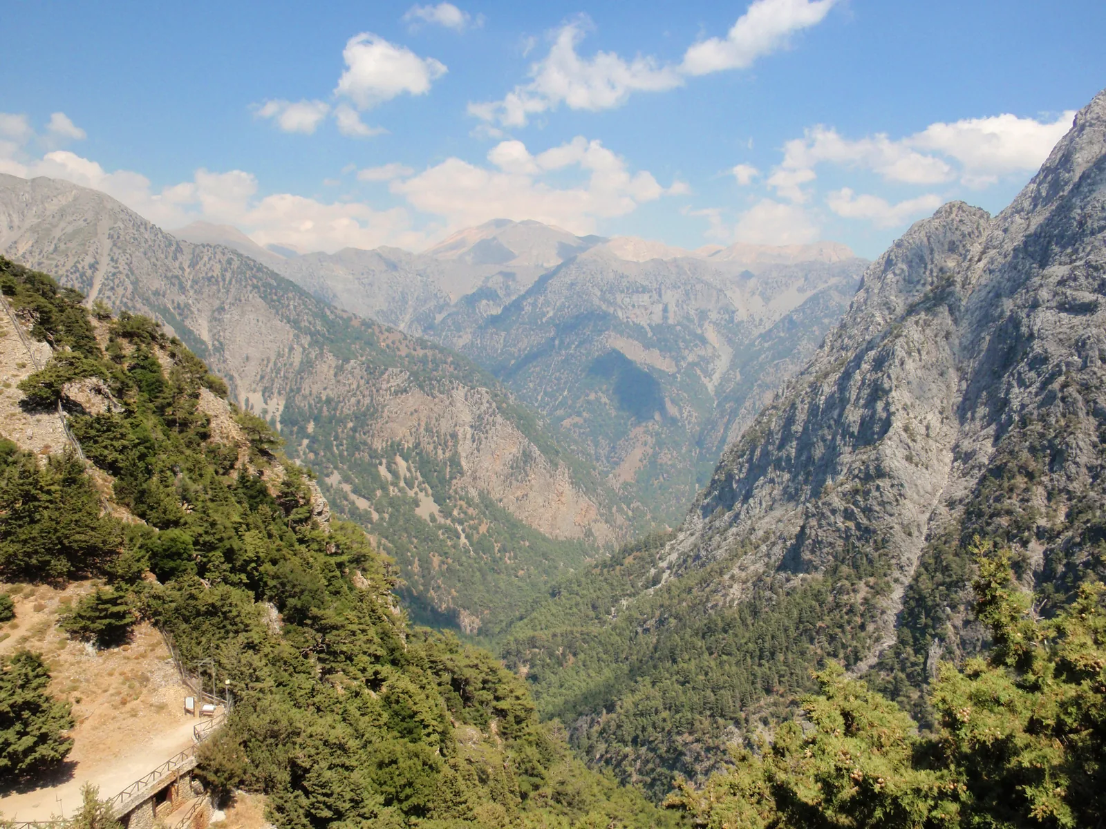
Looking down into the Samaria Gorge on Crete: forested slopes drop steeply between the peaks of the White Mountains

Samaria National Park: map

9 places with verified coordinates · 6 with photo

Bookable in the park · 3

Ad · partner links: we may earn a commission if you book – at no extra cost to you. Thank you for supporting the atlas. Offer details checked 5 Oct 2026; dates and prices with the provider.

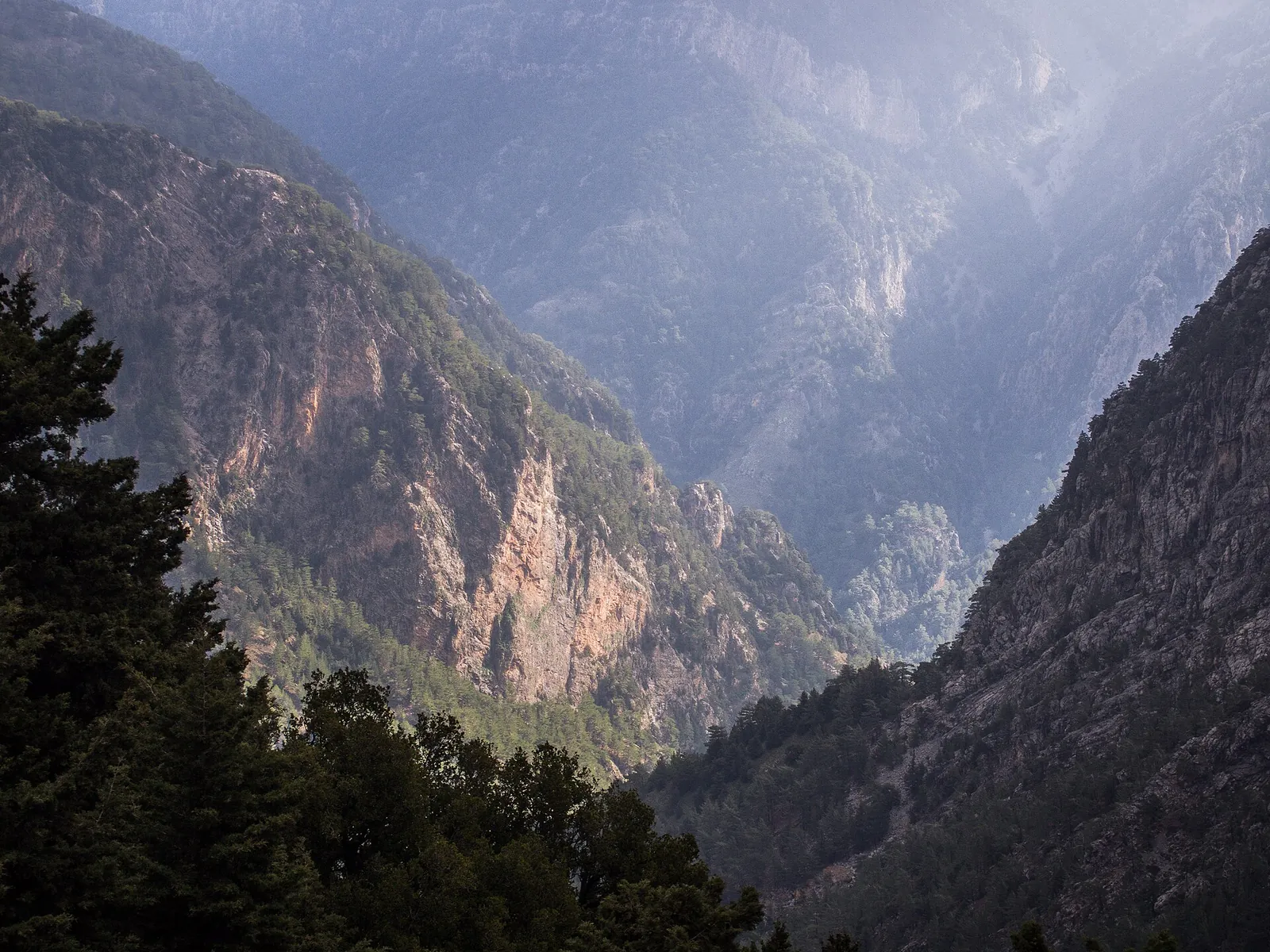
View from Xyloskalo at the north entrance into the Samaria Gorge: steep rock walls and forested slopes in the haze
Photo: C messier ↗ · CC BY-SA 4.0 ↗

Arrival · North entrance, 1,227 m (4,026 ft)

Xyloskalo

Entrance on the Omalos plateau with ticket office and forest outpost; the main trail starts here. Reachable by car and bus.

Samaria National Park: the gorge in the White Mountains

Main trail only

Hiking is only allowed on the main trail. It is about 13 km (8.1 mi) long; from the south entrance to Agia Roumeli it is another 2 km (1.2 mi) or so.

NECCA Samaria ticket portal: current closure notice, season, opening hours, ticket categories and exemptions ↗

Samaria Gorge tickets: €10 and online ticket

Online or at the entrance

NECCA sells tickets at samaria-tickets.necca.gov.gr and at the ticket offices at Xyloskalo and Agia Roumeli.

NECCA Samaria ticket portal: current closure notice, season, opening hours, ticket categories and exemptions ↗

Getting there: bus from Chania, ferry back

Bus from Chania

KTEL runs daily at 05:00, 07:45 and 08:45 from Chania bus station to Xyloskalo; according to NECCA the ride takes about 60 minutes.

KTEL Chania–Rethymno: buses Chania–Xyloskalo and return from Sougia and Chora Sfakion ↗

Things to do: the full gorge, Portes and short walks

The classic descent

Most people walk down from Xyloskalo to Agia Roumeli, about 15 km (9.3 mi). The first 7 km (4.3 mi) run through forest, after that the trail follows the riverbed.

NECCA Samaria ticket portal: current closure notice, season, opening hours, ticket categories and exemptions ↗

Open in OpenStreetMap ↗Location source ↗

35.30786, 23.91837

Arrival · Rest area near the north entrance

Neroutsiko rest area

End of the short section from Xyloskalo that you may still enter between 13:00 and 15:00.

Opening: season, hours and closures

Entry 07:00 to 13:00

For the full route you may only enter until 13:00. Until 15:00 the first 2 km (1.2 mi) from Xyloskalo to Neroutsiko are still open, from Agia Roumeli until 16:00 the first 2 km to Christos.

NECCA Samaria ticket portal: current closure notice, season, opening hours, ticket categories and exemptions ↗

Open in OpenStreetMap ↗Location source ↗

35.30776, 23.92465

Trails · Chapel on the main trail

Agios Nikolaos chapel

Small chapel in the forest on the upper part of the descent.

Open in OpenStreetMap ↗Location source ↗

35.30670, 23.93615

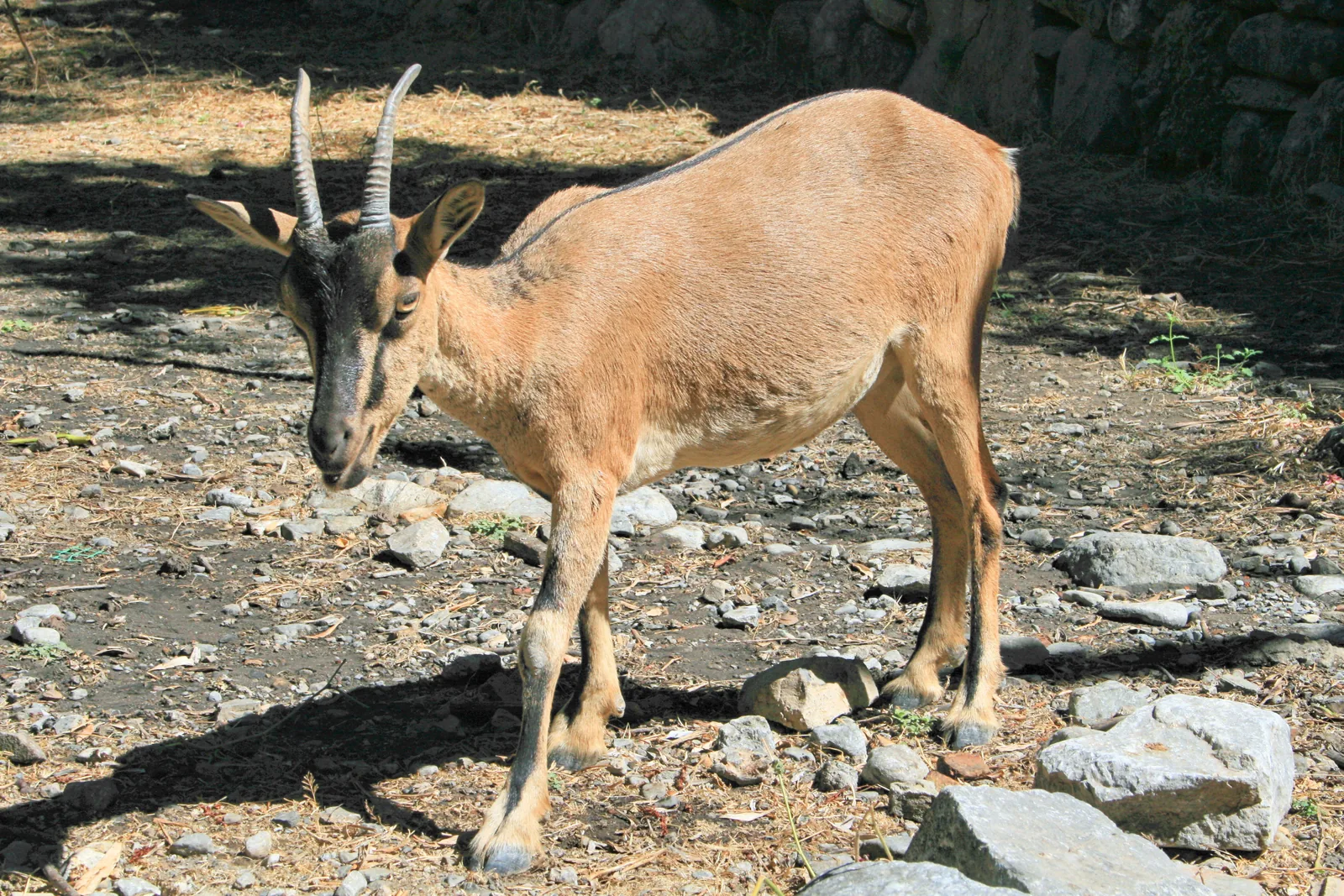
A kri-kri wild goat with long horns looks for food among stones in Samaria National Park
Photo: Lapplaender ↗ · CC BY-SA 3.0 de ↗

Surroundings · Old village, around kilometre 7

Samaria (abandoned village)

After the village the trail follows the riverbed; up to here it runs through forest.

The abandoned village around kilometre 7, halfway along.

Location
around kilometre 7
Trail after it
in the riverbed, rocky

Things to do: the full gorge, Portes and short walks

The abandoned village

Around kilometre 7 lies the old village of Samaria, which gave the gorge its name.

NECCA Samaria ticket portal: current closure notice, season, opening hours, ticket categories and exemptions ↗

Nature: kri-kri, bearded vulture, cypresses

Kri-kri, the Cretan wild goat

The park's emblem animal now lives only in the White Mountains and on a few islands; protecting it was the main reason for the national park.

Archive site of the former management body: wildlife of the White Mountains – kri-kri, bearded vulture, 32 mammal species ↗

Open in OpenStreetMap ↗Location source ↗

35.29150, 23.95867

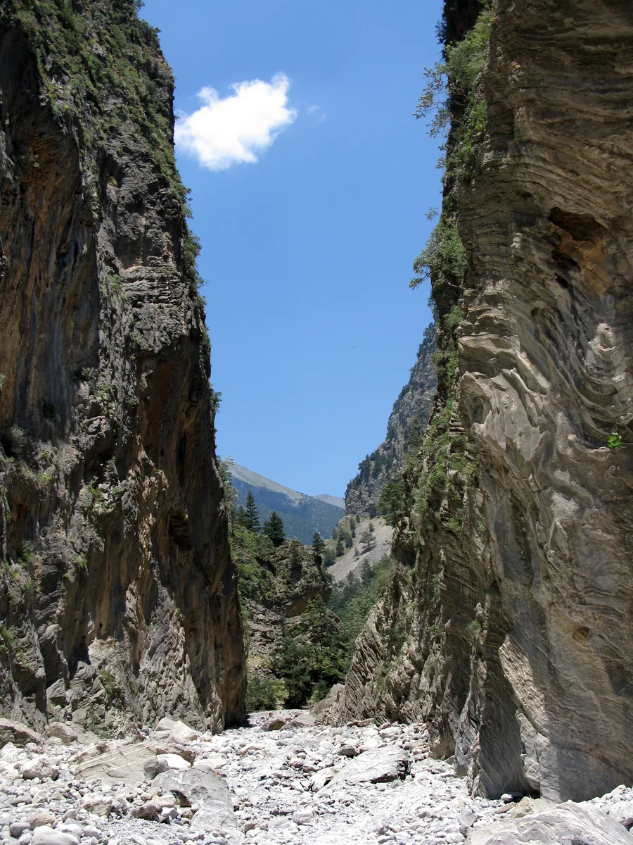
The Portes in the Samaria Gorge: two vertical rock walls stand close together, with a strip of sky and scree between them
Photo: Anna Saini ↗ · CC BY-SA 4.0 ↗

Mountains & rock · Narrowest point of the gorge

Sideroportes (Portes)

According to NECCA the most famous view in the gorge, about 1.5 km (0.9 mi) from the Agia Roumeli forest outpost.

The narrowest point of the gorge, about 1.5 km (0.9 mi) above the south entrance.

Distance from the Agia Roumeli forest outpost
about 1.5 km (0.9 mi)
Short walk from Agia Roumeli
Entry until 16:00

Things to do: the full gorge, Portes and short walks

Portes, the narrowest point

The best-known spot lies about 1.5 km (0.9 mi) above the Agia Roumeli forest outpost, where the rock walls close in.

NECCA Samaria ticket portal: current closure notice, season, opening hours, ticket categories and exemptions ↗

Open in OpenStreetMap ↗Location source ↗

35.25597, 23.96855

Arrival · Rest area near the south entrance

Christos rest area

End of the short section from Agia Roumeli that you may still enter between 13:00 and 16:00.

Things to do: the full gorge, Portes and short walks

A short walk from Agia Roumeli

If you do not want to walk the whole gorge, walk up a little from Agia Roumeli and turn back; the ticket is the same.

NECCA Samaria ticket portal: current closure notice, season, opening hours, ticket categories and exemptions ↗

Open in OpenStreetMap ↗Location source ↗

35.25821, 23.96705

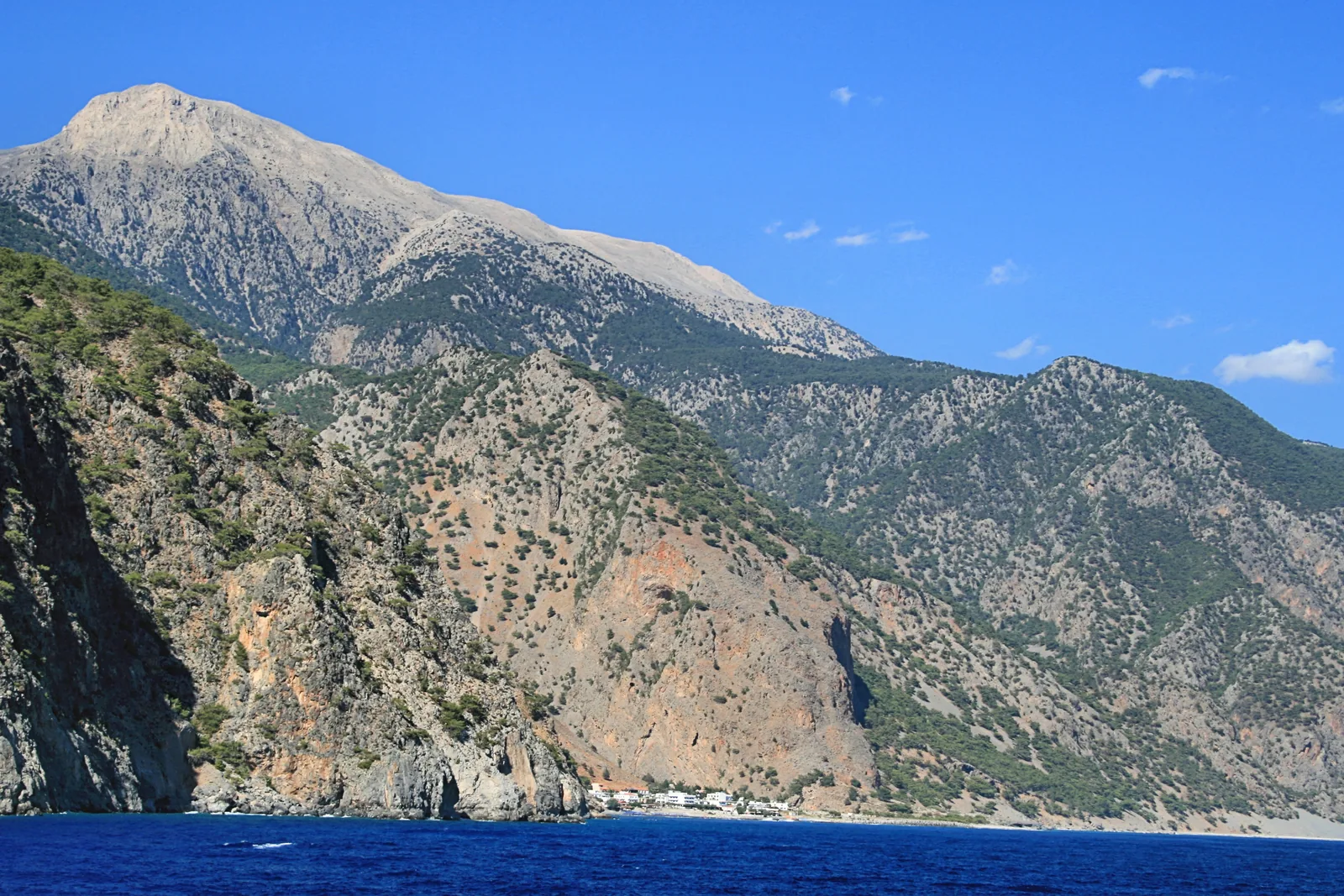
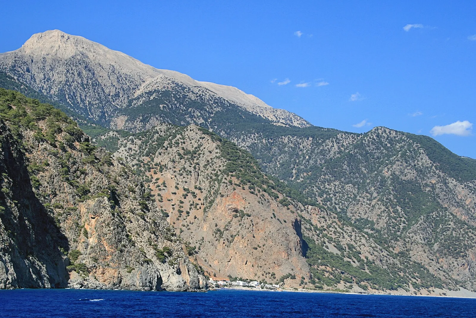
Agia Roumeli from the ferry: the small village at the mouth of the Samaria Gorge below the steep slopes of the White Mountains on the Libyan Sea
Photo: Lapplaender ↗ · CC BY-SA 3.0 de ↗

Arrival · South entrance with ticket office

South entrance, Agia Roumeli

The main trail of about 13 km (8.1 mi) ends here; it is another 2 km (1.2 mi) or so to the village on the sea.

The village at the end of the gorge, reachable only by boat.

Road
none
Ferry to Chora Sfakion and Sougia
17:30

Samaria Gorge tickets: €10 and online ticket

Keep the control stub

On entry you get a second stub that is checked at the exit; this is how the park counts who has left the gorge.

NECCA Samaria ticket portal: current closure notice, season, opening hours, ticket categories and exemptions ↗

Opening: season, hours and closures

Out by 18:00

You must have left the park by 18:00 at the latest.

NECCA Samaria ticket portal: current closure notice, season, opening hours, ticket categories and exemptions ↗

Open in OpenStreetMap ↗Location source ↗

35.24534, 23.96612

Agia Roumeli at the mouth of the Samaria Gorge, seen from the ferry, below the slopes of the White Mountains
Photo: Lapplaender ↗ · CC BY-SA 3.0 de ↗

Surroundings · Village and ferry pier, outside the park

Agia Roumeli, ferry pier

Village with no road on the Libyan Sea; ferries to Chora Sfakion, Sougia and Paleochora.

Samaria National Park: the gorge in the White Mountains

From 1,227 m to sea level

The trail starts at Xyloskalo at 1,227 m (4,026 ft) and ends at Agia Roumeli on the sea. NECCA reckons on 6 to 7 hours.

NECCA Samaria ticket portal: current closure notice, season, opening hours, ticket categories and exemptions ↗

Getting there: bus from Chania, ferry back

Ferry from Agia Roumeli

Agia Roumeli has no road. Until 31 October ANENDYK sails daily at 17:30 to Chora Sfakion and to Sougia; each trip costs €17.

ANENDYK: South Crete ferry timetable 2026 – Agia Roumeli, Chora Sfakion, Sougia, Paleochora ↗

Getting there: bus from Chania, ferry back

Wind stops the ferries

On days with strong wind the boats may not call at Agia Roumeli, even when the gorge is open. NECCA advises checking the timetable beforehand.

NECCA Samaria ticket portal: current closure notice, season, opening hours, ticket categories and exemptions ↗

Rules: dogs, drones, camping, swimming

No overnight stays

Camping and staying overnight in the park are prohibited; if you plan two days, sleep in Agia Roumeli or Omalos.

NECCA Samaria ticket portal: current closure notice, season, opening hours, ticket categories and exemptions ↗

Things to do: the full gorge, Portes and short walks

Uphill in reverse

From Agia Roumeli to Xyloskalo it is about 1,200 metres (3,940 ft) of ascent. NECCA recommends a night in Agia Roumeli and an early start.

NECCA Samaria ticket portal: current closure notice, season, opening hours, ticket categories and exemptions ↗

Where to stay: Agia Roumeli, not a tent

Agia Roumeli

According to ANENDYK the village at the exit has hotels, tavernas, cafés, mini markets and a medical clinic.

ANENDYK: Agia Roumeli – a village without a road at the end of the gorge ↗

Where to stay: Agia Roumeli, not a tent

Old Agia Roumeli

About 2 km (1.2 mi) above today's village lies old Agia Roumeli; after the flood of 1954 its residents moved to the coast.

ANENDYK: Agia Roumeli – a village without a road at the end of the gorge ↗

Where to stay: Agia Roumeli, not a tent

Staying overnight to go uphill

For the reverse route NECCA advises spending the night in Agia Roumeli and starting early in the morning.

NECCA Samaria ticket portal: current closure notice, season, opening hours, ticket categories and exemptions ↗

Onward travel: the south coast by boat

To Chora Sfakion

Via Loutro to Chora Sfakion, several times a day until 31 October; adults pay €17.

ANENDYK: South Crete ferry fares ↗

Onward travel: the south coast by boat

To Sougia and Paleochora

Heading west, the boat leaves at 17:30 for Sougia and on to Paleochora.

ANENDYK: South Crete ferry timetable 2026 – Agia Roumeli, Chora Sfakion, Sougia, Paleochora ↗

Open in OpenStreetMap ↗Location source ↗

35.22866, 23.96044

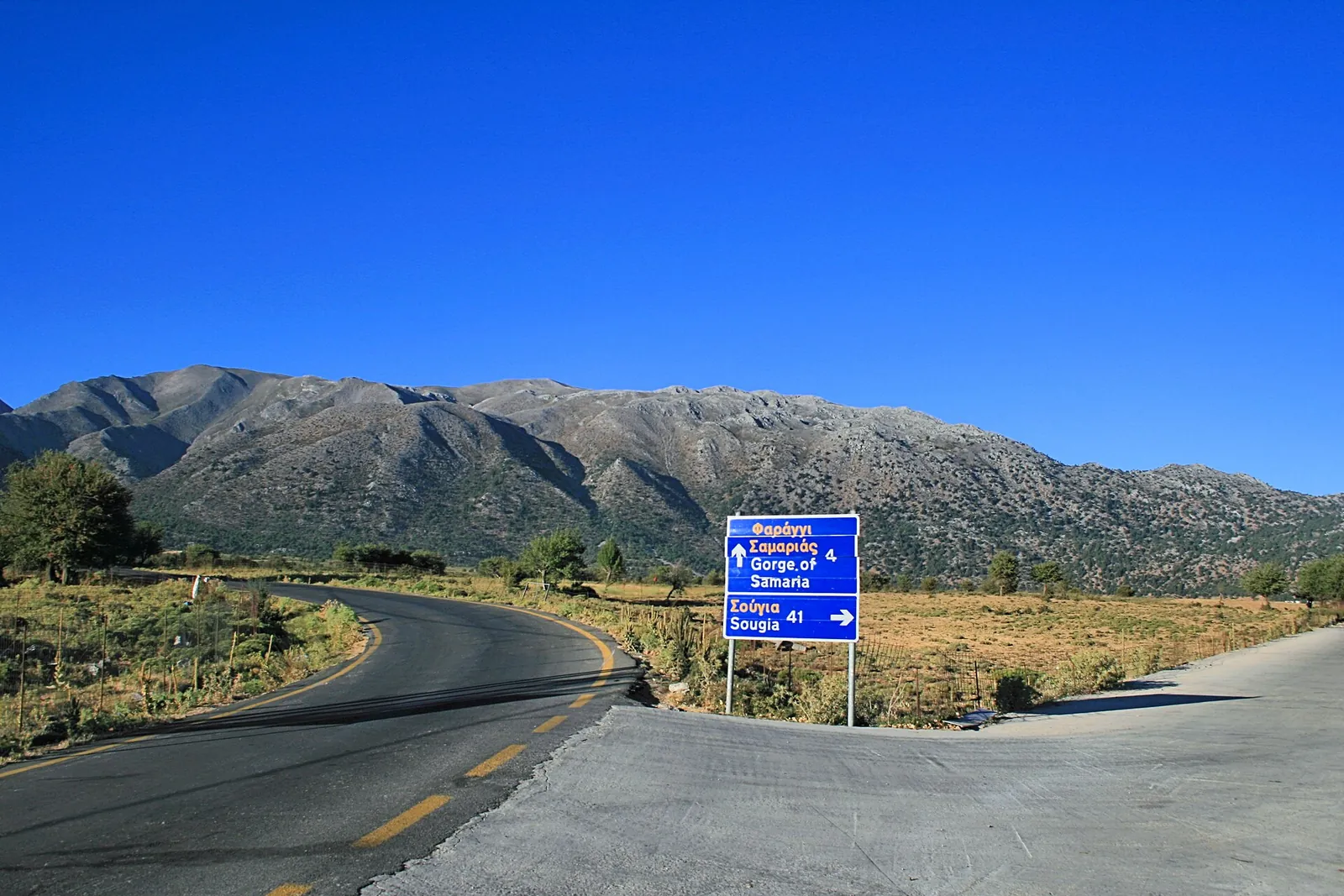
Road across the Omalos plateau with a signpost to the Samaria Gorge, the White Mountains behind
Photo: Lapplaender ↗ · CC BY-SA 3.0 de ↗

Arrival · Plateau before the north entrance, outside the park

Omalos

Buses from Chania stop here on the way to Xyloskalo.

Getting there: bus from Chania, ferry back

By car

Xyloskalo is about 40 km (25 mi) from Chania. If you park there, the only way back to your car on the same day is the ferry to Sougia and the Sougia–Xyloskalo bus.

NECCA Samaria ticket portal: current closure notice, season, opening hours, ticket categories and exemptions ↗

Open in OpenStreetMap ↗Location source ↗

35.34388, 23.90453

Locations verified from the linked original sources and OpenStreetMap. The map shows no trails or park boundaries; markers do not imply that access is permitted.

Map: © OpenStreetMap contributors, OpenMapTiles, OpenFreeMap. Elevation: Terrain Tiles (Mapzen, AWS Open Data); 3DEP, GMTED2010 and SRTM courtesy of the U.S. Geological Survey; EU-DEM (Copernicus, European Union); ETOPO1 (NOAA); ArcticDEM (NSF, DigitalGlobe); Geoscience Australia; Open Data Austria (DGM); Open Government Licence – Canada; INEGI; Land Information New Zealand; Kartverket; Environment Agency (UK).

Park photo: Photo: Jimzoun ↗ · CC BY-SA 4.0 ↗

Loading map …