All places Photo: Wayfool ↗ · CC BY-SA 4.0 ↗
Portería Laguna Amarga Show your ticket here as a QR code and register. From here, a shuttle runs to the Welcome Center.
Own page
Mirador Base Torres Nine kilometres uphill through the Valle Ascencio, finally over a moraine – and then the three towers above the glacial lake.
Base Torres: what a day costs (CLP, as of 5 Oct 2026) Park ticket 1 day, 18+ 32,400 Park ticket 1 day, 13–17 16,600 Park ticket, children up to 12 free
Trail, times & ticket
Guided from here · Ad
Partner links: we may earn a commission if you book – at no extra cost to you. Thank you for supporting the atlas. Dates and prices with the provider.
Add to your Torres del Paine National Park visit Open in OpenStreetMap ↗ Location source ↗
-50.97985, -72.80009
All places
Welcome Center Las Torres Welcome Center of the private Reserva Las Torres between Laguna Amarga and Hotel Las Torres; no entry fee for the Reserva.
Own page
Mirador Base Torres Nine kilometres uphill through the Valle Ascencio, finally over a moraine – and then the three towers above the glacial lake.
Trail, times & ticket
Add to your Torres del Paine National Park visit Open in OpenStreetMap ↗ Location source ↗
-50.96518, -72.86348
All places
Hotel Las Torres CONAF measures the trails to Refugio Chileno and Mirador Base Torres from here.
Own page
Mirador Base Torres Nine kilometres uphill through the Valle Ascencio, finally over a moraine – and then the three towers above the glacial lake.
Trail, times & ticket
Add to your Torres del Paine National Park visit Open in OpenStreetMap ↗ Location source ↗
-50.97316, -72.87498
All places
Refugio Chileno Hut in the Valle Ascencio, 5 km (3.1 mi) and about 2 hours from Hotel Las Torres.
Own page
Mirador Base Torres Nine kilometres uphill through the Valle Ascencio, finally over a moraine – and then the three towers above the glacial lake.
Trail, times & ticket
Add to your Torres del Paine National Park visit Open in OpenStreetMap ↗ Location source ↗
-50.95725, -72.91065
All places Photo: AndrewDeAngelo ↗ · CC BY-SA 4.0 ↗
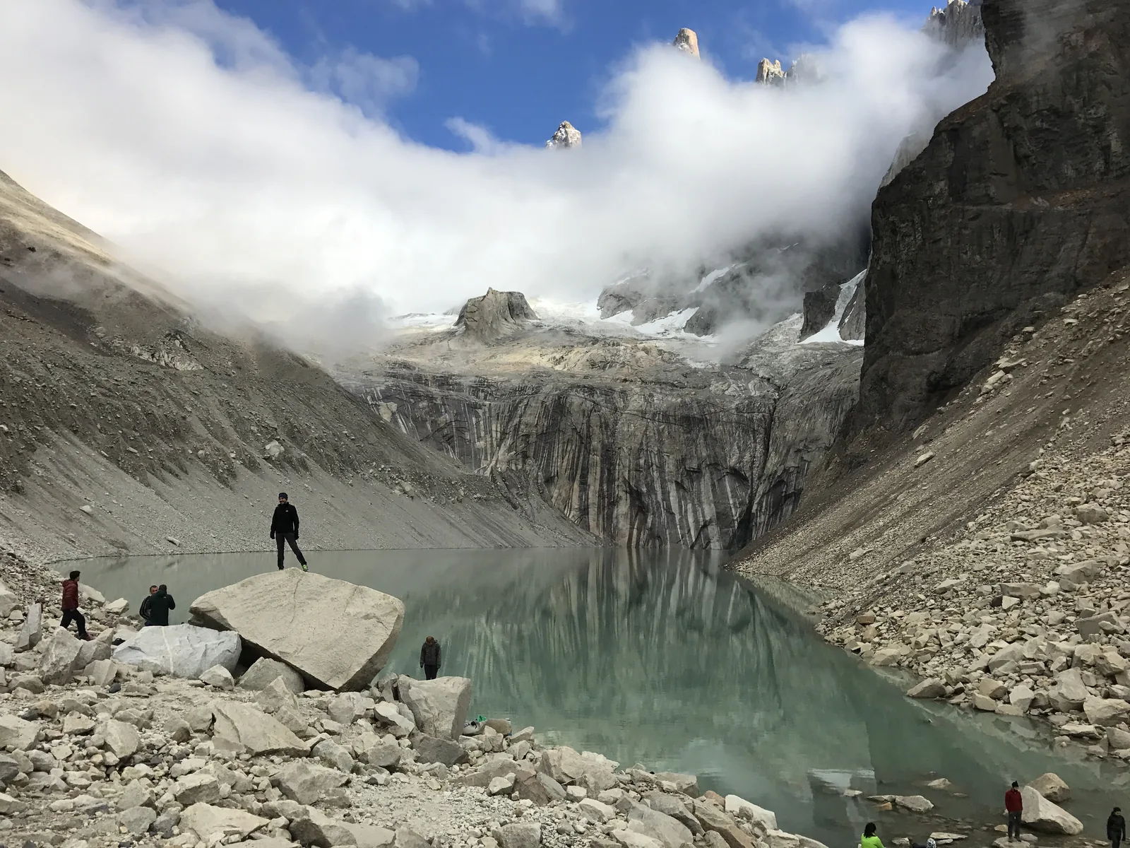
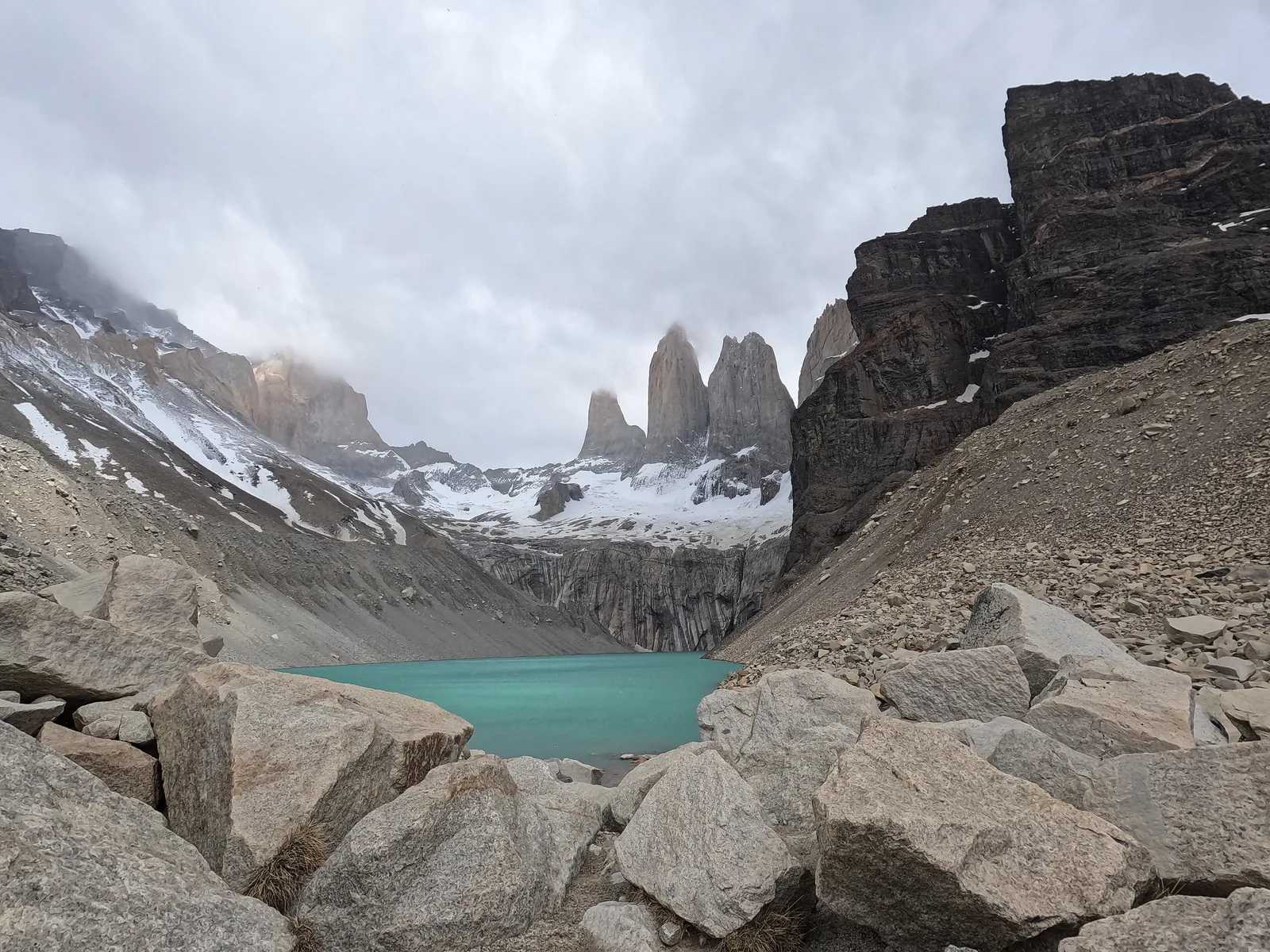
Mirador Base Torres The view of the three granite towers above the glacial lake; the last section crosses a moraine.
The three towers above the glacial lake – the goal of the most popular day hike.
Hotel Las Torres–Chileno 5 km (3.1 mi), 2 h
Chileno–Guardería Torres 3 km (1.9 mi), 90 min
Last section 1.4 km (0.9 mi), 1 h
Booking not needed Own page
Mirador Base Torres Nine kilometres uphill through the Valle Ascencio, finally over a moraine – and then the three towers above the glacial lake.
Trail, times & ticket
Add to your Torres del Paine National Park visit Open in OpenStreetMap ↗ Location source ↗
-50.94267, -72.94966
All places
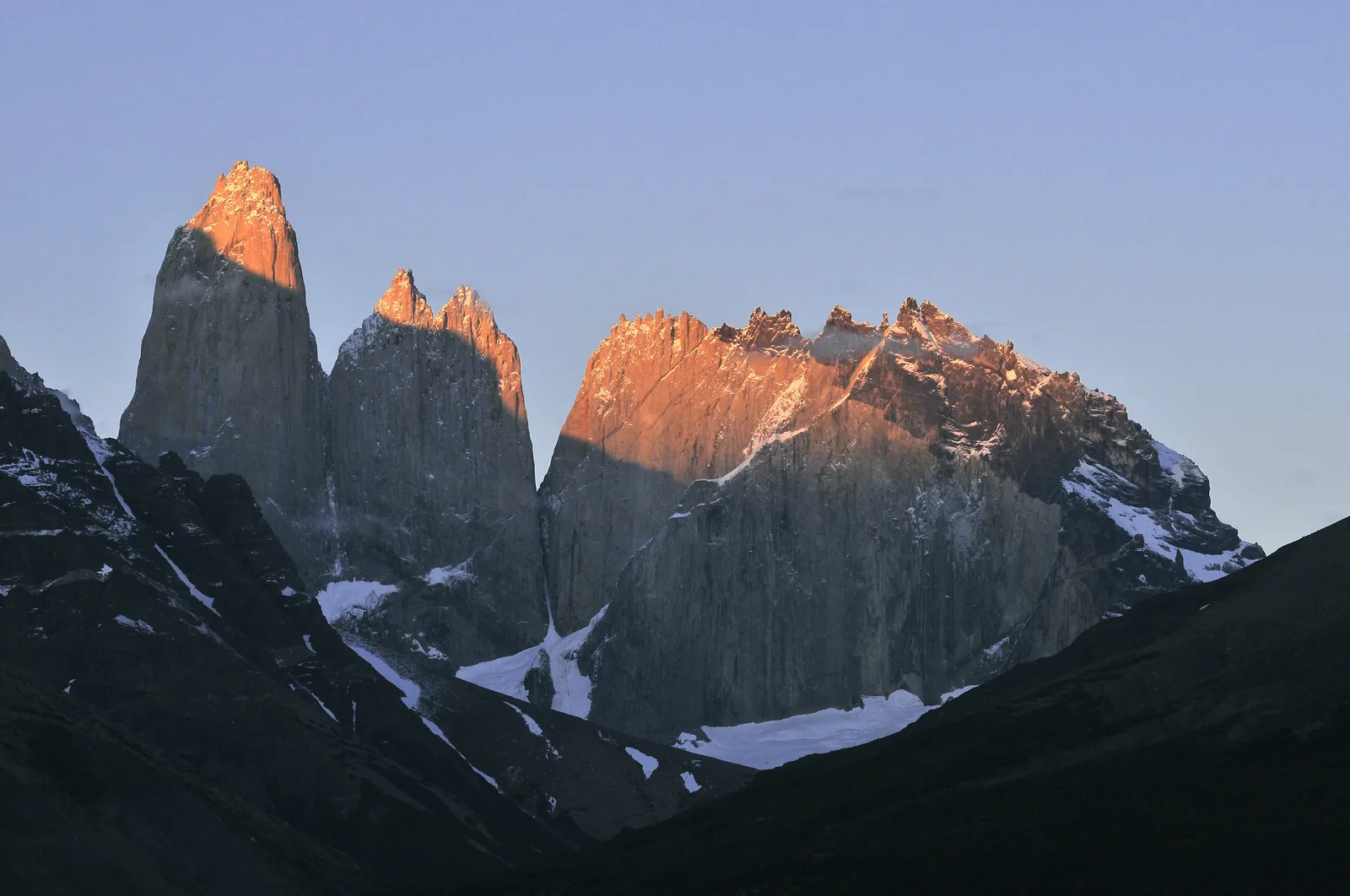
Torre Central The middle of the three towers that give the park its name.
Add to your Torres del Paine National Park visit Open in OpenStreetMap ↗ Location source ↗
-50.94970, -72.98747
All places Photo: LBM1948 ↗ · CC BY-SA 4.0 ↗
Laguna Azul Lake at the park's north-eastern access; a fire broke out here in 2005.
Add to your Torres del Paine National Park visit Open in OpenStreetMap ↗ Location source ↗
-50.88642, -72.78206
All places
Portería Sarmiento Eastern entrance; the Río Don Guillermo border crossing is 52 km (32 mi) away.
Add to your Torres del Paine National Park visit Open in OpenStreetMap ↗ Location source ↗
-51.02745, -72.77402
All places
Lago Nordenskjöld The lake between Las Torres and Pudeto, with the Cuernos del Paine above it.
Add to your Torres del Paine National Park visit Open in OpenStreetMap ↗ Location source ↗
-51.03526, -72.96532
All places
Mirador Cuernos Viewpoint near Pudeto looking out at the Cuernos del Paine.
Add to your Torres del Paine National Park visit Open in OpenStreetMap ↗ Location source ↗
-51.04829, -73.01234
All places Photo: LBM1948 ↗ · CC BY-SA 4.0 ↗
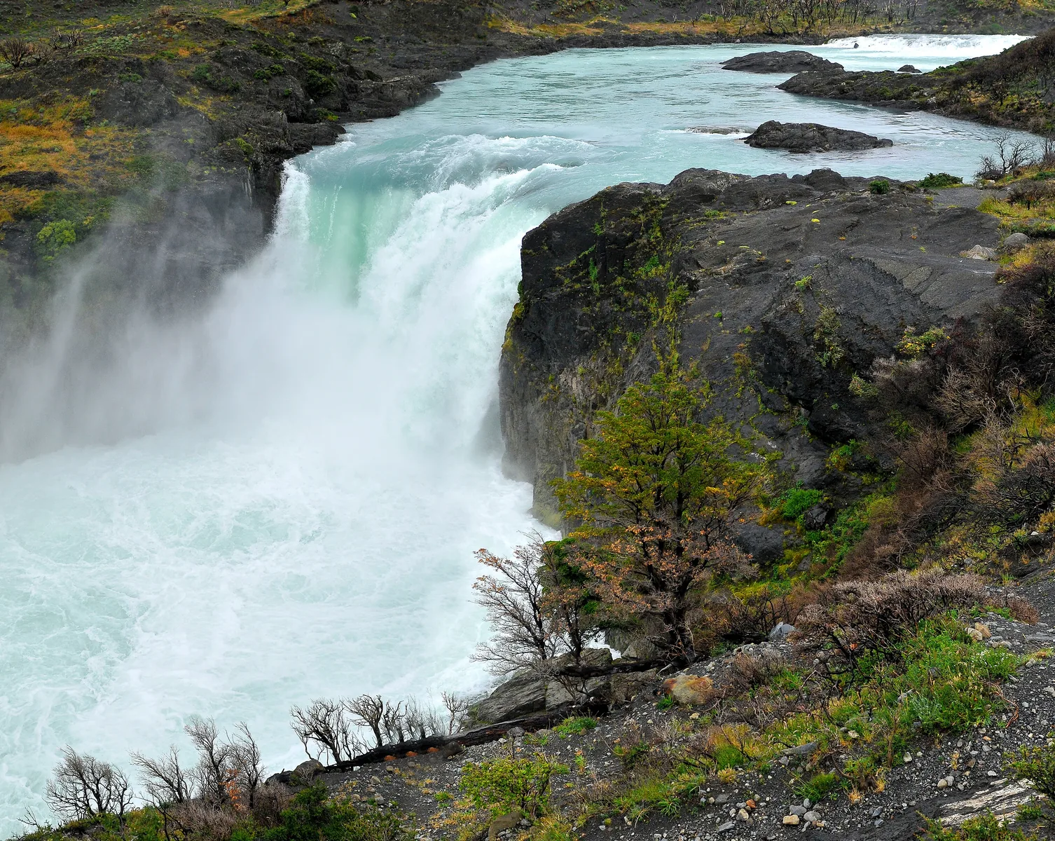
Salto Grande Where Lago Nordenskjöld drains into Lago Pehoé; a short walk from Pudeto.
Waterfall and view without a long hike.
From Pudeto
Booking not needed Add to your Torres del Paine National Park visit Open in OpenStreetMap ↗ Location source ↗
-51.06765, -73.00656
All places
Pudeto Departure point of the catamaran across Lago Pehoé to Paine Grande.
Add to your Torres del Paine National Park visit Open in OpenStreetMap ↗ Location source ↗
-51.06135, -72.99031
All places
Lago Pehoé Turquoise lake in front of the Paine massif; catamaran Pudeto–Paine Grande.
Add to your Torres del Paine National Park visit Open in OpenStreetMap ↗ Location source ↗
-51.09223, -73.03275
All places
Refugio Paine Grande Catamaran landing and hub of the W Trek.
Add to your Torres del Paine National Park visit Open in OpenStreetMap ↗ Location source ↗
-51.07265, -73.09378
All places
Campamento Italiano At the mouth of the Valle del Francés; closed according to the 2025/26 season bulletin.
Add to your Torres del Paine National Park visit Open in OpenStreetMap ↗ Location source ↗
-51.02692, -73.04043
All places Photo: Carlabedrapo ↗ · CC BY-SA 3.0 ↗
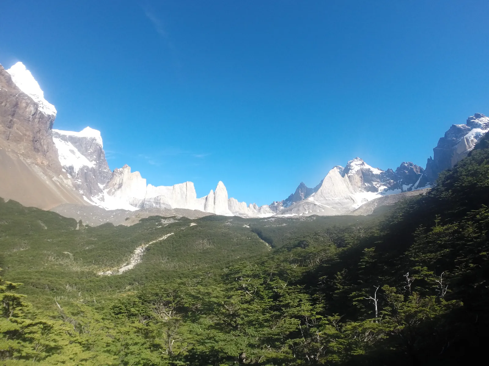
Mirador Británico The farthest point of the W in the Valle del Francés.
Add to your Torres del Paine National Park visit Open in OpenStreetMap ↗ Location source ↗
-50.98268, -73.05375
All places
Refugio Los Cuernos Hut on the north shore of Lago Nordenskjöld on the W.
Add to your Torres del Paine National Park visit Open in OpenStreetMap ↗ Location source ↗
-51.02385, -72.98537
All places
Cerro Paine Grande The highest mountain in the park.
Add to your Torres del Paine National Park visit Open in OpenStreetMap ↗ Location source ↗
-50.99511, -73.08665
All places
Refugio Grey Western end of the W at Lago Grey.
Add to your Torres del Paine National Park visit Open in OpenStreetMap ↗ Location source ↗
-51.00822, -73.17605
All places
Hotel Lago Grey Meeting point for boat trips to Glaciar Grey.
Guided from here · Ad
Partner links: we may earn a commission if you book – at no extra cost to you. Thank you for supporting the atlas. Dates and prices with the provider.
Add to your Torres del Paine National Park visit Open in OpenStreetMap ↗ Location source ↗
-51.12288, -73.11633
All places
Mirador Lago Grey View across Lago Grey from the south shore.
Add to your Torres del Paine National Park visit Open in OpenStreetMap ↗ Location source ↗
-51.12179, -73.12979
All places
Centro de Visitantes (Administración) Administration and visitor centre in Villa Monzino; the only place with mobile reception.
Add to your Torres del Paine National Park visit Open in OpenStreetMap ↗ Location source ↗
-51.17886, -72.95693
All places
Portería Serrano Entrance on the Y-290 road coming from Puerto Natales.
Add to your Torres del Paine National Park visit Open in OpenStreetMap ↗ Location source ↗
-51.21712, -72.97051
All places
Bridge over the Río Ascencio The trail crosses the Río Ascencio here.
Own page
Mirador Base Torres Nine kilometres uphill through the Valle Ascencio, finally over a moraine – and then the three towers above the glacial lake.
Trail, times & ticket
Add to your Torres del Paine National Park visit Open in OpenStreetMap ↗ Location source ↗
-50.97672, -72.88497
All places
Guardería Torres After another 3 km (1.9 mi); CONAF's Torres campsite was closed in 2025/26.
Own page
Mirador Base Torres Nine kilometres uphill through the Valle Ascencio, finally over a moraine – and then the three towers above the glacial lake.
Trail, times & ticket
Add to your Torres del Paine National Park visit Open in OpenStreetMap ↗ Location source ↗
-50.94194, -72.93600
All places
Lago Torres The lake below the towers; swimming is banned in all the park's waters.
Own page
Mirador Base Torres Nine kilometres uphill through the Valle Ascencio, finally over a moraine – and then the three towers above the glacial lake.
Trail, times & ticket
Add to your Torres del Paine National Park visit Open in OpenStreetMap ↗ Location source ↗
-50.94612, -72.96161