All places Photo: Jakub Hałun ↗ · CC BY-SA 4.0 ↗
Palenica Białczańska car park The trail to Morskie Oko starts here, with a park ticket point, the e-bus stop and the horse-drawn carts. Parking only with an online TPN ticket.
Own page
Morskie Oko Eight kilometres of paved road without cars, a car park only with an online ticket, and at the end the largest lake in the Tatras.
Morskie Oko: parking, e-bus and entry 2026 (PLN) Car park Palenica/Łysa Polana, car, online 36–75 Car park, bought on the day +10 E-bus Zakopane–Włosienica 89.00
Parking, trail & e-bus
Guided from here · Ad
Partner links: we may earn a commission if you book – at no extra cost to you. Thank you for supporting the atlas. Dates and prices with the provider.
Add to your Tatra National Park visit Open in OpenStreetMap ↗ Location source ↗
49.25594, 20.10307
All places
Łysa Polana The furthest of the three car park sections, about 1.5 km (0.9 mi) before the trailhead according to the TPN, a 15 to 20 minute walk.
Own page
Morskie Oko Eight kilometres of paved road without cars, a car park only with an online ticket, and at the end the largest lake in the Tatras.
Parking, trail & e-bus
Add to your Tatra National Park visit Open in OpenStreetMap ↗ Location source ↗
49.26535, 20.11631
All places
Wodogrzmoty Mickiewicza Cascades of the Roztoka below a stone bridge from 1900. Since 1 September 2026 the horse-drawn carts turn here.
Own page
Morskie Oko Eight kilometres of paved road without cars, a car park only with an online ticket, and at the end the largest lake in the Tatras.
Parking, trail & e-bus
Add to your Tatra National Park visit Open in OpenStreetMap ↗ Location source ↗
49.23549, 20.08595
All places
Włosienica The park e-buses turn here; until 31 August 2026 the carts also ended here.
Own page
Morskie Oko Eight kilometres of paved road without cars, a car park only with an online ticket, and at the end the largest lake in the Tatras.
Parking, trail & e-bus
Add to your Tatra National Park visit Open in OpenStreetMap ↗ Location source ↗
49.21380, 20.08065
All places Photo: Jakub Krajňák ↗ · CC0 ↗
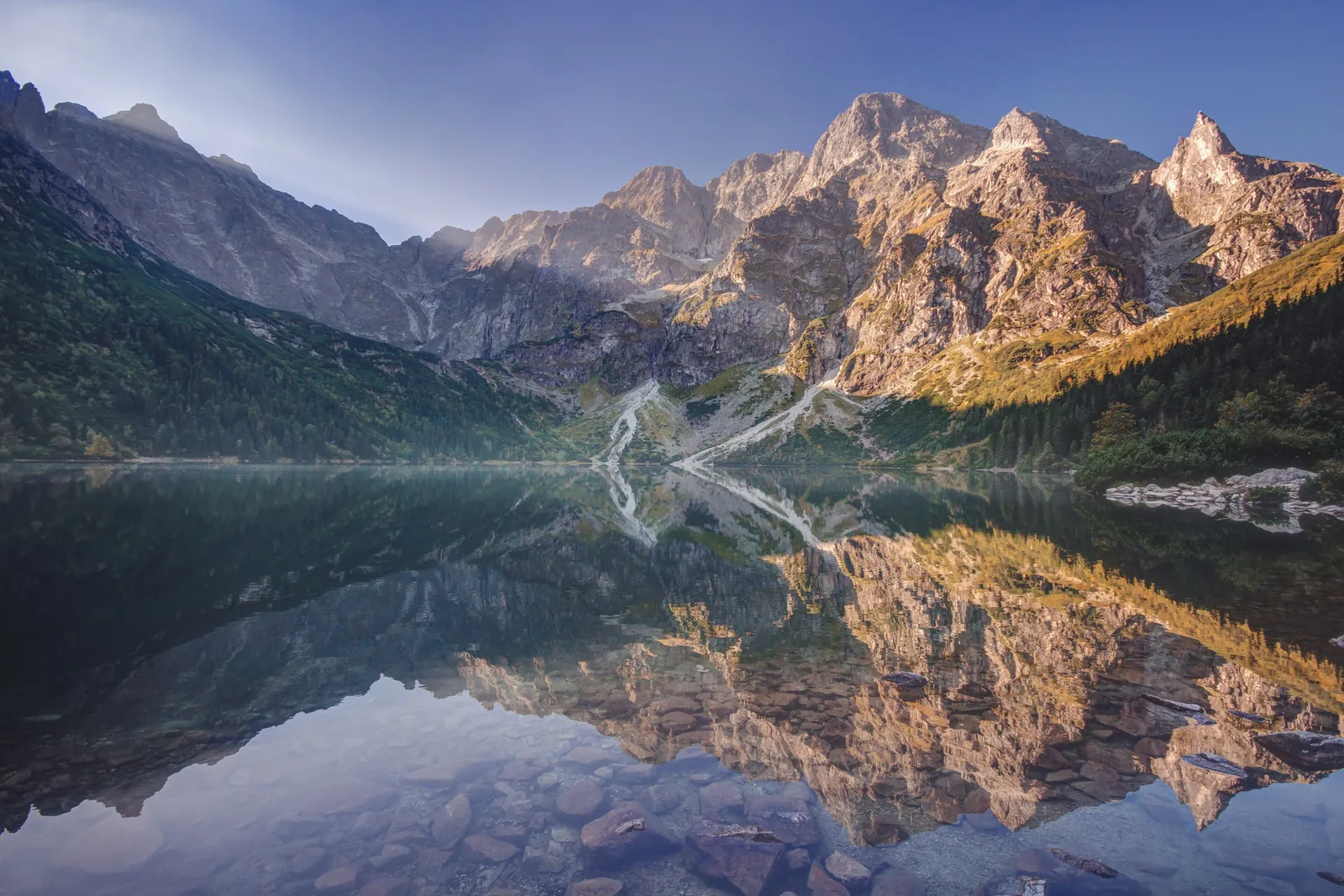
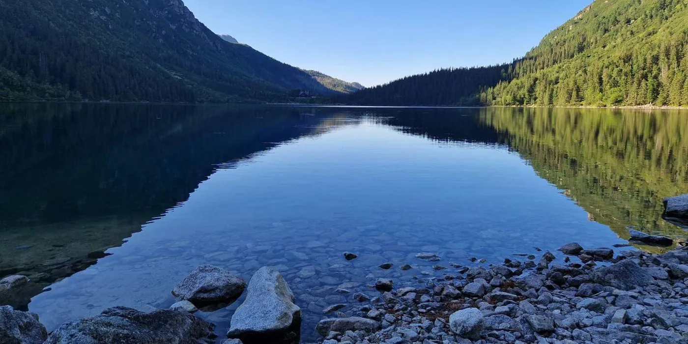
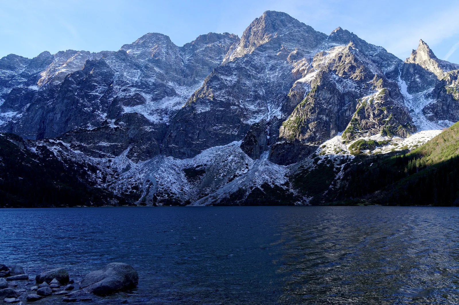
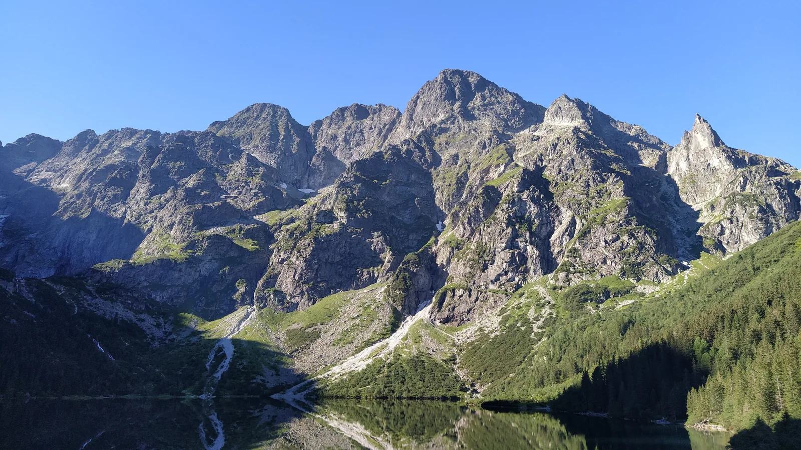
Morskie Oko The largest lake in the Tatras: 34.5 ha, up to 50.8 m (167 ft) deep. A 2.5 km (1.6 mi) path circles the shore in about an hour.
The largest lake in the Tatras, at the end of an 8 km (5 mi) road without cars.
Altitude 1,395 m (4,577 ft)
Area 34.5 ha
Maximum depth 50.8 m (167 ft)
Size 860 × 560 m
Loop path 2.5 km (1.6 mi), about 1 hour Own page
Morskie Oko Eight kilometres of paved road without cars, a car park only with an online ticket, and at the end the largest lake in the Tatras.
Parking, trail & e-bus
Add to your Tatra National Park visit Open in OpenStreetMap ↗ Location source ↗
49.19738, 20.07072
All places
PTTK mountain hut at Morskie Oko On the moraine above the lake. According to the TPN the first hut here stood as early as 1827.
Own page
Morskie Oko Eight kilometres of paved road without cars, a car park only with an online ticket, and at the end the largest lake in the Tatras.
Parking, trail & e-bus
Add to your Tatra National Park visit Open in OpenStreetMap ↗ Location source ↗
49.20140, 20.07126
All places
Czarny Staw pod Rysami The higher lake above Morskie Oko, a stop on the way to Rysy.
Own page
Morskie Oko Eight kilometres of paved road without cars, a car park only with an online ticket, and at the end the largest lake in the Tatras.
Parking, trail & e-bus
Add to your Tatra National Park visit Open in OpenStreetMap ↗ Location source ↗
49.18853, 20.07627
All places
Rysy Poland's highest mountain; the border with Slovakia runs over the top.
Tatra National Park: Poland's high mountains
Rysy, 2,499 metres The highest summits in the park rise above 2,400 m (7,874 ft). Rysy, at 2,499 m (8,199 ft), is Poland's highest mountain.
Tatra National Park (TPN): the park – 21,197 ha, Rysy 2,499 m, 275 km of trails, eight mountain huts (Polish) ↗
Add to your Tatra National Park visit Open in OpenStreetMap ↗ Location source ↗
49.17958, 20.08811
All places Photo: Jakub Hałun ↗ · CC BY-SA 4.0 ↗
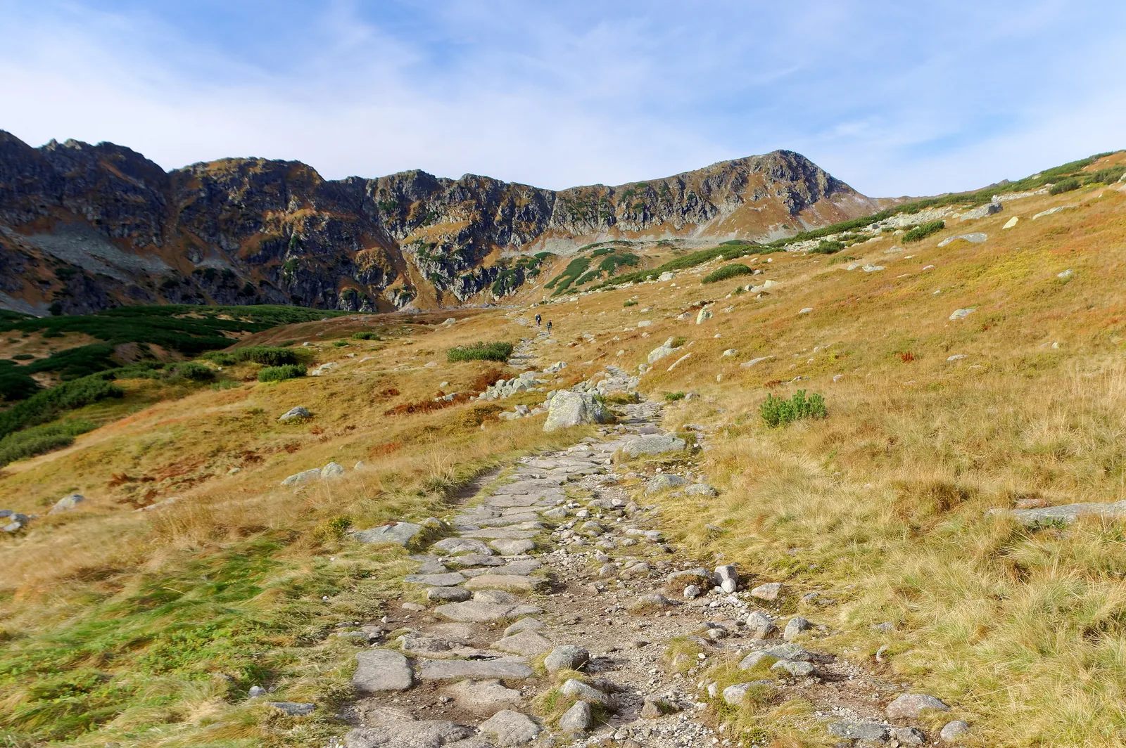
Hut in the Valley of Five Polish Ponds In the Valley of Five Polish Ponds (Dolina Pięciu Stawów Polskich), linked to Morskie Oko by a trail over the ridge.
High valley with five lakes and a hut at 1,670 m (5,479 ft).
Hut 1,670 m (OSM)
Crossing to Morskie Oko closed 1 Dec – 15 May Add to your Tatra National Park visit Open in OpenStreetMap ↗ Location source ↗
49.21364, 20.04862
All places
Kuźnice lower station Kuźnice is closed to private cars; you get there by bus from Zakopane or on foot, about 40 minutes according to PKL.
Own page
Kasprowy Wierch 936 metres of height in two cabins, a summit on the Slovak border and a ticket that already includes park entry.
Cable car, prices & access
Add to your Tatra National Park visit Open in OpenStreetMap ↗ Location source ↗
49.26936, 19.97924
All places
Myślenickie Turnie This is where you change to the second cabin.
Own page
Kasprowy Wierch 936 metres of height in two cabins, a summit on the Slovak border and a ticket that already includes park entry.
Cable car, prices & access
Add to your Tatra National Park visit Open in OpenStreetMap ↗ Location source ↗
49.25192, 19.97380
All places Photo: Jakub Hałun ↗ · CC BY-SA 4.0 ↗
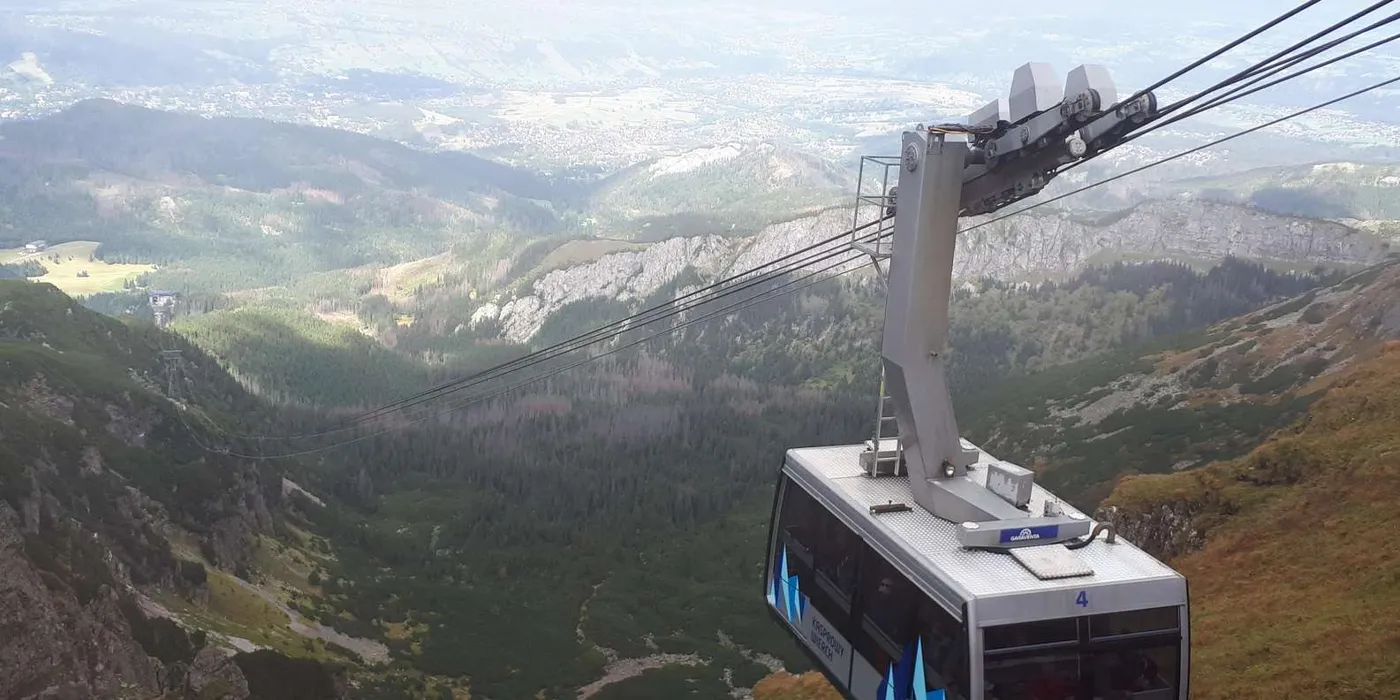
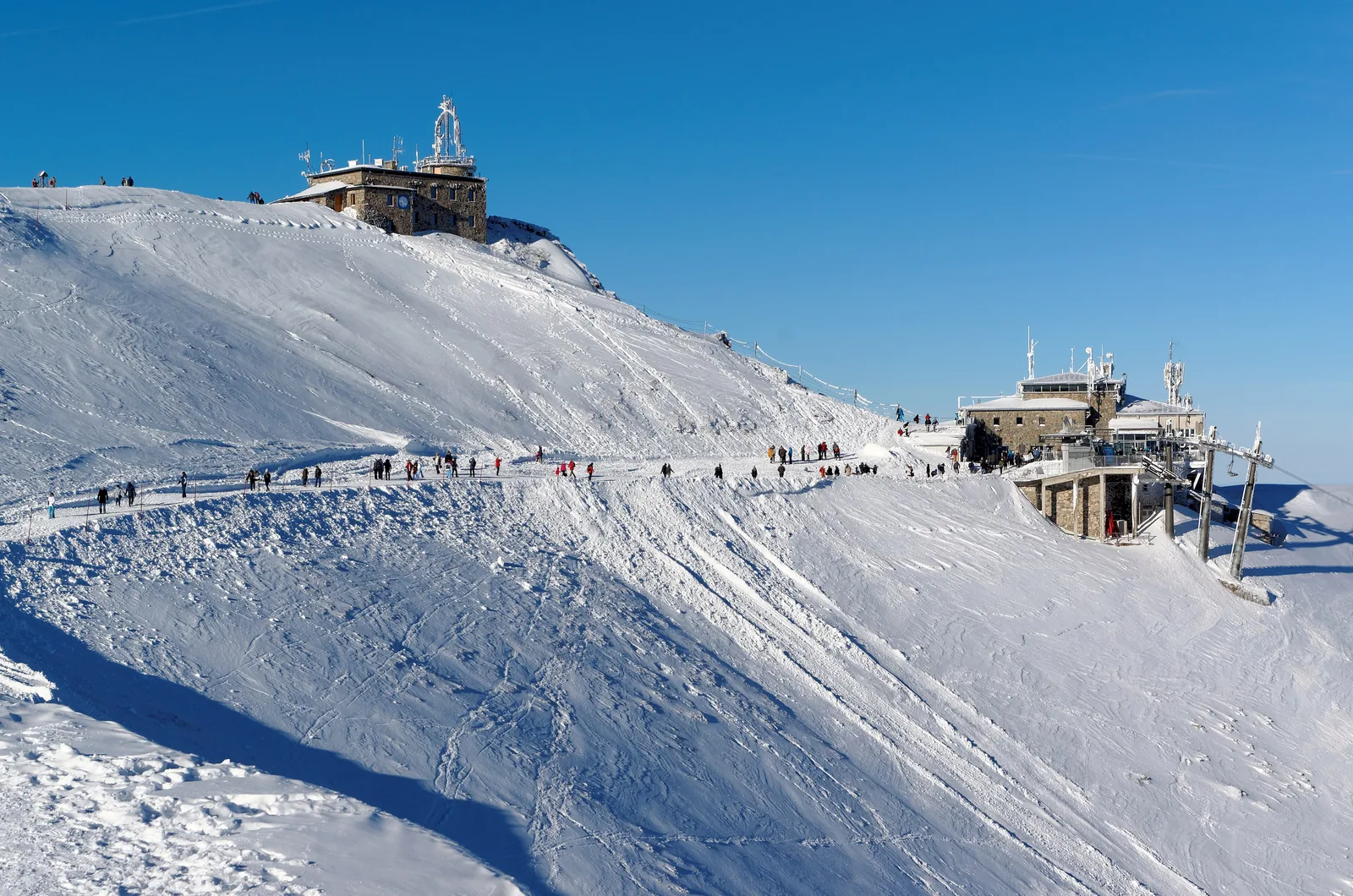
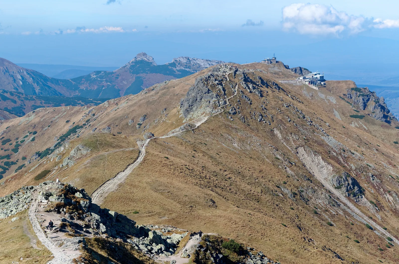
Kasprowy Wierch Summit on the border with Slovakia with a weather observatory; the top station lies at 1,959 m (6,427 ft) according to the TPN.
By cable car from Kuźnice to almost 2,000 metres (6,560 ft).
Line length 4,291.59 m
Height difference 936 m (3,071 ft)
Top station 1,959 m (6,427 ft)
Cabin up to 60 people
Change Myślenickie Turnie Own page
Kasprowy Wierch 936 metres of height in two cabins, a summit on the Slovak border and a ticket that already includes park entry.
Cable car, prices & access
Add to your Tatra National Park visit Open in OpenStreetMap ↗ Location source ↗
49.23180, 19.98156
All places
Murowaniec Hut on Hala Gąsienicowa, reached on foot from Kasprowy Wierch over the Liliowe pass or from Kuźnice.
Own page
Kasprowy Wierch 936 metres of height in two cabins, a summit on the Slovak border and a ticket that already includes park entry.
Cable car, prices & access
Add to your Tatra National Park visit Open in OpenStreetMap ↗ Location source ↗
49.24341, 20.00716
All places
Giewont The mountain above Zakopane whose outline is known as the “Sleeping Knight”.
Add to your Tatra National Park visit Open in OpenStreetMap ↗ Location source ↗
49.25095, 19.93410
All places
Kiry car park TPN car park at the entrance to the Kościeliska Valley, PLN 30 for cars and motorcycles.
How to get there: Zakopane, Palenica Białczańska and Kuźnice
Other TPN car parks Kiry at the Kościeliska Valley and Chałubińskiego in Zakopane cost PLN 30 a day, Wierch Poroniec PLN 40. The Zazadnia car park is closed because of road works.
TPN: All car parks of the park with rates (Polish) ↗
Add to your Tatra National Park visit Open in OpenStreetMap ↗ Location source ↗
49.27603, 19.86705
All places
Dolina Kościeliska A wide limestone valley with a track; in spring flocks of sheep move up to the pastures.
Add to your Tatra National Park visit Open in OpenStreetMap ↗ Location source ↗
49.25264, 19.86601
All places
Jaskinia Mroźna One of the six caves open to visitors, unlit; bring your own torch. Open 9:00 to 17:00.
Add to your Tatra National Park visit Open in OpenStreetMap ↗ Location source ↗
49.25111, 19.86926
All places Photo: Jakub Hałun ↗ · CC BY-SA 4.0 ↗
TPN tourist information Chałubińskiego 44 at the Jana Pawła II roundabout, daily 7:30 to 16:30 except public holidays; tickets for entry and parking.
Own page
Kasprowy Wierch 936 metres of height in two cabins, a summit on the Slovak border and a ticket that already includes park entry.
Kuźnice–Kasprowy Wierch cable car 2026 (PLN, Tourpass) Return, 1 Oct – 18 Dec 2026 129 One way, 1 Oct – 18 Dec 2026 119 Express with fixed time, return, low season 159
Cable car, prices & access
Guided from here · Ad
Partner links: we may earn a commission if you book – at no extra cost to you. Thank you for supporting the atlas. Dates and prices with the provider.
Add to your Tatra National Park visit Open in OpenStreetMap ↗ Location source ↗
49.28492, 19.97333
All places
Kasprowy Wierch top station End of the cable car; the ticket office here is the only place selling tickets just for the ride down.
Own page
Kasprowy Wierch 936 metres of height in two cabins, a summit on the Slovak border and a ticket that already includes park entry.
Cable car, prices & access
Add to your Tatra National Park visit Open in OpenStreetMap ↗ Location source ↗
49.23284, 19.98278
All places
Old Hut (Stare Schronisko) At the end of the paved road; built in 1891 as a coach house for the carriages, later converted into lodgings.
Own page
Morskie Oko Eight kilometres of paved road without cars, a car park only with an online ticket, and at the end the largest lake in the Tatras.
Parking, trail & e-bus
Add to your Tatra National Park visit Open in OpenStreetMap ↗ Location source ↗
49.20205, 20.07080