National Parks Atlas
To the park
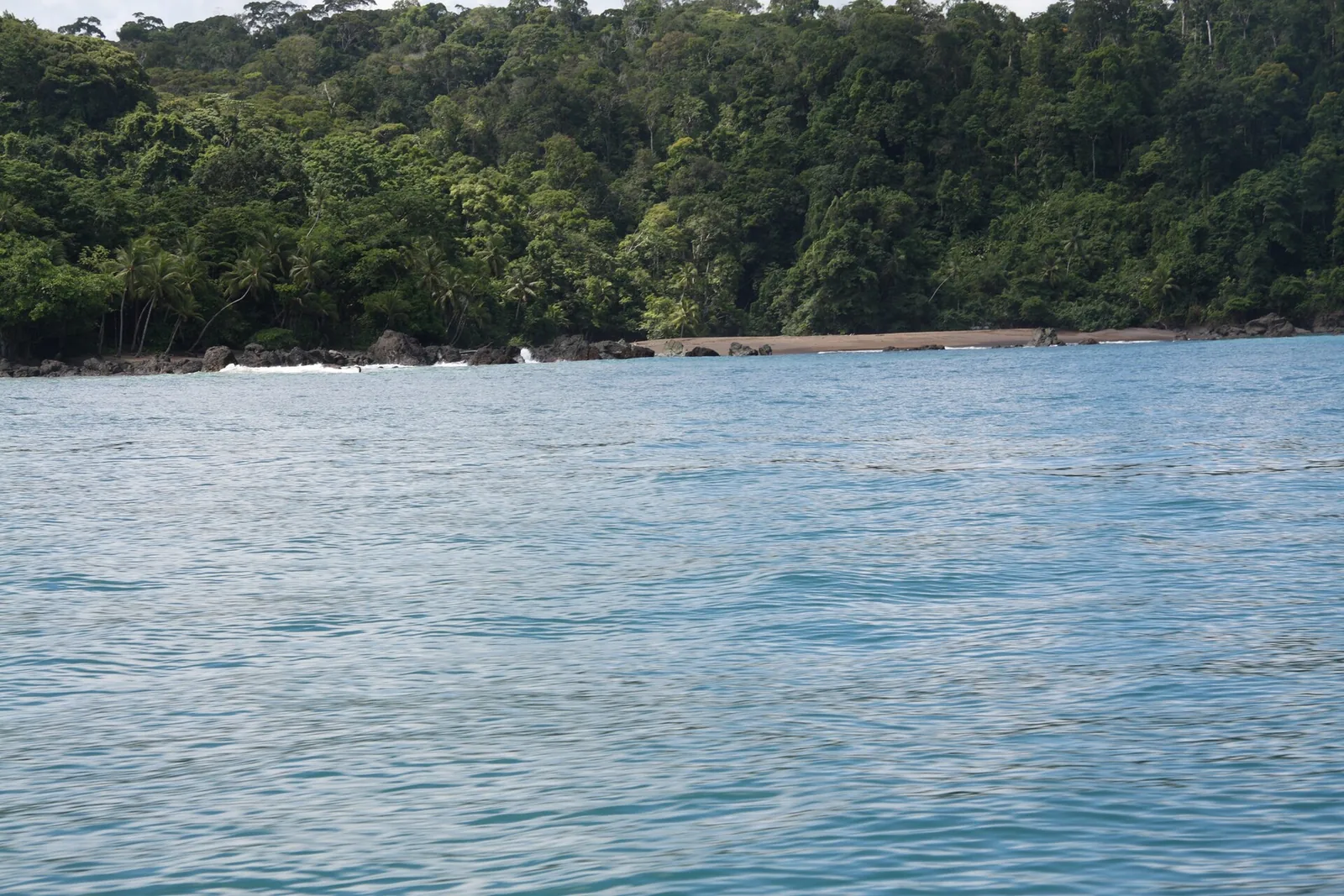
The coast of Corcovado National Park seen from a boat: dense rainforest runs down to the beach above calm blue water

Corcovado National Park: map

11 places with verified coordinates · 3 with photo

Bookable in the park · 3

Ad · partner links: we may earn a commission if you book – at no extra cost to you. Thank you for supporting the atlas. Offer details checked 4 Oct 2026; dates and prices with the provider.

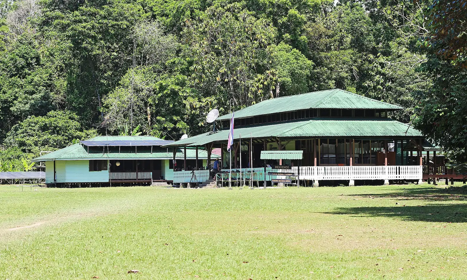
The wooden Sirena ranger station in Corcovado National Park with a green roof on a lawn in front of dense rainforest
Photo: Bernard Gagnon ↗ · CC0 ↗

Arrival · Ranger station in the heart of the park

Sirena Station (Estación Sirena)

Destination of most boat tours, with an airstrip, campsite and basic lodging. Closed in October.

The heart of the park, reached by boat or light aircraft.

Facilities
airstrip, campsite, lodging
Closed
October
Access
only with a guide

Best time to visit: all sectors except in October

Sirena closed in October

Sirena station is closed for the whole of October, according to the ICT – because of heavy rain and for maintenance. The ICT lists the other sectors as open seven days a week all year.

ICT: Admission fees and hours of Costa Rica's national parks (Leona, San Pedrillo, Los Patos, Sirena sectors) ↗

Tours & day trips: guided hikes, day tours and nights at Sirena

Day trip to Sirena

By boat from Drake Bay, then several hours guided through the forest around the station. A checked offer including the park fee is listed below.

GetYourGuide: day trip Drake Bay–Sirena (evidence for itinerary and meeting point) · Ad ↗

Where to stay: Drake Bay, Puerto Jiménez or Sirena station

At Sirena station

The ICT lists a campsite, rustic lodging, drinking water, toilets and radio at the station. The two-day tour below covers a bed, meals and park fees.

Costa Rica Tourism Board (ICT): Corcovado National Park – area, guide rule, getting there ↗

Open in OpenStreetMap ↗Location source ↗

8.48048, -83.58919

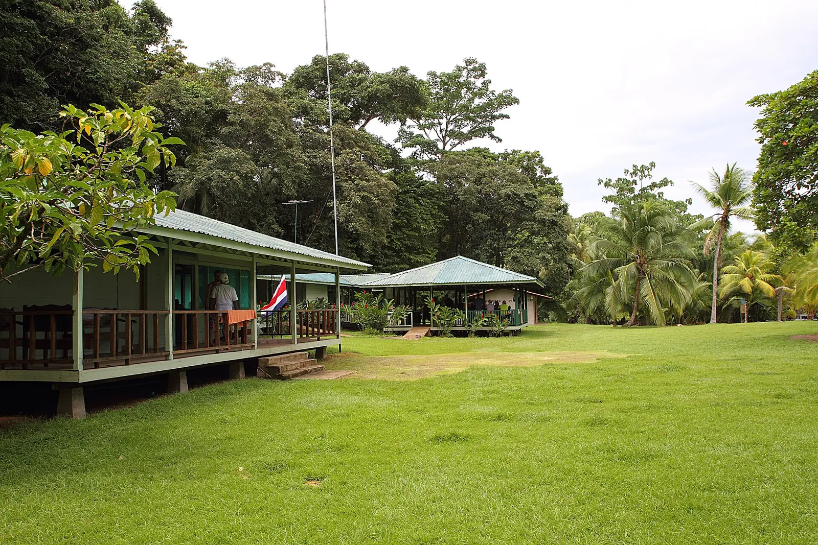
Wooden houses with green roofs on a lawn at San Pedrillo station in Corcovado National Park, surrounded by palms and rainforest
Photo: Cephas ↗ · CC BY-SA 4.0 ↗

Arrival · North-western sector

San Pedrillo

On the beach south of Drake Bay, reached by boat. A sector of its own with a day ticket.

The north-western sector, right by the sea.

Location
north-west coast
Access
boat from Drake Bay or Uvita
Fee, international
US$15 a day

Tours & day trips: guided hikes, day tours and nights at Sirena

San Pedrillo from Uvita

The north-western sector lies right by the sea; from Uvita the boat takes about one and a half hours.

ICT: Admission fees and hours of Costa Rica's national parks (Leona, San Pedrillo, Los Patos, Sirena sectors) ↗

Open in OpenStreetMap ↗Location source ↗

8.62077, -83.73442

Arrival · Ranger station on the eastern edge

Los Patos Station

Reached overland via La Palma, by shared taxi according to the ICT.

How to get there: by boat from Drake Bay or Uvita, via Puerto Jiménez or by air

To Los Patos

A private shared taxi from La Palma goes to Los Patos station on the eastern edge, according to the ICT.

Costa Rica Tourism Board (ICT): Corcovado National Park – area, guide rule, getting there ↗

Open in OpenStreetMap ↗Location source ↗

8.57285, -83.50827

Arrival · Southern sector, on the park edge

La Leona

Reached via Carate on the south coast; from here the coast runs west towards Sirena.

Open in OpenStreetMap ↗Location source ↗

8.44859, -83.48560

Surroundings · Hamlet, outside the park

Carate

End of the 40 km (25 mi) gravel road from Puerto Jiménez.

How to get there: by boat from Drake Bay or Uvita, via Puerto Jiménez or by air

By car

Via the Inter-American Highway to the La Chacarita petrol station, then on gravel roads to Puerto Jiménez or Drake Bay, about seven hours from San José each. From Puerto Jiménez it is 40 km (25 mi) of gravel, about one and a half hours, to Carate.

Costa Rica Tourism Board (ICT): Corcovado National Park – area, guide rule, getting there ↗

Open in OpenStreetMap ↗Location source ↗

8.44305, -83.46015

Surroundings · Town on the Golfo Dulce, outside the park

Puerto Jiménez

Airstrip, bus to San José and the starting point for Carate and Los Patos.

How to get there: by boat from Drake Bay or Uvita, via Puerto Jiménez or by air

By bus

Transportes Blanco Lobo runs directly from San José to Puerto Jiménez, about nine hours. From there a shared truck leaves at 6:00 and 13:30 for Carate, taking about two hours.

Costa Rica Tourism Board (ICT): Corcovado National Park – area, guide rule, getting there ↗

Where to stay: Drake Bay, Puerto Jiménez or Sirena station

Puerto Jiménez

On the Golfo Dulce, with an airstrip and a bus to San José. From here you head to Carate and Los Patos.

Costa Rica Tourism Board (ICT): Corcovado National Park – area, guide rule, getting there ↗

Open in OpenStreetMap ↗Location source ↗

8.53541, -83.30613

Surroundings · Village on the bay, outside the park

Agujitas de Drake (Drake Bay)

Starting point of the boat tours to Sirena and San Pedrillo; airstrip nearby.

How to get there: by boat from Drake Bay or Uvita, via Puerto Jiménez or by air

By boat

According to the ICT, boats leave from Golfito, Puerto Jiménez, Sierpe, Drake Bay and Bahía Uvita; depending on the starting point the trip takes 30 minutes to one and a half hours.

Costa Rica Tourism Board (ICT): Corcovado National Park – area, guide rule, getting there ↗

Where to stay: Drake Bay, Puerto Jiménez or Sirena station

Drake Bay

The village on the bay is the starting point of most boat tours; lodges and small hotels sit by the water.

Costa Rica Tourism Board (ICT): Corcovado National Park – area, guide rule, getting there ↗

Open in OpenStreetMap ↗Location source ↗

8.68907, -83.66452

Arrival · Boat landing on the Río Sierpe, outside

Sierpe

Boats leave from here through the mangroves to Drake Bay.

Open in OpenStreetMap ↗Location source ↗

8.86190, -83.47107

Surroundings · Town on the Pacific coast, outside

Uvita

Boats to San Pedrillo, about one and a half hours across the sea.

Guided from here · Ad

Partner links: we may earn a commission if you book – at no extra cost to you. Thank you for supporting the atlas. Dates and prices with the provider.

Open in OpenStreetMap ↗Location source ↗

9.17310, -83.73640

Water · Lagoon in the interior

Laguna Corcovado

Part of the freshwater marshes at the centre of the park, not reachable on public trails.

Open in OpenStreetMap ↗Location source ↗

8.54687, -83.61030

Locations verified from the linked original sources and OpenStreetMap. The map shows no trails or park boundaries; markers do not imply that access is permitted.

Map: © OpenStreetMap contributors, OpenMapTiles, OpenFreeMap. Elevation: Terrain Tiles (Mapzen, AWS Open Data); 3DEP, GMTED2010 and SRTM courtesy of the U.S. Geological Survey; EU-DEM (Copernicus, European Union); ETOPO1 (NOAA); ArcticDEM (NSF, DigitalGlobe); Geoscience Australia; Open Data Austria (DGM); Open Government Licence – Canada; INEGI; Land Information New Zealand; Kartverket; Environment Agency (UK).

Park photo: Photo: User: (WT-shared) Velorian at wts wikivoyage ↗ · CC BY-SA 1.0 ↗

Loading map …