National Parks Atlas
To the park
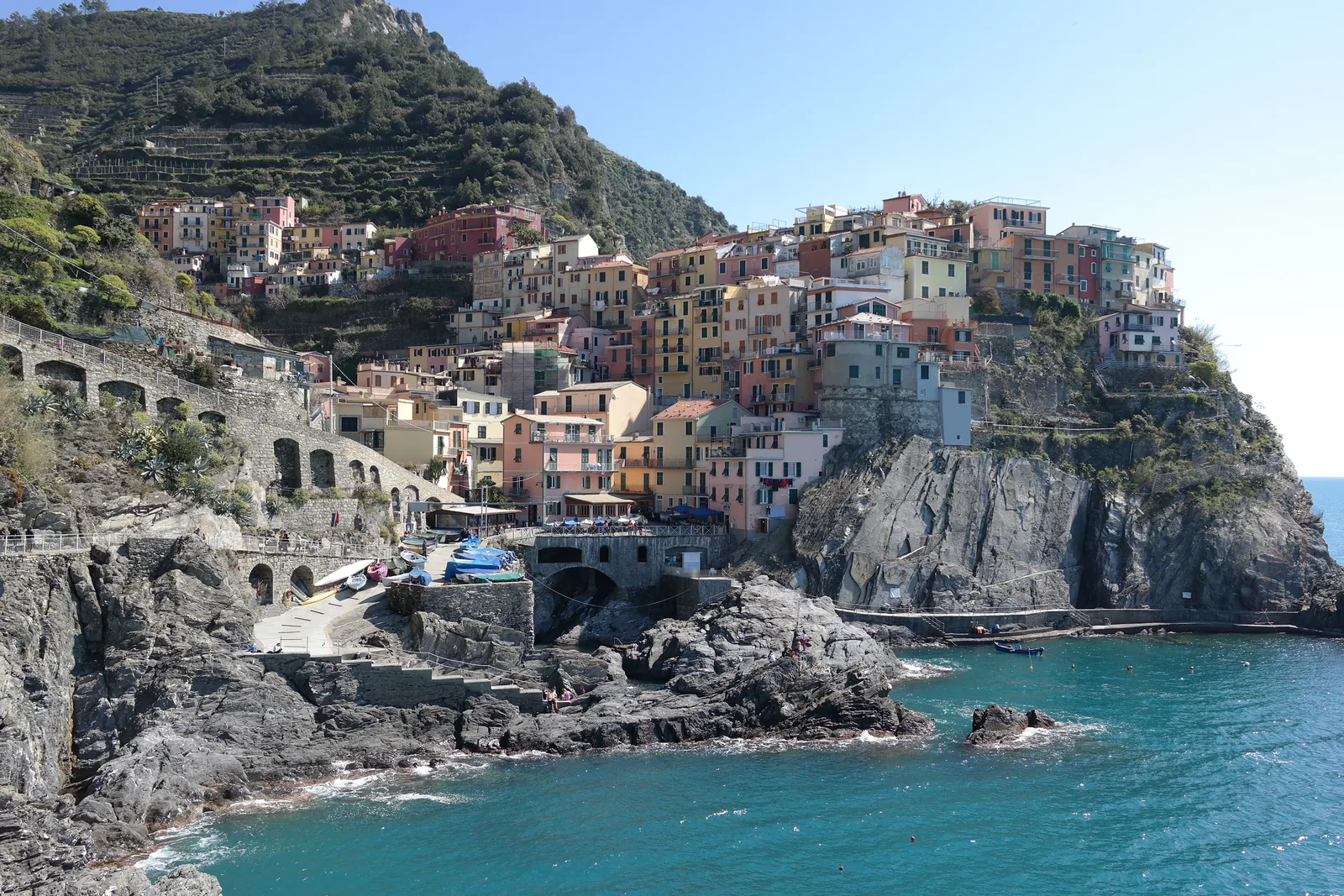
Manarola in Cinque Terre National Park: colourful houses on a dark rock ridge above the sea, with vineyard terraces behind

Cinque Terre National Park: map

28 places with verified coordinates · 7 with photo

Bookable in the park · 8

Ad · partner links: we may earn a commission if you book – at no extra cost to you. Thank you for supporting the atlas. Offer details checked 4 Oct 2026; dates and prices with the provider.

Surroundings · Village, entrance to the Via dell'Amore

Riomaggiore

The southernmost of the five villages. The Via dell'Amore starts here; turn left out of the station.

Where to stay: in the villages, not in a tent

Via dell'Amore in both directions

Guests with the Riomaggiore Guest Card pay less for the Via dell'Amore and may walk it in both directions, even outside the time slot, for the length of their stay. Guests at CETS-labelled places may walk back after closing time.

Park authority: how to visit the Via dell'Amore (2026) ↗

Open in OpenStreetMap ↗Location source ↗

44.09897, 9.73867

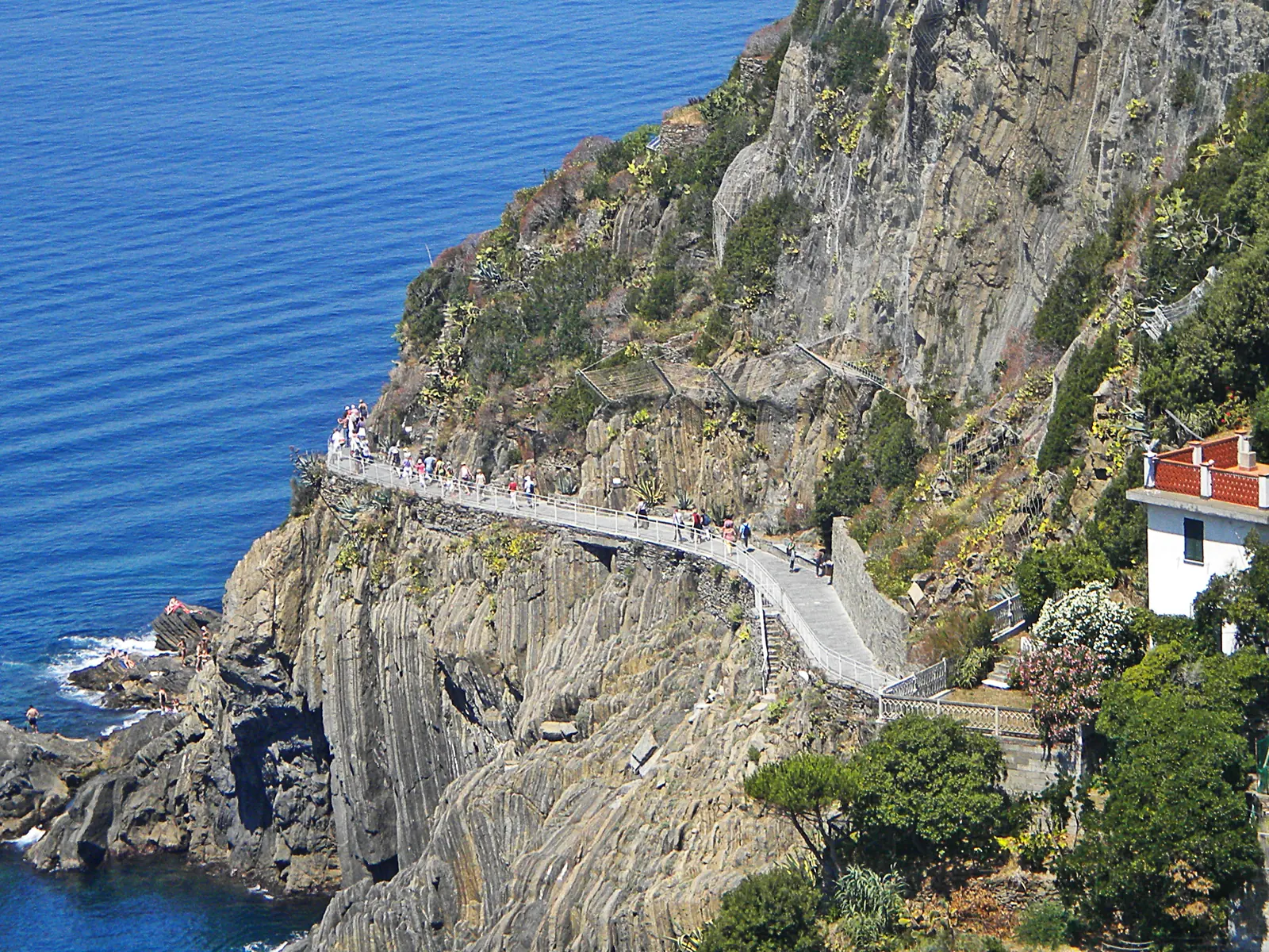
The Via dell'Amore between Riomaggiore and Manarola: a pale path with a railing on the steep cliff coast, deep blue sea below
Photo: Massimilianogalardi ↗ · CC BY-SA 3.0 ↗

Arrival · Station with infopoint

Bahnhof Riomaggiore

Stop for regional trains between La Spezia and Levanto. Park infopoint selling the Card.

Own page

Via dell'Amore

900 metres in the rock above the sea — open again after twelve years, but only with a booked entry.

Via dell'Amore with the Cinque Terre Card, as of 4 Oct 2026
Trekking Card, 1 day, ages 12–69€10
Trekking Card, 2 days€17
Trekking Card, 3 days€23.50

Tickets & hours

Guided from here · Ad

Partner links: we may earn a commission if you book – at no extra cost to you. Thank you for supporting the atlas. Dates and prices with the provider.

Open in OpenStreetMap ↗Location source ↗

44.10062, 9.73614

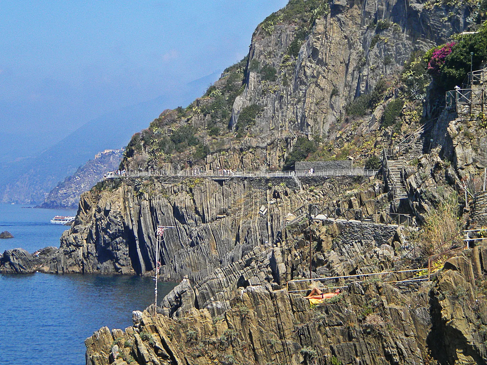
The Via dell'Amore in Cinque Terre National Park: a walled path with a railing on the steep, layered rock coast above the sea
Photo: Massimilianogalardi ↗ · CC BY-SA 3.0 ↗

Trails · Trail 592-1, timed entry only

Via dell'Amore

Riomaggiore–Manarola, 1.1 km (0.7 mi) and 25 minutes according to the park authority. Visitors walk one way only and need a booked entry slot.

Open again since 2024 — but only with a time slot and in one direction.

Length
1.1 km (0.7 mi) per the park, 900 m (2,953 ft) per the municipality
Walking time
25 to 30 minutes
Entry
400 per hour
Direction
Riomaggiore → Manarola only
Until 24 Oct 2026
9:00–21:00
From 26 Oct 2026
9:00–18:00

Own page

Via dell'Amore

900 metres in the rock above the sea — open again after twelve years, but only with a booked entry.

Tickets & hours

Best time to visit: fare bands, weather warnings and winter fares

Via dell'Amore: open until 21:00

From 29 March to 24 October 2026, daily 9:00 to 21:00, last entry 20:30. From 26 October, 9:00 to 18:00, last entry 17:30.

Park authority: how to visit the Via dell'Amore (2026) ↗

Hikes & routes: the Sentiero Azzurro and the trails above it

Via dell'Amore: 25 minutes

Riomaggiore–Manarola over 1.1 km (0.7 mi), level and rated "turistico" by the park. Cut into the rock from 1926 to 1928, following the tracks of the workers who built the railway.

Park authority: trail 592-1 Riomaggiore–Manarola (Via dell'Amore) ↗

Open in OpenStreetMap ↗Location source ↗

44.10135, 9.73426

History · Castle, entry with the Via dell'Amore ticket

Castello di Riomaggiore

Built in 1260 by the Marchesi Turcotti, according to the municipality. Open daily, included in the Via dell'Amore ticket.

Own page

Via dell'Amore

900 metres in the rock above the sea — open again after twelve years, but only with a booked entry.

Tickets & hours

Open in OpenStreetMap ↗Location source ↗

44.09988, 9.73753

History · Sanctuary above Riomaggiore

Santuario di Montenero

End of trail 593V from Riomaggiore, on the edge of zone A of the marine protected area at Capo Montenero.

Open in OpenStreetMap ↗Location source ↗

44.09610, 9.74553

Broken coastal path between Manarola and Corniglia in Cinque Terre National Park, with rocks and surf below
Photo: Tangopaso ↗ · Public Domain ↗

Surroundings · Village

Manarola

Exit of the Via dell'Amore. The coastal path on to Corniglia is closed because of landslides.

A section of the Sentiero Azzurro that has been impassable for years.

Trail
592-2
Length
2.2 km (1.4 mi)
Walking time when open
1 hour 15 minutes
Status 4 Oct 2026
closed because of landslides
Alternative
train or path via Volastra

Own page

Via dell'Amore

900 metres in the rock above the sea — open again after twelve years, but only with a booked entry.

Tickets & hours

Rules: footwear, fines and closed trails

Manarola–Corniglia closed

The coastal section 592-2 is closed because of landslides, according to the park authority. Between the two villages, take the train or the path via Volastra.

Park authority: trail 592-2 Manarola–Corniglia (closed) ↗

Open in OpenStreetMap ↗Location source ↗

44.10633, 9.72748

Nature · Hamlet above Manarola

Volastra

Reached by park bus. The alternative path from Manarola to Corniglia above the closed coast runs via Volastra.

Open in OpenStreetMap ↗Location source ↗

44.11560, 9.72918

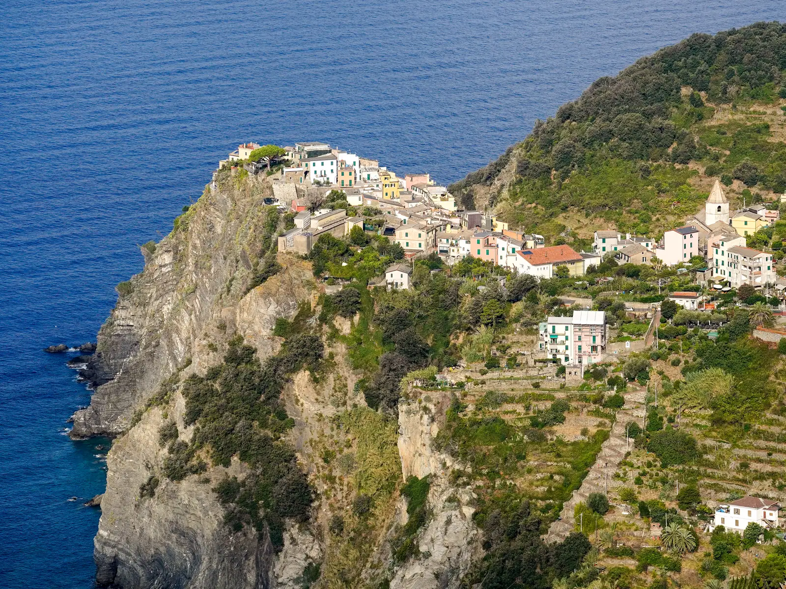
Corniglia in Cinque Terre National Park on its rocky promontory above the sea, with vineyard terraces on the slope to the right
Photo: Timothy A. Gonsalves ↗ · CC BY-SA 4.0 ↗

Surroundings · Village on the cliff, no ferry pier

Corniglia

The only one of the five villages without a harbour; according to the timetable the ferries pass without stopping.

The village without a harbour, 377 steps above the station.

Lardarina staircase
33 flights, 377 steps
Ferry
no stop
To Vernazza
4.1 km (2.5 mi), 1.5 hours
To Manarola along the coast
closed
Ascent to Vernazza
269 m (883 ft)

How to get there: by train from La Spezia, Florence, Pisa and Genoa

By ferry, except to Corniglia

Line 02 of the Consorzio Marittimo runs from La Spezia, Lerici and Porto Venere to Riomaggiore, Manarola, Vernazza and Monterosso. Corniglia has no pier. The day ticket from La Spezia costs €42, reduced €15.

Consorzio Marittimo Turistico: line 02 price list (PDF) ↗

Open in OpenStreetMap ↗Location source ↗

44.11996, 9.70869

Arrival · Staircase from the station

Scalinata Lardarina

33 flights with 377 steps up from the station to the village, according to the park authority.

Hikes & routes: the Sentiero Azzurro and the trails above it

Corniglia–Vernazza: 1.5 hours

4.1 km (2.5 mi) and 269 m (883 ft) of ascent. From Corniglia station up the 377 steps of the Lardarina into the village, then onto the path at the checkpoint beyond it.

Park authority: trail 592-3 Corniglia–Vernazza ↗

Open in OpenStreetMap ↗Location source ↗

44.12000, 9.71101

Arrival · Station down by the sea

Bahnhof Corniglia

Start of trail 592-3 to Vernazza, 4.1 km (2.5 mi) and about 1.5 hours.

Open in OpenStreetMap ↗Location source ↗

44.11854, 9.71631

Water · Bay between Corniglia and Vernazza

Guvano

Shingle bay below an old landslide. The park authority's kayak route 2 runs here from Vernazza.

Hikes & routes: the Sentiero Azzurro and the trails above it

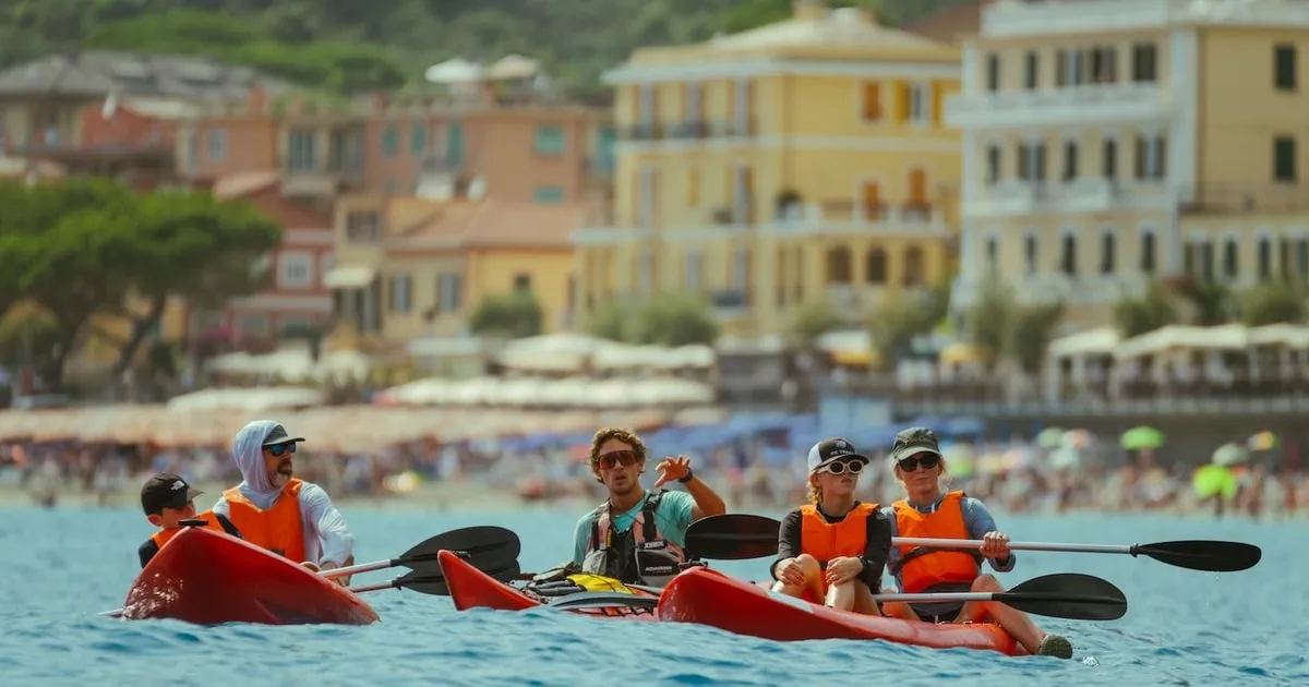
Kayaking in the marine protected area

The park authority describes kayak routes from Levanto to Punta Pineda, such as Monterosso–Vernazza in 22 to 44 minutes. No boat may enter the zones A marked by buoys.

Park authority: kayak routes in the marine protected area ↗

Open in OpenStreetMap ↗Location source ↗

44.12589, 9.70237

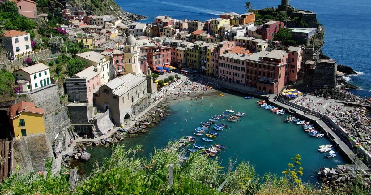
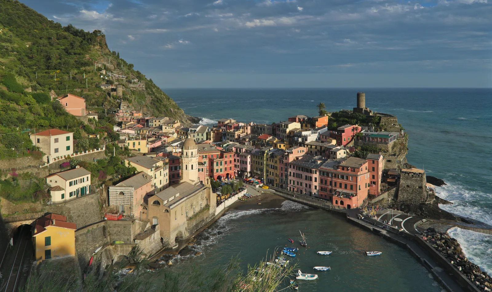
View from the Sentiero Azzurro in Cinque Terre National Park of Vernazza with its small harbour and the tower on the headland
Photo: СССР ↗ · CC BY-SA 2.5 CA ↗

Surroundings · Village with a natural harbour

Vernazza

Finish and start of the two open sections of the Sentiero Azzurro. Line 02 ferry pier.

The busiest section — card required, with steps and a checkpoint.

Length
3.7 km (2.3 mi)
Ascent
217 m (712 ft)
Walking time
2 hours, 2:15 back
Grade
EE, for experienced hikers
Card
Trekking or Train
Status 4 Oct 2026
open, Servano section closed

Hikes & routes: the Sentiero Azzurro and the trails above it

Vernazza–Monterosso: 2 hours

3.7 km (2.3 mi) and 217 m (712 ft) of ascent, 2 hours 15 minutes in the other direction. Card required, with a checkpoint. Near Monterosso the path currently runs via Via Corone.

Park authority: trail 592-4 Vernazza–Monterosso, with ordinance no. 77 of 24 Aug 2026 ↗

Open in OpenStreetMap ↗Location source ↗

44.13494, 9.68278

History · Sanctuary above Vernazza

Santuario di Reggio

On trail 508 from Vernazza to Foce Drignana, 2 hours 15 minutes to the pass.

Open in OpenStreetMap ↗Location source ↗

44.14307, 9.68745

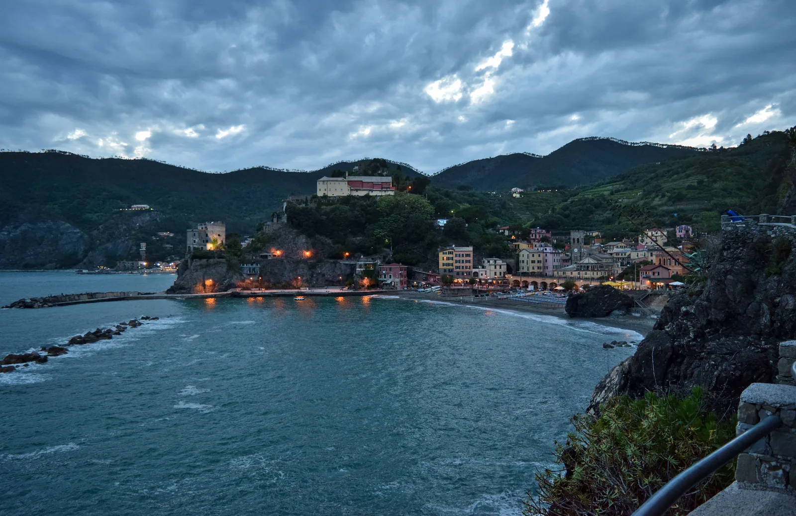
Dusk over the harbour of Monterosso al Mare in Cinque Terre National Park, with the lights of the village and wooded hills behind
Photo: The Cosmonaut ↗ · CC BY-SA 2.5 CA ↗

Surroundings · Largest village, beach

Monterosso al Mare

Northern end of the Sentiero Azzurro, with a ferry pier and the only large car parks of the five villages.

The largest village, with a beach, ferry and the only large car parks.

Park Fegina
270 spaces
Park Loreto
160 spaces
Parking 8:00–22:00
€3 per hour
Parking 24 hours
€30
Train from La Spezia
about 25 minutes
To Punta Mesco
1 hour 15 minutes

Own page

Monterosso al Mare

The largest of the five villages, with a beach, a ferry pier and the start of the Sentiero Azzurro.

Getting there & trails

Cinque Terre National Park: five villages, one park

The villages lie inside the park

By the boundary in OpenStreetMap, Riomaggiore, Manarola, Corniglia, Vernazza and Monterosso are all inside the park. La Spezia and Levanto, the ends of the railway line, lie outside.

Cinque Terre National Park (park authority) ↗

How to get there: by train from La Spezia, Florence, Pisa and Genoa

By car

The park authority advises against driving because of the mountain roads and lack of parking; motorway exits La Spezia or Carrodano. Only permit holders may enter the traffic zone in Riomaggiore. Monterosso has the large car parks: Fegina with 270 spaces, €3 per hour or €30 per day.

Municipality of Monterosso al Mare: car parks and 2026 rates ↗

Open in OpenStreetMap ↗Location source ↗

44.14652, 9.65556

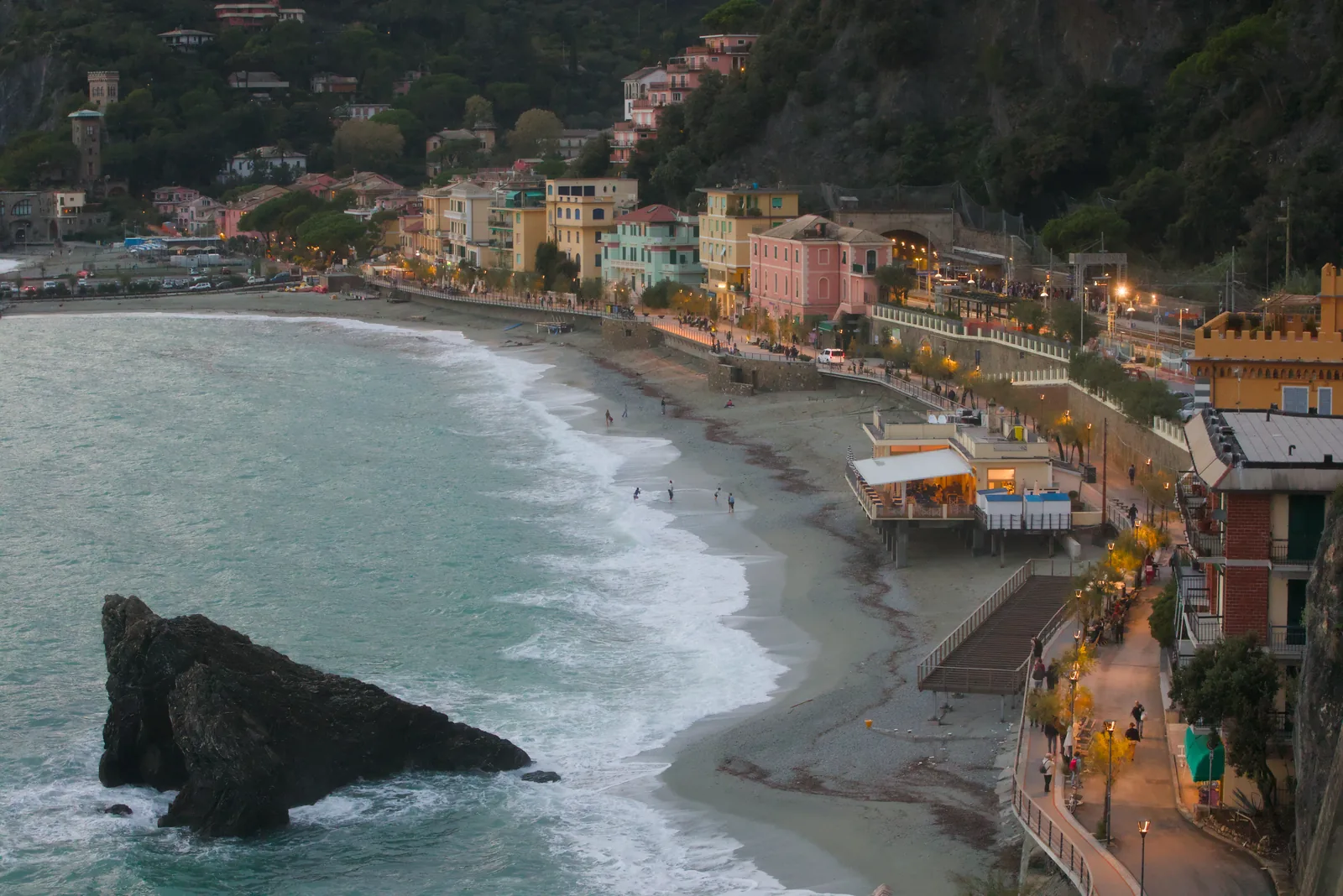
Monterosso al Mare at dusk: the beach of Fegina with a rock in the surf and the lit promenade behind
Photo: Benjamin Smith ↗ · CC BY-SA 4.0 ↗

Arrival · Station in Fegina

Bahnhof Monterosso

All regional trains stop here; the park's infopoint is also in Fegina.

Own page

Monterosso al Mare

The largest of the five villages, with a beach, a ferry pier and the start of the Sentiero Azzurro.

Parking in Monterosso, rates 26 Mar–1 Nov 2026
Hour, 8:00–22:00€3
Hour, 22:00–8:00€0.50
24 hours€30

Getting there & trails

How to get there: by train from La Spezia, Florence, Pisa and Genoa

5 Terre Express every half hour

From 14 March to 1 November 2026, according to Trenitalia, 46 extra trains a day run between Levanto and La Spezia, about every 30 minutes, stopping in all five villages. La Spezia Centrale–Monterosso takes about 25 minutes.

Trenitalia, 13 Mar 2026: 5 Terre Express back in service ↗

Guided from here · Ad

Partner links: we may earn a commission if you book – at no extra cost to you. Thank you for supporting the atlas. Dates and prices with the provider.

Open in OpenStreetMap ↗Location source ↗

44.14589, 9.64899

Nature · Watchtower

Torre Aurora

Tower on the rock between the old town and Fegina, at the start of the path to Vernazza.

Own page

Monterosso al Mare

The largest of the five villages, with a beach, a ferry pier and the start of the Sentiero Azzurro.

Getting there & trails

Best time to visit: fare bands, weather warnings and winter fares

Closure near Monterosso since August

After storms, the municipality of Monterosso closed the section near Servano by ordinance no. 77 of 24 August 2026. The Sentiero Azzurro to Vernazza remains accessible via Via Corone.

Park authority: trail 592-4 Vernazza–Monterosso, with ordinance no. 77 of 24 Aug 2026 ↗

Open in OpenStreetMap ↗Location source ↗

44.14491, 9.65435

Water · Beach, just outside according to OpenStreetMap

Spiaggia di Fegina

The long beach in front of the newer district. By the OpenStreetMap boundary, the beach itself lies just outside the park.

Own page

Monterosso al Mare

The largest of the five villages, with a beach, a ferry pier and the start of the Sentiero Azzurro.

Getting there & trails

Open in OpenStreetMap ↗Location source ↗

44.14514, 9.64950

History · Ruined hermitage

Sant'Antonio del Mesco

From the 11th century according to the park authority; 2.5 km (1.6 mi) and 301 m (988 ft) of ascent from Monterosso on trail 590.

Own page

Monterosso al Mare

The largest of the five villages, with a beach, a ferry pier and the start of the Sentiero Azzurro.

Getting there & trails

Hikes & routes: the Sentiero Azzurro and the trails above it

Monterosso–Punta Mesco: 1 hour 15 minutes

Trail 590 climbs 301 m (988 ft) to the ruined hermitage of Sant'Antonio from the 11th century. Trail 591 continues to Levanto, 2 hours 15 minutes.

Park authority: trail 590 Monterosso–Sant'Antonio del Mesco ↗

Nature: terraces, dry-stone walls and a marine protected area

Marine protected area since 1997

The Area Marina Protetta was created by ministerial decree of 12 December 1997, with two zones A (full protection) and two zones B at Punta Mesco and Capo Montenero. Since 1999 it has been part of the Pelagos Sanctuary for marine mammals.

Park authority: Cinque Terre Marine Protected Area ↗

Open in OpenStreetMap ↗Location source ↗

44.13845, 9.63500

History · Sanctuary above Monterosso

Santuario di Soviore

End of trail 509 from Monterosso, 1 hour 45 minutes.

Own page

Monterosso al Mare

The largest of the five villages, with a beach, a ferry pier and the start of the Sentiero Azzurro.

Getting there & trails

Open in OpenStreetMap ↗Location source ↗

44.15947, 9.66457

Arrival · Station, outside the park

La Spezia Centrale

Terminus of the 5 Terre Express and stop for long-distance trains; about 3 km (1.9 mi) outside the park boundary.

How to get there: by train from La Spezia, Florence, Pisa and Genoa

From Florence, Pisa and Genoa

According to the Trenitalia timetable for a Wednesday in October: Florence S. M. Novella–La Spezia direct in 2 hours 27 minutes, with a change from 2 hours 8 minutes. Pisa Centrale–La Spezia 50 to 75 minutes. Genova Piazza Principe–Monterosso direct in 1 hour 18 minutes.

Trenitalia: journey planner, queried on 4 Oct 2026 for Wednesday 14 Oct 2026 ↗

Open in OpenStreetMap ↗Location source ↗

44.11156, 9.81358

Arrival · Municipal car park

Park Loreto

160 spaces above the old town, €3 per hour around the clock, €30 for 24 hours.

Own page

Monterosso al Mare

The largest of the five villages, with a beach, a ferry pier and the start of the Sentiero Azzurro.

Getting there & trails

Open in OpenStreetMap ↗Location source ↗

44.14983, 9.65521

Arrival · Access to the Sentiero Azzurro

Via Corone

Since the closure near Servano, the access to the path to Vernazza.

Own page

Monterosso al Mare

The largest of the five villages, with a beach, a ferry pier and the start of the Sentiero Azzurro.

Getting there & trails

Open in OpenStreetMap ↗Location source ↗

44.14601, 9.65590

Mountains & rock · Rock off the coast

Scoglio Corone

Rocky islet off the old town, towards Vernazza.

Own page

Monterosso al Mare

The largest of the five villages, with a beach, a ferry pier and the start of the Sentiero Azzurro.

Getting there & trails

Open in OpenStreetMap ↗Location source ↗

44.14306, 9.65876

Nature · Exit towards Manarola

Via dell'Amore, Abschnitt vor Manarola

Visitors leave the path in Manarola; walking back is only for those entitled.

Own page

Via dell'Amore

900 metres in the rock above the sea — open again after twelve years, but only with a booked entry.

Tickets & hours

Open in OpenStreetMap ↗Location source ↗

44.10387, 9.73018

Arrival · Destination, station

Bahnhof Manarola

Back to Riomaggiore by train, one stop.

Own page

Via dell'Amore

900 metres in the rock above the sea — open again after twelve years, but only with a booked entry.

Tickets & hours

Open in OpenStreetMap ↗Location source ↗

44.10492, 9.72920

Nature · Alternative without a card

Trail 531 via the Beccara

The old link over the hill: 1.5 km (0.9 mi), 202 m (663 ft) of ascent, about 1 hour, for experienced hikers.

Own page

Via dell'Amore

900 metres in the rock above the sea — open again after twelve years, but only with a booked entry.

Tickets & hours

Open in OpenStreetMap ↗Location source ↗

44.10694, 9.73002

Nature · Line 02 ferry

Riomaggiore ferry pier

Ferry pier with boats to Manarola, Vernazza, Monterosso, Porto Venere and La Spezia.

Own page

Via dell'Amore

900 metres in the rock above the sea — open again after twelve years, but only with a booked entry.

Tickets & hours

Open in OpenStreetMap ↗Location source ↗

44.09776, 9.73776

Locations verified from the linked original sources and OpenStreetMap. The map shows no trails or park boundaries; markers do not imply that access is permitted.

Map: © OpenStreetMap contributors, OpenMapTiles, OpenFreeMap. Elevation: Terrain Tiles (Mapzen, AWS Open Data); 3DEP, GMTED2010 and SRTM courtesy of the U.S. Geological Survey; EU-DEM (Copernicus, European Union); ETOPO1 (NOAA); ArcticDEM (NSF, DigitalGlobe); Geoscience Australia; Open Data Austria (DGM); Open Government Licence – Canada; INEGI; Land Information New Zealand; Kartverket; Environment Agency (UK).

Park photo: Photo: Luca Aless ↗ · CC BY-SA 4.0 ↗

Loading map …