National Parks Atlas
To the park
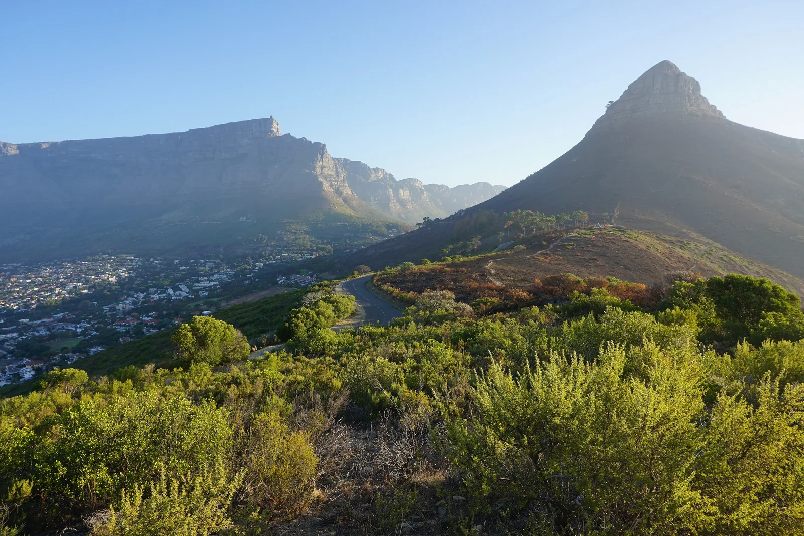
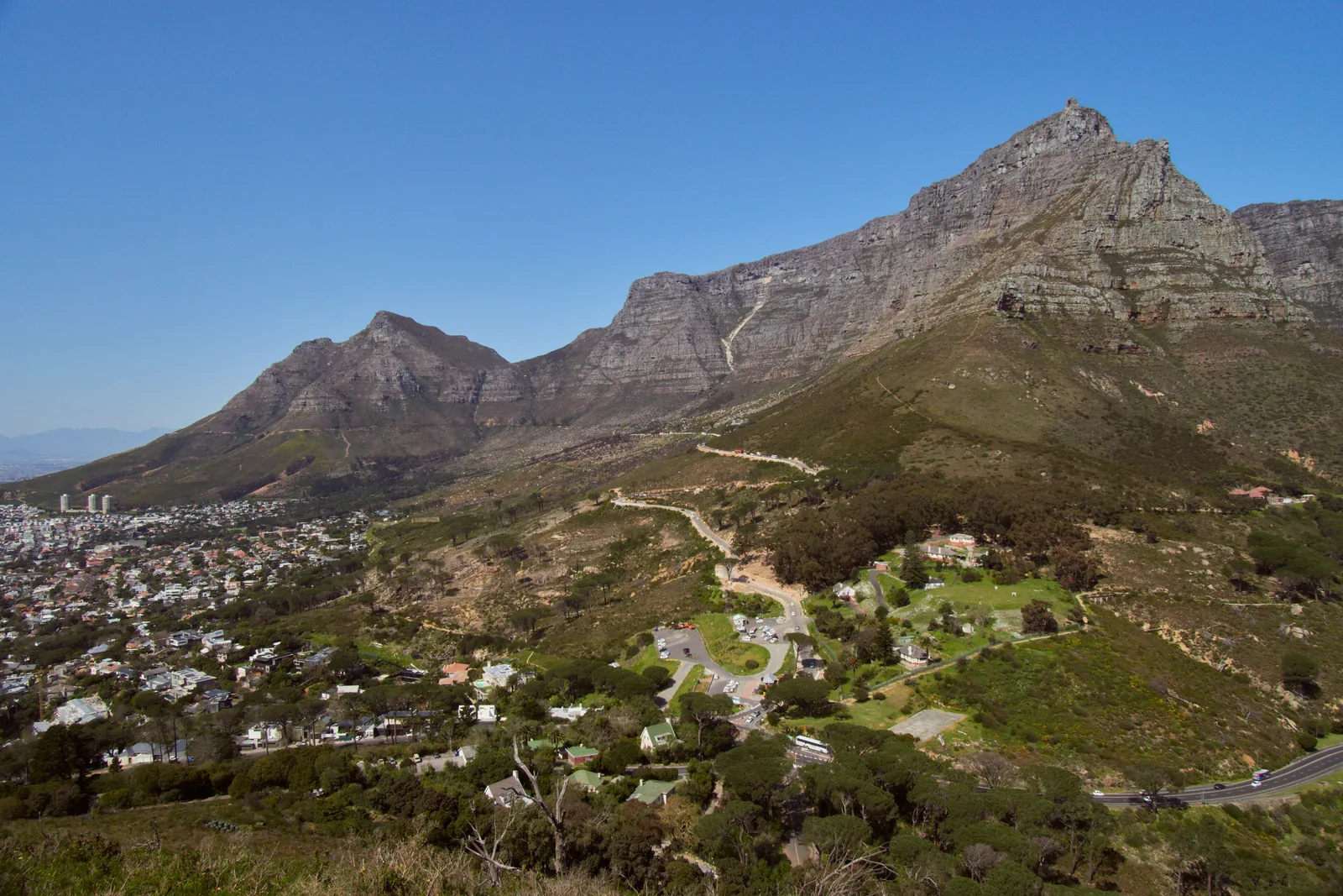
View from Lion’s Head of Table Mountain and Devil’s Peak, with the houses of Cape Town and the road to Kloof Nek below

Table Mountain National Park: map

26 places with verified coordinates · 6 with photo

Bookable in the park · 8

Ad · partner links: we may earn a commission if you book – at no extra cost to you. Thank you for supporting the atlas. Offer details checked 4 Oct 2026; dates and prices with the provider.

Mountains & rock · Lower Cable Station, Tafelberg Road

Lower Cable Station

Where the cableway starts. A free operator shuttle runs here from the free car park on lower Tafelberg Road.

Tickets & entrance fees: Table Mountain free, Cape Point from R515

Cableway: a separate ticket from the operator

The cableway is not run by SANParks and sets its own prices. A return trip costs R475 online for adults and R230 for children aged 4 to 17, R530 and R270 at the ticket office. Children under 4 ride free.

Table Mountain Aerial Cableway: ticket prices 1 Jul 2026 to 30 Jun 2027 ↗

How to get there from Cape Town: bus to the cableway, car to Cape Point

MyCiTi bus to Kloof Nek

Routes 106 and 107 (Civic Centre – Camps Bay) stop at the top of Kloof Nek Road; they leave from the Civic Centre on Hertzog Boulevard. Every passenger needs a loaded myconnect card; cash is not accepted. From the Lower Tafelberg Road stop a free operator shuttle runs to the Lower Cable Station.

Table Mountain Aerial Cableway: getting here ↗

Best time to visit: dry summers, wind all year

Long cableway hours in summer

From 1 December to 31 January the last car goes up at 20:00, from May to August at 17:00. According to the operator, afternoons are usually quieter.

Table Mountain Aerial Cableway: operating hours ↗

Open in OpenStreetMap ↗Location source ↗

-33.94839, 18.40321

Mountains & rock · Upper Cable Station, summit plateau

Upper Cable Station

The end of the cableway and of the Platteklip Gorge path. If the hooter sounds, return to the station straight away.

Best time to visit: dry summers, wind all year

The tablecloth

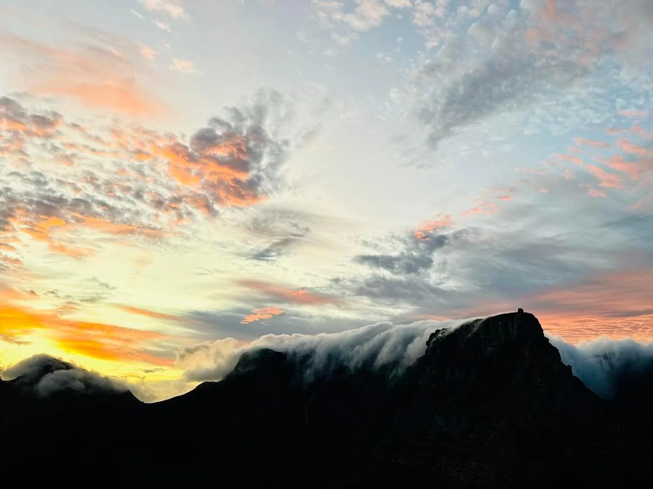
When the south-easter blows in summer, a layer of cloud settles on Table Mountain and pours down its slopes. Mean wind speeds are 20 to 40 km/h (12 to 25 mph) according to SANParks.

SANParks: climate ↗

Tours, hikes and the cableway up Table Mountain

Walks on the summit

The cableway operator runs free 30-minute guided walks every hour on the hour from 9 to 15, from the Twelve Apostles Terrace, weather permitting. On your own: Dassie Walk 15, Agama Walk 30, Klipspringer Walk 45 minutes.

Table Mountain Aerial Cableway: guided walks on the summit ↗

Open in OpenStreetMap ↗Location source ↗

-33.95738, 18.40296

Mountains & rock · Highest point of Table Mountain

Maclear’s Beacon

A cairn on the summit plateau, 45 to 60 minutes from the Upper Cable Station according to SANParks, marked with yellow footprints.

Tours, hikes and the cableway up Table Mountain

To Maclear’s Beacon

From the Upper Cable Station 45 to 60 minutes each way across the plateau, 5.5 km (3.4 mi) in total, easy and marked with yellow footprints. Do not set off in low cloud.

SANParks: hikes, walks and trails (distances and times) ↗

Open in OpenStreetMap ↗Location source ↗

-33.96683, 18.42556

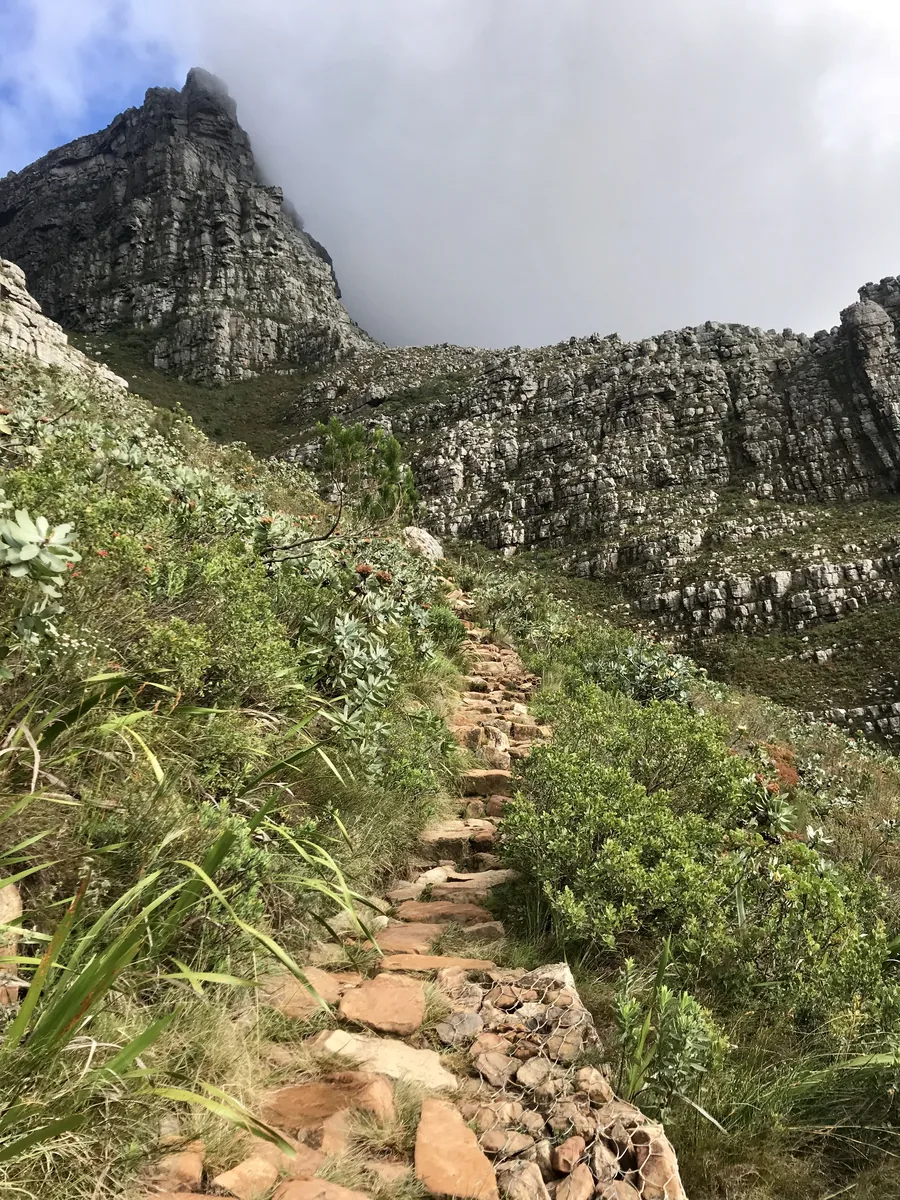
A stone path in Platteklip Gorge on Table Mountain between protea bushes, above it the mountain’s rock face under cloud
Photo: Gnom ↗ · CC BY-SA 4.0 ↗

Trails · Trailhead on Tafelberg Road

Platteklip Gorge trailhead

The most direct route up Table Mountain, about 3 km (1.9 mi) uphill. A visitor safety hut stands at the start.

The direct route: three kilometres of stone steps up the gorge in the middle of the front face.

Length
about 3 km (1.9 mi)
Time up
1 to 3 hours
Difficulty
moderate to tough
Start
Tafelberg Road
Finish
Upper Cable Station
Water
bring your own

Tours, hikes and the cableway up Table Mountain

Platteklip Gorge: the direct route

About 3 km (1.9 mi), all uphill on stone steps. SANParks allows one hour for the very fit to three hours for the less fit, moderate to tough. Leave time for the descent: if the weather turns, the cableway closes without warning.

SANParks: hikes, walks and trails (distances and times) ↗

Rules and safety: baboons, weather, trails

Rangers on patrol

According to SANParks, 52 rangers patrol the park, 16 of them with dogs. There are information points on Tafelberg Road and at Lion’s Head, and a security hut at the foot of Platteklip Gorge.

SANParks: safe hiking ↗

Open in OpenStreetMap ↗Location source ↗

-33.95535, 18.41585

The pointed Lion’s Head in Table Mountain National Park seen from Signal Hill, with flat-topped Table Mountain behind it to the left above the city
Photo: kallerna ↗ · CC BY-SA 4.0 ↗

Mountains & rock · Summit, 669 m (2,195 ft)

Lion’s Head

Spiral path from Signal Hill Drive, about 2 km (1.2 mi) and 1 to 1.5 hours up according to SANParks, with chains near the top.

The spiral path up the neighbouring peak, with views over the city, Table Mountain and the Atlantic.

Summit
669 m (2,195 ft)
Length
about 2 km (1.2 mi) each way
Time up
1 to 1.5 hours
Difficulty
easy, some scrambling
Water
none on the way

Tours, hikes and the cableway up Table Mountain

Lion’s Head

About 2 km (1.2 mi) each way, 1 to 1.5 hours up, easy with some scrambling and chains. The summit is at 669 metres (2,195 ft). At full moon it gets very busy; SANParks advises going only in groups led by someone experienced.

SANParks: hikes, walks and trails (distances and times) ↗

Guided from here · Ad

Partner links: we may earn a commission if you book – at no extra cost to you. Thank you for supporting the atlas. Dates and prices with the provider.

Open in OpenStreetMap ↗Location source ↗

-33.93504, 18.38914

Arrival · Start on Signal Hill Road

Lion’s Head car park

Starting point for most ascents of Lion’s Head.

Open in OpenStreetMap ↗Location source ↗

-33.93648, 18.39509

Nature · Northernmost land point of the park

Signal Hill

Reachable by car, with views over the city and harbour.

Open in OpenStreetMap ↗Location source ↗

-33.91700, 18.40391

Nature · Time signal since 1806

Noon Gun

From the slopes of Signal Hill the gun marks 12 noon every day.

Open in OpenStreetMap ↗Location source ↗

-33.91512, 18.41154

Nature · Fee area

Silvermine Dam

Picnic and braai sites by the reservoir, a boardwalk and easier walks.

Tickets & entrance fees: Table Mountain free, Cape Point from R515

Silvermine, Oudekraal, Newlands, Tokai: R200

At these sites international visitors pay R200 per adult and R100 per child until 31 October 2026, SADC nationals R90 and R45, South Africans R44 and R22.

SANParks: Table Mountain National Park, rates and entry fees (tariff year to 31 Oct 2026, accessed 4 Oct 2026) ↗

Open in OpenStreetMap ↗Location source ↗

-34.07477, 18.39750

Water · Cove with picnic sites, fee area

Oudekraal

A sheltered cove on the Atlantic coast below the Twelve Apostles.

Open in OpenStreetMap ↗Location source ↗

-33.98737, 18.34975

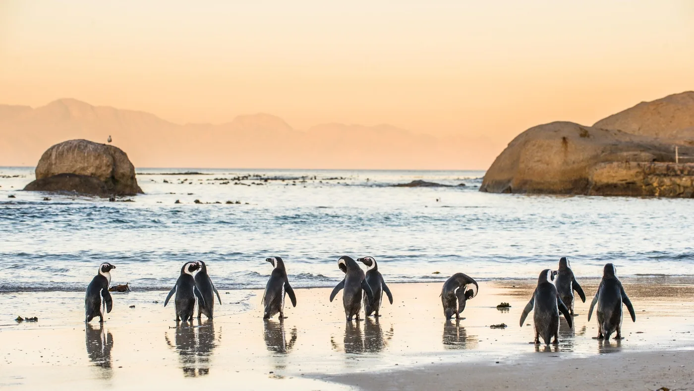
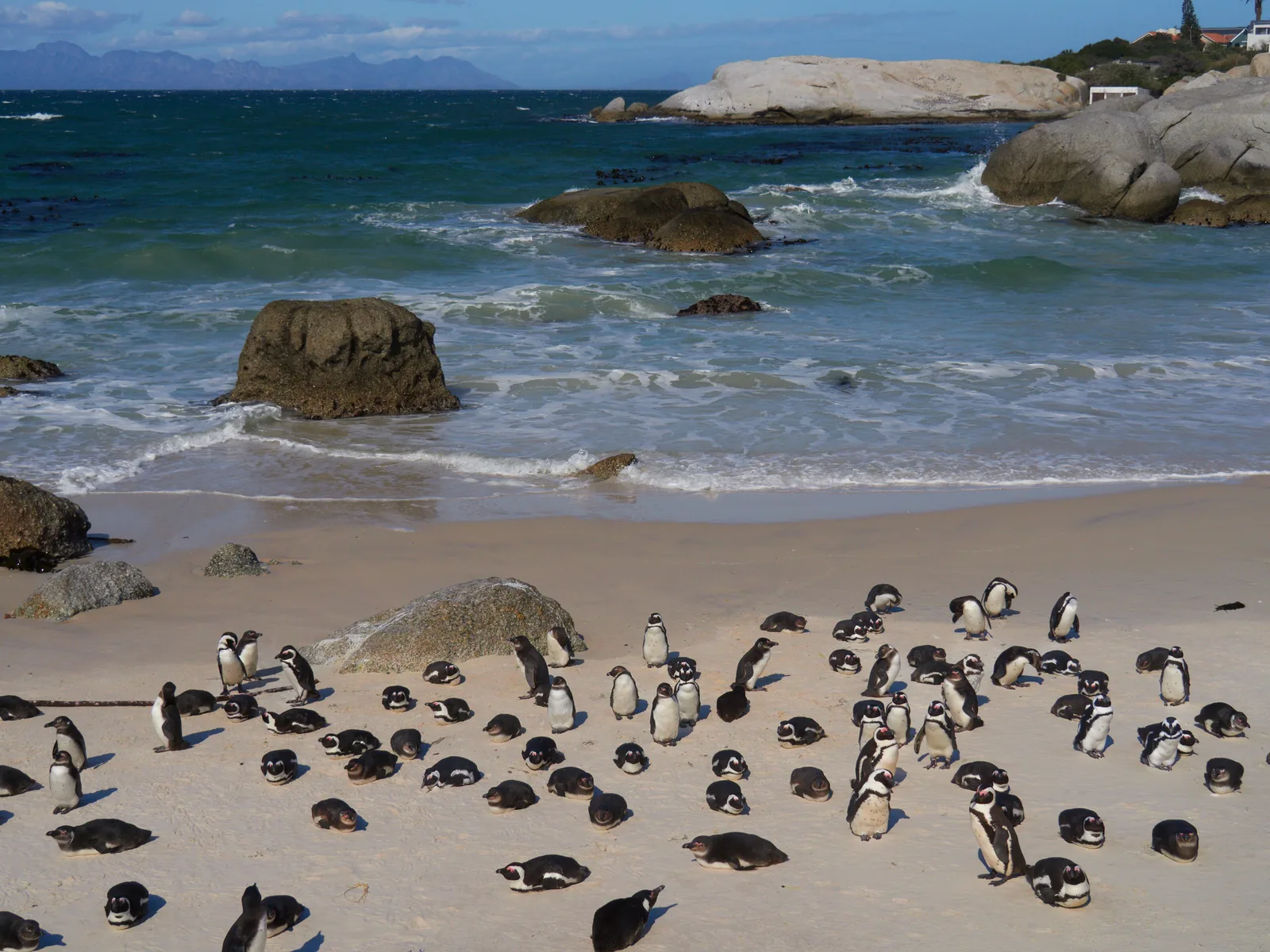
A colony of African penguins stands and rests on the sandy beach at Boulders Beach between round granite boulders
Photo: lumoplank ↗ · CC0 ↗

Arrival · Entrance to the penguin colony

Boulders Visitor Centre

Pay point and information at the start of the boardwalks over Foxy Beach. Card payment only.

Own page

Boulders Beach

Two breeding pairs in 1982 — today one of the few penguin colonies in the world you can walk up to.

Daily conservation fee, Boulders, as of 4 Oct 2026
International, adultsR245
International, children 2–11R120
SADC nationals, adultsR110

Fees & hours

Tickets & entrance fees: Table Mountain free, Cape Point from R515

Boulders: R245

The penguin colony costs R245 per adult and R120 per child for international visitors until 31 October 2026, R110 and R55 for SADC nationals, R55 and R26 for South Africans. Card payment only here too.

SANParks: Table Mountain National Park, rates and entry fees (tariff year to 31 Oct 2026, accessed 4 Oct 2026) ↗

How to get there from Cape Town: bus to the cableway, car to Cape Point

By train to Simon’s Town

A railway runs from Cape Town along False Bay to Simon’s Town, near Boulders. According to SANParks, private vehicles may only drive in the Cape section and on Signal Hill.

SANParks: how to get there ↗

Guided from here · Ad

Partner links: we may earn a commission if you book – at no extra cost to you. Thank you for supporting the atlas. Dates and prices with the provider.

Open in OpenStreetMap ↗Location source ↗

-34.19574, 18.44941

Trails · Penguins from the boardwalks

Foxy Beach

The best place to see the African penguins, from three wooden boardwalks.

Own page

Boulders Beach

Two breeding pairs in 1982 — today one of the few penguin colonies in the world you can walk up to.

Fees & hours

Nature: fynbos, sandstone and African penguins

African penguins

The only penguin species that breeds in Africa. The environment department DFFE puts the number at fewer than 9,000 breeding pairs in South Africa and lists the species as critically endangered.

Department of Forestry, Fisheries and the Environment (DFFE), 25 Apr 2025: World Penguin Day, numbers and no-fishing zones ↗

Open in OpenStreetMap ↗Location source ↗

-34.19613, 18.45046

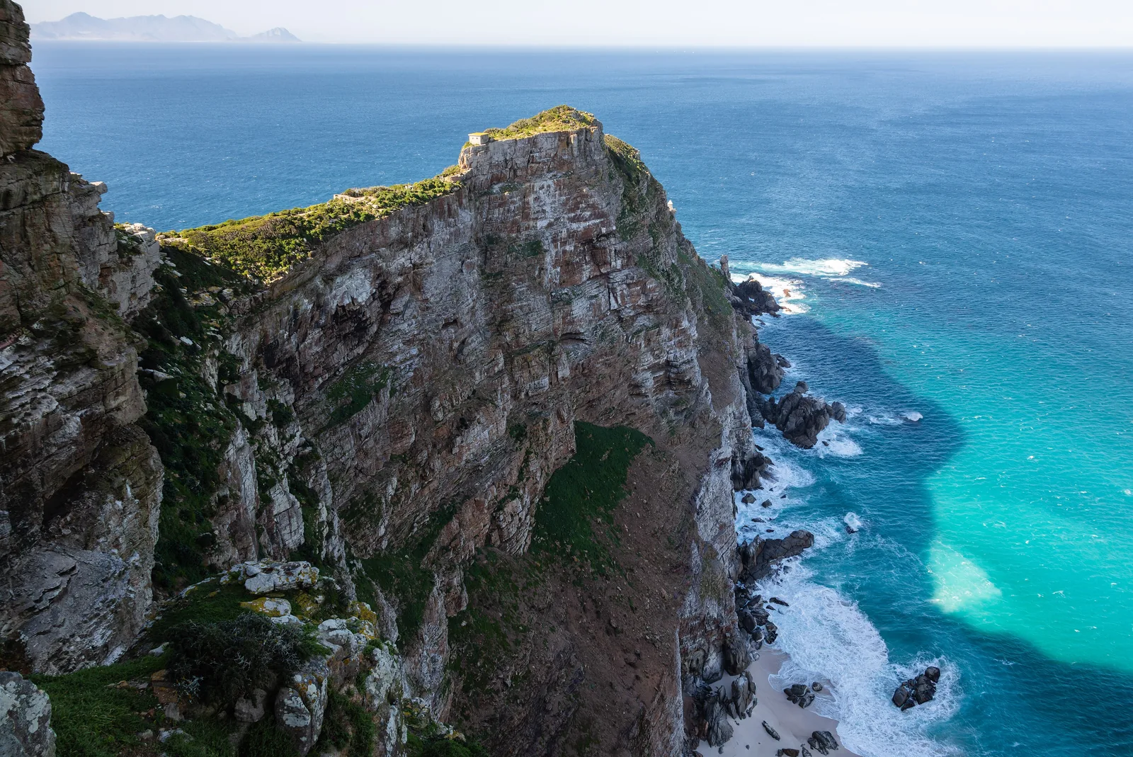
Steep, green cliffs at the Cape of Good Hope drop into turquoise sea with white surf at Cape Point
Photo: Diego Delso ↗ · CC BY-SA 4.0 ↗

Arrival · Entrance to the Cape section

Cape of Good Hope gate

The only way into the fenced Cape section. One payment per vehicle, card only.

Own page

Cape of Good Hope

The cape Dias called the “Cape of Storms” — with a lighthouse at 238 metres (781 ft) that stood too often in fog.

Daily conservation fee, Cape of Good Hope, as of 4 Oct 2026
International, adultsR515
International, children 2–11R250
SADC nationals, adultsR225

Fees & hours

How to get there from Cape Town: bus to the cableway, car to Cape Point

To Cape Point: two coastal routes

Along the Atlantic side via Camps Bay, Hout Bay and Chapman’s Peak Drive to Scarborough, or along False Bay via Muizenberg, Fish Hoek and Simon’s Town. The speed limit in the Cape section is 60 km/h (37 mph); from the gate to Cape Point takes 10 to 15 minutes.

Cape Point (concessionaire): history and lighthouses ↗

Tours, hikes and the cableway up Table Mountain

Cape of Good Hope Trail

A circular trail of 33.8 km (21 mi) over two days with a night in a hut, starting and ending at the gate. SANParks charges R438 per person for the hut plus the daily fee, minimum two people, all over 12.

SANParks: hikes, walks and trails (distances and times) ↗

Rules and safety: baboons, weather, trails

Never feed baboons

No food in their presence, keep car doors, windows and backpacks closed, lock the car. If a baboon comes close: stand still, stay calm, avoid eye contact, back away slowly and leave it an escape route. Do not try to get anything back.

SANParks: Visitor’s Map, Table Mountain National Park (PDF) ↗

Rules and safety: baboons, weather, trails

Gates close on time

In fee areas you must leave by gate closing time. At the Cape gate there is a registration form; bring an ID or passport.

SANParks: entrance gates and opening times by month ↗

Guided from here · Ad

Partner links: we may earn a commission if you book – at no extra cost to you. Thank you for supporting the atlas. Dates and prices with the provider.

Open in OpenStreetMap ↗Location source ↗

-34.26154, 18.45796

Arrival · Information in the Cape section

Buffelsfontein Visitor Centre

Shows which plants and animals are about. Water refill for the Cape hiking trail.

Own page

Cape of Good Hope

The cape Dias called the “Cape of Storms” — with a lighthouse at 238 metres (781 ft) that stood too often in fog.

Fees & hours

Open in OpenStreetMap ↗Location source ↗

-34.31309, 18.44939

Arrival · Funicular at the Cape Point car park

Flying Dutchman Funicular, lower station

The funicular runs from the car park up to the old lighthouse; you can also walk.

Own page

Cape of Good Hope

The cape Dias called the “Cape of Storms” — with a lighthouse at 238 metres (781 ft) that stood too often in fog.

Fees & hours

Open in OpenStreetMap ↗Location source ↗

-34.35066, 18.48468

Nature · New lighthouse of 1914

Cape Point Lighthouse

The most powerful lighthouse on the South African coast, 87 metres (285 ft) above the sea.

Own page

Cape of Good Hope

The cape Dias called the “Cape of Storms” — with a lighthouse at 238 metres (781 ft) that stood too often in fog.

Fees & hours

Best time to visit: dry summers, wind all year

Whales off Cape Point

Whales pass Cape Point on their migration roughly from June to October, according to the operator of the facilities at the Cape.

Cape Point (concessionaire): history and lighthouses ↗

Nature: fynbos, sandstone and African penguins

Two currents at the Cape

According to SANParks, the cold Benguela and the warm Agulhas currents mix at Cape Point. Geographically, though, the Atlantic and Indian oceans meet at Cape Agulhas.

SANParks: Visitor’s Map, Table Mountain National Park (PDF) ↗

Open in OpenStreetMap ↗Location source ↗

-34.35694, 18.49690

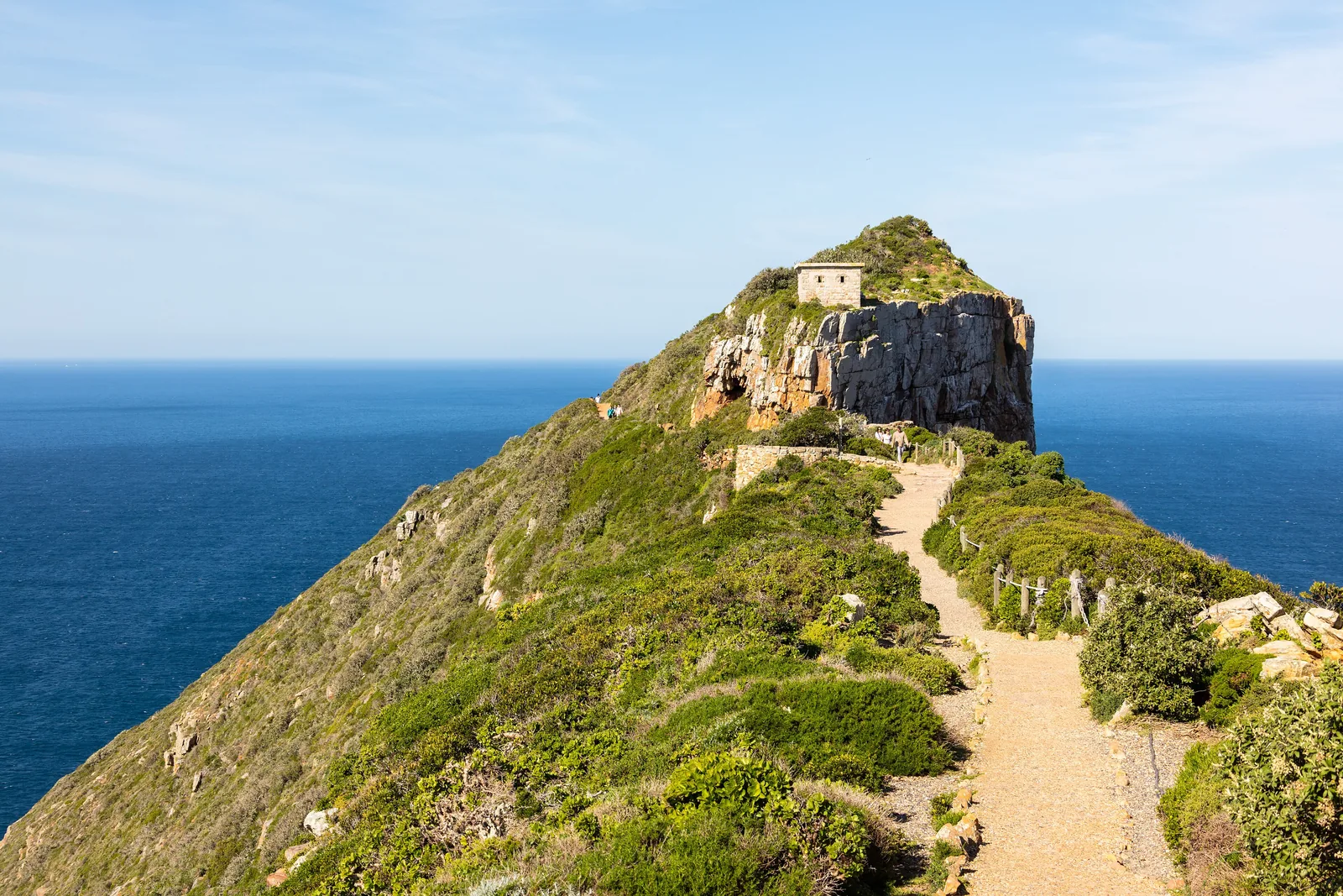
A path runs along a green ridge in Table Mountain National Park to the old lighthouse on the summit of Cape Point, with the sea behind
Photo: Diego Delso ↗ · CC BY-SA 4.0 ↗

Nature · The cape with the sign

Cape of Good Hope

The headland west of Cape Point, with the well-known sign by the beach.

The only fenced part of the park, with two lighthouses and antelope.

International entry
R515
From 1 Nov 2026
R592
Children 2–11
R250
Payment
card only, per vehicle
Gate October–March
6:00–18:00
Gate April–September
7:00–17:00

Own page

Cape of Good Hope

The cape Dias called the “Cape of Storms” — with a lighthouse at 238 metres (781 ft) that stood too often in fog.

Fees & hours

Tickets & entrance fees: Table Mountain free, Cape Point from R515

Cape of Good Hope: R515

Until 31 October 2026 international visitors pay R515 per adult and R250 per child, SADC nationals R225 and R115, South Africans R110 and R55. Card payment only, once per vehicle.

SANParks: Table Mountain National Park, rates and entry fees (tariff year to 31 Oct 2026, accessed 4 Oct 2026) ↗

Open in OpenStreetMap ↗Location source ↗

-34.35811, 18.47193

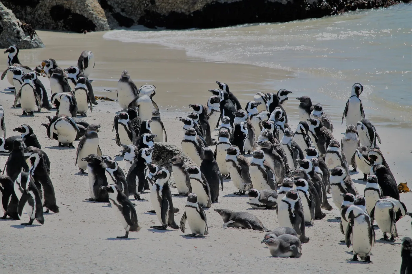
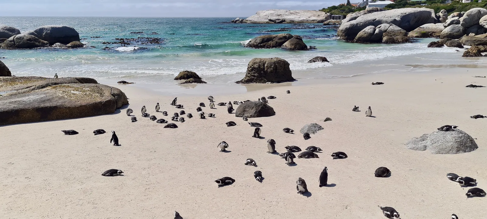
A colony of African penguins stands on the sandy beach at Foxy Beach in Table Mountain National Park, with granite boulders and sea behind
Photo: Bernard DUPONT from FRANCE ↗ · CC BY-SA 2.0 ↗

Water · Swimming beach

Boulders Beach

The sheltered beach between large granite boulders, ideal for children according to SANParks. No lifeguards.

African penguins at close range, from wooden boardwalks.

International entry
R245
From 1 Nov 2026
R282
Children 2–11
R120
Beaches
3
Boardwalks
3
Payment
card only

Own page

Boulders Beach

Two breeding pairs in 1982 — today one of the few penguin colonies in the world you can walk up to.

Fees & hours

Open in OpenStreetMap ↗Location source ↗

-34.19807, 18.45217

Arrival · Second entrance

Boulders Beach entrance

Access to the swimming beach from the car park side on Bellevue Road.

Own page

Boulders Beach

Two breeding pairs in 1982 — today one of the few penguin colonies in the world you can walk up to.

Fees & hours

Open in OpenStreetMap ↗Location source ↗

-34.19791, 18.45304

Trails · Coastal path

Willis Walk

The path along the shore; dogs only here and only on a leash.

Own page

Boulders Beach

Two breeding pairs in 1982 — today one of the few penguin colonies in the world you can walk up to.

Fees & hours

Open in OpenStreetMap ↗Location source ↗

-34.19710, 18.45096

Arrival · End of the line from Cape Town

Simon’s Town station

The train runs from Cape Town along False Bay to here.

Own page

Boulders Beach

Two breeding pairs in 1982 — today one of the few penguin colonies in the world you can walk up to.

Fees & hours

Open in OpenStreetMap ↗Location source ↗

-34.18682, 18.42551

History · Monument

Dias Cross

Commemorates Bartolomeu Dias, the first European to sail round the cape, in 1488.

Own page

Cape of Good Hope

The cape Dias called the “Cape of Storms” — with a lighthouse at 238 metres (781 ft) that stood too often in fog.

Fees & hours

Open in OpenStreetMap ↗Location source ↗

-34.32173, 18.44821

Water · Bay with picnic site

Buffels Bay

Beach, tidal pool and braai sites on the False Bay side.

Own page

Cape of Good Hope

The cape Dias called the “Cape of Storms” — with a lighthouse at 238 metres (781 ft) that stood too often in fog.

Fees & hours

Open in OpenStreetMap ↗Location source ↗

-34.31820, 18.46187

Nature · Tidal pool

Bordjiesrif

A rock pool for swimming, with a picnic site.

Own page

Cape of Good Hope

The cape Dias called the “Cape of Storms” — with a lighthouse at 238 metres (781 ft) that stood too often in fog.

Fees & hours

Open in OpenStreetMap ↗Location source ↗

-34.31332, 18.46199

Nature · Lighthouse of 1859, 238 m (781 ft)

Old lighthouse

Today the central monitoring point for all of South Africa’s lighthouses, with viewpoints all round.

Own page

Cape of Good Hope

The cape Dias called the “Cape of Storms” — with a lighthouse at 238 metres (781 ft) that stood too often in fog.

Fees & hours

Open in OpenStreetMap ↗Location source ↗

-34.35382, 18.49025

Water · Beach between the capes, no swimming

Diaz Beach

Swimming is prohibited here because of strong currents; there are no lifeguards on any beach at the Cape.

Own page

Cape of Good Hope

The cape Dias called the “Cape of Storms” — with a lighthouse at 238 metres (781 ft) that stood too often in fog.

Fees & hours

Open in OpenStreetMap ↗Location source ↗

-34.35457, 18.48201

Locations verified from the linked original sources and OpenStreetMap. The map shows no trails or park boundaries; markers do not imply that access is permitted.

Map: © OpenStreetMap contributors, OpenMapTiles, OpenFreeMap. Elevation: Terrain Tiles (Mapzen, AWS Open Data); 3DEP, GMTED2010 and SRTM courtesy of the U.S. Geological Survey; EU-DEM (Copernicus, European Union); ETOPO1 (NOAA); ArcticDEM (NSF, DigitalGlobe); Geoscience Australia; Open Data Austria (DGM); Open Government Licence – Canada; INEGI; Land Information New Zealand; Kartverket; Environment Agency (UK).

Park photo: Photo: lumoplank ↗ · CC0 ↗

Loading map …