National Parks Atlas
To the park
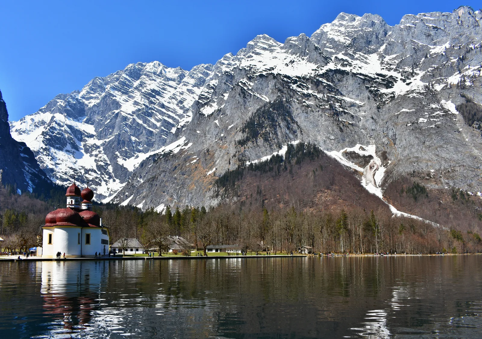
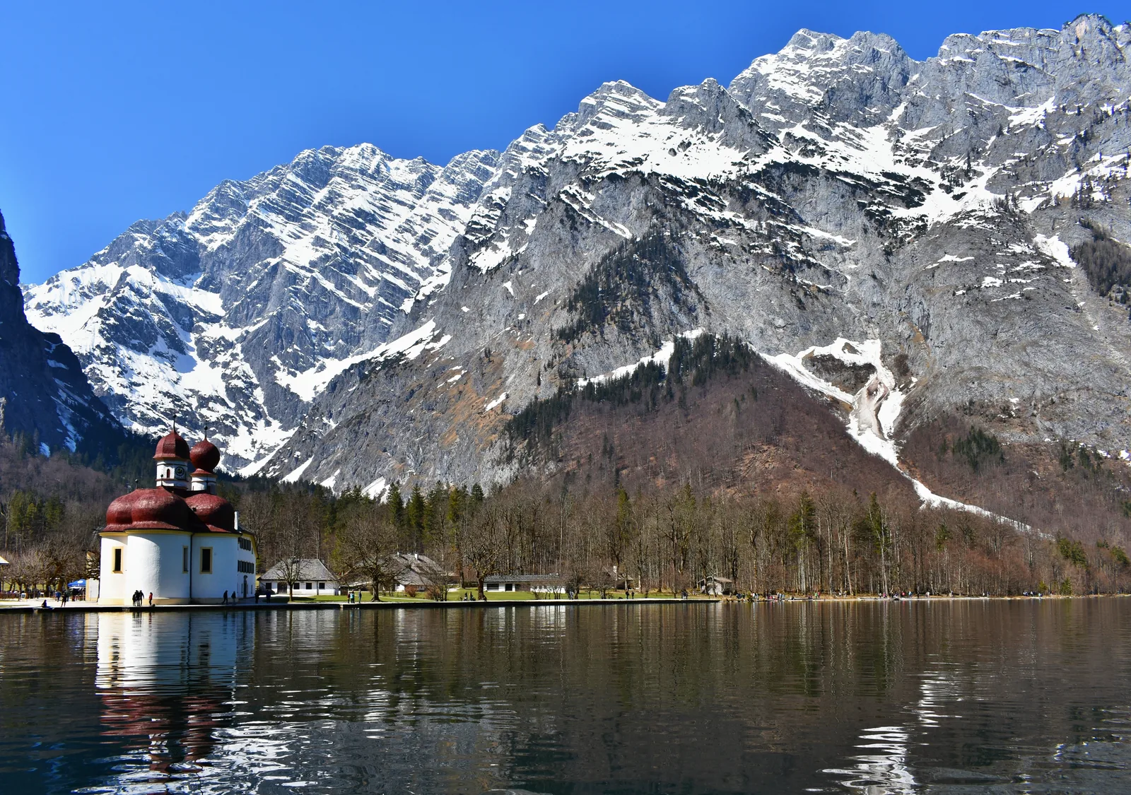
The red-domed pilgrimage church of St. Bartholomä on Lake Königssee in Berchtesgaden National Park, below the snow-covered Watzmann East Face

Berchtesgaden National Park: map

39 places with verified coordinates · 18 with photo

Bookable in the park · 6

Ad · partner links: we may earn a commission if you book. Offer details checked 27 Sep 2026; dates and prices with the provider.

The red-domed pilgrimage church of St. Bartholomä on Lake Königssee in Berchtesgaden National Park, below the snow-covered Watzmann East Face
Photo: Coastfield ↗ · CC BY-SA 4.0 ↗

Water · Fjord-like lake

Lake Königssee

A fjord-like lake between sheer rock walls; its bed lies at 413 metres (1,355 ft). From Schönau you can only reach it on the electric boats.

A fjord-like lake between sheer rock walls: car-free, electric boats only, accessible only by water.

Depth
The bed of Lake Königssee lies 413 metres (1,355 ft) above sea level.
Access
From Schönau by boat only; the lake is car-free.
Propulsion
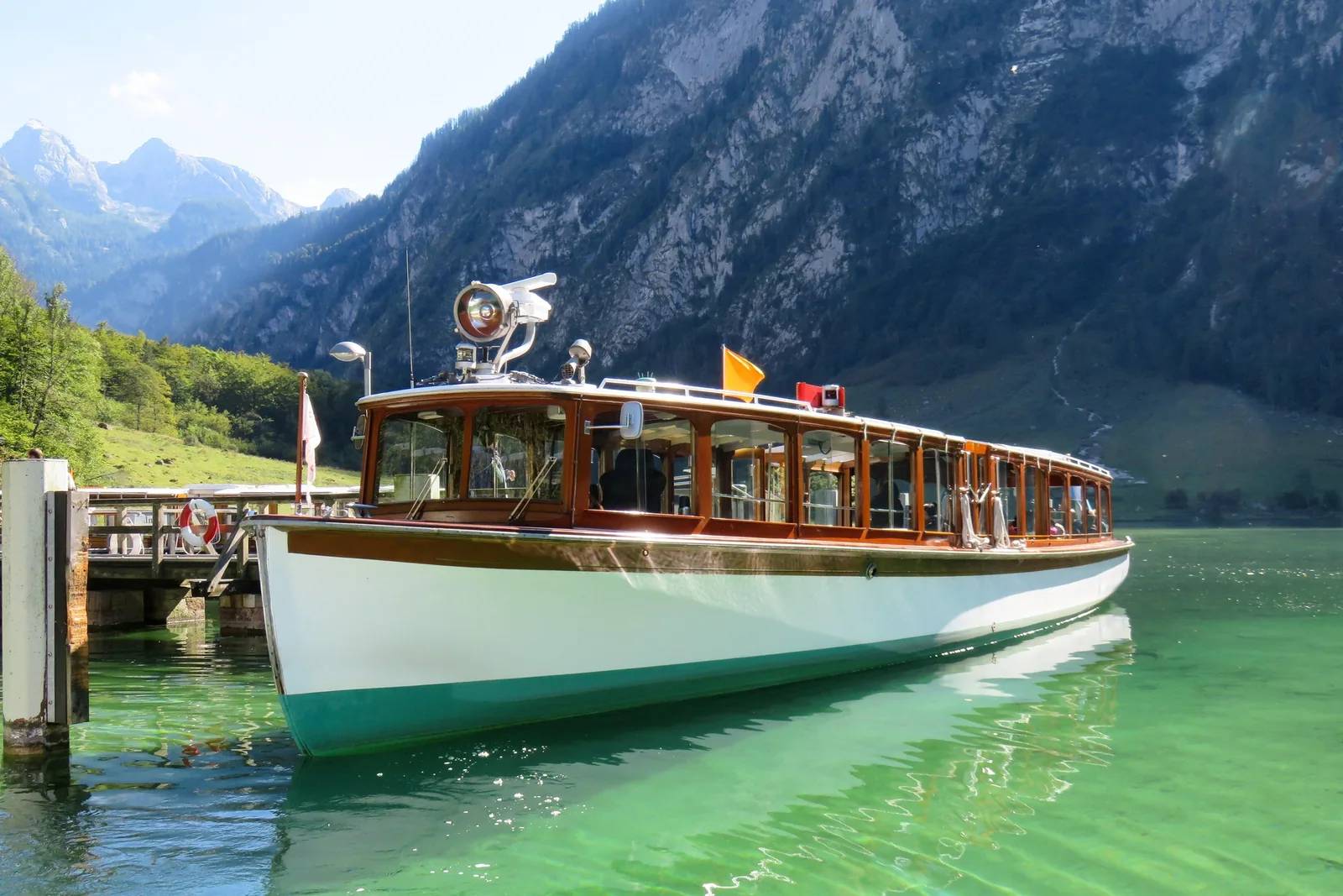
The boats have run on electric motors since 1909.
St. Bartholomä
Pilgrimage church on the peninsula, reachable by boat only.
Above it
The Watzmann East Face, about 1,800 metres (5,906 ft) high.
Cost
The boat service is a separate company; check fares there.

Best time to visit: spring in the valley, winter on the summits

1.6 million visitors a year

The park counts about 1.6 million visitors a year. The park authority calls it the most visited destination in the region.

Rules and advice ↗

Hikes & routes: Lake Königssee, Wimbach Gorge and the Watzmann East Face

Lake Königssee

A fjord-like lake between sheer rock walls; its bed lies 413 metres (1,355 ft) above sea level. You reach it from Schönau on the electric boats; the famous echo at the Echowand is part of the trip.

The national park in figures ↗

Guided from here · Ad

Partner links: we may earn a commission if you book. Dates and prices with the provider.

Open in OpenStreetMap ↗Location source ↗

47.55511, 12.97657

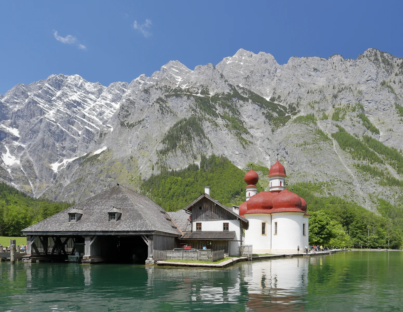
The pilgrimage church of St. Bartholomä in Berchtesgaden National Park, with red onion domes on the shore of Lake Königssee, the Watzmann East Face behind
Photo: Martin Falbisoner ↗ · CC BY-SA 4.0 ↗

Water · Peninsula & pilgrimage church

St. Bartholomä

The pilgrimage church with red domes on the peninsula in Lake Königssee, right below the Watzmann East Face. Reachable by boat only.

The pilgrimage church stands on a peninsula that no road reaches.

Access
By boat only, about 35 minutes from the Seelände pier
Boat
€23.40 return, €11.70 one way
Information centre
“Wasser versetzt Berge” (Water Moves Mountains), free entry
Open
Church and inn while scheduled boats are running
Important
Don't miss the last boat: camping is prohibited

Own page

St. Bartholomä (St. Bartholomew's Church)

The church with the wine-red onion domes stands on a peninsula in the middle of the national park, and no road leads there. You arrive by boat: 35 minutes, €23.40 return.

Boat to the St. Bartholomä landing stage, adults, as of 20 Sep 2026
Seelände – St. Bartholomä€23.40
Seelände – Salet, with a stop at St. Bartholomä possible€29.80
Kessel (request stop)—

Boat times & prices

Best time to visit: spring in the valley, winter on the summits

The boat sets the pace

St. Bartholomä and the Obersee are in practice only reachable by boat. The Königssee boat service, not the park, sets timetables and the season, so check before you go.

Getting there ↗

Tickets & entrance fees: the park is free, the boat is not

The Königssee boat costs money

St. Bartholomä and the Salet-Alm by the Obersee are in practice only reachable by boat. The boat service is an independent company; check fares and timetables there.

Getting there ↗

Hikes & routes: Lake Königssee, Wimbach Gorge and the Watzmann East Face

St. Bartholomä

The pilgrimage church with red domes on the peninsula in Lake Königssee, right below the Watzmann East Face.

The national park in figures ↗

Open in OpenStreetMap ↗Location source ↗

47.54476, 12.97251

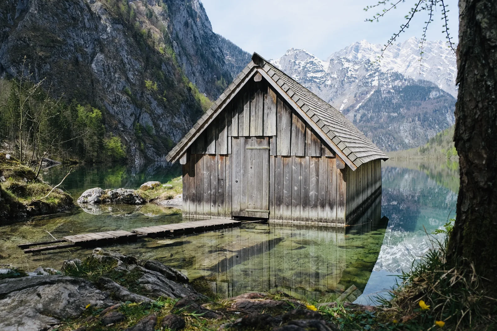
Wooden boathouse at the Fischunkelalm in the clear water of the Obersee
Photo: Sebastian Schütte ↗ · CC BY-SA 4.0 ↗

Water · Lake beyond Lake Königssee

Obersee

A smaller lake beyond Lake Königssee, reached from the Salet-Alm at the last boat stop and then on foot.

The smaller lake beyond Lake Königssee, reached only after a boat trip and a walk.

Location
Beyond Lake Königssee, separated by a strip of land.
Access
By boat to the Salet-Alm, then on foot.
Fischunkelalm
Staffed alpine pasture on the far shore.
Pasture farming
Part of the management zone that the park deliberately keeps.
Rule
“Do not go out on the water.”

Own page

Lake Königssee

Eight kilometres long, 190 m (623 ft) deep and reachable only across the water: what the boat trip costs and how long it takes.

Prices & boat times

Hikes & routes: Lake Königssee, Wimbach Gorge and the Watzmann East Face

The Obersee and the Fischunkelalm

Beyond Lake Königssee lies the smaller Obersee, with the Fischunkelalm pasture on its shore. You get there via the Salet-Alm, the last boat stop, then on foot.

The national park in figures ↗

Open in OpenStreetMap ↗Location source ↗

47.51598, 12.98790

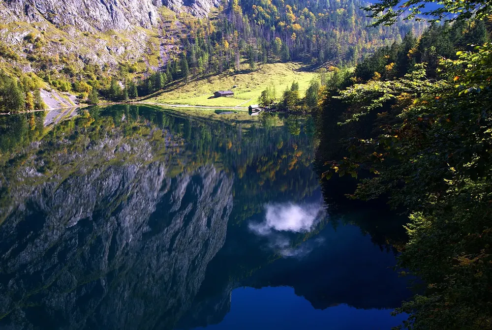
The Obersee in Berchtesgaden National Park, reflecting the rock walls, at the end of the lake the meadow of the Fischunkelalm with its huts
Photo: Dietmarsekanina ↗ · CC BY-SA 4.0 ↗

Water · Alpine pasture by the Obersee

Fischunkelalm

Alpine pasture on the far shore of the Obersee, an example of the pasture farming the park deliberately keeps alive in its management zone.

Own page

Lake Königssee

Eight kilometres long, 190 m (623 ft) deep and reachable only across the water: what the boat trip costs and how long it takes.

Prices & boat times

Open in OpenStreetMap ↗Location source ↗

47.51280, 12.99646

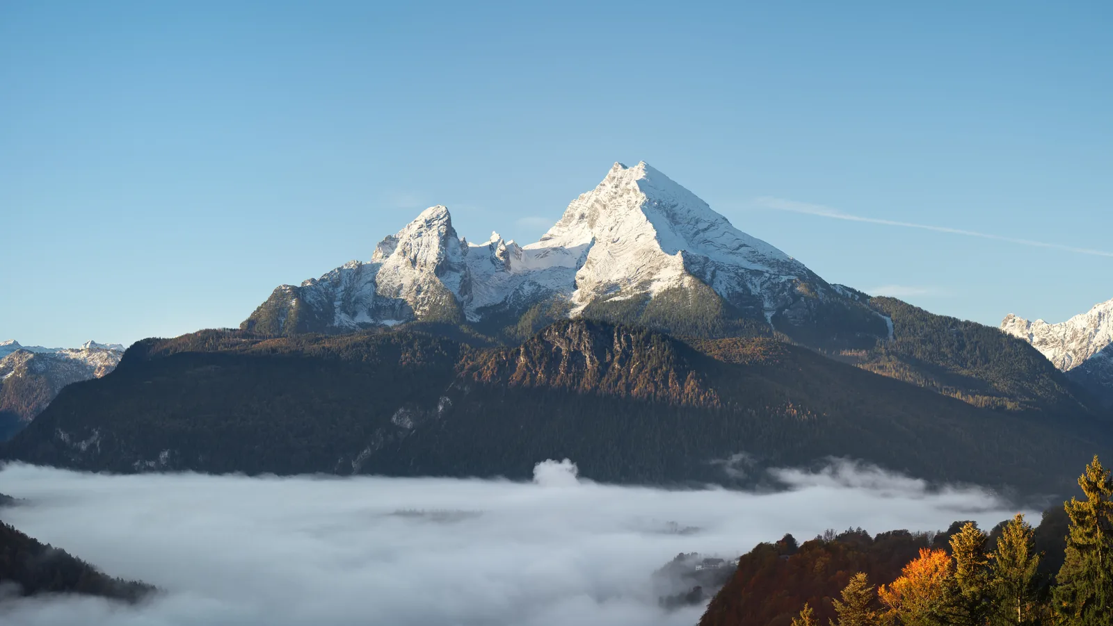
The Watzmann in Berchtesgaden National Park, seen from the north, with Hocheck, Mittelspitze and Südspitze
Photo: Jörg Braukmann ↗ · CC BY-SA 4.0 ↗

Mountains & rock · Summit, 2,713 m (8,901 ft)

Watzmann

At 2,713 metres (8,901 ft), the highest point of the national park.

The park's highest point, with an East Face that ranks among the highest rock faces in the Eastern Alps.

Height
2,713 metres (8,901 ft), the highest point of the national park.
East Face
Almost 1,800 metres (5,906 ft) high; according to the Bavarian Environment Agency, one of the highest rock faces in the Eastern Alps.
Below it
St. Bartholomä on Lake Königssee.
Difficulty
The traverse and the East Face are alpine undertakings.
For everyone else
You can see the face from the boat, with no demands at all.
Altitude range
From the lake bed to the summit it is 2,300 metres (7,546 ft).

Own page

Watzmann

2,713 m (8,901 ft) high, with an East Face of about 1,800 m (5,906 ft), and the best view of it takes not a single metre of climbing.

Trails & difficulty

Visiting Berchtesgaden National Park: overview

2,300 metres of altitude in one park

“Altitude range: 2,300 m (bed of Lake Königssee 413 m above sea level, Watzmann 2,713 m above sea level).” Weather, snow and trail conditions vary dramatically within the park, so you cannot plan for “the park” as a whole.

The national park in figures ↗

Hikes & routes: Lake Königssee, Wimbach Gorge and the Watzmann East Face

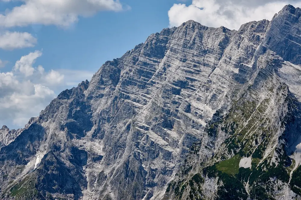
The Watzmann East Face

At almost 1,800 metres (5,906 ft) it is one of the highest rock faces in the Eastern Alps, according to the Bavarian Environment Agency. It rises above St. Bartholomä, which you reach by boat across Lake Königssee.

Bavarian Environment Agency (LfU): geotope Watzmann East Face with Ice Chapel ↗

Nature and history: what the park protects

2,300 metres of difference in altitude

From the bed of Lake Königssee at 413 metres (1,355 ft) to the Watzmann at 2,713 metres (8,901 ft). This range holds habitats from the submontane to the alpine zone, in a very small space.

The national park in figures ↗

Rules: what the park asks of you

High-altitude tours are mountaineering

The Watzmann traverse and the East Face are alpine undertakings with matching demands and equipment. If you only want to see the lake, stay down below. That is no limitation; it is what most visitors do.

Hiking in the national park ↗

Open in OpenStreetMap ↗Location source ↗

47.55439, 12.92203

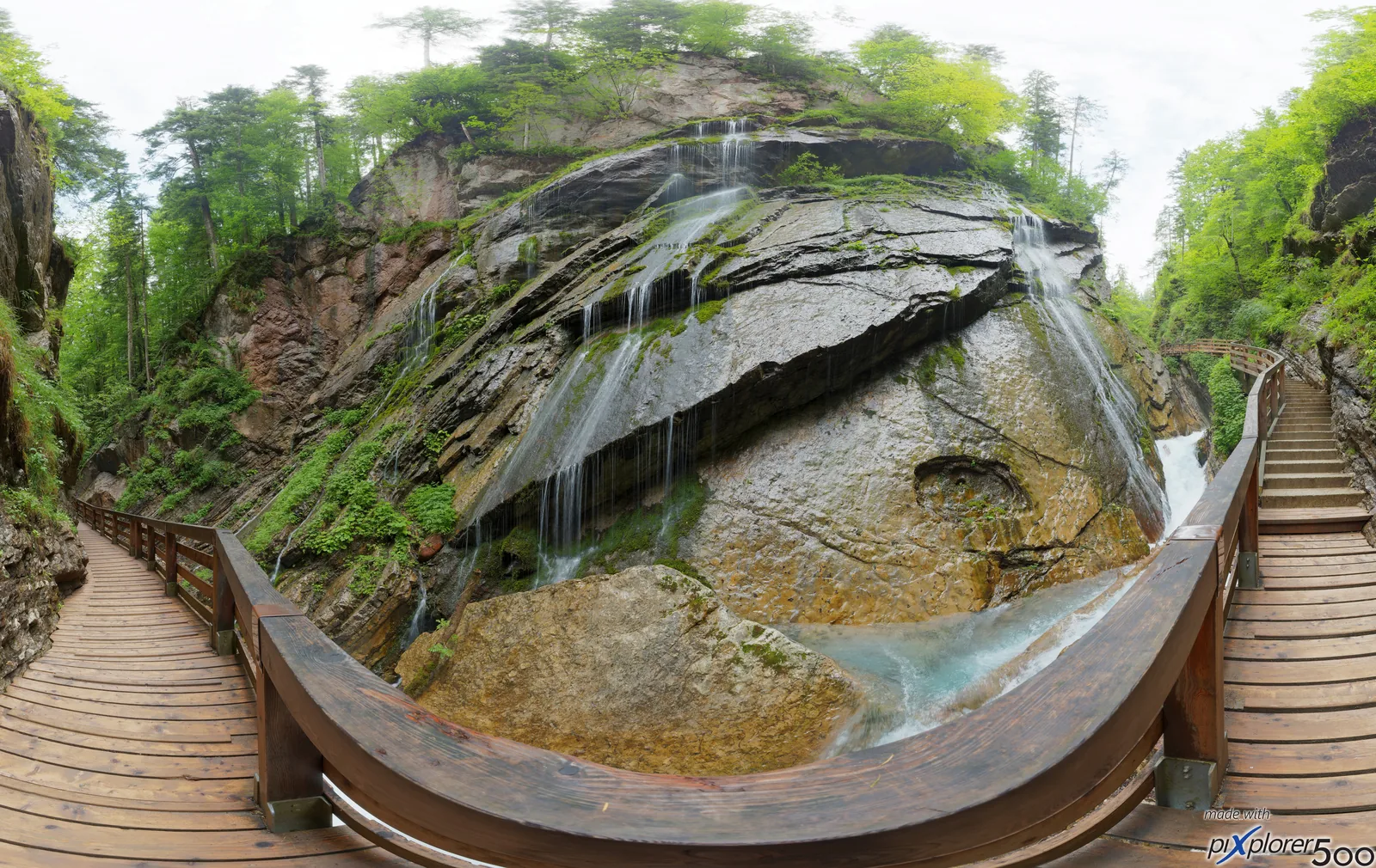
The Wimbach Gorge in Berchtesgaden National Park, near the mountaineering village of Ramsau
Photo: Hartmut Clauß ↗ · CC BY-SA 4.0 ↗

Mountains & rock · Gorge

Wimbach Gorge (Wimbachklamm)

A gorge in the western part of the park near Ramsau, walkable on boardwalks. Beyond it opens the Wimbachgries.

A gorge on boardwalks near Ramsau, and beyond it a valley that keeps filling itself with scree.

Location
Western part of the park near Ramsau.
Walkable
On boardwalks through the gorge.
Beyond
The Wimbachgries, a valley that fills with its own scree.
Getting there
Bus from Berchtesgaden Hauptbahnhof to Ramsau.
Rule
Stay on the trails; do not leave the boardwalks.

Own page

Wimbach Gorge (Wimbachklamm)

About 200 m of bridges and boardwalks through a gorge where the water bursts out of the rock, for four euros.

Wimbach Gorge entry, 2026 season
From age 7€4.00
Up to age 6no fee stated
Wimbachbrücke information pointfree

Tickets & opening hours

Hikes & routes: Lake Königssee, Wimbach Gorge and the Watzmann East Face

Wimbach Gorge (Wimbachklamm)

A gorge in the western part of the park near Ramsau, walkable on boardwalks. Beyond it opens the Wimbachgries, a valley that keeps filling itself with scree.

Hiking in the national park ↗

Open in OpenStreetMap ↗Location source ↗

47.59722, 12.92135

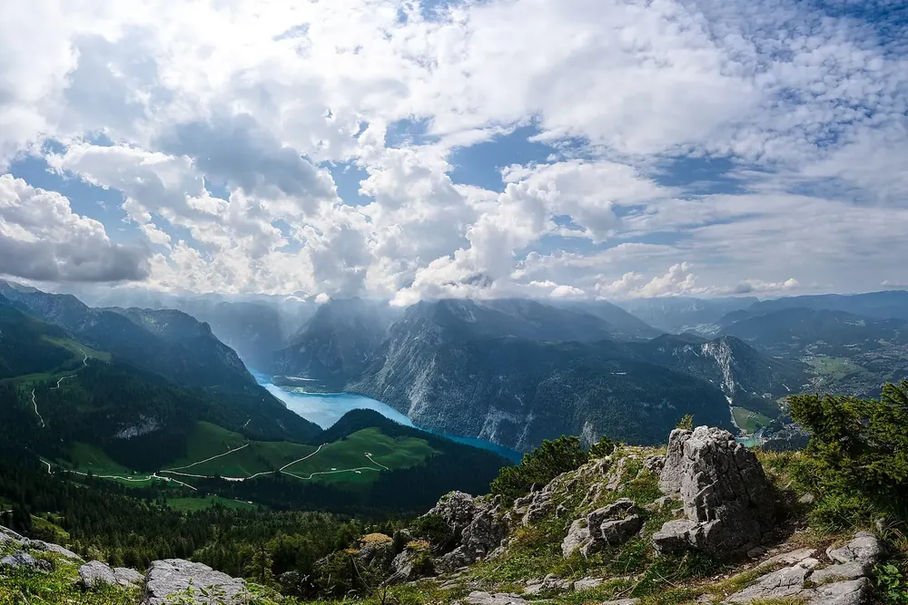
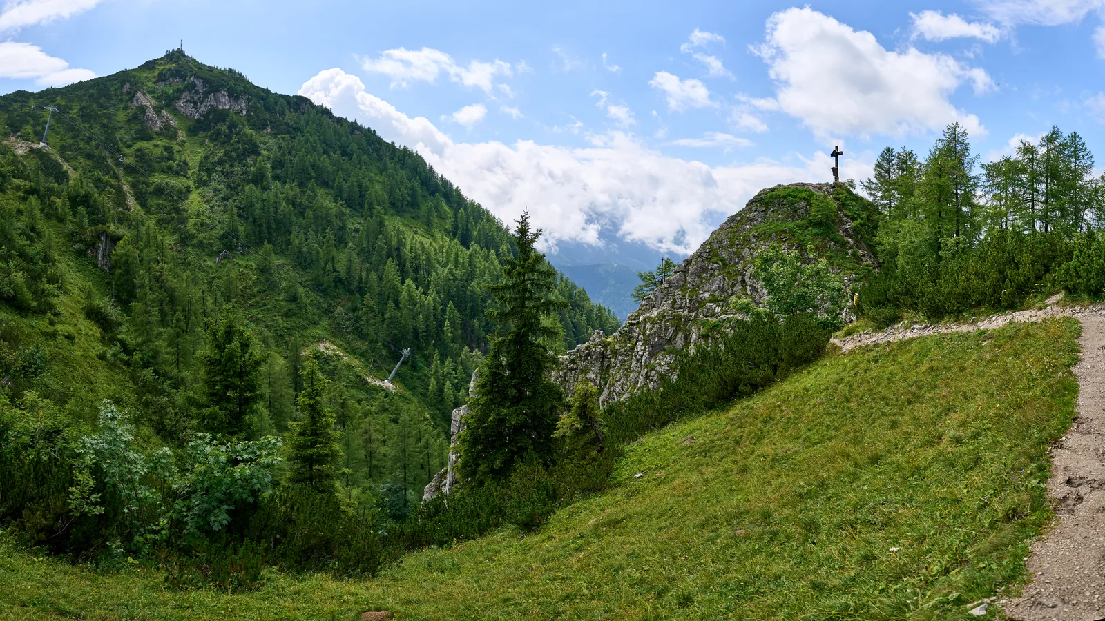
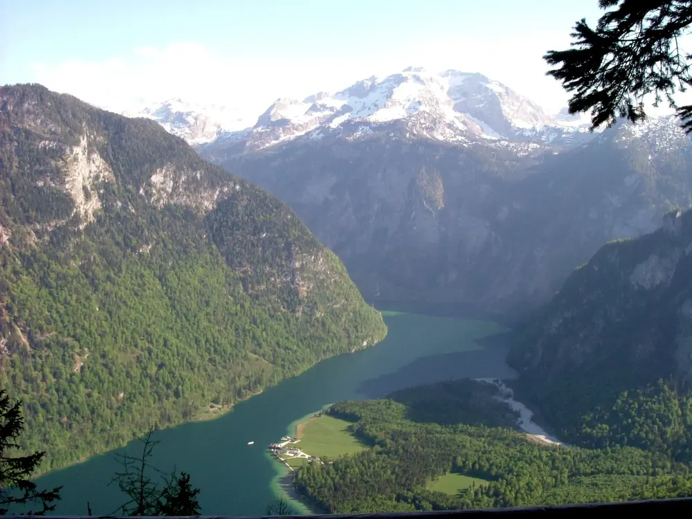
View from the summit of the Jenner over rocks and alpine pastures down to Lake Königssee between steep mountainsides
Photo: Anil Öztas ↗ · CC BY 4.0 ↗

Mountains & rock · Summit above Lake Königssee

Jenner

Viewing mountain above Lake Königssee with a cable car from Schönau. The view reaches across the whole lake to the Watzmann.

Own page

Jenner Cable Car (Jennerbahn)

From Lake Königssee up to 1,800 m (5,906 ft), with a national park exhibition at the top that costs nothing, while the ride costs €47.

Prices & hours

Open in OpenStreetMap ↗Location source ↗

47.57568, 13.02038

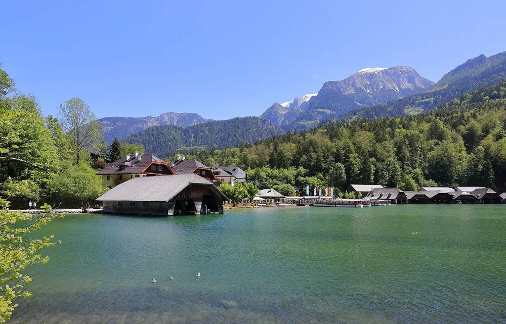
Lake Königssee near Schönau: boathouses on the green shore, wooded slopes and peaks of the Berchtesgaden Alps behind
Photo: Martin Falbisoner ↗ · CC BY-SA 4.0 ↗

Arrival · Access point & boat pier

Schönau am Königssee

Starting point of the Königssee boats and valley station of the Jenner cable car. From here on, the lake is car-free.

How to get there: train to Berchtesgaden, then bus and boat

From Schönau, by boat only

From Schönau, the electric boats of the Königssee boat service cross the lake, for example to St. Bartholomä. Boats there have run on electric motors since 1909.

Königssee boat service: fleet ↗

How to get there: train to Berchtesgaden, then bus and boat

Parking at Königssee: the main car park on Seestraße

The large Königssee car park at Seestraße 3 in Schönau charges fees all year, daily from 7:00 to 19:00. A car costs €3 for up to 1 hour, €7 for up to 3 hours and €9 for a 24-hour day ticket. The boat landing and the Jennerbahn cable car are a few minutes' walk away; motorhomes use a separate site on Schornstraße.

Municipality of Schönau a. Königssee: Königssee car park ↗

Where to stay: mountain huts and villages on the park edge

Schönau, Ramsau and Berchtesgaden

The three villages on the edge of the park are the obvious bases. Berchtesgaden has the railway station, Schönau the access to Lake Königssee, Ramsau the access to Wimbach Gorge.

Getting there ↗

Open in OpenStreetMap ↗Location source ↗

47.60550, 12.98465

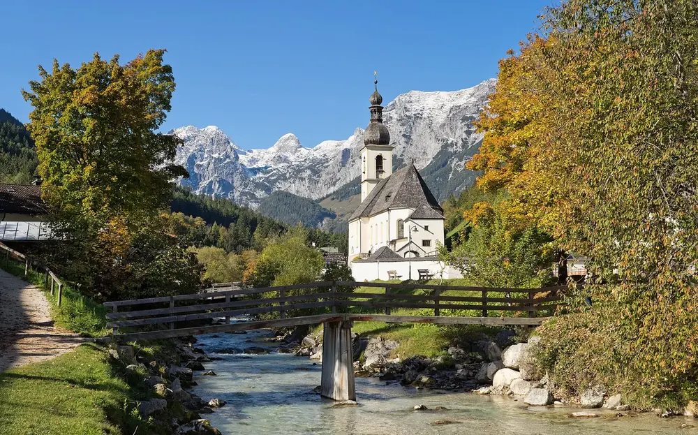
Parish church of St. Sebastian in Ramsau with a wooden bridge over the stream, autumn leaves and snow-covered peaks behind
Photo: Jörg Braukmann ↗ · CC BY-SA 4.0 ↗

Arrival · Western access point

Ramsau bei Berchtesgaden

Gateway to the western part of the park with Wimbach Gorge and Lake Hintersee.

How to get there: train to Berchtesgaden, then bus and boat

Ramsau and Hintersee in the west

Ramsau is the gateway to the western part of the park, with Wimbach Gorge and Lake Hintersee. The Hintersee itself lies on the park boundary, the gorge inside the park.

Getting there ↗

Open in OpenStreetMap ↗Location source ↗

47.60701, 12.89682

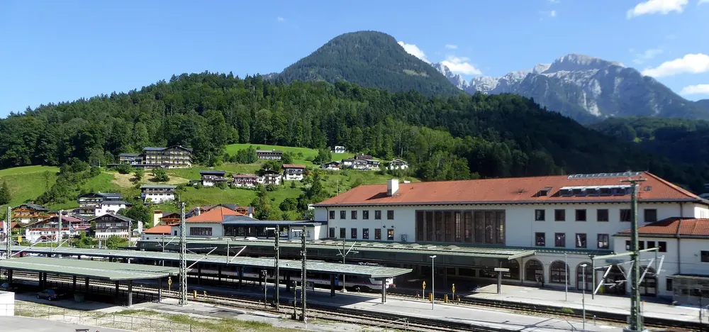
Berchtesgaden Hauptbahnhof (main station) from the north-west: platforms and station building, wooded slopes and peaks behind
Photo: Renardo la vulpo ↗ · CC0 1.0 ↗

Arrival · Railway station

Berchtesgaden Hauptbahnhof (main station)

Rail access to the region; from here, buses run to Schönau, Ramsau and into the Wimbach Valley.

How to get there: train to Berchtesgaden, then bus and boat

By train to Berchtesgaden

Berchtesgaden Hauptbahnhof (main station) is your gateway to the park; from there, buses run to Schönau on Lake Königssee, to Ramsau and into the Wimbach Valley. With the guest card of the valley municipalities, local buses are free from the day you arrive.

Getting there by bus and train ↗

Open in OpenStreetMap ↗Location source ↗

47.62672, 12.99972

Arrival · National park centre, outside the park

Haus der Berge

The park authority's national park centre in Berchtesgaden with the exhibition “Vertical Wilderness” (Vertikale Wildnis). 15 to 20 minutes on foot from the station; bus routes 839 and 841 stop outside.

Visiting Berchtesgaden National Park: overview

The national park centre in Berchtesgaden

The national park centre is in Berchtesgaden, 15 to 20 minutes on foot from the station; bus routes 839 and 841 stop outside. You only pay to enter the exhibition “Vertical Wilderness” (Vertikale Wildnis), a rising walk from the bed of Lake Königssee to the summits. The foyer, cinema, temporary exhibitions and the panorama trail with views of the Watzmann, Hochkalter and Jenner are free.

National park centre in Berchtesgaden: visitor information ↗

Open in OpenStreetMap ↗Location source ↗

47.62622, 12.99240

Arrival · Information centre at the entrance to the Klausbach Valley

Klausbachhaus

The Hintersee national park information centre in a listed farmhouse, with the exhibition “1,000 Years Up and Down” about the park's alpine pastures. Starting point for many hikes, plus a barrier-free circular trail; free entry.

How to get there: train to Berchtesgaden, then bus and boat

By Alm-Erlebnisbus into the Klausbach Valley

The Alm-Erlebnisbus links Ramsau with Weißbach Nature Park in Austria's Pinzgau region and runs from the Hintersee through the Klausbach Valley. You can only buy tickets from the driver and cannot book in advance; a limited number of bicycles can travel, e-bikes cannot. Children up to and including 14 years travel free.

Frequently asked questions to the park authority ↗

Nature and history: what the park protects

Alpine pastures: a thousand years of up and down

Alpine pastures are a habitat with exceptionally high species diversity in the park. At the entrance to the Klausbach Valley, the Klausbachhaus shows in its exhibition “1,000 Years Up and Down” how herders and their livestock move from the valley up to the pastures and back again over the year; entry is free.

Hintersee information centre (Klausbachhaus) ↗

Open in OpenStreetMap ↗Location source ↗

47.59849, 12.84226

Viewpoint · Viewpoint in the Klausbach Valley

Golden eagle viewpoint

About 20 minutes on foot from the Klausbachhaus, with information boards and tips. The eagles prefer to fly on sunny days with good thermals.

Hikes & routes: Lake Königssee, Wimbach Gorge and the Watzmann East Face

Klausbach Valley: the valley of eagles

In the Klausbach Valley you have the best chance of seeing a golden eagle in the wild, the park authority says. About 20 minutes from the Klausbachhaus at the valley entrance there is a viewpoint with information boards. The eagles prefer to fly on sunny days with good thermals; in rain and low cloud they barely move.

Frequently asked questions to the park authority ↗

Open in OpenStreetMap ↗Location source ↗

47.58734, 12.82739

Nature · Geotope on the park edge

Zauberwald (Magic Forest)

Mountain forest among huge boulders: a rockfall on the Hochkalter about 3,500 years ago dammed the Hintersee. The footpath between the Hintersee and the Marxenklamm gorge is cleared in winter.

Open in OpenStreetMap ↗Location source ↗

47.60766, 12.86025

Where to stay · Alpine hut, 1,685 m (5,528 ft)

Gotzenalm

Viewing plateau high above Lake Königssee. The hut is one of the five mountain huts in the park that the Free State of Bavaria leases to hut keepers, and it is staffed in summer.

Open in OpenStreetMap ↗Location source ↗

47.53728, 12.99636

Where to stay · Mountain hut, 1,638 m (5,374 ft)

Kärlingerhaus (Funtensee)

Hut of the Berchtesgaden section of the German Alpine Club (DAV), open from May to October. The easiest approach leads from St. Bartholomä through the Saugasse: about five hours and 1,000 metres (3,281 ft) of ascent.

Open in OpenStreetMap ↗Location source ↗

47.49547, 12.93713

The Jenner and the Kleiner Jenner above Schönau on Lake Königssee
Photo: Anil Öztas ↗ · CC BY 4.0 ↗

Mountains & rock · Cable car at Lake Königssee

Jenner Cable Car (Jennerbahn)

From Lake Königssee up to 1,800 m (5,906 ft), with a national park exhibition at the top that costs nothing, while the ride costs €47.

Own page

Jenner Cable Car (Jennerbahn)

From Lake Königssee up to 1,800 m (5,906 ft), with a national park exhibition at the top that costs nothing, while the ride costs €47.

Jenner cable car, summer 2026 fares to the top station at 1,800 m (5,906 ft)
Return trip€47.00
Return trip, reduced€43.00
Return trip from 15:00€37.00

Prices & hours

Open in OpenStreetMap ↗Location source ↗

47.57632, 13.02436

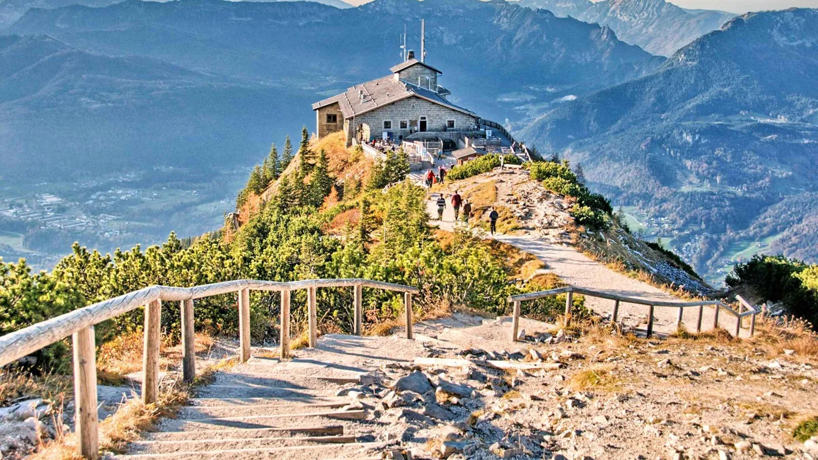
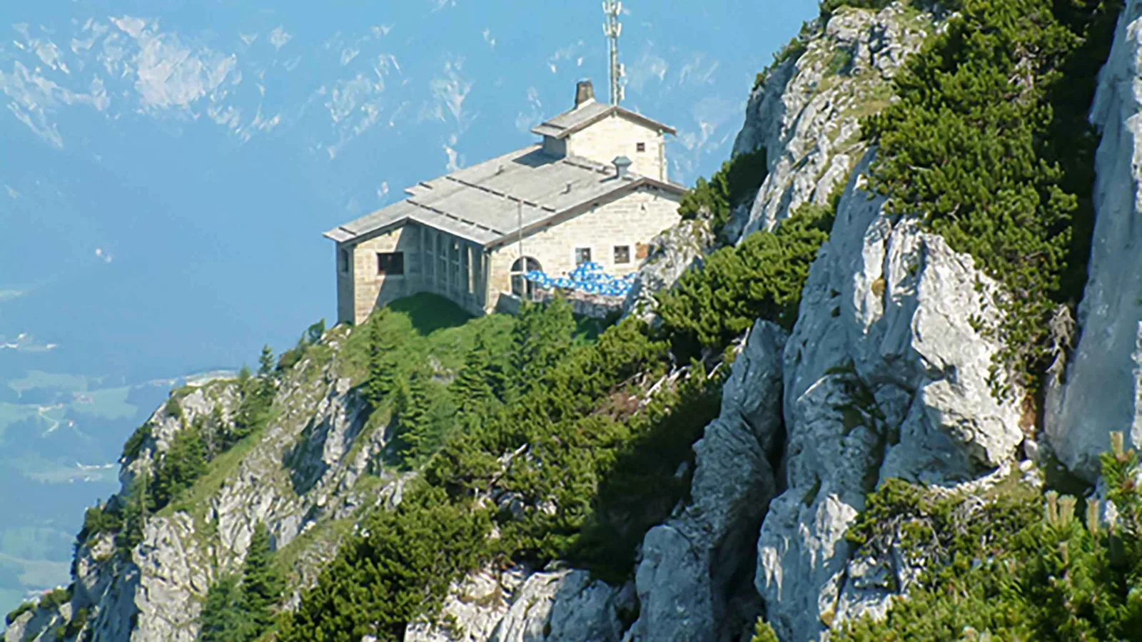
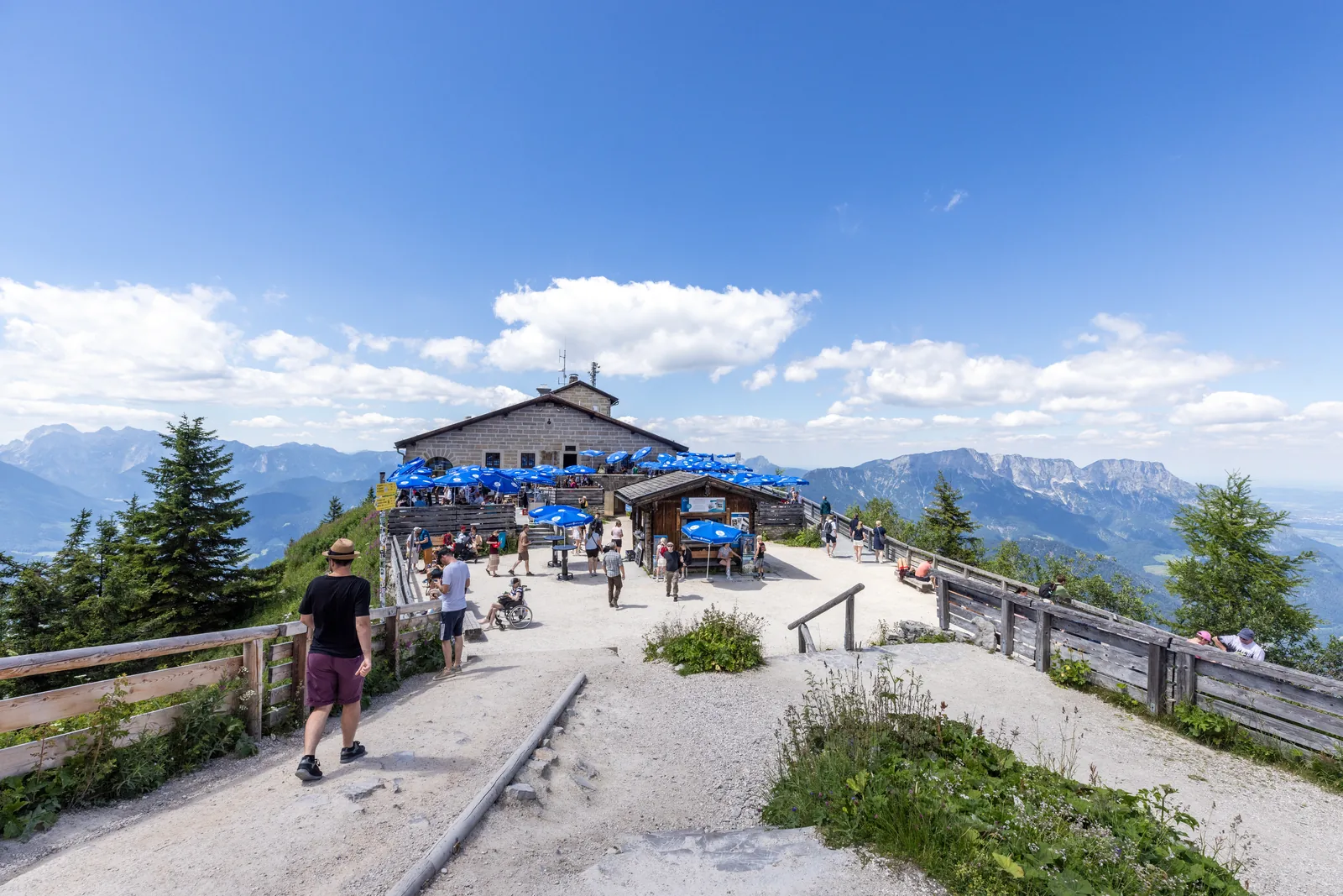
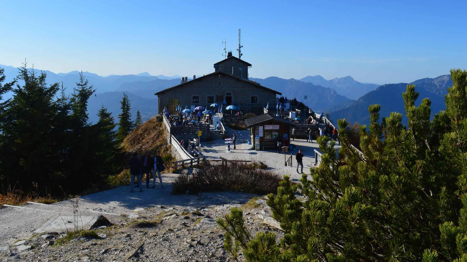
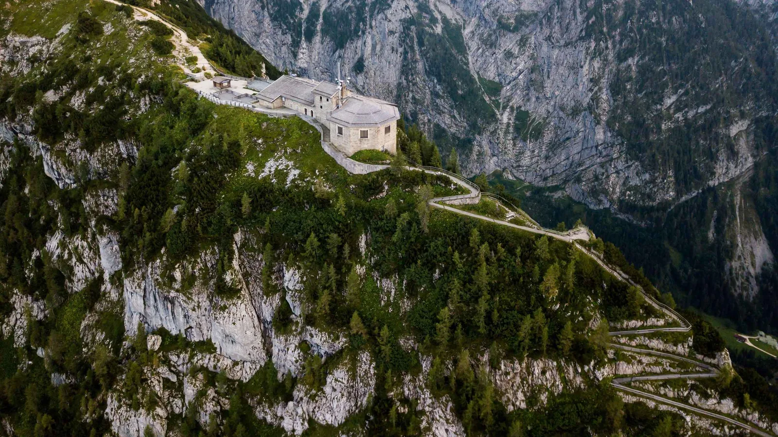
The Eagle's Nest (Kehlsteinhaus) on the summit ridge of the Kehlstein above Berchtesgaden
Photo: Kasa Fue ↗ · CC BY-SA 4.0 ↗

Mountains & rock · Destination on the Obersalzberg

Eagle's Nest (Kehlsteinhaus)

1,834 m (6,017 ft) above Berchtesgaden, reached only by special buses and a lift inside the rock, and historically anything but a harmless day trip.

Own page

Eagle's Nest (Kehlsteinhaus)

1,834 m (6,017 ft) above Berchtesgaden, reached only by special buses and a lift inside the rock, and historically anything but a harmless day trip.

Kehlstein fares 2026, online ticket, prices including the lift
Adults€34.70
Adults with guest card€31.80
Children aged 6 to 14€17.20

Bus fares & hours

Guided from here · Ad

Partner links: we may earn a commission if you book. Dates and prices with the provider.

Open in OpenStreetMap ↗Location source ↗

47.61150, 13.04193

View across the green Königssee in Berchtesgaden National Park to the St. Bartholomä peninsula and its pilgrimage church, with the Watzmann East Face behind
Photo: Coastfield ↗ · CC BY-SA 4.0 ↗

Surroundings · Place in the national park

Lake Königssee

Eight kilometres long, 190 m (623 ft) deep and reachable only across the water: what the boat trip costs and how long it takes.

Own page

Lake Königssee

Eight kilometres long, 190 m (623 ft) deep and reachable only across the water: what the boat trip costs and how long it takes.

Boat fares from Seelände, adults
St. Bartholomä€23.40
Salet (at the Obersee)€29.80
Kessel (on request)—

Prices & boat times

Open in OpenStreetMap ↗Location source ↗

47.58803, 12.98884

Nature · Middle station

Halbzeit middle station

Intermediate station with the Halbzeit restaurant. Bike transport ends here; from here the Carl-von-Linde-Weg trail leads across to the Obersalzbergbahn cable car.

Own page

Jenner Cable Car (Jennerbahn)

From Lake Königssee up to 1,800 m (5,906 ft), with a national park exhibition at the top that costs nothing, while the ride costs €47.

Prices & hours

Open in OpenStreetMap ↗Location source ↗

47.58645, 13.01723

Mountains & rock · Summit cross

Kehlstein summit cross

A few metres above the house. Not reachable by wheelchair. The Kehlstein circular trail starts at the summit, with views into the rock landscape of the Hoher Göll. Also outside the park boundary.

Own page

Eagle's Nest (Kehlsteinhaus)

1,834 m (6,017 ft) above Berchtesgaden, reached only by special buses and a lift inside the rock, and historically anything but a harmless day trip.

Bus fares & hours

Open in OpenStreetMap ↗Location source ↗

47.61039, 13.04446

Arrival · Bus departure & car park

Obersalzberg bus departure point

Salzbergstraße 45, 83471 Berchtesgaden. The Kehlstein line starts here; the departure point is next to Documentation Obersalzberg and the hotel.

Own page

Eagle's Nest (Kehlsteinhaus)

1,834 m (6,017 ft) above Berchtesgaden, reached only by special buses and a lift inside the rock, and historically anything but a harmless day trip.

Bus fares & hours

Open in OpenStreetMap ↗Location source ↗

47.63159, 13.04231

Surroundings · Place of learning and remembrance

Documentation Obersalzberg

The central place of learning and remembrance on the history of the Obersalzberg and the Nazi dictatorship. Entry is included in the Kehlstein ticket for the same day.

Own page

Eagle's Nest (Kehlsteinhaus)

1,834 m (6,017 ft) above Berchtesgaden, reached only by special buses and a lift inside the rock, and historically anything but a harmless day trip.

Bus fares & hours

Open in OpenStreetMap ↗Location source ↗

47.63166, 13.04082

Arrival · Car park

Königssee car park

Seestraße 3, run by the municipality of Schönau. Charges apply all year from 7:00 to 19:00; with toilets, charging points and tourist information.

Own page

Lake Königssee

Eight kilometres long, 190 m (623 ft) deep and reachable only across the water: what the boat trip costs and how long it takes.

Prices & boat times

Open in OpenStreetMap ↗Location source ↗

47.59182, 12.98953

Arrival · Landing stage

Salet

The last stop at the southern end of the lake, served only from about mid-April to mid-October. From here it is about 15 minutes on foot to the Obersee.

Own page

Lake Königssee

Eight kilometres long, 190 m (623 ft) deep and reachable only across the water: what the boat trip costs and how long it takes.

Prices & boat times

Open in OpenStreetMap ↗Location source ↗

47.52517, 12.97272

Water · Waterfall

Röthbachfall (Röthbach Falls)

Drops about 400 m (1,312 ft) and is considered the highest waterfall in Germany. Visible from the Obersee viewpoint.

Own page

Lake Königssee

Eight kilometres long, 190 m (623 ft) deep and reachable only across the water: what the boat trip costs and how long it takes.

Prices & boat times

Open in OpenStreetMap ↗Location source ↗

47.50194, 13.01219

Arrival · Request stop

Kessel

Served only on request. Starting point for mountain walks to the Gotzenalm, the Königsbachalm and the Kahlersberg.

Own page

Lake Königssee

Eight kilometres long, 190 m (623 ft) deep and reachable only across the water: what the boat trip costs and how long it takes.

Prices & boat times

Open in OpenStreetMap ↗Location source ↗

47.56026, 12.98750

Arrival · Stop for the electric boats

St. Bartholomä landing stage

This is where the boats dock and where the pier attendant sells tickets for the return trip. Keep an eye on the last departure; it is listed in the timetable.

Own page

St. Bartholomä (St. Bartholomew's Church)

The church with the wine-red onion domes stands on a peninsula in the middle of the national park, and no road leads there. You arrive by boat: 35 minutes, €23.40 return.

Boat times & prices

Open in OpenStreetMap ↗Location source ↗

47.54376, 12.97273

Nature · Exhibition, free entry

St. Bartholomä national park information centre

Jägerhaus and Holzstube with the exhibition "Wasser versetzt Berge" (Water Moves Mountains), plus an outdoor area with two play stations. Address: Halbinsel St. Bartholomä 2 + 4, 83471 Schönau a. Königssee.

Own page

St. Bartholomä (St. Bartholomew's Church)

The church with the wine-red onion domes stands on a peninsula in the middle of the national park, and no road leads there. You arrive by boat: 35 minutes, €23.40 return.

Boat times & prices

Open in OpenStreetMap ↗Location source ↗

47.54521, 12.97044

Nature · Red deer feeding site opposite

Reitl

In winter, red deer come down from the snowy mountain forests and are fed on Lake Königssee, at St. Bartholomä and at Reitl on the opposite shore. In spring they return to higher ground.

Own page

St. Bartholomä (St. Bartholomew's Church)

The church with the wine-red onion domes stands on a peninsula in the middle of the national park, and no road leads there. You arrive by boat: 35 minutes, €23.40 return.

Boat times & prices

Open in OpenStreetMap ↗Location source ↗

47.54228, 12.97616

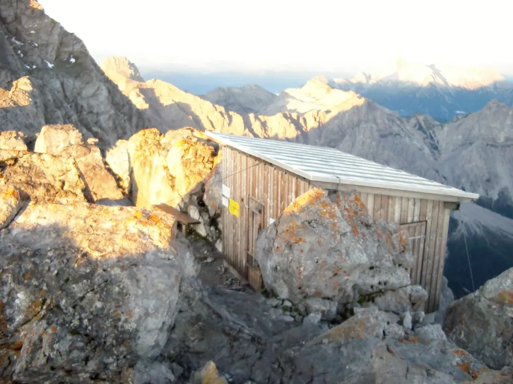
Small wooden shelter hut on the rocky Hocheck summit of the Watzmann in Berchtesgaden National Park, mountain ranges behind in evening light
Photo: Coronium ↗ · CC BY-SA 3.0 ↗

Mountains & rock · Northern summit

Hocheck

The northernmost of the three Watzmann summits and the usual start of the traverse. From here the ridge runs over the Mittelspitze to the Südspitze.

Own page

Watzmann

2,713 m (8,901 ft) high, with an East Face of about 1,800 m (5,906 ft), and the best view of it takes not a single metre of climbing.

Trails & difficulty

Open in OpenStreetMap ↗Location source ↗

47.55842, 12.92379

Watzmann East Face with the Südspitze in Berchtesgaden National Park: a huge banded limestone wall below cumulus clouds
Photo: Günter Seggebäing ↗ · CC BY-SA 4.0 ↗

Mountains & rock · Southern summit

Watzmann Südspitze (south summit)

The southern end of the ridge. The traverse from Hocheck over the Mittelspitze to the Südspitze is a serious alpine route, not a hiking trail.

Own page

Watzmann

2,713 m (8,901 ft) high, with an East Face of about 1,800 m (5,906 ft), and the best view of it takes not a single metre of climbing.

Trails & difficulty

Open in OpenStreetMap ↗Location source ↗

47.54803, 12.91696

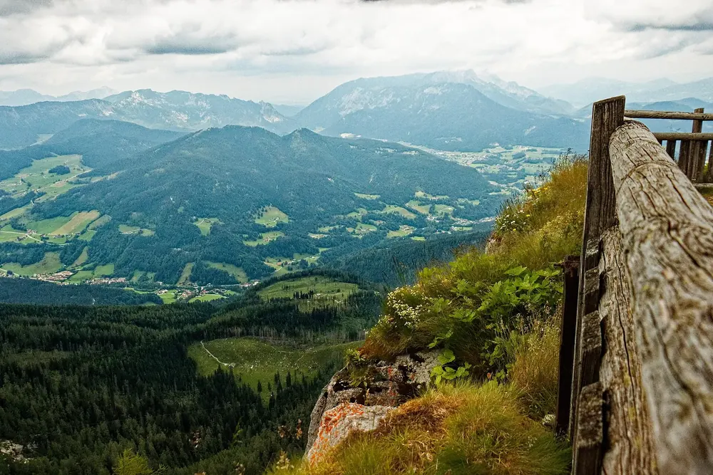
View from the Watzmannhaus in Berchtesgaden National Park over the wooden terrace railing down into the valley and distant mountain rangesSurroundings
Photo: Harry1944 ↗ · CC BY-SA 4.0 ↗

Where to stay · Mountain hut

Watzmannhaus

The classic base below the Hocheck, inside the national park. Closed in winter; check opening times and availability directly with the hut.

Own page

Watzmann

2,713 m (8,901 ft) high, with an East Face of about 1,800 m (5,906 ft), and the best view of it takes not a single metre of climbing.

Trails & difficulty

Open in OpenStreetMap ↗Location source ↗

47.57126, 12.93388

View from the Kührointalm in Berchtesgaden National Park down to Lake Königssee between steep mountainsides, glaciated peaks behindSurroundings
Photo: Geolina163 ↗ · CC BY-SA 4.0 ↗

Where to stay · Park-owned hut

Kührointalm

One of the five huts the Free State of Bavaria owns in the national park, described by the park authority as "at the foot of the Watzmann". Open in summer.

Own page

Watzmann

2,713 m (8,901 ft) high, with an East Face of about 1,800 m (5,906 ft), and the best view of it takes not a single metre of climbing.

Trails & difficulty

Open in OpenStreetMap ↗Location source ↗

47.57085, 12.96123

Nature · Bivouac shelter

Watzmann East Face bivouac shelter

An emergency shelter in the summit gully of the East Face. That it exists says enough about this face: it is not a hiking destination.

Own page

Watzmann

2,713 m (8,901 ft) high, with an East Face of about 1,800 m (5,906 ft), and the best view of it takes not a single metre of climbing.

Trails & difficulty

Open in OpenStreetMap ↗Location source ↗

47.54772, 12.92025

Arrival · Car park & information point

Wimbachbrücke car park

Rotheben 14, Ramsau bei Berchtesgaden. Bus 846 also stops here. The national park's Wimbachbrücke information point is at the car park: unstaffed, free entry.

Own page

Wimbach Gorge (Wimbachklamm)

About 200 m of bridges and boardwalks through a gorge where the water bursts out of the rock, for four euros.
Tickets & opening hours

Open in OpenStreetMap ↗Location source ↗

47.60277, 12.92356

Mountains & rock · Mountain inn in the park

Wimbachschloss

The former Wittelsbach hunting lodge, now a mountain inn. One of the five huts the Free State of Bavaria owns in the national park, open in summer.

Own page

Wimbach Gorge (Wimbachklamm)

About 200 m of bridges and boardwalks through a gorge where the water bursts out of the rock, for four euros.
Tickets & opening hours

Open in OpenStreetMap ↗Location source ↗

47.57221, 12.89666

Where to stay · Hut with overnight stays

Wimbachgrieshütte

In the upper Wimbach valley, the goal of the long route: 5:30 hours, 17 km (10.6 mi), 699 m (2,293 ft) of ascent from the valley.

Own page

Wimbach Gorge (Wimbachklamm)

About 200 m of bridges and boardwalks through a gorge where the water bursts out of the rock, for four euros.
Tickets & opening hours

Open in OpenStreetMap ↗Location source ↗

47.53918, 12.88815

Locations verified from the linked original sources and OpenStreetMap. The map shows no trails or park boundaries; markers do not imply that access is permitted.
Map: © OpenStreetMap contributors, OpenMapTiles, OpenFreeMap. Elevation: Terrain Tiles (Mapzen, AWS Open Data); 3DEP, GMTED2010 and SRTM courtesy of the U.S. Geological Survey; EU-DEM (Copernicus, European Union); ETOPO1 (NOAA); ArcticDEM (NSF, DigitalGlobe); Geoscience Australia; Open Data Austria (DGM); Open Government Licence – Canada; INEGI; Land Information New Zealand; Kartverket; Environment Agency (UK).

Park photo: Photo: Coastfield ↗ · CC BY-SA 4.0 ↗

Loading map …