National Parks Atlas
To the park
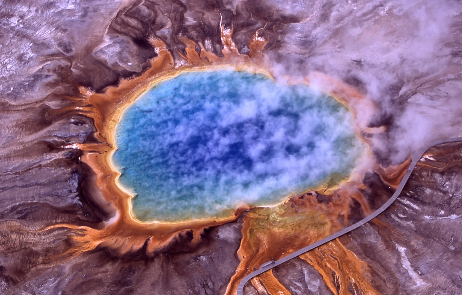
Grand Prismatic Spring in Yellowstone National Park from above: a deep blue hot pool with bright orange edges, conifer forest behind.

Yellowstone National Park: map

14 places with verified coordinates · 13 with photo

Bookable in the park · 7

Ad · partner links: we may earn a commission if you book. Offer details checked 2 Oct 2026; dates and prices with the provider.

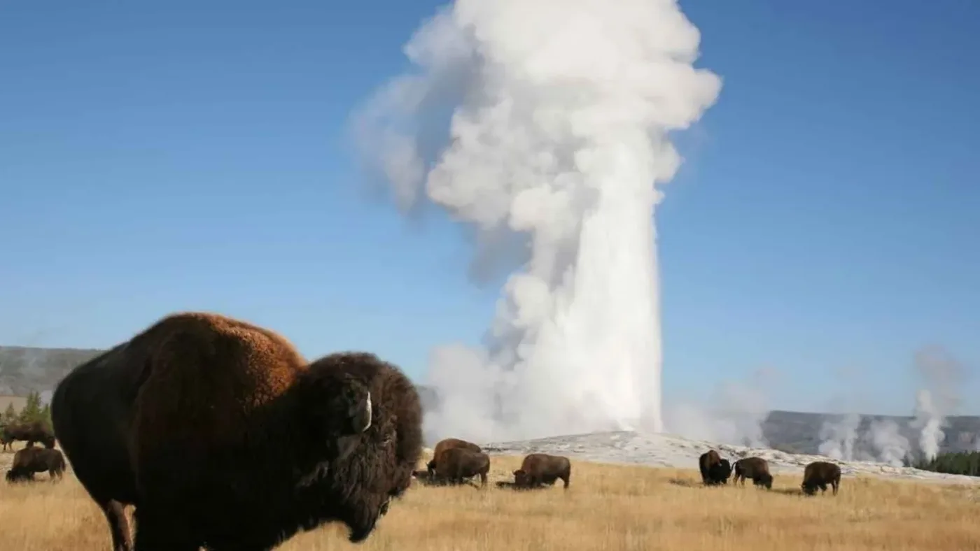
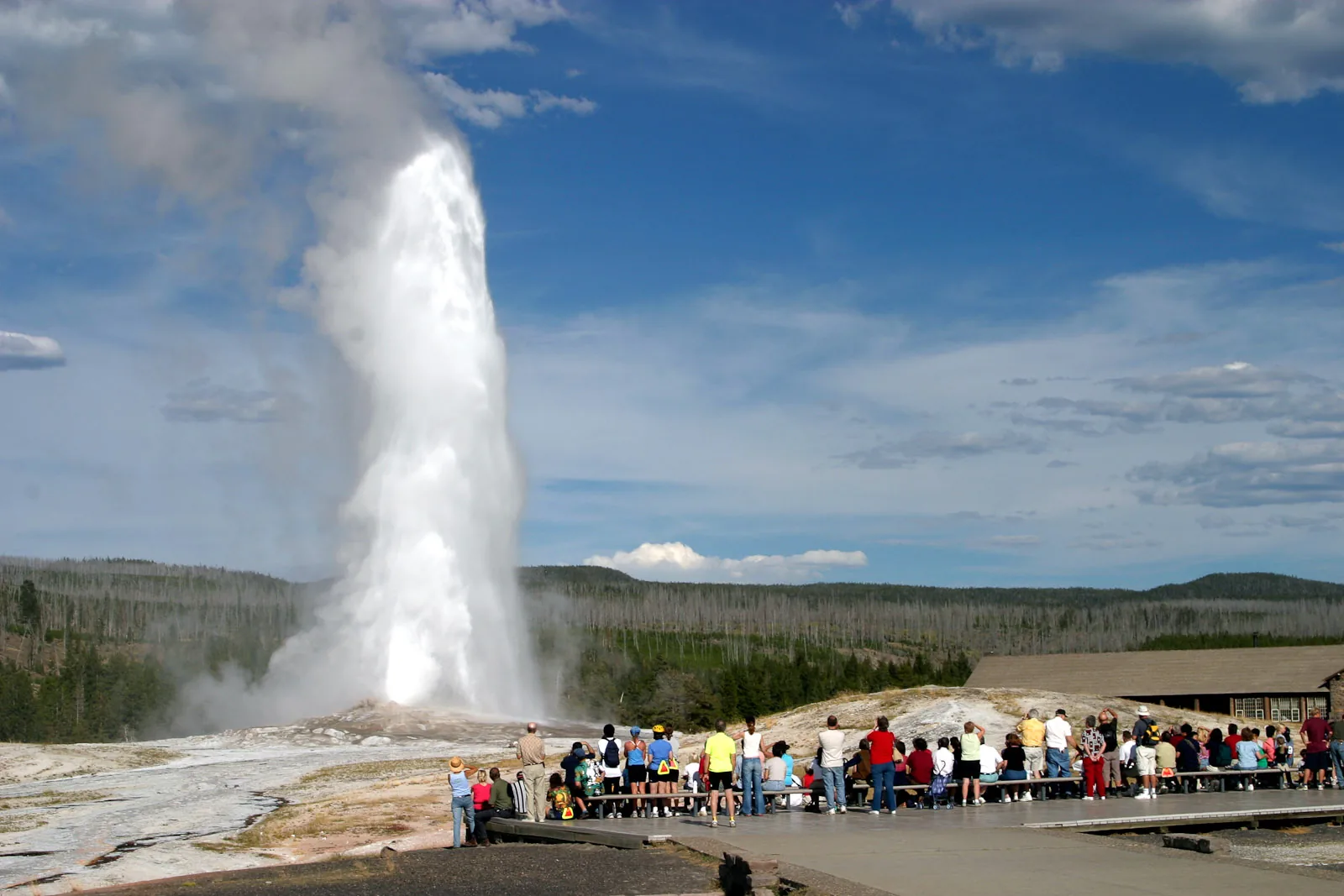
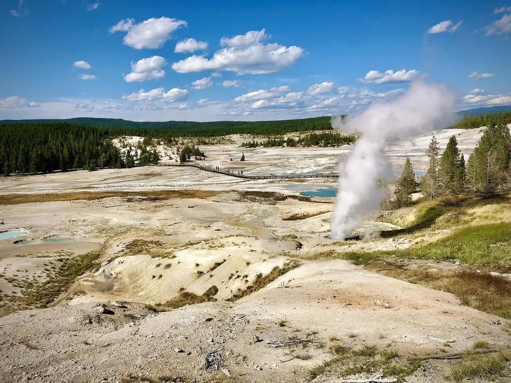
Old Faithful in Yellowstone National Park: a tall white column of steam and water rises from a pale sinter field in front of dark conifer forest.
Photo: Greg Willis ↗ · CC BY-SA 2.0 ↗

Water · Geyser

Old Faithful

The world's best-known geyser, in the Upper Geyser Basin. It erupts several times a day, and the park posts a time window for each eruption. The park's largest visitor centre is here too.

Not the largest geyser in the park, but the most reliable, and so the best known in the world.

Coordinates
44.460464, −110.828146
Location
Upper Geyser Basin
Eruptions
several times a day, with a time window
On site
the park's largest visitor centre
Road open
17 April to 31 October 2026
Rule
stay on the boardwalks

Open in OpenStreetMap ↗Location source ↗

44.46046, -110.82815

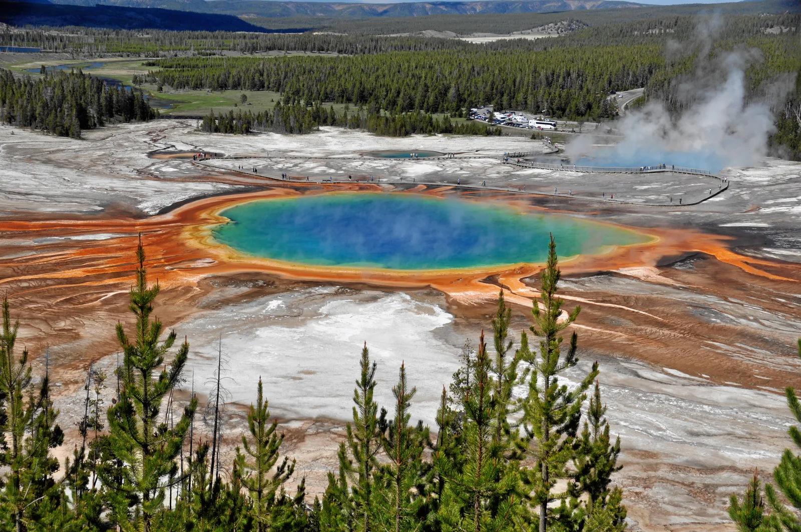
Aerial view of a circular hot spring in Yellowstone National Park with a blue centre and orange-yellow edges amid pale sinter flats.
Photo: Jim Peaco, National Park Service ↗ · Public domain ↗

Water · Hot spring

Grand Prismatic Spring

The largest hot spring in the United States, in the Midway Geyser Basin. Its colour rings come from microorganisms that live at different temperatures. From the boardwalk you see it from the side, from the Overlook trail from above.

The largest hot spring in the United States. Its colour rings are not minerals but living organisms.

Coordinates
44.525113, −110.838193
Location
Midway Geyser Basin
Colours
microorganisms at different temperatures
From the boardwalk
side view across the spring
From the Overlook
view from above, via a trail
Do not touch
touching destroys the organisms

Open in OpenStreetMap ↗Location source ↗

44.52511, -110.83819

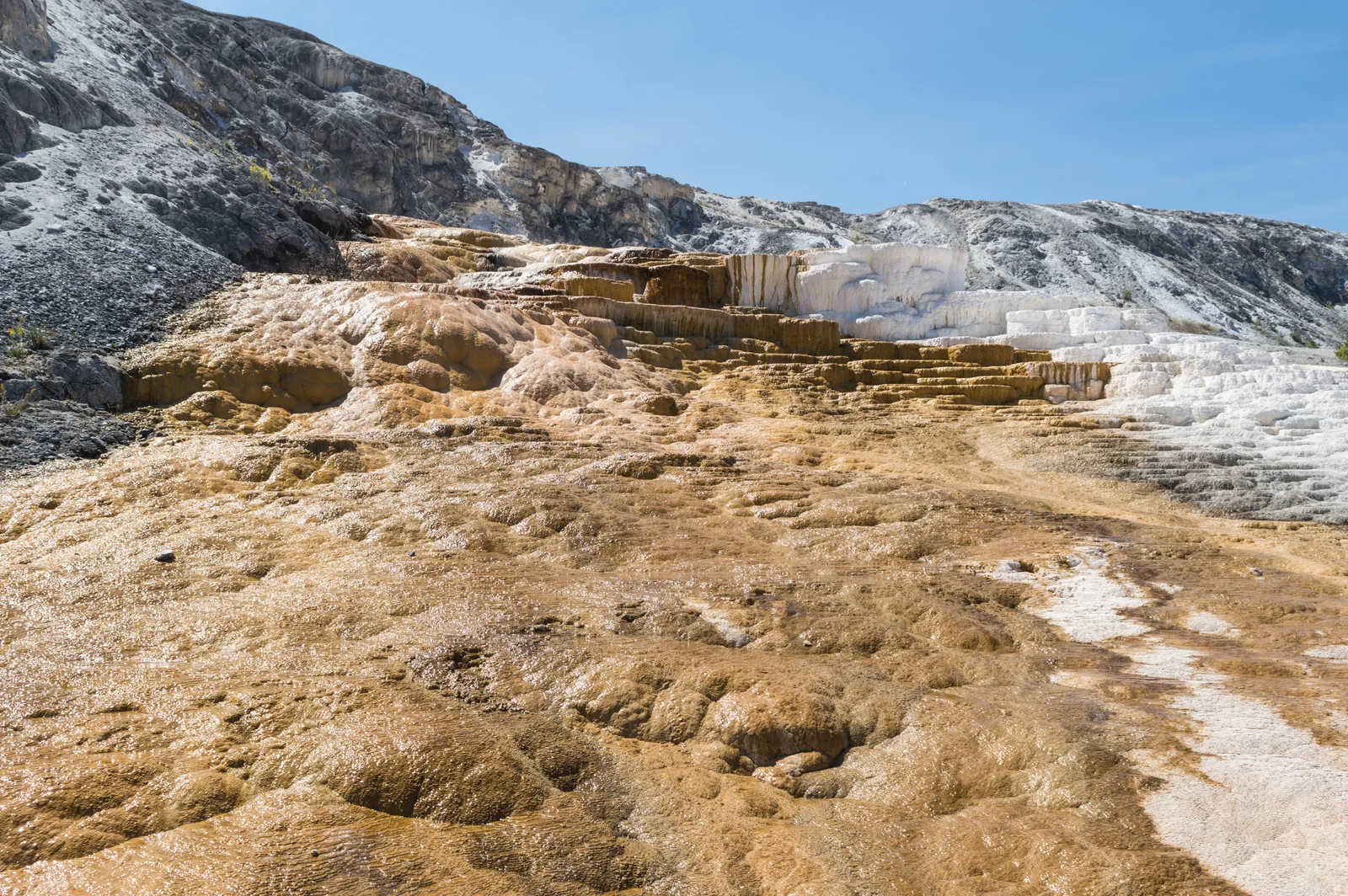
Mammoth Hot Springs in Yellowstone National Park: stepped white sinter terraces with orange streaks, thin films of water running over them.
Photo: Supercarwaar ↗ · CC BY-SA 4.0 ↗

Nature · Travertine terraces

Mammoth Hot Springs

One of the few places in the world with active travertine terraces. Fort Yellowstone, the army post from the park's early days, and the park headquarters are here too.

White travertine terraces that are constantly changing, and next to them the old army post from which the park administration grew.

Coordinates
44.962395, −110.714357
Special feature
active travertine terraces
Worldwide
found in only a few places
Next door
Fort Yellowstone
Access
all year via the North Entrance
Altitude
about 1,900 m (6,230 ft)

Open in OpenStreetMap ↗Location source ↗

44.96239, -110.71436

A bison herd stands in wide grassland in Yellowstone National Park, wooded hills and towering storm clouds behind.
Photo: Acroterion ↗ · CC BY-SA 4.0 ↗

Nature · Valley

Lamar Valley

The valley in the northeast, known for bison herds, wolves and bears. The best time is early morning and dusk, from your car, with binoculars.

The valley in the northeast where you are most likely to see bison herds, wolves and bears, from your car.

Coordinates
44.859019, −110.187967
Best time
early morning and dusk
Access
road open all year
Gear
binoculars, telephoto lens of 300 mm or more
Distance from bison
at least 23 m (25 yards)
Distance from bears and wolves
at least 91 m (100 yards)

Guided from here · Ad

Partner links: we may earn a commission if you book. Dates and prices with the provider.

Open in OpenStreetMap ↗Location source ↗

44.85902, -110.18797

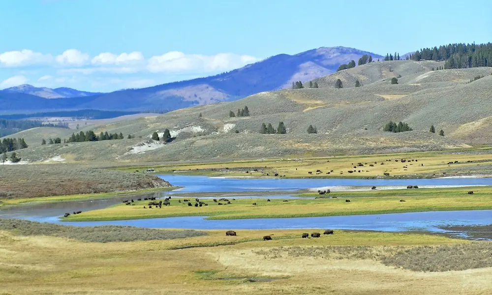
Hayden Valley in Yellowstone National Park: wide valley meadows with the winding Yellowstone River and grazing bison herds in front of hills.
Photo: Montanabw ↗ · CC BY-SA 4.0 ↗

Nature · Valley

Hayden Valley

A broad river valley between Canyon and Yellowstone Lake, the second major area for wildlife watching. Bison herds regularly cross the road here.

Guided from here · Ad

Partner links: we may earn a commission if you book. Dates and prices with the provider.

Open in OpenStreetMap ↗Location source ↗

44.64362, -110.45622

Water · Lake

Yellowstone Lake

The largest lake in North America above 2,100 m (6,900 ft). The water stays cold even in summer; swimming is dangerous.

Open in OpenStreetMap ↗Location source ↗

44.42030, -110.53609

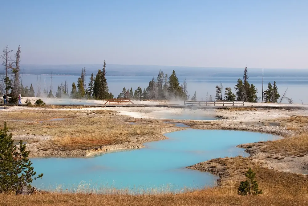
West Thumb Geyser Basin in Yellowstone National Park: turquoise hot springs in pale sinter flats on the shore of Yellowstone Lake.
Photo: Tony Hisgett from Birmingham, UK ↗ · CC BY 2.0 ↗

Water · Geyser basins

West Thumb Geyser Basin

A small basin right on the shore of Yellowstone Lake, with hot springs reaching into the water. From here the road leads over Craig Pass to Old Faithful.

Guided from here · Ad

Partner links: we may earn a commission if you book. Dates and prices with the provider.

Open in OpenStreetMap ↗Location source ↗

44.41701, -110.57197

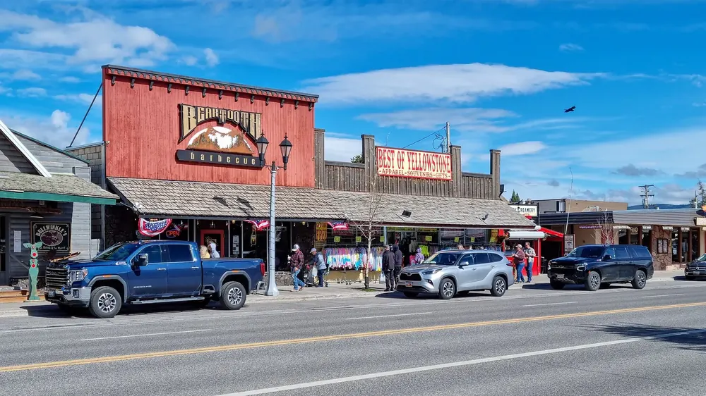
Canyon Street in West Yellowstone: shops with Western facades, pickup trucks in front under a deep blue sky
Photo: Dietmar Rabich ↗ · CC BY-SA 4.0 ↗

Arrival · West Entrance

West Yellowstone

The most-used entrance, in Montana right on the park boundary. Open to regular vehicles from 17 April to 31 October 2026.

Guided from here · Ad

Partner links: we may earn a commission if you book. Dates and prices with the provider.

Open in OpenStreetMap ↗Location source ↗

44.66321, -111.10121

Locations verified from the linked original sources and OpenStreetMap. The map shows no trails or park boundaries; markers do not imply that access is permitted.

Map: © OpenStreetMap contributors, OpenMapTiles, OpenFreeMap. Elevation: Terrain Tiles (Mapzen, AWS Open Data); 3DEP, GMTED2010 and SRTM courtesy of the U.S. Geological Survey; EU-DEM (Copernicus, European Union); ETOPO1 (NOAA); ArcticDEM (NSF, DigitalGlobe); Geoscience Australia; Open Data Austria (DGM); Open Government Licence – Canada; INEGI; Land Information New Zealand; Kartverket; Environment Agency (UK).

Park photo: Photo: James St. John ↗ · CC BY 2.0 ↗

Loading map …